Hetton Common

Downs, Moorland in Yorkshire Craven

England

Hetton Common

Wall enclosed upland pasture Looking south-westward from Boss Moor Lane. Winterburn Reservoir is visible in the far distance.
Wall enclosed upland pasture Credit: Peter Wood

Hetton Common is a historic and picturesque area located in the county of Yorkshire, England. Nestled within the stunning landscape of the Yorkshire Downs and Moorland, Hetton Common is renowned for its natural beauty and tranquil atmosphere.

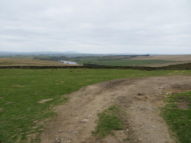
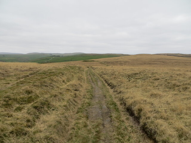
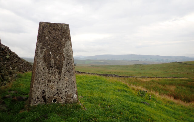
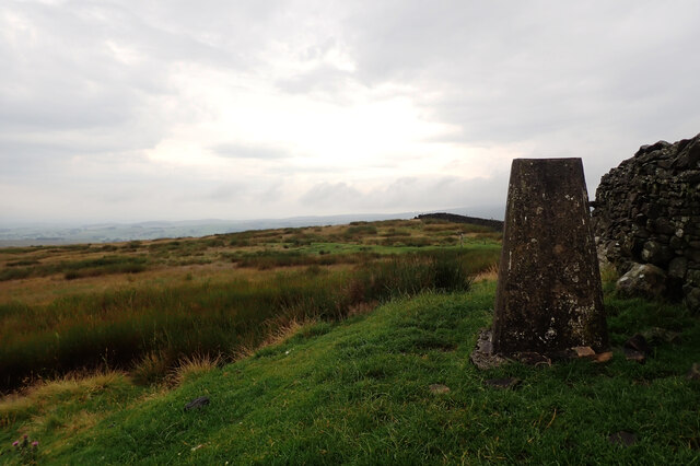
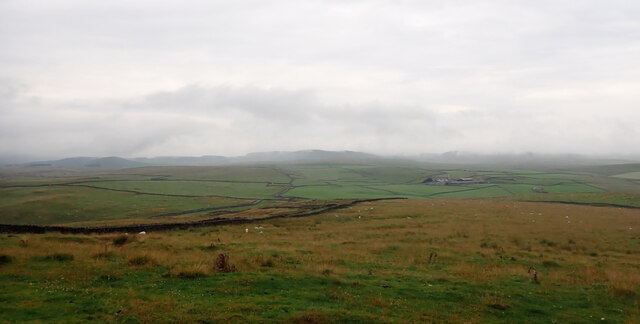
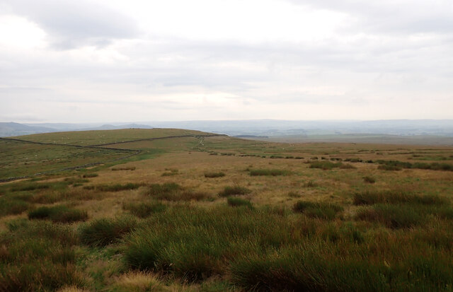
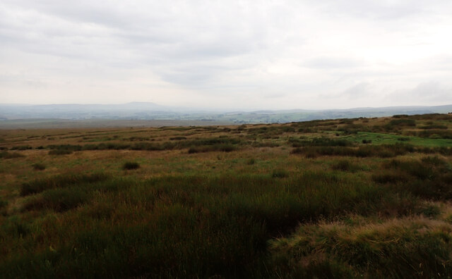
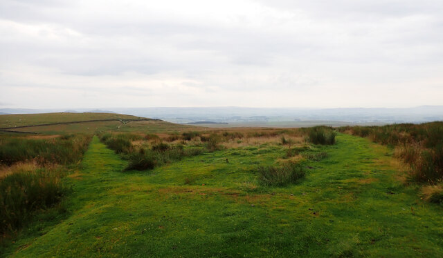
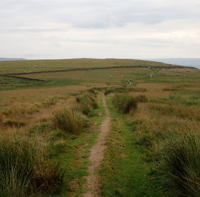
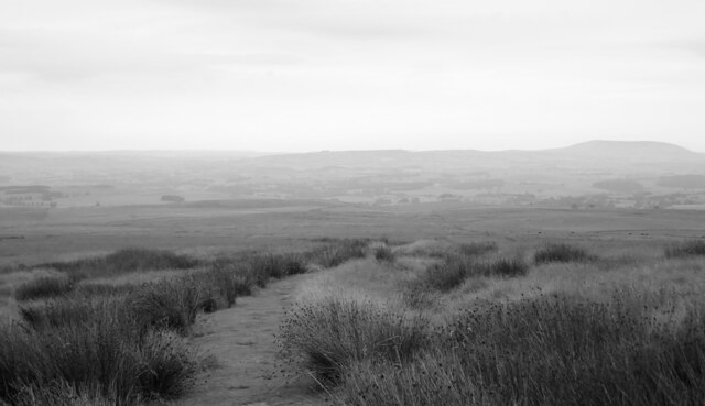
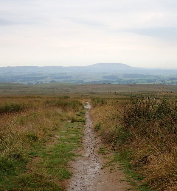
Covering an expansive area, Hetton Common offers a diverse range of landscapes, including rolling hills, open moorland, and lush green valleys. The common is dotted with charming stone-built cottages and traditional farmhouses, adding to its rural charm.

The common is home to a rich variety of flora and fauna, making it a haven for nature enthusiasts and wildlife watchers. Visitors can spot a plethora of bird species, such as curlews, lapwings, and red grouse, as well as various mammals like hares and foxes.

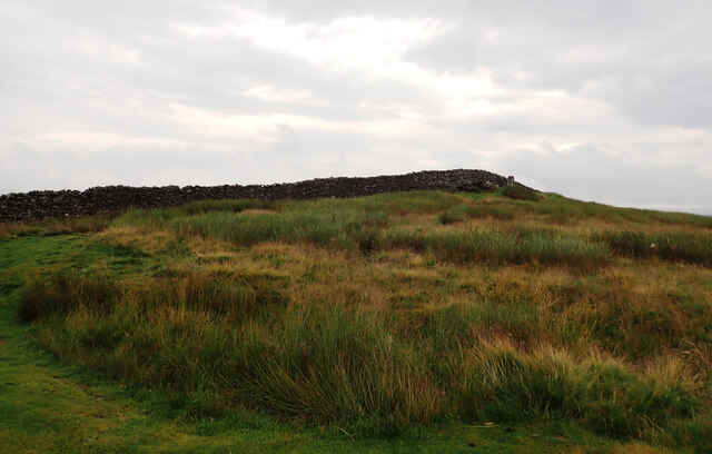
The area also has a fascinating history, with evidence of human occupation dating back thousands of years. There are several ancient burial mounds, known as barrows, scattered across Hetton Common, providing insights into the lives and customs of prehistoric communities.

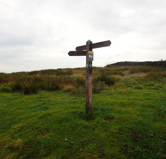
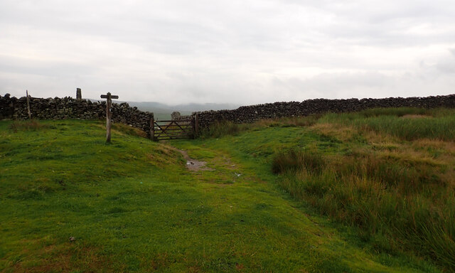
For outdoor enthusiasts, Hetton Common offers numerous opportunities for walking, hiking, and cycling. There are several well-marked trails that crisscross the common, allowing visitors to explore its breathtaking landscapes at their own pace.

Hetton Common is a true gem of Yorkshire, with its unspoiled natural beauty and rich cultural heritage. Whether you are seeking a peaceful retreat or an active adventure, this remarkable area has something to offer to everyone.

If you have any feedback on the listing, please let us know in the comments section below.

Hetton Common Images

Images are sourced within 2km of 54.054784/-2.0929449 or Grid Reference SD9462. Thanks to Geograph Open Source API. All images are credited.

Wall enclosed upland pasture Looking south-westward from Boss Moor Lane. Winterburn Reservoir is visible in the far distance.
Wall enclosed upland pasture
Looking south-westward from Boss Moor Lane. Winterburn Reservoir is visible in the far distance.
Track crossing the open expanse of Boss Moor Looking northward.
Track crossing the open expanse of Boss Moor
Looking northward.
Ordnance Survey Cut Mark This mark can be found on a gatepost at Boss Moor,
The recorded details give a height of 317.9308 metres above sea level.
For more detail see : <span class="nowrap"><a title="https://www.bench-marks.org.uk/bm42973" rel="nofollow ugc noopener" href="https://www.bench-marks.org.uk/bm42973">Link</a><img style="margin-left:2px;" alt="External link" title="External link - shift click to open in new window" src="https://s1.geograph.org.uk/img/external.png" width="10" height="10"/></span>
Ordnance Survey Cut Mark
This mark can be found on a gatepost at Boss Moor, The recorded details give a height of 317.9308 metres above sea level. For more detail see : LinkExternal link
Triangulation Pillar, Weets Top
A view from Weets Top
Direction post, Weets Gate The sign reads:
"Public Bridleway
Calton 2¾ Ml

Public Bridleway
Hawthornes Lane ¼ Ml

Public Bridleway
Hetton 3¾ Ml".
Direction post, Weets Gate
The sign reads: "Public Bridleway Calton 2¾ Ml Public Bridleway Hawthornes Lane ¼ Ml Public Bridleway Hetton 3¾ Ml".
Bridleways to Hetton and Calton, Weets Gate
Bridleway to Hawthornes Lane, Weets Gate An exhilarating and challenging 90 miles across the glorious high country of the Yorkshire Dales with over 13,900 ft of ascent. Walk this spectacular landscape from Saltaire to Appleby-in-Westmorland. Explore its rich history, geology and culture. Return with a breathtaking train ride along England's most beautiful railway.

From Saltaire the route crosses the darkly mysterious Rombalds Moor, with its Stone Age rock art, and follows the dramatic limestone scars of Malhamdale. It meanders along the bank of the River Ribble and climbs the mighty Ingleborough. It skirts the flanks of Whernside and in a breathtaking six-mile ridge walk crosses the velvety folds of the Howgill Fells. It passes the isolated splendour of Sunbiggin Tarn before dropping into the lush green of the Eden valley to finish in Appleby.
Bridleway to Hawthornes Lane, Weets Gate
An exhilarating and challenging 90 miles across the glorious high country of the Yorkshire Dales with over 13,900 ft of ascent. Walk this spectacular landscape from Saltaire to Appleby-in-Westmorland. Explore its rich history, geology and culture. Return with a breathtaking train ride along England's most beautiful railway. From Saltaire the route crosses the darkly mysterious Rombalds Moor, with its Stone Age rock art, and follows the dramatic limestone scars of Malhamdale. It meanders along the bank of the River Ribble and climbs the mighty Ingleborough. It skirts the flanks of Whernside and in a breathtaking six-mile ridge walk crosses the velvety folds of the Howgill Fells. It passes the isolated splendour of Sunbiggin Tarn before dropping into the lush green of the Eden valley to finish in Appleby.
Weets Top seen from Weets Gate
Bridleway to Hetton, Weets Gate An exhilarating and challenging 90 miles across the glorious high country of the Yorkshire Dales with over 13,900 ft of ascent. Walk this spectacular landscape from Saltaire to Appleby-in-Westmorland. Explore its rich history, geology and culture. Return with a breathtaking train ride along England's most beautiful railway.

From Saltaire the route crosses the darkly mysterious Rombalds Moor, with its Stone Age rock art, and follows the dramatic limestone scars of Malhamdale. It meanders along the bank of the River Ribble and climbs the mighty Ingleborough. It skirts the flanks of Whernside and in a breathtaking six-mile ridge walk crosses the velvety folds of the Howgill Fells. It passes the isolated splendour of Sunbiggin Tarn before dropping into the lush green of the Eden valley to finish in Appleby.
Bridleway to Hetton, Weets Gate
An exhilarating and challenging 90 miles across the glorious high country of the Yorkshire Dales with over 13,900 ft of ascent. Walk this spectacular landscape from Saltaire to Appleby-in-Westmorland. Explore its rich history, geology and culture. Return with a breathtaking train ride along England's most beautiful railway. From Saltaire the route crosses the darkly mysterious Rombalds Moor, with its Stone Age rock art, and follows the dramatic limestone scars of Malhamdale. It meanders along the bank of the River Ribble and climbs the mighty Ingleborough. It skirts the flanks of Whernside and in a breathtaking six-mile ridge walk crosses the velvety folds of the Howgill Fells. It passes the isolated splendour of Sunbiggin Tarn before dropping into the lush green of the Eden valley to finish in Appleby.
Sheep by the bridleway to Hetton, Weets Gate
Bridleway to Hetton, Weets Gate An exhilarating and challenging 90 miles across the glorious high country of the Yorkshire Dales with over 13,900 ft of ascent. Walk this spectacular landscape from Saltaire to Appleby-in-Westmorland. Explore its rich history, geology and culture. Return with a breathtaking train ride along England's most beautiful railway.

From Saltaire the route crosses the darkly mysterious Rombalds Moor, with its Stone Age rock art, and follows the dramatic limestone scars of Malhamdale. It meanders along the bank of the River Ribble and climbs the mighty Ingleborough. It skirts the flanks of Whernside and in a breathtaking six-mile ridge walk crosses the velvety folds of the Howgill Fells. It passes the isolated splendour of Sunbiggin Tarn before dropping into the lush green of the Eden valley to finish in Appleby.
Bridleway to Hetton, Weets Gate
An exhilarating and challenging 90 miles across the glorious high country of the Yorkshire Dales with over 13,900 ft of ascent. Walk this spectacular landscape from Saltaire to Appleby-in-Westmorland. Explore its rich history, geology and culture. Return with a breathtaking train ride along England's most beautiful railway. From Saltaire the route crosses the darkly mysterious Rombalds Moor, with its Stone Age rock art, and follows the dramatic limestone scars of Malhamdale. It meanders along the bank of the River Ribble and climbs the mighty Ingleborough. It skirts the flanks of Whernside and in a breathtaking six-mile ridge walk crosses the velvety folds of the Howgill Fells. It passes the isolated splendour of Sunbiggin Tarn before dropping into the lush green of the Eden valley to finish in Appleby.
Bridleway to Calton, Weets Gate
Bridleway to Calton, The Weets
Show me another place!

Hetton Common is located at Grid Ref: SD9462 (Lat: 54.054784, Lng: -2.0929449)

Division: West Riding

Administrative County: North Yorkshire

District: Craven

Police Authority: North Yorkshire

What 3 Words

///both.windows.billiard. Near Grassington, North Yorkshire

Nearby Locations

Hetton Common

Related Wikis

Winterburn Reservoir

Winterburn Reservoir is located near the village of Winterburn in Malhamdale, North Yorkshire, England. It was constructed between 1885 and 1893 by Leeds...

Bordley

Bordley is a village in the civil parish of Hetton-cum-Bordley, in North Yorkshire, England, within the Yorkshire Dales National Park and 12 miles (19...
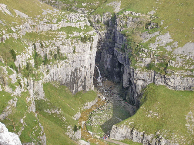
Gordale Scar

Gordale Scar is a limestone ravine 1 mile (1.6 km) north-east of Malham, North Yorkshire, England. It contains two waterfalls and has overhanging limestone...

Winterburn

Winterburn is a village in the Craven district of North Yorkshire, England. It is about 5 miles (8 km) south west of Grassington. Winterburn Reservoir...

Nearby Amenities

Located within 500m of 54.054784,-2.0929449
Hetton Common
Natural: moor
Source: NPE
Lat/Long: 54.0531348/-2.0898607
The data included in this document is from www.openstreetmap.org. The data is made available under ODbL.

Have you been to Hetton Common?

Leave your review of Hetton Common below (or comments, questions and feedback).