Ing Head Moor

Downs, Moorland in Lancashire Pendle

England

Ing Head Moor

Erosion control below the summit of Pendle The western flank of the hill is on a much gentler gradient than the eastern escarpment, leading to boggier ground. The geotextiles, and small wooden dams across the peat grough, are aimed to reduce erosion.
Erosion control below the summit of Pendle Credit: Stephen Craven

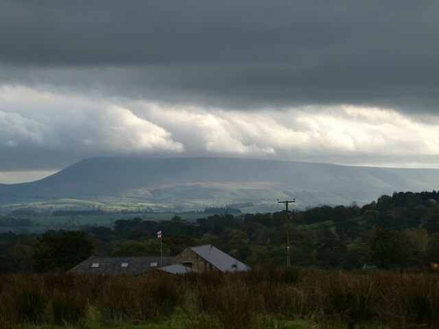
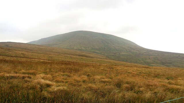
Ing Head Moor is a vast expanse of moorland located in the county of Lancashire, England. Situated in the southern part of the county, it spans an area of approximately 2,000 acres. The moorland is part of the larger West Pennine Moors, which is renowned for its natural beauty and stunning landscapes.

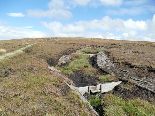
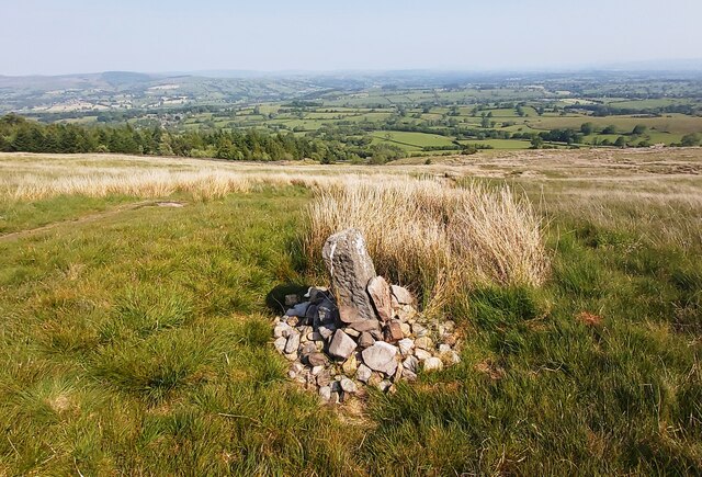
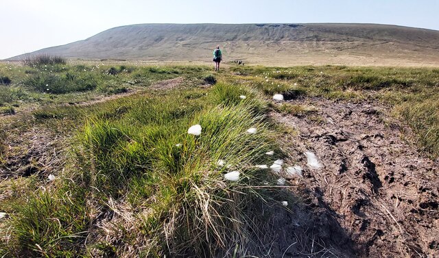
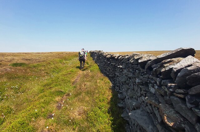
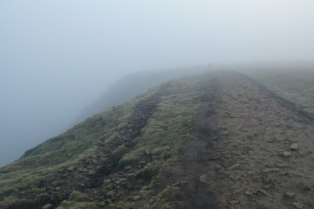
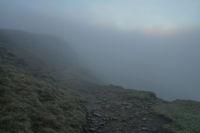
Ing Head Moor is characterized by its rolling hills, heather-covered peat bogs, and scattered clumps of trees. The terrain is predominantly hilly, with some areas reaching elevations of over 1,000 feet. Visitors to the moor can enjoy panoramic views of the surrounding countryside, including the nearby towns of Darwen and Bolton.

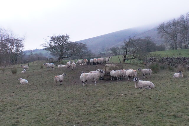
The area is home to a diverse range of flora and fauna, including several species of birds, mammals, and insects. Common sightings include curlews, lapwings, and red grouse, as well as hares and foxes. The moorland also supports a variety of plant life, such as heather, bilberry, and cotton grass.

Ing Head Moor is a popular destination for outdoor enthusiasts, offering opportunities for walking, hiking, and birdwatching. There are several well-marked trails that crisscross the moor, allowing visitors to explore its scenic beauty at their own pace. It is advisable for visitors to come prepared with appropriate footwear and clothing, as the weather on the moor can be changeable and conditions underfoot may be uneven.

Overall, Ing Head Moor is a stunning natural landscape that offers a peaceful retreat from the hustle and bustle of nearby urban areas. Its beauty, tranquility, and abundant wildlife make it a must-visit destination for nature lovers and outdoor enthusiasts in Lancashire.

If you have any feedback on the listing, please let us know in the comments section below.

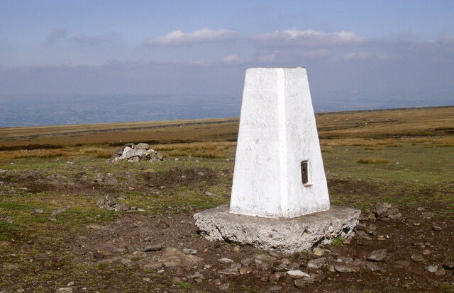
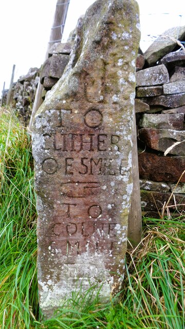
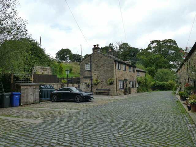
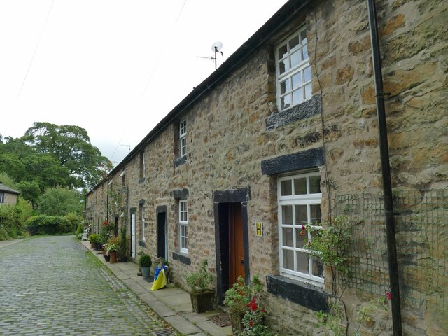
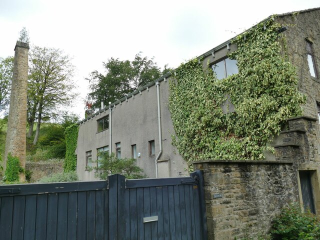
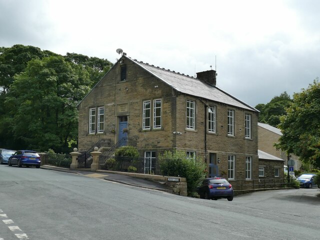
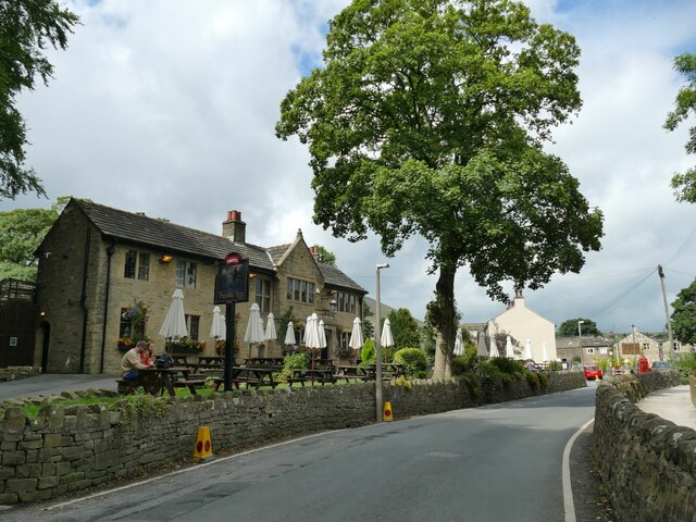
Ing Head Moor Images

Images are sourced within 2km of 53.873905/-2.2829016 or Grid Reference SD8142. Thanks to Geograph Open Source API. All images are credited.

Erosion control below the summit of Pendle The western flank of the hill is on a much gentler gradient than the eastern escarpment, leading to boggier ground. The geotextiles, and small wooden dams across the peat grough, are aimed to reduce erosion.
Erosion control below the summit of Pendle
The western flank of the hill is on a much gentler gradient than the eastern escarpment, leading to boggier ground. The geotextiles, and small wooden dams across the peat grough, are aimed to reduce erosion.
Way Marker Stones on lower slopes of Pendle Hill
Footpath on Downham Moor
Dry Stone Wall on Pendle Hill
Stormclouds over Pendle Hill Pendle View Farm <a href="https://www.geograph.org.uk/gridref/SD7754">SD7754</a> (Shown on the map as Cracoe Hill Farm) in the foreground.
Stormclouds over Pendle Hill
Pendle View Farm SD7754 (Shown on the map as Cracoe Hill Farm) in the foreground.
Pendle Inn Inn in the very popular village of Barley.
Pendle Inn
Inn in the very popular village of Barley.
Path on the edge of Pendle Views are restricted by low cloud.
Path on the edge of Pendle
Views are restricted by low cloud.
Path down Pendle Side The slightly gentler of the two main routes from the Barley side. Views are restricted by low cloud, though a break in the cloud can be seen.
Path down Pendle Side
The slightly gentler of the two main routes from the Barley side. Views are restricted by low cloud, though a break in the cloud can be seen.
Feeding sheep at dusk Low cloud is resting on Pendle Hill behind.
Feeding sheep at dusk
Low cloud is resting on Pendle Hill behind.
Pendle Hill Pendle Hill at 557m (1,827 feet) is something of a Lancashire icon, steeped in folklore and history. The 17th century seems to have been a particularly busy period here with the Pendle witch trials in 1612, Richard Towneley's barometer experiment in 1661 and George Fox's vision of many souls coming to Christ in 1652. Of those the witch trials are perhaps the best known. Ten men and two women living in the immediate area were accused of commiting murder by witchcraft. Ten were found guilty and executed. Towneley, together with Henry Power, used the newly invented barometer to measure air pressure at different altitudes on the hill which led to an understanding of the relationship between air density and pressure.  Finally, George Fox's vision at this spot was an important event in the establishment of the Society of Friends (Quakers). 

Note how the area around the pillar has been eroded away by its many visitors. More recent pictures show how this problem has been addressed: <a href="https://www.geograph.org.uk/photo/3864654">SD8041 : Trig Point on Pendle Hill</a>.
Pendle Hill
Pendle Hill at 557m (1,827 feet) is something of a Lancashire icon, steeped in folklore and history. The 17th century seems to have been a particularly busy period here with the Pendle witch trials in 1612, Richard Towneley's barometer experiment in 1661 and George Fox's vision of many souls coming to Christ in 1652. Of those the witch trials are perhaps the best known. Ten men and two women living in the immediate area were accused of commiting murder by witchcraft. Ten were found guilty and executed. Towneley, together with Henry Power, used the newly invented barometer to measure air pressure at different altitudes on the hill which led to an understanding of the relationship between air density and pressure. Finally, George Fox's vision at this spot was an important event in the establishment of the Society of Friends (Quakers). Note how the area around the pillar has been eroded away by its many visitors. More recent pictures show how this problem has been addressed: SD8041 : Trig Point on Pendle Hill.
Old Guide Stone At Four Lanes End where the Clitheroe to Colne route intersects the Burnley to Gisburn route
Old Guide Stone
At Four Lanes End where the Clitheroe to Colne route intersects the Burnley to Gisburn route
Pendle Big End View from Four Lane Ends
Pendle Big End
View from Four Lane Ends
Narrowgates, Barley (1)  Former millworkers' cottages associated with a nearby cotton mill. There were others nearer the camera that have been demolished at some point.
Narrowgates, Barley (1)
Former millworkers' cottages associated with a nearby cotton mill. There were others nearer the camera that have been demolished at some point.
Narrowgates, Barley (2)  Former millworkers' cottages associated with a nearby cotton mill.
Narrowgates, Barley (2)
Former millworkers' cottages associated with a nearby cotton mill.
Narrowgates Mill, Barley A former cotton mill; <a href="https://www.geograph.org.uk/photo/4455481">SD8240 : Barley:  Narrowgate Mill</a> shows the full height of the chimney.
Narrowgates Mill, Barley
A former cotton mill; SD8240 : Barley: Narrowgate Mill shows the full height of the chimney.
Barley Village Hall A former Wesleyan Methodist church of 1803, see <a href="https://www.geograph.org.uk/photo/2614541">SD8240 : Barley Lane Wesleyan Methodist</a>.
Barley Village Hall
A former Wesleyan Methodist church of 1803, see SD8240 : Barley Lane Wesleyan Methodist.
The Pendle Inn, Barley The pub bears a date of 1930; it is currently a Thwaites house.
The Pendle Inn, Barley
The pub bears a date of 1930; it is currently a Thwaites house.
Barley Garage It's unusual to find a garage (in the sense of car maintenance business) in such a small village. One of the workers told me it was established in the 1930s.
Barley Garage
It's unusual to find a garage (in the sense of car maintenance business) in such a small village. One of the workers told me it was established in the 1930s.
Show me another place!

Ing Head Moor is located at Grid Ref: SD8142 (Lat: 53.873905, Lng: -2.2829016)

Administrative County: Lancashire

District: Pendle

Police Authority: Lancashire

What 3 Words

///flaked.whisk.bearable. Near Chatburn, Lancashire

Related Wikis

Pendle Hill

Pendle Hill is in the east of Lancashire, England, near the towns of Burnley, Nelson, Colne, Brierfield, Clitheroe and Padiham. Its summit is 557 metres...

Black Moss Reservoirs

Upper and Lower Black Moss Reservoirs are reservoirs close to the village of Barley, in the Borough of Pendle, close to the market town of Burnley, England...

Barley-with-Wheatley Booth

Barley-with-Wheatley Booth is a civil parish in the Pendle district of Lancashire, England. It has a population of 298, and contains the village of Barley...

Barley, Lancashire

Barley is a village in the borough of Pendle, in Lancashire, England. It is in the civil parish of Barley-with-Wheatley Booth. The village lies between...

Nearby Amenities

Located within 500m of 53.873905,-2.2829016
Waste Basket
Ele: 324.0876465
Lat/Long: 53.8704291/-2.2835855
Bench
Created By: Potlatch 0.10f
Ele: 339.4686279
Lat/Long: 53.8723471/-2.284521
Barrier: stile
Ele: 341.6315918
Lat/Long: 53.8724486/-2.2844593
Barrier: cattle_grid
Ele: 323.61
Lat/Long: 53.8703888/-2.2836956
Parking
Informal: yes
Parking: lane
Lat/Long: 53.8729967/-2.2841017
Parking
Access: yes
Parking: surface
Lat/Long: 53.8708754/-2.2839063
Parking
Access: yes
Parking: surface
Lat/Long: 53.8702405/-2.2833954
The data included in this document is from www.openstreetmap.org. The data is made available under ODbL.

Have you been to Ing Head Moor?

Leave your review of Ing Head Moor below (or comments, questions and feedback).