Rathmell Common

Downs, Moorland in Yorkshire Craven

England

Rathmell Common

Ford at Rathmell This overgrown ford is found on the track leading to Upper Sheep Wash which has now been bypassed by a new road.
Ford at Rathmell Credit: John Walton

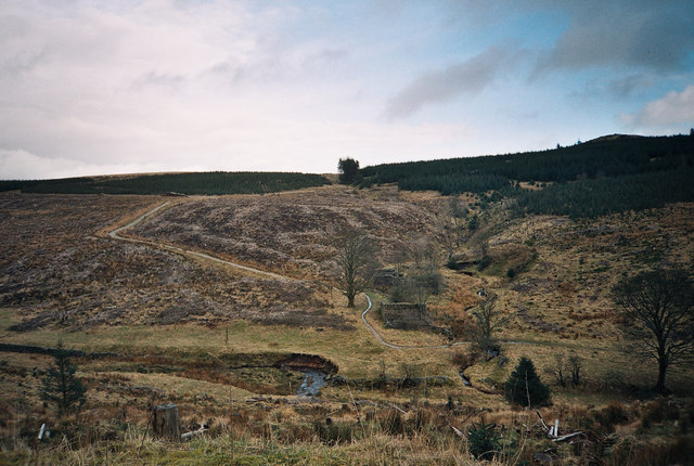
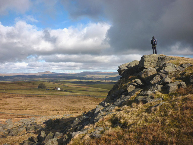
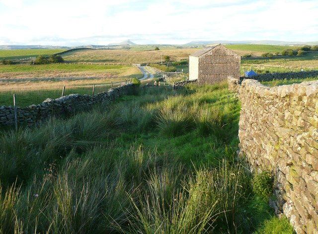
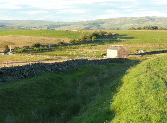
Rathmell Common is a stunning expanse of land located in Yorkshire, England. Nestled amidst the Yorkshire Downs and Moorland, it covers a vast area of approximately 10 square kilometers. This picturesque common is a haven for nature enthusiasts and outdoor adventurers alike.

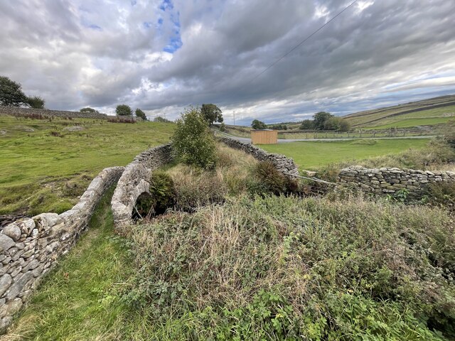
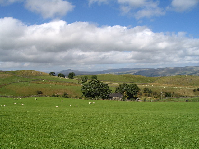
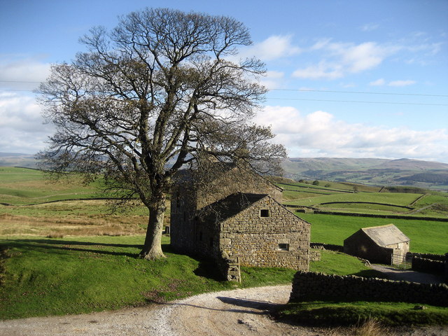
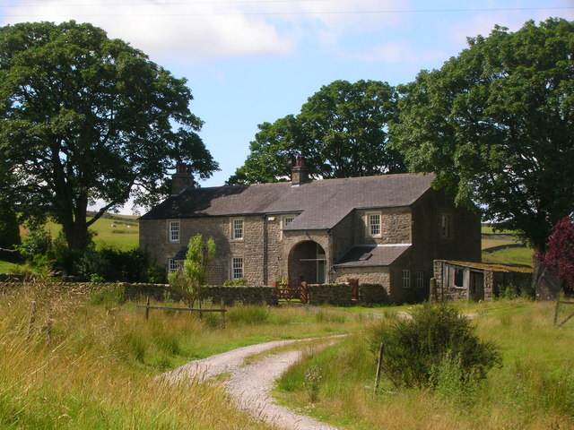
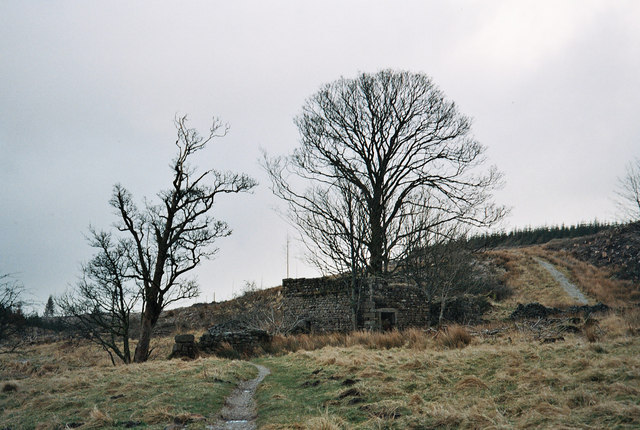
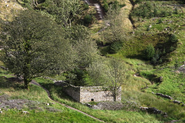
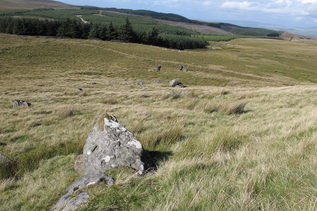
The common is characterized by its rolling hills, heather-covered moorland, and scattered woodland areas. The landscape is truly breathtaking, offering panoramic views of the surrounding countryside. Rathmell Common is home to a diverse range of flora and fauna, including species such as heather, bilberry, and cotton grass, as well as various bird species like curlews and lapwings.

The common is crisscrossed by a network of footpaths, making it an ideal destination for hikers and walkers. These paths wind through the open countryside, allowing visitors to explore and appreciate the natural beauty of the area. Additionally, the common is intersected by several streams and rivers, providing opportunities for fishing and other water-based activities.

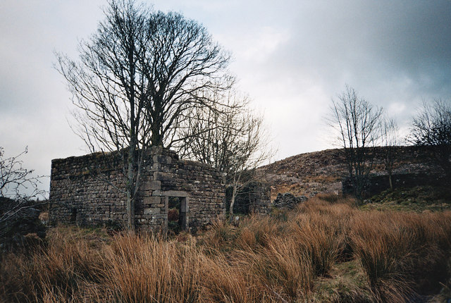
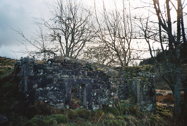
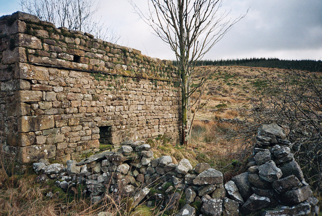
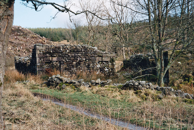
Rathmell Common is also steeped in history, with evidence of human habitation dating back thousands of years. Archaeological sites, such as ancient burial mounds and stone circles, can be found scattered across the common, adding an element of intrigue and fascination to the area.

Overall, Rathmell Common is a truly remarkable location, offering a unique blend of natural beauty, outdoor recreation, and historical significance. Whether visitors are seeking a peaceful stroll, an adrenaline-fueled hike, or a glimpse into the past, this Yorkshire gem has something to offer everyone.

If you have any feedback on the listing, please let us know in the comments section below.

Rathmell Common Images

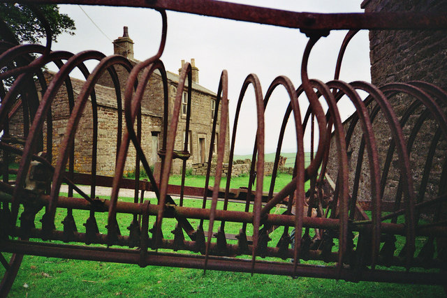
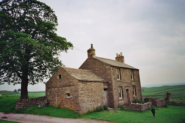
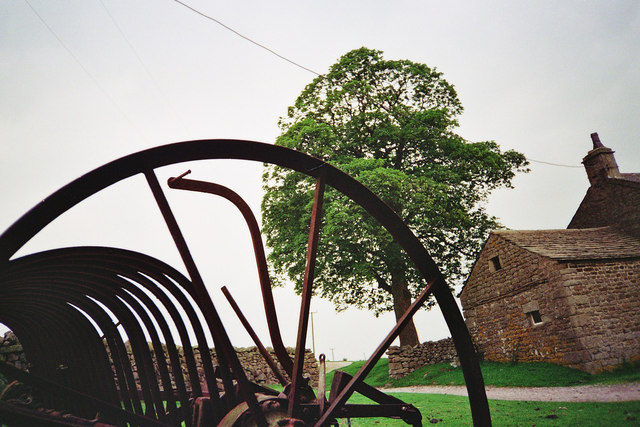
Images are sourced within 2km of 54.04794/-2.3584315 or Grid Reference SD7661. Thanks to Geograph Open Source API. All images are credited.

Ford at Rathmell This overgrown ford is found on the track leading to Upper Sheep Wash which has now been bypassed by a new road.
Ford at Rathmell
This overgrown ford is found on the track leading to Upper Sheep Wash which has now been bypassed by a new road.
Ragged Hall, near Rathmell Long distance views up Ribblesdale can be had from here.
Ragged Hall, near Rathmell
Long distance views up Ribblesdale can be had from here.
Whelpstone Lodge At the end of a long lane from Rathmell, these buildings look deserted when I passed through here.
Whelpstone Lodge
At the end of a long lane from Rathmell, these buildings look deserted when I passed through here.
Ragged Hall
Ragged Hall
Whelpstone Lodge at the sharp end The farm house of Whelpstone Lodge seen through the fang rake of an old farm machine.
Whelpstone Lodge at the sharp end
The farm house of Whelpstone Lodge seen through the fang rake of an old farm machine.
Whelpstone Lodge The old farm house of Whelpstone Lodge. The track in the foreground leads to Owlshaw farm which is the white building in the distance to the left of the tree trunk. The farm track in the picture is officially in Yorkshire but on its short journey to Owlshaw briefly enters back into Lancashire officially. The county boundary being marked by a dry stone wall which the track passes through then after a short distance enters back into Yorkshire through the same wall line. There are no border guards or customs bureaucrats to hassle the free thinking, free roaming poets of the free wild fells. The border line here is part of the 'new'1974 boundary between the Red Rose county of Lancashire and the White Rose of Yorkshire, these being the dictates of control bureaucracies. The old boundary bit deep into the 'Red Rose' making Lancashire geographically resemble a wasps body! The extremity of the 'White Rose' bite was on the high fells of Bowland over looking the Irish sea which was just 9 miles west along SD51 grid line to the coast at Morecambe Bay. This old county boundary area was near 'Greave Clough Head' and 'White Moss' at 1520ft (464M) both being in SD5750. The western extremity of this former boundary is marked on the map as a mound at SD574509 just south of 'Johnny Pye's Clough Top'. Johnny Pye's Clough Top is in SD5751 which also lies on the old county boundary line marked by another mound a short distance towards the north east. A little further on still (NE) the trig point of 'Hawthornthwaite Fell Top' 1567ft (476M) SD579515 was on the former Lancashire/Yorkshire border. Many of us free spirits do not recognise these 'new' 1974 border lines and still refer to villages and places as being in the Red Rose or White rose counties of former times pre 74, even if it does make old Lancashire take the form of a wasps body. Also don't forget we Lancastrians had the south peninsulas of the Lake District dipping into the north of Morecambe Bay. But Yorkshire men and women are wary of us Lancashire folk because they know we have a damned good sting !
Whelpstone Lodge
The old farm house of Whelpstone Lodge. The track in the foreground leads to Owlshaw farm which is the white building in the distance to the left of the tree trunk. The farm track in the picture is officially in Yorkshire but on its short journey to Owlshaw briefly enters back into Lancashire officially. The county boundary being marked by a dry stone wall which the track passes through then after a short distance enters back into Yorkshire through the same wall line. There are no border guards or customs bureaucrats to hassle the free thinking, free roaming poets of the free wild fells. The border line here is part of the 'new'1974 boundary between the Red Rose county of Lancashire and the White Rose of Yorkshire, these being the dictates of control bureaucracies. The old boundary bit deep into the 'Red Rose' making Lancashire geographically resemble a wasps body! The extremity of the 'White Rose' bite was on the high fells of Bowland over looking the Irish sea which was just 9 miles west along SD51 grid line to the coast at Morecambe Bay. This old county boundary area was near 'Greave Clough Head' and 'White Moss' at 1520ft (464M) both being in SD5750. The western extremity of this former boundary is marked on the map as a mound at SD574509 just south of 'Johnny Pye's Clough Top'. Johnny Pye's Clough Top is in SD5751 which also lies on the old county boundary line marked by another mound a short distance towards the north east. A little further on still (NE) the trig point of 'Hawthornthwaite Fell Top' 1567ft (476M) SD579515 was on the former Lancashire/Yorkshire border. Many of us free spirits do not recognise these 'new' 1974 border lines and still refer to villages and places as being in the Red Rose or White rose counties of former times pre 74, even if it does make old Lancashire take the form of a wasps body. Also don't forget we Lancastrians had the south peninsulas of the Lake District dipping into the north of Morecambe Bay. But Yorkshire men and women are wary of us Lancashire folk because they know we have a damned good sting !
Retired farm machine at Whelpstone Lodge Old rusting farm machine and part of Whelpstone Lodge farm house, to the left the track leads to Owlshaw farm.
Retired farm machine at Whelpstone Lodge
Old rusting farm machine and part of Whelpstone Lodge farm house, to the left the track leads to Owlshaw farm.
Felled Forest - Bowland Looking down and over Dob Dale Beck one can see the old farm house ruins of 'Dob Dale' just between the narrow track and the stream to the right which joins Dob Dale Beck. Many years ago this farm was known by locals as 'Dob Dol. I believe this farm was already abandoned decades before the 1920s clearance of farms in this area for Catchment land of the 'Stocks Reservoir' being constructed late 20s early 30s. A large area has been felled here as elsewhere in this the Gisburn Forest in Bowland.
Felled Forest - Bowland
Looking down and over Dob Dale Beck one can see the old farm house ruins of 'Dob Dale' just between the narrow track and the stream to the right which joins Dob Dale Beck. Many years ago this farm was known by locals as 'Dob Dol. I believe this farm was already abandoned decades before the 1920s clearance of farms in this area for Catchment land of the 'Stocks Reservoir' being constructed late 20s early 30s. A large area has been felled here as elsewhere in this the Gisburn Forest in Bowland.
Dob Dale Farm Ruins - Gisburn Forest - Bowland I'd walked through the forest 'n' found a stream with no name, it was good to be out in the wild. In the reed grass there's a stream flowing by collecting the rain from the sky, in a short run or two the stream with no name joins the 'Dob Dale Beck' running by; la la la lal, la la lal, lal la la la lah! (The oldie song 'A Horse With No Name' (changed lyrics) in the Desert etc sung by 'America' you older ones may 'get it'!!)  The farm ruin of 'Dob Dale' known many years ago by locals as 'Dob Dol'!
Dob Dale Farm Ruins - Gisburn Forest - Bowland
I'd walked through the forest 'n' found a stream with no name, it was good to be out in the wild. In the reed grass there's a stream flowing by collecting the rain from the sky, in a short run or two the stream with no name joins the 'Dob Dale Beck' running by; la la la lal, la la lal, lal la la la lah! (The oldie song 'A Horse With No Name' (changed lyrics) in the Desert etc sung by 'America' you older ones may 'get it'!!) The farm ruin of 'Dob Dale' known many years ago by locals as 'Dob Dol'!
Farm Ruins - Gisburn Forest - Bowland Good solid stone work at the farm ruins of 'Dob Dol', this is the very old name for the farm abandoned I believe in the late 19th or possible very early 20th century, the official name of this isolated ruin is 'Dob Dale'.
Farm Ruins - Gisburn Forest - Bowland
Good solid stone work at the farm ruins of 'Dob Dol', this is the very old name for the farm abandoned I believe in the late 19th or possible very early 20th century, the official name of this isolated ruin is 'Dob Dale'.
Dob Dale Ruins - Bowland Solid walls standing at the old farm ruin of 'Dob Dale' in the 'Gisburn Forest'.
Dob Dale Ruins - Bowland
Solid walls standing at the old farm ruin of 'Dob Dale' in the 'Gisburn Forest'.
Dob Dale Farm Ruins - Gisburn Forest in Bowland Having just crossed the small ford through 'Dob Dale Beck' we approach the farm ruins of 'Dob Dale'. A little further ahead one can see the marsh grass just before the ruins, this is where the narrow track crosses yet another stream by a small ford. This stream is nameless, it flows from right to left, in a short distance joining the 'Dob Dale Beck'.
Dob Dale Farm Ruins - Gisburn Forest in Bowland
Having just crossed the small ford through 'Dob Dale Beck' we approach the farm ruins of 'Dob Dale'. A little further ahead one can see the marsh grass just before the ruins, this is where the narrow track crosses yet another stream by a small ford. This stream is nameless, it flows from right to left, in a short distance joining the 'Dob Dale Beck'.
Old Farm Ruins of Dob Dale (Dob Dol) Gisburn Forest - Bowland
Ruined farm at Dob Dale The track coming down to the right of the ruins is one of the new Gisburn Forest mountain biking trails
Ruined farm at Dob Dale
The track coming down to the right of the ruins is one of the new Gisburn Forest mountain biking trails
Moorland north of Whelp Stone Crag
North east from Whelp Stone Crag The north eastern end of the crag has its own jumble of gritstone boulders and outcrops. In the middle distance is the white farmhouse at Owlshaw with Pen-y-ghent (left) and Fountains Fell rising on the skyline above.
North east from Whelp Stone Crag
The north eastern end of the crag has its own jumble of gritstone boulders and outcrops. In the middle distance is the white farmhouse at Owlshaw with Pen-y-ghent (left) and Fountains Fell rising on the skyline above.
Green Lane The bottom end of the lane, where there is a barn. The lane is green, and also wet.
Green Lane
The bottom end of the lane, where there is a barn. The lane is green, and also wet.
Green Lane Named and shown as a walled lane on the 1850 OS map. Fortunately one can now walk along the rim on dry grass.
Green Lane
Named and shown as a walled lane on the 1850 OS map. Fortunately one can now walk along the rim on dry grass.
Show me another place!

Rathmell Common is located at Grid Ref: SD7661 (Lat: 54.04794, Lng: -2.3584315)

Division: West Riding

Administrative County: North Yorkshire

District: Craven

Police Authority: North Yorkshire

What 3 Words

///disarmed.spirit.given. Near Settle, North Yorkshire

Related Wikis

Eldroth

Eldroth is a village in North Yorkshire, England. It is in the civil parish of Lawkland, part of the former Craven District, some 3.25 miles (5.23 km)...

Giggleswick railway station

Giggleswick is a railway station on the Bentham Line, which runs between Leeds and Morecambe via Skipton. The station, situated 41+1⁄4 miles (66 km) north...

Rathmell

Rathmell is a village and civil parish in the Craven district of North Yorkshire, England. The population of the civil parish in the 2011 census was 305...

Lawkland

Lawkland is a civil parish in North Yorkshire, England, near the A65 and 4 miles (6.4 km) west of Settle. It lies within the Forest of Bowland Area of...

Have you been to Rathmell Common?

Leave your review of Rathmell Common below (or comments, questions and feedback).