Gauber High Pasture

Downs, Moorland in Yorkshire Craven

England

Gauber High Pasture

A view over the upper Ribble valley from Park Fell With the cottages at Gauber visible on the right.
A view over the upper Ribble valley from Park Fell Credit: John Lucas

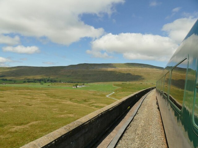
Gauber High Pasture is a picturesque location situated in the Yorkshire Dales, specifically in the region of Yorkshire Downs and Moorland. Covering an expansive area of rolling hills and vast open spaces, it is a popular destination for nature lovers, hikers, and those seeking tranquility away from urban life.

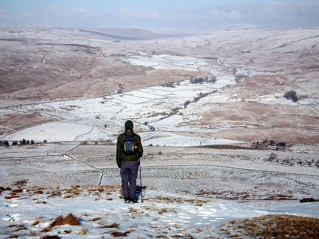
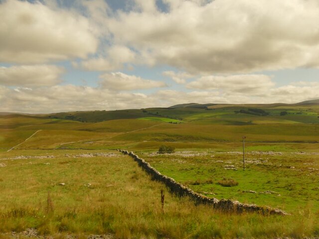
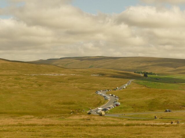
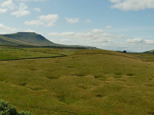
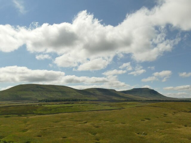
The landscape of Gauber High Pasture is characterized by its undulating hills, which are covered in rich green grasses and scattered with heather and wildflower patches. The area boasts breathtaking panoramic views, with the rugged moorland stretching out as far as the eye can see.

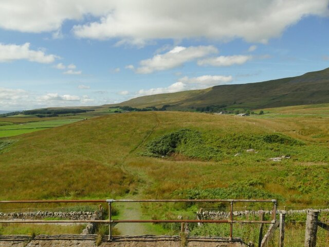
The diversity of flora and fauna found in Gauber High Pasture is remarkable. The heathland supports a variety of plant species, including bilberry, cotton grass, and various types of mosses. This unique ecosystem attracts a range of wildlife, such as red grouse, curlew, and golden plover, making it a haven for birdwatchers.

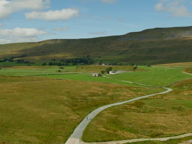
Traversing the terrain, visitors will come across babbling brooks, meandering rivers, and cascading waterfalls, adding to the charm and serenity of the area. The tranquil atmosphere is further enhanced by the absence of any significant human presence or man-made structures.

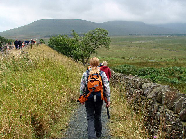
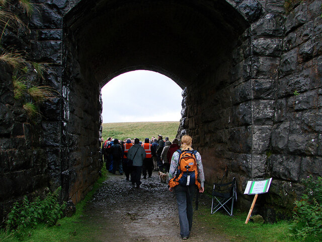
Hiking trails crisscross Gauber High Pasture, catering to both novice and experienced outdoor enthusiasts. These trails offer opportunities to explore the moorland, discover hidden valleys, and stumble upon ancient ruins or standing stones that bear witness to the area's rich history.

Overall, Gauber High Pasture is a remarkable natural landscape that showcases the beauty of the Yorkshire Downs and Moorland. Its idyllic setting, diverse flora and fauna, and peaceful ambiance make it a must-visit destination for those seeking to immerse themselves in the tranquility of the countryside.

If you have any feedback on the listing, please let us know in the comments section below.

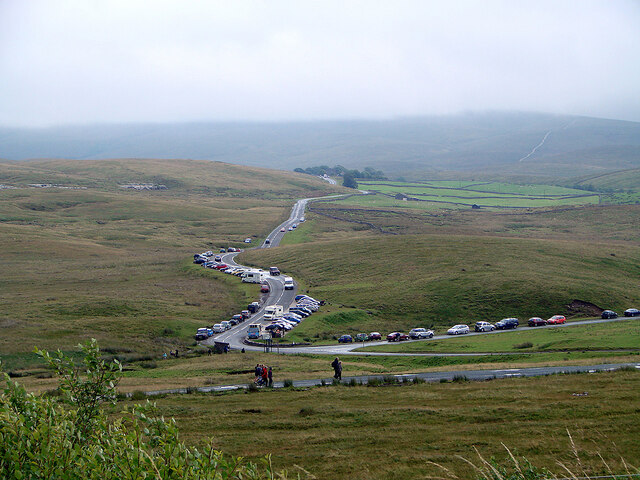
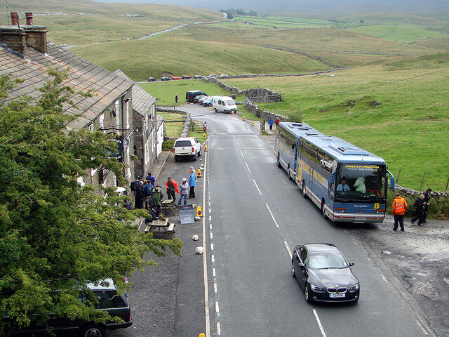
Gauber High Pasture Images

Images are sourced within 2km of 54.197963/-2.3603119 or Grid Reference SD7678. Thanks to Geograph Open Source API. All images are credited.

A view over the upper Ribble valley from Park Fell With the cottages at Gauber visible on the right.
A view over the upper Ribble valley from Park Fell
With the cottages at Gauber visible on the right.
Dry stone wall at Selside Along with the limestone pavement from which the stone was presumably taken, this is typical Ribblesdale scenery.
Dry stone wall at Selside
Along with the limestone pavement from which the stone was presumably taken, this is typical Ribblesdale scenery.
Cars parked at Gearstones This road junction at Ribblehead is popular with both visitors to the famous viaduct, and longer distance walkers.
Cars parked at Gearstones
This road junction at Ribblehead is popular with both visitors to the famous viaduct, and longer distance walkers.
Shake Holes at Batty Moss Taken from a train on the embankment approaching Ribblehead viaduct, you can see why this was difficult terrain for railway building. Ingleborough is in the distance.
Shake Holes at Batty Moss
Taken from a train on the embankment approaching Ribblehead viaduct, you can see why this was difficult terrain for railway building. Ingleborough is in the distance.
View towards Whernside Taken from a train on the Grade II* listed Ribblehead viaduct.
View towards Whernside
Taken from a train on the Grade II* listed Ribblehead viaduct.
View towards Ingleborough Taken from a train on the Grade II* listed Ribblehead viaduct.
View towards Ingleborough
Taken from a train on the Grade II* listed Ribblehead viaduct.
Gunnerfleet Farm Taken from a train on Ribblehead viaduct. See <a href="https://www.geograph.org.uk/photo/5521446">SD7579 : Gunnersfleet Farm from the north-west</a> for a view of the same farm from a different direction.
Gunnerfleet Farm
Taken from a train on Ribblehead viaduct. See SD7579 : Gunnersfleet Farm from the north-west for a view of the same farm from a different direction.
Minor path under the railway embankment This path isn't shown on maps as a public right of way, but is available to cross the line by means of an underpass <a href="https://www.geograph.org.uk/photo/5521457">SD7579 : Railway bridge at Gunnersfleet</a>, presumably provided originally either for local farm traffic (horse drawn in those days) or as part of the railway construction works.
Minor path under the railway embankment
This path isn't shown on maps as a public right of way, but is available to cross the line by means of an underpass SD7579 : Railway bridge at Gunnersfleet, presumably provided originally either for local farm traffic (horse drawn in those days) or as part of the railway construction works.
Crossing Ribblehead railway viaduct, 1985 Back in the day when normal service trains were longer and some needed two locomotives to haul them.
Crossing Ribblehead railway viaduct, 1985
Back in the day when normal service trains were longer and some needed two locomotives to haul them.
Ribblehead Viaduct
Ribblehead Viaduct
Viaduct walkers An official event allowing people to walk across Ribblehead Viaduct. Here people are awaiting their turn to do the walk. Walkers are seen across the viaduct. This was the last day of repairs to the viaduct and no trains were running.
Viaduct walkers
An official event allowing people to walk across Ribblehead Viaduct. Here people are awaiting their turn to do the walk. Walkers are seen across the viaduct. This was the last day of repairs to the viaduct and no trains were running.
Ribblehead viaduct walkers The Settle & Carlisle Railway was closed for repairs to the viaduct. On the last day of the closure, people were permitted to walk across the viaduct. Here, some are seen returning to Ribblehead, viewed from the viaduct.
Ribblehead viaduct walkers
The Settle & Carlisle Railway was closed for repairs to the viaduct. On the last day of the closure, people were permitted to walk across the viaduct. Here, some are seen returning to Ribblehead, viewed from the viaduct.
A busy day at Ribblehead On a day when the viaduct was open to walkers.
A busy day at Ribblehead
On a day when the viaduct was open to walkers.
Buses at Ribblehead Transporting walkers for the walking on the Ribblehead viaduct event.
Buses at Ribblehead
Transporting walkers for the walking on the Ribblehead viaduct event.
Path down from the railway On a day of a special event when people were able to walk across Ribblehead viaduct.
Path down from the railway
On a day of a special event when people were able to walk across Ribblehead viaduct.
Through the arch under the railway After crossing Ribblehead viaduct, walkers were invited to take a tour of the site of Batty Moss navvy camp.
Through the arch under the railway
After crossing Ribblehead viaduct, walkers were invited to take a tour of the site of Batty Moss navvy camp.
End of the Ribblehead viaduct walk event Heading back to Ribblehead. Some 'stragglers' can be seen on the viaduct.
End of the Ribblehead viaduct walk event
Heading back to Ribblehead. Some 'stragglers' can be seen on the viaduct.
Ribblehead Viaduct, 1968 On the Settle and Carlisle Line, it is a Grade II*(star) listed structure.
Ribblehead Viaduct, 1968
On the Settle and Carlisle Line, it is a Grade II*(star) listed structure.
Show me another place!

Gauber High Pasture is located at Grid Ref: SD7678 (Lat: 54.197963, Lng: -2.3603119)

Division: West Riding

Administrative County: North Yorkshire

District: Craven

Police Authority: North Yorkshire

What 3 Words

///shout.tastier.marathons. Near Ingleton, North Yorkshire

Related Wikis

Ribblehead Quarry

Ribblehead Quarry is a former limestone quarry next to Ribblehead railway station in the Yorkshire Dales National Park, North Yorkshire, England. It had...

Ribblehead railway station

Ribblehead is a railway station on the Settle and Carlisle Line, which runs between Carlisle and Leeds via Settle. The station, situated 52 miles 17 chains...
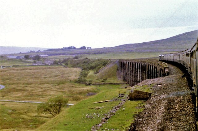
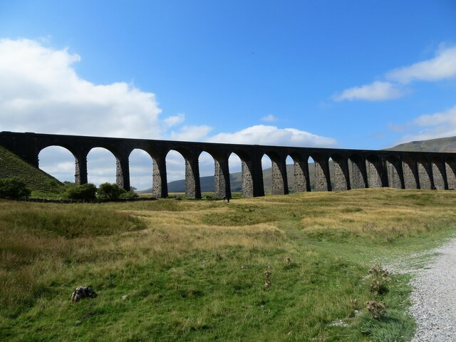
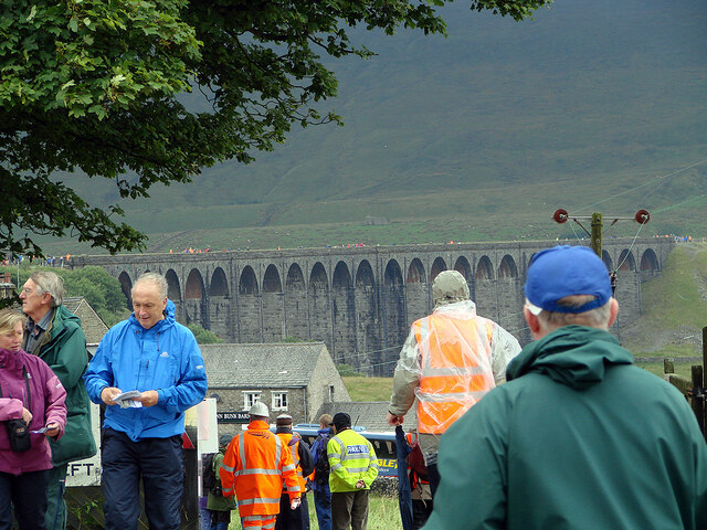
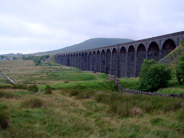
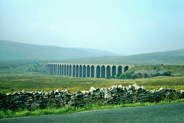
Ribblehead Viaduct

The Ribblehead Viaduct or Batty Moss Viaduct carries the Settle–Carlisle railway across Batty Moss in the Ribble Valley at Ribblehead, in North Yorkshire...
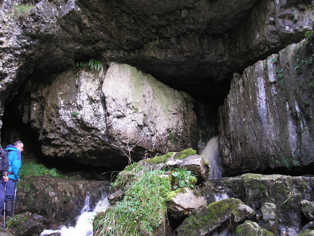
Great Douk Cave

Great Douk Cave is a shallow cave system lying beneath the limestone bench of Ingleborough in Chapel-le-Dale, North Yorkshire, England. It is popular with...

Ribblehead

Ribblehead is the area of moorland at the head of the River Ribble in the area known as Ribblesdale, in the Yorkshire Dales National Park, England. Ribblehead...
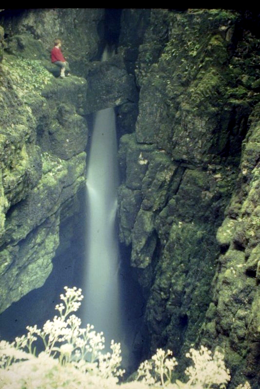
Weathercote Cave

Weathercote Cave is a natural solutional cave in Chapel-le-Dale, North Yorkshire, England. It has been renowned as a natural curiosity since the eighteenth...

Alum Pot

Alum Pot is a pothole with a large open shaft at a surface elevation of 343 metres (1,125 ft) on the eastern flanks of Simon Fell, North Yorkshire, England...

Chapel-le-Dale

Chapel-le-Dale is a hamlet in the civil parish of Ingleton, North Yorkshire, England. It is in the Yorkshire Dales National Park in a valley of the same...

Nearby Amenities

Located within 500m of 54.197963,-2.3603119
Gauber High Pasture
Place: locality
Source: OS 1:25k
Lat/Long: 54.1984864/-2.3598733
Barrier: stile
Lat/Long: 54.1971546/-2.3562967
Natural: spring
Source: NLS-OS-1st_Series
Lat/Long: 54.1944681/-2.3576672
The data included in this document is from www.openstreetmap.org. The data is made available under ODbL.

Have you been to Gauber High Pasture?

Leave your review of Gauber High Pasture below (or comments, questions and feedback).