Gaick Forest

Downs, Moorland in Inverness-shire

Scotland

Gaick Forest

The southern end of Loch an t-Seilich Taken from the slopes of Mullach Coire nan Dearcag. The small stand of trees in the centre of the photo is very close to Gaick Lodge, which is hidden from view.
The southern end of Loch an t-Seilich Credit: Michael Earnshaw

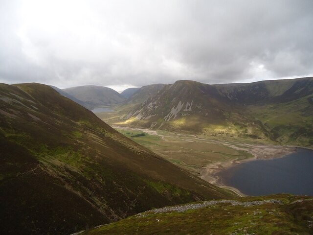
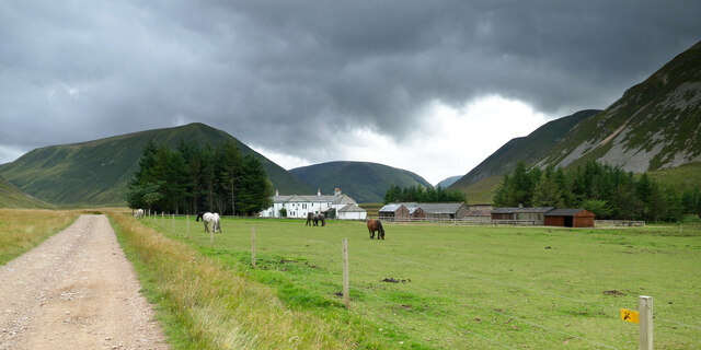
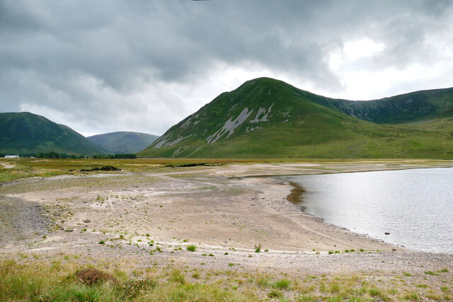
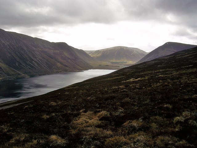
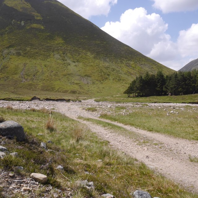
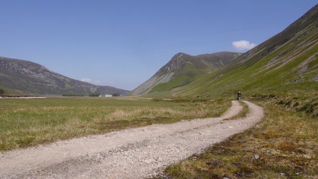
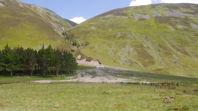
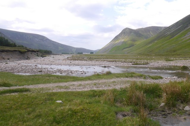
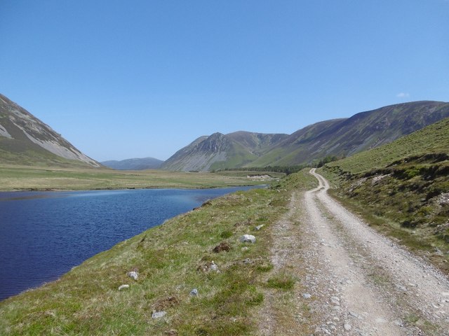
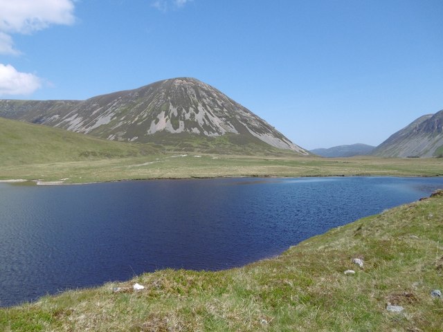
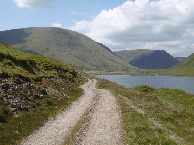
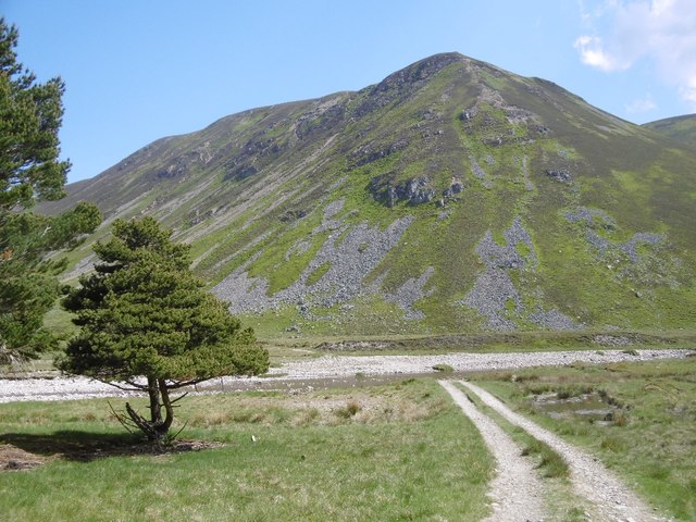
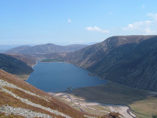
Gaick Forest is a remarkable natural area located in Inverness-shire, Scotland. Covering a vast expanse of downs and moorland, it stretches across approximately 12,000 hectares of stunning Highland landscape. The forest is nestled between the Cairngorm Mountains to the east and the Monadhliath Mountains to the west, offering visitors breathtaking views and a sense of tranquility.

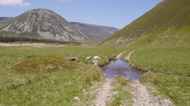
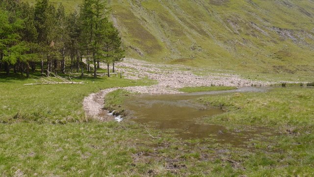
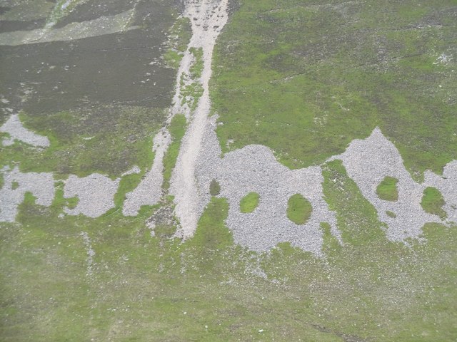
The terrain of Gaick Forest is characterized by rolling hills, heather-covered moors, and scattered woodlands. The area is rich in biodiversity, providing a habitat for a diverse range of wildlife species. Visitors may spot red deer, golden eagles, ospreys, and a variety of other bird species, making it a haven for wildlife enthusiasts and nature lovers.

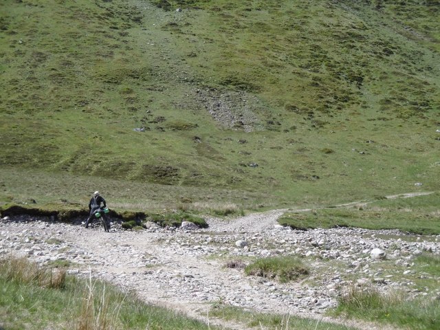
The forest is crisscrossed by a network of paths and trails, making it an ideal destination for hikers and walkers. The routes offer a mix of easy strolls and more challenging hikes, catering to all levels of fitness and experience. Along the way, walkers can soak in the stunning scenery, with panoramic vistas of the surrounding mountains and glens.

For those interested in history, Gaick Forest holds significance as an ancient hunting ground. The area was once used for recreational hunting by Highland clans, and remnants of this past activity can still be found, including former hunting lodges and gamekeeper's cottages.

In summary, Gaick Forest offers a unique opportunity to immerse oneself in the natural beauty of the Scottish Highlands. With its diverse wildlife, picturesque landscapes, and historical significance, it is a must-visit destination for anyone seeking an authentic Scottish outdoor experience.

If you have any feedback on the listing, please let us know in the comments section below.

Gaick Forest Images

Images are sourced within 2km of 56.94004/-4.047856 or Grid Reference NN7585. Thanks to Geograph Open Source API. All images are credited.

The southern end of Loch an t-Seilich Taken from the slopes of Mullach Coire nan Dearcag. The small stand of trees in the centre of the photo is very close to Gaick Lodge, which is hidden from view.
The southern end of Loch an t-Seilich
Taken from the slopes of Mullach Coire nan Dearcag. The small stand of trees in the centre of the photo is very close to Gaick Lodge, which is hidden from view.
Gaick Lodge Traditionally run as a sporting estate, with Garron ponies used to retrieve the stags and grouse during the season, things seem to be changing with web sites suggesting that the lodge "will not be available from 2016". It is apparently now owned by "Wildland Scotland" with a view to rewilding. There's a lot less evidence of forest regeneration in Glen Tromie compared with nearby Glen Feshie in the same ownership, but there are a lot of downed fences and rolled up wire, suggesting that some rewilding is going on. Deer numbers still need to be controlled for that (indeed, even more so) so the gamekeepers house marked on the map will no doubt be in use. Chris Packham having been on TV wildlife viewing up the hill to the right in 2021, perhaps this is destined to become an eco-tourism destination ? It will take a while before the land is suitable for the return of wolves and bears...
Gaick Lodge
Traditionally run as a sporting estate, with Garron ponies used to retrieve the stags and grouse during the season, things seem to be changing with web sites suggesting that the lodge "will not be available from 2016". It is apparently now owned by "Wildland Scotland" with a view to rewilding. There's a lot less evidence of forest regeneration in Glen Tromie compared with nearby Glen Feshie in the same ownership, but there are a lot of downed fences and rolled up wire, suggesting that some rewilding is going on. Deer numbers still need to be controlled for that (indeed, even more so) so the gamekeepers house marked on the map will no doubt be in use. Chris Packham having been on TV wildlife viewing up the hill to the right in 2021, perhaps this is destined to become an eco-tourism destination ? It will take a while before the land is suitable for the return of wolves and bears...
The head of Loch an t-Seilich A natural loch whose outflow is dammed, Loch an t-Seilich at the end of summer 2021 seems to be drawn down to about the lowest level the channel will support, leaving a large area of barren beach exposed. Seems badly out of step with the idea that Wildland Scotland are rewilding the estate, but forest regeneration has barely begun here so things like remediation of exposed banks are presumably some way in the future. Gaick Lodge, the centre of the estate, is just at the left of the photo, separated by the gap of the Gaick Pass (and the continuing cycle route to Sronphadruig and Dalnacardoch) from the imposing hillside of Sgòr Dearg, ascended by a punishingly steep stalkers' path, climbing 350m over less than a half a kilometre as the crow flies (or, more likely here, an eagle).
The head of Loch an t-Seilich
A natural loch whose outflow is dammed, Loch an t-Seilich at the end of summer 2021 seems to be drawn down to about the lowest level the channel will support, leaving a large area of barren beach exposed. Seems badly out of step with the idea that Wildland Scotland are rewilding the estate, but forest regeneration has barely begun here so things like remediation of exposed banks are presumably some way in the future. Gaick Lodge, the centre of the estate, is just at the left of the photo, separated by the gap of the Gaick Pass (and the continuing cycle route to Sronphadruig and Dalnacardoch) from the imposing hillside of Sgòr Dearg, ascended by a punishingly steep stalkers' path, climbing 350m over less than a half a kilometre as the crow flies (or, more likely here, an eagle).
Loch an t-Seilich from above Taken from close to the summit of Maol an t-Seilich.
Loch an t-Seilich from above
Taken from close to the summit of Maol an t-Seilich.
Ford, Allt Gharbh Ghaig A wide but in these conditions, easy ford on the Gaick Pass.
Ford, Allt Gharbh Ghaig
A wide but in these conditions, easy ford on the Gaick Pass.
Bike packing through the Gaick Quite a few bikes cross the Gaick which has a road for all but 2km of its length. The main problem is river crossings but not during a prolonged warm and dry spell like this.

Three folk crossed on horseback today as well, however there are gates between Dalnacardoch and Sronphadruig and these were open today.
Bike packing through the Gaick
Quite a few bikes cross the Gaick which has a road for all but 2km of its length. The main problem is river crossings but not during a prolonged warm and dry spell like this. Three folk crossed on horseback today as well, however there are gates between Dalnacardoch and Sronphadruig and these were open today.
Ford, Garbh Gaick The route of Comyn's Road, once the main route between Badenoch and Atholl. The background hills are the other side of the much derided Monadh Ghaig, east of Dalwhinnie. (tops of Carn na Caim).
Ford, Garbh Gaick
The route of Comyn's Road, once the main route between Badenoch and Atholl. The background hills are the other side of the much derided Monadh Ghaig, east of Dalwhinnie. (tops of Carn na Caim).
A new course for the Allt a' Mhoraire The heavy rains and flooding of December 2015 have had a very big impact on the Gaick.  There are lots of new landslides, outwash plains have been refreshed and rivers have found new courses.  Here the burn's old bed is full of debris and it has yet to wash away the vegetation and soil in its new course.
A new course for the Allt a' Mhoraire
The heavy rains and flooding of December 2015 have had a very big impact on the Gaick. There are lots of new landslides, outwash plains have been refreshed and rivers have found new courses. Here the burn's old bed is full of debris and it has yet to wash away the vegetation and soil in its new course.
Refreshed alluvial fan, Garbh Gaick Eight years on from <a href="https://www.geograph.org.uk/photo/808035">NN7683 : Allt a' Mhoraire</a> and six months after heavy rain made a few big changes to the Mounth, causing bad flooding in several towns.  A fresh load of stone has been washed down the gorge.
Refreshed alluvial fan, Garbh Gaick
Eight years on from NN7683 : Allt a' Mhoraire and six months after heavy rain made a few big changes to the Mounth, causing bad flooding in several towns. A fresh load of stone has been washed down the gorge.
Ford, An Gharbh Ghaig Once bridged, this is a potentially awkward river crossing on the Gaick Pass.  View towards Gaick Lodge.
Ford, An Gharbh Ghaig
Once bridged, this is a potentially awkward river crossing on the Gaick Pass. View towards Gaick Lodge.
Road, Gaick Pass Passing Loch Bhrodainn, just south of the junction with the Garbh Ghaig/Comyn's Road.
Road, Gaick Pass
Passing Loch Bhrodainn, just south of the junction with the Garbh Ghaig/Comyn's Road.
Loch Bhrodainn The middle of the three Gaick lochs with a background of scree covered An Sgòr.
Loch Bhrodainn
The middle of the three Gaick lochs with a background of scree covered An Sgòr.
Gaick Pass: Loch Bhrodainn The road heading south towards Loch an Dùin between the two background hills. (A' Chaoirnich and An Dùn).
Gaick Pass: Loch Bhrodainn
The road heading south towards Loch an Dùin between the two background hills. (A' Chaoirnich and An Dùn).
Scree, Gaick The east side of the Carn na Caim/Bhuidheanaich Beag plateau above Loch Bhrodainn.
Scree, Gaick
The east side of the Carn na Caim/Bhuidheanaich Beag plateau above Loch Bhrodainn.
Bridge, Dubh Bhrodainn Crossing the river leaving Loch Bhrodainn with an alluvial fan from the Allt Bhrodainn which runs in from the west.
Bridge, Dubh Bhrodainn
Crossing the river leaving Loch Bhrodainn with an alluvial fan from the Allt Bhrodainn which runs in from the west.
Garbh Ghaig ford Northward view towards Sròn a' Mhoraire on the other side of the sometimes troublesome ford.
Garbh Ghaig ford
Northward view towards Sròn a' Mhoraire on the other side of the sometimes troublesome ford.
Allt Gharbh Ghaig ford A bike packer contemplates his next move. The river has cut a deep channel through the alluvial fan, and although the water level was low, it was a bit of step down into it.  Adam Watson in the 1970s edition of the SMC district guides describes a bridge here. It has long gone.
Allt Gharbh Ghaig ford
A bike packer contemplates his next move. The river has cut a deep channel through the alluvial fan, and although the water level was low, it was a bit of step down into it. Adam Watson in the 1970s edition of the SMC district guides describes a bridge here. It has long gone.
Loch an t-Seilich
Loch an t-Seilich
Show me another place!

Gaick Forest is located at Grid Ref: NN7585 (Lat: 56.94004, Lng: -4.047856)

Unitary Authority: Highland

Police Authority: Highlands and Islands

What 3 Words

///chuckling.blip.albums. Near Newtonmore, Highland

Nearby Locations

Gaick Forest

Related Wikis

Grampian Mountains

The Grampian Mountains (Scottish Gaelic: Am Monadh) is one of the three major mountain ranges in Scotland, that together occupy about half of Scotland...

Meall Chuaich

Meall Chuaich (951 m) is a mountain in the Grampian Mountains of Scotland, located east of the village of Dalwhinnie. Although the mountain lacks any distinctive...

Kingdom of Scotland

The Kingdom of Scotland (Scottish Gaelic: Rìoghachd na h-Alba; Scots: Kinrick o Scotland, Norn: Kongungdum Skotland) was a sovereign state in northwest...

Scotland

Scotland (Scots: Scotland; Scottish Gaelic: Alba) is a country that is part of the United Kingdom. It contains nearly one-third of the United Kingdom's...

Nearby Amenities

Located within 500m of 56.94004,-4.047856
Ford: yes
Lat/Long: 56.9379968/-4.0472472
Gaick Lodge
Place: isolated_dwelling
Lat/Long: 56.9380506/-4.0435052
5th man
Historic: memorial
Memorial: stone
Lat/Long: 56.9366283/-4.0429151
The data included in this document is from www.openstreetmap.org. The data is made available under ODbL.

Have you been to Gaick Forest?

Leave your review of Gaick Forest below (or comments, questions and feedback).