Red Brae

Downs, Moorland in Kirkcudbrightshire

Scotland

Red Brae

Low Bridge of Tarff nr Tongland Crossing the Tarff Water not far upstream from its confluence with the River Dee upstream from Kirkcudbright
Low Bridge of Tarff nr Tongland Credit: Kirsty Smith

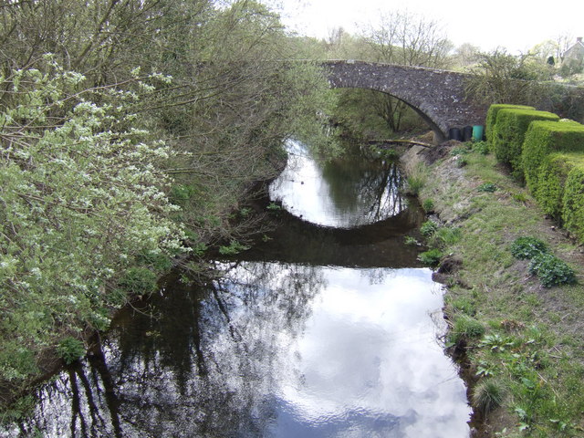
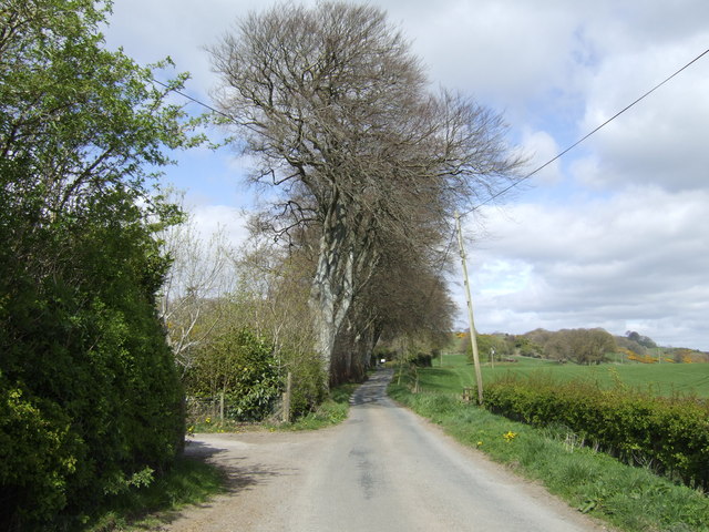
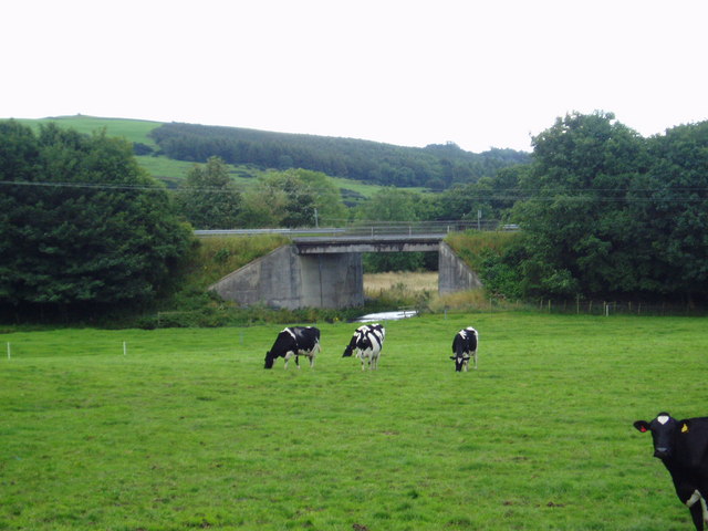
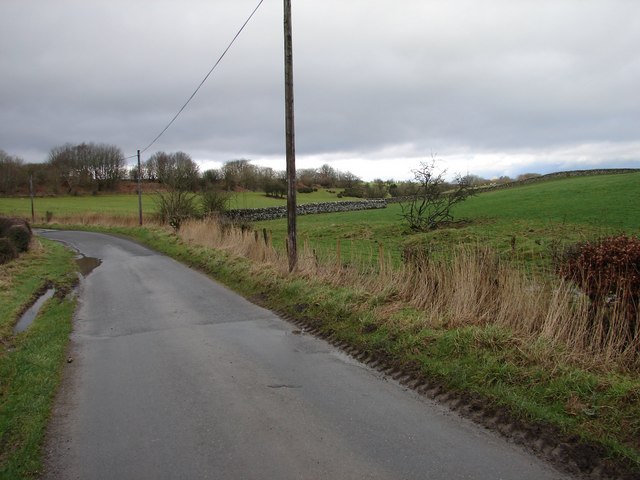
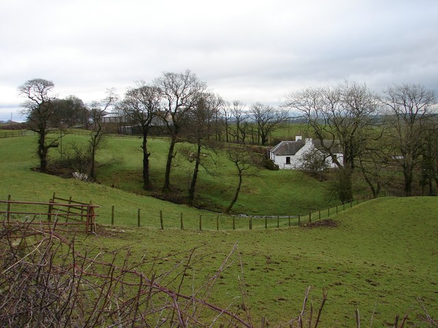
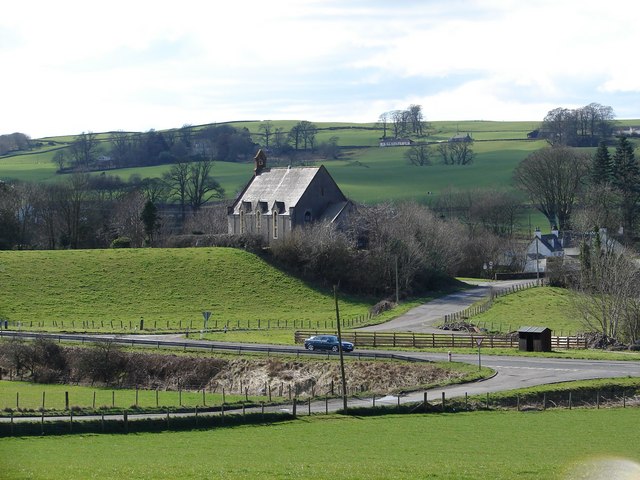
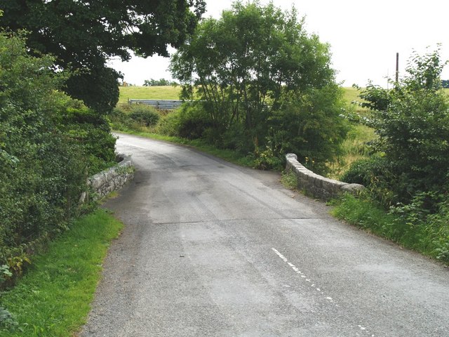
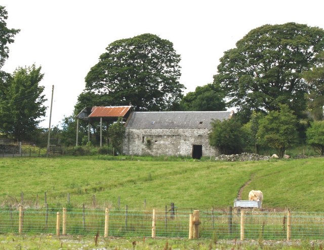
Red Brae is a charming rural area located in Kirkcudbrightshire, Scotland. Situated amidst picturesque downs and moorland, the region offers a tranquil and idyllic setting for those seeking a peaceful retreat. With its unspoiled natural beauty, Red Brae attracts nature enthusiasts, hikers, and outdoor adventurers.

The downs in Red Brae are expansive, rolling hills covered in lush green grasses and dotted with wildflowers. These open spaces provide magnificent views of the surrounding countryside, making it a popular spot for picnics, leisurely walks, and bird-watching. The downs are also home to an array of wildlife, including deer, rabbits, and various bird species, offering visitors a chance to observe these animals in their natural habitat.

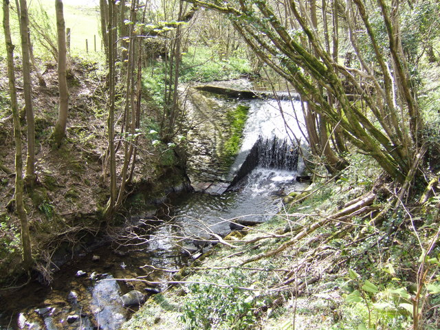
The moorland of Red Brae is a captivating landscape characterized by its vast expanses of heather-covered moors. The vibrant purple hues of the heather create a stunning contrast against the verdant greenery of the area. Moorland walks are a favorite activity among visitors, with numerous trails and pathways meandering through the rugged terrain. This rugged landscape is also home to a diverse range of plant and animal species, adding to its ecological significance.

Red Brae, with its downs and moorland, offers a unique opportunity to immerse oneself in the beauty of Scotland's rural landscapes. Its peaceful ambiance, stunning vistas, and rich biodiversity make it a must-visit destination for nature lovers and those seeking a break from the hustle and bustle of city life.

If you have any feedback on the listing, please let us know in the comments section below.
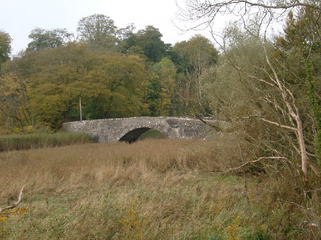
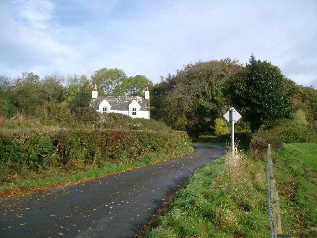
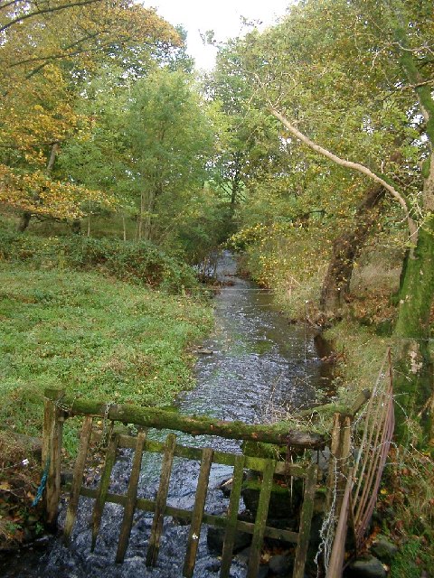
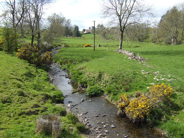
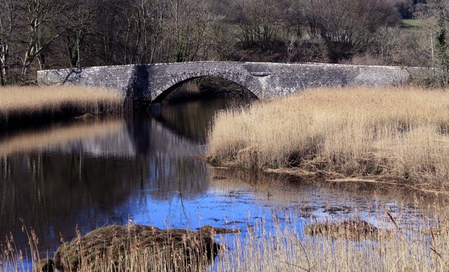
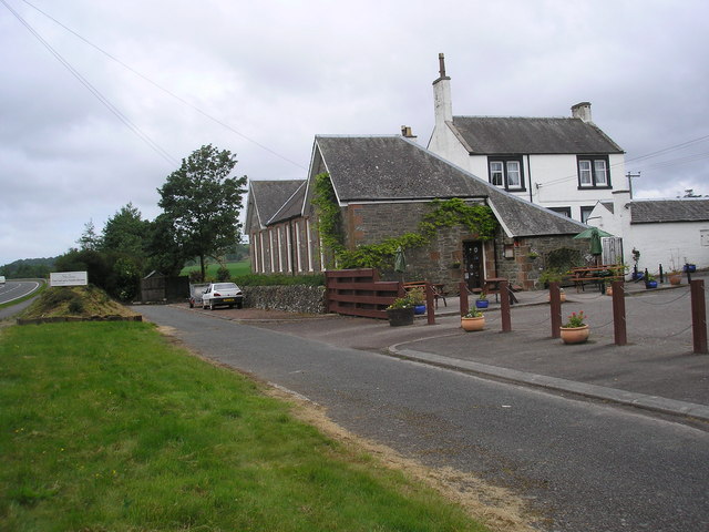
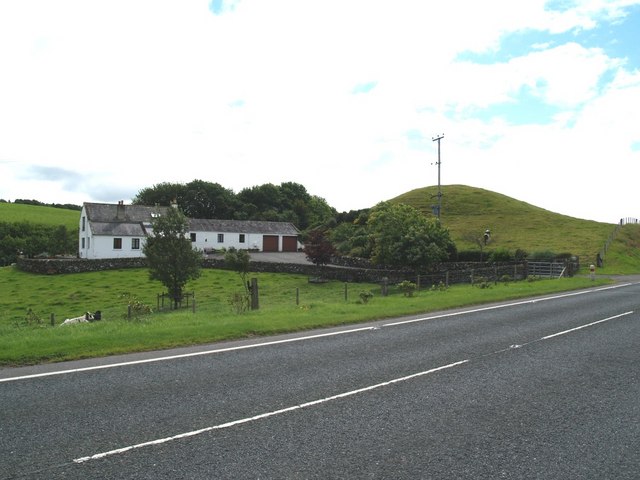
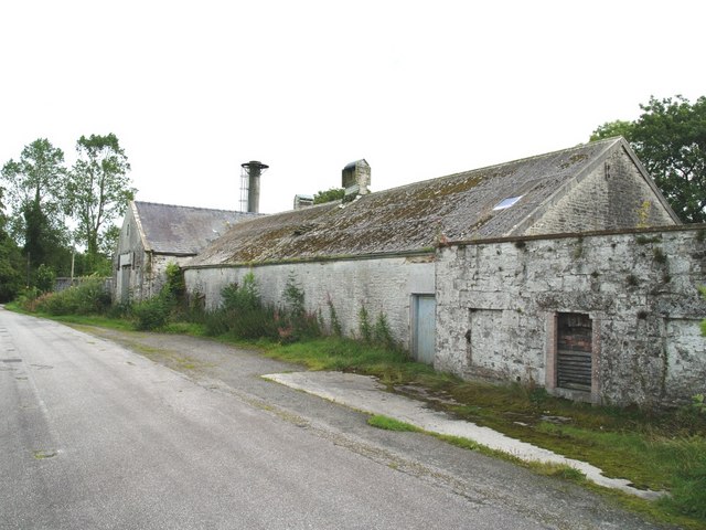
Red Brae Images

Images are sourced within 2km of 54.880177/-4.0590976 or Grid Reference NX6755. Thanks to Geograph Open Source API. All images are credited.

Low Bridge of Tarff nr Tongland Crossing the Tarff Water not far upstream from its confluence with the River Dee upstream from Kirkcudbright
Low Bridge of Tarff nr Tongland
Crossing the Tarff Water not far upstream from its confluence with the River Dee upstream from Kirkcudbright
Low Barcaple
Low Barcaple
Upstream, Spout Burn and Larks Plantation
Old Mill Burn Looking from Ashland towards Twynholm.
Old Mill Burn
Looking from Ashland towards Twynholm.
Weir on the Old Mill Burn Glinting in the spring sunshine.
Weir on the Old Mill Burn
Glinting in the spring sunshine.
The Old Bridge of Tarff Pictured from where the military road crossed the river by the High Bridge of Tarff, this hump-backed bridge was built in the 18th century.
The Old Bridge of Tarff
Pictured from where the military road crossed the river by the High Bridge of Tarff, this hump-backed bridge was built in the 18th century.
Beeches by the lane near Barcaple.
A75 Road Bridge over the Tarff Water. This is the latest bridge to carry the Gretna-Stranraer Road over the Tarff Water and least attractive. The previous two having much more character.
A75 Road Bridge over the Tarff Water.
This is the latest bridge to carry the Gretna-Stranraer Road over the Tarff Water and least attractive. The previous two having much more character.
Glengap Road, Twynholm View NNW from the Glengap Road (Redfield) toward the coppices of Mains of Twynholm.
Glengap Road, Twynholm
View NNW from the Glengap Road (Redfield) toward the coppices of Mains of Twynholm.
Lochhill, Ringford View across Spout Burn to Lochhill Cottage and Lochhill Farm.
Lochhill, Ringford
View across Spout Burn to Lochhill Cottage and Lochhill Farm.
Tarff Valley HQ of Tarff Valley (agriculture merchants) built on site of former station and trackbed of the Kirkcudbright branch railway (1864-1965). Tarff station building shown on left of image.
Tarff Valley
HQ of Tarff Valley (agriculture merchants) built on site of former station and trackbed of the Kirkcudbright branch railway (1864-1965). Tarff station building shown on left of image.
Valleyfield Church The former Tongland & Twynholm Free Church (1843) stands in the hamlet of Valleyfield in Tarff Valley, today by-passed by the A75 trunk road.
Valleyfield Church
The former Tongland & Twynholm Free Church (1843) stands in the hamlet of Valleyfield in Tarff Valley, today by-passed by the A75 trunk road.
Low Bridge of Tarff Low bridge of Tarff, which crosses the Tarff Water.
Low Bridge of Tarff
Low bridge of Tarff, which crosses the Tarff Water.
The Old School Tea Room A useful refreshment stop on the A75.
The Old School Tea Room
A useful refreshment stop on the A75.
Torglass and Torglass Hill, Twynholm. The steep little knowle is called Torglass Hill and the cottage is named after it.
Torglass and Torglass Hill, Twynholm.
The steep little knowle is called Torglass Hill and the cottage is named after it.
The Old Creamery at Tarff
Bridge near Ashland, Twynholm. Bridge over the Old Mill Burn near Ashland.
Bridge near Ashland, Twynholm.
Bridge over the Old Mill Burn near Ashland.
Old farm buildings at Baerlochan, Twynholm
Show me another place!

Red Brae is located at Grid Ref: NX6755 (Lat: 54.880177, Lng: -4.0590976)

Unitary Authority: Dumfries and Galloway

Police Authority: Dumfries and Galloway

What 3 Words

///birdcage.mailing.secret. Near Kirkcudbright, Dumfries & Galloway

Nearby Locations

Red Brae

Related Wikis

Tarff railway station

Tarff railway station served the village of Ringford, Dumfries and Galloway, Scotland from 1864 to 1965 on the Kirkcudbright Railway. == History == The...

Ringford

Ringford is a village in the historical county of Kirkcudbrightshire in Dumfries and Galloway located at grid reference NX689578 beside the Tarff Water...

Twynholm

Twynholm () is a village in Scotland. It is located 2+1⁄4 miles (3.6 km) north-northwest of Kirkcudbright and 4+1⁄2 miles (7.2 km) east of Gatehouse of...

Tongland

Tongland is a small village about 2 miles (3 km) north of Kirkcudbright, in the historic county of Kirkcudbrightshire in Dumfries and Galloway, Scotland...

Tongland Abbey

Tungland or Tongland Abbey was a Premonstratensian monastic community located in Tongland in the historical county of Kirkcudbrightshire in Dumfries and...

Kirkcudbright Railway

The Kirkcudbright Railway was a railway branch line linking Kirkcudbright to the Castle Douglas and Dumfries Railway at Castle Douglas. It opened in 1864...

Kirkcudbright railway station

Kirkcudbright railway station served the town of Kirkcudbright, Dumfries and Galloway, Scotland from 1864 to 1965 on the Kirkcudbright Railway. == History... ==

Broughton House

Broughton House is an 18th-century town house standing on the High Street of Kirkcudbright, Scotland. It was the home of Scots impressionist artist E....

Nearby Amenities

Located within 500m of 54.880177,-4.0590976
Bus Stop
Tarff Bridge
Bus: yes
Naptan AtcoCode: 680000049111
Naptan Bearing: NE
Naptan BusStopType: CUS
Naptan CommonName: Tarff Bridge
Naptan Indicator: A75 Junction
Naptan Landmark: A762
Naptan NaptanCode: 34236493
Naptan Notes: none
Naptan Street: A75
Naptan Verified: no
Public Transport: platform
Source: naptan_import
Lat/Long: 54.8817294/-4.0546672
Bus Stop
Tarff Bridge
Bus: yes
Naptan AtcoCode: 680000049222
Naptan Bearing: SW
Naptan BusStopType: CUS
Naptan CommonName: Tarff Bridge
Naptan Indicator: A762 junction
Naptan Landmark: A762
Naptan NaptanCode: 34236494
Naptan Notes: none
Naptan Street: A75
Naptan Verified: no
Public Transport: platform
Source: naptan_import
Lat/Long: 54.8816631/-4.0543364
Post Box
Ref: DG6 9
Lat/Long: 54.8833448/-4.0572165
Power: pole
Lat/Long: 54.8767465/-4.0620941
Power: pole
Lat/Long: 54.8772632/-4.0612519
Power: pole
Lat/Long: 54.8778712/-4.0604028
Power: pole
Lat/Long: 54.878345/-4.0599199
Power: pole
Lat/Long: 54.8790482/-4.0592014
Power: pole
Lat/Long: 54.8792657/-4.0583872
Power: pole
Lat/Long: 54.8796871/-4.0567333
Power: pole
Lat/Long: 54.8793475/-4.0553173
Power: pole
Lat/Long: 54.8790107/-4.0539036
Power: pole
Lat/Long: 54.878698/-4.0525482
Power: pole
Lat/Long: 54.878553/-4.051972
Power: pole
Lat/Long: 54.8823805/-4.0552198
Power: pole
Lat/Long: 54.8835463/-4.0550562
Power: pole
Lat/Long: 54.8838677/-4.0550201
Power: pole
Lat/Long: 54.8845276/-4.0576778
Power: pole
Lat/Long: 54.8843443/-4.0590417
Power: pole
Lat/Long: 54.8841904/-4.0604099
Power: pole
Lat/Long: 54.8840107/-4.0618248
Power: pole
Lat/Long: 54.880095/-4.0593551
Power: pole
Lat/Long: 54.8795206/-4.058875
Power: pole
Lat/Long: 54.8804067/-4.0576343
Power: pole
Lat/Long: 54.8808137/-4.0571287
Power: pole
Lat/Long: 54.8815592/-4.0562236
The data included in this document is from www.openstreetmap.org. The data is made available under ODbL.

Have you been to Red Brae?

Leave your review of Red Brae below (or comments, questions and feedback).