Bual na Creige

Cliff, Slope in Inverness-shire

Scotland

Bual na Creige

Mingulay Bay and schoolhouse A visit possible by the small Barra boat that took 20 or so folk on a tour of the southern Hebrides with time to explore the cliffs of Mingulay.
Mingulay Bay and schoolhouse Credit: Julian Paren

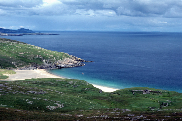
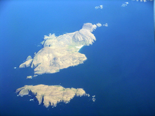
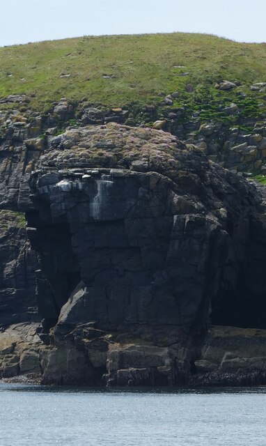
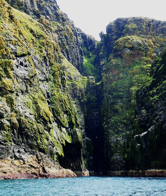
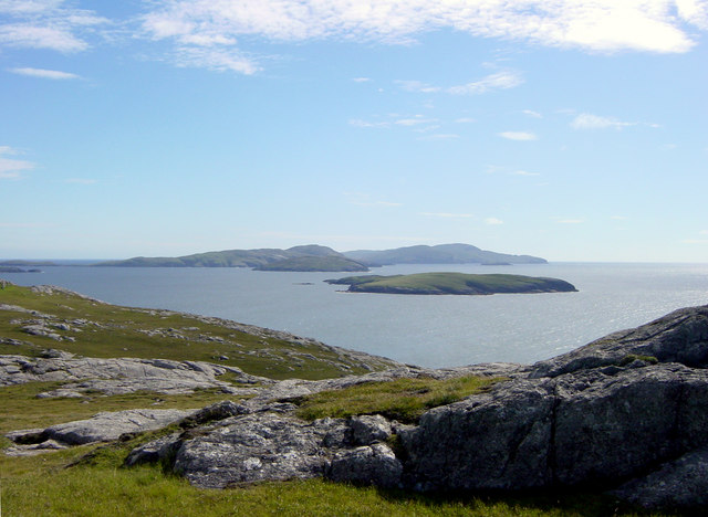
Bual na Creige is a prominent cliff located in Inverness-shire, Scotland. Rising majestically above the surrounding landscape, it stands as a striking geological formation and a notable landmark within the region.

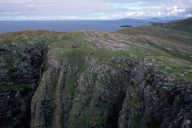
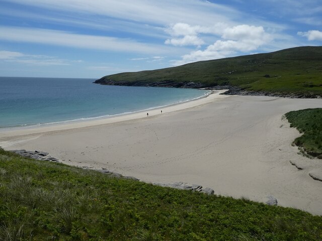
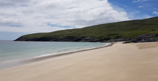
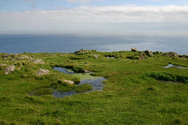
The cliff is situated in a remote area, characterized by rugged terrain and stunning natural beauty. Its location provides visitors with breathtaking panoramic views of the surrounding countryside, including the picturesque lochs and mountains that define the Scottish Highlands.

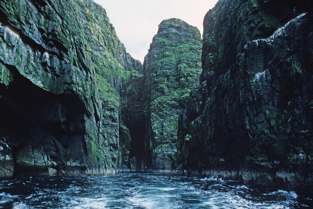
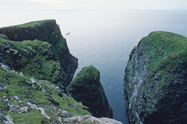
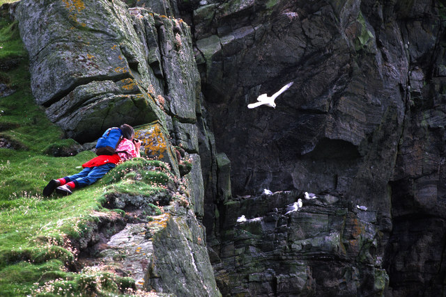
Bual na Creige features a steep slope, which makes it a challenging yet thrilling destination for outdoor enthusiasts and hikers. Its rugged terrain offers opportunities for various outdoor activities such as rock climbing, abseiling, and mountaineering. However, due to the steepness and potentially hazardous conditions, caution and appropriate equipment are advised when engaging in these activities.

The cliff is also a popular spot for birdwatching, as it serves as a nesting site for several bird species. Visitors may have the chance to observe birds such as peregrine falcons, golden eagles, and ravens soaring above the cliff and nesting in its crevices.

Bual na Creige is accessible via well-maintained trails, although it may require a moderate level of fitness to reach the summit. The journey is rewarded with awe-inspiring views and an immersive experience in the Scottish Highlands' untamed natural landscape.

Overall, Bual na Creige stands as an impressive and captivating cliff, offering visitors a chance to immerse themselves in the raw beauty of Inverness-shire's natural surroundings.

If you have any feedback on the listing, please let us know in the comments section below.

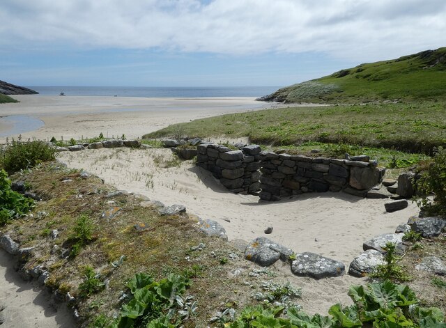
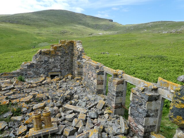
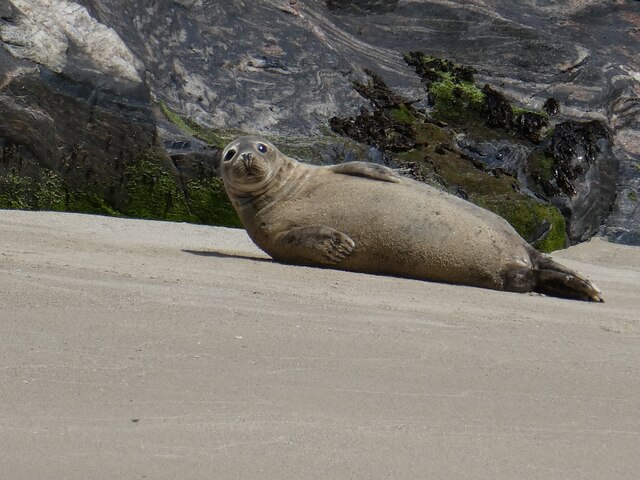
Bual na Creige Images

Images are sourced within 2km of 56.809715/-7.6567717 or Grid Reference NL5482. Thanks to Geograph Open Source API. All images are credited.

Mingulay Bay and schoolhouse A visit possible by the small Barra boat that took 20 or so folk on a tour of the southern Hebrides with time to explore the cliffs of Mingulay.
Mingulay Bay and schoolhouse
A visit possible by the small Barra boat that took 20 or so folk on a tour of the southern Hebrides with time to explore the cliffs of Mingulay.
Passage beside Arnamuil and Mingulay Looking back after the fastest left turn by a boat I have experienced. The channel narrows to just a little wider than a small 20-passenger boat.  Bob Jones shared the same experience from August 2006.  <a href="https://www.geograph.org.uk/photo/228967">NL5482 : Natural arch, Mingulay</a>
Passage beside Arnamuil and Mingulay
Looking back after the fastest left turn by a boat I have experienced. The channel narrows to just a little wider than a small 20-passenger boat. Bob Jones shared the same experience from August 2006. NL5482 : Natural arch, Mingulay
Passage between Arnamuil and Gunamuil Later that day we were to sail up the passage.  Dun Mingulay lies at the end of the left ridge.
Passage between Arnamuil and Gunamuil
Later that day we were to sail up the passage. Dun Mingulay lies at the end of the left ridge.
Cliffs of Mingulay Precipitous cliffs descending to narrow channels.
Cliffs of Mingulay
Precipitous cliffs descending to narrow channels.
Birdwatching on the Mingulay cliffs A very calm day so no problems for the birds foraging.
Birdwatching on the Mingulay cliffs
A very calm day so no problems for the birds foraging.
Mingulay/Miughlaigh and Berneray/Bearnaraigh An aerial view from the south. Mingulay is the larger of the two islands.
Mingulay/Miughlaigh and Berneray/Bearnaraigh
An aerial view from the south. Mingulay is the larger of the two islands.
Mingulay - Abandoned village - entrance to former dwelling Mingulay was abandoned in 1912, some 18 years before its more famous (and more distant) twin, St. Kilda.
Remnants of many of the houses still stand, but few exceed about 6' (2m) in height. Here we see the entrance to one of these former dwellings.
See <a href="https://www.geograph.org.uk/photo/6888621">NL5683 : Mingulay - former entrance to dwelling</a> for close-up of the doorway.
Mingulay - Abandoned village - entrance to former dwelling
Mingulay was abandoned in 1912, some 18 years before its more famous (and more distant) twin, St. Kilda. Remnants of many of the houses still stand, but few exceed about 6' (2m) in height. Here we see the entrance to one of these former dwellings. See NL5683 : Mingulay - former entrance to dwelling for close-up of the doorway.
Mingulay - former entrance to dwelling The narrow (and low) entrance to a former dwelling on Mingulay. See <a href="https://www.geograph.org.uk/photo/6888618">NL5683 : Mingulay - Abandoned village - entrance to former dwelling</a> to see this in context.
Mingulay - former entrance to dwelling
The narrow (and low) entrance to a former dwelling on Mingulay. See NL5683 : Mingulay - Abandoned village - entrance to former dwelling to see this in context.
Mingulay - sand-filled ruined house Being next to the beach, the abandoned buildings of the former village on the island of Mingulay have had sand blown in to cover their floors.
Mingulay - sand-filled ruined house
Being next to the beach, the abandoned buildings of the former village on the island of Mingulay have had sand blown in to cover their floors.
Mingulay - former chapel The utterly ruinous remains of the former chapel on Mingulay. This was the only building in the former village with a "Dangerous Building - Keep Out" sign on it. It retains its concrete steps on its north-east side from which I took this photo looking down into the devastation.
Mingulay - former chapel
The utterly ruinous remains of the former chapel on Mingulay. This was the only building in the former village with a "Dangerous Building - Keep Out" sign on it. It retains its concrete steps on its north-east side from which I took this photo looking down into the devastation.
Mingulay - stream flowing to the bay This is one of several streams that flow down from the hills of Mingulay to meet the bay beyond the village.
Mingulay - stream flowing to the bay
This is one of several streams that flow down from the hills of Mingulay to meet the bay beyond the village.
Mingulay - beach and bay The magnificent sands of Bàgh Mhiùghlaigh (Mingulay Bay) as seen from the hills to the north.
Mingulay - beach and bay
The magnificent sands of Bàgh Mhiùghlaigh (Mingulay Bay) as seen from the hills to the north.
Mingulay - Seal on the beach This seal seemed as interested in me as I was in him/her. I think that this is a grey (rather than a common/harbour) seal, but would welcome confirmation.
Mingulay - Seal on the beach
This seal seemed as interested in me as I was in him/her. I think that this is a grey (rather than a common/harbour) seal, but would welcome confirmation.
Gèarum Beag - Sphinx-like rock This rock feature looks to me as though Marty Feldman had posed for a Scottish version of the Sphinx.
Gèarum Beag - Sphinx-like rock
This rock feature looks to me as though Marty Feldman had posed for a Scottish version of the Sphinx.
Mingulay - Sloc Hèisegeo The west coast of Mingulay has amazing cliff scenery such as this at Sloc Hèisegeo.
Mingulay - Sloc Hèisegeo
The west coast of Mingulay has amazing cliff scenery such as this at Sloc Hèisegeo.
Mingulay - Sloc Dubh an Duin One of many superb inlets on the western coast of Mingulay. There was an amazing range of colours in the rocks - some the actual rock colours, some from the vegetation ... and a splash of white from the guano.
Mingulay - Sloc Dubh an Duin
One of many superb inlets on the western coast of Mingulay. There was an amazing range of colours in the rocks - some the actual rock colours, some from the vegetation ... and a splash of white from the guano.
Mingulay - Abandoned village from the beach Looking back from the beach to the abandoned village of Mingulay.
See <a href="https://www.geograph.org.uk/photo/6890287">NL5683 : Mingulay - The abandoned village</a>
 for a closer view.
Mingulay - Abandoned village from the beach
Looking back from the beach to the abandoned village of Mingulay. See NL5683 : Mingulay - The abandoned village for a closer view.
Mingulay - view SSW along the beach Looking along the beautiful beach which is in front of the abandoned village on the island of Mingulay.
Mingulay - view SSW along the beach
Looking along the beautiful beach which is in front of the abandoned village on the island of Mingulay.
Show me another place!

Bual na Creige is located at Grid Ref: NL5482 (Lat: 56.809715, Lng: -7.6567717)

Unitary Authority: Na h-Eileanan an Iar

Police Authority: Highlands and Islands

Also known as: Biulacraig

What 3 Words

///sour.cabs.cured. Near CastleBay, Na h-Eileanan Siar

Related Wikis

Arnamul

Arnamul (Scottish Gaelic: Arnamuil) is a stack off the west coast of Mingulay in the Western Isles, Scotland. Although precipitous, sheep were grazed on...

Barra Isles

The Barra Isles, also known as the Bishop's Isles, are a small archipelago in the Outer Hebrides of Scotland. They lie south of the island of Barra, for...

Mingulay

Mingulay (Scottish Gaelic: Miughalaigh) is the second largest of the Bishop's Isles in the Outer Hebrides of Scotland. Located 12 nautical miles (22 kilometres...

Barra Head Lighthouse

Barra Head Lighthouse on Barra Head identifies the southern entrance to The Minch, roughly halfway between the Eilean Glas and Rinns of Islay lighthouses...

Barra Head

Barra Head, also known as Berneray (Scottish Gaelic: Beàrnaraigh; Scots: Barra Heid), is the southernmost island of the Outer Hebrides in Scotland. Within...

Pabbay, Barra Isles

Pabbay (Scottish Gaelic: Pabaigh) is one of the Barra Isles at the southern tip of the Outer Hebrides of Scotland. The name comes from Papey, which is...

Lingeigh

Lingeigh or Lingay is an unpopulated islet in the Outer Hebrides. It lies towards the southern end of the archipelago, just north of Pabbay and five kilometres...

Nearby Amenities

Located within 500m of 56.809715,-7.6567717
Càrnan
Corbett: no
Ele: 273
Graham: no
Marilyn: yes
Munro: no
Natural: peak
Prominence: 273
Lat/Long: 56.8085562/-7.6510344
Bual na Creige
Place: locality
Lat/Long: 56.8110631/-7.6535361
Bàgh na h-Aoineig
Natural: bay
Lat/Long: 56.8119911/-7.6530426
The data included in this document is from www.openstreetmap.org. The data is made available under ODbL.

Have you been to Bual na Creige?

Leave your review of Bual na Creige below (or comments, questions and feedback).