Creag Rùairidh

Cliff, Slope in Ross-shire

Scotland

Creag Rùairidh

Thatched Cottage on Loch Duich Although I have stated that this  cottage is on Loch Duich this bit of the pebble beach might actually be the beginning of the banks of Loch Alsh. The sea loch changes its name at some indeterminate point about here when its direction near enough follows a 90° bend. Loch Alsh is the bit nearest the sea.
A large proportion of the properties round here are either bed and breakfasts or self-catering. This one was obviously self-catering, and is part of a small collection of houses that make up Lower Ardelve.
The houses round here are a strange mix of older ones, which go from fairly dilapidated to very well-maintained, and newer ones, which sometimes blend in but at other times are obviously designed to make a status statement!
So it is quite common to see a showy newbuild next to a very functional home with a corrugated metal roof which could easily be mistaken for a scout hut.
The seaweed on the beech is a type of egg-wrack. Unlike most seaweeds it doesn't attach itself to pebbles on the beach or seabed. It just floats when the tide comes in. The big length of seaweed in the picture is actually formed from hundreds of individual plants, mostly around two feet long. This type of free-floating egg-wrack can be found at various locations on the West coast of Scotland but apparently right here is one of its hotspots, so to speak.
Thatched Cottage on Loch Duich Credit: Ian Dodds

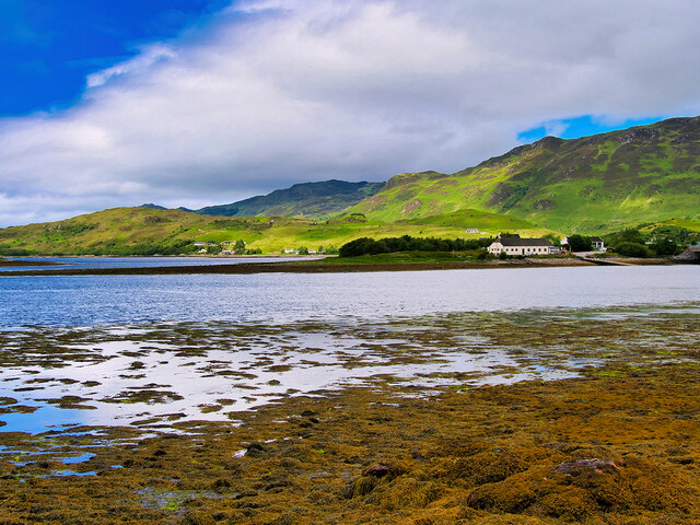
Creag Rùairidh, located in Ross-shire, Scotland, is a prominent cliff and slope formation that offers stunning views and natural beauty. This geological feature is situated in the Highlands region, near the small village of Contin.

Rising to an impressive height of approximately 300 meters, Creag Rùairidh dominates the landscape with its rugged and steep cliffs. The cliff face is made up of layers of sedimentary rock, which have been exposed over time due to erosion caused by wind, water, and ice. The layers reveal a rich geological history spanning millions of years.

The slope of Creag Rùairidh is covered in lush vegetation, including heather, grasses, and scattered trees, which add to its scenic appeal. The varied terrain provides a habitat for a diverse range of wildlife, such as birds, small mammals, and insects.

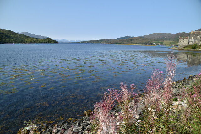
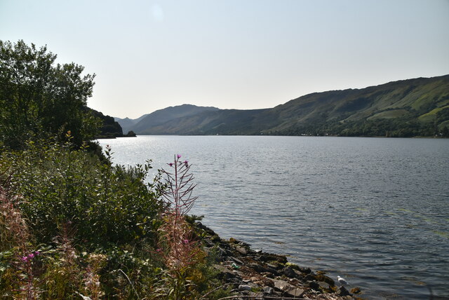
Due to its height and location, Creag Rùairidh offers breathtaking panoramic views of the surrounding countryside, including the picturesque River Beauly. On a clear day, visitors can see as far as the distant mountains of the Scottish Highlands.

The area around Creag Rùairidh is popular among hikers and nature enthusiasts who enjoy exploring the rugged trails and observing the unique flora and fauna. The cliff also attracts rock climbers, seeking to challenge themselves on its vertical faces.

Overall, Creag Rùairidh is a remarkable natural feature, showcasing the geological wonders and scenic beauty of Ross-shire, Scotland.

If you have any feedback on the listing, please let us know in the comments section below.

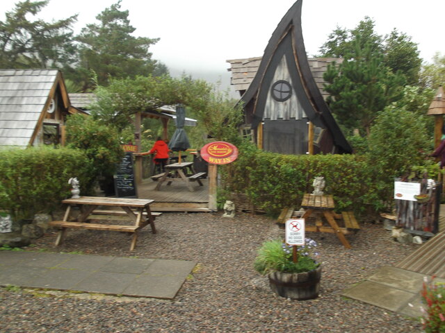
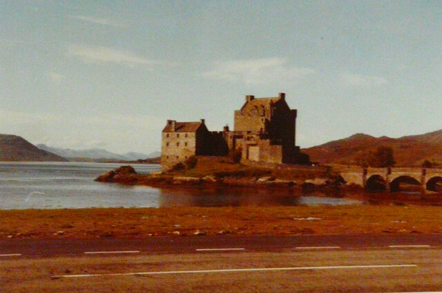
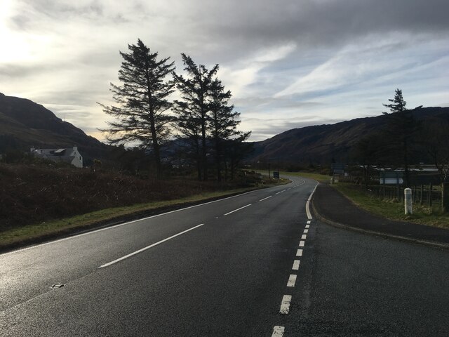
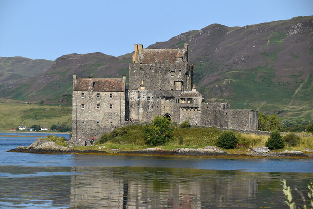
Creag Rùairidh Images

Images are sourced within 2km of 57.268279/-5.5437571 or Grid Reference NG8625. Thanks to Geograph Open Source API. All images are credited.

Thatched Cottage on Loch Duich Although I have stated that this  cottage is on Loch Duich this bit of the pebble beach might actually be the beginning of the banks of Loch Alsh. The sea loch changes its name at some indeterminate point about here when its direction near enough follows a 90° bend. Loch Alsh is the bit nearest the sea.
A large proportion of the properties round here are either bed and breakfasts or self-catering. This one was obviously self-catering, and is part of a small collection of houses that make up Lower Ardelve.
The houses round here are a strange mix of older ones, which go from fairly dilapidated to very well-maintained, and newer ones, which sometimes blend in but at other times are obviously designed to make a status statement!
So it is quite common to see a showy newbuild next to a very functional home with a corrugated metal roof which could easily be mistaken for a scout hut.
The seaweed on the beech is a type of egg-wrack. Unlike most seaweeds it doesn't attach itself to pebbles on the beach or seabed. It just floats when the tide comes in. The big length of seaweed in the picture is actually formed from hundreds of individual plants, mostly around two feet long. This type of free-floating egg-wrack can be found at various locations on the West coast of Scotland but apparently right here is one of its hotspots, so to speak.
Thatched Cottage on Loch Duich
Although I have stated that this cottage is on Loch Duich this bit of the pebble beach might actually be the beginning of the banks of Loch Alsh. The sea loch changes its name at some indeterminate point about here when its direction near enough follows a 90° bend. Loch Alsh is the bit nearest the sea. A large proportion of the properties round here are either bed and breakfasts or self-catering. This one was obviously self-catering, and is part of a small collection of houses that make up Lower Ardelve. The houses round here are a strange mix of older ones, which go from fairly dilapidated to very well-maintained, and newer ones, which sometimes blend in but at other times are obviously designed to make a status statement! So it is quite common to see a showy newbuild next to a very functional home with a corrugated metal roof which could easily be mistaken for a scout hut. The seaweed on the beech is a type of egg-wrack. Unlike most seaweeds it doesn't attach itself to pebbles on the beach or seabed. It just floats when the tide comes in. The big length of seaweed in the picture is actually formed from hundreds of individual plants, mostly around two feet long. This type of free-floating egg-wrack can be found at various locations on the West coast of Scotland but apparently right here is one of its hotspots, so to speak.
Castle Donnan
Castle Donnan
A87 near Ardelve
A87 near Ardelve
Eilean Donan Eilean Donan (Scottish Gaelic: Eilean Donnain) is a small tidal island situated at the confluence of three sea lochs (Loch Duich, Loch Long and Loch Alsh).  It is connected to the mainland by a footbridge that was installed early in the 20th century and is dominated by the picturesque Castle Donan; one of the most photographed monuments in Scotland (<span class="nowrap"><a title="http://travel.nationalgeographic.co.uk/travel/countries/scotland-photos" rel="nofollow ugc noopener" href="http://travel.nationalgeographic.co.uk/travel/countries/scotland-photos">Link</a><img style="margin-left:2px;" alt="External link" title="External link - shift click to open in new window" src="https://s1.geograph.org.uk/img/external.png" width="10" height="10"/></span> National Geographic; archived from the original on 25 March 2013).

The island's original castle was built in the thirteenth century; it became a stronghold of the Clan Mackenzie. Government ships destroyed the castle in 1719 in response to the Mackenzies' involvement in the Jacobite rebellions. The present-day castle is a 20th-century reconstruction of the old castle; it was built between 1912 and 1932 incorporating some remains of the keep and enclosing walls. It is a Category A listed building (LB 7209 <span class="nowrap"><a title="http://portal.historicenvironment.scot/designation/LB7209" rel="nofollow ugc noopener" href="http://portal.historicenvironment.scot/designation/LB7209">Link</a><img style="margin-left:2px;" alt="External link" title="External link - shift click to open in new window" src="https://s1.geograph.org.uk/img/external.png" width="10" height="10"/></span> Historic Environment Scotland) and a scheduled monument (SM7575).
Eilean Donan
Eilean Donan (Scottish Gaelic: Eilean Donnain) is a small tidal island situated at the confluence of three sea lochs (Loch Duich, Loch Long and Loch Alsh). It is connected to the mainland by a footbridge that was installed early in the 20th century and is dominated by the picturesque Castle Donan; one of the most photographed monuments in Scotland (LinkExternal link National Geographic; archived from the original on 25 March 2013). The island's original castle was built in the thirteenth century; it became a stronghold of the Clan Mackenzie. Government ships destroyed the castle in 1719 in response to the Mackenzies' involvement in the Jacobite rebellions. The present-day castle is a 20th-century reconstruction of the old castle; it was built between 1912 and 1932 incorporating some remains of the keep and enclosing walls. It is a Category A listed building (LB 7209 LinkExternal link Historic Environment Scotland) and a scheduled monument (SM7575).
Eilean Donan Castle Eilean Donan (Scottish Gaelic: Eilean Donnain) is a small tidal island situated at the confluence of three sea lochs (Loch Duich, Loch Long and Loch Alsh).  It is connected to the mainland by a footbridge that was installed early in the 20th century and is dominated by the picturesque Castle Donnan; one of the most photographed monuments in Scotland (<span class="nowrap"><a title="http://travel.nationalgeographic.co.uk/travel/countries/scotland-photos" rel="nofollow ugc noopener" href="http://travel.nationalgeographic.co.uk/travel/countries/scotland-photos">Link</a><img style="margin-left:2px;" alt="External link" title="External link - shift click to open in new window" src="https://s1.geograph.org.uk/img/external.png" width="10" height="10"/></span> National Geographic; archived from the original on 25 March 2013).

The island's original castle was built in the thirteenth century; it became a stronghold of the Clan Mackenzie. Government ships destroyed the castle in 1719 in response to the Mackenzies' involvement in the Jacobite rebellions. The present-day castle is a 20th-century reconstruction of the old castle that was built between 1912 and 1932 incorporating some remains of the keep and enclosing walls. It is a Category A listed building (LB 7209 <span class="nowrap"><a title="http://portal.historicenvironment.scot/designation/LB7209" rel="nofollow ugc noopener" href="http://portal.historicenvironment.scot/designation/LB7209">Link</a><img style="margin-left:2px;" alt="External link" title="External link - shift click to open in new window" src="https://s1.geograph.org.uk/img/external.png" width="10" height="10"/></span> Historic Environment Scotland) and a scheduled monument (SM7575).
Eilean Donan Castle
Eilean Donan (Scottish Gaelic: Eilean Donnain) is a small tidal island situated at the confluence of three sea lochs (Loch Duich, Loch Long and Loch Alsh). It is connected to the mainland by a footbridge that was installed early in the 20th century and is dominated by the picturesque Castle Donnan; one of the most photographed monuments in Scotland (LinkExternal link National Geographic; archived from the original on 25 March 2013). The island's original castle was built in the thirteenth century; it became a stronghold of the Clan Mackenzie. Government ships destroyed the castle in 1719 in response to the Mackenzies' involvement in the Jacobite rebellions. The present-day castle is a 20th-century reconstruction of the old castle that was built between 1912 and 1932 incorporating some remains of the keep and enclosing walls. It is a Category A listed building (LB 7209 LinkExternal link Historic Environment Scotland) and a scheduled monument (SM7575).
Castle Donan Eilean Donan (Scottish Gaelic: Eilean Donnain) is a small tidal island situated at the confluence of three sea lochs (Loch Duich, Loch Long and Loch Alsh).  It is connected to the mainland by a footbridge that was installed early in the 20th century and is dominated by the picturesque Castle Donnan; one of the most photographed monuments in Scotland (<span class="nowrap"><a title="http://travel.nationalgeographic.co.uk/travel/countries/scotland-photos" rel="nofollow ugc noopener" href="http://travel.nationalgeographic.co.uk/travel/countries/scotland-photos">Link</a><img style="margin-left:2px;" alt="External link" title="External link - shift click to open in new window" src="https://s1.geograph.org.uk/img/external.png" width="10" height="10"/></span> National Geographic; archived from the original on 25 March 2013).

The island's original castle was built in the thirteenth century; it became a stronghold of the Clan Mackenzie. Government ships destroyed the castle in 1719 in response to the Mackenzies' involvement in the Jacobite rebellions. The present-day castle is a 20th-century reconstruction of the old castle that was built between 1912 and 1932 incorporating some remains of the keep and enclosing walls. It is a Category A listed building (LB 7209 <span class="nowrap"><a title="http://portal.historicenvironment.scot/designation/LB7209" rel="nofollow ugc noopener" href="http://portal.historicenvironment.scot/designation/LB7209">Link</a><img style="margin-left:2px;" alt="External link" title="External link - shift click to open in new window" src="https://s1.geograph.org.uk/img/external.png" width="10" height="10"/></span> Historic Environment Scotland) and a scheduled monument (SM7575).
Castle Donan
Eilean Donan (Scottish Gaelic: Eilean Donnain) is a small tidal island situated at the confluence of three sea lochs (Loch Duich, Loch Long and Loch Alsh). It is connected to the mainland by a footbridge that was installed early in the 20th century and is dominated by the picturesque Castle Donnan; one of the most photographed monuments in Scotland (LinkExternal link National Geographic; archived from the original on 25 March 2013). The island's original castle was built in the thirteenth century; it became a stronghold of the Clan Mackenzie. Government ships destroyed the castle in 1719 in response to the Mackenzies' involvement in the Jacobite rebellions. The present-day castle is a 20th-century reconstruction of the old castle that was built between 1912 and 1932 incorporating some remains of the keep and enclosing walls. It is a Category A listed building (LB 7209 LinkExternal link Historic Environment Scotland) and a scheduled monument (SM7575).
Loch Duich, Eilean Donan Castle Eilean Donan (Scottish Gaelic: Eilean Donnain) is a small tidal island situated at the confluence of three sea lochs (Loch Duich, Loch Long and Loch Alsh).  It is connected to the mainland by a footbridge that was installed early in the 20th century and is dominated by the picturesque Castle Donnan; one of the most photographed monuments in Scotland (<span class="nowrap"><a title="http://travel.nationalgeographic.co.uk/travel/countries/scotland-photos" rel="nofollow ugc noopener" href="http://travel.nationalgeographic.co.uk/travel/countries/scotland-photos">Link</a><img style="margin-left:2px;" alt="External link" title="External link - shift click to open in new window" src="https://s1.geograph.org.uk/img/external.png" width="10" height="10"/></span> National Geographic; archived from the original on 25 March 2013).

The island's original castle was built in the thirteenth century; it became a stronghold of the Clan Mackenzie. Government ships destroyed the castle in 1719 in response to the Mackenzies' involvement in the Jacobite rebellions. The present-day castle is a 20th-century reconstruction of the old castle that was built between 1912 and 1932 incorporating some remains of the keep and enclosing walls. It is a Category A listed building (LB 7209 <span class="nowrap"><a title="http://portal.historicenvironment.scot/designation/LB7209" rel="nofollow ugc noopener" href="http://portal.historicenvironment.scot/designation/LB7209">Link</a><img style="margin-left:2px;" alt="External link" title="External link - shift click to open in new window" src="https://s1.geograph.org.uk/img/external.png" width="10" height="10"/></span> Historic Environment Scotland) and a scheduled monument (SM7575).
Loch Duich, Eilean Donan Castle
Eilean Donan (Scottish Gaelic: Eilean Donnain) is a small tidal island situated at the confluence of three sea lochs (Loch Duich, Loch Long and Loch Alsh). It is connected to the mainland by a footbridge that was installed early in the 20th century and is dominated by the picturesque Castle Donnan; one of the most photographed monuments in Scotland (LinkExternal link National Geographic; archived from the original on 25 March 2013). The island's original castle was built in the thirteenth century; it became a stronghold of the Clan Mackenzie. Government ships destroyed the castle in 1719 in response to the Mackenzies' involvement in the Jacobite rebellions. The present-day castle is a 20th-century reconstruction of the old castle that was built between 1912 and 1932 incorporating some remains of the keep and enclosing walls. It is a Category A listed building (LB 7209 LinkExternal link Historic Environment Scotland) and a scheduled monument (SM7575).
Loch Long Bridge (Dornie New Bridge) The current bridge carrying the A87 across Loch Long between Dornie and Ardelve was opened in 1990, providing a two-way road in place of the narrower old structure a little upstream. It consists of ten spans across the river, supported by pairs of concrete piers under the deck.

The old bridge was a single-track concrete structure, which spanned from the middle of Dornie Village to immediately north of the new bridge on the Ardelve side. Nothing now remains of the old bridge, as it was removed soon after the new bridge opened. The new road, bypassing Carr Brae, had been built some years earlier.
Loch Long Bridge (Dornie New Bridge)
The current bridge carrying the A87 across Loch Long between Dornie and Ardelve was opened in 1990, providing a two-way road in place of the narrower old structure a little upstream. It consists of ten spans across the river, supported by pairs of concrete piers under the deck. The old bridge was a single-track concrete structure, which spanned from the middle of Dornie Village to immediately north of the new bridge on the Ardelve side. Nothing now remains of the old bridge, as it was removed soon after the new bridge opened. The new road, bypassing Carr Brae, had been built some years earlier.
Loch Long Shore near Dornie Looking across Loch Long towards Ardelve Point.
Loch Long Shore near Dornie
Looking across Loch Long towards Ardelve Point.
Approaching Eilean Donan Castle Eilean Donan (Scottish Gaelic: Eilean Donnain) is a small tidal island situated at the confluence of three sea lochs (Loch Duich, Loch Long and Loch Alsh).  It is connected to the mainland by a footbridge that was installed early in the 20th century and is dominated by the picturesque Castle Donnan; one of the most photographed monuments in Scotland (<span class="nowrap"><a title="http://travel.nationalgeographic.co.uk/travel/countries/scotland-photos" rel="nofollow ugc noopener" href="http://travel.nationalgeographic.co.uk/travel/countries/scotland-photos">Link</a><img style="margin-left:2px;" alt="External link" title="External link - shift click to open in new window" src="https://s1.geograph.org.uk/img/external.png" width="10" height="10"/></span> National Geographic; archived from the original on 25 March 2013).

The island's original castle was built in the thirteenth century; it became a stronghold of the Clan Mackenzie. Government ships destroyed the castle in 1719 in response to the Mackenzies' involvement in the Jacobite rebellions. The present-day castle is a 20th-century reconstruction of the old castle that was built between 1912 and 1932 incorporating some remains of the keep and enclosing walls. It is a Category A listed building (LB 7209 <span class="nowrap"><a title="http://portal.historicenvironment.scot/designation/LB7209" rel="nofollow ugc noopener" href="http://portal.historicenvironment.scot/designation/LB7209">Link</a><img style="margin-left:2px;" alt="External link" title="External link - shift click to open in new window" src="https://s1.geograph.org.uk/img/external.png" width="10" height="10"/></span> Historic Environment Scotland) and a scheduled monument (SM7575).
Approaching Eilean Donan Castle
Eilean Donan (Scottish Gaelic: Eilean Donnain) is a small tidal island situated at the confluence of three sea lochs (Loch Duich, Loch Long and Loch Alsh). It is connected to the mainland by a footbridge that was installed early in the 20th century and is dominated by the picturesque Castle Donnan; one of the most photographed monuments in Scotland (LinkExternal link National Geographic; archived from the original on 25 March 2013). The island's original castle was built in the thirteenth century; it became a stronghold of the Clan Mackenzie. Government ships destroyed the castle in 1719 in response to the Mackenzies' involvement in the Jacobite rebellions. The present-day castle is a 20th-century reconstruction of the old castle that was built between 1912 and 1932 incorporating some remains of the keep and enclosing walls. It is a Category A listed building (LB 7209 LinkExternal link Historic Environment Scotland) and a scheduled monument (SM7575).
Eilean Donan Castle, 1989
Westbound A87 near to Nostie The A87 is a primary route  in the Highland region of Scotland. It runs west for 99 miles from its junction with the A82 at Invergarry, along the north shores of Loch Garry and Loch Cluanie, then through Glen Shiel and along Loch Duich to Kyle of Lochalsh before crossing the Skye Bridge to Kyleakin, Broadford, and Portree, before terminating at Uig in the north of the Isle of Skye.
Westbound A87 near to Nostie
The A87 is a primary route in the Highland region of Scotland. It runs west for 99 miles from its junction with the A82 at Invergarry, along the north shores of Loch Garry and Loch Cluanie, then through Glen Shiel and along Loch Duich to Kyle of Lochalsh before crossing the Skye Bridge to Kyleakin, Broadford, and Portree, before terminating at Uig in the north of the Isle of Skye.
Manuella's Wee Bakery, Ardelve
Eilean Donan castle
Eilean Donan castle
A87 near Ardelve
A87 near Ardelve
Eilean Donan Castle Eilean Donan is a small tidal island situated at the confluence of three sea lochs (Loch Duich, Loch Long and Loch Alsh). The island is dominated by a 2oth century replacement of an original 13th century castle.
Wikipedia: <span class="nowrap"><a title="https://en.wikipedia.org/wiki/Eilean_Donan" rel="nofollow ugc noopener" href="https://en.wikipedia.org/wiki/Eilean_Donan">Link</a><img style="margin-left:2px;" alt="External link" title="External link - shift click to open in new window" src="https://s1.geograph.org.uk/img/external.png" width="10" height="10"/></span>
Eilean Donan Castle
Eilean Donan is a small tidal island situated at the confluence of three sea lochs (Loch Duich, Loch Long and Loch Alsh). The island is dominated by a 2oth century replacement of an original 13th century castle. Wikipedia: LinkExternal link
Loch Duich
Loch Duich
Loch Duich
Loch Duich
Show me another place!

Creag Rùairidh is located at Grid Ref: NG8625 (Lat: 57.268279, Lng: -5.5437571)

Unitary Authority: Highland

Police Authority: Highlands and Islands

What 3 Words

///stores.music.nicer. Near Glenelg, Highland

Related Wikis

Caisteal Grugaig

Caisteal Grugaig (or Dun Totaig) is an Iron Age broch near the eastern end of Loch Alsh in the Scottish Highlands (grid reference NG86682508). == Location... ==
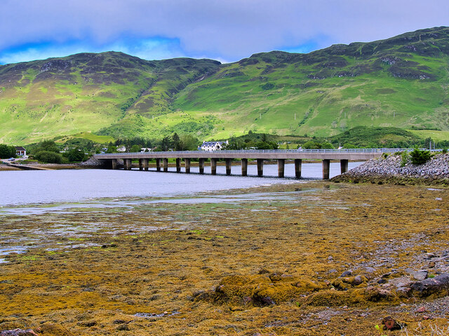
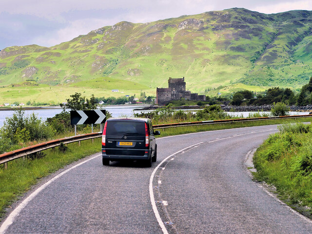
Ardelve

Ardelve (Scottish Gaelic: Àird Eilbh) is a village in Highland, Scotland, on Loch Alsh. It overlooks the Eilean Donan Castle, which is in Dornie, also...
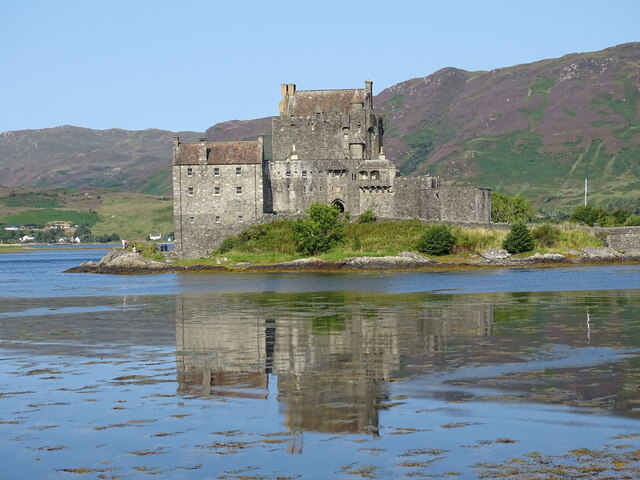
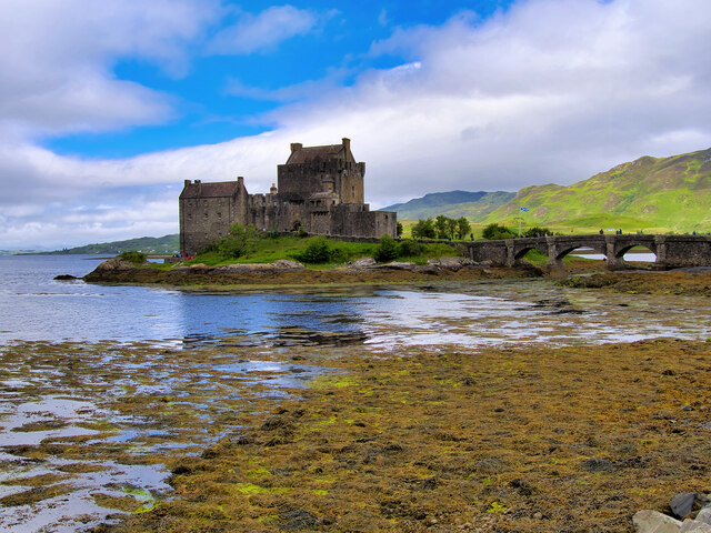
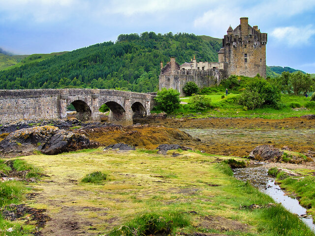
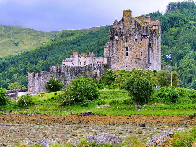
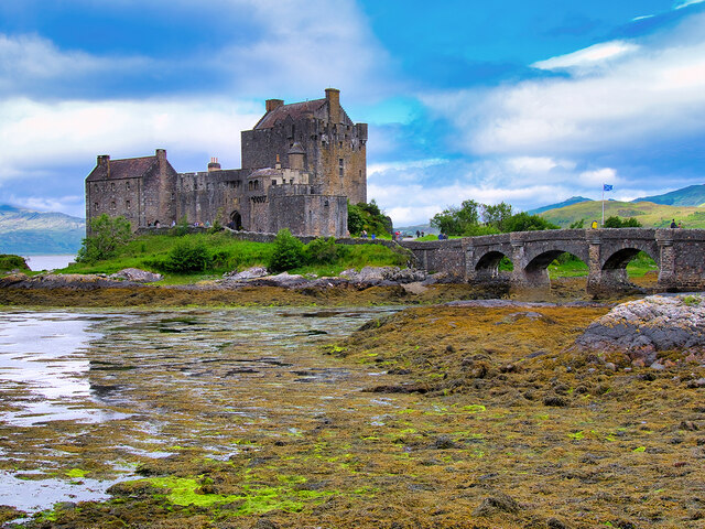
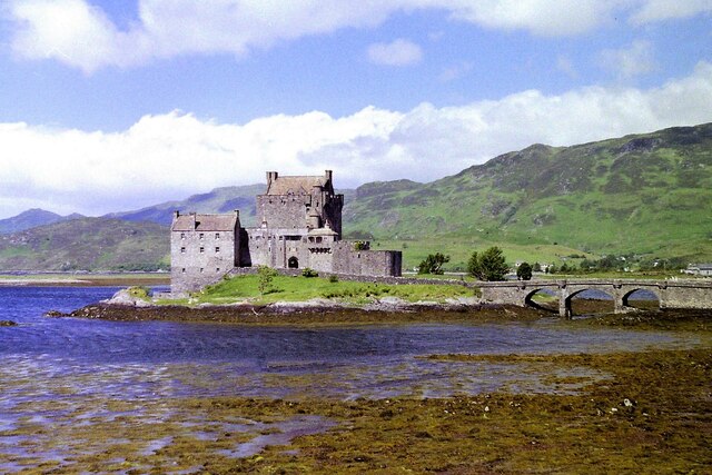
Eilean Donan

Eilean Donan (Scottish Gaelic: Eilean Donnain) is a small tidal island situated at the confluence of three sea lochs (Loch Duich, Loch Long and Loch Alsh...

Capture of Eilean Donan Castle

The Capture of Eilean Donan Castle was a land-based naval engagement that took place in 1719 during the British Jacobite rising of that year, and the War...

Nearby Amenities

Located within 500m of 57.268279,-5.5437571
Source: PGS
Lat/Long: 57.2685386/-5.5368428
Source: PGS
Lat/Long: 57.268775/-5.5372666
Source: PGS
Lat/Long: 57.268918/-5.5371263
Source: PGS
Lat/Long: 57.2689223/-5.5382576
Source: PGS
Lat/Long: 57.2688539/-5.538531
Source: PGS
Lat/Long: 57.2689506/-5.5389671
Source: PGS
Lat/Long: 57.269176/-5.5394309
Source: PGS
Lat/Long: 57.2691902/-5.539863
Source: PGS
Lat/Long: 57.2691905/-5.5404834
Source: PGS
Lat/Long: 57.2691902/-5.5413975
Source: PGS
Lat/Long: 57.2692091/-5.5422011
Source: PGS
Lat/Long: 57.2686284/-5.5441602
Source: PGS
Lat/Long: 57.2684662/-5.5443916
Source: PGS
Lat/Long: 57.2682664/-5.5445137
Source: PGS
Lat/Long: 57.2679047/-5.544452
Source: PGS
Lat/Long: 57.2677608/-5.5448197
Source: PGS
Lat/Long: 57.2674866/-5.5451515
Source: PGS
Lat/Long: 57.2673034/-5.5452942
Source: PGS
Lat/Long: 57.2671586/-5.5456343
Source: PGS
Lat/Long: 57.2670561/-5.5461048
Source: PGS
Lat/Long: 57.2671098/-5.5463478
Source: PGS
Lat/Long: 57.2670996/-5.5465141
Source: PGS
Lat/Long: 57.2668356/-5.5471465
Source: PGS
Lat/Long: 57.2662512/-5.5476138
Source: PGS
Lat/Long: 57.2659276/-5.5480185
Source: PGS
Lat/Long: 57.2656063/-5.5486389
Source: PGS
Lat/Long: 57.2651715/-5.5492424
Caisteal Grugaig Broch
Alt Name: Dun Totaig
Description: Iron Age Fortified Dwelling
Historic: ruins
Wikidata: Q18157532
Wikipedia: en:Caisteal Grugaig
Lat/Long: 57.2664762/-5.5391958
The data included in this document is from www.openstreetmap.org. The data is made available under ODbL.

Have you been to Creag Rùairidh?

Leave your review of Creag Rùairidh below (or comments, questions and feedback).