Sròn Bad an Fheidh

Landscape Feature in Perthshire

Scotland

Sròn Bad an Fheidh

End of track Shows the last section of the road leading the quarry marked OS maps.
End of track Credit: AllanKnaik

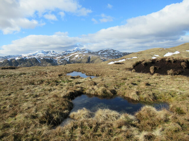
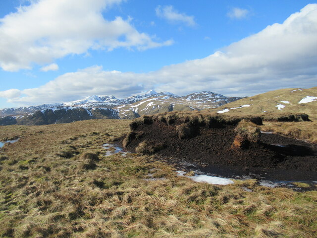
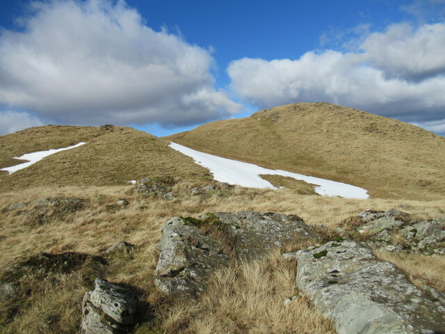
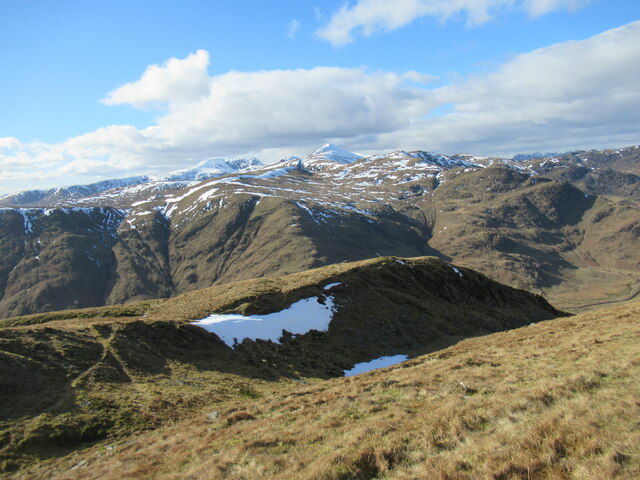
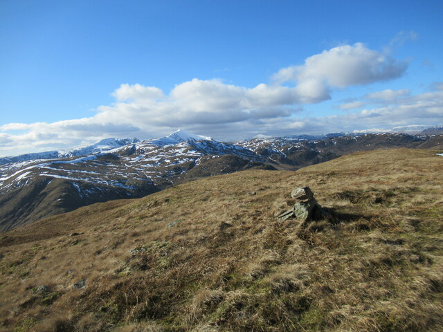
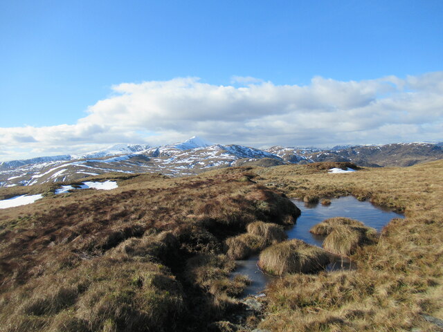
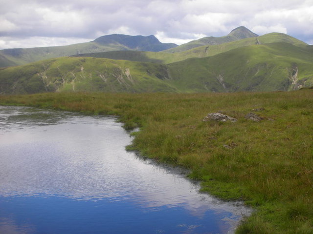
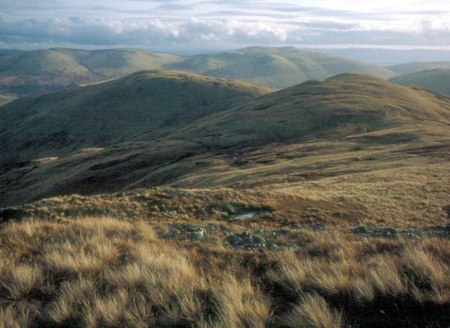
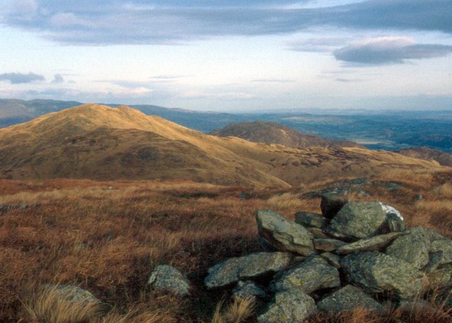
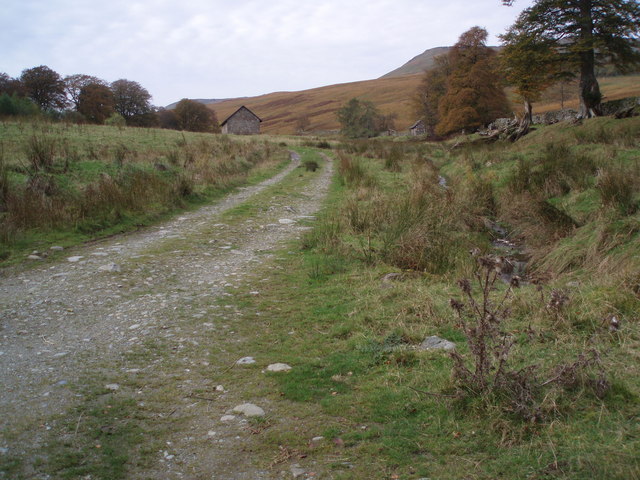
Sròn Bad an Fheidh is a prominent hill located in Perthshire, Scotland. The hill is known for its distinctive shape, with a steep slope leading up to a rounded summit that offers stunning panoramic views of the surrounding countryside. The name Sròn Bad an Fheidh translates to "hill of the deer's horn" in Gaelic, reflecting the abundance of wildlife in the area.

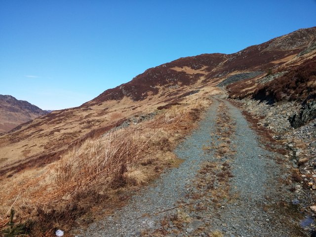
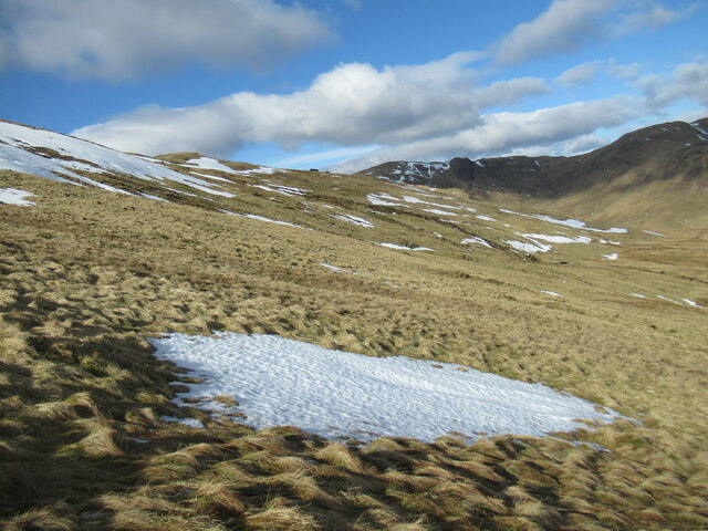
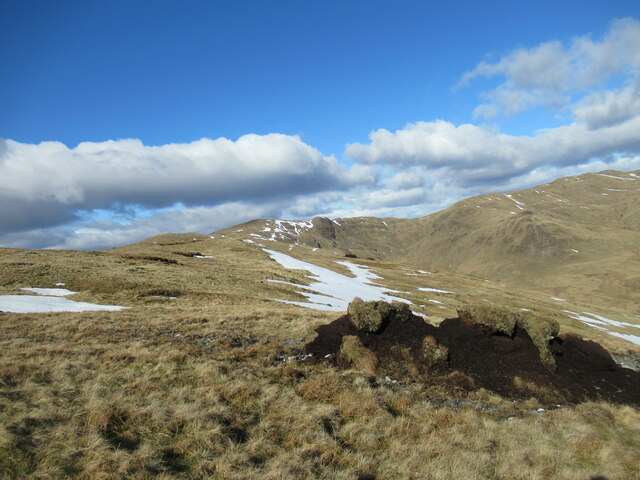
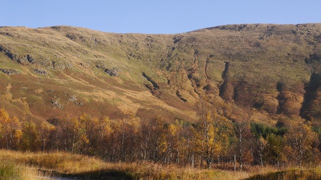
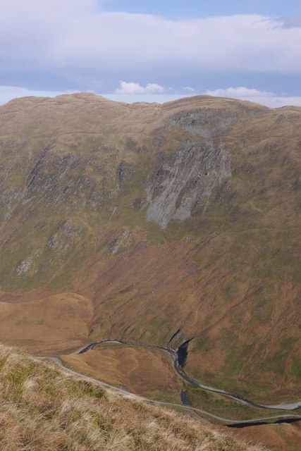
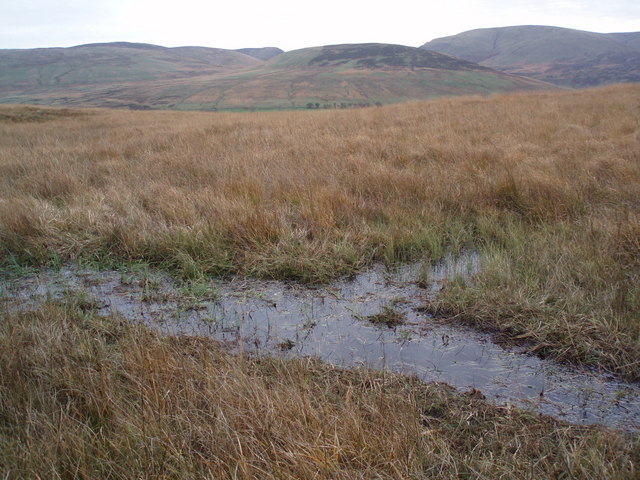
The hill is a popular destination for hikers and outdoor enthusiasts, with a network of walking trails leading to the summit. The terrain is rugged and challenging, with rocky outcrops and heather-covered slopes providing a scenic backdrop for those willing to make the climb.

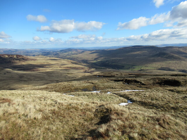
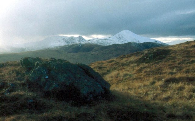
At the top of Sròn Bad an Fheidh, visitors can enjoy breathtaking views of the surrounding landscape, including the rolling hills of Perthshire and the distant peaks of the Scottish Highlands. On a clear day, it is possible to see as far as Loch Tay and Ben Lawers, making it a truly memorable experience for those who reach the summit.

Overall, Sròn Bad an Fheidh is a striking landscape feature that offers a unique opportunity to explore the natural beauty of Perthshire.

If you have any feedback on the listing, please let us know in the comments section below.

Sròn Bad an Fheidh Images

Images are sourced within 2km of 56.343158/-4.1038906 or Grid Reference NN7018. Thanks to Geograph Open Source API. All images are credited.

End of track Shows the last section of the road leading the quarry marked OS maps.
End of track
Shows the last section of the road leading the quarry marked OS maps.
Slopes of Sròn na Maoile Looking towards Coire a' Choire, on Beinn Dearg, in Glen Artney.
Slopes of Sròn na Maoile
Looking towards Coire a' Choire, on Beinn Dearg, in Glen Artney.
Looking down Sròn nan Cabar into Glen Artney Sròn nan Cabar means 'nose (or promontory) of the logs'. The word 'caber', better known from being tossed at Highland Games events, derives from this Gaelic word, 'cabar'.
Looking down Sròn nan Cabar into Glen Artney
Sròn nan Cabar means 'nose (or promontory) of the logs'. The word 'caber', better known from being tossed at Highland Games events, derives from this Gaelic word, 'cabar'.
Peat hag and snow patches on Sròn na Maoile Remnants of eroded peat on Beinn Dearg, above Glen Artney.
Peat hag and snow patches on Sròn na Maoile
Remnants of eroded peat on Beinn Dearg, above Glen Artney.
Half-frozen bog pools north-west of Sròn na Maoile Some eroded peat hags are visible on the right, and in the distance, with the pointed snow-covered peak of Ben Vorlich prominent in the distance.
Half-frozen bog pools north-west of Sròn na Maoile
Some eroded peat hags are visible on the right, and in the distance, with the pointed snow-covered peak of Ben Vorlich prominent in the distance.
Peat hags north-west of Sròn na Maoile Eroded remnants of peat cover on the hillside, with the snowy peak of Ben Vorlich prominent in the distance.
Peat hags north-west of Sròn na Maoile
Eroded remnants of peat cover on the hillside, with the snowy peak of Ben Vorlich prominent in the distance.
Sròn nam Broighleag One of a succession of lumps and bumps at the western end of the Beinn Dearg in Glen Artney, Sròn nam Broighleag translates from Gaelic as 'nose (or promontory) of the blaeberries'.
Sròn nam Broighleag
One of a succession of lumps and bumps at the western end of the Beinn Dearg in Glen Artney, Sròn nam Broighleag translates from Gaelic as 'nose (or promontory) of the blaeberries'.
Spur leading off Sròn na Broighleag Sròn na Broighleag translates from Gaelic as 'nose (or promontory) of the blaeberries.

The snowy peak of Ben Vorlich is prominent in the distance.
Spur leading off Sròn na Broighleag
Sròn na Broighleag translates from Gaelic as 'nose (or promontory) of the blaeberries. The snowy peak of Ben Vorlich is prominent in the distance.
Western top of Beinn Dearg A resurvey carried out in the last few years has concluded that this is actually the highest point on Beinn Dearg, rather than the top to the north-east as previously thought. This is, therefore, the Graham summit.
Western top of Beinn Dearg
A resurvey carried out in the last few years has concluded that this is actually the highest point on Beinn Dearg, rather than the top to the north-east as previously thought. This is, therefore, the Graham summit.
Part-frozen bog pool near the summit of Beinn Dearg The snowy peak of Ben Vorlich is prominent in the distance.
Part-frozen bog pool near the summit of Beinn Dearg
The snowy peak of Ben Vorlich is prominent in the distance.
High lochan above Glen Artney This lochan is situated near the summit of Beinn Dearg and Stuc a'Chroin and Ben Vorlich can be seen in the background.
High lochan above Glen Artney
This lochan is situated near the summit of Beinn Dearg and Stuc a'Chroin and Ben Vorlich can be seen in the background.
Bealach na Moine in the Forest of Glenartney Grassy hills flank the glen on both sides
Bealach na Moine in the Forest of Glenartney
Grassy hills flank the glen on both sides
On the western part of Beinn Dearg Ben Halton and Strathearn lie beyond
On the western part of Beinn Dearg
Ben Halton and Strathearn lie beyond
Sròn na Maoile The view is westward to Ben Vorlich
Sròn na Maoile
The view is westward to Ben Vorlich
Eastern side of Sròn na Maoile The eastern side of Srath a' Ghlinne with steep slopes leading up to the easternmost of the two main Beinn Dearg ridges.
Eastern side of Sròn na Maoile
The eastern side of Srath a' Ghlinne with steep slopes leading up to the easternmost of the two main Beinn Dearg ridges.
Beinn Dearg: Sròn na Broigleag Looking over the deep Srath a' Ghlinne to the higher Beinn Dearg summit and the top to its south, Sròn na Broigleag.
Beinn Dearg: Sròn na Broigleag
Looking over the deep Srath a' Ghlinne to the higher Beinn Dearg summit and the top to its south, Sròn na Broigleag.
Track to Dalclathick Lodge You can just see Dalclathick Lodge in Glen Artney in this photograph.
Track to Dalclathick Lodge
You can just see Dalclathick Lodge in Glen Artney in this photograph.
Bog Boggy ground on the north side of Glen Artney. Prominent hill at right of picture is the un-named most easterly top of the Donald, Uamh Bheag (also a Graham) - in fact it's the most northerly Donald top.
Bog
Boggy ground on the north side of Glen Artney. Prominent hill at right of picture is the un-named most easterly top of the Donald, Uamh Bheag (also a Graham) - in fact it's the most northerly Donald top.
Show me another place!

Sròn Bad an Fheidh is located at Grid Ref: NN7018 (Lat: 56.343158, Lng: -4.1038906)

Unitary Authority: Perth and Kinross

Police Authority: Tayside

What 3 Words

///inefficient.backup.operating. Near Comrie, Perth & Kinross

Related Wikis

Glen Artney

Glen Artney or Glenartney is a valley in Perthshire, Scotland.Several ships have been named Glenartney: SS Glenartney (1869), an iron-hulled steamship...

Dundurn, Scotland

Dundurn is the site of a Pictish hillfort in what is now Strathearn in Perth and Kinross, Scotland. The fort was situated on a hill with the River Earn...

Aberuchill Castle

Aberuchill Castle is located 3 kilometres (1.9 mi) west of Comrie in Perthshire, Scotland. It comprises an early 17th-century tower house, which was extended...

St Fillans

St Fillans is a village in Perthshire in the central highlands of Scotland, in the council area of Perth and Kinross. The village lies at the eastern end...

Have you been to Sròn Bad an Fheidh?

Leave your review of Sròn Bad an Fheidh below (or comments, questions and feedback).