Rubha na Mòine

Coastal Feature, Headland, Point in Ross-shire

Scotland

Rubha na Mòine

Sheepfold at Riof
Sheepfold at Riof Credit: Sandy Gerrard

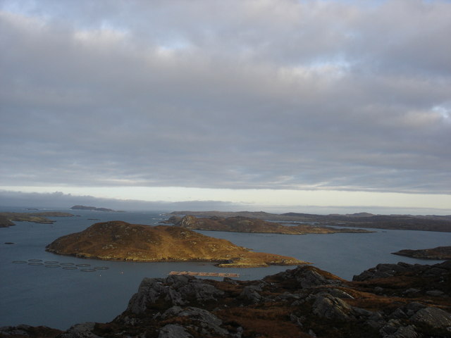
Rubha na Mòine, located in Ross-shire, Scotland, is a prominent coastal feature that consists of a headland or point jutting out into the sea. The name "Rubha na Mòine" translates to "Point of the Peat" in English, which reflects the area's historical association with peat bogs.

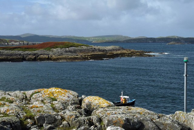
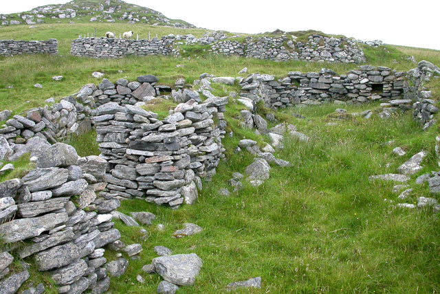
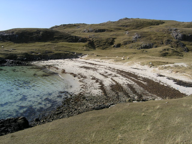
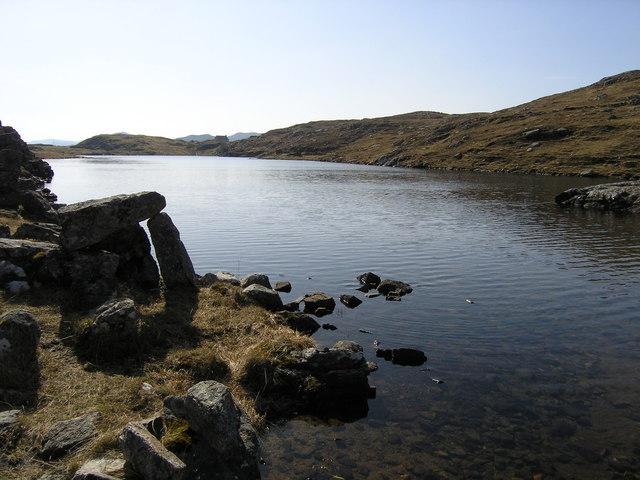
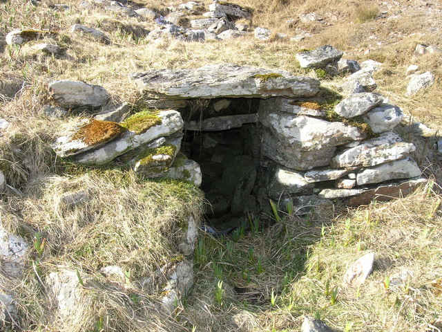
Situated along the rugged and picturesque coastline, Rubha na Mòine offers stunning panoramic views of the surrounding seascape. It is characterized by its steep cliffs, rocky outcrops, and a diverse array of flora and fauna. The headland is predominantly composed of sedimentary rocks, with layers of sandstone, limestone, and shale visible in some sections.

The coastal area of Rubha na Mòine is known for its rich biodiversity. Various species of seabirds, including gulls, fulmars, and puffins, can be observed nesting along the cliffs. The adjacent waters are also home to a range of marine life, including seals, dolphins, and occasionally, whales.

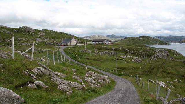
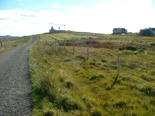
Visitors to Rubha na Mòine can explore the headland by following a coastal path that winds along the cliff edges. The path offers hikers the opportunity to appreciate the stunning scenery and observe the local wildlife in its natural habitat. However, caution is advised due to the steep and sometimes unstable terrain.

Overall, Rubha na Mòine is a captivating coastal feature that showcases the beauty and diversity of the Scottish coastline. Its dramatic cliffs, abundant wildlife, and breathtaking views make it a popular destination for nature lovers and outdoor enthusiasts alike.

If you have any feedback on the listing, please let us know in the comments section below.

Rubha na Mòine Images

Images are sourced within 2km of 58.204652/-6.8878729 or Grid Reference NB1234. Thanks to Geograph Open Source API. All images are credited.

Sheepfold at Riof
Sheepfold at Riof
Norse Mill on burn leading from Loch Lionais The mill is very ruinous and survives as a spread of rubble overlying the lower courses of the building.  The leat serving the mill is represented by the bright green stripe.
Norse Mill on burn leading from Loch Lionais
The mill is very ruinous and survives as a spread of rubble overlying the lower courses of the building. The leat serving the mill is represented by the bright green stripe.
Norse Mill on burn leading from Loch Lionais The lower mill is rather better preserved with the tail race opening still intact.
Norse Mill on burn leading from Loch Lionais
The lower mill is rather better preserved with the tail race opening still intact.
Morning RIB Commute Seatrek worker on morning commute to work at Miabhaig on a RIB. Photo taken from the MV Lochlann.
Morning RIB Commute
Seatrek worker on morning commute to work at Miabhaig on a RIB. Photo taken from the MV Lochlann.
Coastline, Rubha Domhain, Great Bernera Looking towards the island of Eunaigh Mòr.  The part of the island shown in the photo also lies within the grid square.
Coastline, Rubha Domhain, Great Bernera
Looking towards the island of Eunaigh Mòr. The part of the island shown in the photo also lies within the grid square.
Tràigh Teinish
Tràigh Teinish
Cove by Rubha Sheotharaid It is a surprise that this feature is unnamed on the 1:25,000 map.
Cove by Rubha Sheotharaid
It is a surprise that this feature is unnamed on the 1:25,000 map.
End of the road at Riof. The road finishes at the two houses, although there is a pleasant walk onwards around the coast to Traigh na Beirigh.
End of the road at Riof.
The road finishes at the two houses, although there is a pleasant walk onwards around the coast to Traigh na Beirigh.
Houses at Tacleit Tacleit is a small crofting settlement on the southeastern coast of Bearnaraigh (Great Bernera)
Houses at Tacleit
Tacleit is a small crofting settlement on the southeastern coast of Bearnaraigh (Great Bernera)
Vuia Mhor in Loch Roag On the island of Vuia Mhor, looking at ruined croft houses between the two beaches.  On the point beyond is a ruined kiln.  The island was cleared of its inhabitants in 1841 and is now only used for grazing sheep.
Vuia Mhor in Loch Roag
On the island of Vuia Mhor, looking at ruined croft houses between the two beaches. On the point beyond is a ruined kiln. The island was cleared of its inhabitants in 1841 and is now only used for grazing sheep.
Ruined croft houses on Vuia Mhor The remains of houses and sheep fanks on the deserted island of Vuia Mhor in Loch Roag
Ruined croft houses on Vuia Mhor
The remains of houses and sheep fanks on the deserted island of Vuia Mhor in Loch Roag
Cliatasay On the island of Cliatasay in Loch Roag, on the site of a kelp kiln.  Vuia Mhor is visible in the distance.  The Geshader crofters used to graze their bull on this island.
Cliatasay
On the island of Cliatasay in Loch Roag, on the site of a kelp kiln. Vuia Mhor is visible in the distance. The Geshader crofters used to graze their bull on this island.
Cliatasay Natural landing stage on the island of Cliatasay in Loch Roag, used for the manufacture of potash from kelp in the early 19th century.  Vuia Mhor in the distance.
Cliatasay
Natural landing stage on the island of Cliatasay in Loch Roag, used for the manufacture of potash from kelp in the early 19th century. Vuia Mhor in the distance.
Cliatasay The rather featureless west-side of Cliatasay in Loch Roag; evidence of an old peat-cutting.
Cliatasay
The rather featureless west-side of Cliatasay in Loch Roag; evidence of an old peat-cutting.
Traigh Theinis Known locally as the Shell Beach.
Traigh Theinis
Known locally as the Shell Beach.
Loch Lionais
Loch Lionais
Mill at Lionais Remains of a horizontal mill on the burn draining Loch Lionais in Reef.
Mill at Lionais
Remains of a horizontal mill on the burn draining Loch Lionais in Reef.
Mullach Sgrithir Eileanan Loch Rog bho mullach Sgrithir.  The islands of Loch Roag from the top of Sgrithir (pronounced Skreeher).  The islands are Bhuaigh Beag, Bhuaigh Mor, Great Bernera to the right and on the horizon The Old Hill and Berisay.
Mullach Sgrithir
Eileanan Loch Rog bho mullach Sgrithir. The islands of Loch Roag from the top of Sgrithir (pronounced Skreeher). The islands are Bhuaigh Beag, Bhuaigh Mor, Great Bernera to the right and on the horizon The Old Hill and Berisay.
Show me another place!

Rubha na Mòine is located at Grid Ref: NB1234 (Lat: 58.204652, Lng: -6.8878729)

Unitary Authority: Na h-Eileanan an Iar

Police Authority: Highlands and Islands

What 3 Words

///take.allies.believer. Near Carloway, Na h-Eileanan Siar

Related Wikis

Loch Ròg

Loch Ròg or Loch Roag is a large sea loch on the west coast of Lewis, Outer Hebrides. It is broadly divided into East Loch Roag and West Loch Roag with...

Fuaigh Mòr

Fuaigh Mòr (sometimes anglicised as Vuia Mor) is an island in the Outer Hebrides of Scotland. It is off the west coast of Lewis near Great Bernera in...

Fuaigh Beag

Fuaigh Beag or Vuia Be(a)g is an island in the Outer Hebrides. It is off the west coast of Lewis near Great Bernera in Loch Roag. Its name means "little...

Loch na Berie

Loch Na Berie is a broch in the Outer Hebrides of Scotland, located approximately 400 yards from the shore, and is thought to have been located on an island...

Flodaigh, Lewis

Flodaigh is a small island in Loch Roag on the west coast of Lewis in the Outer Hebrides of Scotland. It is about 33 hectares (82 acres) in extent and...

Dun Bharabhat, Great Bernera

Dun Bharabhat (or Dun Baravat) is an Iron Age galleried dun or "semi-broch" situated on the island of Great Bernera near Lewis in Scotland (grid reference...

Vacsay

Vacsay (Scottish Gaelic: Bhacsaigh from Old Norse "bakkiey" meaning "peat bank island") is one of the Outer Hebrides. It is off the west coast of Lewis...

Callanish VIII

The Callanish VIII stone setting is one of many megalithic structures around the better-known (and larger) Calanais I on the west coast of the Isle of...

Have you been to Rubha na Mòine?

Leave your review of Rubha na Mòine below (or comments, questions and feedback).