Vestey Wood

Wood, Forest in Cambridgeshire South Cambridgeshire

England

Vestey Wood

Fields on the edge of Wandlebury Country Park Beautiful open countryside just a couple of miles to the south east of Cambridge.
Fields on the edge of Wandlebury Country Park Credit: Peter S

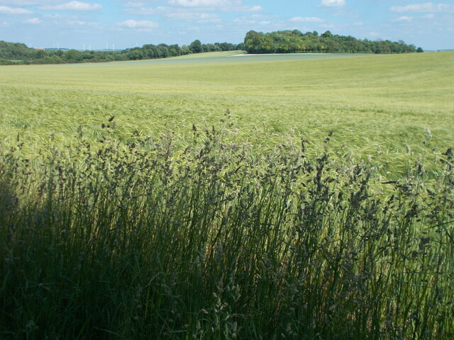
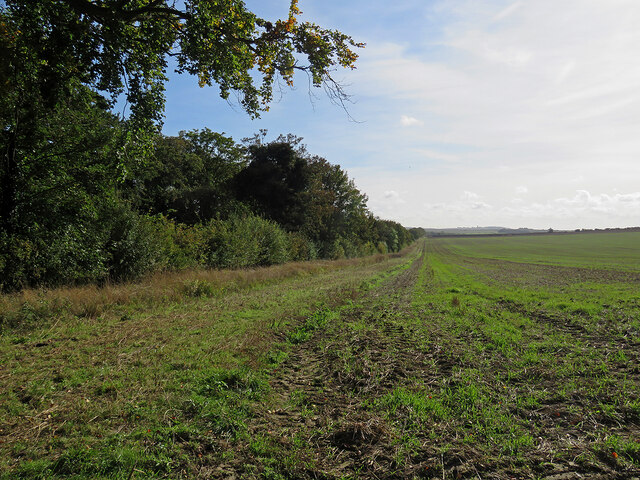
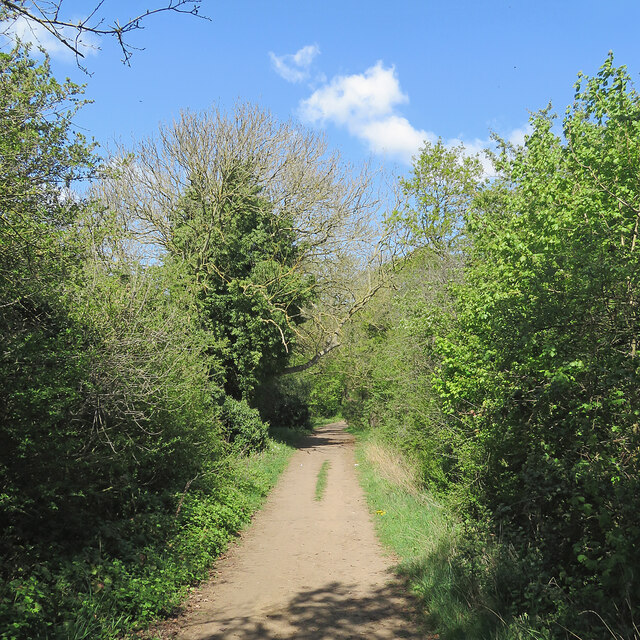
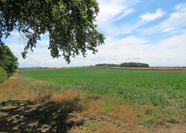
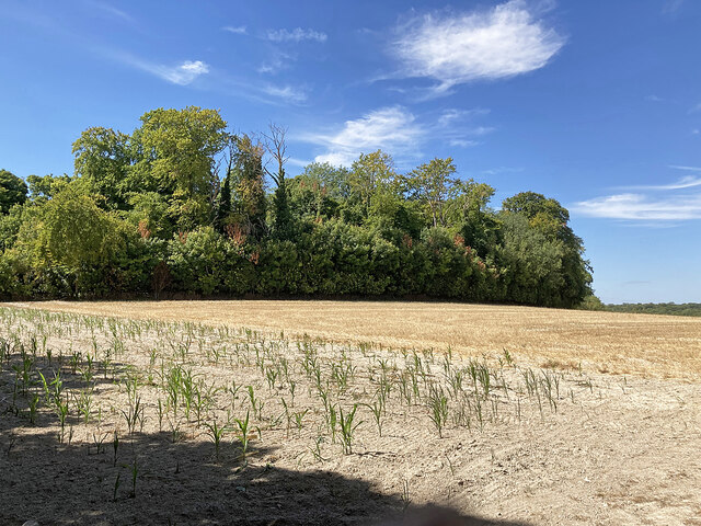
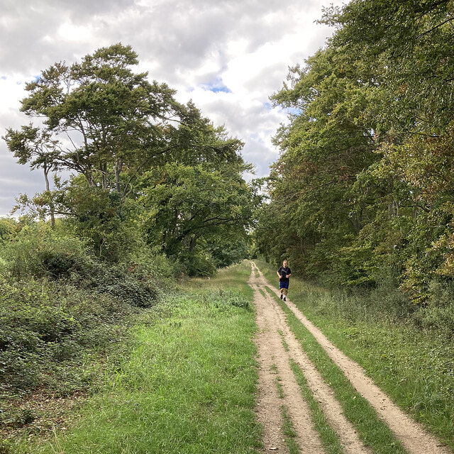
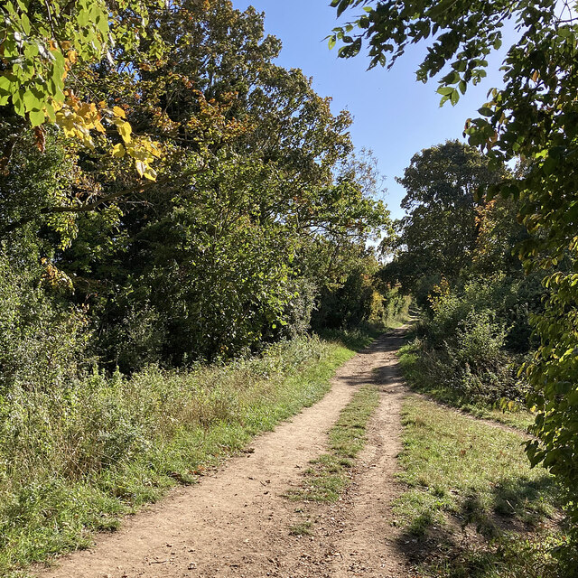
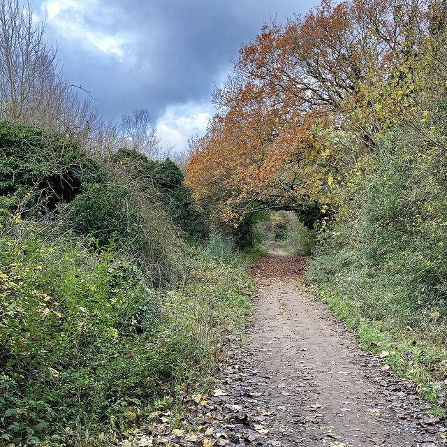
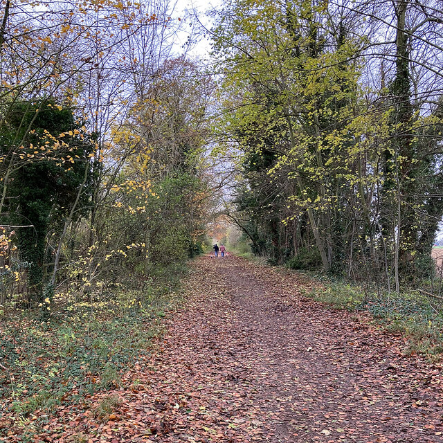
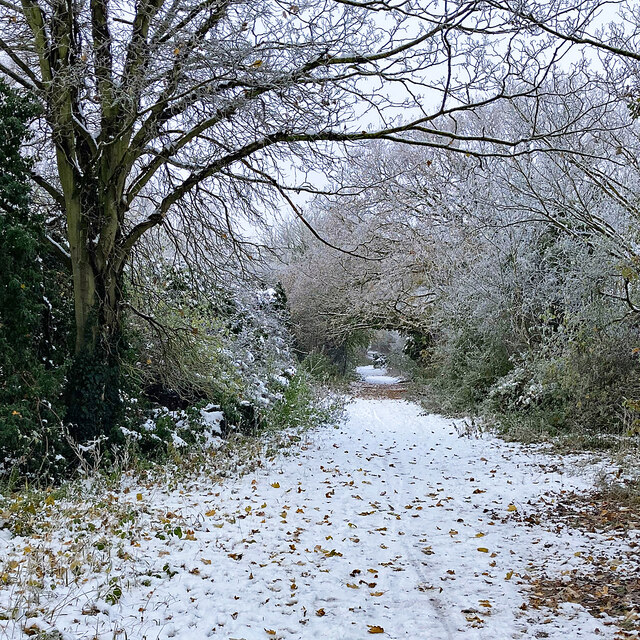
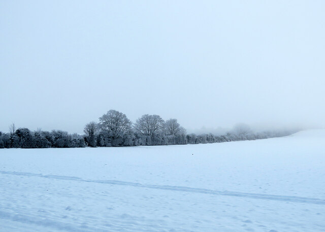
Vestey Wood is a picturesque woodland area located in Cambridgeshire, England. Covering an area of approximately 100 acres, it is a popular destination for nature lovers and outdoor enthusiasts. The wood is characterized by a diverse range of tree species, including oak, ash, birch, and pine, creating a rich and vibrant ecosystem.

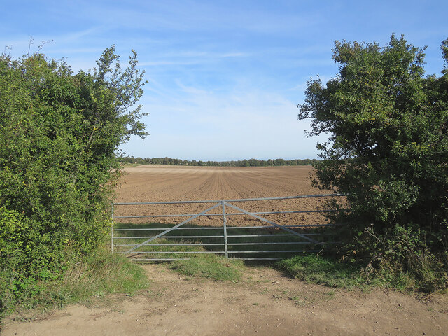
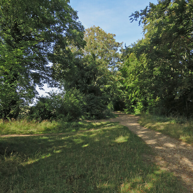
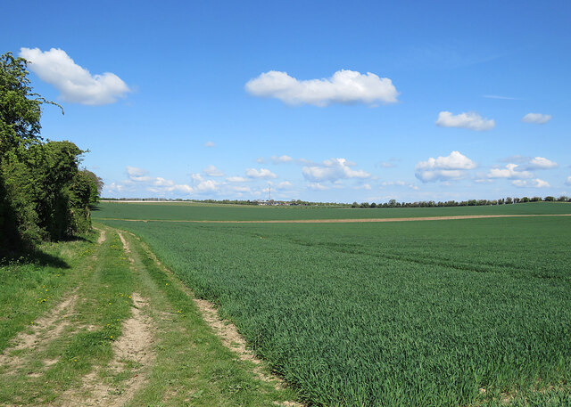
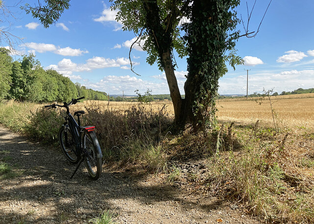
Visitors to Vestey Wood can enjoy a variety of activities such as walking, birdwatching, and photography. The well-maintained footpaths meander through the wood, providing an opportunity to explore its natural beauty at a leisurely pace. The tranquil atmosphere and peaceful surroundings make it an ideal spot for relaxation and contemplation.

The wood is particularly renowned for its birdlife, attracting a wide array of species throughout the year. Birdwatchers can spot woodpeckers, owls, and various songbirds amidst the dense foliage. Additionally, the wood is home to several small mammals, including squirrels and hare, adding to the diversity of wildlife in the area.

Vestey Wood is easily accessible, located just a short distance from the nearby village of Cambridgeshire. It offers ample parking facilities, ensuring convenience for visitors. The wood is open to the public year-round, allowing visitors to experience the changing seasons and the beauty they bring to the landscape.

Overall, Vestey Wood is a tranquil and enchanting woodland area that offers a peaceful retreat from the hustle and bustle of everyday life. Its natural beauty and diverse wildlife make it a must-visit destination for those seeking solace in nature.

If you have any feedback on the listing, please let us know in the comments section below.

Vestey Wood Images

Images are sourced within 2km of 52.149856/0.18724489 or Grid Reference TL4952. Thanks to Geograph Open Source API. All images are credited.

Fields on the edge of Wandlebury Country Park Beautiful open countryside just a couple of miles to the south east of Cambridge.
Fields on the edge of Wandlebury Country Park
Beautiful open countryside just a couple of miles to the south east of Cambridge.
Autumn cultivation on The Gogs Looking north-east through a gateway on The Roman Road. <a href="https://www.geograph.org.uk/photo/4209983">TL5053 : Field gate on The Roman Road</a> and <a href="https://www.geograph.org.uk/photo/6904416">TL5053 : Harvest time on The Gogs</a> are two of several pictures of the view uphill in the opposite direction.
Autumn cultivation on The Gogs
Looking north-east through a gateway on The Roman Road. TL5053 : Field gate on The Roman Road and TL5053 : Harvest time on The Gogs are two of several pictures of the view uphill in the opposite direction.
Early autumn on The Roman Road At the junction with Mile Road (left) on a bright October morning.
Early autumn on The Roman Road
At the junction with Mile Road (left) on a bright October morning.
Trees lining The Roman Road The Roman Road runs south-east from the Gog Magog Hills on the edge of Cambridge into the hills of East Cambridgeshire, petering out near Horseheath. This picture was taken from a field edge on a bright October morning.
Trees lining The Roman Road
The Roman Road runs south-east from the Gog Magog Hills on the edge of Cambridge into the hills of East Cambridgeshire, petering out near Horseheath. This picture was taken from a field edge on a bright October morning.
A spring morning on The Roman Road Bright and warm, with a lot of vivid greens.
A spring morning on The Roman Road
Bright and warm, with a lot of vivid greens.
Wheatfields on The Gogs Taken from just inside a gateway on The Roman Road on a fine morning in late April. Hill Farm is on the skyline in the centre, getting on for a mile away.
Wheatfields on The Gogs
Taken from just inside a gateway on The Roman Road on a fine morning in late April. Hill Farm is on the skyline in the centre, getting on for a mile away.
Stubble on the Gogs Looking uphill towards Fox's Burrow Plantation from the track which runs from The Roman Road to the A1307.
Stubble on the Gogs
Looking uphill towards Fox's Burrow Plantation from the track which runs from The Roman Road to the A1307.
Stubble and big sky Harvest time in South Cambridgeshire, seen from a gap in the trees lining The Roman Road. The plantations at Lodge Farm are on the skyline.
Stubble and big sky
Harvest time in South Cambridgeshire, seen from a gap in the trees lining The Roman Road. The plantations at Lodge Farm are on the skyline.
Towards Signal Hill and Meggs Hill The skyline plantations are on Signal Hill (left) and Meggs Hill, two of the gentle Gog Magog Hills south-east of Cambridge. The picture was taken from a field corner at the junction of The Roman Road (which the trees on the extreme left line) and Mile Road.
Towards Signal Hill and Meggs Hill
The skyline plantations are on Signal Hill (left) and Meggs Hill, two of the gentle Gog Magog Hills south-east of Cambridge. The picture was taken from a field corner at the junction of The Roman Road (which the trees on the extreme left line) and Mile Road.
Copley Hill in a dry summer Mid August in the drought summer of 2022 - and some of the leaves in the plantation on Copley Hill are turning while the rest have lost their high summer richness.
Copley Hill in a dry summer
Mid August in the drought summer of 2022 - and some of the leaves in the plantation on Copley Hill are turning while the rest have lost their high summer richness.
Stubble on The Gogs An August view from the bridle track from the A1307 to The Roman Road (ahead), skirting Wandlebury Country Park.
Stubble on The Gogs
An August view from the bridle track from the A1307 to The Roman Road (ahead), skirting Wandlebury Country Park.
Café sign on the edge of Wandlebury Country Park
A runner on The Roman Road Near Copley Hill on a mid-September afternoon - one of high cloud and some lengthy sunny spells.
A runner on The Roman Road
Near Copley Hill on a mid-September afternoon - one of high cloud and some lengthy sunny spells.
On The Roman Road in early autumn Looking south east on a cloudless Sunday morning in early October. Some leaves have turned in the last week.
On The Roman Road in early autumn
Looking south east on a cloudless Sunday morning in early October. Some leaves have turned in the last week.
The Roman Road: dark sky and bright leaves On the Gog Magog Hills, looking towards the Cambridge end of The Roman Road on the first Saturday morning of December.
The Roman Road: dark sky and bright leaves
On the Gog Magog Hills, looking towards the Cambridge end of The Roman Road on the first Saturday morning of December.
Roman Road walk Looking in the Cambridge direction on the cloudy first Saturday morning of December.
Roman Road walk
Looking in the Cambridge direction on the cloudy first Saturday morning of December.
A cold morning on The Roman Road Looking uphill towards the Cambridge end of The Roman Road, with the temperature below zero, as it had been all week. <a href="https://www.geograph.org.uk/photo/7355096">TL5053 : The Roman Road: dark sky and bright leaves</a> was taken hereabouts eleven days before.
A cold morning on The Roman Road
Looking uphill towards the Cambridge end of The Roman Road, with the temperature below zero, as it had been all week. TL5053 : The Roman Road: dark sky and bright leaves was taken hereabouts eleven days before.
Snow, frost, fog and The Roman Road The line of frosted trees and bushes - lost in the mist to the right as it rises towards Copley Hill - marks the course of The Roman Road. This was a fiercely cold morning during the cold spell in mid December 2022.
Snow, frost, fog and The Roman Road
The line of frosted trees and bushes - lost in the mist to the right as it rises towards Copley Hill - marks the course of The Roman Road. This was a fiercely cold morning during the cold spell in mid December 2022.
Show me another place!

Vestey Wood is located at Grid Ref: TL4952 (Lat: 52.149856, Lng: 0.18724489)

Administrative County: Cambridgeshire

District: South Cambridgeshire

Police Authority: Cambridgeshire

What 3 Words

///delivers.bends.accusing. Near Sawston, Cambridgeshire

Related Wikis

Wandlebury Hill Fort

Wandlebury Hill Fort, also known as the Wandlebury Ring, is an Iron Age hillfort located on Wandlebury Hill in the Gog Magog Hills, Cambridgeshire, England...

Wandlebury Hill

Wandlebury Hill (grid reference TL493534) is a peak in the Gog Magog Hills, a ridge of low chalk hills extending for several miles to the southeast of...

Little Trees Hill

Little Trees Hill is one of the highest points of the Gog Magog Hills, a ridge of low chalk hills extending for several miles to the south-east of Cambridge...

Gog Magog Golf Club

Gog Magog Golf Club is a golf club, located in Shelford Bottom, Cambridgeshire, England. It is located about 4 miles south of Cambridge. == History... ==

Gog Magog Hills

The Gog Magog Hills are a range of low chalk hills, extending for several miles to the southeast of Cambridge in England. The highest points are situated...

Middlefield, Stapleford

Middlefield is a mansion in Stapleford, Cambridgeshire, England, designed in 1908–9 by Edwin Lutyens. It is a grade II* listed building.Middlefield was...

Gog Magog Golf Course

Gog Magog Golf Course is an 88.4-hectare (218-acre) biological Site of Special Scientific Interest on Gog Magog Golf Club south-east of Cambridge in Cambridgeshire...

Babraham Institute

The Babraham Institute is a life sciences research institution and a partner organisation of the University of Cambridge. The Babraham Institute is based...

Nearby Amenities

Located within 500m of 52.149856,0.18724489
Wormwood Hill
Natural: hill
Note: Wormwood Hill tumulus is registered as a scheduled monument
Place: locality
Source: npe
Lat/Long: 52.1541118/0.1870665
Fixme: check which route this line takes
Guyed: yes
Height: 8
Material: wood
Power: pole
Lat/Long: 52.1542665/0.1884629
Power: pole
Lat/Long: 52.1535563/0.1896551
Power: pole
Lat/Long: 52.1527829/0.1890838
Power: pole
Lat/Long: 52.1493434/0.1928322
Power: pole
Lat/Long: 52.1502355/0.19188
Location Transition: yes
Power: portal
Transformer: distribution
Lat/Long: 52.1489461/0.1934987
Power: pole
Lat/Long: 52.1510038/0.1910338
Power: pole
Lat/Long: 52.1518829/0.1900776
Vanilla House
Building: office
Lat/Long: 52.1479841/0.1933696
Post Box
Collection Times: Mo-Fr 09:00; Sa 07:00
Operator: Royal Mail
Post Box Type: lamp
Ref: CB22 554
Royal Cypher: EIIR
Royal Cypher Wikidata: Q33102113
Source: survey
Lat/Long: 52.1478863/0.1924208
Give Way
Lat/Long: 52.14801/0.1922784
Colour: yellow
Inscription: GAS
Marker: post
Material: plastic
Utility: gas
Lat/Long: 52.1518616/0.1888308
Colour: yellow
Inscription: GAS IP GAS PIPELINE
Marker: post
Material: plastic
Utility: gas
Lat/Long: 52.1518576/0.1888403
Colour: yellow
Inscription: GAS
Marker: post
Material: plastic
Utility: gas
Lat/Long: 52.1517583/0.1886723
Colour: yellow
Inscription: GAS
Marker: post
Material: plastic
Utility: gas
Lat/Long: 52.1517631/0.1886652
Material: wood
Power: pole
Lat/Long: 52.1535557/0.189655
Power: pole
Lat/Long: 52.1534318/0.1886042
Bench
Lat/Long: 52.1482803/0.1861553
Man Made: utility_pole
Lat/Long: 52.1491355/0.1929603
Give Way
Lat/Long: 52.1488885/0.1919583
Cafe
Docky Barn Café
Check Date: 2024-02-17
Lat/Long: 52.1485494/0.194213
Leisure: picnic_table
Lat/Long: 52.1489167/0.1935764
The data included in this document is from www.openstreetmap.org. The data is made available under ODbL.

Have you been to Vestey Wood?

Leave your review of Vestey Wood below (or comments, questions and feedback).