Gravelpit Spring

Wood, Forest in Essex Harlow

England

Gravelpit Spring

Church Langley Water Tower Built between 1993 and 1994 the tower stores water for businesses and homes in the Church Langley area of Harlow. The tower is 36.5 metres (120 feet) tall.
Church Langley Water Tower Credit: David Malt

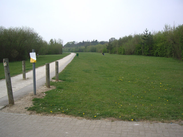
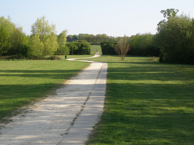
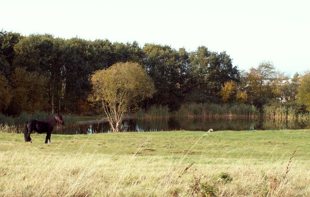
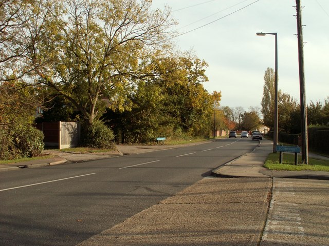
Gravelpit Spring, located in Essex, England, is a serene and picturesque woodland area known for its natural beauty and abundant wildlife. This secluded oasis is nestled within the larger Essex Forest, offering visitors a peaceful and tranquil retreat from the bustling city life.

The main attraction of Gravelpit Spring is its pristine spring, which is the primary water source for the surrounding woodland. The crystal-clear water flows gracefully through the area, creating a soothing ambiance and providing a refreshing spot for visitors to relax and unwind.

The woodland itself is a haven for nature enthusiasts, with its diverse flora and fauna. Lush greenery, towering trees, and vibrant wildflowers create a stunning backdrop, making it a popular destination for photographers and artists. The forest is home to various wildlife species, including deer, foxes, and a wide array of bird species, making it an excellent spot for birdwatching and wildlife observation.

Visitors to Gravelpit Spring can enjoy leisurely walks along the well-maintained trails, immersing themselves in the serenity of the surroundings. The area also offers picnic spots and seating areas, allowing individuals and families to enjoy a peaceful outdoor meal amidst nature.

Gravelpit Spring, Essex is a true hidden gem, offering a slice of tranquility and natural beauty. Whether one seeks solitude, a connection with nature, or simply a break from the fast-paced urban lifestyle, this woodland retreat provides the perfect escape.

If you have any feedback on the listing, please let us know in the comments section below.

Gravelpit Spring Images

Images are sourced within 2km of 51.773138/0.13410454 or Grid Reference TL4710. Thanks to Geograph Open Source API. All images are credited.

Church Langley Water Tower Built between 1993 and 1994 the tower stores water for businesses and homes in the Church Langley area of Harlow. The tower is 36.5 metres (120 feet) tall.
Church Langley Water Tower
Built between 1993 and 1994 the tower stores water for businesses and homes in the Church Langley area of Harlow. The tower is 36.5 metres (120 feet) tall.
The Clock Tower The Clock Tower by the Clock Tower Roundabout.
The Clock Tower
The Clock Tower by the Clock Tower Roundabout.
Brays Grove School Brays Grove is a mixed secondary school of non denomination.
Brays Grove School
Brays Grove is a mixed secondary school of non denomination.
Church Langley Way Church Langley, Harlow.
Church Langley Way
Church Langley, Harlow.
The Bridleway The bridleway crosses Church Langley Way.
The Bridleway
The bridleway crosses Church Langley Way.
Training a horse on Harlow Common
Old Piggeries nr Brenthall Wood These have now been demolished and replaced by a house!
Old Piggeries nr Brenthall Wood
These have now been demolished and replaced by a house!
Barnsley Cottage
Barnsley Cottage
The Bridleway looking South towards Harlow Common The picture was taken from the southern side of Kiln Lane. The Common is the open space through the gap in the hedgherow in the middle-far distance.
The Bridleway looking South towards Harlow Common
The picture was taken from the southern side of Kiln Lane. The Common is the open space through the gap in the hedgherow in the middle-far distance.
The pond on Harlow Common
'The White Horse' public house This is a view from Church Road and the pub stands on Potter Street
'The White Horse' public house
This is a view from Church Road and the pub stands on Potter Street
The entrance to Kitchen Hall Farm A few years ago this farm was surrounded by fields and open countryside, now it is surrounded by new houses except for the southern side that faces Harlow Common.
The entrance to Kitchen Hall Farm
A few years ago this farm was surrounded by fields and open countryside, now it is surrounded by new houses except for the southern side that faces Harlow Common.
Public bridleway to Kingsdon Lane from Red Lion Lane
The northern end of Potter Street
Pennymead Tower
Pennymead Tower
Church Langley Water tower
Albert Gardens, Church Langley, Harlow.
Church Langley Water Tower A water tower is an elevated structure supporting a water tank constructed at a height sufficient to pressurize a water supply system for the distribution of drinkable water, and to provide emergency storage for fire protection.
Wikipedia: <span class="nowrap"><a title="http://en.wikipedia.org/wiki/Water_tower" rel="nofollow ugc noopener" href="http://en.wikipedia.org/wiki/Water_tower">Link</a><img style="margin-left:2px;" alt="External link" title="External link - shift click to open in new window" src="https://s1.geograph.org.uk/img/external.png" width="10" height="10"/></span>
Church Langley Water Tower
A water tower is an elevated structure supporting a water tank constructed at a height sufficient to pressurize a water supply system for the distribution of drinkable water, and to provide emergency storage for fire protection. Wikipedia: LinkExternal link
Show me another place!

Gravelpit Spring is located at Grid Ref: TL4710 (Lat: 51.773138, Lng: 0.13410454)

Administrative County: Essex

District: Harlow

Police Authority: Essex

What 3 Words

///tidy.double.move. Near Old Harlow, Essex

Nearby Locations

Gravelpit Spring

Related Wikis

Newhall, Essex

Newhall is a new housing estate within Harlow, Essex, England. In 2009, it was being built on land originally forming part of Soper Farm. A landowner led...

Mark Hall Academy

Mark Hall Academy, formerly Mark Hall Specialist Sport College, is a coeducational secondary school with academy status, located in Harlow, Essex, England...

Church Langley

Church Langley is part of Harlow, Essex, England.Church Langley was built from 1992 and was originally named Brenthall Park, consisting of three developers...

Harlow

Harlow is a town and local government district located in the west of Essex, England. Founded as a new town, it is situated on the border with Hertfordshire...
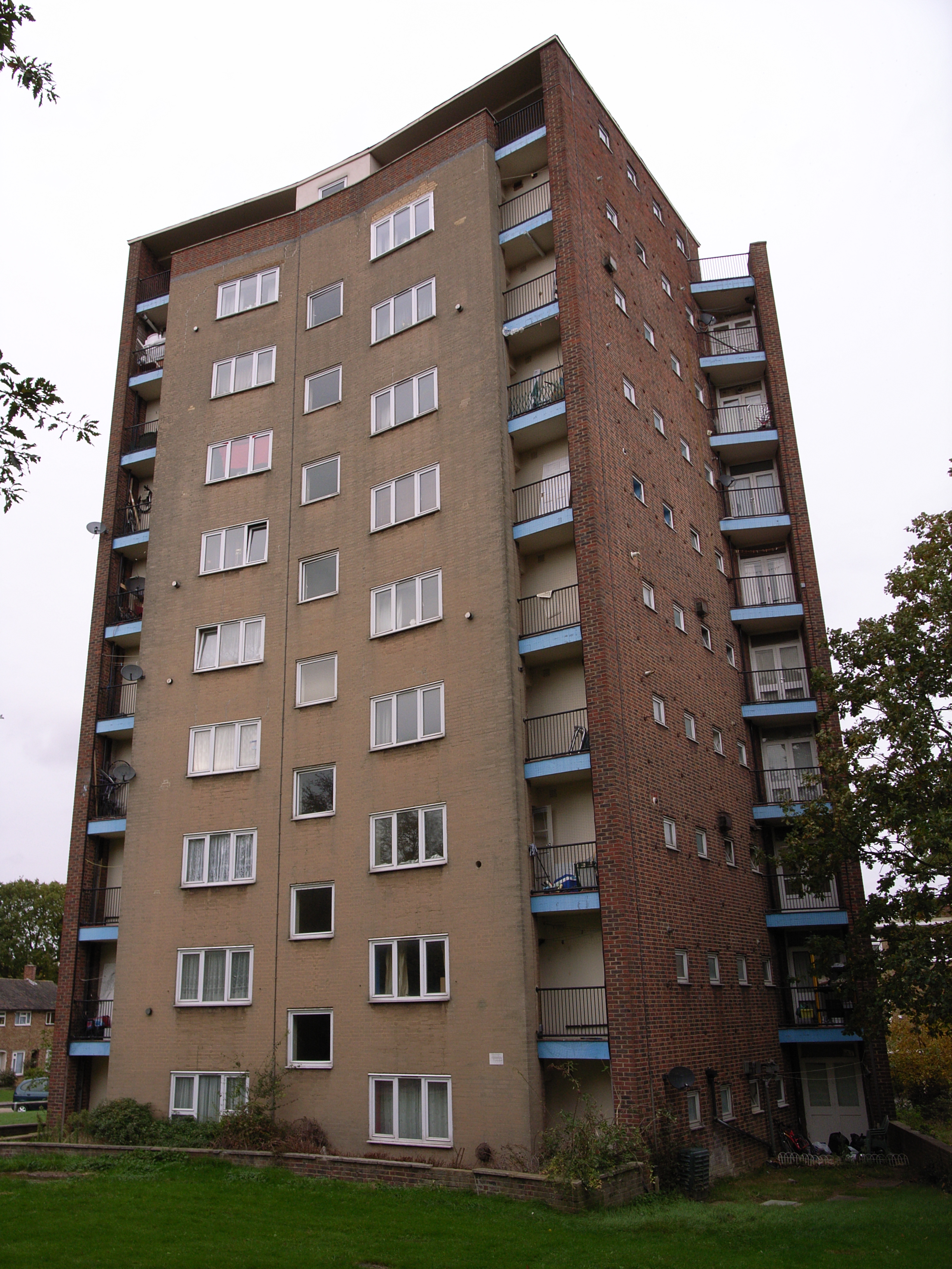
The Lawn (Harlow)

The Lawn is a mid-twentieth-century low-rise building located on the outskirts of Old Harlow, to the east of the town of Harlow, Essex, England. The building...

Old Harlow

Old Harlow is the old town area of Harlow, in Essex, England. It was the historical town centre prior to Harlow being designated a new town in 1947 during...

Saint Nicholas School, Essex

Saint Nicholas School is a co-educational independent day school in Old Harlow, Essex for children aged 2 1/2 to 16 years old. The current Headmaster is...

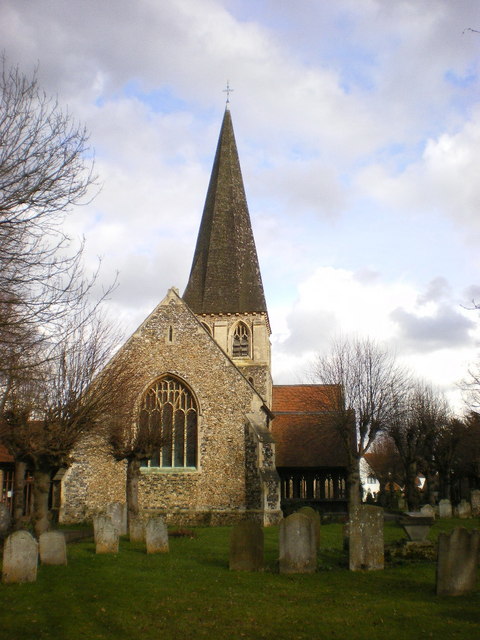
St Mary & St Hugh, Old Harlow

St Mary & St Hugh's Church is a Church of England parish church in Churchgate Street, Old Harlow in Essex, England. The church is of medieval origin and...

Nearby Amenities

Located within 500m of 51.773138,0.13410454
Crossing
Crossing: marked
Lat/Long: 51.7711631/0.1333958
Direction: both
Traffic Calming: table
Lat/Long: 51.7724942/0.1352009
Direction: both
Traffic Calming: table
Lat/Long: 51.7726937/0.1367561
Direction: 260;180;backward
Traffic Calming: table
Lat/Long: 51.7720348/0.1368125
Bus Stop
London Road
Bus: yes
Naptan AtcoCode: 150035006001
Naptan Bearing: S
Naptan CommonName: The May Pole
Naptan Crossing: New Hall
Naptan Indicator: S-bound
Naptan Landmark: The May Pole
Naptan NaptanCode: esxapjpw
Naptan PlusbusZoneRef: HRLWTWN
Naptan Street: London Road
Naptan Verified: no
Public Transport: platform
Source: naptan_import
Lat/Long: 51.7734008/0.1333873
Bus Stop
London Road
Bus: yes
Naptan AtcoCode: 150035006002
Naptan Bearing: N
Naptan CommonName: The May Pole
Naptan Crossing: New Hall
Naptan Indicator: N-bound
Naptan Landmark: The May Pole
Naptan NaptanCode: esxapjta
Naptan PlusbusZoneRef: HRLWTWN
Naptan Street: London Road
Naptan Verified: no
Public Transport: platform
Source: naptan_import
Lat/Long: 51.7725475/0.1335356
Direction: both
Traffic Calming: table
Lat/Long: 51.7714109/0.136672
Direction: both
Traffic Calming: table
Lat/Long: 51.7713229/0.1375678
Direction: both
Traffic Calming: table
Lat/Long: 51.7712598/0.1382322
Direction: both
Traffic Calming: table
Lat/Long: 51.7725722/0.1382894
Direction: both
Traffic Calming: table
Lat/Long: 51.7722435/0.1373724
Direction: 80;160;260
Traffic Calming: table
Lat/Long: 51.7742433/0.1358163
Direction: backward;0
Traffic Calming: table
Lat/Long: 51.7733519/0.1361026
Direction: both
Traffic Calming: table
Lat/Long: 51.7743629/0.1370058
Direction: backward
Traffic Calming: table
Lat/Long: 51.7708957/0.1364384
Direction: both
Traffic Calming: table
Lat/Long: 51.7739074/0.1385491
Direction: forward;90
Traffic Calming: table
Lat/Long: 51.7739032/0.1377794
Direction: backward;0
Traffic Calming: table
Lat/Long: 51.7738976/0.1370447
Direction: both
Traffic Calming: table
Lat/Long: 51.770337/0.1364216
Direction: both
Traffic Calming: table
Lat/Long: 51.7703045/0.1349021
Direction: both
Traffic Calming: table
Lat/Long: 51.770837/0.1377832
Barrier: bollard
Lat/Long: 51.7724987/0.1347275
Noexit: yes
Lat/Long: 51.770739/0.1383874
Newhall
Place: suburb
Lat/Long: 51.7728187/0.1390174
Noexit: yes
Lat/Long: 51.77159/0.1371148
Noexit: yes
Lat/Long: 51.7718315/0.1371596
Noexit: yes
Lat/Long: 51.7716486/0.1379777
Noexit: yes
Lat/Long: 51.7719125/0.137975
Noexit: yes
Lat/Long: 51.7721224/0.1380587
Noexit: yes
Lat/Long: 51.771239/0.1356249
Noexit: yes
Lat/Long: 51.7740148/0.1363786
Noexit: yes
Lat/Long: 51.7740771/0.1356464
Barrier: bollard
Lat/Long: 51.7720987/0.1346996
Noexit: yes
Lat/Long: 51.772271/0.1357264
Direction: forward
Traffic Calming: table
Lat/Long: 51.7722447/0.1393016
Kindergarten
Smiles Montissori
Lat/Long: 51.7728828/0.1383955
The Food Store Newhall
Alcohol: yes
Shop: convenience
Lat/Long: 51.7728647/0.1379472
Turning Loop
Lat/Long: 51.7724284/0.1403839
Direction: both
Traffic Calming: table
Lat/Long: 51.7750312/0.1331564
Addr Postcode: CM17 9FL
Building: yes
Lat/Long: 51.7704938/0.1355887
Direction: both
Traffic Calming: table
Lat/Long: 51.7752897/0.1344136
Mini Roundabout
Lat/Long: 51.7696408/0.1300643
Traffic Signals
Lat/Long: 51.7745785/0.1284939
Traffic Signals
Lat/Long: 51.774586/0.1283933
Home
Addr Housenumber: 21
Addr Postcode: CM17 9JA
Addr Street: The Chase
Tourism: apartment
Lat/Long: 51.7727114/0.1357433
Bus Stop
Newhall
Bus: yes
Naptan AtcoCode: 1500350070Y2
Naptan NaptanCode: esxjgmtp
Naptan Verified: no
Public Transport: platform
Shelter: no
Source: naptan
Lat/Long: 51.7744207/0.1331816
Bus Stop
Braggowens Ley
Bus: yes
Naptan AtcoCode: 1500350081Y2
Naptan NaptanCode: esxjgmtw
Naptan Verified: no
Public Transport: platform
Source: naptan
Lat/Long: 51.7717722/0.1336198
Bus Stop
Braggowens Ley
Bus: yes
Naptan AtcoCode: 150035008102
Naptan NaptanCode: esxjgmwa
Naptan Verified: no
Public Transport: platform
Source: naptan
Lat/Long: 51.7716995/0.1336598
Bus Stop
Newhall
Bus: yes
Naptan AtcoCode: 150035007002
Naptan NaptanCode: esxjgmtm
Naptan Verified: no
Public Transport: platform
Shelter: yes
Source: naptan
Lat/Long: 51.7753856/0.1332541
Direction: both
Traffic Calming: table
Lat/Long: 51.7759138/0.1380339
Direction: backward;210
Traffic Calming: table
Lat/Long: 51.7749999/0.1391127
Direction: 350
Traffic Calming: table
Lat/Long: 51.7755949/0.1381312
Direction: 185
Traffic Calming: table
Lat/Long: 51.7755413/0.1381325
Noexit: yes
Lat/Long: 51.7705929/0.1367788
Noexit: yes
Lat/Long: 51.7705747/0.1359044
Noexit: yes
Lat/Long: 51.7711763/0.1355474
Crossing
Lat/Long: 51.7727251/0.1361314
Crossing
Crossing: unmarked
Crossing Island: yes
Tactile Paving: yes
Lat/Long: 51.7722234/0.1340573
Noexit: yes
Lat/Long: 51.7740451/0.1373232
Noexit: yes
Lat/Long: 51.7740369/0.1379038
Crossing
Crossing: unmarked
Crossing Markings: no
Lat/Long: 51.7756594/0.1331908
Crossing
Crossing: unmarked
Crossing Island: no
Crossing Markings: no
Tactile Paving: yes
Lat/Long: 51.7746857/0.1312692
Crossing
Crossing: unmarked
Crossing Island: no
Crossing Markings: no
Tactile Paving: yes
Lat/Long: 51.7751843/0.1331408
Traffic Calming: island
Lat/Long: 51.7747764/0.128796
Crossing
Crossing: traffic_signals
Crossing Island: no
Crossing Markings: dots
Crossing Ref: puffin
Tactile Paving: yes
Lat/Long: 51.7748474/0.1284861
Crossing
Crossing: traffic_signals
Crossing Island: no
Crossing Markings: dots
Crossing Ref: puffin
Tactile Paving: yes
Lat/Long: 51.7748008/0.128671
Crossing
Crossing: traffic_signals
Crossing Island: no
Crossing Markings: dots
Crossing Ref: puffin
Tactile Paving: yes
Lat/Long: 51.7748028/0.1288479
Crossing
Crossing: traffic_signals
Crossing Island: no
Crossing Markings: dots
Crossing Ref: puffin
Tactile Paving: yes
Lat/Long: 51.774641/0.1287503
Crossing
Crossing: traffic_signals
Crossing Island: no
Crossing Markings: dots
Crossing Ref: puffin
Tactile Paving: yes
Lat/Long: 51.7745402/0.1287419
Crossing
Crossing: traffic_signals
Crossing Island: no
Crossing Markings: dots
Crossing Ref: puffin
Tactile Paving: yes
Lat/Long: 51.7747273/0.1288054
Crossing
Crossing: unmarked
Crossing Island: no
Crossing Markings: no
Tactile Paving: yes
Lat/Long: 51.7743453/0.1310145
Barrier: wall
Lat/Long: 51.7711805/0.1330734
Direction: both
Traffic Calming: hump
Lat/Long: 51.7716629/0.1396935
Direction: both
Traffic Calming: hump
Lat/Long: 51.7710346/0.1401642
Direction: forward
Traffic Calming: table
Lat/Long: 51.7709439/0.1365294
Noexit: yes
Lat/Long: 51.772774/0.1349569
Direction: forward
Traffic Calming: chicane
Lat/Long: 51.7767646/0.1330177
Noexit: yes
Lat/Long: 51.7736148/0.1354174
Noexit: yes
Lat/Long: 51.7736339/0.1355582
Noexit: yes
Lat/Long: 51.7738779/0.1353852
Co-op Food
Brand: Co-op Food
Brand Wikidata: Q3277439
Brand Wikipedia: en:Co-op Food
Operator: The Co-operative Group
Operator Wikidata: Q117202
Shop: convenience
Website: https://www.coop.co.uk/store-finder/CM17-9TW/north-square
Lat/Long: 51.7753293/0.1339427
Coffee Base
Shop: coffee
Lat/Long: 51.775321/0.1334183
Noexit: yes
Lat/Long: 51.773117/0.138481
Direction: 180
Traffic Calming: choker
Lat/Long: 51.7740029/0.1332611
Direction: forward
Traffic Calming: choker
Lat/Long: 51.7729158/0.1334603
Methuselah
Artist Name: Nick Turvey
Artwork Type: sculpture
Material: steel
Start Date: 2010
Tourism: artwork
Lat/Long: 51.77229/0.1387758
Barrier: bollard
Lat/Long: 51.7716124/0.1357125
Barrier: bollard
Lat/Long: 51.7719643/0.1366261
Bench
Lat/Long: 51.7716963/0.1353867
Bench
Lat/Long: 51.7716432/0.135443
Bench
Lat/Long: 51.7716789/0.1352123
Bench
Lat/Long: 51.7717112/0.1353035
Bench
Lat/Long: 51.7716166/0.1351935
Bench
Lat/Long: 51.7715627/0.1352458
Bench
Lat/Long: 51.7715477/0.1353438
Bench
Lat/Long: 51.7715785/0.1354269
Noexit: yes
Lat/Long: 51.7708417/0.1389957
Direction: forward;70
Traffic Calming: table
Lat/Long: 51.7755902/0.135854
Crossing
Lat/Long: 51.773544/0.128701
Crossing
Lat/Long: 51.7735405/0.1289469
Crossing
Lat/Long: 51.7735369/0.1291973
Sophrosyne
Artist Name: Ekkehard Althenburgher
Artwork Type: sculpture
Material: stone
Start Date: 2010
Tourism: artwork
Lat/Long: 51.7728792/0.1381734
Noexit: yes
Lat/Long: 51.7726993/0.1393006
Twofold
Artist Name: Nick Hornby
Artwork Type: sculpture
Material: steel
Start Date: 2019
Tourism: artwork
Lat/Long: 51.7737112/0.1300155
Crossing
Crossing: unmarked
Crossing Island: no
Crossing Markings: no
Tactile Paving: yes
Lat/Long: 51.7749582/0.1331585
Crossing
Crossing: unmarked
Crossing Island: no
Crossing Markings: no
Tactile Paving: yes
Lat/Long: 51.7732159/0.1303084
Barrier: bollard
Lat/Long: 51.7732869/0.1383909
Crossing
Crossing: unmarked
Crossing Island: no
Crossing Markings: no
Tactile Paving: no
Lat/Long: 51.77281/0.1387714
Direction: both
Traffic Calming: table
Lat/Long: 51.7728522/0.1397854
Crossing
Crossing: unmarked
Crossing Island: no
Crossing Markings: no
Tactile Paving: yes
Lat/Long: 51.7775152/0.1330651
Crossing
Crossing: unmarked
Crossing Island: no
Crossing Markings: no
Tactile Paving: yes
Lat/Long: 51.7774491/0.1330754
Barrier: bollard
Motor Vehicle: no
Lat/Long: 51.7750824/0.1371048
Barrier: bollard
Motor Vehicle: no
Lat/Long: 51.7748816/0.1379953
Barrier: bollard
Motor Vehicle: no
Lat/Long: 51.7748909/0.1371128
Post Box
Lat/Long: 51.7724597/0.1345662
Waste Basket
Lat/Long: 51.7724646/0.1345863
Barrier: bollard
Lat/Long: 51.7740115/0.1334735
Traffic Calming: island
Lat/Long: 51.7774853/0.1330722
Crossing
Crossing: unmarked
Crossing Island: no
Crossing Markings: no
Tactile Paving: yes
Lat/Long: 51.7731694/0.131067
Bicycle Parking
Bicycle Parking: stands
Covered: yes
Lat/Long: 51.7729845/0.1298757
Bicycle Parking
Bicycle Parking: stands
Covered: yes
Lat/Long: 51.7728085/0.1307769
Direction: forward
Traffic Calming: table
Lat/Long: 51.7738957/0.1370032
Direction: both
Traffic Calming: table
Lat/Long: 51.7730228/0.1406607
Next Move Residential
Addr City: Harlow
Addr Housenumber: 6
Addr Postcode: CM17 9FG
Addr Street: New Pond Street
Office: estate_agent
Opening Hours: Mo-Th 09:00-18:00; Fr 09:00-17:30; Sa 10:00-14:00
Phone: +44 1279 703300
Website: https://nextmoveresidential.co.uk/
Lat/Long: 51.7730988/0.1382216
Barrier: bollard
Lat/Long: 51.7750567/0.1381833
Barrier: bollard
Lat/Long: 51.7748927/0.1364038
Barrier: bollard
Lat/Long: 51.7748897/0.1369012
Bench
Backrest: yes
Material: wood
Lat/Long: 51.775022/0.1372502
Bench
Backrest: yes
Material: wood
Lat/Long: 51.7749996/0.1378229
Bench
Backrest: yes
Material: wood
Lat/Long: 51.7749738/0.1378631
Bench
Backrest: no
Material: wood
Lat/Long: 51.7749124/0.137615
Entrance: yes
Lat/Long: 51.7744152/0.135837
Direction: forward
Traffic Calming: table
Lat/Long: 51.7757906/0.1342595
Parking
Parking: street_side
Lat/Long: 51.7741517/0.1386666
Parking
Parking: street_side
Lat/Long: 51.7744985/0.1387122
Parking
Parking: street_side
Lat/Long: 51.7747126/0.1390421
Parking
Parking: street_side
Lat/Long: 51.7743757/0.1362312
Parking
Parking: street_side
Lat/Long: 51.7744205/0.1367059
Parking
Parking: street_side
Lat/Long: 51.7744338/0.137288
Parking
Parking: street_side
Lat/Long: 51.7744288/0.1377332
Parking
Parking: street_side
Lat/Long: 51.7735957/0.1361722
Parking
Parking: street_side
Lat/Long: 51.7741782/0.1351744
Parking
Parking: street_side
Lat/Long: 51.7742214/0.135397
Parking
Parking: street_side
Lat/Long: 51.7742463/0.1355606
Parking
Parking: street_side
Lat/Long: 51.7747707/0.134874
Parking
Parking: street_side
Lat/Long: 51.774779/0.1350644
Parking
Parking: street_side
Lat/Long: 51.7752271/0.1362661
Parking
Parking: street_side
Lat/Long: 51.7757499/0.1339406
Parking
Parking: street_side
Lat/Long: 51.7745085/0.1369017
Parking
Parking: street_side
Lat/Long: 51.7747574/0.1369125
Parking
Parking: street_side
Lat/Long: 51.7750263/0.1369768
Parking
Parking: street_side
Lat/Long: 51.7749101/0.138149
Parking
Parking: street_side
Lat/Long: 51.7752105/0.1369983
Parking
Parking: street_side
Lat/Long: 51.7755142/0.1356894
Direction: backward
Traffic Calming: table
Lat/Long: 51.7760609/0.1342399
Entrance: yes
Lat/Long: 51.7772793/0.1333993
Crossing
Crossing: unmarked
Crossing Island: no
Crossing Markings: no
Tactile Paving: yes
Lat/Long: 51.7738084/0.1303862
Barrier: bollard
Motor Vehicle: no
Lat/Long: 51.775072/0.1380005
Crossing
Crossing: unmarked
Crossing Island: no
Crossing Markings: no
Tactile Paving: yes
Lat/Long: 51.7734022/0.1333255
Crossing
Crossing: unmarked
Crossing Island: no
Crossing Markings: no
Tactile Paving: yes
Lat/Long: 51.7725319/0.1336206
Barrier: bollard
Lat/Long: 51.7728777/0.1388629
Crossing
Crossing: unmarked
Crossing Island: no
Crossing Markings: no
Tactile Paving: yes
Lat/Long: 51.7749853/0.1329109
Leisure: outdoor_seating
Lat/Long: 51.7751092/0.1328144
Bench
Backrest: yes
Lat/Long: 51.7752357/0.1333884
Bench
Backrest: yes
Lat/Long: 51.775198/0.1333851
Bench
Backrest: no
Lat/Long: 51.7752262/0.1334649
Bicycle Parking
Bicycle Parking: stands
Lat/Long: 51.7752084/0.1335192
Bicycle Parking
Bicycle Parking: stands
Lat/Long: 51.7752279/0.1336754
Bench
Backrest: yes
Lat/Long: 51.775281/0.1337525
Bench
Backrest: yes
Lat/Long: 51.7753117/0.1338162
Waste Basket
Lat/Long: 51.7753162/0.1338498
Bicycle Parking
Bicycle Parking: stands
Lat/Long: 51.7752793/0.1338638
Waste Basket
Lat/Long: 51.7752706/0.1340221
Noexit: yes
Lat/Long: 51.7739905/0.1351213
The data included in this document is from www.openstreetmap.org. The data is made available under ODbL.

Have you been to Gravelpit Spring?

Leave your review of Gravelpit Spring below (or comments, questions and feedback).