Bull Coppy Plantation
Wood, Forest in Yorkshire Craven
England
Bull Coppy Plantation
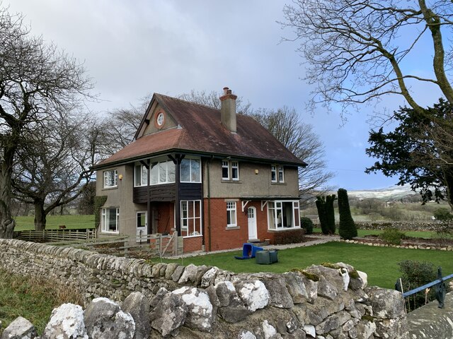
Bull Coppy Plantation, located in Yorkshire, England, is a picturesque woodland known for its natural beauty and diverse ecosystem. Spanning over a vast area, the plantation is a popular destination for nature enthusiasts and walkers alike.
The plantation is predominantly made up of dense woodland, primarily consisting of oak and beech trees, which provide a lush green canopy throughout the year. The rich biodiversity of the plantation is evident in the wide variety of plant species that thrive within its boundaries, including bluebells, primroses, and wild garlic, creating a vibrant and colorful landscape during the spring and summer months.
Furthermore, Bull Coppy Plantation is home to a diverse range of wildlife, with sightings of deer, squirrels, and numerous bird species being common. The woodland provides a sanctuary for these animals, offering them a safe and undisturbed habitat to thrive in.
For visitors, the plantation offers a network of well-maintained footpaths and trails, allowing them to explore the woodland and take in the breathtaking scenery. The tranquil atmosphere and peaceful surroundings make it an ideal location for leisurely walks, picnics, and photography.
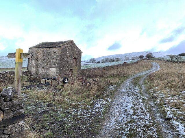
Bull Coppy Plantation also holds historical significance, with some areas showcasing remnants of the region's industrial past, such as old mine workings and quarry sites. This adds another layer of interest for visitors looking to delve into the area's heritage.
In conclusion, Bull Coppy Plantation in Yorkshire is a captivating woodland that offers a perfect blend of natural beauty, wildlife, and history. Its accessibility and scenic trails make it a must-visit destination for nature lovers and those seeking a peaceful retreat in the heart of Yorkshire.
If you have any feedback on the listing, please let us know in the comments section below.
Bull Coppy Plantation Images
Images are sourced within 2km of 54.064122/-2.0059079 or Grid Reference SD9963. Thanks to Geograph Open Source API. All images are credited.
![Grassington features [2] Grassington Bridge, also known as Linton Bridge, carries Station Road, B6265, over the River Wharfe. With 17th century origins, the bridge was widened in 1780 and the road surface substantially rebuilt in 1824. With 4 segmental arches in squared, coursed gritstone with some ashlar. Listed, grade II, with details at: <span class="nowrap"><a title="https://historicengland.org.uk/listing/the-list/list-entry/1316846" rel="nofollow ugc noopener" href="https://historicengland.org.uk/listing/the-list/list-entry/1316846">Link</a><img style="margin-left:2px;" alt="External link" title="External link - shift click to open in new window" src="https://s1.geograph.org.uk/img/external.png" width="10" height="10"/></span>
Grassington is a small market town, receiving its charter in 1282. The town is located in Wharfedale in the Yorkshire Dales National Park, some 7½ miles north of Skipton. Lead mining brought prosperity to the town in the 18th and 19th centuries. The town now attracts many tourists, especially walkers, with some excellent routes on the surrounding fells.](https://s2.geograph.org.uk/geophotos/07/03/85/7038550_b7091aeb.jpg)
![Grassington features [3] Grassington Bridge, also known as Linton Bridge, carries Station Road, B6265, over the River Wharfe. With 17th century origins, the bridge was widened in 1780 and the road surface substantially rebuilt in 1824. With 4 segmental arches in squared, coursed gritstone with some ashlar. Listed, grade II, with details at: <span class="nowrap"><a title="https://historicengland.org.uk/listing/the-list/list-entry/1316846" rel="nofollow ugc noopener" href="https://historicengland.org.uk/listing/the-list/list-entry/1316846">Link</a><img style="margin-left:2px;" alt="External link" title="External link - shift click to open in new window" src="https://s1.geograph.org.uk/img/external.png" width="10" height="10"/></span>
Grassington is a small market town, receiving its charter in 1282. The town is located in Wharfedale in the Yorkshire Dales National Park, some 7½ miles north of Skipton. Lead mining brought prosperity to the town in the 18th and 19th centuries. The town now attracts many tourists, especially walkers, with so](https://s0.geograph.org.uk/geophotos/07/03/85/7038556_397c2fd6.jpg)
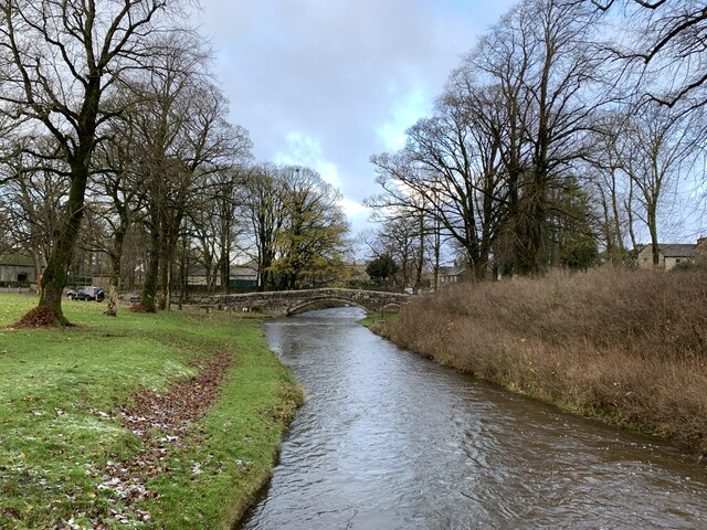
![Grassington features [4] The River Wharfe, looking upstream from Grassington Bridge which carries Station Road, B6265.
Grassington is a small market town, receiving its charter in 1282. The town is located in Wharfedale in the Yorkshire Dales National Park, some 7½ miles north of Skipton. Lead mining brought prosperity to the town in the 18th and 19th centuries. The town now attracts many tourists, especially walkers, with some excellent routes on the surrounding fells.](https://s0.geograph.org.uk/geophotos/07/03/85/7038560_a39b39a7.jpg)
![Grassington features [5] The River Wharfe, looking downstream from Grassington Bridge which carries Station Road, B6265.
Grassington is a small market town, receiving its charter in 1282. The town is located in Wharfedale in the Yorkshire Dales National Park, some 7½ miles north of Skipton. Lead mining brought prosperity to the town in the 18th and 19th centuries. The town now attracts many tourists, especially walkers, with some excellent routes on the surrounding fells.](https://s2.geograph.org.uk/geophotos/07/03/85/7038562_4e2c9c73.jpg)
![Grassington features [6] This County Bridge Marker is seen on the south side of Station Road, B6265. The marker indicates the extent of roadway adjoining the bridge that the County was obliged to maintain.
Grassington is a small market town, receiving its charter in 1282. The town is located in Wharfedale in the Yorkshire Dales National Park, some 7½ miles north of Skipton. Lead mining brought prosperity to the town in the 18th and 19th centuries. The town now attracts many tourists, especially walkers, with some excellent routes on the surrounding fells.](https://s1.geograph.org.uk/geophotos/07/03/85/7038565_6a08fee3.jpg)
![Grassington houses [7] Ladywell Cottage in located in Linton Road near a spring known as Our Lady&#039;s Well. The existing house was erected next to a steeply roofed, possibly cruck built, building, now the site of a 20th century range. The house is 17th century of gritstone rubble with freestone dressings under a stone slate roof. Listed, grade II, with details at: <span class="nowrap"><a title="https://historicengland.org.uk/listing/the-list/list-entry/1132095" rel="nofollow ugc noopener" href="https://historicengland.org.uk/listing/the-list/list-entry/1132095">Link</a><img style="margin-left:2px;" alt="External link" title="External link - shift click to open in new window" src="https://s1.geograph.org.uk/img/external.png" width="10" height="10"/></span>
Grassington is a small market town, receiving its charter in 1282. The town is located in Wharfedale in the Yorkshire Dales National Park, some 7½ miles north of Skipton. Lead mining brought prosperity to the town in the 18th and 19th centuries. The town now attracts many tourists, especially walkers, with some excellent routes on the surrounding fells.](https://s0.geograph.org.uk/geophotos/07/03/85/7038576_3b2a2c56.jpg)
![Grassington houses [8] Bridge End Farmhouse, Linton Road, was built in the mid or late 18th century. Constructed of gritstone rubble, partly slobbered, under a stone slate roof. Listed, grade II, with details at: <span class="nowrap"><a title="https://historicengland.org.uk/listing/the-list/list-entry/1132096" rel="nofollow ugc noopener" href="https://historicengland.org.uk/listing/the-list/list-entry/1132096">Link</a><img style="margin-left:2px;" alt="External link" title="External link - shift click to open in new window" src="https://s1.geograph.org.uk/img/external.png" width="10" height="10"/></span>
Grassington is a small market town, receiving its charter in 1282. The town is located in Wharfedale in the Yorkshire Dales National Park, some 7½ miles north of Skipton. Lead mining brought prosperity to the town in the 18th and 19th centuries. The town now attracts many tourists, especially walkers, with some excellent routes on the surrounding fells.](https://s0.geograph.org.uk/geophotos/07/03/85/7038580_c792a225.jpg)
![Swinden Quarry [1] The quarry sign.
The quarry is 2 miles south of Grassington and supplies limestone. The quarry is served by the former Skipton to Grassington railway, which now terminates here.](https://s3.geograph.org.uk/geophotos/07/03/90/7039039_ccbc39e4.jpg)
![Swinden Quarry [2] The roadway into the quarry.
The quarry is 2 miles south of Grassington and supplies limestone. The quarry is served by the former Skipton to Grassington railway, which now terminates here.](https://s1.geograph.org.uk/geophotos/07/03/90/7039041_721689be.jpg)
![Swinden Quarry [3] Railway wagons at the end of the line.
The quarry is 2 miles south of Grassington and supplies limestone. The quarry is served by the former Skipton to Grassington railway, which now terminates here.](https://s3.geograph.org.uk/geophotos/07/03/90/7039043_e3fe59df.jpg)
![Swinden Quarry [4] This fine view of Elbolton Hill is seen by those departing the quarry.
The quarry is 2 miles south of Grassington and supplies limestone. The quarry is served by the former Skipton to Grassington railway, which now terminates here.](https://s0.geograph.org.uk/geophotos/07/03/90/7039044_ac75fd8d.jpg)
Bull Coppy Plantation is located at Grid Ref: SD9963 (Lat: 54.064122, Lng: -2.0059079)
Division: West Riding
Administrative County: North Yorkshire
District: Craven
Police Authority: North Yorkshire
What 3 Words
///lobster.tweed.desire. Near Grassington, North Yorkshire
Nearby Locations
Related Wikis

Linton, North Yorkshire
Linton is a village and civil parish in the Craven district of North Yorkshire, England. The population as of the 2011 census was 176. It lies not far...

Linton Falls Hydro
Linton Falls Hydro is a hydroelectric generating power station located on the Linton Falls Weir of the River Wharfe, near Grassington, North Yorkshire...

Grassington & Threshfield railway station
Grassington & Threshfield railway station (or Threshfield station) was a railway station that served the town of Grassington and village of Threshfield...
Upper Wharfedale School
Upper Wharfedale School is a coeducational secondary school located in Threshfield, North Yorkshire, England. The school is named after Wharfedale, one...
Nearby Amenities
Located within 500m of 54.064122,-2.0059079Have you been to Bull Coppy Plantation?
Leave your review of Bull Coppy Plantation below (or comments, questions and feedback).