Ham Copse

Wood, Forest in Dorset

England

Ham Copse

Blandford Road in Hamworthy
Blandford Road in Hamworthy Credit: Steve Daniels

Ham Copse is a charming woodland area located in the county of Dorset, England. It covers an estimated area of approximately 50 acres and is situated near the village of Hammoon. The copse is well-known for its diverse range of tree species, including oak, beech, ash, and birch, which create a rich and vibrant canopy throughout the year.

The woodland floor is carpeted with a variety of flora, such as bluebells, primroses, and wild garlic, providing a picturesque and tranquil setting for visitors. The copse is also home to a wide array of wildlife, including deer, badgers, foxes, and a plethora of bird species, making it a popular spot for nature enthusiasts and birdwatchers.

There are several well-maintained footpaths that wind their way through Ham Copse, allowing visitors to explore the area and immerse themselves in its natural beauty. These paths are suitable for walkers of all abilities and offer breathtaking views of the surrounding countryside.

Ham Copse is managed by the local council and is designated as a Site of Special Scientific Interest (SSSI) due to its ecological importance. This recognition ensures that the woodland is protected and preserved for future generations to enjoy.

The copse also holds historical significance, with evidence of ancient settlements and farming activities dating back thousands of years. Archaeological discoveries, such as pottery fragments, have been made within its boundaries, adding to its cultural value.

Overall, Ham Copse in Dorset is a haven of natural beauty, biodiversity, and historical significance, offering visitors a chance to connect with nature and experience the tranquillity of a woodland retreat.

If you have any feedback on the listing, please let us know in the comments section below.
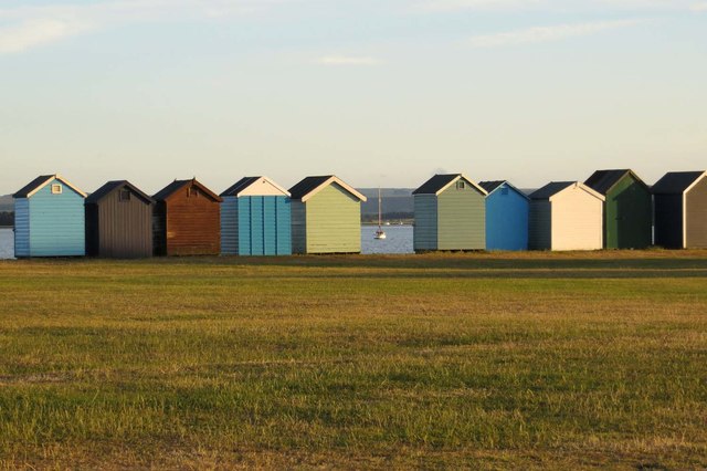
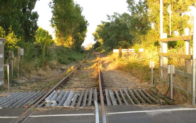
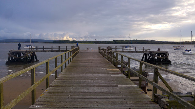
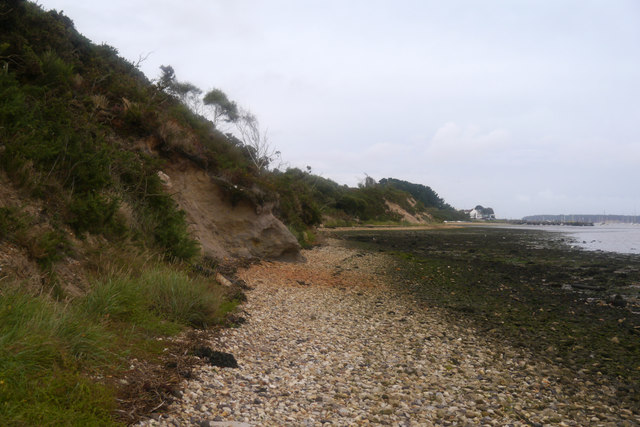
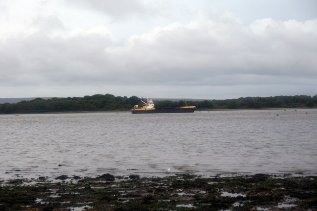
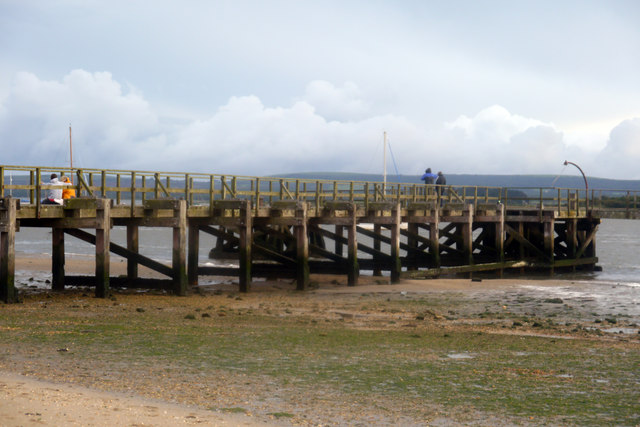
Ham Copse Images

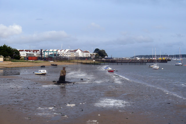
Images are sourced within 2km of 50.720443/-2.0090848 or Grid Reference SY9991. Thanks to Geograph Open Source API. All images are credited.

Blandford Road in Hamworthy
The Red Lion on Blandford Road
Rockley Park
Rockley Park
Hamworthy Park
Hamworthy Park
Beach huts in Hamworthy Park
The line to Hamworthy Quay
St Michaels View The view of St Michaels Church on Blandford Road, Hamworthy.
St Michaels View
The view of St Michaels Church on Blandford Road, Hamworthy.
St Michaels Close The view down Blandford Road in Hamworthy.
St Michaels Close
The view down Blandford Road in Hamworthy.
Poole : Upton Bypass A350 Looking along the Upton Bypass Road.
Poole : Upton Bypass A350
Looking along the Upton Bypass Road.
Beach below Ham Common, Poole Harbour
Foreshore near Ham Common and Hamworthy Beach, Poole Harbour
Hamworthy Beach and Lake Pier, Poole Harbour
Lake Pier, Poole Harbour
Beach below Ham Common, Poole Harbour, Dorset Adjoining Rock Lea River / Wareham Channel.
Beach below Ham Common, Poole Harbour, Dorset
Adjoining Rock Lea River / Wareham Channel.
View across Wareham Channel, Poole Harbour, towards Arne
Lake Pier, Wareham Channel, Poole Harbour
Foreshore east of Lake Pier, Poole Harbour Looking towards RM Poole and beyond to the rooftops of houses and apartments at Moriconium Quay.
Foreshore east of Lake Pier, Poole Harbour
Looking towards RM Poole and beyond to the rooftops of houses and apartments at Moriconium Quay.
Trainers and 7-Up - Lake Pier, Wareham Channel Not sure what these are doing here or what happened to the owner.
Trainers and 7-Up - Lake Pier, Wareham Channel
Not sure what these are doing here or what happened to the owner.
Show me another place!

Ham Copse is located at Grid Ref: SY9991 (Lat: 50.720443, Lng: -2.0090848)

Unitary Authority: Bournemouth, Christchurch and Poole

Police Authority: Dorset

What 3 Words

///dare.lift.always. Near Poole, Dorset

Related Wikis

Hamworthy

Hamworthy is a village, parish, peninsula and suburb of Poole in Dorset, England. It is sited on a peninsula of approximately 3 square kilometres (1.2...

The Cornerstone Academy

The Cornerstone Academy (previously Carter Community School) is a co-educational secondary school located in Hamworthy, Poole, Dorset, England. The school...

Hamworthy United F.C.

Hamworthy United Football Club is a football club based in Hamworthy, a suburb of Poole, England. Formed in 1970 as a merger of Hamworthy and Trinidad...

RM Poole

Royal Marines Base Poole (RM Poole) is a British naval base located in Hamworthy a suburb of Poole, Dorset, England on the Poole Harbour and is the centre...

Nearby Amenities

Located within 500m of 50.720443,-2.0090848
Source: PGS
Lat/Long: 50.7214917/-2.0033074
Source: PGS
Lat/Long: 50.7219194/-2.0032672
Source: PGS
Lat/Long: 50.7209037/-2.0035528
Source: PGS
Lat/Long: 50.7212954/-2.0033543
Turning Circle
Lat/Long: 50.7199365/-2.0118072
Turning Circle
Lat/Long: 50.7179733/-2.0109623
Turning Circle
Lat/Long: 50.7190965/-2.0127404
Turning Circle
Lat/Long: 50.7197144/-2.0085066
Turning Circle
Lat/Long: 50.7187263/-2.00783
Turning Circle
Lat/Long: 50.721469/-2.0158295
Turning Circle
Lat/Long: 50.7219555/-2.0149763
Turning Circle
Lat/Long: 50.7225381/-2.0152356
Mini Roundabout
Lat/Long: 50.721916/-2.0039924
Bus Stop
Hamworthy Co-op
Bus: yes
Naptan AtcoCode: 1280POA11110
Naptan Bearing: SE
Naptan CommonName: Hamworthy Co-op
Naptan Indicator: SE-bound
Naptan NaptanCode: pleagjm
Naptan PlusbusZoneRef: BOMO
Naptan Street: Blandford Road
Naptan Verified: no
Public Transport: platform
Lat/Long: 50.716366/-2.0071404
Car Wash
B&A Hand Car Wash
Automated: no
Self Service: no
Lat/Long: 50.7207949/-2.0112361
Traffic Signals
Traffic Signals: signal
Lat/Long: 50.7166588/-2.0074892
Power: tower
Source: bing
Lat/Long: 50.7188708/-2.0028276
Power: tower
Source: bing
Lat/Long: 50.7191411/-2.0023031
Power: tower
Source: bing
Lat/Long: 50.7210782/-2.0063943
Power: tower
Source: bing
Lat/Long: 50.7211803/-2.0060923
Power: tower
Source: bing
Lat/Long: 50.7225771/-2.0080916
Power: tower
Source: bing
Lat/Long: 50.7227043/-2.0078158
Power: tower
Source: bing
Lat/Long: 50.7237263/-2.0093832
Power: tower
Source: bing
Lat/Long: 50.7238495/-2.009088
Material: wood
Power: pole
Source: bing
Lat/Long: 50.7186138/-2.0031305
Material: wood
Power: pole
Source: bing
Lat/Long: 50.7186814/-2.003036
Material: wood
Power: pole
Source: bing
Lat/Long: 50.7205623/-2.0059589
Material: wood
Power: pole
Source: bing
Lat/Long: 50.7206116/-2.0058844
Material: wood
Power: pole
Source: bing
Lat/Long: 50.7209975/-2.0065141
Cobbs Quay Marina
Leisure: marina
Seamark Harbour Category: marina
Seamark Type: harbour
Lat/Long: 50.7223579/-2.0065928
Entrance: yes
Lat/Long: 50.7166721/-2.0072614
Generator Method: photovoltaic
Generator Output Electricity: yes
Generator Source: solar
Generator Type: solar_photovoltaic_panel
Location: roof
Power: generator
Lat/Long: 50.7172809/-2.0112035
Generator Method: photovoltaic
Generator Output Electricity: yes
Generator Source: solar
Generator Type: solar_photovoltaic_panel
Location: roof
Power: generator
Lat/Long: 50.7170652/-2.0108172
Generator Method: photovoltaic
Generator Output Electricity: yes
Generator Source: solar
Generator Type: solar_photovoltaic_panel
Location: roof
Power: generator
Lat/Long: 50.7169294/-2.0115548
Generator Method: photovoltaic
Generator Output Electricity: yes
Generator Source: solar
Generator Type: solar_photovoltaic_panel
Location: roof
Power: generator
Lat/Long: 50.7162403/-2.009975
Generator Method: photovoltaic
Generator Output Electricity: yes
Generator Source: solar
Generator Type: solar_photovoltaic_panel
Location: roof
Power: generator
Lat/Long: 50.7162671/-2.0098597
Generator Method: photovoltaic
Generator Output Electricity: yes
Generator Source: solar
Generator Type: solar_photovoltaic_panel
Location: roof
Power: generator
Lat/Long: 50.716532/-2.0105812
Generator Method: photovoltaic
Generator Output Electricity: yes
Generator Source: solar
Generator Type: solar_photovoltaic_panel
Location: roof
Power: generator
Lat/Long: 50.7165676/-2.0103532
Generator Method: photovoltaic
Generator Output Electricity: yes
Generator Source: solar
Generator Type: solar_photovoltaic_panel
Location: roof
Power: generator
Lat/Long: 50.7165014/-2.0112008
Generator Method: photovoltaic
Generator Output Electricity: yes
Generator Source: solar
Generator Type: solar_photovoltaic_panel
Location: roof
Power: generator
Lat/Long: 50.7166186/-2.0119116
Generator Method: photovoltaic
Generator Output Electricity: yes
Generator Source: solar
Generator Type: solar_photovoltaic_panel
Location: roof
Power: generator
Lat/Long: 50.7165727/-2.0116621
Generator Method: photovoltaic
Generator Output Electricity: yes
Generator Source: solar
Generator Type: solar_photovoltaic_panel
Location: roof
Power: generator
Lat/Long: 50.7166262/-2.0097885
Generator Method: photovoltaic
Generator Output Electricity: yes
Generator Source: solar
Generator Type: solar_photovoltaic_panel
Location: roof
Power: generator
Lat/Long: 50.7166687/-2.0090549
Generator Method: photovoltaic
Generator Output Electricity: yes
Generator Source: solar
Generator Type: solar_photovoltaic_panel
Location: roof
Power: generator
Lat/Long: 50.7166619/-2.0090147
Generator Method: photovoltaic
Generator Output Electricity: yes
Generator Source: solar
Generator Type: solar_photovoltaic_panel
Location: roof
Power: generator
Lat/Long: 50.7172703/-2.0123172
Generator Method: photovoltaic
Generator Output Electricity: yes
Generator Source: solar
Generator Type: solar_photovoltaic_panel
Location: roof
Power: generator
Lat/Long: 50.7186156/-2.0117331
Generator Method: photovoltaic
Generator Output Electricity: yes
Generator Source: solar
Generator Type: solar_photovoltaic_panel
Location: roof
Power: generator
Lat/Long: 50.7205929/-2.0149922
Generator Method: photovoltaic
Generator Output Electricity: yes
Generator Source: solar
Generator Type: solar_photovoltaic_panel
Location: roof
Power: generator
Lat/Long: 50.7205968/-2.0153113
Generator Method: photovoltaic
Generator Output Electricity: yes
Generator Source: solar
Generator Type: solar_photovoltaic_panel
Location: roof
Power: generator
Lat/Long: 50.72059/-2.0156607
Generator Method: photovoltaic
Generator Output Electricity: yes
Generator Source: solar
Generator Type: solar_photovoltaic_panel
Location: roof
Power: generator
Lat/Long: 50.7205917/-2.01576
Generator Method: photovoltaic
Generator Output Electricity: yes
Generator Source: solar
Generator Type: solar_photovoltaic_panel
Location: roof
Power: generator
Lat/Long: 50.7209071/-2.0155722
Generator Method: photovoltaic
Generator Output Electricity: yes
Generator Source: solar
Generator Type: solar_photovoltaic_panel
Location: roof
Power: generator
Lat/Long: 50.7206142/-2.0084067
Generator Method: photovoltaic
Generator Output Electricity: yes
Generator Source: solar
Generator Type: solar_photovoltaic_panel
Location: roof
Power: generator
Lat/Long: 50.7220321/-2.0085234
Generator Method: photovoltaic
Generator Output Electricity: yes
Generator Source: solar
Generator Type: solar_photovoltaic_panel
Location: roof
Power: generator
Lat/Long: 50.7229439/-2.0085636
Generator Method: photovoltaic
Generator Output Electricity: yes
Generator Source: solar
Generator Type: solar_photovoltaic_panel
Location: roof
Power: generator
Lat/Long: 50.7234652/-2.0083597
Generator Method: photovoltaic
Generator Output Electricity: yes
Generator Source: solar
Generator Type: solar_photovoltaic_panel
Location: roof
Power: generator
Lat/Long: 50.723253/-2.0111385
Generator Method: photovoltaic
Generator Output Electricity: yes
Generator Source: solar
Generator Type: solar_photovoltaic_panel
Location: roof
Power: generator
Lat/Long: 50.7246814/-2.010932
Generator Method: photovoltaic
Generator Output Electricity: yes
Generator Source: solar
Generator Type: solar_photovoltaic_panel
Location: roof
Power: generator
Lat/Long: 50.7227402/-2.0134801
Generator Method: photovoltaic
Generator Output Electricity: yes
Generator Source: solar
Generator Type: solar_photovoltaic_panel
Location: roof
Power: generator
Lat/Long: 50.7220919/-2.0155039
Post Box
Collection Times: Mo-Fr 09:00; Sa 07:00
Operator: Royal Mail
Operator Wikidata: Q638098
Post Box Mounting: telegraph_pole
Post Box Type: lamp
Ref: BH15 249D
Ref GB Uprn: 10015804925
Royal Cypher: EIIR
Royal Cypher Wikidata: Q33102113
Lat/Long: 50.7196405/-2.0068744
Post Box
Collection Times: Mo-Fr 09:00; Sa 07:00
Operator: Royal Mail
Operator Wikidata: Q638098
Post Box Type: pillar
Ref: BH15 67D
Ref GB Uprn: 10015275140
Royal Cypher: EIIR
Royal Cypher Wikidata: Q33102113
Lat/Long: 50.7179734/-2.0140319
Crossing
Crossing: unmarked
Crossing Island: no
Crossing Markings: no
Tactile Paving: yes
Lat/Long: 50.7209834/-2.0108299
Atm
Operator: The Co-operative
Lat/Long: 50.7165657/-2.0069866
Bicycle Rental
Blandford Road & Coles Avenue
Bicycle Rental: dropoff_point
Capacity: 7
Email: support@beryl.cc
Fee: yes
Name Signed: no
Network: Beryl - Bournemouth Poole Christchurch
Official Name: Blandford Road & Coles Avenue
Operator: Beryl
Operator Wikidata: Q106575369
Payment App: yes
Payment App Android: cc.beryl.basis
Payment App Ios: 1386768364
Payment Cash: no
Payment Credit Cards: no
Payment Cryptocurrencies: no
Payment Debit Cards: no
Payment Electronic Purses: no
Phone: +44 20 3003 5044
Ref Gbfs: beryl_bcp:384
Rental: city_bike
Website: https://beryl.cc/scheme/bournemouth-christchurch-and-poole
Lat/Long: 50.7165718/-2.007319
Bicycle Rental
Adams Surgery Hamworthy
Bicycle Rental: dropoff_point
Capacity: 5
Email: support@beryl.cc
Fee: yes
Name Signed: no
Network: Beryl - Bournemouth Poole Christchurch
Official Name: Adams Surgery Hamworthy
Operator: Beryl
Operator Wikidata: Q106575369
Payment App: yes
Payment App Android: cc.beryl.basis
Payment App Ios: 1386768364
Payment Cash: no
Payment Credit Cards: no
Payment Cryptocurrencies: no
Payment Debit Cards: no
Payment Electronic Purses: no
Phone: +44 20 3003 5044
Ref Gbfs: beryl_bcp:2062
Rental: city_bike
Website: https://beryl.cc/scheme/bournemouth-christchurch-and-poole
Lat/Long: 50.7210647/-2.0105266
Post Box
Collection Times: Mo-Fr 17:15; Sa 11:45
Operator: Royal Mail
Operator Wikidata: Q638098
Post Box Type: pillar
Ref: BH15 42
Ref GB Uprn: 10015406056
Royal Cypher: EIIR
Royal Cypher Wikidata: Q33102113
Lat/Long: 50.7205346/-2.0110868
Bus Stop
Hamilton Road
Bus: yes
Naptan AtcoCode: 1280POA11118
Naptan Bearing: S
Naptan CommonName: Hamilton Road
Naptan Indicator: S-bound
Naptan NaptanCode: pleadtg
Naptan PlusbusZoneRef: BOMO
Naptan Street: Lake Road
Naptan Verified: no
Public Transport: platform
Lat/Long: 50.7183669/-2.0133385
Bus Stop
Hamworthy, Red Lion
Bus: yes
Naptan AtcoCode: 1280POA11194
Naptan Bearing: S
Naptan CommonName: Red Lion
Naptan Indicator: S-bound
Naptan NaptanCode: pleagaj
Naptan PlusbusZoneRef: BOMO
Naptan Street: Blandford Road
Naptan Verified: no
Public Transport: platform
Lat/Long: 50.7215411/-2.0111157
Bus Stop
Dawkins Road
Bus: yes
Naptan AtcoCode: 1280POA11122
Naptan Bearing: SE
Naptan CommonName: Dawkins Road
Naptan Indicator: SE-bound
Naptan NaptanCode: pleadpj
Naptan PlusbusZoneRef: BOMO
Naptan Street: Blandford Road
Naptan Verified: no
Public Transport: platform
Lat/Long: 50.7233551/-2.013588
Bus Stop
Dawkins Road
Bus: yes
Naptan AtcoCode: 1280POA11121
Naptan Bearing: NW
Naptan CommonName: Dawkins Road
Naptan Indicator: NW-bound
Naptan NaptanCode: pleadpm
Naptan PlusbusZoneRef: BOMO
Naptan Street: Blandford Road
Naptan Verified: no
Public Transport: platform
Lat/Long: 50.7231114/-2.0135102
Bus Stop
Hamworthy, Red Lion
Bus: yes
Naptan AtcoCode: 1280POA11120
Naptan Bearing: N
Naptan CommonName: Red Lion
Naptan Indicator: N-bound
Naptan NaptanCode: pleagad
Naptan PlusbusZoneRef: BOMO
Naptan Street: Blandford Road
Naptan Verified: no
Public Transport: platform
Lat/Long: 50.7217725/-2.0114663
Bus Stop
Hamilton Road
Bus: yes
Naptan AtcoCode: 1280POA11119
Naptan Bearing: N
Naptan CommonName: Hamilton Road
Naptan Indicator: N-bound
Naptan NaptanCode: pleadtd
Naptan PlusbusZoneRef: BOMO
Naptan Street: Lake Road
Naptan Verified: no
Public Transport: platform
Lat/Long: 50.7184858/-2.0134002
Bus Stop
Hamworthy Labour Club
Bus: yes
Naptan AtcoCode: 1280POA11117
Naptan Bearing: N
Naptan CommonName: Hamworthy Labour Club
Naptan Indicator: N-bound
Naptan NaptanCode: pleadpt
Naptan PlusbusZoneRef: BOMO
Naptan Street: Lake Road
Naptan Verified: no
Public Transport: platform
Lat/Long: 50.7173811/-2.0135665
Entrance: main
Lat/Long: 50.7210685/-2.0103839
Entrance: yes
Lat/Long: 50.7165758/-2.0071623
Entrance: main
Lat/Long: 50.7198945/-2.0100597
Barrier: lych_gate
Lat/Long: 50.7195967/-2.0100916
Entrance: main
Lat/Long: 50.7196624/-2.00991
Community Centre
St Michael's Church Centre
Lat/Long: 50.7199067/-2.010031
Crossing
Crossing: unmarked
Crossing Island: yes
Crossing Markings: no
Tactile Paving: yes
Lat/Long: 50.720836/-2.010992
Barrier: kerb
Kerb: lowered
Tactile Paving: yes
Lat/Long: 50.7208237/-2.0110712
Barrier: kerb
Kerb: lowered
Tactile Paving: yes
Lat/Long: 50.720848/-2.0108953
Barrier: kerb
Kerb: lowered
Tactile Paving: yes
Lat/Long: 50.7209589/-2.0108174
Barrier: kerb
Kerb: lowered
Tactile Paving: yes
Lat/Long: 50.7210113/-2.0108441
Barrier: kerb
Kerb: lowered
Tactile Paving: yes
Lat/Long: 50.7204975/-2.010941
Barrier: kerb
Kerb: lowered
Tactile Paving: yes
Lat/Long: 50.7205161/-2.0108247
Barrier: kerb
Kerb: lowered
Tactile Paving: yes
Lat/Long: 50.7206112/-2.0110852
Crossing
Crossing: unmarked
Crossing Island: yes
Crossing Markings: no
Tactile Paving: yes
Lat/Long: 50.7206732/-2.0111019
Barrier: kerb
Kerb: lowered
Tactile Paving: yes
Lat/Long: 50.7207314/-2.0111167
Bus Stop
Burngate Road
Bus: yes
Public Transport: platform
Lat/Long: 50.7184569/-2.0090197
Bus Stop
The Rectory
Bus: yes
Public Transport: platform
Lat/Long: 50.718625/-2.0094393
The data included in this document is from www.openstreetmap.org. The data is made available under ODbL.

Have you been to Ham Copse?

Leave your review of Ham Copse below (or comments, questions and feedback).