Northmead Copse

Wood, Forest in Dorset

England

Northmead Copse

On Broadstone Way Broadstone Way, laid on the trackbed of the former London & South Western Railway line.
On Broadstone Way Credit: Peter Kazmierczak

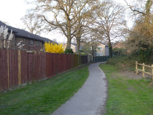
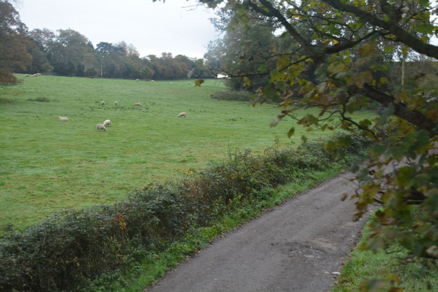
Northmead Copse, located in Dorset, is a picturesque wood nestled in the heart of the countryside. Covering an area of approximately 20 hectares, it is a haven for nature enthusiasts and a popular destination for locals and tourists alike.

The copse mainly consists of broadleaf trees, including oak, beech, and ash, creating a diverse and vibrant woodland ecosystem. These trees provide a rich habitat for a variety of wildlife, such as deer, squirrels, and a wide range of bird species. The forest floor is adorned with a carpet of wildflowers during the spring and summer months, adding a burst of color to the landscape.

Visitors to Northmead Copse can enjoy a network of well-maintained footpaths that wind through the woodland, allowing for pleasant walks and exploration. The tranquil atmosphere and peaceful surroundings make it an ideal place for relaxation and contemplation.

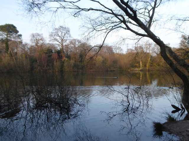
The copse is also home to a small stream that meanders through the trees, adding to the natural beauty and providing a water source for the inhabitants of the woodland. It is a popular spot for children to play and paddle during the warmer months.

Northmead Copse is managed by the local conservation authority, ensuring the preservation of its natural features and promoting biodiversity. The wood is open to the public year-round, with no entry fees, and there are picnic areas and benches scattered throughout, providing opportunities for visitors to enjoy a picnic or simply sit and soak up the serene surroundings.

Overall, Northmead Copse offers a peaceful retreat for nature lovers, with its diverse woodland, abundant wildlife, and tranquil atmosphere making it a delightful destination for all.

If you have any feedback on the listing, please let us know in the comments section below.

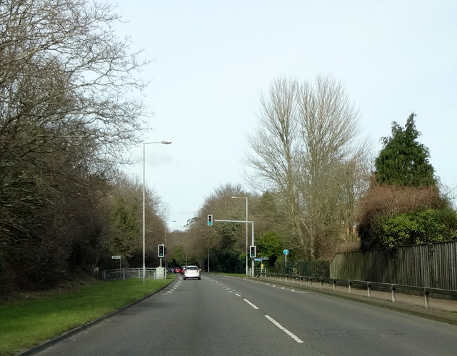
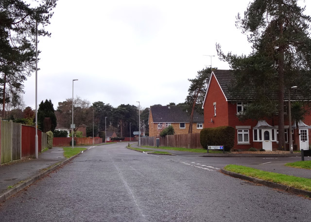
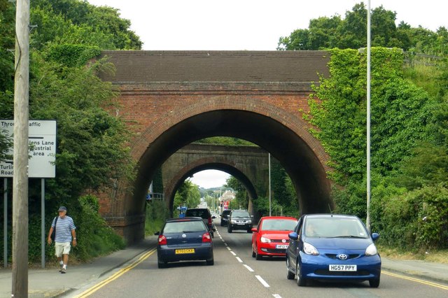
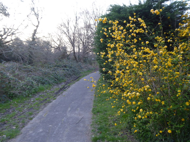
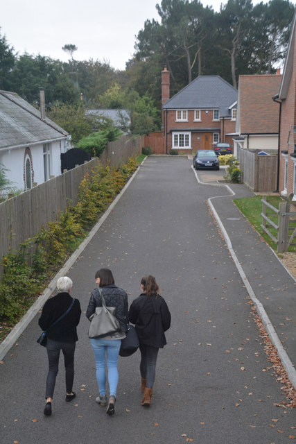
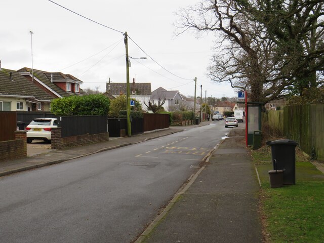
Northmead Copse Images

Images are sourced within 2km of 50.741171/-2.0098967 or Grid Reference SY9993. Thanks to Geograph Open Source API. All images are credited.

On Broadstone Way Broadstone Way, laid on the trackbed of the former London & South Western Railway line.
On Broadstone Way
Broadstone Way, laid on the trackbed of the former London & South Western Railway line.
Woodpecker Drive, Creekmoor Suburban housing estate on the edge of Poole.
Woodpecker Drive, Creekmoor
Suburban housing estate on the edge of Poole.
Blandford Road in Hamworthy
Footpath off Tarn Drive Leading to Creekmoor ponds.
Footpath off Tarn Drive
Leading to Creekmoor ponds.
Footpath at the rear of houses in Honeysuckle Lane
Pond on Creekmoor The smaller of two flooded former sandpits in this 14 acre nature reserve.
Pond on Creekmoor
The smaller of two flooded former sandpits in this 14 acre nature reserve.
Poole : Upton Bypass A350 Looking along the Upton Bypass Road.
Poole : Upton Bypass A350
Looking along the Upton Bypass Road.
Poole : Upton Country Park An entrance into Upton Country Park from Poole Road.
Poole : Upton Country Park
An entrance into Upton Country Park from Poole Road.
Purbeck : Country Lane A small lane heading off from Poole Road.
Purbeck : Country Lane
A small lane heading off from Poole Road.
Upton : Poole Road Looking along Poole Road as it heads out from Upton.
Upton : Poole Road
Looking along Poole Road as it heads out from Upton.
Upton : Poole Road Houses A small access road and homes on Poole Road.
Upton : Poole Road Houses
A small access road and homes on Poole Road.
Upton : Construction Site A small construction site seen off Poole Road.
Upton : Construction Site
A small construction site seen off Poole Road.
Upton : The Co-Operative Food A convenience store located on Poole Road.
Upton : The Co-Operative Food
A convenience store located on Poole Road.
Upton : St Dunstan's Church Looking towards the church on Poole Road.
Upton : St Dunstan's Church
Looking towards the church on Poole Road.
Upton : Costa Coffee The coffee shop is next to a Lloyds Pharmacy.
Upton : Costa Coffee
The coffee shop is next to a Lloyds Pharmacy.
Upton : Dorchester Road B3067 Looking along Dorchester Road as it heads through Upton.
Upton : Dorchester Road B3067
Looking along Dorchester Road as it heads through Upton.
Upton : Oxborrow Close Looking along Oxborrow Close off of Dorchester Road.
Upton : Oxborrow Close
Looking along Oxborrow Close off of Dorchester Road.
Sandy Lane, Upton, near Poole Sandy Lane is a minor road in Upton, near Poole.  The road is served by buses, as shown by the bus stops either side of the road.
Sandy Lane, Upton, near Poole
Sandy Lane is a minor road in Upton, near Poole. The road is served by buses, as shown by the bus stops either side of the road.
Show me another place!

Northmead Copse is located at Grid Ref: SY9993 (Lat: 50.741171, Lng: -2.0098967)

Unitary Authority: Bournemouth, Christchurch and Poole

Police Authority: Dorset

What 3 Words

///boxer.answer.probe. Near Broadstone, Dorset

Related Wikis

Holes Bay Nature Park

Holes Bay Nature Park is a protected area, 286 hectares in size, on and around Holes Bay, an embayment of Poole Harbour within the Borough of Poole that...

Upton House, Dorset

Upton House is a country house in the grounds of Upton Country Park on the northwestern shoreline of Holes Bay in the county of Dorset on the south coast...

Creekmoor

Creekmoor is a suburb of Poole in Dorset, England, with a population of 9,257, reducing to 9,180 at the 2011 census. Bordered by the Upton Heath Nature...

Creekmoor Light Railway

The Creekmoor Light Railway was a small, privately run, 2 ft (610 mm) narrow gauge railway. It was situated off Creekmoor Lane, to the north of Poole,...

Creekmoor Halt railway station

Creekmoor was a halt on the former Southampton and Dorchester Railway opened by the Southern Railway for workers at the adjacent "Oerlikon" munitions...

Pergins Island

Pergins Island is a small, uninhabited island in Holes Bay, an embayment off Poole Harbour in Dorset on the south coast of England. It is not accessible...

Holes Bay

Holes Bay is an intertidal embayment off Poole Harbour in the county of Dorset on the south coast of England. It lies mostly within the Borough of Poole...

Parvalux

Parvalux Electric Motors Ltd is a British manufacturer of fractional horsepower geared electric motors. Based in Poole in Southern England. In December...

Nearby Amenities

Located within 500m of 50.741171,-2.0098967
Motorway Junction
Lat/Long: 50.7387773/-2.010666
Turning Circle
Lat/Long: 50.7445492/-2.0113252
Turning Circle
Lat/Long: 50.7443006/-2.0085975
Turning Circle
Lat/Long: 50.7447486/-2.0098956
Turning Circle
Lat/Long: 50.7442126/-2.0101853
Turning Circle
Lat/Long: 50.7431128/-2.0088877
Turning Circle
Lat/Long: 50.7435673/-2.0094772
Turning Circle
Lat/Long: 50.7439752/-2.0077821
Turning Circle
Lat/Long: 50.7415899/-2.0071336
Turning Circle
Lat/Long: 50.7435673/-2.0105716
Turning Circle
Lat/Long: 50.7427351/-2.0115164
Turning Circle
Lat/Long: 50.7428373/-2.0097669
Turning Circle
Lat/Long: 50.7426776/-2.0080679
Turning Circle
Lat/Long: 50.7416346/-2.0078315
Turning Circle
Lat/Long: 50.7415034/-2.0084365
Turning Circle
Lat/Long: 50.7421823/-2.0092305
Turning Circle
Lat/Long: 50.7418293/-2.0061513
Turning Circle
Lat/Long: 50.7423086/-2.0072401
Turning Circle
Lat/Long: 50.7410779/-2.007722
Turning Circle
Lat/Long: 50.7407796/-2.0064436
Turning Circle
Lat/Long: 50.7407697/-2.0057206
Parking
Lat/Long: 50.7454577/-2.0086764
Bus Stop
Woodpecker Drive
Bench: no
Bin: no
Bus: yes
Naptan AtcoCode: 1280POA11158
Naptan Bearing: S
Naptan CommonName: Woodpecker Drive
Naptan Indicator: S-bound
Naptan NaptanCode: pleadtw
Naptan PlusbusZoneRef: BOMO
Naptan Street: Longmeadow Lane
Naptan Verified: no
Public Transport: platform
Shelter: no
Tactile Paving: no
Lat/Long: 50.7431257/-2.0120909
Turning Circle
Lat/Long: 50.7437689/-2.0114766
Turning Circle
Lat/Long: 50.7408139/-2.0045217
Barrier: swing_gate
Lat/Long: 50.7387998/-2.0123868
Fire Hydrant
Emergency: fire_hydrant
Fire Hydrant Diameter: 150
Fire Hydrant Type: underground
Ref: 1437
Source: GPS
Lat/Long: 50.7412338/-2.0044585
Fire Hydrant
Emergency: fire_hydrant
Fire Hydrant Diameter: 100
Fire Hydrant Type: underground
Ref: 663
Source: GPS
Lat/Long: 50.7422702/-2.009805
Fire Hydrant
Emergency: fire_hydrant
Fire Hydrant Diameter: 100
Fire Hydrant Type: underground
Ref: 6058
Source: GPS
Lat/Long: 50.7423651/-2.0063393
The Co-operative Food
Brand: The Co-operative Food
Brand Wikidata: Q107617274
Check Date Opening Hours: 2023-09-08
Opening Hours: Mo-Su 06:30-22:00
Operator: The Southern Co-operative
Operator Wikidata: Q7569773
Shop: convenience
Website: https://stores.southern.coop/dorset/poole/northmead-drive.html
Lat/Long: 50.7414398/-2.0031719
Phase One
Phone: +44 1202 699009
Shop: hairdresser
Lat/Long: 50.7414534/-2.0030378
Recycling
Recycling Type: container
Type: clothing & shoes
Lat/Long: 50.7417571/-2.003705
Pharmacy
Rowlands Pharmacy
Brand: Rowlands Pharmacy
Brand Wikidata: Q62663235
Dispensing: yes
Healthcare: pharmacy
Website: https://rowlandspharmacy.co.uk/find-local-pharmacy#!/l/poole/northmead-drive,-birchwood-medical-centre/1324
Lat/Long: 50.7417783/-2.0044041
Doctors
Birchwood Practice
Lat/Long: 50.7418123/-2.0044684
Barrier: cycle_barrier
Lat/Long: 50.7429972/-2.0042731
Barrier: cycle_barrier
Lat/Long: 50.7431501/-2.0043978
Fire Hydrant
Emergency: fire_hydrant
Fire Hydrant Type: underground
Source: GPS
Lat/Long: 50.7414596/-2.0083902
Fire Hydrant
Emergency: fire_hydrant
Fire Hydrant Diameter: 100
Fire Hydrant Type: underground
Ref: 9158
Source: GPS
Lat/Long: 50.742383/-2.0071248
Fire Hydrant
Emergency: fire_hydrant
Fire Hydrant Type: underground
Source: GPS
Lat/Long: 50.7426443/-2.0079548
Fire Hydrant
Emergency: fire_hydrant
Fire Hydrant Diameter: 150
Fire Hydrant Type: underground
Ref: 010871
Source: GPS+GLONASS
Lat/Long: 50.7440619/-2.0119427
Location: underground
Source: GPS+GLONASS
Water: wash_out
Lat/Long: 50.744502/-2.010199
Post Box
Collection Times: Mo-Fr 17:45; Sa 11:45
Operator: Royal Mail
Operator Wikidata: Q638098
Post Box Type: pillar
Ref: BH17 198
Ref GB Uprn: 10015366041
Royal Cypher: GR
Royal Cypher Wikidata: Q33102273
Source: GPS+GLONASS
Lat/Long: 50.7448936/-2.0117473
Location: underground
Source: GPS+GLONASS
Water: wash_out
Lat/Long: 50.744992/-2.0104798
Marker: plate
Orienteering: marker
Ref: D
Sport: orienteering
Lat/Long: 50.7380235/-2.0130516
Julia's House Shop
Shop: charity
Lat/Long: 50.7416045/-2.0029278
Barrier: cycle_barrier
Lat/Long: 50.7434271/-2.0059579
Barrier: cycle_barrier
Lat/Long: 50.7436621/-2.0059427
Recycling
Recycling Type: bin
Lat/Long: 50.7448037/-2.0060899
Waste Basket
Lat/Long: 50.7447929/-2.0060997
Waste Basket
Lat/Long: 50.7439522/-2.0059259
Waste Basket
Waste: dog_excrement
Lat/Long: 50.7439522/-2.0059132
Bench
Lat/Long: 50.738057/-2.0130404
Bench
Lat/Long: 50.7381104/-2.0130319
Bench
Lat/Long: 50.7381579/-2.0130242
Bench
Lat/Long: 50.7371652/-2.0128524
Bench
Lat/Long: 50.7370951/-2.0128973
Marker: post
Orienteering: marker
Ref: J
Sport: orienteering
Lat/Long: 50.7370282/-2.0121602
Bench
Lat/Long: 50.7384343/-2.0114422
Marker: plate
Orienteering: marker
Ref: R
Sport: orienteering
Lat/Long: 50.7369764/-2.0080507
Marker: plate
Orienteering: marker
Ref: G
Sport: orienteering
Lat/Long: 50.7373764/-2.0111155
Colour: green
Man Made: street_cabinet
Operator: BT OpenReach
Ref: 40
Source: survey
Street Cabinet: telecom
Lat/Long: 50.7430458/-2.0081414
Colour: green
Fttc: yes
Man Made: street_cabinet
Manufacturer: ECI
Operator: BT OpenReach
Source: survey
Street Cabinet: telecom
Lat/Long: 50.7430051/-2.007903
Post Box
Collection Times: Mo-Fr 18:00; Sa 11:45
Operator: Royal Mail
Operator Wikidata: Q638098
Post Box Type: pillar
Ref: BH17 7
Ref GB Uprn: 10015345008
Royal Cypher: GR
Royal Cypher Wikidata: Q33102273
Lat/Long: 50.741542/-2.0048218
Colour: green
Man Made: street_cabinet
Operator: Virgin Media
Ref: 05202114
Source: survey
Street Cabinet: cable_tv
Lat/Long: 50.7418488/-2.0053039
Colour: green
Man Made: street_cabinet
Manufacturer: Malcoe
Operator: Virgin Media
Ref: 05202700
Source: survey
Street Cabinet: cable_tv
Lat/Long: 50.7426053/-2.0092501
Colour: green
Man Made: street_cabinet
Manufacturer: Malcoe
Operator: Virgin Media
Ref: 05202200
Source: survey
Street Cabinet: cable_tv
Lat/Long: 50.7425841/-2.0093226
Colour: white
Marker: post
Material: plastic
Pressure: high
Utility: gas
Lat/Long: 50.74118/-2.013539
Note: Continues
Lat/Long: 50.7409548/-2.0140541
Note: Continues
Lat/Long: 50.7416499/-2.0142663
Note: Continues
Lat/Long: 50.7416262/-2.0142251
Marker: post
Operator: Wessex Orienteering Club
Orienteering: marker
Ref: F
Sport: orienteering
Lat/Long: 50.7385765/-2.0129938
Marker: post
Orienteering: marker
Ref: C
Sport: orienteering
Lat/Long: 50.7383166/-2.0118423
Marker: post
Orienteering: marker
Ref: E
Sport: orienteering
Lat/Long: 50.7383812/-2.0112289
Orienteering: marker
Ref: A
Sport: orienteering
Lat/Long: 50.7373438/-2.0132376
Marker: post
Orienteering: marker
Ref: Start/Finish
Sport: orienteering
Lat/Long: 50.7371873/-2.0127589
Marker: post
Orienteering: marker
Ref: H
Sport: orienteering
Lat/Long: 50.7370313/-2.0111951
Marker: plate
Orienteering: marker
Ref: N
Sport: orienteering
Lat/Long: 50.7366983/-2.0093926
Marker: post
Orienteering: marker
Ref: B
Sport: orienteering
Lat/Long: 50.7377123/-2.0122669
Generator Method: photovoltaic
Generator Output Electricity: yes
Generator Source: solar
Generator Type: solar_photovoltaic_panel
Location: roof
Power: generator
Lat/Long: 50.7454747/-2.0104577
Generator Method: photovoltaic
Generator Output Electricity: yes
Generator Source: solar
Generator Type: solar_photovoltaic_panel
Location: roof
Power: generator
Lat/Long: 50.7432588/-2.0111805
Generator Method: photovoltaic
Generator Output Electricity: yes
Generator Source: solar
Generator Type: solar_photovoltaic_panel
Location: roof
Power: generator
Lat/Long: 50.7432761/-2.0109102
Generator Method: photovoltaic
Generator Output Electricity: yes
Generator Source: solar
Generator Type: solar_photovoltaic_panel
Location: roof
Power: generator
Lat/Long: 50.7409563/-2.0065094
Ford: yes
Lat/Long: 50.7425156/-2.0132622
Power: transformer
Source: bing
Lat/Long: 50.7424195/-2.0110757
Bus Stop
Grebe Close
Bench: yes
Bin: no
Bus: yes
Lit: yes
Naptan AtcoCode: 1280POA11182
Naptan Bearing: E
Naptan CommonName: Grebe Close
Naptan Indicator: opp
Naptan NaptanCode: pleagaw
Naptan PlusbusZoneRef: BOMO
Naptan Street: Woodpecker Drive
Naptan Verified: no
Network: morebus
Public Transport: platform
Ref: 1280POA11182
Shelter: yes
Tactile Paving: no
Lat/Long: 50.74256/-2.0094741
Bus Stop
Grebe Close
Bench: no
Bin: no
Bus: yes
Lit: no
Naptan AtcoCode: 1280POA11181
Naptan Bearing: SW
Naptan CommonName: Grebe Close
Naptan Indicator: SW-bound
Naptan NaptanCode: pleagdj
Naptan PlusbusZoneRef: BOMO
Naptan Street: Woodpecker Drive
Naptan Verified: no
Network: morebus
Public Transport: platform
Ref: 1280POA11181
Shelter: no
Tactile Paving: no
Lat/Long: 50.7425043/-2.0092913
Bus Stop
Blackbird Close
Bench: no
Bin: no
Bus: yes
Check Date Bin: 2022-12-03
Lit: no
Naptan AtcoCode: 1280POA90846
Naptan Bearing: E
Naptan CommonName: Blackbird Close
Naptan Indicator: E-bound
Naptan NaptanCode: plejwdp
Naptan Street: Woodpecker Drive
Naptan Verified: no
Network: morebus
Public Transport: platform
Shelter: no
Tactile Paving: no
Lat/Long: 50.7423912/-2.0112249
Bus Stop
Blackbird Close
Bench: no
Bin: no
Bus: yes
Lit: no
Naptan AtcoCode: 1280POA90847
Naptan Bearing: W
Naptan CommonName: Blackbird Close
Naptan Indicator: W-bound
Naptan NaptanCode: plejwdt
Naptan Street: Woodpecker Drive
Naptan Verified: no
Network: morebus
Public Transport: platform
Shelter: no
Tactile Paving: no
Lat/Long: 50.7422748/-2.0111118
Bus Stop
Swift Close
Bus: yes
Naptan AtcoCode: 1280POA11179
Naptan Bearing: NW
Naptan CommonName: Swift Close
Naptan Indicator: NW-bound
Naptan NaptanCode: pleagja
Naptan PlusbusZoneRef: BOMO
Naptan Street: Northmead Drive
Naptan Verified: no
Network: morebus
Public Transport: platform
Ref: 1280POA11179
Shelter: no
Lat/Long: 50.7428973/-2.0077033
Bus Stop
Swift Close
Bus: yes
Naptan AtcoCode: 1280POA11180
Naptan Bearing: SE
Naptan CommonName: Swift Close
Naptan Indicator: SE-bound
Naptan NaptanCode: pleagjd
Naptan PlusbusZoneRef: BOMO
Naptan Street: Northmead Drive
Naptan Verified: no
Network: morebus
Public Transport: platform
Ref: 1280POA11180
Shelter: yes
Lat/Long: 50.7427772/-2.0071335
Bicycle Rental
Woodpecker Drive
Bicycle Rental: dropoff_point
Brand: Beryl
Brand Wikidata: Q106575365
Capacity: 8
Email: support@beryl.cc
Fee: yes
Mapillary: 3797958720281562
Name Signed: no
Network: Beryl - Bournemouth Poole Christchurch
Official Name: Woodpecker Drive
Operator: Beryl
Operator Type: business
Operator Wikidata: Q106575369
Payment App: yes
Payment App Android: cc.beryl.basis
Payment App Ios: 1386768364
Payment Cash: no
Payment Credit Cards: no
Payment Cryptocurrencies: no
Payment Debit Cards: no
Payment Electronic Purses: no
Phone: +44 20 3003 5044
Ref Gbfs: beryl_bcp:370
Rental: city_bike
Survey Date: 2020-09-08
Website: https://beryl.cc/scheme/bournemouth-christchurch-and-poole
Lat/Long: 50.7429543/-2.01208
Bus Stop
Creekmoor Medical Centre
Bench: no
Bin: no
Bus: yes
Lit: no
Naptan AtcoCode: 1280POA11178
Naptan Bearing: SE
Naptan CommonName: Medical Centre
Naptan Indicator: opp
Naptan NaptanCode: pleagpw
Naptan PlusbusZoneRef: BOMO
Naptan Street: Northmead Drive
Naptan Verified: no
Network: morebus
Public Transport: platform
Ref: 1280POA11178
Shelter: yes
Tactile Paving: no
Lat/Long: 50.7417269/-2.0050455
Bus Stop
Creekmoor Medical Centre
Bench: no
Bin: no
Bus: yes
Check Date Bench: 2022-12-03
Lit: yes
Naptan AtcoCode: 1280POA11177
Naptan Bearing: NW
Naptan CommonName: Medical Centre
Naptan Indicator: NW-bound
Naptan NaptanCode: pleagpj
Naptan PlusbusZoneRef: BOMO
Naptan Street: Northmead Drive
Naptan Verified: no
Network: morebus
Public Transport: platform
Ref: 1280POA11177
Shelter: no
Tactile Paving: no
Lat/Long: 50.7419026/-2.0055074
Bus Stop
Upton Country Park, entrance
Bench: no
Bin: no
Bus: yes
Lit: no
Naptan AtcoCode: 1200POA11156
Naptan Bearing: W
Naptan CommonName: Upton Country Park
Naptan Indicator: W-bound
Naptan NaptanCode: dordamdm
Naptan PlusbusZoneRef: BOMO
Naptan Street: Poole Road
Naptan Verified: no
Public Transport: platform
Shelter: no
Tactile Paving: no
Lat/Long: 50.7384616/-2.0155245
Bus Stop
Upton Country Park, entrance
Bench: no
Bin: no
Bus: yes
Lit: no
Naptan AtcoCode: 1200POA11155
Naptan Bearing: E
Naptan CommonName: Upton Country Park
Naptan Indicator: opp
Naptan NaptanCode: dordamdt
Naptan PlusbusZoneRef: BOMO
Naptan Street: Poole Road
Naptan Verified: no
Public Transport: platform
Shelter: no
Tactile Paving: no
Lat/Long: 50.7386738/-2.0150417
Fire Hydrant
Emergency: fire_hydrant
Fire Hydrant Diameter: 100
Fire Hydrant Type: underground
Fixme: Check ref
Ref: 725
Lat/Long: 50.74447/-2.006741
Fire Hydrant
Emergency: fire_hydrant
Fire Hydrant Diameter: 100
Fire Hydrant Type: underground
Fixme: Check ref
Ref: 010285
Source: survey
Lat/Long: 50.744976/-2.009488
Fire Hydrant
Emergency: fire_hydrant
Fire Hydrant Diameter: 100
Fire Hydrant Type: underground
Ref: 012332
Source: survey
Lat/Long: 50.743541/-2.010495
Fire Hydrant
Emergency: fire_hydrant
Fire Hydrant Diameter: 100
Fire Hydrant Type: underground
Ref: 013053
Source: survey
Lat/Long: 50.745004/-2.010767
Entrance: main
Lat/Long: 50.7422329/-2.0121231
Gas: valve
Pressure: MP
Ref: 8882
Size: 100
Source: survey
Lat/Long: 50.7422228/-2.0121174
Gas: valve
Pressure: LP
Ref: 8883
Size: 150
Source: survey
Lat/Long: 50.7422343/-2.0121067
The data included in this document is from www.openstreetmap.org. The data is made available under ODbL.

Have you been to Northmead Copse?

Leave your review of Northmead Copse below (or comments, questions and feedback).