Pennylaws North Plantation

Wood, Forest in Northumberland

England

Pennylaws North Plantation

Public Bridleway near Prendwick This Public Bridleway initially leads from Prendwick to the cottage of Northfieldhead. Thereafter, it quickly links up with the ancient cross-border track of the Salter's Road. For a selection of detailed free to download walking routes in the area visit <span class="nowrap"><a title="www.cheviotwalks.co.uk" rel="nofollow ugc noopener" href="http://www.cheviotwalks.co.uk">Link</a><img style="margin-left:2px;" alt="External link" title="External link - shift click to open in new window" src="https://s1.geograph.org.uk/img/external.png" width="10" height="10"/></span>
Public Bridleway near Prendwick Credit: Geoff Holland

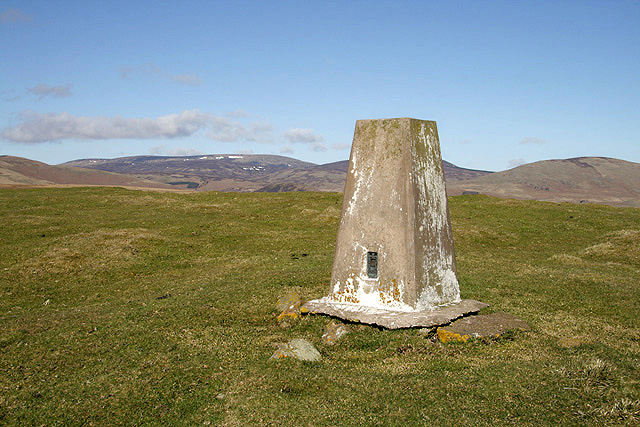
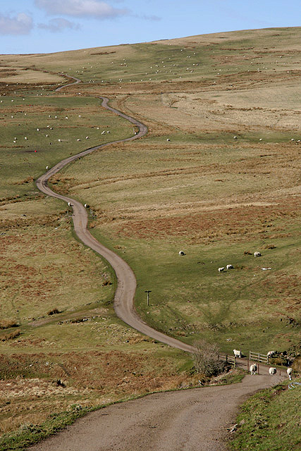
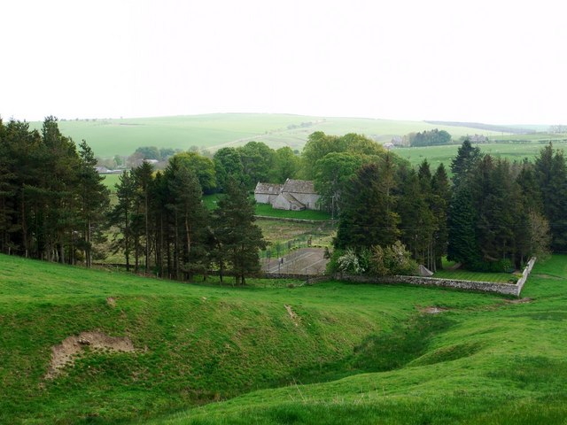
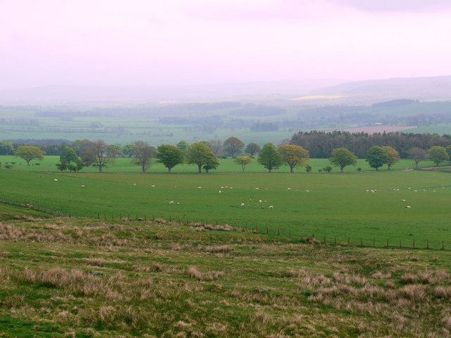
Pennylaws North Plantation is a captivating woodland area situated in Northumberland, a county in the northeast of England. This natural gem is nestled in the heart of the region, boasting an enchanting mix of woodlands and forests that stretch over a vast expanse of land.

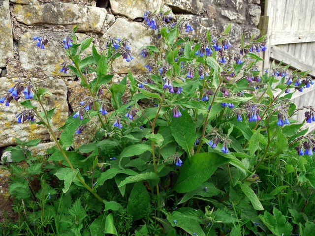
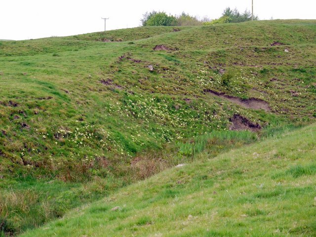
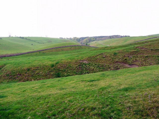
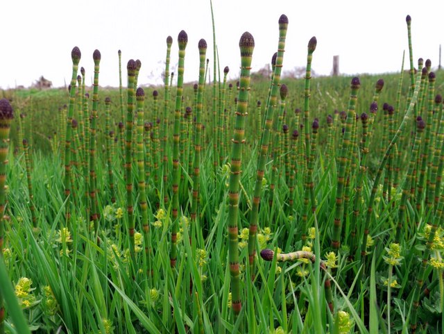
The plantation is known for its rich biodiversity and stunning natural beauty. It is home to a diverse array of flora and fauna, including towering oak and beech trees, vibrant wildflowers, and a myriad of animal species. The thick canopy of trees provides a haven for various bird species, such as woodpeckers, owls, and songbirds, making it a paradise for birdwatchers and nature enthusiasts.

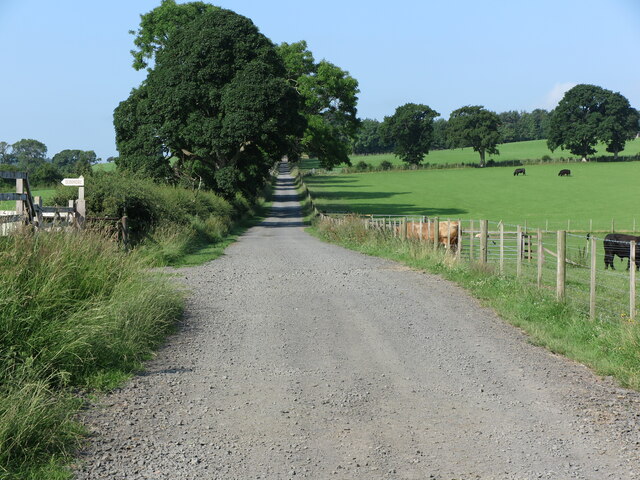
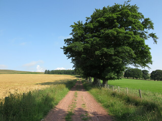
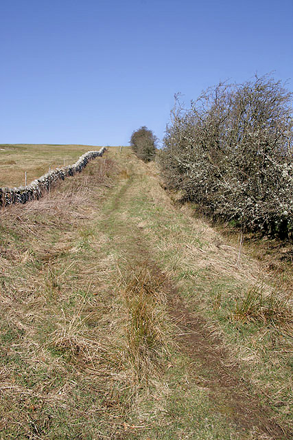
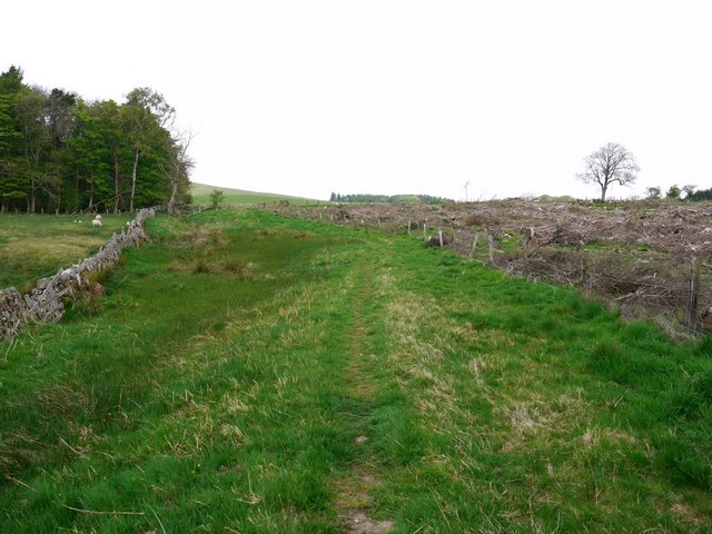
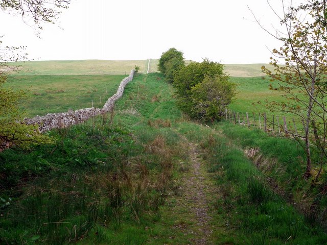
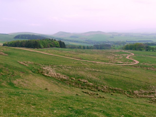
Visitors to Pennylaws North Plantation can explore the numerous walking trails that wind their way through the woodland, offering a peaceful and tranquil escape from the hustle and bustle of everyday life. These well-maintained paths allow visitors to immerse themselves in the beauty of nature, breathing in the fresh air and taking in the sights and sounds of the forest.

In addition to its natural wonders, Pennylaws North Plantation also holds historical significance. The area has been carefully managed for centuries, with evidence of ancient settlements and remnants of a once-thriving industry. This combination of natural beauty and historical heritage makes the plantation a truly unique destination for visitors.

Whether you are seeking a peaceful retreat, a chance to reconnect with nature, or a glimpse into the past, Pennylaws North Plantation offers it all. With its breathtaking landscapes, abundant wildlife, and fascinating history, this woodland sanctuary in Northumberland is a must-visit for anyone looking to experience the beauty of the British countryside.

If you have any feedback on the listing, please let us know in the comments section below.

Pennylaws North Plantation Images

Images are sourced within 2km of 55.397203/-2.0262442 or Grid Reference NT9811. Thanks to Geograph Open Source API. All images are credited.

Public Bridleway near Prendwick This Public Bridleway initially leads from Prendwick to the cottage of Northfieldhead. Thereafter, it quickly links up with the ancient cross-border track of the Salter's Road. For a selection of detailed free to download walking routes in the area visit <span class="nowrap"><a title="www.cheviotwalks.co.uk" rel="nofollow ugc noopener" href="http://www.cheviotwalks.co.uk">Link</a><img style="margin-left:2px;" alt="External link" title="External link - shift click to open in new window" src="https://s1.geograph.org.uk/img/external.png" width="10" height="10"/></span>
Public Bridleway near Prendwick
This Public Bridleway initially leads from Prendwick to the cottage of Northfieldhead. Thereafter, it quickly links up with the ancient cross-border track of the Salter's Road. For a selection of detailed free to download walking routes in the area visit LinkExternal link
Shepherd's Hut near Prendwick This shepherd's hut is one of a few such huts dotted alongside the Public Bridleway between Prendwick and Northfieldhead, all of a different design, which are marketed for holiday letting under the name, 'Huts in the Hills' <span class="nowrap"><a title="https://www.hutsinthehills.co.uk/" rel="nofollow ugc noopener" href="https://www.hutsinthehills.co.uk/">Link</a><img style="margin-left:2px;" alt="External link" title="External link - shift click to open in new window" src="https://s1.geograph.org.uk/img/external.png" width="10" height="10"/></span>. This particular one, which enjoys fantastic views over Whittingham Vale, is called 'Hedgehope'. For a selection of detailed free to download walking routes in the area visit <span class="nowrap"><a title="www.cheviotwalks.co.uk" rel="nofollow ugc noopener" href="http://www.cheviotwalks.co.uk">Link</a><img style="margin-left:2px;" alt="External link" title="External link - shift click to open in new window" src="https://s1.geograph.org.uk/img/external.png" width="10" height="10"/></span>
Shepherd's Hut near Prendwick
This shepherd's hut is one of a few such huts dotted alongside the Public Bridleway between Prendwick and Northfieldhead, all of a different design, which are marketed for holiday letting under the name, 'Huts in the Hills' LinkExternal link. This particular one, which enjoys fantastic views over Whittingham Vale, is called 'Hedgehope'. For a selection of detailed free to download walking routes in the area visit LinkExternal link
Public Bridleway near Northfieldhead This Public Bridleway opens up a vast array of walking opportunities in the Cheviot Hills along the southern edge of the Northumberland National Park. For a selection of detailed free to download walking routes in the area visit <span class="nowrap"><a title="www.cheviotwalks.co.uk" rel="nofollow ugc noopener" href="http://www.cheviotwalks.co.uk">Link</a><img style="margin-left:2px;" alt="External link" title="External link - shift click to open in new window" src="https://s1.geograph.org.uk/img/external.png" width="10" height="10"/></span>
Public Bridleway near Northfieldhead
This Public Bridleway opens up a vast array of walking opportunities in the Cheviot Hills along the southern edge of the Northumberland National Park. For a selection of detailed free to download walking routes in the area visit LinkExternal link
Public Bridleway near Hart Law This public bridleway heads towards Chesters, once a shepherd's dwelling, more recently a scout outdoor centre. In the background is Dunmoor Hill with Cunyan Crags just right of centre. For a selection of detailed free to download walking routes in the area visit <span class="nowrap"><a title="www.cheviotwalks.co.uk" rel="nofollow ugc noopener" href="http://www.cheviotwalks.co.uk">Link</a><img style="margin-left:2px;" alt="External link" title="External link - shift click to open in new window" src="https://s1.geograph.org.uk/img/external.png" width="10" height="10"/></span>
Public Bridleway near Hart Law
This public bridleway heads towards Chesters, once a shepherd's dwelling, more recently a scout outdoor centre. In the background is Dunmoor Hill with Cunyan Crags just right of centre. For a selection of detailed free to download walking routes in the area visit LinkExternal link
Signage, Prendwick At this point the minor road takes a sharp turn left whilst a Public Bridleway, signed behind the photographer, continues straight on through the gateway. The Pennine Cycleway, Route 68 on the National Cycle Network, passes this way, as indicated on the signage. This route runs in sections between Derbyshire and Northumberland, and is 265 miles in length. For a selection of detailed free to download walking routes in the area visit <span class="nowrap"><a title="www.cheviotwalks.co.uk" rel="nofollow ugc noopener" href="http://www.cheviotwalks.co.uk">Link</a><img style="margin-left:2px;" alt="External link" title="External link - shift click to open in new window" src="https://s1.geograph.org.uk/img/external.png" width="10" height="10"/></span>
Signage, Prendwick
At this point the minor road takes a sharp turn left whilst a Public Bridleway, signed behind the photographer, continues straight on through the gateway. The Pennine Cycleway, Route 68 on the National Cycle Network, passes this way, as indicated on the signage. This route runs in sections between Derbyshire and Northumberland, and is 265 miles in length. For a selection of detailed free to download walking routes in the area visit LinkExternal link
Post Box, Prendwick This tiny King George V post box is mounted into the exterior wall of a large farm building and lies next to the road signage shown at <a title="https://www.geograph.org.uk/photo/6908755" href="https://www.geograph.org.uk/photo/6908755">Link</a>. For a selection of detailed free to download walking routes in the area visit <span class="nowrap"><a title="www.cheviotwalks.co.uk" rel="nofollow ugc noopener" href="http://www.cheviotwalks.co.uk">Link</a><img style="margin-left:2px;" alt="External link" title="External link - shift click to open in new window" src="https://s1.geograph.org.uk/img/external.png" width="10" height="10"/></span>
Post Box, Prendwick
This tiny King George V post box is mounted into the exterior wall of a large farm building and lies next to the road signage shown at Link. For a selection of detailed free to download walking routes in the area visit LinkExternal link
A public footpath on Northfieldhead Hill Viewed in mid March near the northeast corner of Pennylaws South Plantation.
A public footpath on Northfieldhead Hill
Viewed in mid March near the northeast corner of Pennylaws South Plantation.
The triangulation pillar on Hart Law Trig point S8034 is at 341m in an improved grazing area.
The triangulation pillar on Hart Law
Trig point S8034 is at 341m in an improved grazing area.
The road to Ewartly Shank This road from Alnham passes through hill farming countryside on the way to Ewartly Shank Farm.
The road to Ewartly Shank
This road from Alnham passes through hill farming countryside on the way to Ewartly Shank Farm.
Comfrey (Symphytum officinale) by garden back gate of Tower House
Small valley west of Salters Road The east facing valley sides are lined with primroses
Small valley west of Salters Road
The east facing valley sides are lined with primroses
View south-west from Salters Road Looking over the primorose-speckled valley <a href="https://www.geograph.org.uk/photo/2385345">NT9811 : Small valley west of Salters Road</a> in the green pastures south-west of the wall by the Salters Road bridleway. The wood in the distance is Hazeltonrig Plantation, beyond the road which ascends from Alnham to Ewartly Shank.
View south-west from Salters Road
Looking over the primorose-speckled valley NT9811 : Small valley west of Salters Road in the green pastures south-west of the wall by the Salters Road bridleway. The wood in the distance is Hazeltonrig Plantation, beyond the road which ascends from Alnham to Ewartly Shank.
Valley east of Salters Road Looking south-east towards Alnham Church and the Tower House (Vicarage) garden.
Valley east of Salters Road
Looking south-east towards Alnham Church and the Tower House (Vicarage) garden.
Salter's Road near Pennylaws South Plantation My last visit here was two years ago and just over one month earlier. Comparison of the same scene in early March <a href="https://www.geograph.org.uk/photo/1202729">NT9811 : Salter's Road near Pennylaws South Plantation</a> show the extent of changes even in the uplands. The seasonal difference has greened up the grass and the trees. The marsh to the left of the path is now thick with the flowering stems of horsetails <a href="https://www.geograph.org.uk/photo/2385405">NT9811 : Flowering horsetails in marsh near Pennylaws South Plantation</a> and the bright yellow dots of marsh marigolds.
The plantation to the right of the track has now been partially felled, opening up the landscape.
Salter's Road near Pennylaws South Plantation
My last visit here was two years ago and just over one month earlier. Comparison of the same scene in early March NT9811 : Salter's Road near Pennylaws South Plantation show the extent of changes even in the uplands. The seasonal difference has greened up the grass and the trees. The marsh to the left of the path is now thick with the flowering stems of horsetails NT9811 : Flowering horsetails in marsh near Pennylaws South Plantation and the bright yellow dots of marsh marigolds. The plantation to the right of the track has now been partially felled, opening up the landscape.
Flowering horsetails in marsh near Pennylaws South Plantation The water horsetail (Equisitum fluviatile) is just starting to develop its whorled branches.
Flowering horsetails in marsh near Pennylaws South Plantation
The water horsetail (Equisitum fluviatile) is just starting to develop its whorled branches.
Salter's Road climbing Northfieldhead Hill This is a duplicate of a photo taken two years and one month earlier from the same location <a href="https://www.geograph.org.uk/photo/1202743">NT9811 : Salter's Road climbing Northfieldhead Hill</a>
Salter's Road climbing Northfieldhead Hill
This is a duplicate of a photo taken two years and one month earlier from the same location NT9811 : Salter's Road climbing Northfieldhead Hill
Fields north-west of Northfieldhead
Track east of Northfieldhead Hill
Show me another place!

Pennylaws North Plantation is located at Grid Ref: NT9811 (Lat: 55.397203, Lng: -2.0262442)

Unitary Authority: Northumberland

Police Authority: Northumbria

What 3 Words

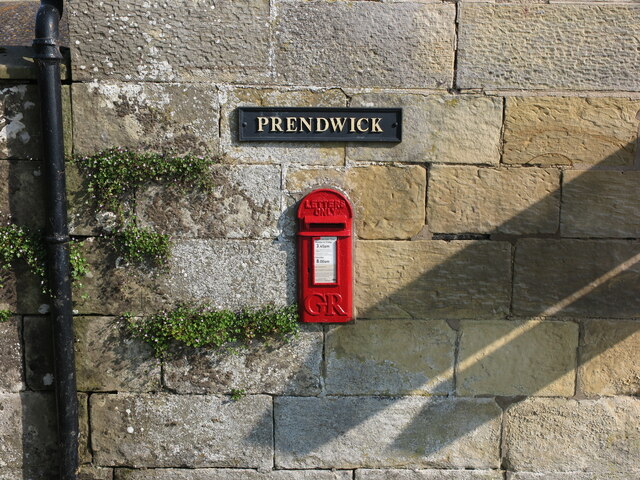
///heads.equipping.hogs. Near Whittingham, Northumberland

Related Wikis

Church of St Michael, Alnham

The Church of St Michael in Alnham, in the English county of Northumberland, is a medieval structure dating from circa 1200. Built on a Roman camp site...
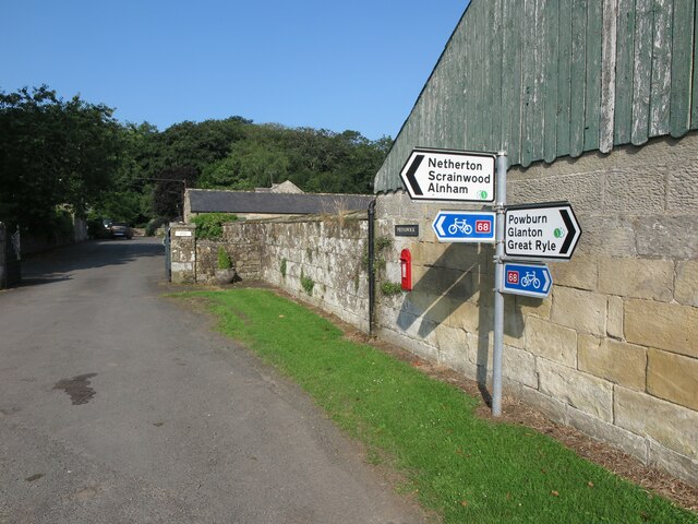
Alnham

Alnham is a hamlet and civil parish in Northumberland, England. It is about 14 miles (23 km) west of Alnwick, about 6 miles (9.7 km) from Scotland and...

Milbourne, Northumberland

Milbourne is a village and former civil parish 14 miles (23 km) from Morpeth, now in the parish of Ponteland, in the county of Northumberland, England...

Scrainwood

Scrainwood is a hamlet and former civil parish 20 miles (32 km) from Morpeth, now in the parish of Alnham, in the county of Northumberland, England. In...

Unthank, Alnham

Unthank is a hamlet and former civil parish, now in the parish of Alnham in Northumberland, England. In 1951 the parish had a population of 11. == History... ==

Netherton, Northumberland

Netherton is a village and civil parish in the English county of Northumberland. The population of the village at the 2011 census was 185.Located 6+1⁄2...

Biddlestone

Biddlestone is a village and civil parish in Northumberland, England. It is about 14 miles (23 km) to the west of Alnwick. In the early 21st Century several...

Biddlestone Chapel

Biddlestone Chapel is a redundant Roman Catholic chapel in Biddlestone, Northumberland, England. It is recorded in the National Heritage List for England...

Related Videos

EP 26 Alnham to Hartside - The Grand Tour of Northumberland

Northumberland #History #Hiking 7th November 2020 Join me on my walk of historic Northumberland as I continue my hike.

Nearby Amenities

Located within 500m of 55.397203,-2.0262442
Northfield Hill
Created By: Potlatch 0.10f
Place: locality
Lat/Long: 55.4010336/-2.0287405
Northfieldhead
Place: locality
Lat/Long: 55.3977982/-2.0185709
The data included in this document is from www.openstreetmap.org. The data is made available under ODbL.

Have you been to Pennylaws North Plantation?

Leave your review of Pennylaws North Plantation below (or comments, questions and feedback).