Hollywood Slade

Wood, Forest in Staffordshire Stafford

England

Hollywood Slade

'Turn right along the track' The Heart of England Way at Brocton Field, Cannock Chase. The quote comes from Staffordshire County Council's 'Cannock Chase Circular Walk'.
'Turn right along the track' Credit: Christine Johnstone

Hollywood Slade is a quaint village nestled in the heart of Staffordshire, England. Located on the outskirts of the bustling town of Stafford, Hollywood Slade is known for its lush woodlands and enchanting forests. The name "Slade" is derived from an Old English word meaning "valley," indicating the village's position in a picturesque low-lying area surrounded by rolling hills.

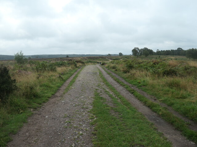
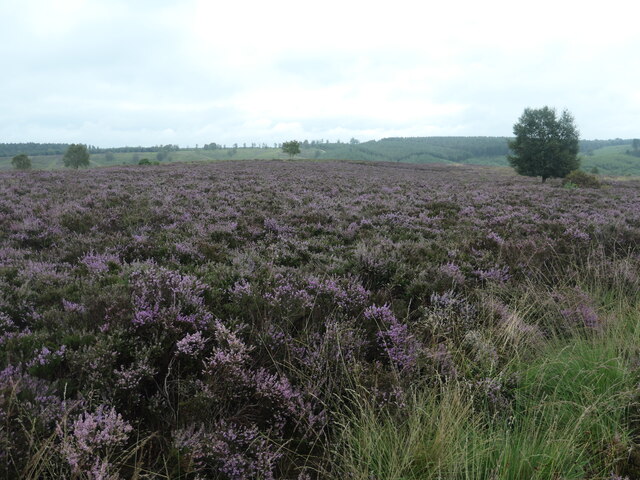
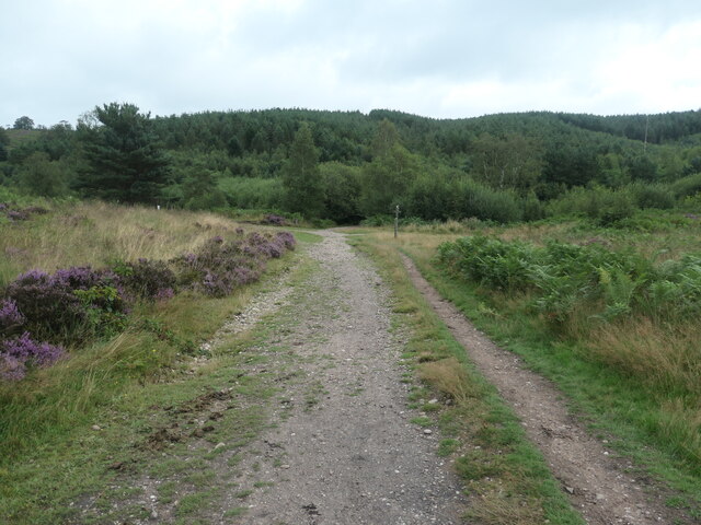
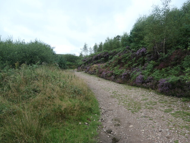
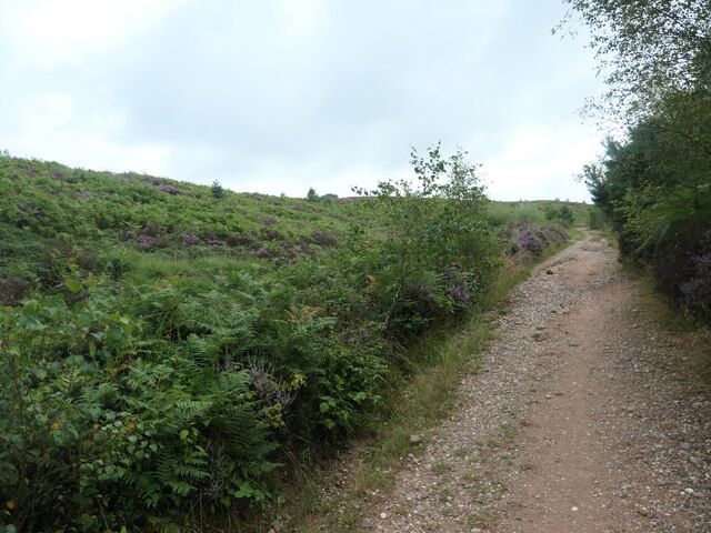
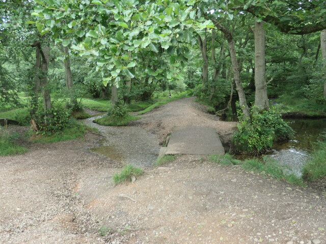
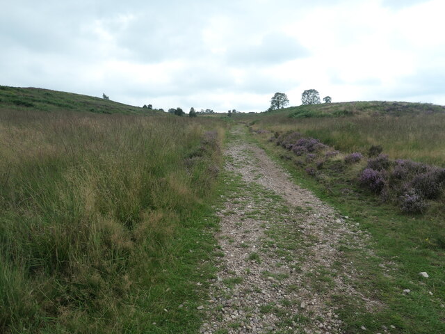
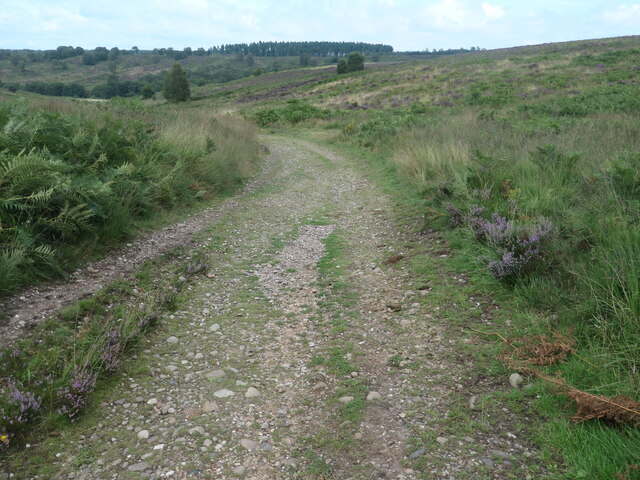
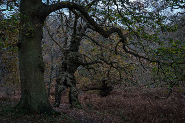
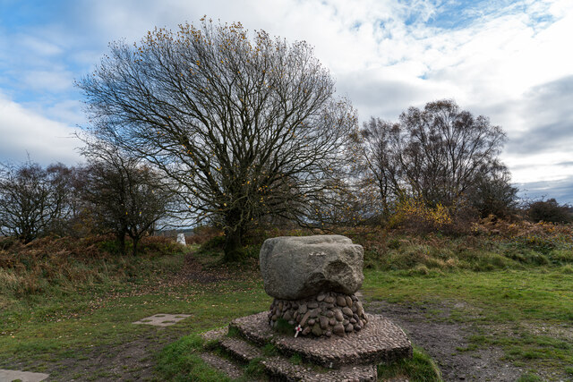
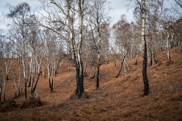
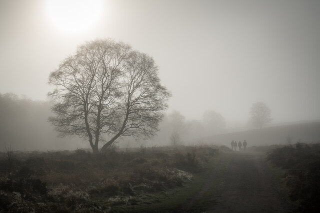
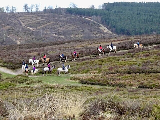
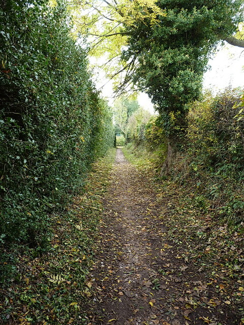
The woodland in Hollywood Slade is a prominent feature, attracting nature enthusiasts and outdoor lovers. The forest is home to a diverse array of flora and fauna, including ancient oak trees, bluebells, and various species of birds. The tranquil atmosphere and scenic beauty make it a popular spot for leisurely walks, picnics, and even birdwatching.

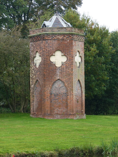
In addition to its natural wonders, Hollywood Slade boasts a close-knit community that takes pride in preserving its heritage. The village is dotted with charming cottages and traditional buildings, reflecting its rich history. The locals actively participate in community events and festivals, celebrating their cultural traditions and fostering a strong sense of belonging.

Despite its idyllic setting, Hollywood Slade is conveniently located near major transportation routes, making it easily accessible to visitors from nearby towns and cities. This accessibility allows residents to enjoy the tranquility of rural life while still being within reach of urban amenities.

In summary, Hollywood Slade offers a peaceful escape from the hustle and bustle of city life. Its verdant woodlands, community spirit, and convenient location make it an ideal destination for nature lovers and those seeking a tranquil retreat.

If you have any feedback on the listing, please let us know in the comments section below.

Hollywood Slade Images

Images are sourced within 2km of 52.772267/-2.0356206 or Grid Reference SJ9719. Thanks to Geograph Open Source API. All images are credited.
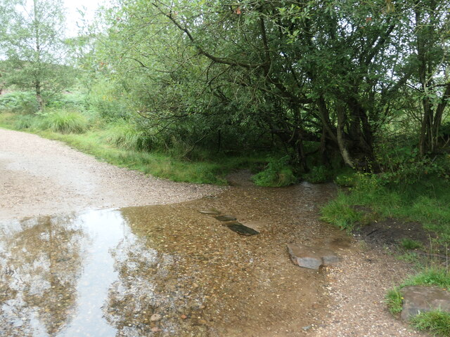
'Turn right along the track' The Heart of England Way at Brocton Field, Cannock Chase. The quote comes from Staffordshire County Council's 'Cannock Chase Circular Walk'.
'Turn right along the track'
The Heart of England Way at Brocton Field, Cannock Chase. The quote comes from Staffordshire County Council's 'Cannock Chase Circular Walk'.
Flowering heather, Cannock Chase The heathland west of Sher Brook.
Flowering heather, Cannock Chase
The heathland west of Sher Brook.
'You reach a fingerpost at the bottom of the slope' Bridleway descending east towards Sher Brook. The quote comes from Staffordshire County Council's 'Cannock Chase Circular Walk'.
'You reach a fingerpost at the bottom of the slope'
Bridleway descending east towards Sher Brook. The quote comes from Staffordshire County Council's 'Cannock Chase Circular Walk'.
'Take the stepping stones over Sher Brook' Hardly necessary when the water level is this low. The quote comes from Staffordshire County Council's 'Cannock Chase Circular Walk'.
'Take the stepping stones over Sher Brook'
Hardly necessary when the water level is this low. The quote comes from Staffordshire County Council's 'Cannock Chase Circular Walk'.
'The left-hand path around the edge of the pine plantation' On the east bank of Sher Brook. The quote comes from Staffordshire County Council's 'Cannock Chase Circular Walk'.
'The left-hand path around the edge of the pine plantation'
On the east bank of Sher Brook. The quote comes from Staffordshire County Council's 'Cannock Chase Circular Walk'.
'Walk straight on up the hill' Bridleway on the boundary of a pine plantation. The quote comes from Staffordshire County Council's 'Cannock Chase Circular Walk'.
'Walk straight on up the hill'
Bridleway on the boundary of a pine plantation. The quote comes from Staffordshire County Council's 'Cannock Chase Circular Walk'.
Sher Brook, looking downstream [locally north] The brook is a civil parish boundary here, between Brocton and Rugeley.
Sher Brook, looking downstream [locally north]
The brook is a civil parish boundary here, between Brocton and Rugeley.
'Cross the footbridge over Sher Brook' A parish boundary on Cannock Chase. The quote comes from Staffordshire County Council's 'Cannock Chase Circular Walk'.
'Cross the footbridge over Sher Brook'
A parish boundary on Cannock Chase. The quote comes from Staffordshire County Council's 'Cannock Chase Circular Walk'.
'Ascend the hill following ... the Staffordshire Way' The western side of Sherbrook valley, Cannock Chase. The quote comes from Staffordshire County Council's 'Cannock Chase Circular Walk'.
'Ascend the hill following ... the Staffordshire Way'
The western side of Sherbrook valley, Cannock Chase. The quote comes from Staffordshire County Council's 'Cannock Chase Circular Walk'.
Staffordshire Way, Cannock Chase Descending Sherbrook Banks.
Staffordshire Way, Cannock Chase
Descending Sherbrook Banks.
Groot Tree, Brockton Coppice, Cannock Chase Old Oak Tree, maybe 500+ years old.
Groot Tree, Brockton Coppice, Cannock Chase
Old Oak Tree, maybe 500+ years old.
Glacial Boulder and Trigpoint, Cannock Chase Set upon a pedestal of Triassic pebbles, the boulder is of Granite which is out of place here on the Moorlands of South Staffordshire, there being no granite outcrops anywhere in the Midlands. The boulder has been matched however, to the intrusive rock outcrop at Cniffel in Dumfries & Galloway, which is over 170 miles (280km) away from the Chase in the Southern Uplands of Scotland. This granite 'erratic' is marked on the OS map as the "Glacial Boulder", which gives some idea how it got here. The boulder was ripped from its parent mountain sometime during the last Ice-Age, and was transported by glacial action to its present location, the journey perhaps taking ten-thousand years during which the edges of the rock were worn down, giving its present rounded appearance.
Glacial Boulder and Trigpoint, Cannock Chase
Set upon a pedestal of Triassic pebbles, the boulder is of Granite which is out of place here on the Moorlands of South Staffordshire, there being no granite outcrops anywhere in the Midlands. The boulder has been matched however, to the intrusive rock outcrop at Cniffel in Dumfries & Galloway, which is over 170 miles (280km) away from the Chase in the Southern Uplands of Scotland. This granite 'erratic' is marked on the OS map as the "Glacial Boulder", which gives some idea how it got here. The boulder was ripped from its parent mountain sometime during the last Ice-Age, and was transported by glacial action to its present location, the journey perhaps taking ten-thousand years during which the edges of the rock were worn down, giving its present rounded appearance.
Silver Burnt Trees, Cannock Chase Looks like there has been a fire early this year or last.
Silver Burnt Trees, Cannock Chase
Looks like there has been a fire early this year or last.
Misty Staffordshire Way, Brocton, Cannock Chase The staffs way looking pretty in the mist and sun.
Misty Staffordshire Way, Brocton, Cannock Chase
The staffs way looking pretty in the mist and sun.
Horse riding on Sherbrook Banks
Southern end of the bridleway The track from Walton on the Hill, which runs in a generally southeasterly direction, emerges here onto Sawpit Lane at Brocton.
Southern end of the bridleway
The track from Walton on the Hill, which runs in a generally southeasterly direction, emerges here onto Sawpit Lane at Brocton.
Dovecot at Brocton Hall In the grounds of Brocton Hall, which is now the golf club, this 18th century former dovecot was Grade II listed <span class="nowrap"><a title="https://britishlistedbuildings.co.uk/101116692-dovecote-at-brocton-hall-brocton#.Yle9wOjMI2w" rel="nofollow ugc noopener" href="https://britishlistedbuildings.co.uk/101116692-dovecote-at-brocton-hall-brocton#.Yle9wOjMI2w">Link</a><img style="margin-left:2px;" alt="External link" title="External link - shift click to open in new window" src="https://s1.geograph.org.uk/img/external.png" width="10" height="10"/></span> & <span class="nowrap"><a title="https://historicengland.org.uk/listing/the-list/list-entry/1116692" rel="nofollow ugc noopener" href="https://historicengland.org.uk/listing/the-list/list-entry/1116692">Link</a><img style="margin-left:2px;" alt="External link" title="External link - shift click to open in new window" src="https://s1.geograph.org.uk/img/external.png" width="10" height="10"/></span> in 1968.
Dovecot at Brocton Hall
In the grounds of Brocton Hall, which is now the golf club, this 18th century former dovecot was Grade II listed LinkExternal link & LinkExternal link in 1968.
Brocton Hall Originally the 18th century hall had a third floor, but this was lost to a fire around the start of WWII, and was never rebuilt. The hall is now the clubhouse of the golf club, and attracted a Grade II listing <span class="nowrap"><a title="https://britishlistedbuildings.co.uk/101116688-brocton-hall-brocton#.Yle__ujMI2w" rel="nofollow ugc noopener" href="https://britishlistedbuildings.co.uk/101116688-brocton-hall-brocton#.Yle__ujMI2w">Link</a><img style="margin-left:2px;" alt="External link" title="External link - shift click to open in new window" src="https://s1.geograph.org.uk/img/external.png" width="10" height="10"/></span> & <span class="nowrap"><a title="https://historicengland.org.uk/listing/the-list/list-entry/1116688" rel="nofollow ugc noopener" href="https://historicengland.org.uk/listing/the-list/list-entry/1116688">Link</a><img style="margin-left:2px;" alt="External link" title="External link - shift click to open in new window" src="https://s1.geograph.org.uk/img/external.png" width="10" height="10"/></span> in 1953.
Brocton Hall
Originally the 18th century hall had a third floor, but this was lost to a fire around the start of WWII, and was never rebuilt. The hall is now the clubhouse of the golf club, and attracted a Grade II listing LinkExternal link & LinkExternal link in 1953.
Show me another place!

Hollywood Slade is located at Grid Ref: SJ9719 (Lat: 52.772267, Lng: -2.0356206)

Administrative County: Staffordshire

District: Stafford

Police Authority: Staffordshire

What 3 Words

///midwinter.thing.token. Near Colwich, Staffordshire

Related Wikis

Brocton, Staffordshire

Brocton is a village and civil parish in the English county of Staffordshire. It is within the borough of Stafford. The village describes itself as the...

Milford, Staffordshire

Milford is a village in the county of Staffordshire, England. It lies at the edge of Cannock Chase, on the A513 road between Stafford and Rugeley. Just...

Milford and Brocton railway station

Milford and Brocton railway station served the villages of Milford and Brocton in Staffordshire, England from 1877 to 1950 on the Trent Valley line....

Milford Hall

Milford Hall is a privately owned 18th-century English country house at Milford, near Stafford. It is the family seat of the Levett Haszard family and...

Shugborough Tunnel

The Shugborough Tunnel is a 777-yard (710 m) railway tunnel on the Trent Valley line running under part of the Shugborough Estate in Colwich, Staffordshire...

Walton-on-the-Hill, Staffordshire

Walton-on-the-Hill is a village in the Borough of Stafford in Staffordshire, England. It is about 5 km east of the centre of Stafford, and lies on the...

Walton High School, Stafford

Walton High School is a large mixed secondary school and sixth form serving a community in the southern part of Stafford, England.There are approximately...

Berkswich

Berkswich ( BAHK-switch) is a civil parish in the borough of Stafford in Staffordshire, England. According to the 2001 census it had a population of 1...

Nearby Amenities

Located within 500m of 52.772267,-2.0356206
Man Made: silo
Lat/Long: 52.7678471/-2.0352622
The data included in this document is from www.openstreetmap.org. The data is made available under ODbL.

Have you been to Hollywood Slade?

Leave your review of Hollywood Slade below (or comments, questions and feedback).