Mountain Clump

Wood, Forest in Dorset

England

Mountain Clump

Ford At Corfe Mullen The ford at Corfe Mullen is secured by a locked pair of gates.
Ford At Corfe Mullen Credit: John Walton

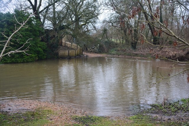
Mountain Clump is a picturesque woodland located in the county of Dorset, England. Situated at the western edge of the county, it covers an area of approximately 100 acres and is known for its breathtaking natural beauty. The woodland is part of the larger Dorset Area of Outstanding Natural Beauty, which attracts visitors from far and wide.

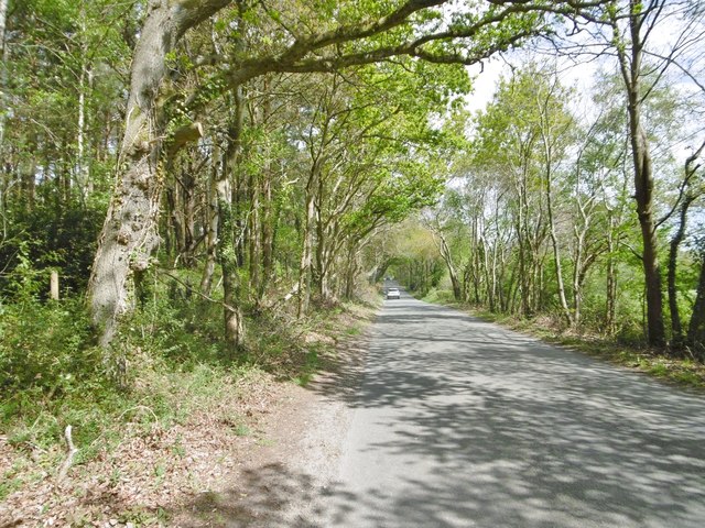
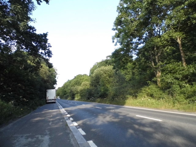
The main feature of Mountain Clump is its dense forest of predominantly deciduous trees, including oak, beech, and birch. This creates a stunning display of colors during the autumn season, attracting photographers and nature enthusiasts alike. The woodland is also home to a variety of wildlife, including deer, foxes, badgers, and a rich bird population.

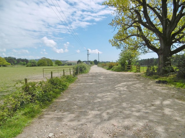
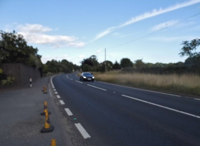
There are several well-maintained walking trails that wind through Mountain Clump, offering visitors the opportunity to explore its diverse flora and fauna. These trails vary in difficulty, catering to both casual walkers and more experienced hikers. Along the paths, visitors can discover hidden streams, ponds, and wildflowers, adding to the charm and tranquility of the area.

Mountain Clump is popular among outdoor enthusiasts, who often visit for activities such as birdwatching, photography, and picnicking. The woodland provides a peaceful retreat away from the hustle and bustle of urban life, allowing visitors to reconnect with nature and enjoy the serenity of the surroundings.

Overall, Mountain Clump, Dorset is a natural gem that showcases the beauty of the English countryside. Its lush forests, diverse wildlife, and well-maintained trails make it a must-visit destination for anyone seeking an escape into nature.

If you have any feedback on the listing, please let us know in the comments section below.

Mountain Clump Images

Images are sourced within 2km of 50.77638/-2.0382697 or Grid Reference SY9797. Thanks to Geograph Open Source API. All images are credited.

Ford At Corfe Mullen The ford at Corfe Mullen is secured by a locked pair of gates.
Ford At Corfe Mullen
The ford at Corfe Mullen is secured by a locked pair of gates.
Remains of the Somerset & Dorset Joint Railway The site of Corfe Mullen Junction, with some old crossing gates and an (extended) crossing keeper / signalman's house.
Remains of the Somerset & Dorset Joint Railway
The site of Corfe Mullen Junction, with some old crossing gates and an (extended) crossing keeper / signalman's house.
Corfe Mullen, Rushall Lane Lane from Blandford Road North to Corfe Mullen; plantation, left, and properties and grazing land, right.
Corfe Mullen, Rushall Lane
Lane from Blandford Road North to Corfe Mullen; plantation, left, and properties and grazing land, right.
Corfe Mullen, plantation Stony Down Plantation - conifers with a little hardwood.
Corfe Mullen, plantation
Stony Down Plantation - conifers with a little hardwood.
Corfe Mullen, bridleway Bridleway and access road, from Rushall Lane to Upton Heath.
Corfe Mullen, bridleway
Bridleway and access road, from Rushall Lane to Upton Heath.
Corfe Mullen, timber Softwood logs awaiting collection in Stony Down Plantation.
Corfe Mullen, timber
Softwood logs awaiting collection in Stony Down Plantation.
Corfe Mullen, bridleway Across Stony Down Plantation, from Rushall Lane to Old Market Road.
Corfe Mullen, bridleway
Across Stony Down Plantation, from Rushall Lane to Old Market Road.
Corfe Mullen, plantation Stony Down Plantation - conifers with patches of hardwood.
Corfe Mullen, plantation
Stony Down Plantation - conifers with patches of hardwood.
Corfe Mullen, track junction From camera and ahead, the bridleway to Old Market Road; left and right, tracks belonging to a local camping business. Upgrading of the tracks seems to have caused local controversy: <span class="nowrap"><a title="https://susanjefferies.mycouncillor.org.uk/2015/10/16/stoney-down-plantation/" rel="nofollow ugc noopener" href="https://susanjefferies.mycouncillor.org.uk/2015/10/16/stoney-down-plantation/">Link</a><img style="margin-left:2px;" alt="External link" title="External link - shift click to open in new window" src="https://s1.geograph.org.uk/img/external.png" width="10" height="10"/></span>
Corfe Mullen, track junction
From camera and ahead, the bridleway to Old Market Road; left and right, tracks belonging to a local camping business. Upgrading of the tracks seems to have caused local controversy: LinkExternal link
Corfe Mullen, power lines Crossing Stony Down Plantation.
Corfe Mullen, power lines
Crossing Stony Down Plantation.
Corfe Mullen, bridleway Through Stony Down Plantation, from Rushall Lane to Old Market Road.
Corfe Mullen, bridleway
Through Stony Down Plantation, from Rushall Lane to Old Market Road.
Layby on the A31, Sleight
Bale carrier on the A31, Sleight
Mill Street, Corfe Mullen
Old Milestone by the A31, north west of Sleight Stone post (plate lost) by the A31, in parish of CORFE MULLEN (EAST DORSET District), grass area opposite St Huberts church, just inside safety barrier, on South side of road. Dorset 2 (limestone), erected by the Puddletown & Wimborne turnpike trust in the 19th century. 

Inscription reads:-
DORCHESTER
20
WIMBORNE
2  

Milestone Society National ID: DO_DOWB20
Old Milestone by the A31, north west of Sleight
Stone post (plate lost) by the A31, in parish of CORFE MULLEN (EAST DORSET District), grass area opposite St Huberts church, just inside safety barrier, on South side of road. Dorset 2 (limestone), erected by the Puddletown & Wimborne turnpike trust in the 19th century. Inscription reads:- DORCHESTER 20 WIMBORNE 2 Milestone Society National ID: DO_DOWB20
Old Milestone by the B3074, Corfe Mullen Carved stone post by the B3074, in parish of CORFE MULLEN (EAST DORSET District), Blandford Road, Corfe Mullen, at junction of Wimborne Rd and B3074 by Lockyers Middle School, on East side of road. Dorset 2 (limestone), erected by the Blandford & Poole turnpike trust in the 19th century. 

Inscription reads:-
POOLE
5   
Carved benchmark front lower centre.  

Milestone Society National ID: DO_POBFA05
Old Milestone by the B3074, Corfe Mullen
Carved stone post by the B3074, in parish of CORFE MULLEN (EAST DORSET District), Blandford Road, Corfe Mullen, at junction of Wimborne Rd and B3074 by Lockyers Middle School, on East side of road. Dorset 2 (limestone), erected by the Blandford & Poole turnpike trust in the 19th century. Inscription reads:- POOLE 5 Carved benchmark front lower centre. Milestone Society National ID: DO_POBFA05
Show me another place!

Mountain Clump is located at Grid Ref: SY9797 (Lat: 50.77638, Lng: -2.0382697)

Unitary Authority: Dorset

Police Authority: Dorset

What 3 Words

///enigma.wishes.speeded. Near Lytchett Matravers, Dorset

Related Wikis

Castle Court School

Castle Court School is a co-educational, preparatory school located near the village of Corfe Mullen in the county of Dorset, England. == Location == Castle...

St. Hubert's Church, Corfe Mullen

St Hubert's Church is a 13th-century Church of England parish church in Corfe Mullen, a district of Wimborne, in the ceremonial county of Dorset, on the...

Stoney Down

Stoney Down or Stony Down is both a hill and an area of forested countryside in the county of Dorset, England, that has been designated an "Area of Great...

Corfe Mullen

Corfe Mullen is a village in Dorset, England, on the north-western urban fringe of the South East Dorset conurbation. The community had a population of...

Henbury, Dorset

Henbury is a hamlet in the civil parish of Sturminster Marshall in Dorset, England. It lies on the A31 road. Henbury House is a classical Georgian house...

Corfe Mullen Halt railway station

Corfe Mullen Halt was a station in the English county of Dorset. It was located between Bailey Gate and Broadstone stations on the Somerset and Dorset...

Corfe Hills School

Corfe Hills School is a co-educational upper school in Broadstone, Poole, Dorset, England, in the urban fringe between Poole and Wimborne. The school became...

Cogdean Hundred

Cogdean Hundred was a hundred in the county of Dorset, England, containing the following parishes: Canford Magna Charlton Marshall Corfe Mullen Hamworthy...

Nearby Amenities

Located within 500m of 50.77638,-2.0382697
Power: tower
Source: bing
Lat/Long: 50.7750942/-2.0439711
Power: tower
Source: bing
Lat/Long: 50.7765243/-2.0445961
Material: wood
Power: pole
Source: bing
Lat/Long: 50.7728019/-2.0362839
Material: wood
Power: pole
Source: bing
Lat/Long: 50.7742471/-2.0379626
Material: wood
Power: pole
Source: bing
Lat/Long: 50.7746677/-2.0384521
Material: wood
Power: pole
Source: bing
Lat/Long: 50.7753104/-2.039197
Material: wood
Power: pole
Source: bing
Lat/Long: 50.7758937/-2.039908
Material: wood
Power: pole
Source: bing
Lat/Long: 50.7765145/-2.0405944
Material: wood
Power: pole
Source: bing
Lat/Long: 50.7770697/-2.0412489
Material: wood
Power: pole
Source: bing
Lat/Long: 50.7779717/-2.0422863
Material: wood
Power: pole
Source: bing
Lat/Long: 50.7783952/-2.0428093
Barrier: kissing_gate
Foot: yes
Lat/Long: 50.7771105/-2.0342087
Poles: bipole
Power: pole
Source: bing
Transformer: distribution
Lat/Long: 50.7745884/-2.0327899
Power: pole
Source: bing
Lat/Long: 50.7733722/-2.0369098
Power: pole
Source: bing
Lat/Long: 50.7738065/-2.0374368
Power: pole
Source: bing
Lat/Long: 50.7730991/-2.0341605
The data included in this document is from www.openstreetmap.org. The data is made available under ODbL.

Have you been to Mountain Clump?

Leave your review of Mountain Clump below (or comments, questions and feedback).