Aqueduct Covert

Wood, Forest in Staffordshire Stafford

England

Aqueduct Covert

Brocton Hall Originally the 18th century hall had a third floor, but this was lost to a fire around the start of WWII, and was never rebuilt. The hall is now the clubhouse of the golf club, and attracted a Grade II listing <span class="nowrap"><a title="https://britishlistedbuildings.co.uk/101116688-brocton-hall-brocton#.Yle__ujMI2w" rel="nofollow ugc noopener" href="https://britishlistedbuildings.co.uk/101116688-brocton-hall-brocton#.Yle__ujMI2w">Link</a><img style="margin-left:2px;" alt="External link" title="External link - shift click to open in new window" src="https://s1.geograph.org.uk/img/external.png" width="10" height="10"/></span> & <span class="nowrap"><a title="https://historicengland.org.uk/listing/the-list/list-entry/1116688" rel="nofollow ugc noopener" href="https://historicengland.org.uk/listing/the-list/list-entry/1116688">Link</a><img style="margin-left:2px;" alt="External link" title="External link - shift click to open in new window" src="https://s1.geograph.org.uk/img/external.png" width="10" height="10"/></span> in 1953.
Brocton Hall Credit: Richard Law

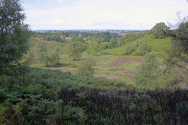
Aqueduct Covert is a woodland area located in Staffordshire, England. Situated near the town of Wood, it is renowned for its natural beauty and diverse range of flora and fauna. Spanning over a significant area, Aqueduct Covert is a popular destination for nature enthusiasts and hikers alike.

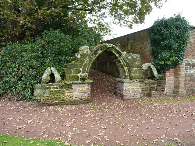
The woodland is named after the nearby aqueduct, which was built in the early 19th century to supply water to the surrounding towns and villages. This historic structure adds to the charm and character of the area, providing a picturesque backdrop for visitors.

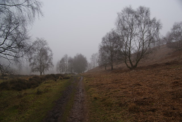
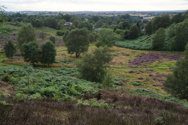
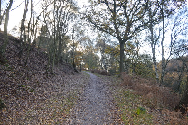
The forest is home to a rich variety of plant species, including oak, ash, and beech trees. These towering giants create a dense canopy, providing shade and shelter for the smaller plants and animals that inhabit the woodland. Bluebells, wild garlic, and ferns carpet the forest floor, adding a vibrant touch of color to the landscape.

Aqueduct Covert is also a haven for wildlife. Foxes, badgers, and rabbits can often be spotted darting between the trees, while a variety of bird species, such as woodpeckers and owls, make their homes in the branches above. The tranquil atmosphere of the woodland provides the perfect environment for these creatures to thrive.

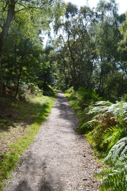
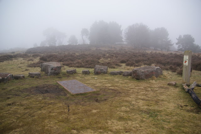
Visitors to Aqueduct Covert can enjoy a range of activities, including walking, cycling, and birdwatching. There are well-maintained paths that meander through the forest, allowing visitors to explore its hidden corners and soak in the natural beauty. Picnic areas and benches are also available for those looking to relax and enjoy the peaceful surroundings.

In conclusion, Aqueduct Covert in Staffordshire is a stunning woodland area that offers a tranquil escape from the hustle and bustle of everyday life. With its diverse range of plants and animals, as well as its rich history, it is a must-visit destination for nature lovers and outdoor enthusiasts.

If you have any feedback on the listing, please let us know in the comments section below.

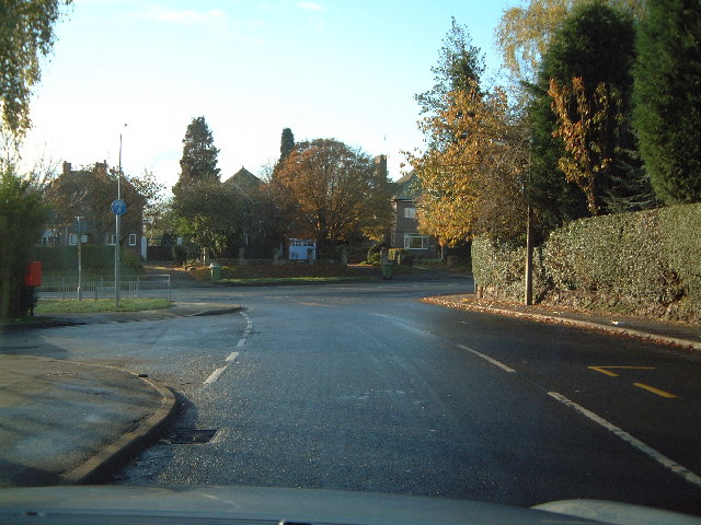
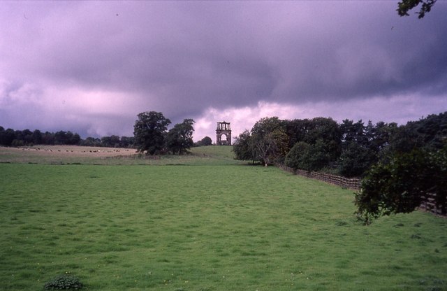
Aqueduct Covert Images

Images are sourced within 2km of 52.791861/-2.0447567 or Grid Reference SJ9721. Thanks to Geograph Open Source API. All images are credited.

Brocton Hall Originally the 18th century hall had a third floor, but this was lost to a fire around the start of WWII, and was never rebuilt. The hall is now the clubhouse of the golf club, and attracted a Grade II listing <span class="nowrap"><a title="https://britishlistedbuildings.co.uk/101116688-brocton-hall-brocton#.Yle__ujMI2w" rel="nofollow ugc noopener" href="https://britishlistedbuildings.co.uk/101116688-brocton-hall-brocton#.Yle__ujMI2w">Link</a><img style="margin-left:2px;" alt="External link" title="External link - shift click to open in new window" src="https://s1.geograph.org.uk/img/external.png" width="10" height="10"/></span> & <span class="nowrap"><a title="https://historicengland.org.uk/listing/the-list/list-entry/1116688" rel="nofollow ugc noopener" href="https://historicengland.org.uk/listing/the-list/list-entry/1116688">Link</a><img style="margin-left:2px;" alt="External link" title="External link - shift click to open in new window" src="https://s1.geograph.org.uk/img/external.png" width="10" height="10"/></span> in 1953.
Brocton Hall
Originally the 18th century hall had a third floor, but this was lost to a fire around the start of WWII, and was never rebuilt. The hall is now the clubhouse of the golf club, and attracted a Grade II listing LinkExternal link & LinkExternal link in 1953.
Ruins of a medieval building behind Brocton Hall Tucked away, attached to the wall of the large rear kitchen garden of <a href="https://www.geograph.org.uk/photo/7146661">SJ9619 : Brocton Hall</a>, these stone arches are the remains of an unknown building that once lay somewhere nearby. Despite the lack of detail, they were Grade II listed <span class="nowrap"><a title="https://britishlistedbuildings.co.uk/101116745-ruins-to-north-west-of-brocton-hall-brocton#.YlfBVujMI2w" rel="nofollow ugc noopener" href="https://britishlistedbuildings.co.uk/101116745-ruins-to-north-west-of-brocton-hall-brocton#.YlfBVujMI2w">Link</a><img style="margin-left:2px;" alt="External link" title="External link - shift click to open in new window" src="https://s1.geograph.org.uk/img/external.png" width="10" height="10"/></span> & <span class="nowrap"><a title="https://historicengland.org.uk/listing/the-list/list-entry/1116745" rel="nofollow ugc noopener" href="https://historicengland.org.uk/listing/the-list/list-entry/1116745">Link</a><img style="margin-left:2px;" alt="External link" title="External link - shift click to open in new window" src="https://s1.geograph.org.uk/img/external.png" width="10" height="10"/></span> in 1968.
Ruins of a medieval building behind Brocton Hall
Tucked away, attached to the wall of the large rear kitchen garden of SJ9619 : Brocton Hall, these stone arches are the remains of an unknown building that once lay somewhere nearby. Despite the lack of detail, they were Grade II listed LinkExternal link & LinkExternal link in 1968.
Mere Valley Looking towards Brocton.
Mere Valley
Looking towards Brocton.
Tackeroo Railway in summer Near to Mere Pits embankment.
Tackeroo Railway in summer
Near to Mere Pits embankment.
Path in Mere Valley near Brocton The temperature is near freezing but it is also misty.
Path in Mere Valley near Brocton
The temperature is near freezing but it is also misty.
Millennium sundial on Broc Hill You have to stand on the right part of the plate depending on the month, and the time is given on the rocks beyond. I am assured it works, but it wasn't working on this misty day.
Millennium sundial on Broc Hill
You have to stand on the right part of the plate depending on the month, and the time is given on the rocks beyond. I am assured it works, but it wasn't working on this misty day.
Slopes above Brocton Brocton is mostly hidden in the trees. The two valleys of the Mere Valley and Hollywood Slade meet just above the village.
Slopes above Brocton
Brocton is mostly hidden in the trees. The two valleys of the Mere Valley and Hollywood Slade meet just above the village.
Tackeroo Railway - leaving the Mere Pits embankment A standard gauge military railway was completed in 1915 by the West Cannock Colliery Company to service the large Brocton and Rugeley training camps established on Cannock Chase at the outbreak of the Great War. There were connections to the Rugeley to Stafford line at Milford & Brocton Station and the Walsall to Rugeley line at Hednesford. 

Large numbers of British and Commonwealth servicemen trained on the open heathland of Cannock Chase with upwards of 250000 passing through the camps during the war.
Tackeroo Railway - leaving the Mere Pits embankment
A standard gauge military railway was completed in 1915 by the West Cannock Colliery Company to service the large Brocton and Rugeley training camps established on Cannock Chase at the outbreak of the Great War. There were connections to the Rugeley to Stafford line at Milford & Brocton Station and the Walsall to Rugeley line at Hednesford. Large numbers of British and Commonwealth servicemen trained on the open heathland of Cannock Chase with upwards of 250000 passing through the camps during the war.
Tackeroo Railway - Mere Pits to Coppice Hill A standard gauge military railway was completed in 1915 by the West Cannock Colliery Company to service the large Brocton and Rugeley training camps established on Cannock Chase at the outbreak of the Great War. There were connections to the Rugeley to Stafford line at Milford & Brocton Station and the Walsall to Rugeley line at Hednesford. 

Large numbers of British and Commonwealth servicemen trained on the open heathland of Cannock Chase with upwards of 250000 passing through the camps during the war.
Tackeroo Railway - Mere Pits to Coppice Hill
A standard gauge military railway was completed in 1915 by the West Cannock Colliery Company to service the large Brocton and Rugeley training camps established on Cannock Chase at the outbreak of the Great War. There were connections to the Rugeley to Stafford line at Milford & Brocton Station and the Walsall to Rugeley line at Hednesford. Large numbers of British and Commonwealth servicemen trained on the open heathland of Cannock Chase with upwards of 250000 passing through the camps during the war.
Tixall Wide on The Staffs. & Worcs. Canal When this stretch of the Staffs . & Worcs. Canal was built, the landowner at this point insisted that the canal be made very wide here so as to resemble a lake and not an ugly narrow canal!
Tixall Wide on The Staffs. & Worcs. Canal
When this stretch of the Staffs . & Worcs. Canal was built, the landowner at this point insisted that the canal be made very wide here so as to resemble a lake and not an ugly narrow canal!
Nickolls Transport DAF 85CF taken in our yard. The depot is in Milford near Stafford.
Nickolls Transport
DAF 85CF taken in our yard. The depot is in Milford near Stafford.
Milford Church Fete A true vision of little Britain, this picture was taken at the Church Garden Fete on a very warm day in June 2005
Milford Church Fete
A true vision of little Britain, this picture was taken at the Church Garden Fete on a very warm day in June 2005
Two Trucks in the yard Two vehicles belonging to Nickolls Transport, Milford, Stafford.  Behind the yard you can see the railway line.
Two Trucks in the yard
Two vehicles belonging to Nickolls Transport, Milford, Stafford. Behind the yard you can see the railway line.
Aerial View of Milford, near Stafford Showing Transport Depot
Aerial View of Milford, near Stafford
Showing Transport Depot
Quarrying on Cannock Chase 1926 Satnall Hills
Quarrying on Cannock Chase 1926
Satnall Hills
Walton High School Walton School Old Croft Road
Walton High School
Walton School Old Croft Road
The north end of Stockton Lane Top of the road and turn left for Rugeley
The north end of Stockton Lane
Top of the road and turn left for Rugeley
Folly, Shugborough Estate Bizarre edifice near the railway line that runs through the Shrugborough Estate, taken from the Staffordshire Way
Folly, Shugborough Estate
Bizarre edifice near the railway line that runs through the Shrugborough Estate, taken from the Staffordshire Way
Show me another place!

Aqueduct Covert is located at Grid Ref: SJ9721 (Lat: 52.791861, Lng: -2.0447567)

Administrative County: Staffordshire

District: Stafford

Police Authority: Staffordshire

What 3 Words

///comic.turns.popped. Near Great Haywood, Staffordshire

Related Wikis

Milford and Brocton railway station

Milford and Brocton railway station served the villages of Milford and Brocton in Staffordshire, England from 1877 to 1950 on the Trent Valley line....

Milford, Staffordshire

Milford is a village in the county of Staffordshire, England. It lies at the edge of Cannock Chase, on the A513 road between Stafford and Rugeley. Just...
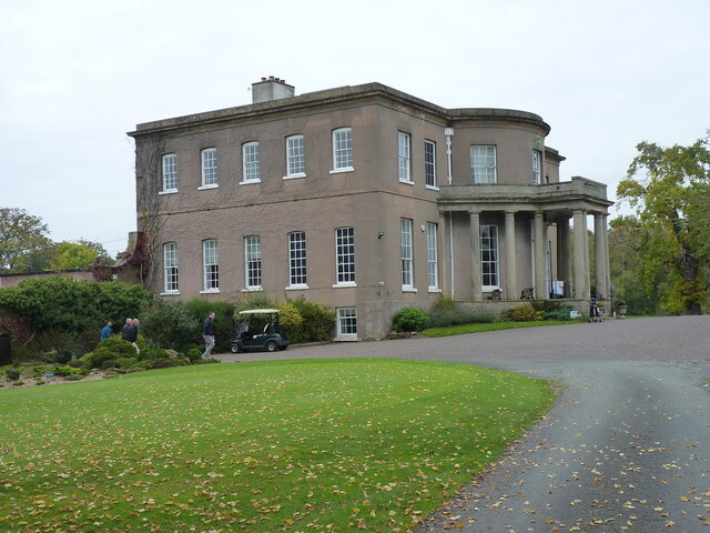
Milford Hall

Milford Hall is a privately owned 18th-century English country house at Milford, near Stafford. It is the family seat of the Levett Haszard family and...

Shugborough Tunnel

The Shugborough Tunnel is a 777-yard (710 m) railway tunnel on the Trent Valley line running under part of the Shugborough Estate in Colwich, Staffordshire...

Tixall

Tixall is a small village and civil parish in the Stafford district, in the English county of Staffordshire lying on the western side of the Trent valley...

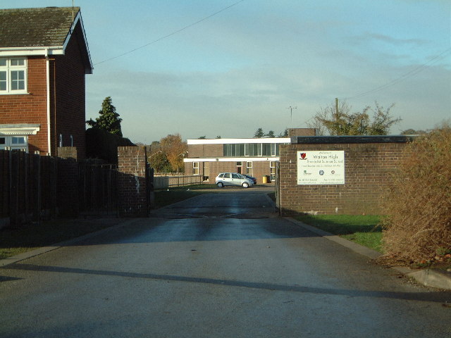
Walton-on-the-Hill, Staffordshire

Walton-on-the-Hill is a village in the Borough of Stafford in Staffordshire, England. It is about 5 km east of the centre of Stafford, and lies on the...

Tixall Gatehouse

Tixall Gatehouse is a 16th-century gatehouse situated at Tixall, near Stafford, Staffordshire and is all that remains of Tixall Hall which was demolished...
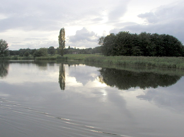
Tixall Wide

Tixall Wide, also known as Tixall Broad or The Broad Water, is a body of water that forms part of the Staffordshire and Worcestershire Canal near Tixall...

Nearby Amenities

Located within 500m of 52.791861,-2.0447567
Mini Roundabout
Direction: clockwise
Lat/Long: 52.7884131/-2.0425851
Source: www.npemap.org.uk
Uk Postcode Centroid: ST18
Lat/Long: 52.789255/-2.042892
Bus Stop
Barley Mow PH
Bus: yes
Naptan AtcoCode: 3800C706400
Naptan Bearing: SE
Naptan CommonName: Barley Mow PH
Naptan Indicator: Adj
Naptan Landmark: Barley Mow PH
Naptan Street: Main Rd
Naptan Verified: no
Public Transport: platform
Source: naptan_import
Lat/Long: 52.7884385/-2.0422758
Bus Stop
Cricket Club
Bench: no
Bus: yes
Naptan AtcoCode: 3800C746001
Naptan Bearing: W
Naptan CommonName: Cricket Club
Naptan Indicator: Adj
Naptan Landmark: Cricket Club
Naptan Street: Main Road
Naptan Verified: no
Public Transport: platform
Shelter: no
Source: naptan_import
Tactile Paving: no
Lat/Long: 52.788706/-2.0481037
Bus Stop
Cricket Club
Bench: no
Bus: yes
Naptan AtcoCode: 3800C746002
Naptan Bearing: E
Naptan CommonName: Cricket Club
Naptan Indicator: Opp
Naptan Landmark: Cricket Club
Naptan Street: Main Road
Naptan Verified: no
Public Transport: platform
Shelter: no
Source: naptan_import
Tactile Paving: no
Lat/Long: 52.7887421/-2.0477924
Bus Stop
Cannock Chase Information Centre
Bus: yes
Naptan AtcoCode: 3800C790000
Naptan Bearing: N
Naptan CommonName: Cannock Chase Information Centre
Naptan Indicator: Adj
Naptan Landmark: Information Centre
Naptan Street: Brocton Rd
Naptan Verified: no
Public Transport: platform
Source: naptan_import
Lat/Long: 52.7878721/-2.0426312
Bus Stop
Cannock Chase Information Centre
Bus: yes
Naptan AtcoCode: 3800C790001
Naptan Bearing: S
Naptan CommonName: Cannock Chase Information Centre
Naptan Indicator: Opp
Naptan Landmark: Information Centre
Naptan Street: Brocton Road
Naptan Verified: no
Public Transport: platform
Source: naptan_import
Lat/Long: 52.7878631/-2.0424681
Restaurant
Viceroy
Lat/Long: 52.7877011/-2.0427246
Railway: switch
Lat/Long: 52.7900127/-2.038935
Post Box
Post Box Type: lamp
Ref: ST17 202
Royal Cypher: EIIR
Royal Cypher Wikidata: Q33102113
Lat/Long: 52.7880149/-2.0426543
Toilets
Lat/Long: 52.7879587/-2.0428418
Milford
Power: substation
Ref: 845538
Lat/Long: 52.7881012/-2.046234
Kitchen & Bedroom Design
Shop: kitchen
Lat/Long: 52.7891635/-2.0502806
Chase of Milford
Shop: fireplace
Lat/Long: 52.7888752/-2.0481468
Designer Curtains
Shop: curtain
Lat/Long: 52.789157/-2.049988
Mammoth
Shop: bicycle
Url: http://www.mammothlifestyle.co.uk
Lat/Long: 52.7890384/-2.0496777
Jilly's
Shop: clothes
Lat/Long: 52.7883467/-2.0433531
Noexit: yes
Lat/Long: 52.7895154/-2.0403383
Noexit: yes
Lat/Long: 52.7887532/-2.0396081
Revive
Shop: beauty
Lat/Long: 52.7891437/-2.0497737
Healthcare: sports_massage_therapist
Lat/Long: 52.788499/-2.0413567
The Flower Barn of Milford
Shop: florist
Lat/Long: 52.789305/-2.0503253
The Grooming Barn
Shop: pet_grooming
Lat/Long: 52.7893083/-2.050128
Milford
Place: hamlet
Source: NLS - OS 1:25k 1st Series 1937-61
Wikidata: Q11781219
Lat/Long: 52.7899564/-2.0485374
Milford
Place: village
Wikidata: Q11781219
Lat/Long: 52.7886974/-2.0433883
Milford and Brocton
Abandoned Railway: station
Railway: site
Wikidata: Q38250608
Wikipedia: en:Milford and Brocton railway station
Lat/Long: 52.7899945/-2.0391785
Give Way
Lat/Long: 52.7882177/-2.0410519
Wacky Warehouse
Addr Country: GB
Addr Housenumber: 28
Addr Postcode: ST17 0UW
Addr Street: Main Road
Brand: Wacky Warehouse
Brand Wikidata: Q104215014
Fhrs Id: 1195806
Leisure: indoor_play
Operator: Greene King
Operator Wikidata: Q5564162
Source Addr: FHRS Open Data
Website: https://www.wackywarehouse.co.uk/barley-mow/
Lat/Long: 52.7888268/-2.0426457
The data included in this document is from www.openstreetmap.org. The data is made available under ODbL.

Have you been to Aqueduct Covert?

Leave your review of Aqueduct Covert below (or comments, questions and feedback).