Miry Wood

Wood, Forest in Staffordshire Newcastle-under-Lyme

England

Miry Wood

Bridge over the Audley Branch Line Bridge over the North Staffordshire Railway (NSR) Audley branch line. 
The line was opened 1870 and closed in 1962.
Bridge over the Audley Branch Line Credit: Brian Deegan

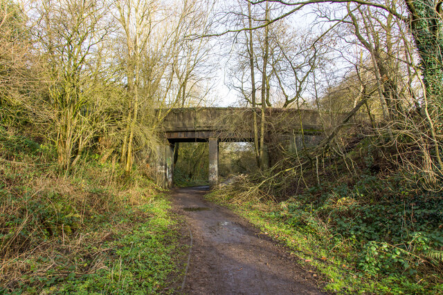
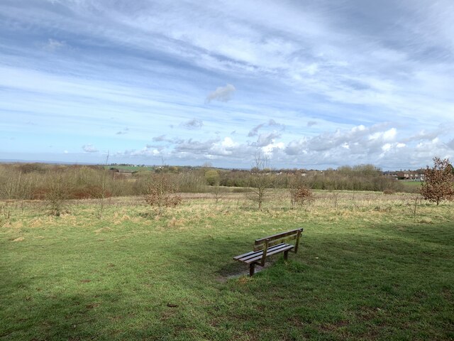
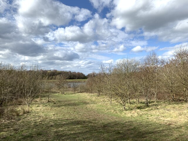
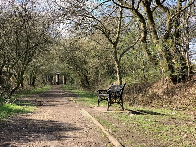
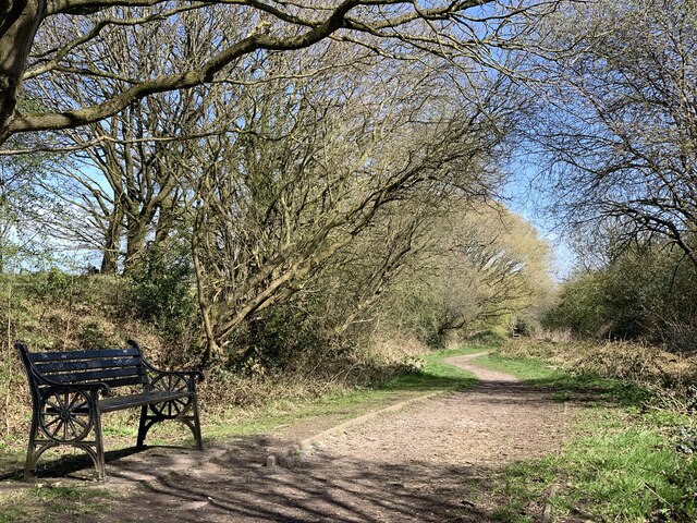
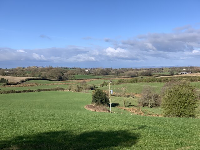
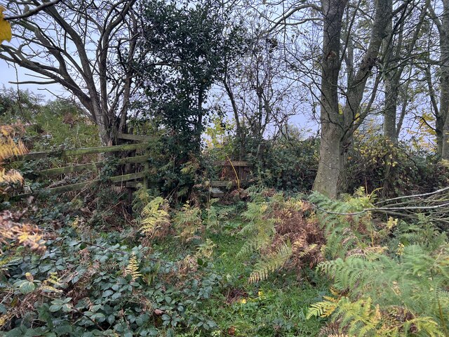
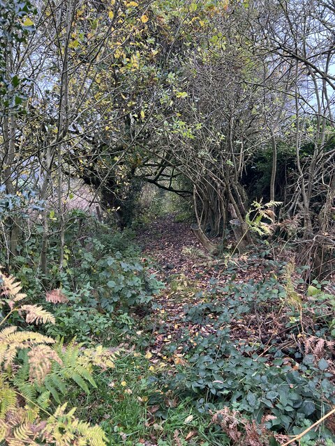
Miry Wood is a picturesque forest located in Staffordshire, England. Spanning over a vast area, this woodland is known for its rich biodiversity and natural beauty. The wood is situated in close proximity to the town of Stone and is easily accessible to visitors.

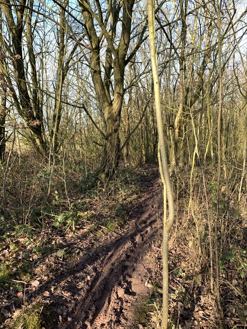
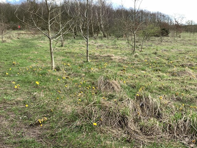
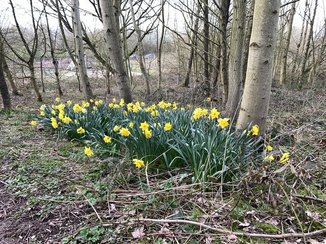
One of the notable features of Miry Wood is its dense vegetation, comprising a variety of trees, such as oak, birch, and beech. These towering trees create a soothing ambiance and provide a habitat for numerous wildlife species. The forest floor is covered in moss and ferns, adding to the enchanting atmosphere.

The wood boasts several well-maintained walking trails, allowing visitors to explore its diverse landscape. The paths meander through the forest, offering breathtaking views of ancient trees and wildlife. Birdwatchers will be delighted to spot a range of avian species, including woodpeckers, owls, and various songbirds.

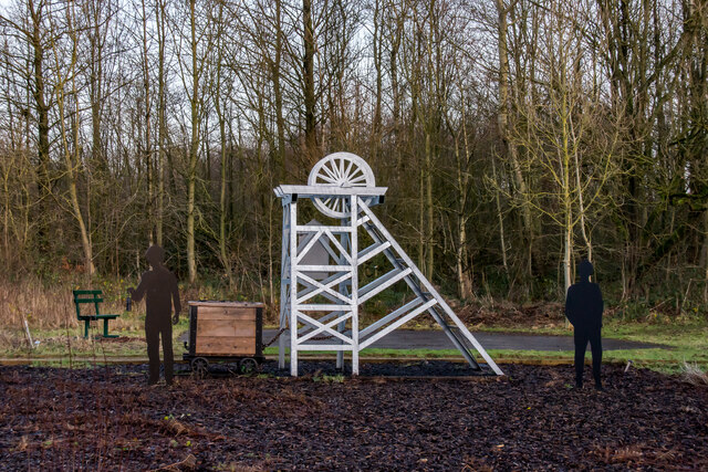
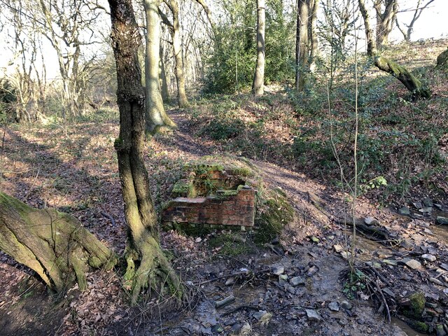
Miry Wood is not only a haven for nature enthusiasts but also a place of historical significance. The forest has a rich heritage, with evidence of human activity dating back to the Neolithic period. Archaeological discoveries, such as ancient burial mounds and tools, have been found within the wood, providing insight into the area's past.

In addition to its natural and historical attractions, Miry Wood offers recreational activities such as picnicking and wildlife photography. The forest is open year-round, allowing visitors to witness the changing seasons and experience the beauty of nature in every time of the year.

Overall, Miry Wood in Staffordshire is a captivating destination for those seeking to immerse themselves in the tranquility of nature while exploring the region's rich history.

If you have any feedback on the listing, please let us know in the comments section below.
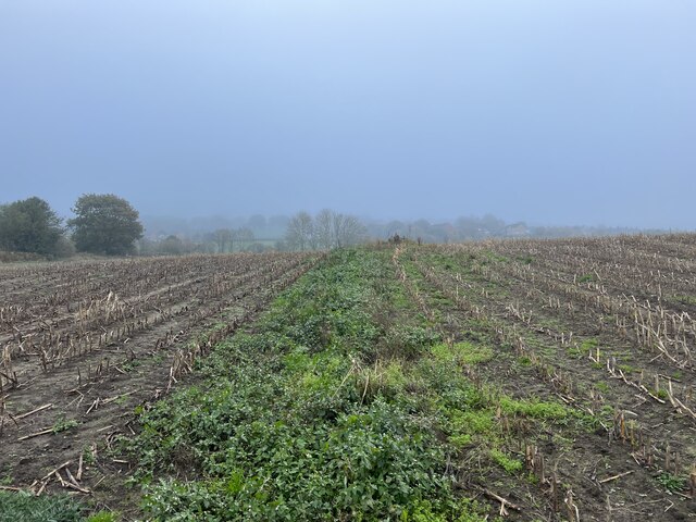
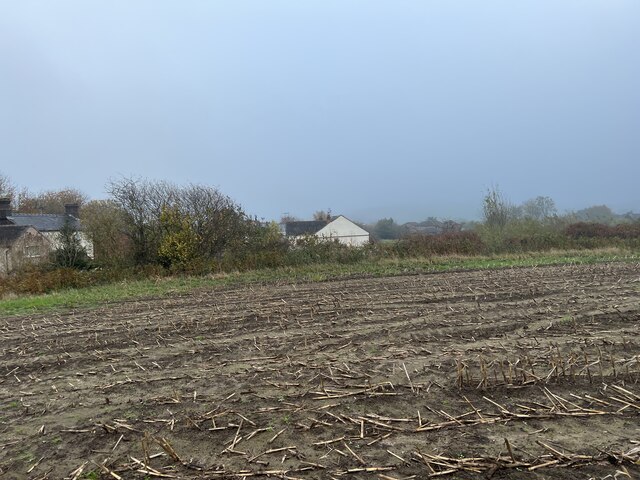
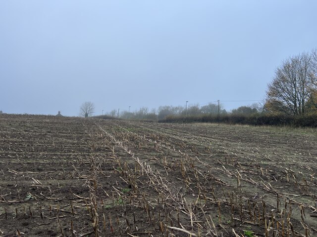
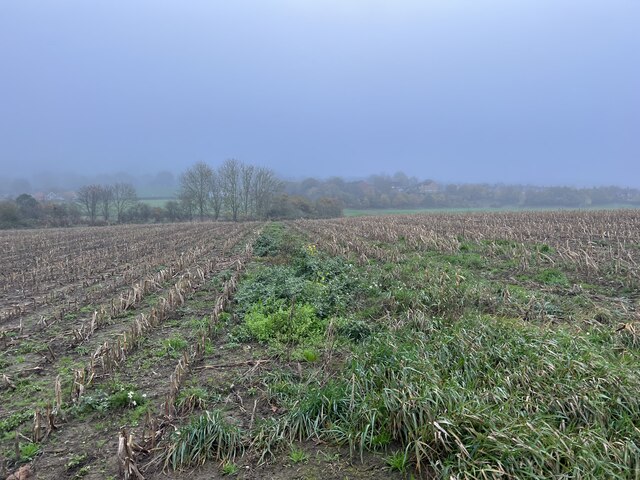
Miry Wood Images

Images are sourced within 2km of 53.041663/-2.2816244 or Grid Reference SJ8149. Thanks to Geograph Open Source API. All images are credited.

Bridge over the Audley Branch Line Bridge over the North Staffordshire Railway (NSR) Audley branch line. 
The line was opened 1870 and closed in 1962.
Bridge over the Audley Branch Line
Bridge over the North Staffordshire Railway (NSR) Audley branch line. The line was opened 1870 and closed in 1962.
Minnie Pit Disaster (1918) Heritage site The Minnie Pit disaster was a coal mining accident that took place on 12 January 1918 in Halmer End, Staffordshire, in which 155 men and boys died. The disaster, which was caused by an explosion due to firedamp, is the worst ever recorded in the North Staffordshire Coalfield.

<span class="nowrap"><a title="https://en.wikipedia.org/wiki/Minnie_Pit_Disaster" rel="nofollow ugc noopener" href="https://en.wikipedia.org/wiki/Minnie_Pit_Disaster">Link</a><img style="margin-left:2px;" alt="External link" title="External link - shift click to open in new window" src="https://s1.geograph.org.uk/img/external.png" width="10" height="10"/></span>
Minnie Pit Disaster (1918) Heritage site
The Minnie Pit disaster was a coal mining accident that took place on 12 January 1918 in Halmer End, Staffordshire, in which 155 men and boys died. The disaster, which was caused by an explosion due to firedamp, is the worst ever recorded in the North Staffordshire Coalfield. LinkExternal link
Rutted path in Bates Wood The deep ruts are caused by cycle wheels. The path is designated Audley FP 110.
Rutted path in Bates Wood
The deep ruts are caused by cycle wheels. The path is designated Audley FP 110.
Footings of former brick structure in Bates Wood This brick structure was presumably part of the mine workings which operated here.
Footings of former brick structure in Bates Wood
This brick structure was presumably part of the mine workings which operated here.
Bateswood Country Park in early spring Bateswood Country Park, north-west of Newcastle-under-Lyme in Staffordshire and adjacent to the village of Halmer End, is designated as a Local Nature Reserve (LNR). It was developed after the cessation of opencast mining in the 1990s, which left the area as a barren wasteland with poor quality soil. Birch reforestation and the creation of a lake have improved the habitat for wildlife, while a network of footpaths and a bridle path create access to most parts of the site. In 2012 managed fishing by a local angling club was permitted, in an attempt to curb illicit fishing.

The site is managed by Newcastle Borough Council in partnership with Halmer End Wildlife Trust, a group of volunteers.

This site is not to be confused with Staffordshire Wildlife Trust's reserve immediately to the south, also called Bateswood (see <a title="https://www.geograph.org.uk/snippet/12701)" href="https://www.geograph.org.uk/snippet/12701)">Link</a>.
Bateswood Country Park in early spring
Bateswood Country Park, north-west of Newcastle-under-Lyme in Staffordshire and adjacent to the village of Halmer End, is designated as a Local Nature Reserve (LNR). It was developed after the cessation of opencast mining in the 1990s, which left the area as a barren wasteland with poor quality soil. Birch reforestation and the creation of a lake have improved the habitat for wildlife, while a network of footpaths and a bridle path create access to most parts of the site. In 2012 managed fishing by a local angling club was permitted, in an attempt to curb illicit fishing. The site is managed by Newcastle Borough Council in partnership with Halmer End Wildlife Trust, a group of volunteers. This site is not to be confused with Staffordshire Wildlife Trust's reserve immediately to the south, also called Bateswood (see Link.
Coltsfoot at Bateswood Country Park Bateswood Country Park, north-west of Newcastle-under-Lyme in Staffordshire and adjacent to the village of Halmer End, is designated as a Local Nature Reserve (LNR). It was developed after the cessation of opencast mining in the 1990s, which left the area as a barren wasteland with poor quality soil. Birch reforestation and the creation of a lake have improved the habitat for wildlife, while a network of footpaths and a bridle path create access to most parts of the site. In 2012 managed fishing by a local angling club was permitted, in an attempt to curb illicit fishing.

The site is managed by Newcastle Borough Council in partnership with Halmer End Wildlife Trust, a group of volunteers.

This site is not to be confused with Staffordshire Wildlife Trust's reserve immediately to the south, also called Bateswood (see <a title="https://www.geograph.org.uk/snippet/12701)" href="https://www.geograph.org.uk/snippet/12701)">Link</a>.
Coltsfoot at Bateswood Country Park
Bateswood Country Park, north-west of Newcastle-under-Lyme in Staffordshire and adjacent to the village of Halmer End, is designated as a Local Nature Reserve (LNR). It was developed after the cessation of opencast mining in the 1990s, which left the area as a barren wasteland with poor quality soil. Birch reforestation and the creation of a lake have improved the habitat for wildlife, while a network of footpaths and a bridle path create access to most parts of the site. In 2012 managed fishing by a local angling club was permitted, in an attempt to curb illicit fishing. The site is managed by Newcastle Borough Council in partnership with Halmer End Wildlife Trust, a group of volunteers. This site is not to be confused with Staffordshire Wildlife Trust's reserve immediately to the south, also called Bateswood (see Link.
Daffodils at Bateswood Country Park Bateswood Country Park, north-west of Newcastle-under-Lyme in Staffordshire and adjacent to the village of Halmer End, is designated as a Local Nature Reserve (LNR). It was developed after the cessation of opencast mining in the 1990s, which left the area as a barren wasteland with poor quality soil. Birch reforestation and the creation of a lake have improved the habitat for wildlife, while a network of footpaths and a bridle path create access to most parts of the site. In 2012 managed fishing by a local angling club was permitted, in an attempt to curb illicit fishing.

The site is managed by Newcastle Borough Council in partnership with Halmer End Wildlife Trust, a group of volunteers.

This site is not to be confused with Staffordshire Wildlife Trust's reserve immediately to the south, also called Bateswood (see <a title="https://www.geograph.org.uk/snippet/12701)" href="https://www.geograph.org.uk/snippet/12701)">Link</a>.
Daffodils at Bateswood Country Park
Bateswood Country Park, north-west of Newcastle-under-Lyme in Staffordshire and adjacent to the village of Halmer End, is designated as a Local Nature Reserve (LNR). It was developed after the cessation of opencast mining in the 1990s, which left the area as a barren wasteland with poor quality soil. Birch reforestation and the creation of a lake have improved the habitat for wildlife, while a network of footpaths and a bridle path create access to most parts of the site. In 2012 managed fishing by a local angling club was permitted, in an attempt to curb illicit fishing. The site is managed by Newcastle Borough Council in partnership with Halmer End Wildlife Trust, a group of volunteers. This site is not to be confused with Staffordshire Wildlife Trust's reserve immediately to the south, also called Bateswood (see Link.
Bench seat on 'the Lines' 'The Lines' is the local term for the trackbed of the former Audley branch railway (closed 1963). It is not an official footpath but is regularly used by walkers, cyclists, dog-walkers, and schoolchildren going to and from Sir Thomas Boughey school in Halmer End.
Bench seat on 'the Lines'
'The Lines' is the local term for the trackbed of the former Audley branch railway (closed 1963). It is not an official footpath but is regularly used by walkers, cyclists, dog-walkers, and schoolchildren going to and from Sir Thomas Boughey school in Halmer End.
Audley Meadows from Wereton Road
Broken stile and footbridge Staffordshire County Council were notified that the bridge and stile on this public footpath had become almost impassable, and with commendable promptness rebuilt it much more sturdily, see <a href="https://www.geograph.org.uk/photo/7339980">SJ7949 : Rebuilt footbridge over brook</a>
Broken stile and footbridge
Staffordshire County Council were notified that the bridge and stile on this public footpath had become almost impassable, and with commendable promptness rebuilt it much more sturdily, see SJ7949 : Rebuilt footbridge over brook
Footpath through maize field
Maize stubble in November
Footpath through maize field
Stile in hedge on overgrown path
Little-used footpath to Halmer End
Show me another place!

Miry Wood is located at Grid Ref: SJ8149 (Lat: 53.041663, Lng: -2.2816244)

Administrative County: Staffordshire

District: Newcastle-under-Lyme

Police Authority: Staffordshire

What 3 Words

///sunset.chill.discouraged. Near Audley, Staffordshire

Nearby Locations

Miry Wood Apedale

Related Wikis

Apedale Hall

Apedale Hall was a manor house near Newcastle-under-Lyme in Staffordshire. The seat of the Heathcote family, it was rebuilt in 1826 in the Elizabethan...

Halmerend (ward)

Halmerend was a ward of the Borough of Newcastle-under-Lyme, in Staffordshire, England. The ward covered the villages of Alsagers Bank, Balterley, Betley...

Audley and Bignall End

Audley and Bignall End was a ward in the Borough of Newcastle-under-Lyme, in the county of Staffordshire, England. It covered the villages of Audley and...

Miles Green

Miles Green is a village in the civil parish of Audley Rural, in the Newcastle-under-Lyme district, in the county of Staffordshire, England and is about...

Newcastle-under-Lyme (UK Parliament constituency)

Newcastle-under-Lyme is a constituency in northern Staffordshire created in 1354 and represented in the House of Commons of the UK Parliament since 2019...

Apedale Community Country Park

Apedale Community Country Park is a 454-acre (184 ha) country park in the borough of Newcastle-under-Lyme, Staffordshire, England. The park is unusual...

Alsagers Bank

Alsagers Bank is a village in the Borough of Newcastle-under-Lyme in Staffordshire. Population details at the 2011 census can be found under Audley Rural...

Apedale

Apedale is a village in Staffordshire, England. The population at the 2011 census can be found under the Holditch (Ward) of Newcastle-under-Lyme. The village...

Nearby Amenities

Located within 500m of 53.041663,-2.2816244
Barrier: stile
Lat/Long: 53.0430997/-2.2837024
Barrier: stile
Lat/Long: 53.0434965/-2.2878975
Apedale
Place: hamlet
Lat/Long: 53.0389409/-2.2772191
Barrier: stile
Material: wood
Step Count: 1
Stile: stepover
Lat/Long: 53.0420681/-2.2793227
Barrier: stile
Foot: yes
Material: wood
Step Count: 1
Stile: stepover
Lat/Long: 53.0445986/-2.2829765
Addr Housename: Apedale House
Source: OS-OpenData_StreetView
Lat/Long: 53.03989/-2.2780762
Addr Housename: Fairacre
Source: OS-OpenData_StreetView
Lat/Long: 53.0378115/-2.2810985
Power: pole
Lat/Long: 53.0437884/-2.2791924
Power: pole
Lat/Long: 53.0431063/-2.2799796
Power: pole
Lat/Long: 53.0422814/-2.2808406
Power: pole
Lat/Long: 53.039989/-2.283394
Power: pole
Lat/Long: 53.0384827/-2.2850503
Power: pole
Lat/Long: 53.0446319/-2.2782683
Power: pole
Lat/Long: 53.0411873/-2.2820593
Barrier: stile
Material: wood
Step Count: 1
Stile: stepover
Lat/Long: 53.040214/-2.2752549
Barrier: stile
Material: wood
Step Count: 1
Stile: stepover
Lat/Long: 53.0402612/-2.2752931
Barrier: stile
Material: wood
Step Count: 1
Stile: stepover
Lat/Long: 53.0399167/-2.276314
The data included in this document is from www.openstreetmap.org. The data is made available under ODbL.

Have you been to Miry Wood?

Leave your review of Miry Wood below (or comments, questions and feedback).