Witham Park

Wood, Forest in Somerset Mendip

England

Witham Park

Pasture near Kilmington Small pasture fields are divided by barbed wire.

In 1874 Joseph F Glidden, a sixty year old farmer from Illinois, invented and patented barbed wire.  It has also been called the Devil's Rope or the Devil's Hatband.
Pasture near Kilmington Credit: Maigheach-gheal

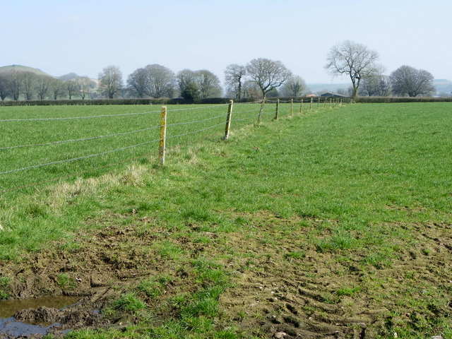
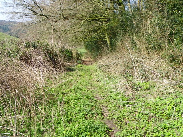
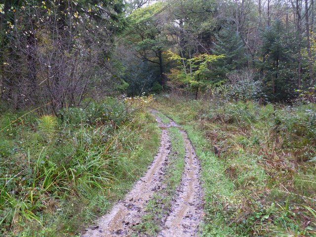
Witham Park, Somerset, also known as Wood or Forest, is a picturesque and serene natural reserve located in the county of Somerset, England. Spanning an area of approximately 200 acres, this enchanting park offers a tranquil retreat for nature enthusiasts and those seeking respite from the hustle and bustle of city life.

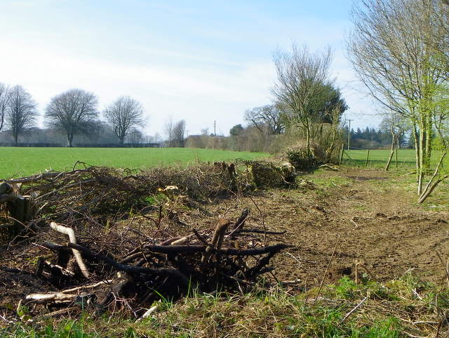
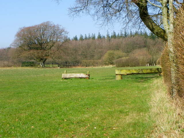
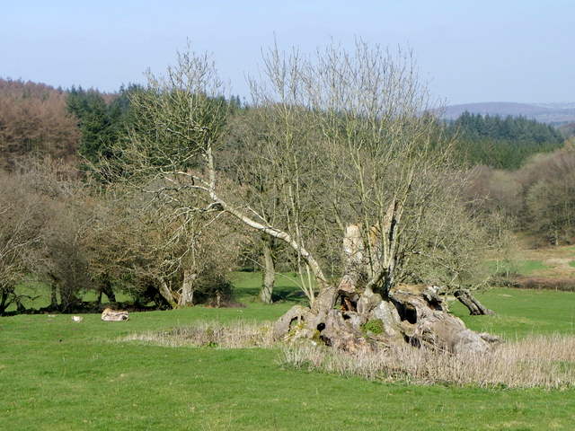
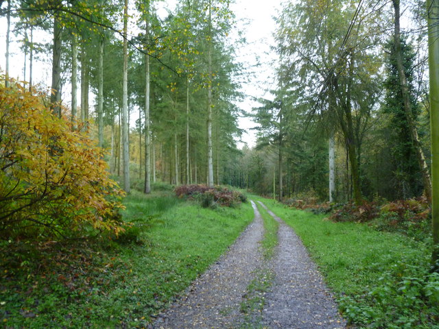
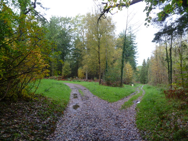
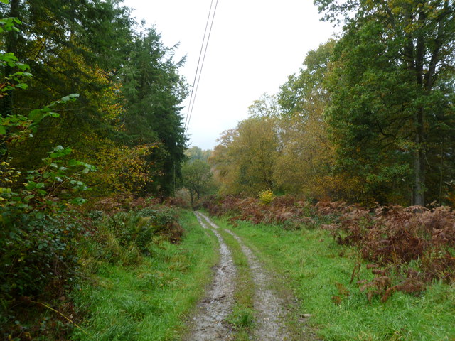
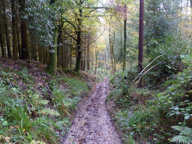
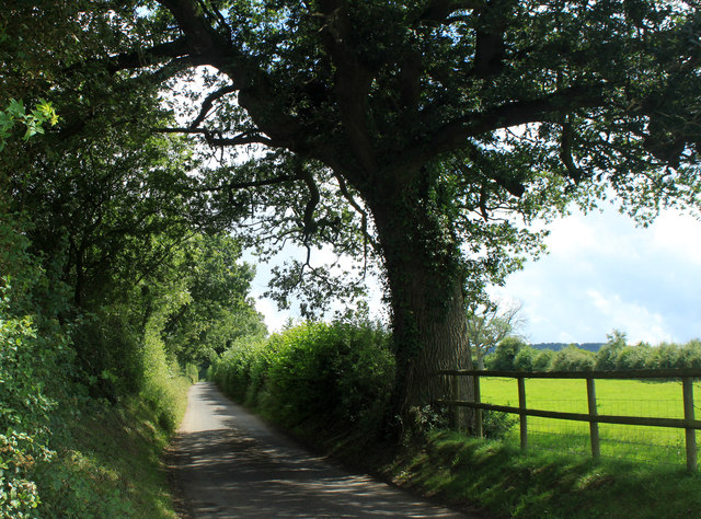
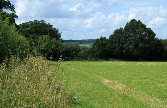
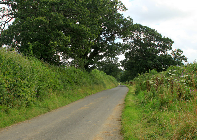
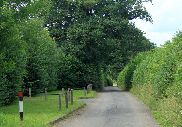
The park is characterized by its lush greenery, dense woodlands, and diverse wildlife, making it a haven for flora and fauna alike. Visitors can explore an extensive network of walking trails, allowing them to immerse themselves in the park's idyllic surroundings and discover its hidden gems. These trails wind their way through ancient oak trees, offering breathtaking views of the rolling hills and meandering rivers that define the landscape.

Witham Park is also home to a variety of wildlife, including deer, rabbits, and an array of bird species. Nature lovers can delight in birdwatching, as the park provides an ideal habitat for numerous avian creatures, from robins and blackbirds to herons and owls.

The park's natural beauty is complemented by the presence of a charming lake, offering a peaceful spot for fishing or simply enjoying the soothing sounds of the water. Additionally, there are picnic areas scattered throughout the park, providing the perfect setting for a leisurely lunch or a family gathering.

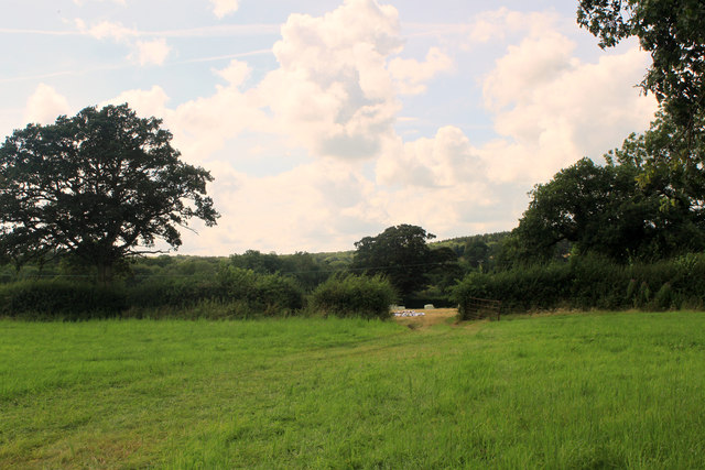
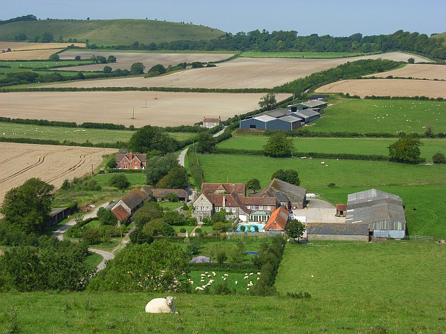
Witham Park, Somerset, is a true gem that showcases the beauty and tranquility of the English countryside. Its rich biodiversity, scenic trails, and serene atmosphere make it a must-visit destination for nature lovers and those seeking solace in the wonders of the natural world.

If you have any feedback on the listing, please let us know in the comments section below.

Witham Park Images

Images are sourced within 2km of 51.149765/-2.3305218 or Grid Reference ST7638. Thanks to Geograph Open Source API. All images are credited.

Pasture near Kilmington Small pasture fields are divided by barbed wire.

In 1874 Joseph F Glidden, a sixty year old farmer from Illinois, invented and patented barbed wire.  It has also been called the Devil's Rope or the Devil's Hatband.
Pasture near Kilmington
Small pasture fields are divided by barbed wire. In 1874 Joseph F Glidden, a sixty year old farmer from Illinois, invented and patented barbed wire. It has also been called the Devil's Rope or the Devil's Hatband.
Hedge laying, Grange Farm A small length of hedge is in the process of being laid.

Laid hedges are made by bending over the samplings of the growing bush at an angle of 45 degrees.  The bent saplings are woven around stakes driven into the ground at intervals of 1-2 yards.  The crest is crowned by a tightly woven layer of severed rods, known as hethers, which prevent the growing wood from springing erect.  Unwanted twigs and branches are removed.

To prevent it from running wild, a hedge needs this treatment every five to ten years.  Because hedge-laying is a skilled, expensive and time-consuming task, many hedges have been neglected.
Hedge laying, Grange Farm
A small length of hedge is in the process of being laid. Laid hedges are made by bending over the samplings of the growing bush at an angle of 45 degrees. The bent saplings are woven around stakes driven into the ground at intervals of 1-2 yards. The crest is crowned by a tightly woven layer of severed rods, known as hethers, which prevent the growing wood from springing erect. Unwanted twigs and branches are removed. To prevent it from running wild, a hedge needs this treatment every five to ten years. Because hedge-laying is a skilled, expensive and time-consuming task, many hedges have been neglected.
Horse jumps near Grange Farm A couple of a series of solid cross country fences in fields near the farm.
Horse jumps near Grange Farm
A couple of a series of solid cross country fences in fields near the farm.
Old tree near Gare Hill The old gnarled tree stands on the site of the lost Medieval village of Yarnfield.
Old tree near Gare Hill
The old gnarled tree stands on the site of the lost Medieval village of Yarnfield.
Footpath near Maiden Bradley The footpath takes walkers from Manor Farm towards Moulton's Park Wood.
Footpath near Maiden Bradley
The footpath takes walkers from Manor Farm towards Moulton's Park Wood.
Maiden Bradley, track & footpath Forestry track with right of way, from Bradley Lane to Gare Hill.
Maiden Bradley, track & footpath
Forestry track with right of way, from Bradley Lane to Gare Hill.
Maiden Bradley, track junction On the Duke of Somerset's Estate. Left, to Manor Farm; right, to Gare Hill. Both tracks are rights of way.
Maiden Bradley, track junction
On the Duke of Somerset's Estate. Left, to Manor Farm; right, to Gare Hill. Both tracks are rights of way.
Maiden Bradley, woodland On the Duke of Somerset's Estate. Hazel and birch are showing good autumn colours.
Maiden Bradley, woodland
On the Duke of Somerset's Estate. Hazel and birch are showing good autumn colours.
Maiden Bradley, ford Shown on OS as "Ford", but in reality a dip in the track, with a 1m wide stream; there is a simple plank bridge for pedestrians, out of sight.
Maiden Bradley, ford
Shown on OS as "Ford", but in reality a dip in the track, with a 1m wide stream; there is a simple plank bridge for pedestrians, out of sight.
Gare Hill, hillside Looking down the hillside towards <a href="https://www.geograph.org.uk/photo/2680194">ST7839 : Maiden Bradley, ford</a>.
Gare Hill, hillside
Looking down the hillside towards ST7839 : Maiden Bradley, ford.
2012 : Stack of baled straw off Dark Lane  Or it could be silage, haven't seen much wheat in this area, more mowing grass.
2012 : Stack of baled straw off Dark Lane
Or it could be silage, haven't seen much wheat in this area, more mowing grass.
2012 : Hired low loader entering Holt Farm
2012 : South east on Dark Lane Near the entrance to Holt Farm.
Dark Lane runs south and east from Witham Friary to a spot near Upper Gibbons Farm where it becomes Holt Road.
2012 : South east on Dark Lane
Near the entrance to Holt Farm. Dark Lane runs south and east from Witham Friary to a spot near Upper Gibbons Farm where it becomes Holt Road.
2012 : South  west from Dark Lane Near the point where it turns into Holt Road.
A field of mowing grass not long after mowing.
A fine oak tree to the right and another at the end of the hedgerow.
2012 : South west from Dark Lane
Near the point where it turns into Holt Road. A field of mowing grass not long after mowing. A fine oak tree to the right and another at the end of the hedgerow.
2012 : South west from Dark Lane  The Hermitage is partly seen through the trees and Hick's Park Wood.
Oak trees abound in this area at least two here.
Electricity pylons are notable for their absence, it can be done.
2012 : South west from Dark Lane
The Hermitage is partly seen through the trees and Hick's Park Wood. Oak trees abound in this area at least two here. Electricity pylons are notable for their absence, it can be done.
2012 : Dark Lane heading south east Somewhere along here it becomes Holt Road and passes Upper Gibbons Farm.
A couple of fine oak trees overhang the road. It's all right my beauties, Nelson won't be after you, he's long gone.
2012 : Dark Lane heading south east
Somewhere along here it becomes Holt Road and passes Upper Gibbons Farm. A couple of fine oak trees overhang the road. It's all right my beauties, Nelson won't be after you, he's long gone.
2012 : Dark Lane heading north west To Witham Friary.
The entrance on the right is a private road to The Hermitage.
2012 : Dark Lane heading north west
To Witham Friary. The entrance on the right is a private road to The Hermitage.
2012 : Pleasant dreams at Sweetnap Farm Sweetnap Farm - the sign.
Off Holt Road near Yarnfield Gate. There is a website <span class="nowrap"><a title="http://www.searchme4.co.uk/caravan-transport-and-towing/frome/somerset/l-f-nicholls-and-sons/9252801.html" rel="nofollow ugc noopener" href="http://www.searchme4.co.uk/caravan-transport-and-towing/frome/somerset/l-f-nicholls-and-sons/9252801.html">Link</a><img style="margin-left:2px;" alt="External link" title="External link - shift click to open in new window" src="https://s1.geograph.org.uk/img/external.png" width="10" height="10"/></span>

They also do models <span class="nowrap"><a title="http://www.sweetnapfarmmodels.co.uk/aboutus.asp" rel="nofollow ugc noopener" href="http://www.sweetnapfarmmodels.co.uk/aboutus.asp">Link</a><img style="margin-left:2px;" alt="External link" title="External link - shift click to open in new window" src="https://s1.geograph.org.uk/img/external.png" width="10" height="10"/></span> yes please, nice legs and big ... what? not that kind of model?  Ah well, can't win 'em all.
2012 : Pleasant dreams at Sweetnap Farm
Sweetnap Farm - the sign. Off Holt Road near Yarnfield Gate. There is a website LinkExternal link They also do models LinkExternal link yes please, nice legs and big ... what? not that kind of model? Ah well, can't win 'em all.
Show me another place!

Witham Park is located at Grid Ref: ST7638 (Lat: 51.149765, Lng: -2.3305218)

Administrative County: Somerset

District: Mendip

Police Authority: Avon and Somerset

What 3 Words

///stables.shadowing.elaborate. Near Kilmington, Wiltshire

Related Wikis

St Michael's Church, Gare Hill

St Michael's Church is a former Church of England church at Gare Hill, Somerset, England. The church, which was designed by William Butterfield and built...

Kilmington, Wiltshire

Kilmington is a village and civil parish in the extreme west of Wiltshire, England, about 8 miles (13 km) southwest of Warminster. The parish includes...

Bradley Woods

Bradley Woods (grid reference ST789410) is an area of woodland in Wiltshire, south of Longleat Woods and north of Gare Hill. A 48.7 hectare area within...

Witham Charterhouse

Witham Charterhouse, also Witham Priory, at Witham Friary, Somerset, was established in 1178/79, the earliest of the ten medieval Carthusian houses (charterhouses...

North Brewham Meadows

North Brewham Meadows (grid reference ST743379) is an 8.9 hectare (21.9 acre) biological Site of Special Scientific Interest at North Brewham in Somerset...

Witham (Somerset) railway station

This station in Somerset is closed. For the open station in East Anglia, see Witham railway station.Witham (Somerset) railway station was a station serving...

Maiden Bradley

Maiden Bradley is a village in south-west Wiltshire, England, about 6 miles (10 km) south-west of Warminster and bordering the county of Somerset. The...

Maiden Bradley Priory

Maiden Bradley Priory was a priory in Wiltshire, England. It was founded as a leper colony in 1164, and in 1189 was handed over to the Augustinian order...

Have you been to Witham Park?

Leave your review of Witham Park below (or comments, questions and feedback).