Crans Wood

Wood, Forest in Banffshire

Scotland

Crans Wood

Field near Castlehill Looking southwards over a grassy field with Castlehill in the background amidst the trees.
Field near Castlehill Credit: Scott Cormie

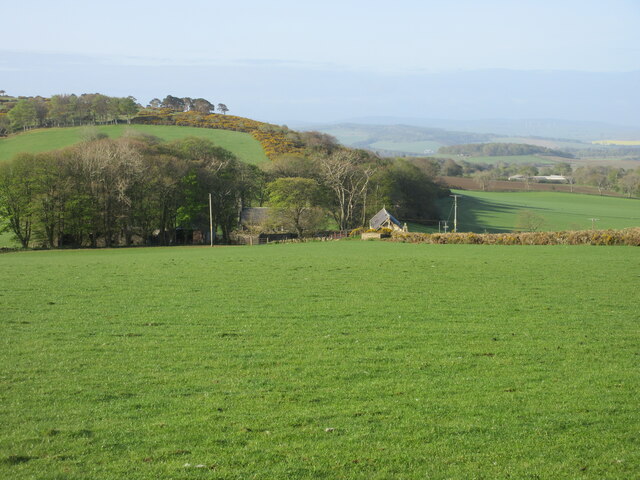
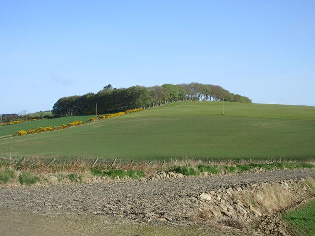
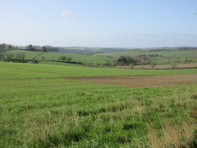
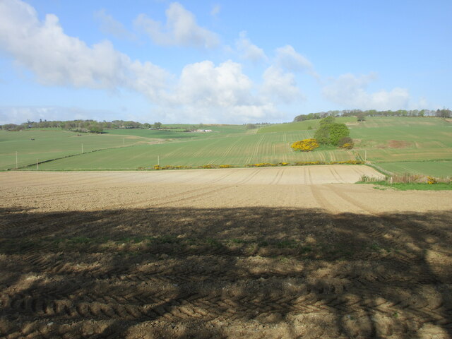
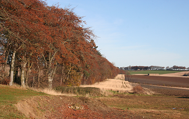
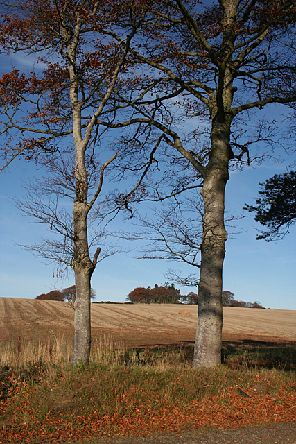
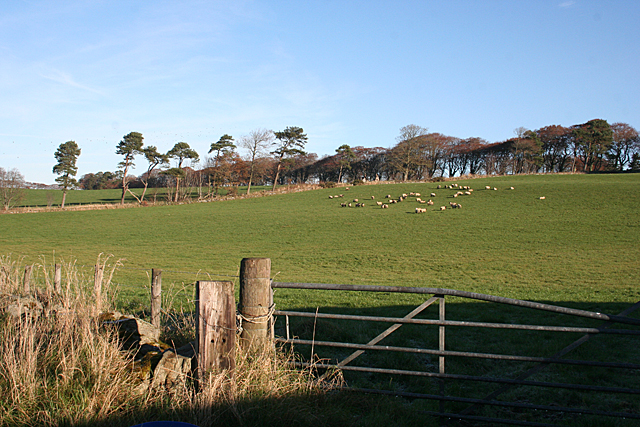
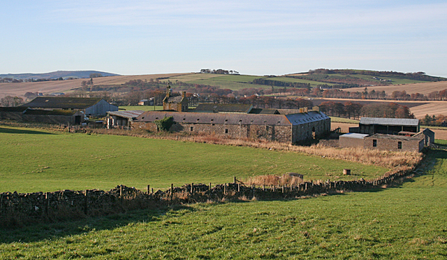
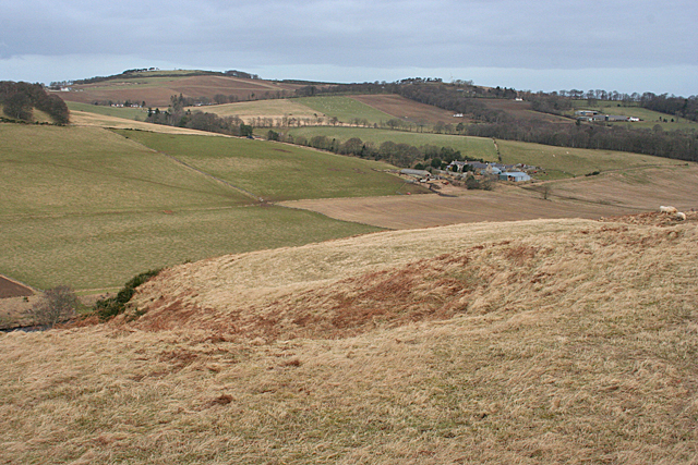
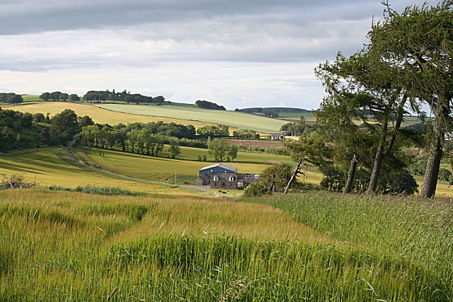
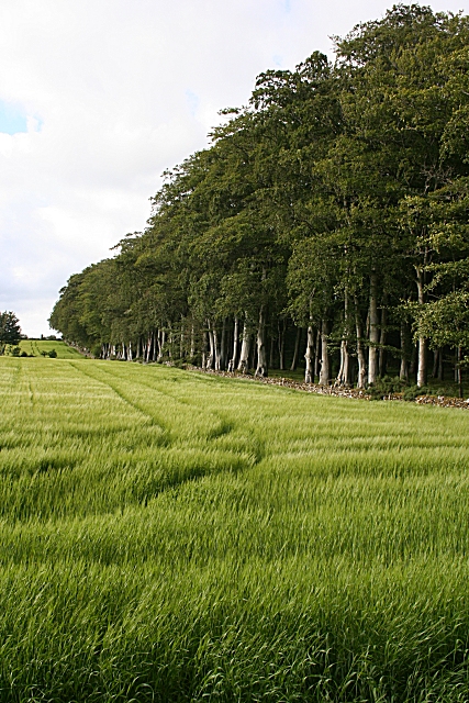
Crans Wood is a picturesque forest located in Banffshire, Scotland. Covering an area of approximately 150 acres, it is renowned for its natural beauty and diverse wildlife. The wood is situated on the southern slope of the River Deveron valley, offering stunning views of the surrounding countryside.

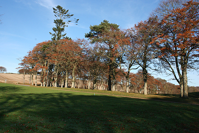
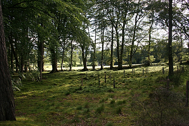
The forest is predominantly composed of native tree species, including oak, birch, and pine. These towering trees create a dense canopy, providing a cool and shaded environment during the summer months. The forest floor is adorned with a rich carpet of mosses, ferns, and wildflowers, adding to its enchanting atmosphere.

Crans Wood is home to a wide variety of wildlife, making it a popular destination for nature enthusiasts and bird watchers. Visitors may spot woodland birds such as woodpeckers, owls, and various songbirds. Small mammals, including red squirrels and badgers, can also be observed within the wood.

The forest offers several well-maintained walking trails, allowing visitors to explore its hidden treasures. These paths wind through ancient woodland and offer glimpses of the River Deveron as it meanders along the valley floor. The tranquil ambiance of Crans Wood makes it an ideal spot for picnics, photography, or simply immersing oneself in nature.

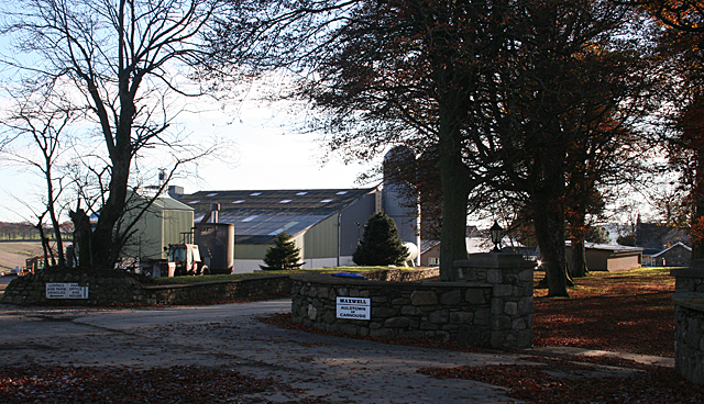
Managed by the local forestry commission, Crans Wood is well-preserved and cared for. The forest is easily accessible by car or foot, with parking facilities available nearby. Its proximity to nearby towns such as Huntly and Banff makes it a popular destination for both locals and tourists alike, seeking solace in the beauty of nature.

If you have any feedback on the listing, please let us know in the comments section below.

Crans Wood Images

Images are sourced within 2km of 57.537417/-2.5794492 or Grid Reference NJ6549. Thanks to Geograph Open Source API. All images are credited.

Field near Castlehill Looking southwards over a grassy field with Castlehill in the background amidst the trees.
Field near Castlehill
Looking southwards over a grassy field with Castlehill in the background amidst the trees.
Ardreddie Hill Looking up Ardreddie Hill from the roadside near Auldtownhill.
Ardreddie Hill
Looking up Ardreddie Hill from the roadside near Auldtownhill.
Fields near Carnousie Looking southwards over countryside near Carnousie.
Fields near Carnousie
Looking southwards over countryside near Carnousie.
Aberdeenshire countryside Looking west over fields near Craiglug.
Aberdeenshire countryside
Looking west over fields near Craiglug.
Auldtown of Carnousie The farm house, to the right, is dwarfed by extensive modern buildings.
Auldtown of Carnousie
The farm house, to the right, is dwarfed by extensive modern buildings.
Beech Avenue One of the characteristics of this part of the country is that many of the minor roads are lined with mature trees, often beeches.
Beech Avenue
One of the characteristics of this part of the country is that many of the minor roads are lined with mature trees, often beeches.
Near Carnousie An impressive belt of beeches lines the edge of the fields just north of Auldtown of Carnousie.
Near Carnousie
An impressive belt of beeches lines the edge of the fields just north of Auldtown of Carnousie.
Auldtown Hill Presumably the hill is named for Auldtown of Carnousie, which is on its lower slopes.
Auldtown Hill
Presumably the hill is named for Auldtown of Carnousie, which is on its lower slopes.
White Hill Looking towards the hill from just outside the steading at Mains of Carnousie.
White Hill
Looking towards the hill from just outside the steading at Mains of Carnousie.
Mains of Carnousie The steading here is exceptionally fine, built in a square with arches to north and south. This is the decorative tower above the south arch. Sadly, the whole steading appears to be disused.
Mains of Carnousie
The steading here is exceptionally fine, built in a square with arches to north and south. This is the decorative tower above the south arch. Sadly, the whole steading appears to be disused.
Carnousie Castle Nigel Tranter, describing Carnousie in 1970, lamented the fact that the building was abandoned and had deteriorated sadly, part of it being used as a piggery. Since then it has been fully restored as an inhabited house, though the screen of trees makes it difficult to appreciate its features. It was probably built by Walter Ogilvy of Carnousie, because he sold his newly constructed fortalice in 1583 to his brother Ogilvy of Dunlugas. It was subsequently sold to the Gordons of Park. It is a Z-plan, with a circular tower to the north-west of the main block and a square tower to the south-east.
Carnousie Castle
Nigel Tranter, describing Carnousie in 1970, lamented the fact that the building was abandoned and had deteriorated sadly, part of it being used as a piggery. Since then it has been fully restored as an inhabited house, though the screen of trees makes it difficult to appreciate its features. It was probably built by Walter Ogilvy of Carnousie, because he sold his newly constructed fortalice in 1583 to his brother Ogilvy of Dunlugas. It was subsequently sold to the Gordons of Park. It is a Z-plan, with a circular tower to the north-west of the main block and a square tower to the south-east.
Mains of Carnousie The steading here is exceptionally fine, built in a square with arches to north and south, the latter crowned with an elaborate tower. The south elevation is largely obscured by a modern lean-to for storing straw, but the east elevation gives an idea of how it originally appeared.
Mains of Carnousie
The steading here is exceptionally fine, built in a square with arches to north and south, the latter crowned with an elaborate tower. The south elevation is largely obscured by a modern lean-to for storing straw, but the east elevation gives an idea of how it originally appeared.
Mains of Carnousie From here you can see the square of the original steading, with the roofs of additional buildings inside the square and a motley collection of modern structures outside it.
Mains of Carnousie
From here you can see the square of the original steading, with the roofs of additional buildings inside the square and a motley collection of modern structures outside it.
Craignetherty Thanks to the lie of the land the 500 metres or so of land in this square isn't seen from here, and the eye is drawn across the river and into the next square to the farm buildings at Craignetherty. On the skyline at left is Clunie Hill. The name Clunie (or Cluny, Clunas) is fairly common and is from a Gaelic word meaning 'slope'.
Craignetherty
Thanks to the lie of the land the 500 metres or so of land in this square isn't seen from here, and the eye is drawn across the river and into the next square to the farm buildings at Craignetherty. On the skyline at left is Clunie Hill. The name Clunie (or Cluny, Clunas) is fairly common and is from a Gaelic word meaning 'slope'.
Shargerwells A prosperous-looking farm amid rolling fields of cereal crops, mainly barley.
Shargerwells
A prosperous-looking farm amid rolling fields of cereal crops, mainly barley.
Shargerwells Barley is the most commonly grown cereal around here, but the foreground field in this view is planted with wheat.
Shargerwells
Barley is the most commonly grown cereal around here, but the foreground field in this view is planted with wheat.
Beech and Barley A field of barley bounded by an avenue of beeches at Netherdale.
Beech and Barley
A field of barley bounded by an avenue of beeches at Netherdale.
Netherdale Sunlight on the fields, seen through the line of beeches at the field edge. It looks as if there has been some recent planting of young trees to fill the clearing.
Netherdale
Sunlight on the fields, seen through the line of beeches at the field edge. It looks as if there has been some recent planting of young trees to fill the clearing.
Show me another place!

Crans Wood is located at Grid Ref: NJ6549 (Lat: 57.537417, Lng: -2.5794492)

Unitary Authority: Aberdeenshire

Police Authority: North East

What 3 Words

///lifelong.alongside.destroyer. Near Aberchirder, Aberdeenshire

Nearby Locations

Crans Wood

Related Wikis

Bogton

Bogton is a rural area in Aberdeenshire, Scotland. To the south is Whitehill Wood and megalithic circle. == References ==

Whitehill Wood, Aberdeenshire

Whitehill Wood is a wood and megalithic stone circle in Aberdeenshire, Scotland, located off the B9025 road between Aberchirder and Turriff and between...

Inverkeithny

Inverkeithny is a village in the Formartine area of Aberdeenshire, Scotland. The village lies near where the Burn of Forgue flows into the River Deveron...

Aberchirder

Aberchirder (Scots: Fogieloan, Scottish Gaelic: Obar Chiardair) known locally as Foggieloan or Foggie, is a village in Aberdeenshire, Scotland, situated...

Nearby Amenities

Located within 500m of 57.537417,-2.5794492
Power: pole
Lat/Long: 57.5334456/-2.5830281
Power: pole
Lat/Long: 57.5366259/-2.5731154
Power: pole
Lat/Long: 57.5361917/-2.5742965
Power: pole
Lat/Long: 57.5358721/-2.5751877
Power: pole
Lat/Long: 57.5353601/-2.5766194
Power: pole
Lat/Long: 57.5351909/-2.5777221
Power: pole
Lat/Long: 57.5348544/-2.5787191
Power: pole
Lat/Long: 57.5344991/-2.5798022
Power: pole
Lat/Long: 57.5341405/-2.5808814
Power: pole
Lat/Long: 57.5337999/-2.5819332
Power: pole
Lat/Long: 57.5386354/-2.5716698
Power: pole
Lat/Long: 57.5384499/-2.5729098
Power: pole
Lat/Long: 57.53796/-2.5731194
Power: pole
Lat/Long: 57.5374523/-2.5733368
Power: pole
Lat/Long: 57.5369277/-2.5735542
Power: pole
Lat/Long: 57.5361392/-2.5724201
Power: pole
Lat/Long: 57.5387842/-2.5738989
Power: pole
Lat/Long: 57.5391364/-2.5749174
Power: pole
Lat/Long: 57.539497/-2.5760788
Power: pole
Lat/Long: 57.5398659/-2.5772716
Power: pole
Lat/Long: 57.5402181/-2.5783489
Power: pole
Lat/Long: 57.5405608/-2.579479
Power: pole
Lat/Long: 57.5407752/-2.5801685
Power: pole
Lat/Long: 57.5409813/-2.580852
Power: pole
Lat/Long: 57.5411684/-2.5814455
Power: pole
Lat/Long: 57.5413671/-2.5820801
Generator Method: wind_turbine
Generator Output Electricity: yes
Generator Source: wind
Generator Type: horizontal_axis
Power: generator
Lat/Long: 57.5387992/-2.5856602
The data included in this document is from www.openstreetmap.org. The data is made available under ODbL.

Have you been to Crans Wood?

Leave your review of Crans Wood below (or comments, questions and feedback).