Hag Plantation

Wood, Forest in Roxburghshire

Scotland

Hag Plantation

Road, farmland
Road, farmland Credit: Alex McGregor

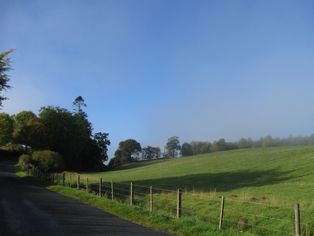
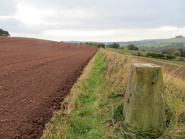
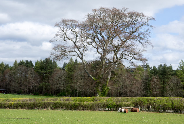
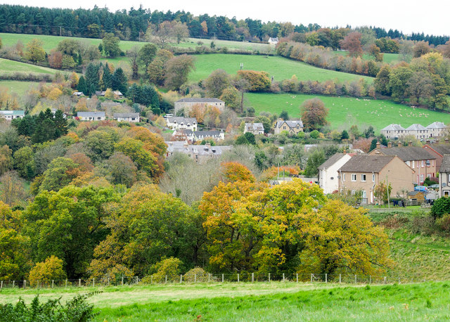
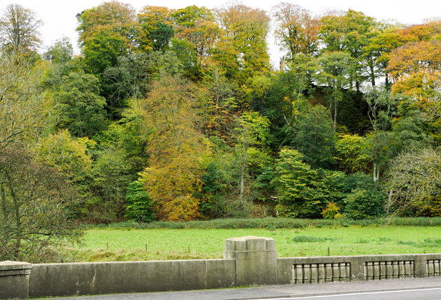
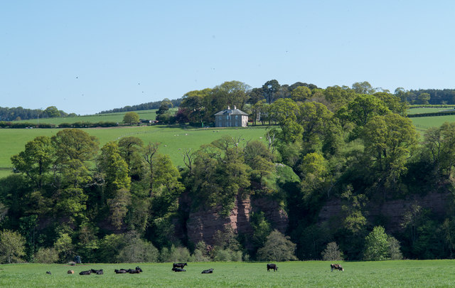
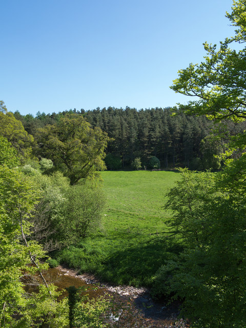
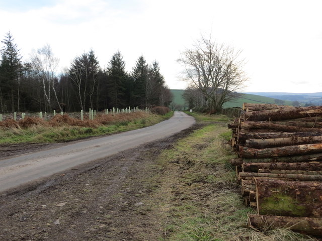
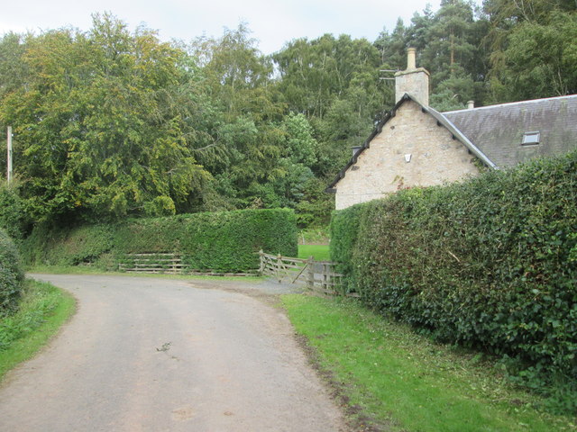
Hag Plantation is a renowned woodland area located in Roxburghshire, a historic county in the Scottish Borders region of Scotland. This sprawling forest covers an extensive area and is an important natural asset in the region. The plantation is characterized by its dense growth of trees, predominantly made up of conifers and deciduous species.

The name "Hag" is derived from the Old Norse word "hagi," meaning enclosed pasture, reflecting the history of the area. The plantation is believed to have been established in the late 18th century, primarily for timber production. Over the years, it has evolved into a thriving ecosystem, attracting a diverse range of flora and fauna.

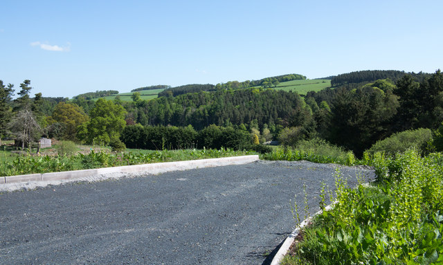
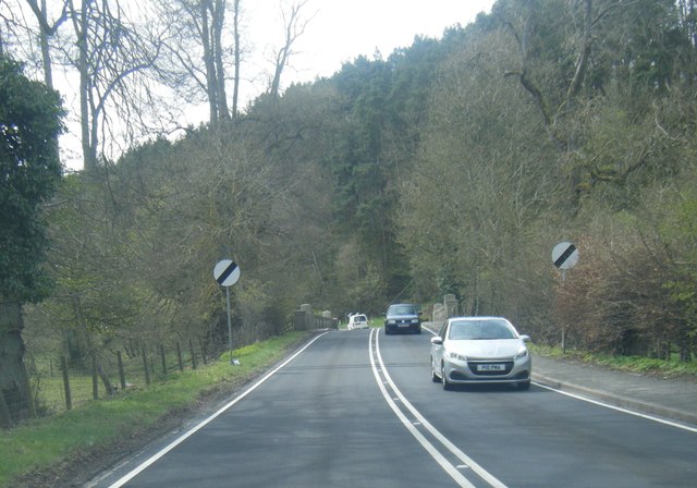
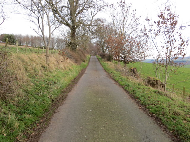
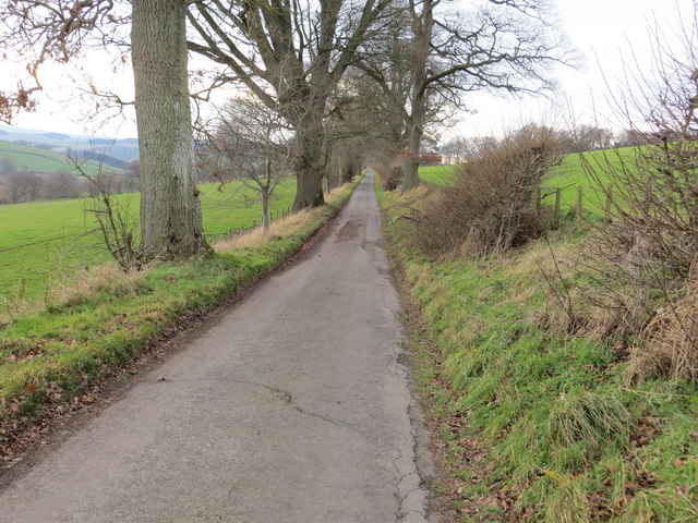
Visitors to Hag Plantation are greeted by a well-maintained network of walking trails, allowing them to explore the natural beauty of the woodland. These trails wind their way through the forest, providing opportunities for leisurely walks, birdwatching, and photography. The plantation is also popular with nature enthusiasts, who can spot various wildlife species, including roe deer, red squirrels, and a variety of bird species.

The management of Hag Plantation focuses on sustainable forestry practices, ensuring the long-term health and vitality of the woodland. Regular tree planting and maintenance activities are carried out to ensure a healthy mix of tree species and age classes. This proactive approach not only supports the local timber industry but also contributes to the conservation of the area's biodiversity.

Hag Plantation is a cherished natural treasure in Roxburghshire, offering a tranquil escape for visitors and playing a vital role in the ecological landscape of the region.

If you have any feedback on the listing, please let us know in the comments section below.

Hag Plantation Images

Images are sourced within 2km of 55.458044/-2.5512753 or Grid Reference NT6518. Thanks to Geograph Open Source API. All images are credited.

Road, farmland
Road, farmland
Jedburgh Circular Riding Route near the golf course Here the route crosses the B6358 from Denholm near the golf clubhouse.
Jedburgh Circular Riding Route near the golf course
Here the route crosses the B6358 from Denholm near the golf clubhouse.
Field edge view from Howden Triangulation Pillar Looking south-westward.
Field edge view from Howden Triangulation Pillar
Looking south-westward.
Linthaugh Cottage
Linthaugh Cottage
Hedges and oil drums The A68 runs between the two hedge lines. The oil drums appear to be part of a jump for horses - there are other similar things in the field.
Hedges and oil drums
The A68 runs between the two hedge lines. The oil drums appear to be part of a jump for horses - there are other similar things in the field.
Autumnal trees at edge of Howdenburn Glen The Howden Burn (of the Howdenburn Glen) is a minor stream entering the Jed Water to the south of Jedburgh. The houses beyond are of course in the town.
Autumnal trees at edge of Howdenburn Glen
The Howden Burn (of the Howdenburn Glen) is a minor stream entering the Jed Water to the south of Jedburgh. The houses beyond are of course in the town.
Deciduous woodland on slope beyond Hundalee Bridge The trees are on a steep slope with exposed rock. One of the parapets of Hundalee Bridge is in the foreground.
Deciduous woodland on slope beyond Hundalee Bridge
The trees are on a steep slope with exposed rock. One of the parapets of Hundalee Bridge is in the foreground.
Sandstone crag above Jed Water The crag is seen across a field with cattle, descending from the A68 a few kilometres south of Jedburgh.
Sandstone crag above Jed Water
The crag is seen across a field with cattle, descending from the A68 a few kilometres south of Jedburgh.
A road going nowhere A curious stretch of road! It's broad as it leaves the A68 to the west but it ends within perhaps 30 metres of the junction and the height of the kerbstones and roughness of surface shows that no 'black top' has been applied. Beyond the road end a slope descends so steeply towards the Jed Water that is seems unlikely that it would continue directly in that direction.
A road going nowhere
A curious stretch of road! It's broad as it leaves the A68 to the west but it ends within perhaps 30 metres of the junction and the height of the kerbstones and roughness of surface shows that no 'black top' has been applied. Beyond the road end a slope descends so steeply towards the Jed Water that is seems unlikely that it would continue directly in that direction.
Jed Water below the A68 The river, Jed Water, flowing below a steep slope just south of Jedburgh.
Jed Water below the A68
The river, Jed Water, flowing below a steep slope just south of Jedburgh.
A68 at Inchbonny Bridge
Minor road approaching Violet Strip Looking north-eastward.
Minor road approaching Violet Strip
Looking north-eastward.
Minor road heading in the direction of Mossburnford Looking south-westward.
Minor road heading in the direction of Mossburnford
Looking south-westward.
Harvested timber awaiting beside a road near to Mossburnfoot for onward transportation Looking south-eastward.
Harvested timber awaiting beside a road near to Mossburnfoot for onward transportation
Looking south-eastward.
The end of a minor road at Kersheugh Farm Looking south-westward.
The end of a minor road at Kersheugh Farm
Looking south-westward.
Road (B6357) near Lintalee Looking north-eastward towards the A68.
Road (B6357) near Lintalee
Looking north-eastward towards the A68.
Over  field  to  Hunthill  Farm From track from Natural Wood
Over field to Hunthill Farm
From track from Natural Wood
Lane  and  Coach  House The footpath from Hunthill through the woods comes out on to the lane here
Lane and Coach House
The footpath from Hunthill through the woods comes out on to the lane here
Show me another place!

Hag Plantation is located at Grid Ref: NT6518 (Lat: 55.458044, Lng: -2.5512753)

Unitary Authority: The Scottish Borders

Police Authority: The Lothians and Scottish Borders

What 3 Words

///crouches.freedom.riverboat. Near Jedburgh, Scottish Borders

Related Wikis

Ferniehirst Castle

Ferniehirst Castle (sometimes spelled Ferniehurst) is an L-shaped construction on the east bank of the Jed Water, about a mile and a half south of Jedburgh...

Jedforest

Jedforest is an historic forest in the Scottish Borders, that has been heavily wooded in the past. It is close to Jed Water and the town of Jedburgh, from...

Capon Oak Tree

The Capon Oak Tree is one of the last surviving trees of the ancient Scottish Jedforest. It is close to the A68 and Jed Water, a small river which has...

Jedburgh Castle

Jedburgh Castle was a castle at Jedburgh in Scotland. It was fought over during the Wars of Scottish Independence, and was demolished by the Scots commanded...

Nearby Amenities

Located within 500m of 55.458044,-2.5512753
Bus Stop
Castle Road End
Bench: no
Bin: no
Lit: no
Naptan AtcoCode: 69001230
Naptan Bearing: N
Naptan CommonName: Castle Road End
Naptan Indicator: at Lodge
Naptan Landmark: B6357 junction
Naptan NaptanCode: 72725626
Naptan Street: A68
Naptan Verified: no
Shelter: no
Source: naptan_import
Tactile Paving: no
Lat/Long: 55.4566571/-2.5575454
Bus Stop
Lodge
Bench: no
Bin: no
Bus: yes
Lit: no
Naptan AtcoCode: 6900497
Naptan Bearing: S
Naptan CommonName: Lodge
Naptan Indicator: opp
Naptan Landmark: B6357
Naptan NaptanCode: 72723287
Naptan Street: A68
Operator: Scottish Borders Council
Public Transport: platform
Ref: 6900497
Shelter: no
Source: NaPTAN
Tactile Paving: no
Lat/Long: 55.4567669/-2.5572971
Post Box
Brand: Royal Mail
Brand Wikidata: Q638098
Collection Times: Mo-Fr 12:15; Sa 11:45
Operator: Royal Mail
Operator Wikidata: Q638098
Post Box Type: lamp
Ref: TD8 88
Royal Cypher: scottish_crown
Source: survey
Lat/Long: 55.4567098/-2.5574683
Barrier: stile
Lat/Long: 55.4594865/-2.5520544
Ford: yes
Lat/Long: 55.4615235/-2.5528903
Barrier: stile
Lat/Long: 55.461628/-2.5529756
Linthaugh
Place: hamlet
Lat/Long: 55.4566293/-2.5571216
Barrier: stile
Lat/Long: 55.4622261/-2.5531076
Barrier: stile
Lat/Long: 55.4555162/-2.5481485
Noexit: yes
Lat/Long: 55.4554159/-2.5487195
Barrier: stile
Lat/Long: 55.4607295/-2.5523391
Power: pole
Lat/Long: 55.4553007/-2.5450044
Power: pole
Lat/Long: 55.4539672/-2.5496127
Power: pole
Lat/Long: 55.4609078/-2.5571395
Power: pole
Lat/Long: 55.4553274/-2.5488985
Power: pole
Lat/Long: 55.4556233/-2.550675
Power: pole
Lat/Long: 55.45629/-2.5517159
Power: pole
Lat/Long: 55.4569596/-2.5527543
Power: pole
Lat/Long: 55.4577692/-2.5540218
Power: pole
Lat/Long: 55.4584316/-2.5550627
Power: pole
Lat/Long: 55.4591142/-2.5561138
Power: pole
Lat/Long: 55.4597073/-2.5570403
Power: pole
Lat/Long: 55.4600276/-2.5570861
The data included in this document is from www.openstreetmap.org. The data is made available under ODbL.

Have you been to Hag Plantation?

Leave your review of Hag Plantation below (or comments, questions and feedback).