Muirhouselaw Wood

Wood, Forest in Roxburghshire

Scotland

Muirhouselaw Wood

Farm track near Pirnie
Farm track near Pirnie Credit: JThomas

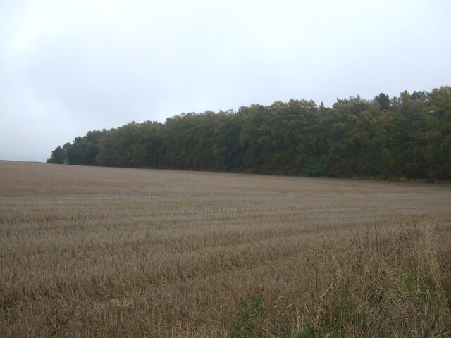
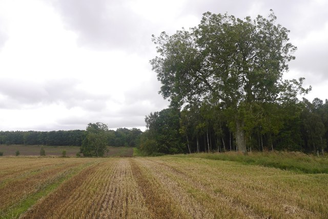
Muirhouselaw Wood is a woodland area located in Roxburghshire, a historic county in the Scottish Borders region of Scotland. This beautiful woodland covers an approximate area of 200 acres, making it a significant natural attraction in the region.

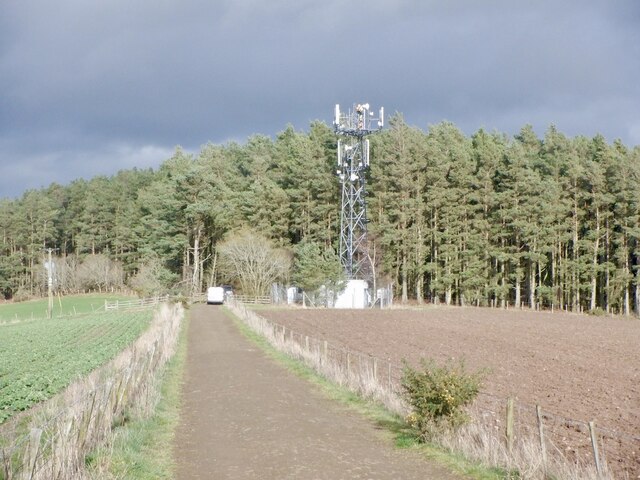
The wood is situated near the small village of Denholm, offering visitors a serene and tranquil environment to explore and enjoy nature. It is characterized by a diverse range of tree species, including oak, beech, birch, and Scots pine, creating a rich and varied ecosystem. The different tree types provide habitat for a wide variety of wildlife, such as birds, squirrels, and small mammals.

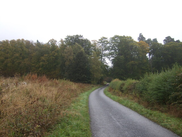
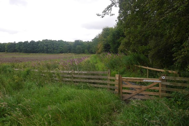
Muirhouselaw Wood is a popular destination for outdoor enthusiasts and nature lovers, who can engage in activities like walking, hiking, and birdwatching. The woodland has a network of well-maintained trails that wind through the forest, allowing visitors to immerse themselves in the natural beauty and observe the flora and fauna up close.

The wood also holds historical significance, with remnants of an Iron Age hillfort located within its boundaries. This adds an element of intrigue and interest for those interested in the region's past.

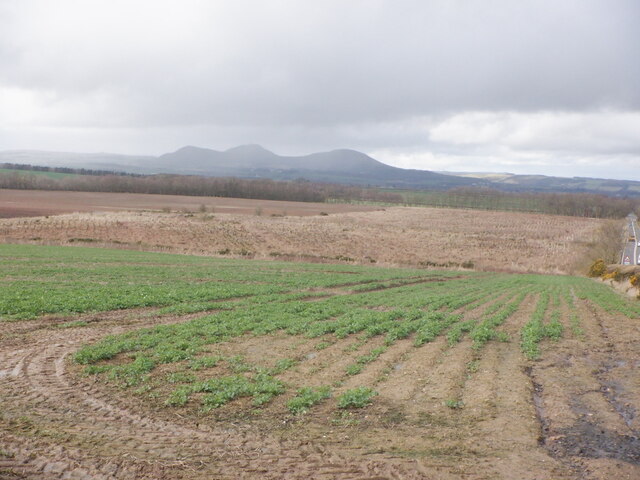
Overall, Muirhouselaw Wood is a picturesque and biodiverse woodland that offers a peaceful retreat for visitors seeking to reconnect with nature and explore the natural treasures of Roxburghshire.

If you have any feedback on the listing, please let us know in the comments section below.

Muirhouselaw Wood Images

Images are sourced within 2km of 55.543071/-2.5869011 or Grid Reference NT6327. Thanks to Geograph Open Source API. All images are credited.

Farm track near Pirnie
Grazing near Pirnie
Grazing near Pirnie
Minor road near Pirnie Towards Fairnington.
Minor road near Pirnie
Towards Fairnington.
Ploughed field near Fairnington Towards Major's Plantation.
Ploughed field near Fairnington
Towards Major's Plantation.
Ploughed field near Fairnington Towards distant woodland and the Waterloo Monument on Peniel Heugh.
Ploughed field near Fairnington
Towards distant woodland and the Waterloo Monument on Peniel Heugh.
Minor road Fairnington
Prepared field and woodland near Fairnington
Minor beside woodland near Fairnington Towards Muirhouselaw.
Minor beside woodland near Fairnington
Towards Muirhouselaw.
Stubble field and woodland, Under Snipecleuch
Minor road into woodland, Under Snipecleuch
Oilseed rape, Lilliards Edge
Telephone mast, Lilliards Edge Undergoing maintenance. The road runs between the Monteath Mausoleum and caravan park.
Telephone mast, Lilliards Edge
Undergoing maintenance. The road runs between the Monteath Mausoleum and caravan park.
Ordnance Survey Cut Mark This OS cut mark can be found on the west angle of a roadside barn at Muirhouselaw Farm. It marks a point 136.547m above mean sea level.
Ordnance Survey Cut Mark
This OS cut mark can be found on the west angle of a roadside barn at Muirhouselaw Farm. It marks a point 136.547m above mean sea level.
A68 lay-by
A68 lay-by
Stubble, Ancrum Moor
Baron’s Folly This octagonal stone structure with slated roof on Down Law is reputed to have been built by a local Baron as a trysting place for himself and his lover. The Eildon Hills are on the skyline to the left.
Baron’s Folly
This octagonal stone structure with slated roof on Down Law is reputed to have been built by a local Baron as a trysting place for himself and his lover. The Eildon Hills are on the skyline to the left.
Course of Dere Street The Roman road usually runs through a strip wood here, but there are breaks in the woodland.
Course of Dere Street
The Roman road usually runs through a strip wood here, but there are breaks in the woodland.
Gate, St Cuthbert's Way On the course of Dere Street.
Gate, St Cuthbert's Way
On the course of Dere Street.
Show me another place!

Muirhouselaw Wood is located at Grid Ref: NT6327 (Lat: 55.543071, Lng: -2.5869011)

Unitary Authority: The Scottish Borders

Police Authority: The Lothians and Scottish Borders

What 3 Words

///dome.competing.occurs. Near Saint Boswells, Scottish Borders

Related Wikis

Battle of Ancrum Moor

The Battle of Ancrum Moor was fought during the War of the Rough Wooing in 1545. The Scottish victory put a temporary end to English incursions in the...
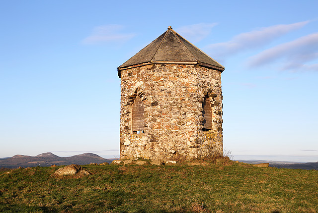
Monteath Mausoleum

The Monteath Mausoleum is a large landmark in the Scottish Borders near the village of Ancrum. The listed building can be seen from the A68 road just north...

Maxton railway station

Maxton railway station served the hamlet of Maxton, Roxburghshire, Scotland from 1851 to 1964 on the Kelso Line. == History == The station opened in June...

Peniel Heugh

Peniel Heugh (; 237 m) is a hill near Ancrum and Nisbet in the Scottish Borders area of Scotland. On it stands the Waterloo Monument. == Geology == The...

Nearby Amenities

Located within 500m of 55.543071,-2.5869011
Natural: peak
Lat/Long: 55.5398978/-2.5893065
Power: pole
Lat/Long: 55.5397025/-2.5899015
Power: pole
Lat/Long: 55.5402693/-2.589008
Power: pole
Lat/Long: 55.5408477/-2.5881351
Power: pole
Lat/Long: 55.5414421/-2.5872261
Power: pole
Lat/Long: 55.5419972/-2.5863789
Power: pole
Lat/Long: 55.5425567/-2.5853876
Power: pole
Lat/Long: 55.5430695/-2.5843241
Power: pole
Lat/Long: 55.5435677/-2.5833122
Power: pole
Lat/Long: 55.5439669/-2.582398
Power: pole
Lat/Long: 55.5443384/-2.5815251
Power: pole
Lat/Long: 55.5451863/-2.5814144
Power: pole
Lat/Long: 55.5460269/-2.5813191
The data included in this document is from www.openstreetmap.org. The data is made available under ODbL.

Have you been to Muirhouselaw Wood?

Leave your review of Muirhouselaw Wood below (or comments, questions and feedback).