Dipper Plantation

Wood, Forest in Roxburghshire

Scotland

Dipper Plantation

The ruined remains of Abbotrule Church The church had belonged to Jedburgh Abbey from the early 12th century until its abandonment in 1777. The gable walls and bellcote are all that remain together with some old headstones inside the building and in the former churchyard.
The ruined remains of Abbotrule Church Credit: Walter Baxter

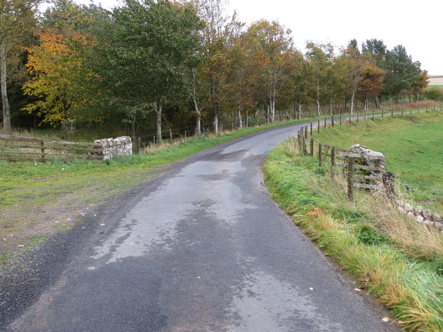
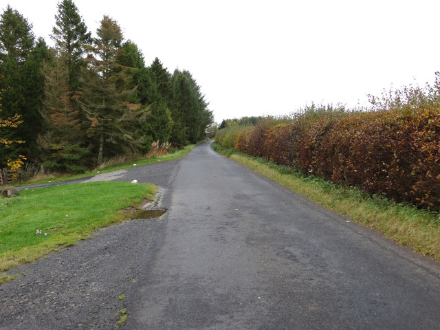
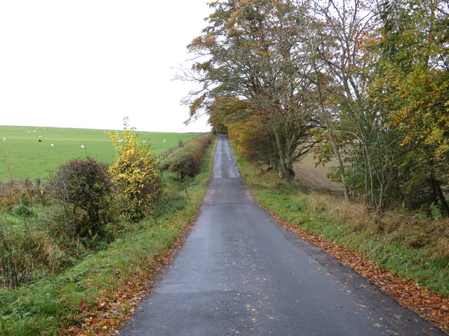
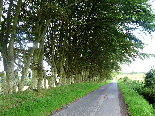
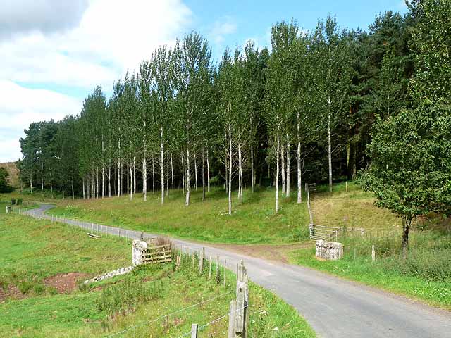
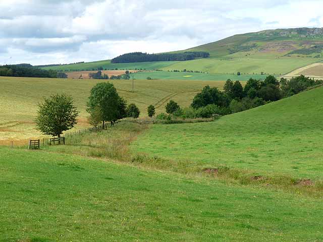
Dipper Plantation, located in Roxburghshire, is a vibrant and diverse wood and forest area renowned for its natural beauty and rich ecosystem. Spanning over a vast expanse of land, the plantation is characterized by its dense forest cover, consisting primarily of a variety of deciduous and coniferous trees.

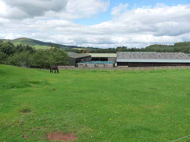
The woodlands at Dipper Plantation are a haven for wildlife enthusiasts and nature lovers alike. The area boasts a wide range of animal species, including red squirrels, roe deer, and a plethora of bird species such as dippers, after which the plantation is named. The presence of numerous small streams and a river running through the plantation provides an ideal habitat for otters and other aquatic creatures.

Visitors to Dipper Plantation can explore its extensive network of well-maintained walking trails, offering breathtaking views of the surrounding countryside. The trails cater to all levels of fitness, from leisurely strolls to more challenging hikes, ensuring that there is something for everyone.

The plantation also serves as an important educational resource, with various opportunities for environmental learning and research. Local schools and organizations often visit Dipper Plantation to gain a deeper understanding of the ecosystem and engage in conservation efforts.

Furthermore, the woodlands at Dipper Plantation play a crucial role in carbon sequestration, making a significant contribution towards mitigating the effects of climate change. The sustainable management practices employed at the plantation ensure the preservation of its natural beauty and ecological balance.

In summary, Dipper Plantation in Roxburghshire is a captivating wood and forest area, celebrated for its diverse wildlife, picturesque landscapes, and its commitment to environmental conservation.

If you have any feedback on the listing, please let us know in the comments section below.

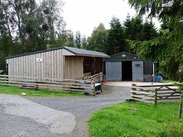
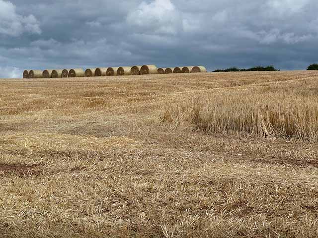
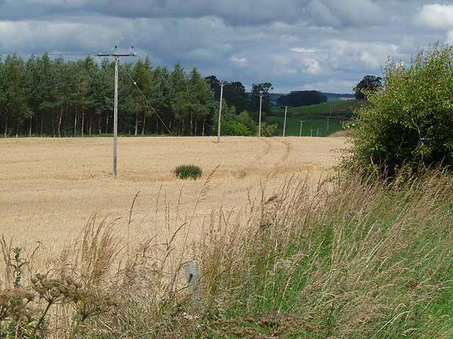
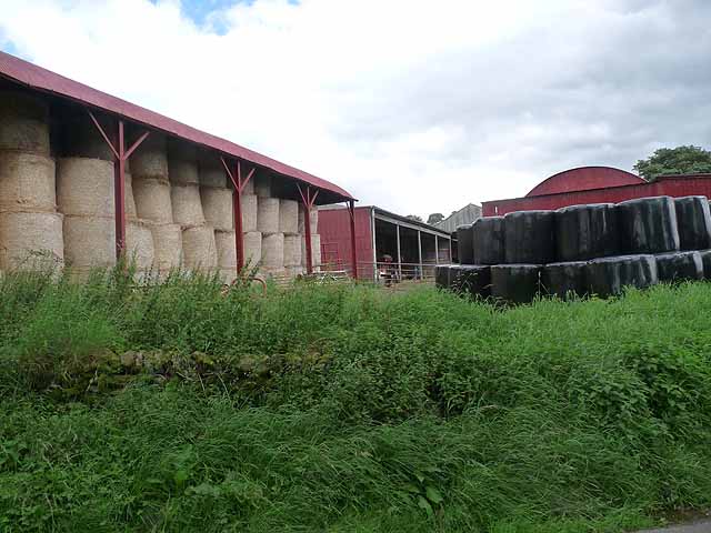
Dipper Plantation Images

Images are sourced within 2km of 55.416061/-2.6299565 or Grid Reference NT6013. Thanks to Geograph Open Source API. All images are credited.

The ruined remains of Abbotrule Church The church had belonged to Jedburgh Abbey from the early 12th century until its abandonment in 1777. The gable walls and bellcote are all that remain together with some old headstones inside the building and in the former churchyard.
The ruined remains of Abbotrule Church
The church had belonged to Jedburgh Abbey from the early 12th century until its abandonment in 1777. The gable walls and bellcote are all that remain together with some old headstones inside the building and in the former churchyard.
Old gravestones inside the ruins of Abbotrule Church These old stones are resting against the east gable wall.
Old gravestones inside the ruins of Abbotrule Church
These old stones are resting against the east gable wall.
Old grave slabs by the ruined Abbotrule Church These stones are on the south side of the ruined church. The grave marker on the left is a hogback stone.
Old grave slabs by the ruined Abbotrule Church
These stones are on the south side of the ruined church. The grave marker on the left is a hogback stone.
Sheep at Abbotrule A large grazing field with the remains of Abbotrule Church on the right.
Sheep at Abbotrule
A large grazing field with the remains of Abbotrule Church on the right.
Gravestones by the remains of Abbotrule Church The stones are on the south side of the ruined church.
Gravestones by the remains of Abbotrule Church
The stones are on the south side of the ruined church.
The ruined remains of Abbotrule Church The church had belonged to Jedburgh Abbey from the early 12th century until its abandonment in 1777. The gable walls and bellcote are all that remain together with some old headstones inside the building and in the former churchyard. This was viewed in early December 2017. For a similar view in October 2006 see <a href="https://www.geograph.org.uk/photo/255079">NT6112 : The remains of Abbotrule Church</a>.
The ruined remains of Abbotrule Church
The church had belonged to Jedburgh Abbey from the early 12th century until its abandonment in 1777. The gable walls and bellcote are all that remain together with some old headstones inside the building and in the former churchyard. This was viewed in early December 2017. For a similar view in October 2006 see NT6112 : The remains of Abbotrule Church.
Road and Bridge crossing Fodderlee Sike Looking south-eastward.
Road and Bridge crossing Fodderlee Sike
Looking south-eastward.
Minor road at High Fodderlee Looking north-westward.
Minor road at High Fodderlee
Looking north-westward.
Minor road at Bowshot Looking south-eastward.
Minor road at Bowshot
Looking south-eastward.
Farm yard near High Fodderlee Farm yard close, but not adjacent, to High Fodderlee Farm. The distinctive summit of Rubers Law <a href="https://www.geograph.org.uk/gridref/NT5815">NT5815</a> can be seen on the skyline beyond the valley of the Rule Water.
Farm yard near High Fodderlee
Farm yard close, but not adjacent, to High Fodderlee Farm. The distinctive summit of Rubers Law NT5815 can be seen on the skyline beyond the valley of the Rule Water.
Farm buildings at High Fodderlee This appears to be a new farm, possibly associated with a timber business.
Farm buildings at High Fodderlee
This appears to be a new farm, possibly associated with a timber business.
Barley field above Fodderlee Syke A partly-harvested field of barley. Bales of straw can be seen at the top of the field.
Barley field above Fodderlee Syke
A partly-harvested field of barley. Bales of straw can be seen at the top of the field.
Field of barley in the valley of the Rule Water Beside the road south of Fulton Tower.
Field of barley in the valley of the Rule Water
Beside the road south of Fulton Tower.
Barns at Ruletownhead Farm
Country road near Ruletownhead A very fine, but one-sided avenue of mature beech trees.
Country road near Ruletownhead
A very fine, but one-sided avenue of mature beech trees.
Farm buildings at East Fodderlee Rubers Law <a href="https://www.geograph.org.uk/gridref/NT5815">NT5815</a> on the skyline.
Farm buildings at East Fodderlee
Rubers Law NT5815 on the skyline.
Poplar plantation by Fodderlee Sike
Farmland along Fodderlee Sike The craggy summit of Rubers Law <a href="https://www.geograph.org.uk/gridref/NT5815">NT5815</a> on the skyline.
Farmland along Fodderlee Sike
The craggy summit of Rubers Law NT5815 on the skyline.
Show me another place!

Dipper Plantation is located at Grid Ref: NT6013 (Lat: 55.416061, Lng: -2.6299565)

Unitary Authority: The Scottish Borders

Police Authority: The Lothians and Scottish Borders

What 3 Words

///bouncing.photo.trickster. Near Jedburgh, Scottish Borders

Related Wikis

Hallrule

Hallrule is a hamlet on the B6357 road, in the Scottish Borders area of Scotland, on the Rule Water, near Abbotrule, Bedrule Bonchester Bridge, Denholm...

Abbotrule

Abbotrule is a hamlet south of the B6357 road, in the Scottish Borders area of Scotland, on Rule Burn, east of the Rule Water. Places nearby include Bedrule...

Fulton Tower

Fulton Tower is a ruined 16th century tower house, about 4.5 miles (7.2 km) south west of Jedburgh, Scottish Borders, Scotland, and about 2 miles (3.2...

Bonchester Bridge

Bonchester Bridge (Scots Binster Brig) is a village in Roxburghshire, within the Scottish Borders area of Scotland, lying on the Rule Water, six miles...

Rubers Law

Rubers Law is a prominent, conical hill in the Scottish Borders area of south-east Scotland. It stands on the south bank of the River Teviot, between the...

Hobkirk

Hobkirk (Scottish Gaelic: Eaglais Ruail) is a village and civil parish in the Scottish Borders area of Scotland, by the Rule Water, south-west of Jedburgh...

Bedrule

Bedrule (Scottish Gaelic: Ruail Bheathaig) is a hamlet and civil parish in the historic county of Roxburghshire in the Scottish Borders area of Scotland...

Bedrule Castle

Bedrule Castle is a ruined 13th-century castle in the Rule Valley, in the Scottish Borders area of Scotland.The castle was built in the 13th century by...

Related Videos

BONCHESTER BRIDGE LOOP

Hello Jamie here and with another video. So after my massive Ruberslaw walk, somehow in the afternoon period. I managed to ...

Nearby Amenities

Located within 500m of 55.416061,-2.6299565
Paradise
Place: isolated_dwelling
Lat/Long: 55.412136/-2.6287758
Ford: yes
Lat/Long: 55.4183038/-2.6330172
Power: pole
Lat/Long: 55.4141874/-2.6368771
Power: pole
Lat/Long: 55.4147841/-2.6360016
Power: pole
Lat/Long: 55.4153041/-2.6352406
Power: pole
Lat/Long: 55.4160033/-2.6342225
Power: pole
Lat/Long: 55.4166289/-2.6333114
Power: pole
Lat/Long: 55.4172948/-2.632329
Power: pole
Lat/Long: 55.417968/-2.6313288
Power: pole
Lat/Long: 55.4185704/-2.6304456
Power: pole
Lat/Long: 55.4190846/-2.6296923
Power: pole
Lat/Long: 55.4193692/-2.6292825
Power: pole
Lat/Long: 55.4200972/-2.628206
Power: pole
Lat/Long: 55.4163168/-2.6352329
Power: pole
Lat/Long: 55.4166462/-2.6363248
Power: pole
Lat/Long: 55.4203774/-2.630242
Power: pole
Lat/Long: 55.4118196/-2.628461
The data included in this document is from www.openstreetmap.org. The data is made available under ODbL.

Have you been to Dipper Plantation?

Leave your review of Dipper Plantation below (or comments, questions and feedback).