Boat Plantation

Wood, Forest in Aberdeenshire

Scotland

Boat Plantation

A93 towards Banchory
A93 towards Banchory Credit: Steven Brown

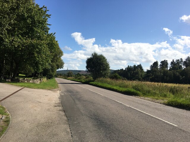
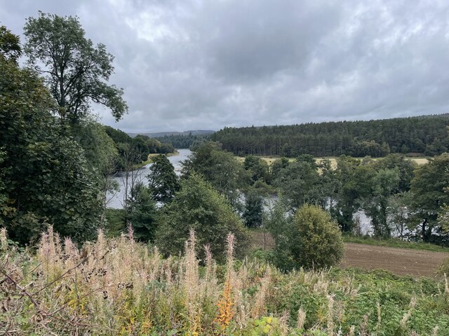
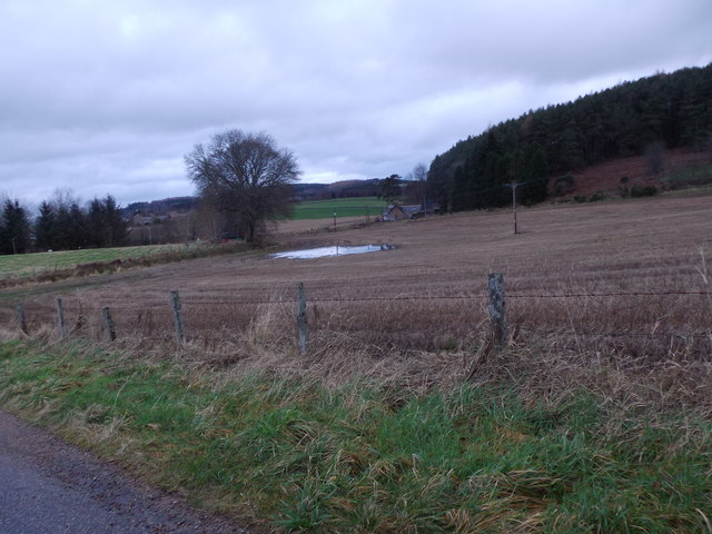
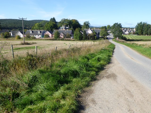
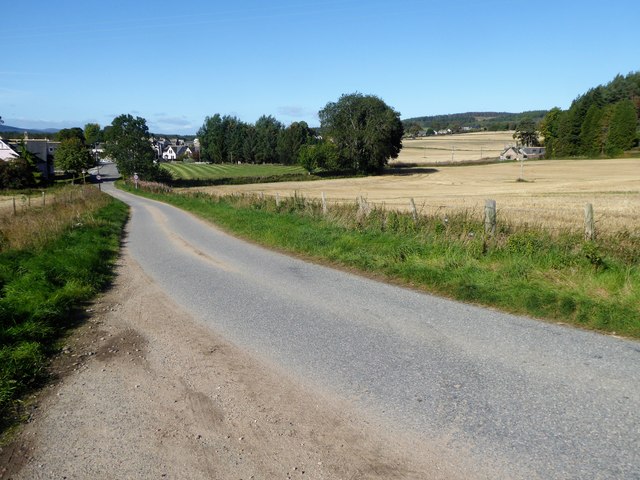
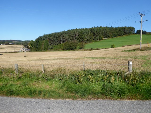
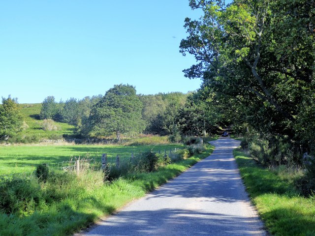
Boat Plantation is a stunning woodland area located in Aberdeenshire, Scotland. Spanning over acres of land, this plantation is known for its dense and diverse forest, making it a popular destination for nature enthusiasts and hikers alike.

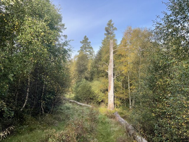
The woodland is predominantly composed of various species of trees, including Scots pine, oak, birch, and beech, creating a rich and vibrant ecosystem. The lush greenery and towering trees provide a serene and peaceful atmosphere, making it an ideal spot for relaxation and escapism.

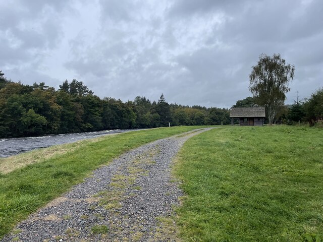
The plantation is home to a wide range of wildlife, including deer, squirrels, and a variety of bird species. This makes it a fantastic location for wildlife observation and birdwatching. Visitors can often spot red squirrels darting between the trees or catch a glimpse of roe deer grazing in the undergrowth.

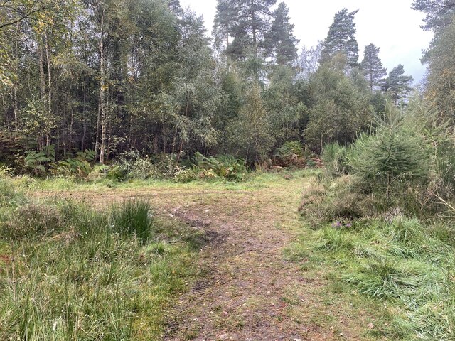
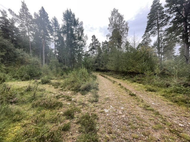
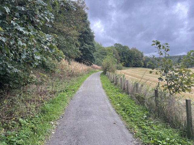
The woodland offers a network of well-maintained trails, allowing visitors to explore the plantation at their own pace. These paths wind through the forest, offering breathtaking views of the surrounding countryside and the nearby River Dee. The trails are suitable for all levels of fitness and provide an opportunity to immerse oneself in the natural beauty of the area.

Boat Plantation also boasts a picnic area, providing a perfect spot for visitors to enjoy a packed lunch while surrounded by the stunning scenery. Additionally, there are informative signposts scattered throughout the woodland, offering insight into the various tree species and wildlife that inhabit the area.

Overall, Boat Plantation is a true gem in Aberdeenshire, offering a peaceful retreat for nature lovers and a chance to reconnect with the natural world.

If you have any feedback on the listing, please let us know in the comments section below.

Boat Plantation Images

Images are sourced within 2km of 57.076785/-2.6851905 or Grid Reference NO5898. Thanks to Geograph Open Source API. All images are credited.

A93 towards Banchory
A lone dead tree Geocaching is a type of global treasure hunt of people looking for caches, or hidden stashes of objects. Geocaching may also be described as a series of hide-and-seek games, where hiders provide online clues for seekers. Seekers use global positioning system (GPS) devices to find hidden caches
A lone dead tree
Geocaching is a type of global treasure hunt of people looking for caches, or hidden stashes of objects. Geocaching may also be described as a series of hide-and-seek games, where hiders provide online clues for seekers. Seekers use global positioning system (GPS) devices to find hidden caches
Path junction in the forest Geocaching is a type of global treasure hunt of people looking for caches, or hidden stashes of objects. Geocaching may also be described as a series of hide-and-seek games, where hiders provide online clues for seekers. Seekers use global positioning system (GPS) devices to find hidden caches
Path junction in the forest
Geocaching is a type of global treasure hunt of people looking for caches, or hidden stashes of objects. Geocaching may also be described as a series of hide-and-seek games, where hiders provide online clues for seekers. Seekers use global positioning system (GPS) devices to find hidden caches
Path junction in the forest
Looking towards the River Dee
The Deeside way
The Deeside way
Fishermans Bothy
Fishermans Bothy
Flood water pool, January spate 2016 Near St Erchard's well, Kincardine O'Neil.
Flood water pool, January spate 2016
Near St Erchard's well, Kincardine O'Neil.
Entry into Kincardine O'Neil By minor road from Lower Craigton.
Entry into Kincardine O'Neil
By minor road from Lower Craigton.
A view west - - - - from a dogleg on the minor road into Kincardine O'Neil from Craigton.
A view west - -
- - from a dogleg on the minor road into Kincardine O'Neil from Craigton.
Gallowhill Wood Seen from Craigton to Kincardine O'Neil road.
Gallowhill Wood
Seen from Craigton to Kincardine O'Neil road.
Westhall Cottage (long range shot) With two hilltop masts in the rear. Seen from the minor road between Craigton and Kincardine O'Neil.
Westhall Cottage (long range shot)
With two hilltop masts in the rear. Seen from the minor road between Craigton and Kincardine O'Neil.
Uphill to Craigton Wood Westhill junction off left ahead.
Uphill to Craigton Wood
Westhill junction off left ahead.
Road (A93) through Kincardine O'Neil Looking north-westward.
Road (A93) through Kincardine O'Neil
Looking north-westward.
Ordnance Survey Flush Bracket G1165 This bracket can be found on the wall of a school in Kincardine O'Neil. The benchmark height is recorded as being 97.219 metres above sea level.
For more detail see : <span class="nowrap"><a title="https://www.bench-marks.org.uk/bm19991" rel="nofollow ugc noopener" href="https://www.bench-marks.org.uk/bm19991">Link</a><img style="margin-left:2px;" alt="External link" title="External link - shift click to open in new window" src="https://s1.geograph.org.uk/img/external.png" width="10" height="10"/></span>
Ordnance Survey Flush Bracket G1165
This bracket can be found on the wall of a school in Kincardine O'Neil. The benchmark height is recorded as being 97.219 metres above sea level. For more detail see : LinkExternal link
Old Milestone by the A93, Aboyne and Glentanner parish Aberdeen granite by the A93, in parish of Aboyne and Glentanner (Aberdeen District), East of drive down to Lower Dess House, under safety barrier, South side of road.

Inscription reads:-
27
(To Aberdeen)

Surveyed

Milestone Society National ID: AD_ADBM27
Old Milestone by the A93, Aboyne and Glentanner parish
Aberdeen granite by the A93, in parish of Aboyne and Glentanner (Aberdeen District), East of drive down to Lower Dess House, under safety barrier, South side of road. Inscription reads:- 27 (To Aberdeen) Surveyed Milestone Society National ID: AD_ADBM27
Cottages in Kincardine O'Neil
Former Tollhouse by the A93, Pitmurchie Road Kincardine O'Neil by the A93, in parish of KINCARDINE O'NEIL (Aberdeen District), The Toll House, Pitmurchie Road.

HES Grade C listed.
Reference: LB9562 <span class="nowrap"><a title="http://portal.historicenvironment.scot/designation/LB9562" rel="nofollow ugc noopener" href="http://portal.historicenvironment.scot/designation/LB9562">Link</a><img style="margin-left:2px;" alt="External link" title="External link - shift click to open in new window" src="https://s1.geograph.org.uk/img/external.png" width="10" height="10"/></span>

Surveyed

Milestone Society National ID: AD.KKO
Former Tollhouse by the A93, Pitmurchie Road
Kincardine O'Neil by the A93, in parish of KINCARDINE O'NEIL (Aberdeen District), The Toll House, Pitmurchie Road. HES Grade C listed. Reference: LB9562 LinkExternal link Surveyed Milestone Society National ID: AD.KKO
Show me another place!

Boat Plantation is located at Grid Ref: NO5898 (Lat: 57.076785, Lng: -2.6851905)

Unitary Authority: Aberdeenshire

Police Authority: North East

What 3 Words

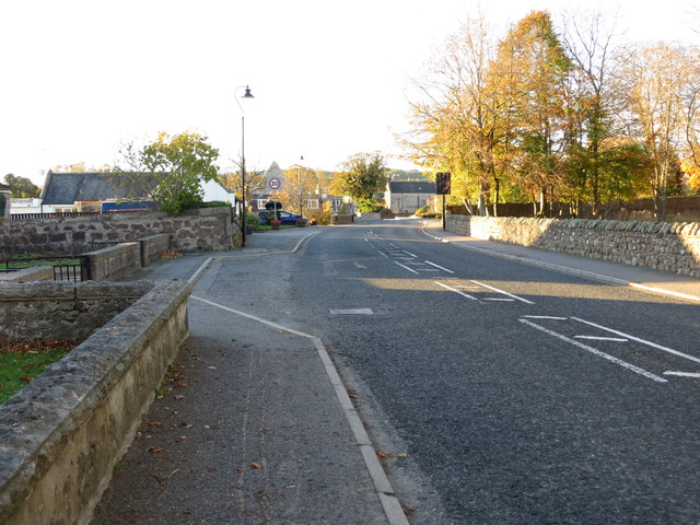
///pits.whirlwind.scenes. Near Torphins, Aberdeenshire

Related Wikis

Kincardine O'Neil Hospital, Aberdeenshire

Kincardine O'Neil Hospital was founded in the 13th century in the village of Kincardine O'Neil in Scotland. Almost certainly it served as a traveler's...

Kincardine O'Neil

Kincardine O'Neil (Scottish Gaelic: Cinn Chàrdainn, Scots: Kinker) is a village in Aberdeenshire, Scotland. It is situated between the towns of Banchory...

Kincardine Castle, Royal Deeside

Kincardine Castle is a Victorian country house in Royal Deeside, Scotland. Formerly known as Kincardine House, it is the private home of the Bradford family...

Dinnie Stones

The Dinnie Stones (also called Stanes or Steens) are a pair of Scottish lifting stones located in Potarch, Aberdeenshire. They were made famous by strongman...

Potarch

Potarch ( pot-ARKH) is a hamlet in Aberdeenshire, Scotland, with a bridge across the River Dee.It is a popular location with tourists and day-trippers...

Belwade Farm

Belwade Farm is a horse stables near Aboyne, Scotland owned by World Horse Welfare. == History == A new visitor centre and indoor arena was opened by Princess...

Dess railway station

Dess railway station was opened on 2 December 1859 on the Deeside Extension Railway and served the rural area around Dess House and estate from 1859 to...

Kinminity

Kinminity is a former village located south-east of Birse, Aberdeenshire in Scotland. == History == The property was in hands of the cadet family of Sutherlands...

Have you been to Boat Plantation?

Leave your review of Boat Plantation below (or comments, questions and feedback).