Toft Plantation

Wood, Forest in Roxburghshire

Scotland

Toft Plantation

Derelict weir on River Tweed A lade, just to the left of the image, carried water to the abbey some 500 m to the east.
Derelict weir on River Tweed Credit: Russel Wills

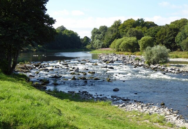
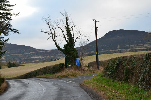
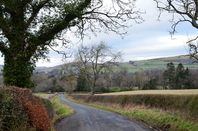
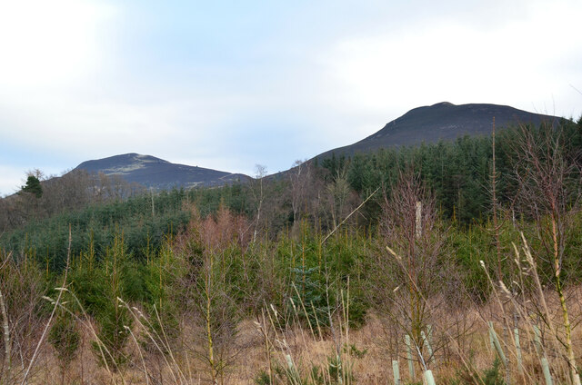
Toft Plantation is a picturesque woodland located in Roxburghshire, a historic county in the Scottish Borders region of Scotland. Covering an area of approximately 500 acres, the plantation is known for its scenic beauty and rich biodiversity. It is situated in close proximity to the village of Toft, hence its name.

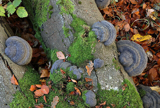
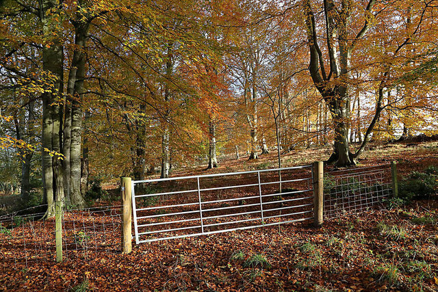
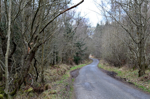
The plantation is predominantly composed of native broadleaf trees, such as oak, beech, and birch, which create a dense and vibrant forest. These trees provide a habitat for a diverse range of wildlife, including various bird species, mammals, and insects. The tranquil atmosphere of the woodland offers a haven for nature enthusiasts and outdoor adventurers alike.

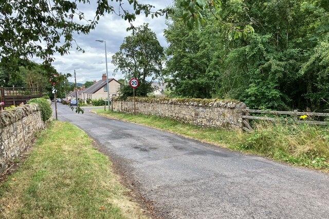
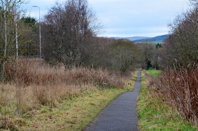
Toft Plantation boasts a network of well-maintained footpaths and trails, allowing visitors to explore the area and immerse themselves in its natural wonders. These paths offer stunning views of the surrounding countryside, making it an ideal spot for leisurely walks, picnics, or even photography.

The woodland is managed by the local authorities to ensure the preservation of its ecological value and to provide a sustainable environment for both wildlife and visitors. Educational activities and events are often organized to raise awareness about the importance of conservation and to engage the local community.

In conclusion, Toft Plantation in Roxburghshire is a captivating woodland that offers a serene escape from the hustle and bustle of daily life. With its diverse flora and fauna, well-kept trails, and educational initiatives, this forest sanctuary is a must-visit destination for those seeking to reconnect with nature in the heart of Scotland.

If you have any feedback on the listing, please let us know in the comments section below.

Toft Plantation Images

Images are sourced within 2km of 55.593016/-2.7523828 or Grid Reference NT5233. Thanks to Geograph Open Source API. All images are credited.

Derelict weir on River Tweed A lade, just to the left of the image, carried water to the abbey some 500 m to the east.
Derelict weir on River Tweed
A lade, just to the left of the image, carried water to the abbey some 500 m to the east.
Tweedbank station An aerial view over Tweedbank station looking towards Melrose.

Forms part of Railway Routes Blogpost <span class="nowrap"><a title="https://tinyurl.com/e94tw557" rel="nofollow ugc noopener" href="https://tinyurl.com/e94tw557">Link</a><img style="margin-left:2px;" alt="External link" title="External link - shift click to open in new window" src="https://s1.geograph.org.uk/img/external.png" width="10" height="10"/></span>
Tweedbank station
An aerial view over Tweedbank station looking towards Melrose. Forms part of Railway Routes Blogpost LinkExternal link
Tweedbank station Aerial view of Tweedbank station which forms part of "Railway Routes" BlogPost <span class="nowrap"><a title="https://tinyurl.com/e94tw557" rel="nofollow ugc noopener" href="https://tinyurl.com/e94tw557">Link</a><img style="margin-left:2px;" alt="External link" title="External link - shift click to open in new window" src="https://s1.geograph.org.uk/img/external.png" width="10" height="10"/></span>
Tweedbank station
Aerial view of Tweedbank station which forms part of "Railway Routes" BlogPost LinkExternal link
Broomilees Road. Infilled Railway cutting At this point was an over bridge on the Waverley Line, now infilled.


<span class="nowrap"><a title="https://tinyurl.com/e94tw557" rel="nofollow ugc noopener" href="https://tinyurl.com/e94tw557">Link</a><img style="margin-left:2px;" alt="External link" title="External link - shift click to open in new window" src="https://s1.geograph.org.uk/img/external.png" width="10" height="10"/></span>
Broomilees Road. Infilled Railway cutting
At this point was an over bridge on the Waverley Line, now infilled. LinkExternal link
A climbing tree, Abbotsford A dead tree now furnished with handholds in the woodland near the visitor centre.
A climbing tree, Abbotsford
A dead tree now furnished with handholds in the woodland near the visitor centre.
Borders Book Festival 2021, Abbotsford Normally the Borders Book Festival is held in early summer at Harmony House, Melrose. The 2020 event was cancelled due to the Covid-19 pandemic, but this year's festival took place between 2nd and 7th November in the grounds of Abbotsford House.
Borders Book Festival 2021, Abbotsford
Normally the Borders Book Festival is held in early summer at Harmony House, Melrose. The 2020 event was cancelled due to the Covid-19 pandemic, but this year's festival took place between 2nd and 7th November in the grounds of Abbotsford House.
Borders Book Festival 2021, Abbotsford (2) Abbotsford on a rather damp and squally day at the Borders Book Festival.
Borders Book Festival 2021, Abbotsford (2)
Abbotsford on a rather damp and squally day at the Borders Book Festival.
Borders Book Festival 2021, Abbotsford (3) Queueing at the visitor centre before entrance to the marquee to hear Hilary Mantel, winner of the 2021 Walter Scott Prize for historical fiction, for her novel 'The Mirror and the Light'.
Borders Book Festival 2021, Abbotsford (3)
Queueing at the visitor centre before entrance to the marquee to hear Hilary Mantel, winner of the 2021 Walter Scott Prize for historical fiction, for her novel 'The Mirror and the Light'.
Borders Book Festival 2021, Abbotsford (4) Food stalls and covered area now in use for the Saturday programme of events once the strong winds had abated.
Borders Book Festival 2021, Abbotsford (4)
Food stalls and covered area now in use for the Saturday programme of events once the strong winds had abated.
Feeding time for hungry cows The cows posed briefly for the camera as I walked past a cattle shed by the minor road to Kaeside Farm.
Feeding time for hungry cows
The cows posed briefly for the camera as I walked past a cattle shed by the minor road to Kaeside Farm.
Hoof fungus (Fomes fomentarius) This grey bracket fungus was growing on a fallen beech tree in Broomyknowe Plantation.
Hoof fungus (Fomes fomentarius)
This grey bracket fungus was growing on a fallen beech tree in Broomyknowe Plantation.
A gateway to a beech wood Most of the trees in Broomyknowe Plantation are beech.
A gateway to a beech wood
Most of the trees in Broomyknowe Plantation are beech.
Cyclepath alongside Melrose By-Pass A path by the A6091 east of the Borders General Hospital.
Cyclepath alongside Melrose By-Pass
A path by the A6091 east of the Borders General Hospital.
Underpass near Borders General Hospital The underpass carries the Dingleton road and the Huntly Burn below the A6091 Melrose By-Pass.
Underpass near Borders General Hospital
The underpass carries the Dingleton road and the Huntly Burn below the A6091 Melrose By-Pass.
Road junction near Borders General Hospital Junction for a minor road, single track with passing places, with the road between Darnick and Dingleton. Eildon Mid Hill is to the right.
Road junction near Borders General Hospital
Junction for a minor road, single track with passing places, with the road between Darnick and Dingleton. Eildon Mid Hill is to the right.
Minor road near Dingleton A single-track road through farmland and plantations west of Dingleton.
Minor road near Dingleton
A single-track road through farmland and plantations west of Dingleton.
Minor road through plantations, Dingleton A single-track road west of Dingleton.
Minor road through plantations, Dingleton
A single-track road west of Dingleton.
Eildon Hills from plantations near Dingleton Eildon Hill North (L) and Eildon Mid Hill seen from a minor road west of Dingleton.
Eildon Hills from plantations near Dingleton
Eildon Hill North (L) and Eildon Mid Hill seen from a minor road west of Dingleton.
Show me another place!

Toft Plantation is located at Grid Ref: NT5233 (Lat: 55.593016, Lng: -2.7523828)

Unitary Authority: The Scottish Borders

Police Authority: The Lothians and Scottish Borders

What 3 Words

///intrigues.rise.storm. Near Tweedbank, Scottish Borders

Nearby Locations

Toft Plantation

Related Wikis

Borders General Hospital

Borders General Hospital (BGH) is a district general hospital on the outskirts of Melrose, Scotland. It is managed by NHS Borders. == History == The hospital...

Darnick

Darnick is a village near Melrose in the Scottish Borders area of Scotland, in the former Roxburghshire. The name was first recorded in 1124, and has changed...

Tweedbank

Tweedbank is a large village south-east of Galashiels in the Scottish Borders, Scotland. It is part of the county of Roxburghshire. It is an outer suburb...

Melrose, Scottish Borders

Melrose (Scottish Gaelic: Maolros, "bald moor") is a town and civil parish in the Scottish Borders, historically in Roxburghshire. It lies within the Eildon...

Nearby Amenities

Located within 500m of 55.593016,-2.7523828
Power: tower
Lat/Long: 55.5962932/-2.7552253
Power: tower
Lat/Long: 55.5926684/-2.7514671
Power: tower
Lat/Long: 55.5899004/-2.7495043
Power: tower
Lat/Long: 55.5940512/-2.7529008
Power: pole
Lat/Long: 55.5965924/-2.7508897
Power: pole
Lat/Long: 55.597144/-2.752381
Power: pole
Lat/Long: 55.5964913/-2.7550352
Power: pole
Lat/Long: 55.5956544/-2.7541317
Power: pole
Lat/Long: 55.594862/-2.7532664
Power: pole
Lat/Long: 55.5940682/-2.7523985
Power: pole
Lat/Long: 55.5935275/-2.7516299
Power: pole
Lat/Long: 55.5929004/-2.7507264
Power: pole
Lat/Long: 55.5920605/-2.7501436
Power: pole
Lat/Long: 55.5906914/-2.7491714
Waste Basket
Survey Date: 2021-11-22
Lat/Long: 55.5953361/-2.7461058
Bench
Survey Date: 2021-11-22
Lat/Long: 55.5952119/-2.7458126
Power: pole
Lat/Long: 55.5958715/-2.7503217
Power: pole
Lat/Long: 55.5951741/-2.7496066
Power: pole
Lat/Long: 55.5945197/-2.7489652
Power: pole
Lat/Long: 55.5942249/-2.7487972
Power: pole
Lat/Long: 55.5936123/-2.7482653
Power: pole
Lat/Long: 55.5930025/-2.7477537
Power: pole
Lat/Long: 55.5922446/-2.7483238
Power: pole
Lat/Long: 55.5919627/-2.7489983
Power: pole
Lat/Long: 55.5916636/-2.7497491
Power: pole
Lat/Long: 55.5913846/-2.7496636
Power: pole
Lat/Long: 55.5899596/-2.7486412
Power: pole
Lat/Long: 55.589226/-2.7481098
The data included in this document is from www.openstreetmap.org. The data is made available under ODbL.

Have you been to Toft Plantation?

Leave your review of Toft Plantation below (or comments, questions and feedback).