Blackcock Plantation

Wood, Forest in Roxburghshire

Scotland

Blackcock Plantation

Road to Stow, Wooplaw The minor road through farmland bordering Longpark windfarm.
Road to Stow, Wooplaw Credit: Jim Barton

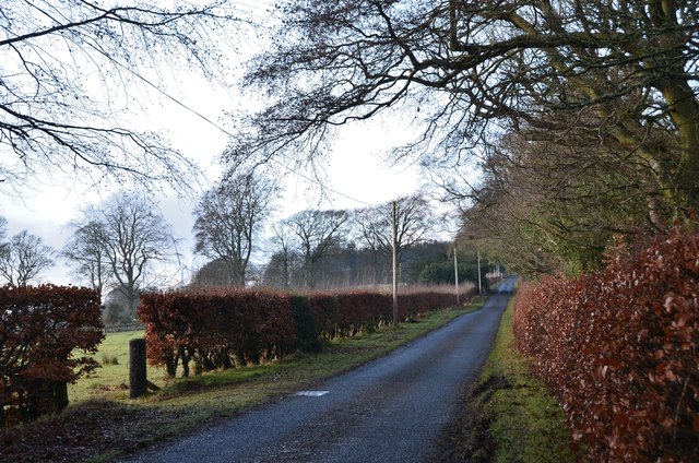
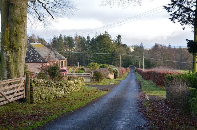
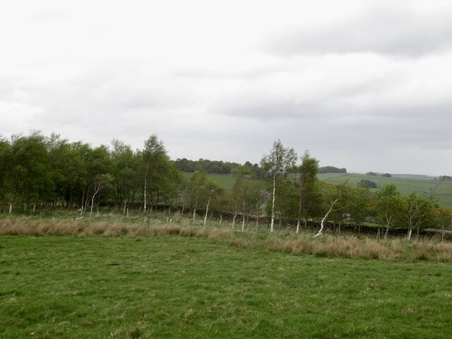
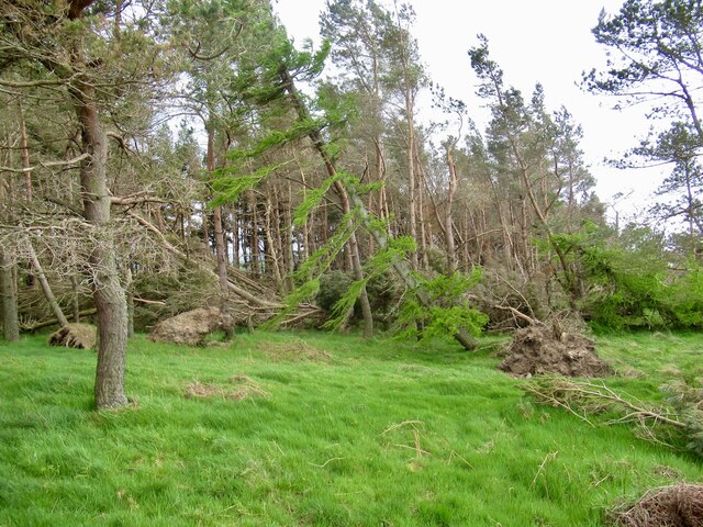
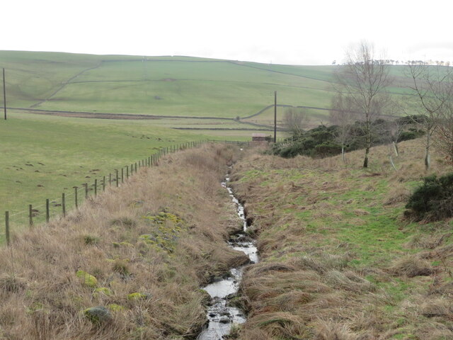
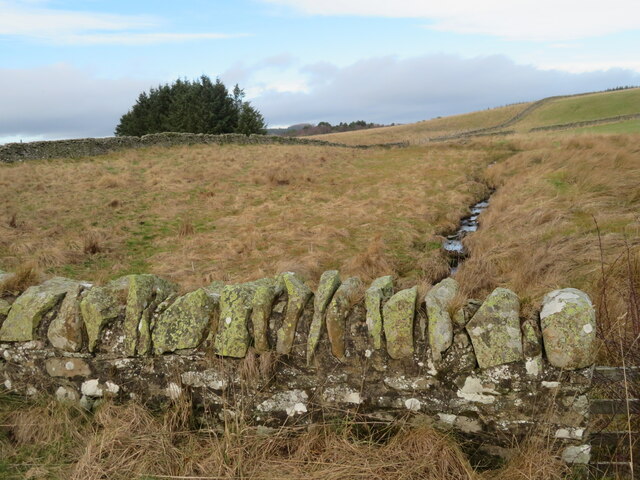
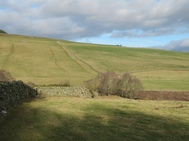
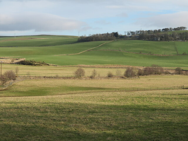
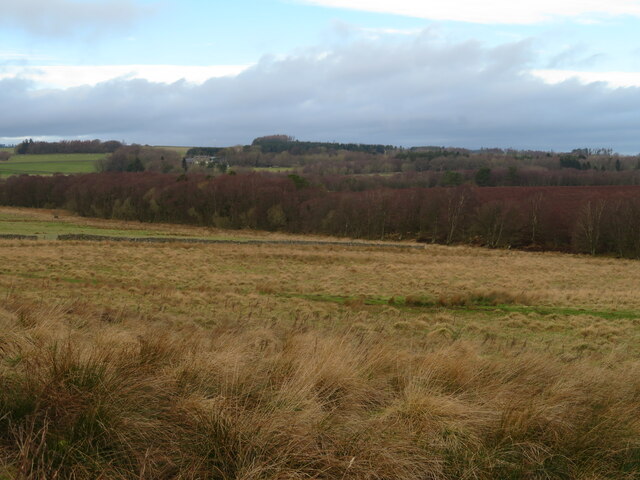
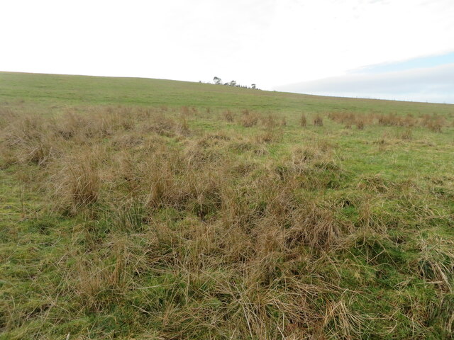
Blackcock Plantation is a sprawling forest located in the county of Roxburghshire, Scotland. Covering a vast area, it is renowned for its stunning natural beauty and diverse range of flora and fauna. The plantation is predominantly composed of dense woodlands, making it a haven for wildlife enthusiasts and nature lovers alike.

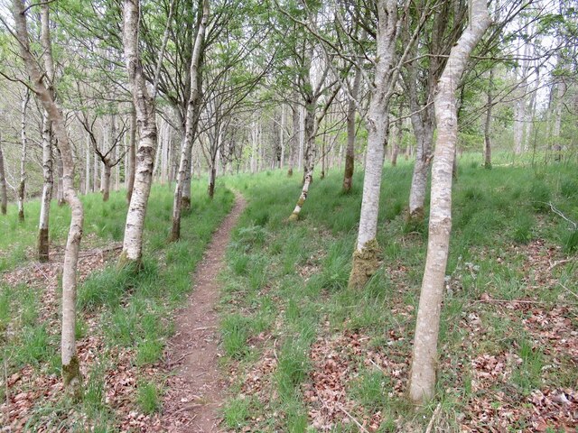
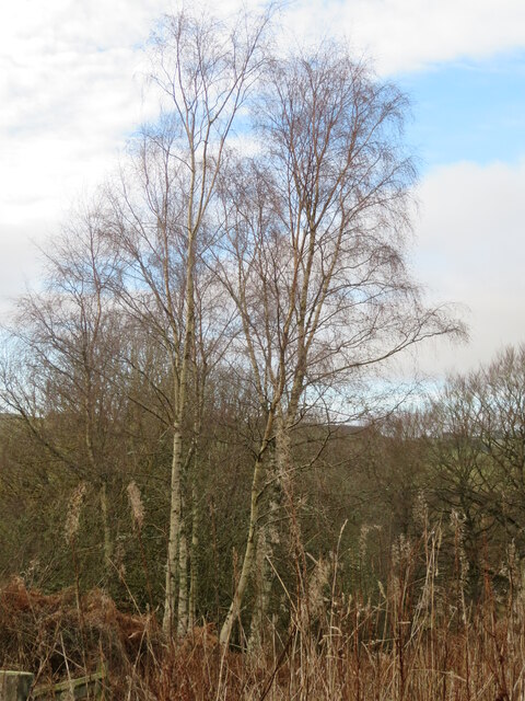
The forest features a variety of tree species, including oak, birch, and pine, which contribute to its rich and vibrant ecosystem. This diverse habitat supports a wide array of wildlife, such as red squirrels, roe deer, and numerous bird species, including the iconic black grouse after which the plantation is named.

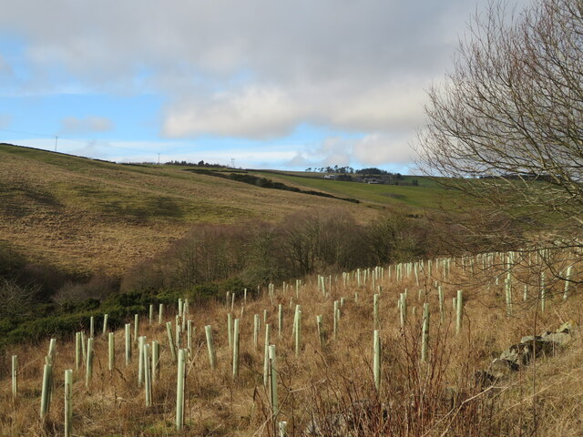
The Blackcock Plantation offers several well-maintained walking trails and paths, allowing visitors to explore the enchanting woodland at their own pace. The trails provide breathtaking views of the surrounding countryside and offer opportunities for birdwatching and wildlife spotting.

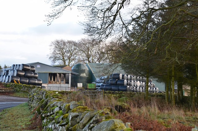
The plantation is managed by the local authorities, ensuring the preservation of its natural beauty and the conservation of its inhabitants. As a result, it has become a popular destination for outdoor activities, including hiking, cycling, and picnicking.

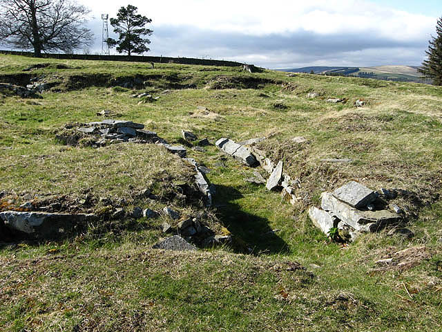
In addition to its natural attractions, Blackcock Plantation also holds historical significance. It is believed to have been used as a hunting ground for centuries, with evidence of ancient hunting lodges and gamekeepers' cottages still visible within its boundaries.

Overall, Blackcock Plantation in Roxburghshire is a captivating woodland that combines natural beauty, biodiversity, and historical value. Its accessibility and range of activities make it a must-visit destination for anyone seeking a serene and immersive experience in nature.

If you have any feedback on the listing, please let us know in the comments section below.

Blackcock Plantation Images

Images are sourced within 2km of 55.65969/-2.7807778 or Grid Reference NT5040. Thanks to Geograph Open Source API. All images are credited.

Road to Stow, Wooplaw The minor road through farmland bordering Longpark windfarm.
Road to Stow, Wooplaw
The minor road through farmland bordering Longpark windfarm.
Wooplaw farm The name comes from the Norse 'uplaw' meaning a shallow valley at the top of a hill (from the information board at the Community Woodland). It is certainly on top of a hill as the land here is around 310m.
Wooplaw farm
The name comes from the Norse 'uplaw' meaning a shallow valley at the top of a hill (from the information board at the Community Woodland). It is certainly on top of a hill as the land here is around 310m.
Road east of Wooplaw The road meets the Langlee to Lauder road about 1km E of here.
Road east of Wooplaw
The road meets the Langlee to Lauder road about 1km E of here.
Path, Gullet Wood
Path, Gullet Wood
Stripwood, Blackcock Hill
Windthrow, Blackcock Plantation After the stormy Winter of 2021/2022 there were a lot of trees strewn about on the ground. Hilltop plantations like this were particularly vulnerable.
Windthrow, Blackcock Plantation
After the stormy Winter of 2021/2022 there were a lot of trees strewn about on the ground. Hilltop plantations like this were particularly vulnerable.
Shooting range in an old quarry The Joint Services Pistol Club range at Colmslie. It has had a makeover since Richard Webb visited in 2006 <a href="https://www.geograph.org.uk/photo/114684">NT5040 : Quarry on the Allan Water</a>.
Shooting range in an old quarry
The Joint Services Pistol Club range at Colmslie. It has had a makeover since Richard Webb visited in 2006 NT5040 : Quarry on the Allan Water.
Trees by the Allan Water A fairly steep sided valley of the Allan Water a tributary of the River Tweed, which it joins at Langlee, near Tweedbank, with new planting on the east bank.
Trees by the Allan Water
A fairly steep sided valley of the Allan Water a tributary of the River Tweed, which it joins at Langlee, near Tweedbank, with new planting on the east bank.
Birch tree in Gullet Wood Part of the Wooplaw Community Woodland.
Birch tree in Gullet Wood
Part of the Wooplaw Community Woodland.
Farm buildings at Over Langshaw With Over Langshaw Farm ice cream dispenser, between the rightmost red doors.
Farm buildings at Over Langshaw
With Over Langshaw Farm ice cream dispenser, between the rightmost red doors.
Over Langshaw Farm Shop A novel use for a container.
Over Langshaw Farm Shop
A novel use for a container.
Telephone Exchange near Langshaw In what might be described as 'the middle of nowhere'.
Telephone Exchange near Langshaw
In what might be described as 'the middle of nowhere'.
The Moss Burn A tributary of the Allan Water, near Langshaw. The small building will be connected with the hydraulic ram on the burn, marked on the map.
The Moss Burn
A tributary of the Allan Water, near Langshaw. The small building will be connected with the hydraulic ram on the burn, marked on the map.
The Moss Burn Looking north from the bridge over. A tributary of the Allan Water.
The Moss Burn
Looking north from the bridge over. A tributary of the Allan Water.
Pastures near Allan Water Looking down to the Allan Water, and beyond.
Pastures near Allan Water
Looking down to the Allan Water, and beyond.
The valley of the Allan Water Looking east across the valley to Over Langshaw.
The valley of the Allan Water
Looking east across the valley to Over Langshaw.
Rough grassland near Threepwood With Birch woodland along the course of the Moss Burn.
Rough grassland near Threepwood
With Birch woodland along the course of the Moss Burn.
Rough grassland on Colmslie Hill Marginal land near Threepwood.
Rough grassland on Colmslie Hill
Marginal land near Threepwood.
Show me another place!

Blackcock Plantation is located at Grid Ref: NT5040 (Lat: 55.65969, Lng: -2.7807778)

Unitary Authority: The Scottish Borders

Police Authority: The Lothians and Scottish Borders

What 3 Words

///lifeboats.secondly.normal. Near Galashiels, Scottish Borders

Nearby Locations

Blackcock Plantation

Related Wikis

Allanshaws

Allanshaws is a place and farm off the B6362, in Lauderdale, by the Allan Water, in the parish of Melrose in the Scottish Borders area of Scotland, formerly...

Buckholm

Buckholm is a farm near to the A7, in the Scottish Borders, Galashiels area of Scotland. Places nearby include Abbotsford, the Bow Castle Broch, Clovenfords...

Galashiels Golf Club

Galashiels Golf Club is a golf course to the north of Galashiels, Scotland. The course was reduced from 18 holes to 9 holes in 2008. == History == Founded...

Galashiels

Galashiels (; Scots: Gallae, Scottish Gaelic: An Geal Àth) is a town in the Scottish Borders with a population of around 12,600. Its name is often colloquially...

Gala Water

The Gala Water (Lowland Scots: Gala Watter; Scottish Gaelic An Geal Ath) is a river in the Scottish Borders area of Scotland and a tributary of the River...

Bow Castle Broch

Bow Castle is the remains of an iron-age broch near the Gala Water, in the Scottish Borders area of Scotland, in the parish of Stow. It is a scheduled...

Galashiels railway station

Galashiels is a railway station on the Borders Railway, which runs between Edinburgh Waverley and Tweedbank. The station, situated 33 miles 22 chains...

Torwoodlee Broch

Torwoodlee Broch is the remains of an iron-age broch located near the town of Galashiels in the Scottish Borders. == Description == Torwoodlee Broch...

Nearby Amenities

Located within 500m of 55.65969,-2.7807778
Ele: 297
Natural: peak
Lat/Long: 55.660191/-2.7805019
Power: pole
Lat/Long: 55.6590143/-2.7734668
Power: pole
Lat/Long: 55.6597637/-2.7739121
Power: pole
Lat/Long: 55.6605347/-2.7743779
Power: pole
Lat/Long: 55.6613071/-2.7748793
Power: pole
Lat/Long: 55.6620696/-2.7753549
Power: pole
Lat/Long: 55.662523/-2.7756377
Power: pole
Lat/Long: 55.662289/-2.7763096
Power: pole
Lat/Long: 55.6625259/-2.7773378
Power: pole
Lat/Long: 55.6628116/-2.7785976
Power: pole
Lat/Long: 55.6630944/-2.7798269
Power: pole
Lat/Long: 55.6633029/-2.7812369
Power: pole
Lat/Long: 55.6634203/-2.782031
Power: pole
Lat/Long: 55.6636371/-2.7834308
Power: pole
Lat/Long: 55.663838/-2.7806719
The data included in this document is from www.openstreetmap.org. The data is made available under ODbL.

Have you been to Blackcock Plantation?

Leave your review of Blackcock Plantation below (or comments, questions and feedback).