Wood of Drumfergue

Wood, Forest in Aberdeenshire

Scotland

Wood of Drumfergue

The drive to Bogairdy
The drive to Bogairdy Credit: David Purchase

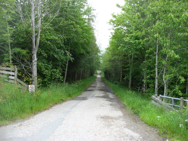
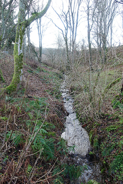
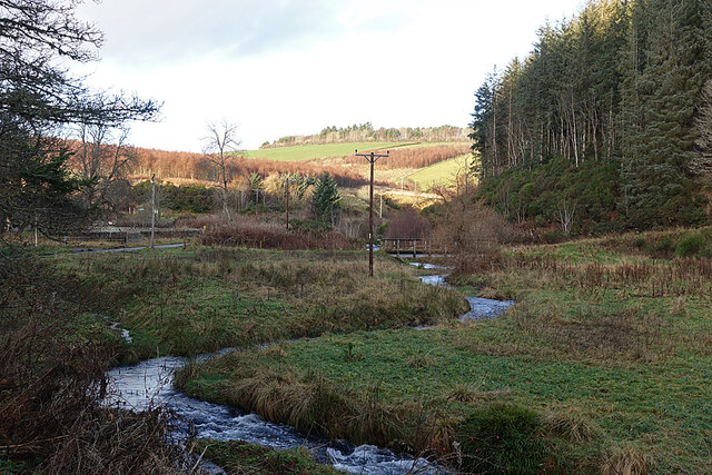
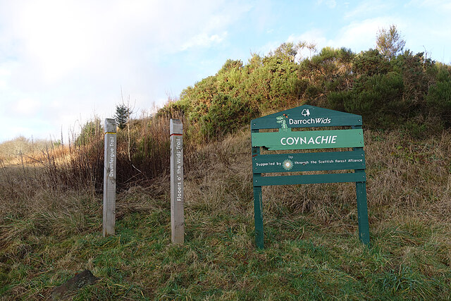
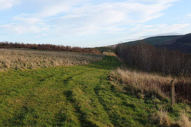
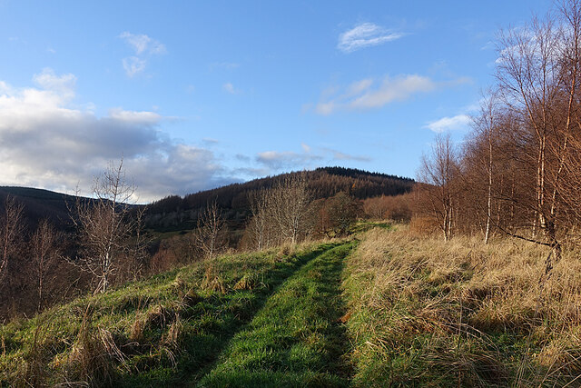
Wood of Drumfergue is a picturesque forest located in Aberdeenshire, Scotland. Covering an area of approximately 500 acres, it is a haven for nature lovers and outdoor enthusiasts. The wood is known for its diverse range of flora and fauna, making it a popular destination for wildlife enthusiasts and bird watchers.

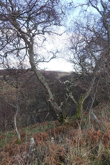
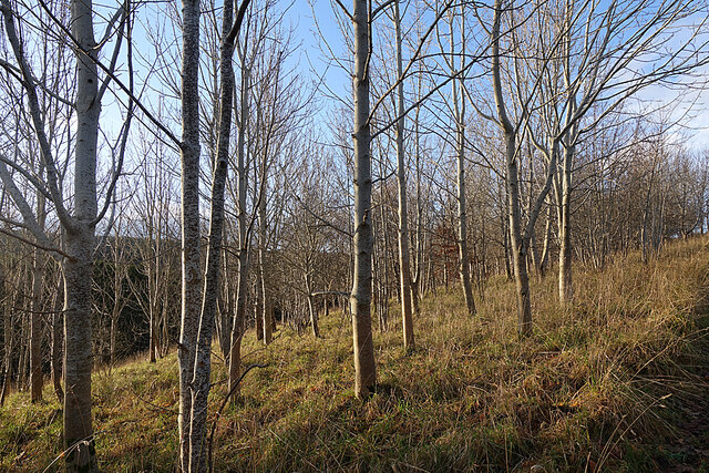
The Wood of Drumfergue is mainly composed of native tree species such as oak, birch, and pine, creating a beautiful and vibrant landscape throughout the seasons. The forest floor is carpeted with an array of colorful wildflowers, adding to its natural charm.

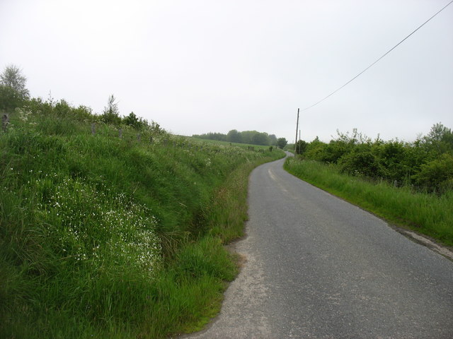
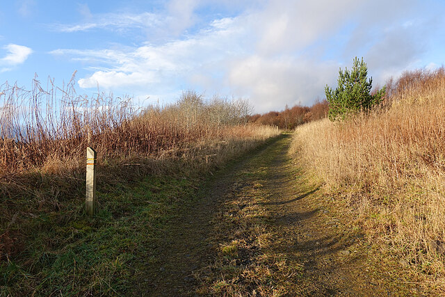
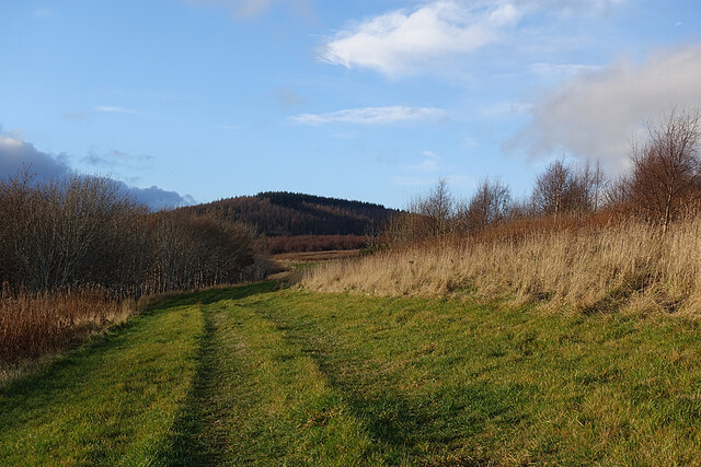
Visitors to the wood can enjoy a variety of activities such as walking, hiking, and cycling, as there are well-maintained trails that wind their way through the forest. These trails offer stunning views of the surrounding countryside and provide opportunities to spot wildlife such as red squirrels, deer, and a wide variety of bird species.

For those seeking a tranquil escape, the Wood of Drumfergue offers secluded picnic spots and peaceful areas to sit and enjoy the serenity of nature. The forest also has several designated camping areas for those who wish to spend the night under the starry sky.

Overall, the Wood of Drumfergue is a hidden gem in Aberdeenshire, offering a beautiful natural environment, diverse wildlife, and a range of activities for visitors to enjoy. It is a place where one can truly immerse themselves in the wonders of nature and experience the beauty of Scotland's woodlands.

If you have any feedback on the listing, please let us know in the comments section below.

Wood of Drumfergue Images

Images are sourced within 2km of 57.392533/-2.8700731 or Grid Reference NJ4733. Thanks to Geograph Open Source API. All images are credited.

The drive to Bogairdy
The lane in Strathbogie Goes as far as Tillathrowie (in <a href="https://www.geograph.org.uk/gridref/NJ4735">NJ4735</a>), where the lane comes to an end.
The lane in Strathbogie
Goes as far as Tillathrowie (in NJ4735), where the lane comes to an end.
Roadside Woodland Hoary-looking birches, complete with lichen and fungi, line the side of the road.
Roadside Woodland
Hoary-looking birches, complete with lichen and fungi, line the side of the road.
Cottages at Coynachie An old whitewashed cottage and a more recent one just off the road approaching Coynachie.
Cottages at Coynachie
An old whitewashed cottage and a more recent one just off the road approaching Coynachie.
Burn of Glack-en-tore One of those burns that are only seen in winter when the vegetation is mostly absent.
Burn of Glack-en-tore
One of those burns that are only seen in winter when the vegetation is mostly absent.
Ness Bogie The burn here is called the Ness Bogie. It eventaully joins the River Bogie just below the Nessbogie Bridge. Here, at Coynachie, is a footbridge beside a ford on the track leading to fields on Bar Hill.
Ness Bogie
The burn here is called the Ness Bogie. It eventaully joins the River Bogie just below the Nessbogie Bridge. Here, at Coynachie, is a footbridge beside a ford on the track leading to fields on Bar Hill.
Coynachie There's a fine example of a traditional stone farm house at Coynachie, but it's difficult to photograph because of trees. The farm sign features some of the livestock.
Coynachie
There's a fine example of a traditional stone farm house at Coynachie, but it's difficult to photograph because of trees. The farm sign features some of the livestock.
Driveway to Coynachie Farm House We assume that the wooden dolmen-like structure is to discourage obstructing the driveway by parking. There is a forestry car park only a few tens of metres away.
Driveway to Coynachie Farm House
We assume that the wooden dolmen-like structure is to discourage obstructing the driveway by parking. There is a forestry car park only a few tens of metres away.
Darroch Wids at Coynachie The sign is in the style of Forestry Commission signs, and bears the FC logo, but makes no reference to the FC. There are two walking loops, one called the Flooers o' the Wids Trail and the other the Drumfergue Trail. We opted for the Drumfergue Trail which parallels the road, because the road was still in the shade and we expected the trail to be in the sunshine, which it was.
Darroch Wids at Coynachie
The sign is in the style of Forestry Commission signs, and bears the FC logo, but makes no reference to the FC. There are two walking loops, one called the Flooers o' the Wids Trail and the other the Drumfergue Trail. We opted for the Drumfergue Trail which parallels the road, because the road was still in the shade and we expected the trail to be in the sunshine, which it was.
Trails on the Drum Two trails, one waymarked in red and one in yellow, follow the track through the strip of woodland on The Drum. The name is from Gaelic 'druim' which means a ridge, and that fits the topography perfectly.
Trails on the Drum
Two trails, one waymarked in red and one in yellow, follow the track through the strip of woodland on The Drum. The name is from Gaelic 'druim' which means a ridge, and that fits the topography perfectly.
Leafless Trees A plantation of young deciduous trees stands between the road and the path on The Drum. I think some are beech and ash but a summer visit would be needed to check.
Leafless Trees
A plantation of young deciduous trees stands between the road and the path on The Drum. I think some are beech and ash but a summer visit would be needed to check.
Grass Track The grass track on the south slope of The Drum, looking towards the Hill of Drumfergue.
Grass Track
The grass track on the south slope of The Drum, looking towards the Hill of Drumfergue.
Grass Track on The Drum On the right is the waymarker for the two short trails on The Drum.
Grass Track on The Drum
On the right is the waymarker for the two short trails on The Drum.
Trails on the Drum The trails on The Drum climb gently towards the forested Hill of Drumfergue.
Trails on the Drum
The trails on The Drum climb gently towards the forested Hill of Drumfergue.
Track on The Drum Looking back downhill on the waymarked grassy track. The road is in the shade below to the right, so we were glad to have come across the sunny off-road option.
Track on The Drum
Looking back downhill on the waymarked grassy track. The road is in the shade below to the right, so we were glad to have come across the sunny off-road option.
Woods on The Drum This looks like another stand of young deciduous trees planted beside the track as it approaches Drumfergue.
Woods on The Drum
This looks like another stand of young deciduous trees planted beside the track as it approaches Drumfergue.
Drumfergue This is the last farm before the end of the public road and the entrance to the forest. The grassy strip is the route of the waymarked Drumfergue Trail, which turns and descends back to the car park on the otehr side of The Drum.
Drumfergue
This is the last farm before the end of the public road and the entrance to the forest. The grassy strip is the route of the waymarked Drumfergue Trail, which turns and descends back to the car park on the otehr side of The Drum.
Sign at Drumfergue I thought I heard the screech of a falcon as we approached Drumfergue, and the sign, showing a falconer, seems to confirm that this was indeed what I heard.
Sign at Drumfergue
I thought I heard the screech of a falcon as we approached Drumfergue, and the sign, showing a falconer, seems to confirm that this was indeed what I heard.
Show me another place!

Wood of Drumfergue is located at Grid Ref: NJ4733 (Lat: 57.392533, Lng: -2.8700731)

Unitary Authority: Aberdeenshire

Police Authority: North East

What 3 Words

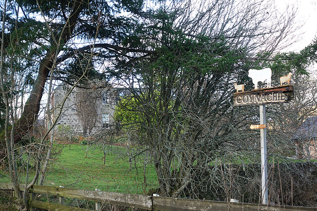
///stiletto.indicate.symphonic. Near Huntly, Aberdeenshire

Related Wikis

Kye Hill

Kye Hill is a hill by Huntly, Aberdeenshire, Scotland. It lies southwest of The Clashmach hill and is nearly the same height. There is a former limestone...

Strathbogie, Scotland

Strathbogie (Scottish Gaelic: Srath Bhalgaidh) is the valley of the River Bogie in Aberdeenshire, Scotland. It was formerly a lordship belonging to the...

Wormy Hillock Henge

Wormy Hillock Henge, also known as The Dragon's Grave, is a small henge in Aberdeenshire, Scotland. It is a Scheduled Ancient Monument located in the Clashindarroch...

Gartly

Gartly (Scots: Gairtlie, Scottish Gaelic: Gartaidh) is an inland hamlet in Aberdeenshire, Scotland. It is several miles south of the town of Huntly, and...

Nearby Amenities

Located within 500m of 57.392533,-2.8700731
Power: pole
Lat/Long: 57.3949732/-2.8770116
Power: pole
Lat/Long: 57.3944457/-2.8767764
Drumfergue
Name Gd: Druim a' Choirce
Place: isolated_dwelling
Lat/Long: 57.3939192/-2.8768201
The data included in this document is from www.openstreetmap.org. The data is made available under ODbL.

Have you been to Wood of Drumfergue?

Leave your review of Wood of Drumfergue below (or comments, questions and feedback).