Loch Plantation

Wood, Forest in Selkirkshire

Scotland

Loch Plantation

Rough grazing Hill pasture above Wester Alemoor.
Rough grazing Credit: Richard Webb

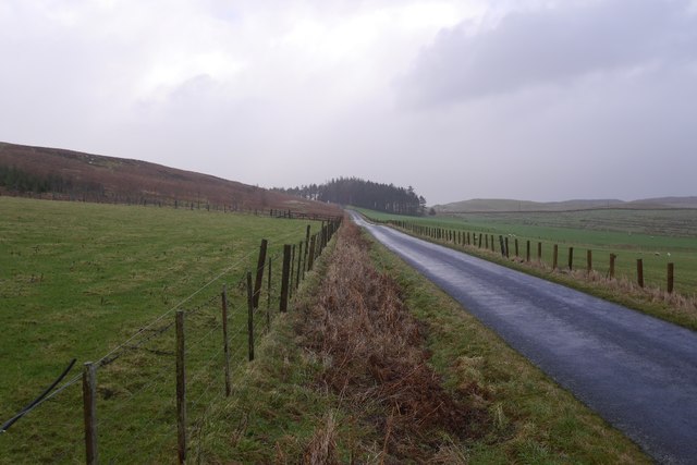
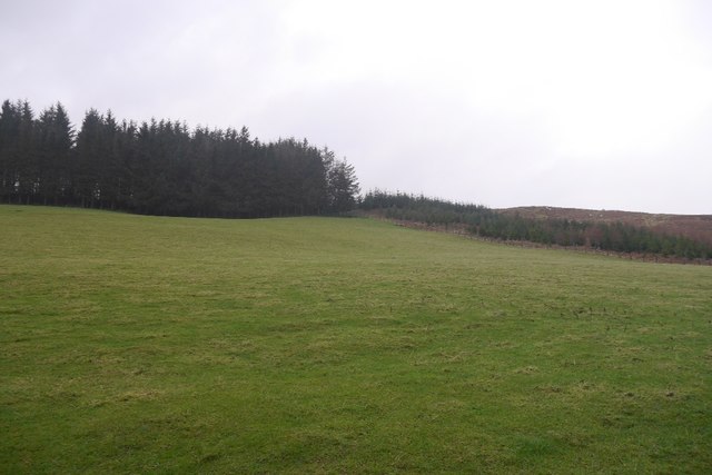
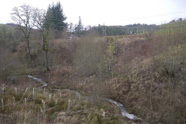
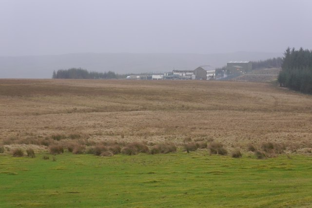
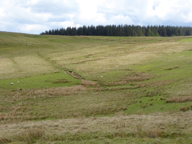
Loch Plantation, located in Selkirkshire, Scotland, is a stunning woodland area known for its natural beauty and diverse flora and fauna. Spanning over an expansive area, Loch Plantation is a prime example of a well-preserved forest ecosystem.

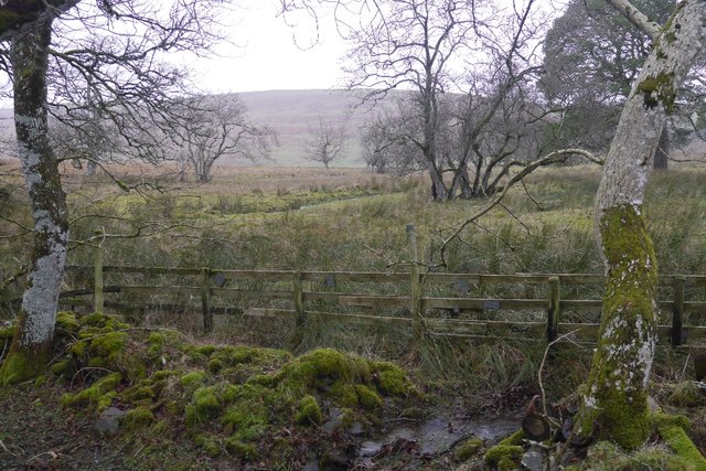
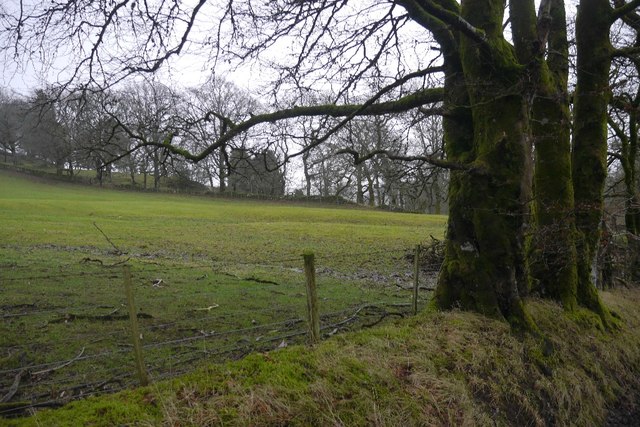
The plantation features a wide variety of tree species, including oak, pine, birch, and beech, which create a rich and vibrant canopy. The forest floor is covered in a lush carpet of mosses, ferns, and wildflowers, adding to the enchanting atmosphere of the woodland.

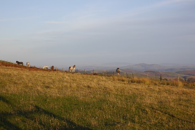
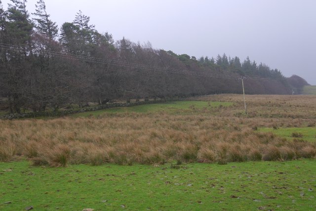
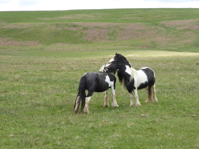
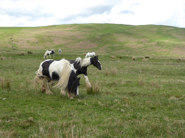
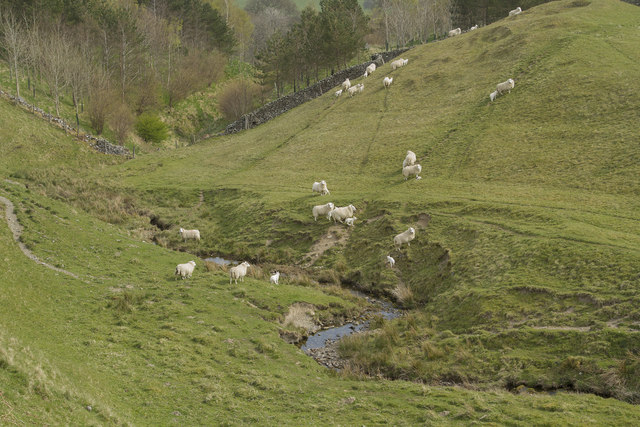
This picturesque landscape is home to an abundance of wildlife. Deer, foxes, and badgers roam freely among the trees, while birds such as woodpeckers, owls, and various songbirds fill the air with their melodic tunes. Loch Plantation also boasts several small lochs and streams, attracting a variety of water-loving creatures like ducks, herons, and otters.

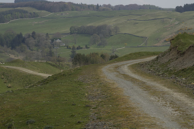
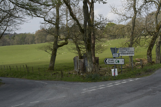
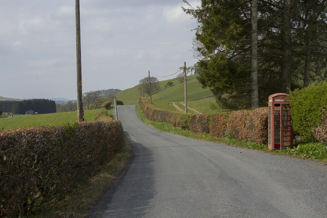
The plantation is a popular destination for outdoor enthusiasts and nature lovers. Visitors can explore the numerous walking trails that wind through the forest, offering breathtaking views of the surrounding countryside. The tranquil atmosphere and the opportunity to observe wildlife in its natural habitat make Loch Plantation an ideal spot for birdwatching and photography.

In addition to its natural beauty, Loch Plantation also holds historical significance. The area was once home to ancient settlements, and remnants of stone circles and burial sites can still be found within the woodland, adding an intriguing layer of mystery to the site.

Overall, Loch Plantation in Selkirkshire is a captivating destination that offers a unique blend of natural splendor and cultural heritage, making it a must-visit location for those seeking an immersive and enriching experience in the heart of Scotland.

If you have any feedback on the listing, please let us know in the comments section below.

Loch Plantation Images

Images are sourced within 2km of 55.428182/-2.9097878 or Grid Reference NT4215. Thanks to Geograph Open Source API. All images are credited.

Rough grazing Hill pasture above Wester Alemoor.
Rough grazing
Hill pasture above Wester Alemoor.
Ordnance Survey Flush Bracket G490 This can be found on the parapet wall of the road bridge at Howcleuch.
For more detail see : <span class="nowrap"><a title="http://www.bench-marks.org.uk/bm13078" rel="nofollow ugc noopener" href="http://www.bench-marks.org.uk/bm13078">Link</a><img style="margin-left:2px;" alt="External link" title="External link - shift click to open in new window" src="https://s1.geograph.org.uk/img/external.png" width="10" height="10"/></span>
Ordnance Survey Flush Bracket G490
This can be found on the parapet wall of the road bridge at Howcleuch. For more detail see : LinkExternal link
Road (B711) and Bridge at Howcleuchshiel Looking eastward.
Road (B711) and Bridge at Howcleuchshiel
Looking eastward.
Wet woodland, Roberton Scattered trees in marshy ground beside the road to Ashkirk.
Wet woodland, Roberton
Scattered trees in marshy ground beside the road to Ashkirk.
Roberton to Ashkirk road, Borthwickshiels
Young woodland, Borthwickshiels The woodland shown here <a href="https://www.geograph.org.uk/photo/913283">NT4316 : An enlarged wood, Borthwickshiels Horn</a> is becoming established. There are older trees on the left.
Young woodland, Borthwickshiels
The woodland shown here NT4316 : An enlarged wood, Borthwickshiels Horn is becoming established. There are older trees on the left.
Field, Howcleuchshiel
A damp pasture, Borthwickshiels
Glen Burn, Roberton
Glen Burn, Roberton
Waterworks, Borthwickshiels
Hillside above the Alemoor Reservoir The Parkhead Plantation can be seen at the top of the hill.
Hillside above the Alemoor Reservoir
The Parkhead Plantation can be seen at the top of the hill.
Just good friends Two horses on the hillside above Roberton.
Just good friends
Two horses on the hillside above Roberton.
Horses on the hillside above Roberton
The Reivers Path This path is well maintained. It has a stone surface and is good for walking and is also used by cyclists.
The Reivers Path
This path is well maintained. It has a stone surface and is good for walking and is also used by cyclists.
Sheep crossing a stream As soon as we appeared the sheep started to walk and run across the stream.
Sheep crossing a stream
As soon as we appeared the sheep started to walk and run across the stream.
New houses in Roberton Two stunning new houses in Roberton. As we look at them the left hand one is for sale. It is a large house with a lot of land and fishing rights so commands a good price.
New houses in Roberton
Two stunning new houses in Roberton. As we look at them the left hand one is for sale. It is a large house with a lot of land and fishing rights so commands a good price.
The road to Craik This is a single track road with passing places, hence the notice prohibiting parking in the Passing Places.
The road to Craik
This is a single track road with passing places, hence the notice prohibiting parking in the Passing Places.
A working Telephone Box The telephone box door does not close fully but the phone is in working order.
A working Telephone Box
The telephone box door does not close fully but the phone is in working order.
Show me another place!

Loch Plantation is located at Grid Ref: NT4215 (Lat: 55.428182, Lng: -2.9097878)

Unitary Authority: The Scottish Borders

Police Authority: The Lothians and Scottish Borders

What 3 Words

///pianists.legs.nerve. Near Hawick, Scottish Borders

Related Wikis

Roberton, Scottish Borders

Roberton is a small village in the Scottish Borders area of Scotland, on the B711 and near to the A7, 5 miles (8 kilometres) from Hawick, 22 mi (35 km...

Harden Castle

Harden Castle is a 16th century tower house, about 3.5 miles (5.6 km) west of Hawick, Scottish Borders. It is alternatively known as Harden House or Harden...

Alemoor Loch

Alemoor Loch, also known as Alemoor Reservoir, is a small reservoir in the Scottish Borders area of Scotland. It is situated on the Ale Water, 10 kilometres...

Burnfoot, Roberton

Burnfoot (Scottish Gaelic: Bun na h-Aibhne) is a hamlet in the Scottish Borders area of Scotland, close to Roberton, by the Borthwick Water. The nearest...

Nearby Amenities

Located within 500m of 55.428182,-2.9097878
Power: pole
Lat/Long: 55.4279383/-2.9173431
Power: pole
Lat/Long: 55.4276797/-2.9166015
Power: pole
Lat/Long: 55.427421/-2.9158264
Power: pole
Lat/Long: 55.4271127/-2.9149226
Power: pole
Lat/Long: 55.4268877/-2.9142969
Power: pole
Lat/Long: 55.4265078/-2.9132206
Power: pole
Lat/Long: 55.4263777/-2.9116653
Power: pole
Lat/Long: 55.4262681/-2.9101461
Power: pole
Lat/Long: 55.4261439/-2.9086165
Power: pole
Lat/Long: 55.4261074/-2.9081762
Power: pole
Lat/Long: 55.4260563/-2.9069505
Power: pole
Lat/Long: 55.4259438/-2.9044528
Barrier: cattle_grid
Lat/Long: 55.4263303/-2.9160135
The data included in this document is from www.openstreetmap.org. The data is made available under ODbL.

Have you been to Loch Plantation?

Leave your review of Loch Plantation below (or comments, questions and feedback).