Magazine Wood

Wood, Forest in Midlothian

Scotland

Magazine Wood

Turning for Blackcastle Several no through road signs, it only goes to the farm.
Turning for Blackcastle Credit: Richard Webb

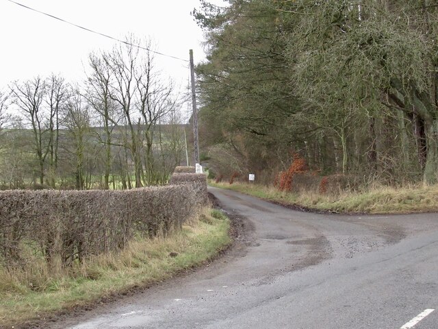
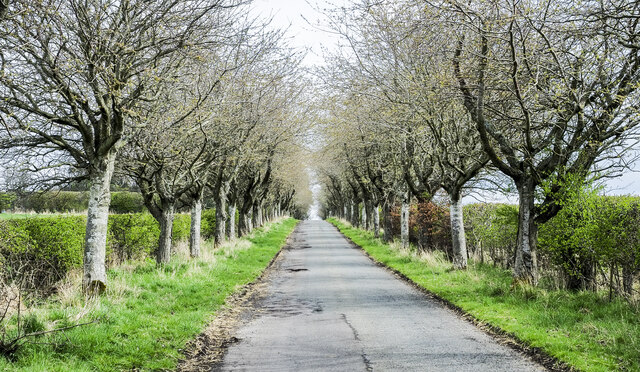
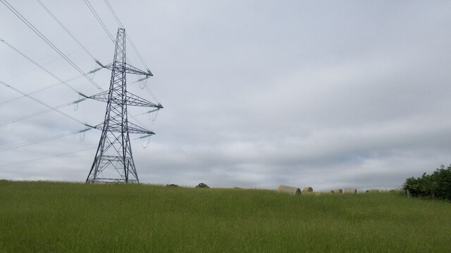
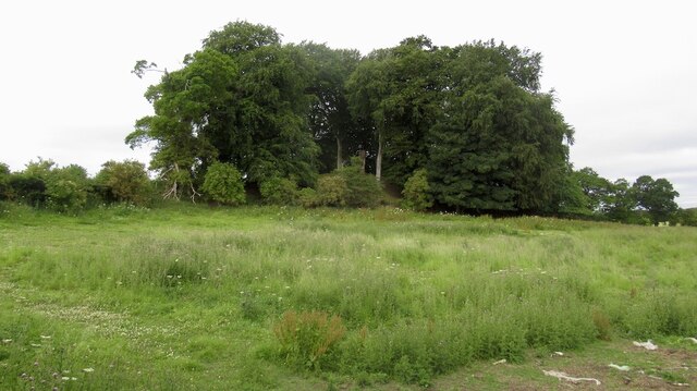
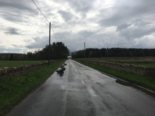
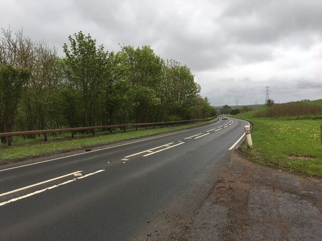
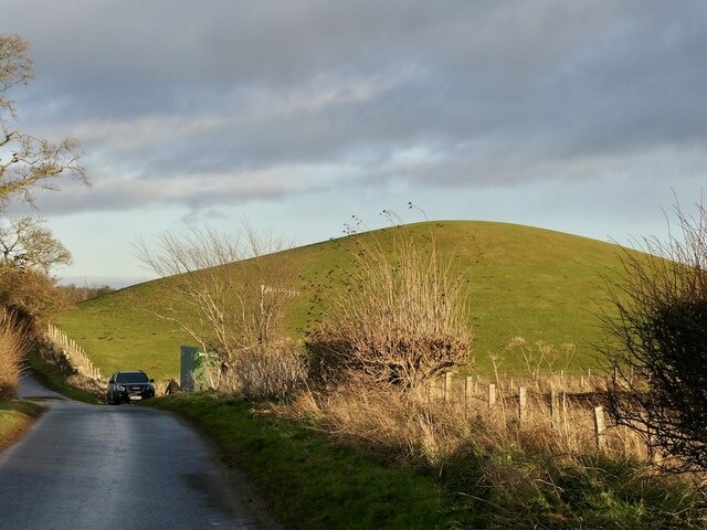
Magazine Wood is a picturesque forest located in Midlothian, Scotland. It is known for its stunning beauty and serene atmosphere, making it a popular destination for nature lovers and outdoor enthusiasts.

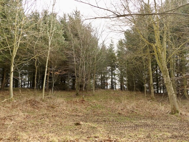
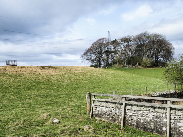
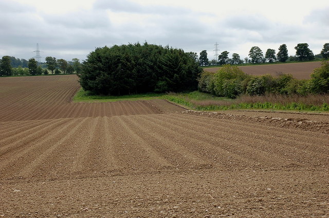
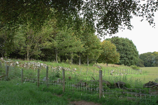
Covering an area of approximately 200 acres, Magazine Wood is abundant in diverse flora and fauna, offering visitors a glimpse into the region's natural biodiversity. The forest is primarily composed of mature deciduous trees, such as oak, beech, and birch, which create a vibrant and colorful landscape throughout the year. The forest floor is typically carpeted with mosses, ferns, and wildflowers, adding to its enchanting appeal.

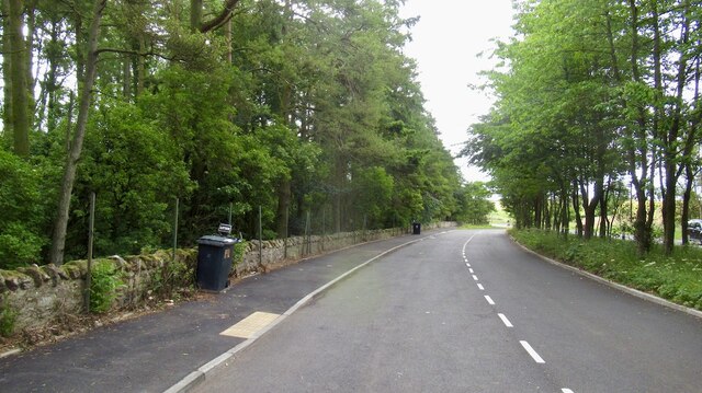
The wood is crisscrossed by a network of well-maintained trails, providing ample opportunities for walking, hiking, and cycling. These paths wind through the forest, offering visitors breathtaking views of the surrounding countryside and glimpses of local wildlife, including deer, rabbits, and various bird species.

In addition to its natural beauty, Magazine Wood also holds historical significance. It was named after a former munitions storage facility that was located in the area during World War II. Though the storage facility no longer exists, remnants of its presence can still be seen, adding an interesting historical element to the forest.

Magazine Wood is a haven for those seeking tranquility and a connection with nature. With its captivating scenery, abundant wildlife, and rich history, it is a must-visit destination for anyone exploring the Midlothian region.

If you have any feedback on the listing, please let us know in the comments section below.

Magazine Wood Images

Images are sourced within 2km of 55.852646/-2.9384032 or Grid Reference NT4162. Thanks to Geograph Open Source API. All images are credited.

Turning for Blackcastle Several no through road signs, it only goes to the farm.
Turning for Blackcastle
Several no through road signs, it only goes to the farm.
Summit area, Dodridge Law A stripwood.
Summit area, Dodridge Law
A stripwood.
North side of Dodridge Law
Costerton Mains Taken 16 years after <a href="https://www.geograph.org.uk/photo/82964">NT4362 : Costerton Mains</a>.
Costerton Mains
Taken 16 years after NT4362 : Costerton Mains.
Tree-lined road near to A68 A minor road heading towards Whitburgh Mains Farm on the north-east side of the A68 close to Pathhead.
Tree-lined road near to A68
A minor road heading towards Whitburgh Mains Farm on the north-east side of the A68 close to Pathhead.
Clump of trees on south-west side of A68 Trees close to the A68, south-east of Pathhead.
Clump of trees on south-west side of A68
Trees close to the A68, south-east of Pathhead.
Minor road passing Old Chrighton Dean Cottage The road is close to the A68 and soon joins it in the direction of view. The cottage is named on OS maps with its name spelled without the first 'g'; the spelling used on the property's gate is used here.
Minor road passing Old Chrighton Dean Cottage
The road is close to the A68 and soon joins it in the direction of view. The cottage is named on OS maps with its name spelled without the first 'g'; the spelling used on the property's gate is used here.
A68 layby, Magazine Wood Taken shortly before a high fence was erected between wood and road.
A68 layby, Magazine Wood
Taken shortly before a high fence was erected between wood and road.
Power line near Hope Line from Cockenzie southwards.
Power line near Hope
Line from Cockenzie southwards.
Woodland, Hope View from the A68.
Woodland, Hope
View from the A68.
Junction of the B6458 and A68
B6458 near Saughland
A68 south of Pathhead
Power line, Crichton Serving Galashiels
Power line, Crichton
Serving Galashiels
Crow Law A striking small hill near Crichton
Crow Law
A striking small hill near Crichton
Ploughed field near Loanhead In the farming country of the Midlothian / East Lothian border.
Ploughed field near Loanhead
In the farming country of the Midlothian / East Lothian border.
Roman fort, Longfaugh The SE boundary of this sizeable fort in farmland W of Longfaugh. 

The remains of the fort are two roughly circular concentric earth ramparts over 100m diameter overall, fenced off from the adjacent fields with trees planted inside the fence. It is thought to have been a Roman fort; around 1785 12 Roman coins were found probably from this site. For more details, see <span class="nowrap"><a title="http://www.scotlandsplaces.gov.uk/search_item/index.php?service=RCAHMS&id=54796" rel="nofollow ugc noopener" href="http://www.scotlandsplaces.gov.uk/search_item/index.php?service=RCAHMS&id=54796">Link</a><img style="margin-left:2px;" alt="External link" title="External link - shift click to open in new window" src="https://s1.geograph.org.uk/img/external.png" width="10" height="10"/></span>
Roman fort, Longfaugh
The SE boundary of this sizeable fort in farmland W of Longfaugh. The remains of the fort are two roughly circular concentric earth ramparts over 100m diameter overall, fenced off from the adjacent fields with trees planted inside the fence. It is thought to have been a Roman fort; around 1785 12 Roman coins were found probably from this site. For more details, see LinkExternal link
Show me another place!

Magazine Wood is located at Grid Ref: NT4162 (Lat: 55.852646, Lng: -2.9384032)

Unitary Authority: Midlothian

Police Authority: The Lothians and Scottish Borders

What 3 Words

///grumble.iteration.trades. Near Pencaitland, East Lothian

Related Wikis

Pathhead, Midlothian

Pathhead village is a conservation area in Midlothian, Scotland. == Location == Pathhead is located around 4 miles (6.4 km) south east of Dalkeith and...

Crichton, Midlothian

Crichton is a small village and civil parish in Midlothian, Scotland, around 2 miles (3 km) south of Pathhead and the same distance east of Gorebridge...

Peaston

Peaston is a small settlement on the B6371 road in the parish of Ormiston in East Lothian, Scotland, about 14 miles (23 km) south-east of Edinburgh, 7...

Vogrie Country Park

Vogrie Country Park in Scotland is managed by Midlothian Council. It consists of a woodland estate surrounding the Victorian Vogrie House. It is located...

Vogrie House

Vogrie House forms the centrepiece of Vogrie Country Park in Midlothian. It was built for James Dewar and his family in 1876 by Andrew Heiton, the town...

Crichton Collegiate Church

Crichton Collegiate Church is situated about 0.6 miles (0.97 km) south-west of the hamlet of Crichton in Midlothian, Scotland. == Origins and Pre-Reformation... ==
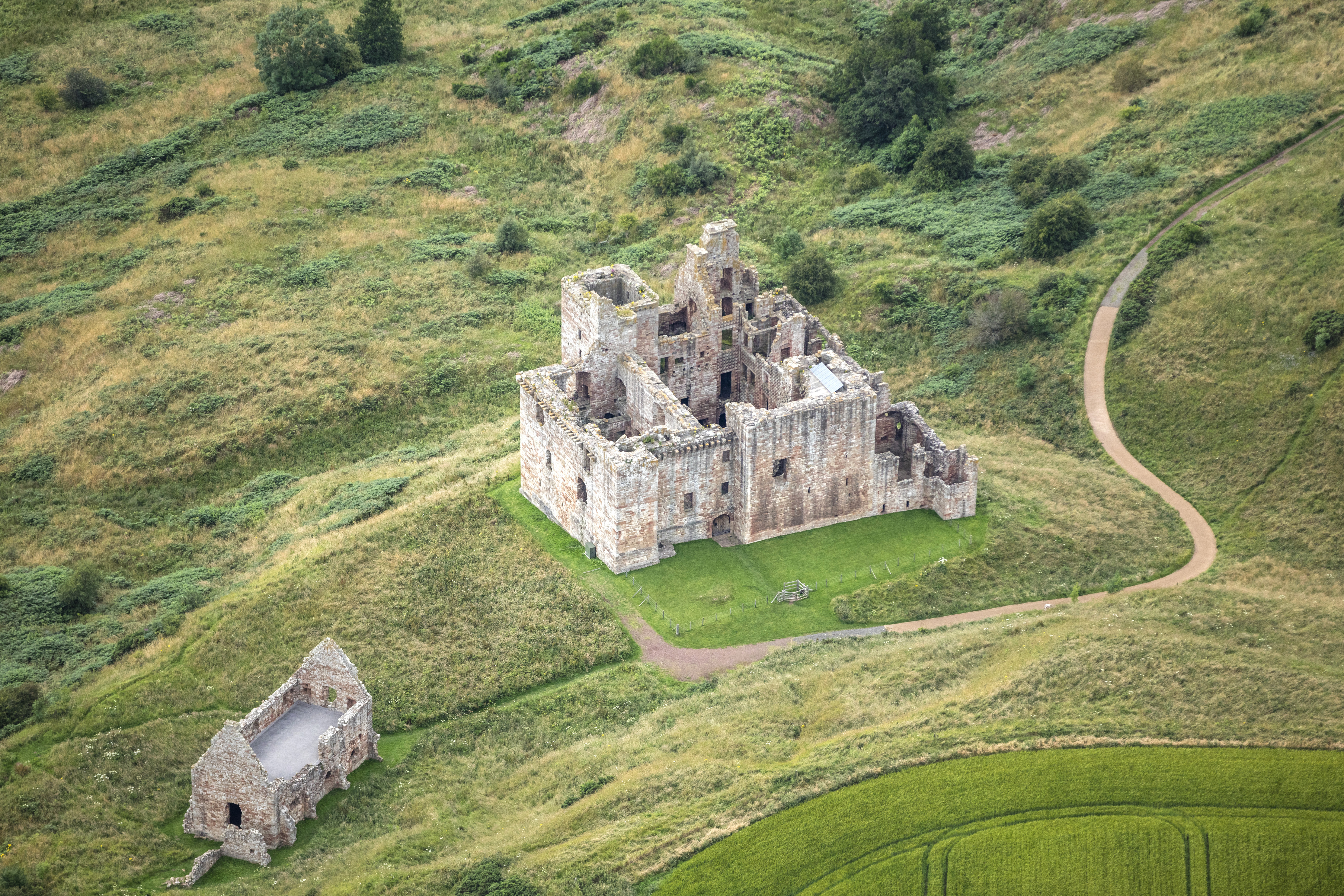
Crichton Castle

Crichton Castle is a ruined castle near the village of Crichton in Midlothian, Scotland. It is situated at the head of the River Tyne, 2 miles (3.2 km...

Cakemuir Castle

Cakemuir Castle is an historic house situated 4 miles (6.4 km) southeast of Pathhead, in the Lammermuir Hills, Midlothian, Scotland. The name may be connected...

Nearby Amenities

Located within 500m of 55.852646,-2.9384032
Design: barrel
Power: tower
Lat/Long: 55.8520849/-2.9447127
Design: barrel
Power: tower
Lat/Long: 55.848854/-2.9424903
Magazine
Place: locality
Lat/Long: 55.8536725/-2.9436037
Design: barrel
Power: tower
Lat/Long: 55.8544262/-2.9416867
Design: barrel
Power: tower
Lat/Long: 55.8566076/-2.9387544
Speed Camera
Source: survey
Lat/Long: 55.8491432/-2.9365798
Bus Stop
Crichton House Road End
Bus: yes
Local Ref: at
Naptan AtcoCode: 6280000062
Naptan Bearing: NW
Naptan CommonName: Crichton House Road End
Naptan Indicator: at
Naptan Landmark: Crichton House Road End
Naptan NaptanCode: 64327962
Naptan Street: A68
Naptan Verified: yes
Public Transport: platform
Ref: 6280000062
Source: NaPTAN
Lat/Long: 55.8510191/-2.9412969
Bus Stop
Crichton House Road End
Bus: yes
Local Ref: opp
Naptan AtcoCode: 6280000063
Naptan Bearing: SE
Naptan CommonName: Crichton House Road End
Naptan Indicator: opp
Naptan Landmark: Crichton House Road End
Naptan NaptanCode: 64326842
Naptan Street: A68
Naptan Verified: yes
Public Transport: platform
Ref: 6280000063
Source: NaPTAN
Lat/Long: 55.8510868/-2.941194
The data included in this document is from www.openstreetmap.org. The data is made available under ODbL.

Have you been to Magazine Wood?

Leave your review of Magazine Wood below (or comments, questions and feedback).