Shiel Moss

Wood, Forest in Dumfriesshire

Scotland

Shiel Moss

Clearfell, Shaw Rig
Clearfell, Shaw Rig Credit: Richard Webb

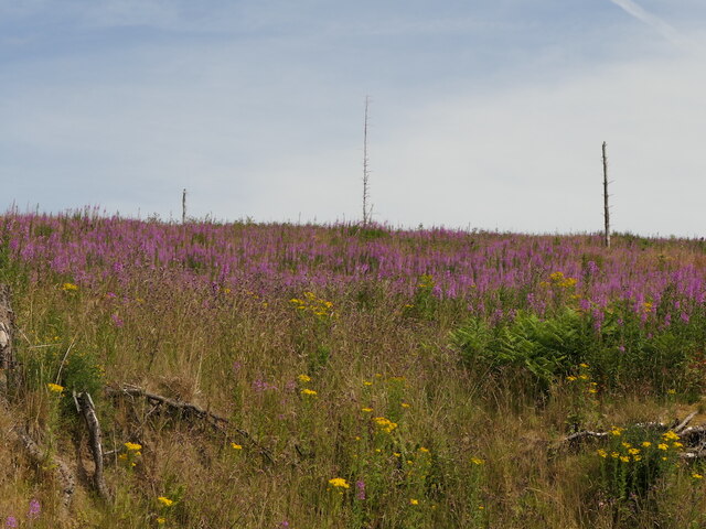
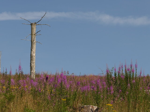
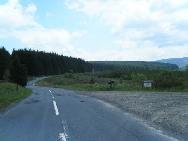
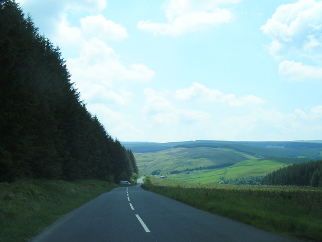
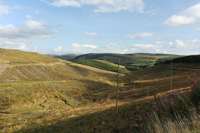
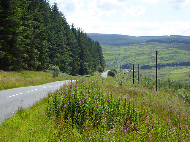
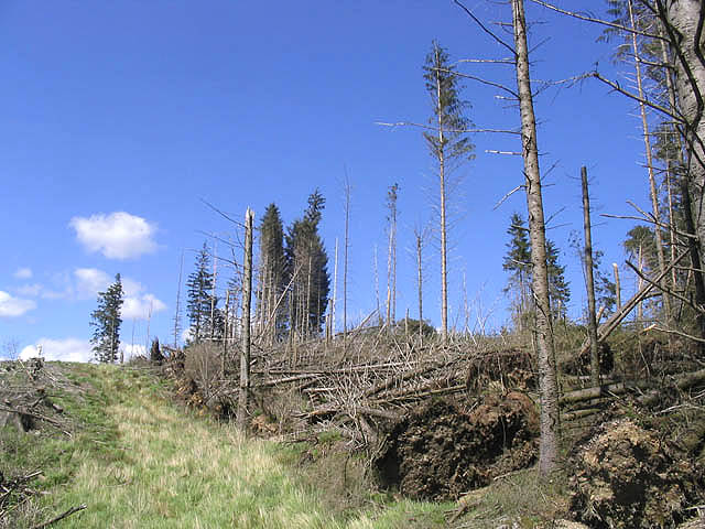
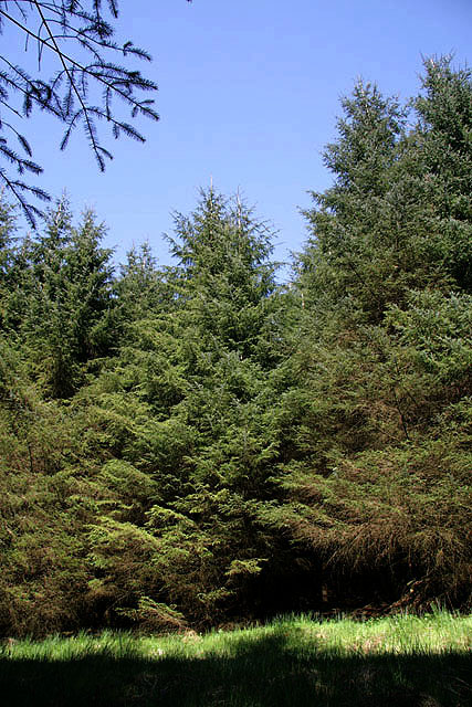
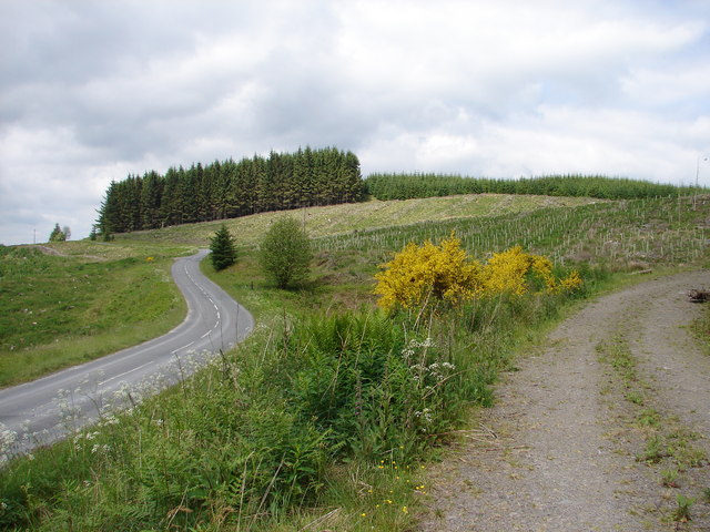
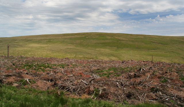
Shiel Moss is a small woodland area located in Dumfriesshire, Scotland. Situated near the village of Wood, it is known for its picturesque forest landscape and tranquil atmosphere. The woodland covers an area of approximately 200 acres and is a haven for nature enthusiasts and walkers alike.

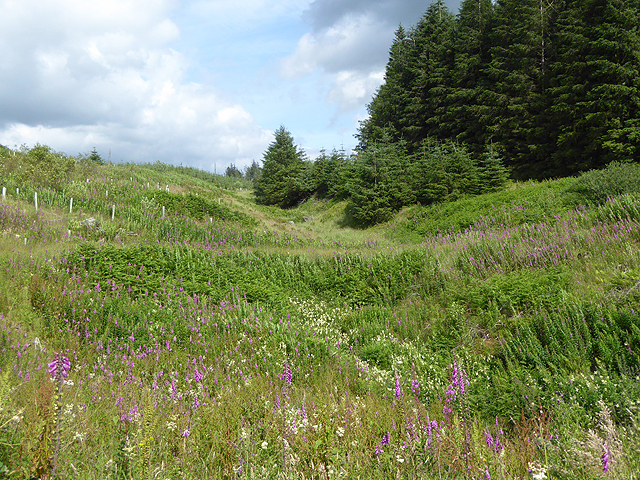
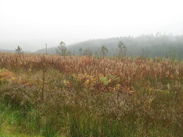
The forest is predominantly comprised of native tree species such as oak, birch, and pine, creating a diverse and vibrant ecosystem. The lush undergrowth is home to a variety of flora and fauna, including bluebells, mosses, and ferns, as well as small mammals and numerous bird species.

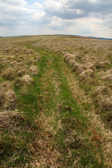
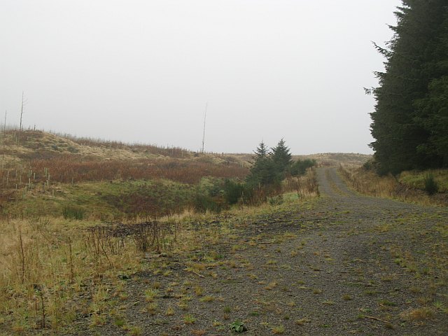
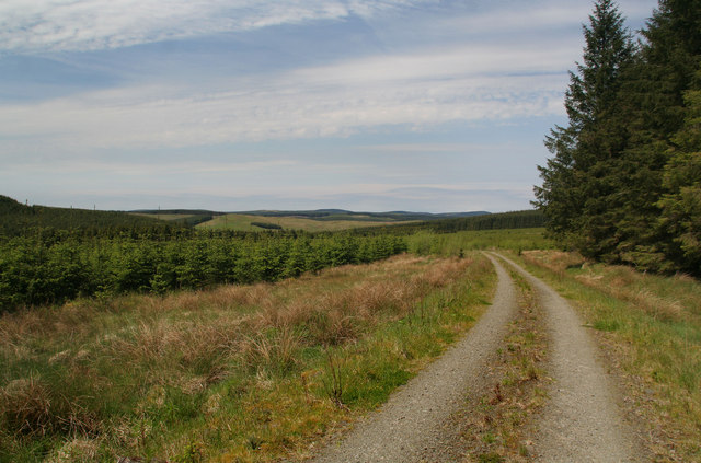
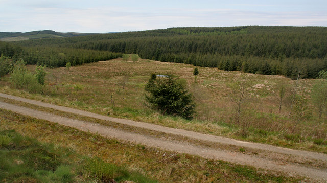
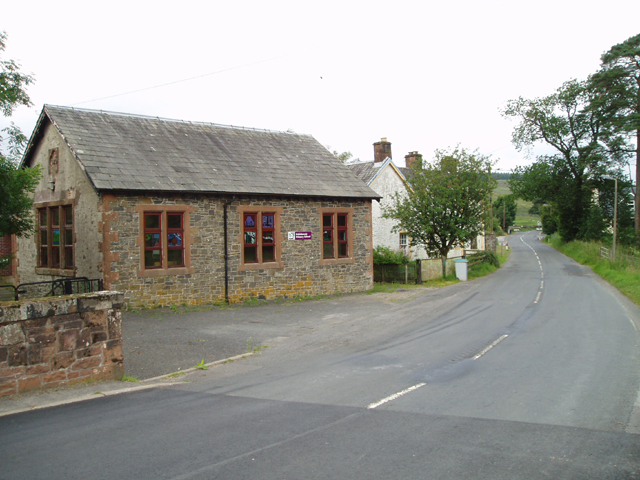
Visitors to Shiel Moss can explore the area through a network of well-maintained trails and footpaths, providing access to the heart of the woodland. These pathways lead through enchanting groves and beside babbling streams, offering opportunities for peaceful walks and wildlife spotting.

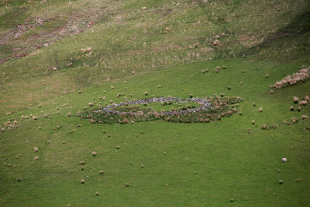
The forest also boasts a rich history, with traces of ancient settlements and archaeological features scattered throughout the area. Ruins of old buildings and remnants of stone walls can be discovered, providing a glimpse into the past and adding to the allure of Shiel Moss.

Overall, Shiel Moss in Dumfriesshire offers a serene and captivating woodland experience. With its diverse flora and fauna, well-maintained trails, and historical remnants, it is a place of natural beauty and cultural significance, providing a peaceful retreat for visitors to enjoy.

If you have any feedback on the listing, please let us know in the comments section below.

Shiel Moss Images

Images are sourced within 2km of 55.243389/-3.1402304 or Grid Reference NY2794. Thanks to Geograph Open Source API. All images are credited.

Clearfell, Shaw Rig
Clearfell, Shaw Rig
Clearfell, Shaw Rig
Clearfell, Shaw Rig
B709 south of Toothope Hill
B709 southbound near Shaw Rig
Pine Clearing
Pine Clearing
The road down Eskdale The B709 here takes a short cut over the hill by-passing the big bend in the River Esk.
The road down Eskdale
The B709 here takes a short cut over the hill by-passing the big bend in the River Esk.
Valley of the Bankhead Burn A small burn, tributary of the River Esk, near Toothope Hill. Foxgloves in the foreground; some young trees protected by Tuley tubes beyond.
Valley of the Bankhead Burn
A small burn, tributary of the River Esk, near Toothope Hill. Foxgloves in the foreground; some young trees protected by Tuley tubes beyond.
Forestry clear fell area
Wind damaged trees Uprooted trees on Toothope Hill.
Wind damaged trees
Uprooted trees on Toothope Hill.
Shaw Rig Plantation Viewed from the southwest side of an overgrown forestry road at the corner of the square.
Shaw Rig Plantation
Viewed from the southwest side of an overgrown forestry road at the corner of the square.
A grass track on Hog Hill The track is a great help for walking through this rough grazing terrain.
A grass track on Hog Hill
The track is a great help for walking through this rough grazing terrain.
Toothope Hill View westward from a forestry track (part of the Castle O'er Forest) of the B709 Langholm-Eskdalemuir road making its way around Toothope Hill.
Toothope Hill
View westward from a forestry track (part of the Castle O'er Forest) of the B709 Langholm-Eskdalemuir road making its way around Toothope Hill.
Head of the Bankhead Burn A misty morning in Eskdale. Taken after finding out that I had left my pump at home, and before choosing a hopefully not too Sitka infested walking alternative.
A block that has been replanted with the usual amenity strip around the outside that fools no one.
Head of the Bankhead Burn
A misty morning in Eskdale. Taken after finding out that I had left my pump at home, and before choosing a hopefully not too Sitka infested walking alternative. A block that has been replanted with the usual amenity strip around the outside that fools no one.
Forest road A short logging road, currently inactive and blocked by logs.  Probably saw active service when the block on the left was harvested.
Forest road
A short logging road, currently inactive and blocked by logs. Probably saw active service when the block on the left was harvested.
Rennald Burn Forest track above Renald Burn.
Rennald Burn
Forest track above Renald Burn.
Allengill Clearing in the forest alongside Allengill Burn.
Allengill
Clearing in the forest alongside Allengill Burn.
Westerker Rig Sheepfold on the side of Westerker Rig.
Westerker Rig
Sheepfold on the side of Westerker Rig.
Westerker Rig Looking across Shiel Burn towards the hill above Westerker Rigg.
Westerker Rig
Looking across Shiel Burn towards the hill above Westerker Rigg.
Show me another place!

Shiel Moss is located at Grid Ref: NY2794 (Lat: 55.243389, Lng: -3.1402304)

Unitary Authority: Dumfries and Galloway

Police Authority: Dumfries and Galloway

What 3 Words

///refreshed.notebook.croak. Near Bentpath, Dumfries & Galloway

Nearby Locations

Shiel Moss

Related Wikis

Loupin Stanes

The Loupin Stanes (grid reference NY25709663) is a stone circle near Eskdalemuir, Dumfries and Galloway. Oval in shape, it consists of twelve stones set...

Girdle Stanes

The Girdle Stanes (grid reference NY 25351 96153) is a stone circle near Eskdalemuir, Dumfries and Galloway. The western portion of the circle has been...

Eskdalemuir

Eskdalemuir is a civil parish and small village in Dumfries and Galloway, Scotland, with a population of 265. It is around 10 miles (16 km) north-west...

Holm, Inverness

Holm is a small residential area in the south of the city of Inverness, Scotland. The area lies east of the River Ness. The most prominent structure in...

Have you been to Shiel Moss?

Leave your review of Shiel Moss below (or comments, questions and feedback).