Limekilns Wood

Wood, Forest in Morayshire

Scotland

Limekilns Wood

A96, Bridge of Findhorn A very busy road crossing the Findhorn near Forres.
A96, Bridge of Findhorn Credit: Richard Webb

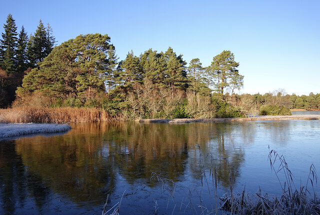
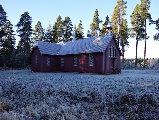
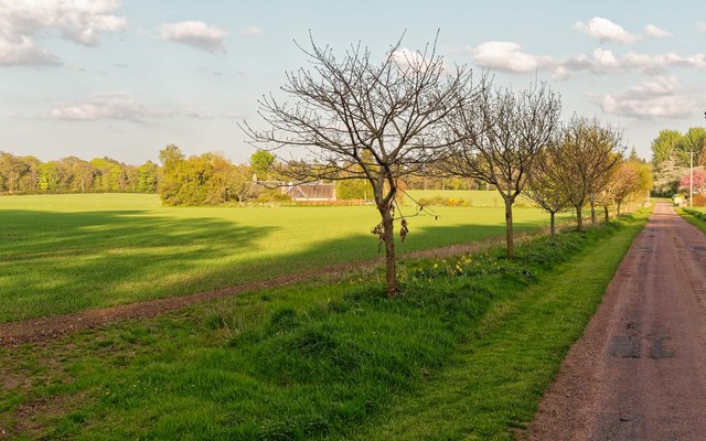
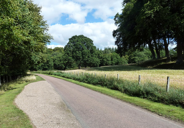
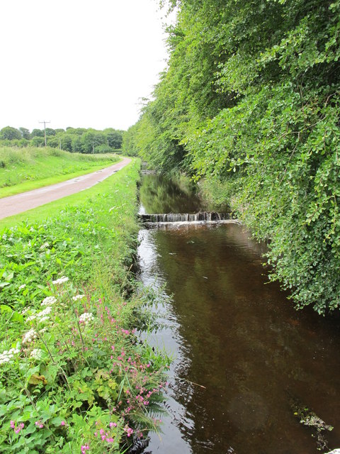
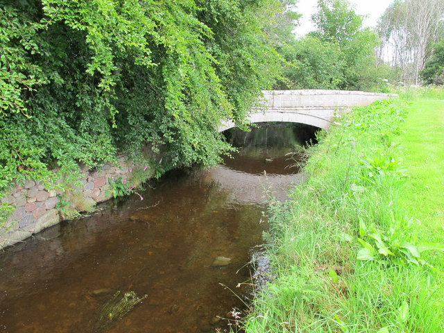
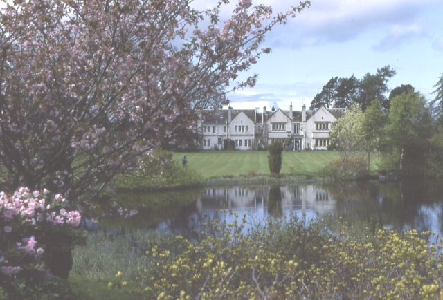
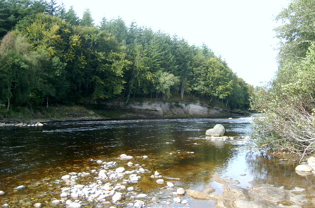
Limekilns Wood is a picturesque forest located in Morayshire, Scotland. Spanning over a vast area, this woodland is known for its diverse flora and fauna, making it a haven for nature lovers and outdoor enthusiasts. The wood is situated in a tranquil setting, surrounded by rolling hills and offering stunning views of the surrounding countryside.

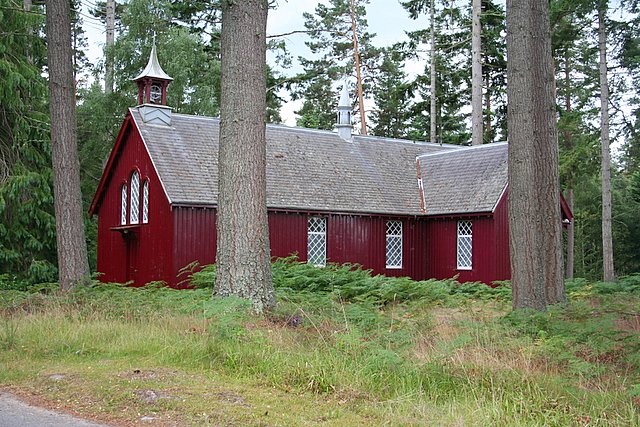
The forest is characterized by a mix of deciduous and coniferous trees, including oak, birch, pine, and spruce. These trees provide a variety of habitats for a wide range of wildlife, such as deer, red squirrels, and numerous bird species. The wood is particularly renowned for its population of crossbills, which can often be spotted feeding on the cones of the pine trees.

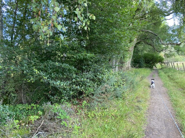
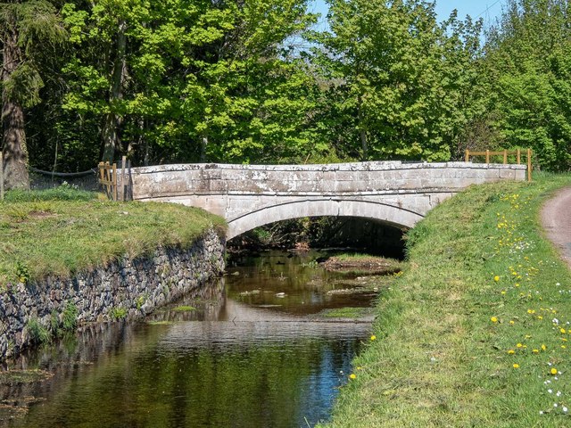
Limekilns Wood is crisscrossed by several well-maintained trails, making it an ideal location for walking, hiking, and nature exploration. These paths offer visitors the opportunity to immerse themselves in the natural beauty of the forest, with its towering trees, vibrant wildflowers, and bubbling streams.

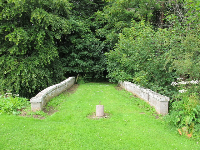
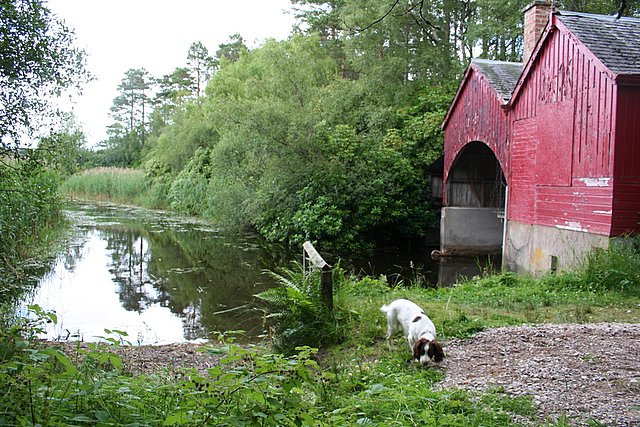
In addition to its natural splendor, Limekilns Wood also holds historical significance. The name of the woodland is derived from the limekilns that were once used to produce lime for agricultural purposes. These kilns, now in ruins, serve as a reminder of the area's industrial past.

Overall, Limekilns Wood is a captivating destination that combines scenic beauty, biodiversity, and a touch of history. Whether you are seeking a peaceful stroll, birdwatching, or a memorable picnic spot, this enchanting woodland offers something for everyone to enjoy.

If you have any feedback on the listing, please let us know in the comments section below.

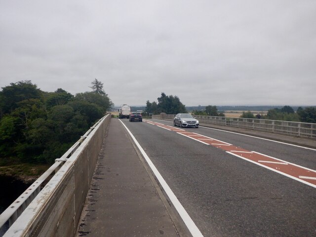
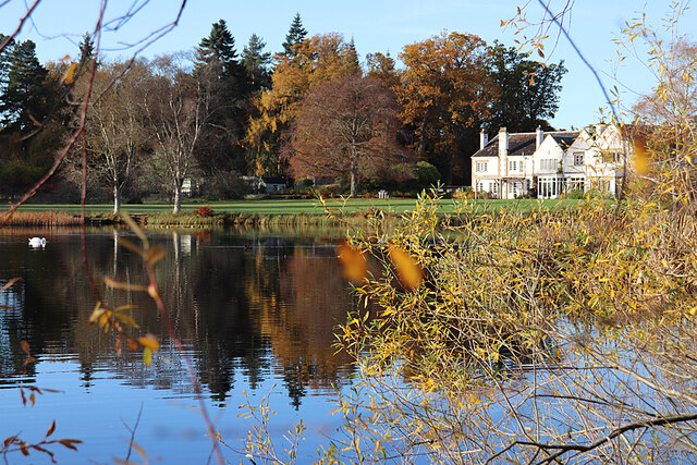
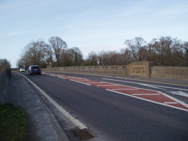
Limekilns Wood Images

Images are sourced within 2km of 57.584452/-3.650093 or Grid Reference NJ0156. Thanks to Geograph Open Source API. All images are credited.

A96, Bridge of Findhorn A very busy road crossing the Findhorn near Forres.
A96, Bridge of Findhorn
A very busy road crossing the Findhorn near Forres.
Altyre House and Lake From the bank beside the road. There are few gaps in the vegetation, making it difficult to photograph well.
Altyre House and Lake
From the bank beside the road. There are few gaps in the vegetation, making it difficult to photograph well.
Section of path around Loch of Blairs
The A96 at the Bridge of Findhorn
Loch of Blairs A mixture of trees along the shore, on a frosty afternoon.
Loch of Blairs
A mixture of trees along the shore, on a frosty afternoon.
Altyre Chapel A timber church, built circa 1900. It is part of the Scottish Episcopal Church, linked with St John's Church in Forres.

It is a Category C listed building. <span class="nowrap"><a title="https://portal.historicenvironment.scot/designation/LB15598" rel="nofollow ugc noopener" href="https://portal.historicenvironment.scot/designation/LB15598">Link</a><img style="margin-left:2px;" alt="External link" title="External link - shift click to open in new window" src="https://s1.geograph.org.uk/img/external.png" width="10" height="10"/></span>
Altyre Chapel
A timber church, built circa 1900. It is part of the Scottish Episcopal Church, linked with St John's Church in Forres. It is a Category C listed building. LinkExternal link
Oak tree lined drive Berryley Young oaks on the road towards Berryley and the Moray Estates Office
Oak tree lined drive Berryley
Young oaks on the road towards Berryley and the Moray Estates Office
Moray Estates office at Berryley The 1995 built Moray Estates office on the left, sits next to the category C listed steading which dates from around 1800
Moray Estates office at Berryley
The 1995 built Moray Estates office on the left, sits next to the category C listed steading which dates from around 1800
In Darnaway Estate An open space with arable crops and occasional clumps of mature trees.
In Darnaway Estate
An open space with arable crops and occasional clumps of mature trees.
Unsafe bridge over the Speedie Burn Unfortunately, the centre of this fine old estate bridge over the Speedie Burn near Darnaway Castle has developed a dip in the centre near the keystone. It is now fenced off and marked as unsafe.
Unsafe bridge over the Speedie Burn
Unfortunately, the centre of this fine old estate bridge over the Speedie Burn near Darnaway Castle has developed a dip in the centre near the keystone. It is now fenced off and marked as unsafe.
Berryley One of the farms on Daranaway Estate. The building to the right is the new Estate Office.
Berryley
One of the farms on Daranaway Estate. The building to the right is the new Estate Office.
Bridge Over Speedie Burn An old grass topped bridge near Darnaway Castle.
Bridge Over Speedie Burn
An old grass topped bridge near Darnaway Castle.
Speedie Burn This burn near Darnaway Castle does not live up to its name as it gently drops over a series of small steps.
Speedie Burn
This burn near Darnaway Castle does not live up to its name as it gently drops over a series of small steps.
Old Bridge Over Speedie Burn
Altyre House The seat of the Gordon-Cumming family. The gardens are open to the public from time to time.
Altyre House
The seat of the Gordon-Cumming family. The gardens are open to the public from time to time.
River Findhorn, Limekilns Wood A view of the River Findhorn taken from Limekilns Wood (beware of grumpy fishermen!)
River Findhorn, Limekilns Wood
A view of the River Findhorn taken from Limekilns Wood (beware of grumpy fishermen!)
The boathouse at Loch of Blairs. A very popular and well run trout fishery containing both Brown and Rainbow trout.
The boathouse at Loch of Blairs.
A very popular and well run trout fishery containing both Brown and Rainbow trout.
The striking Altyre Church. A very attractive wooden church on Altyre Estate.
The striking Altyre Church.
A very attractive wooden church on Altyre Estate.
Show me another place!

Limekilns Wood is located at Grid Ref: NJ0156 (Lat: 57.584452, Lng: -3.650093)

Unitary Authority: Moray

Police Authority: North East

What 3 Words

///satin.climber.clouding. Near Forres, Moray

Nearby Locations

Limekilns Wood

Related Wikis

RAF Forres

Royal Air Force Forres or more simply RAF Forres is a former Royal Air Force satellite station located near Forres, Moray, Scotland. The station was controlled...

Dalvey, Elgin

Dalvey is a place near to the town of Forres in Moray, Scotland. The name gave rise to the Baronets Grant of Dalvey, Elgin.

Balnageith

Balnageith, located on the western edge of the suburbs of Forres in Moray, Scotland, is the site of an excavated linear cropmark with a rounded corner...

Dalvey railway station

Dalvey railway station, also known as Dalvie railway station, served the burgh of Forres, Moray, Scotland, from 1863 to 1868 on the Strathspey Railway...

Nearby Amenities

Located within 500m of 57.584452,-3.650093
The data included in this document is from www.openstreetmap.org. The data is made available under ODbL.

Have you been to Limekilns Wood?

Leave your review of Limekilns Wood below (or comments, questions and feedback).