Roundfell Wood

Wood, Forest in Kirkcudbrightshire

Scotland

Roundfell Wood

Dumfries and Galloway farmland Viewed from the B793
Dumfries and Galloway farmland Credit: Eirian Evans

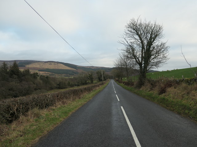
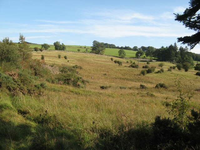
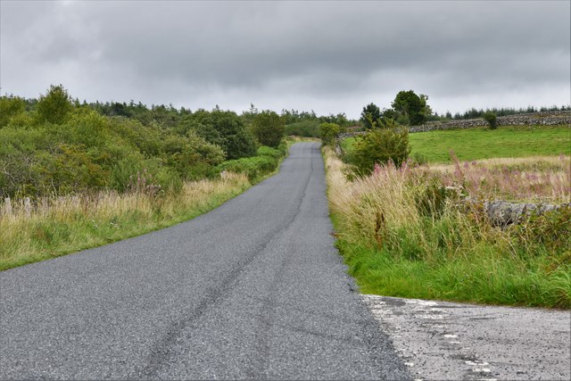
Roundfell Wood is a charming woodland located in the region of Kirkcudbrightshire, Scotland. Covering an area of approximately 100 acres, this forest is a haven for nature lovers and outdoor enthusiasts. The wood is situated on the outskirts of the town of Kirkcudbright and is easily accessible from the local road network.

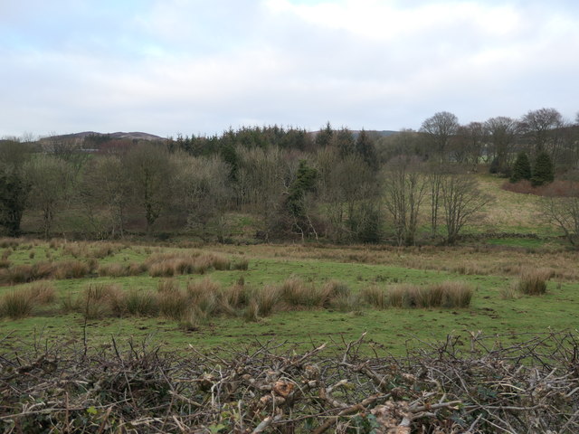
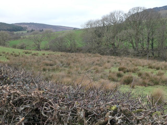
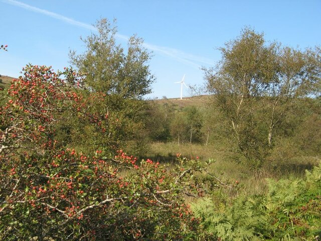
The wood boasts a diverse range of tree species, including oak, beech, and birch, creating a picturesque landscape throughout the seasons. The dense canopy of the trees provides a cool and shaded environment during the summer months, making it an ideal place for a leisurely walk or a picnic. The forest floor is adorned with a rich carpet of wildflowers, adding to the beauty of the surroundings.

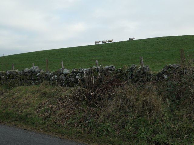
Roundfell Wood is home to a variety of wildlife, making it a paradise for birdwatchers and animal enthusiasts. Visitors may catch a glimpse of woodpeckers, owls, and other woodland birds, as well as deer and squirrels. The tranquil atmosphere of the wood allows for peaceful and uninterrupted observation of these creatures in their natural habitat.

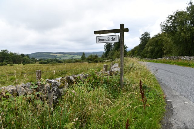
The wood is well-maintained with clearly marked trails, making it easy for visitors to explore and navigate their way through the forest. There are also several benches and resting areas scattered throughout the wood, providing opportunities for visitors to sit back and enjoy the tranquil surroundings.

Overall, Roundfell Wood offers a delightful escape from the hustle and bustle of everyday life, providing visitors with the chance to immerse themselves in the beauty of nature and enjoy the peaceful ambiance of this charming woodland.

If you have any feedback on the listing, please let us know in the comments section below.

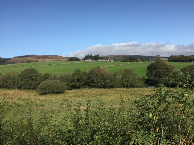
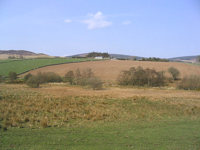
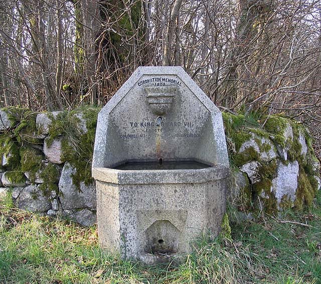
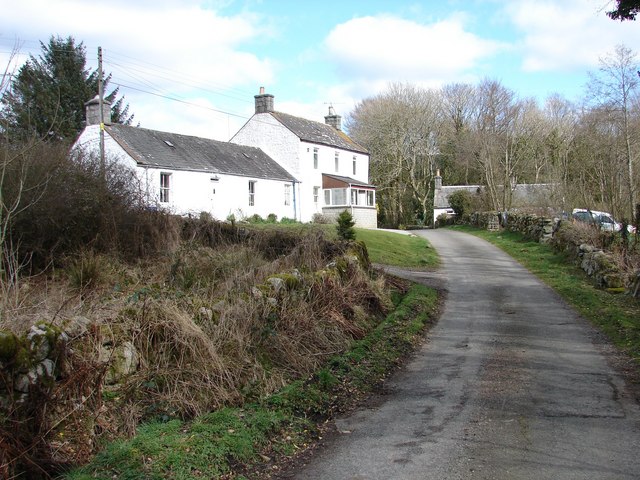
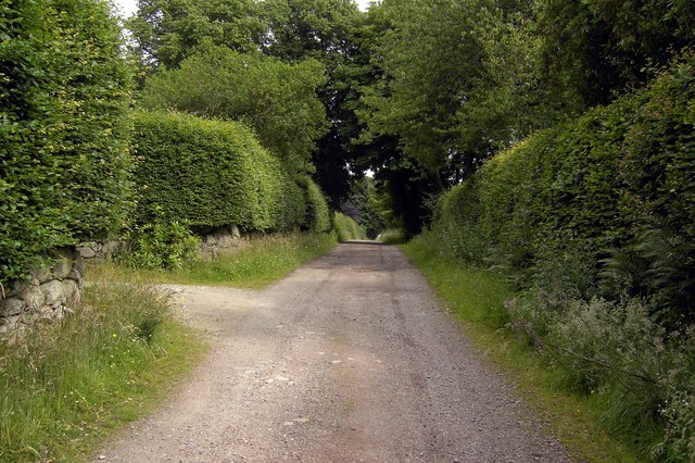
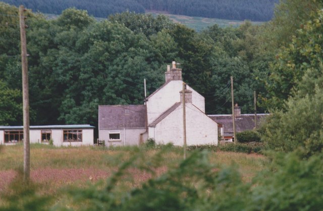
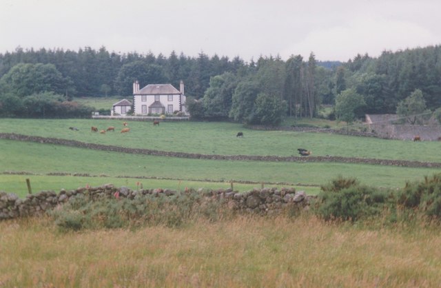
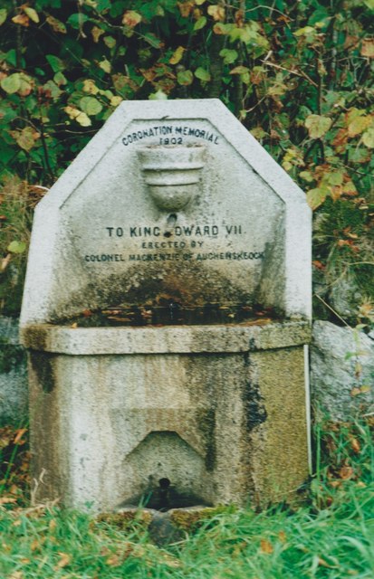
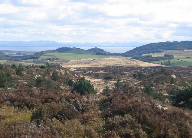
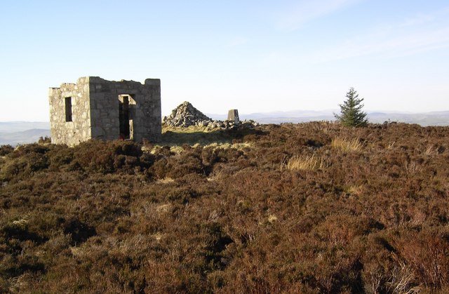
Roundfell Wood Images

Images are sourced within 2km of 54.925893/-3.7235082 or Grid Reference NX8960. Thanks to Geograph Open Source API. All images are credited.

Dumfries and Galloway farmland Viewed from the B793
Dumfries and Galloway farmland
Viewed from the B793
Mixed farmland Viewed from the B793 with Glensone Farm in the background.
Mixed farmland
Viewed from the B793 with Glensone Farm in the background.
Coronation Memorial Fountain Dated 1902 to King Edward VII and erected by Colonel Mackenzie of Auchenskeoch. By the side of the B793.
Coronation Memorial Fountain
Dated 1902 to King Edward VII and erected by Colonel Mackenzie of Auchenskeoch. By the side of the B793.
Bogfoot, Caulkerbush Bogfoot farm, situated above Southwick Burn near Bogknowe Bridge on B793.
Bogfoot, Caulkerbush
Bogfoot farm, situated above Southwick Burn near Bogknowe Bridge on B793.
Track to White Croft The rough track which runs behind Auchenskeoch Lodge along to White Croft.
Track to White Croft
The rough track which runs behind Auchenskeoch Lodge along to White Croft.
Bogfoot, near Glensone
Glensone, house and walled garden Viewed from the unclassified road near Bogknowe. Since the photograph was taken in 1998 the walled garden (to the right of Glensone) has been restored and has been open to the public for charity as part of 'Scotland's Gardens' scheme.
Glensone, house and walled garden
Viewed from the unclassified road near Bogknowe. Since the photograph was taken in 1998 the walled garden (to the right of Glensone) has been restored and has been open to the public for charity as part of 'Scotland's Gardens' scheme.
1902 Coronation memorial fountain Dedicated to King Edward VII. Erected by Colonel MacKenzie of Auchenskeoch. The mason was W W Robson.
1902 Coronation memorial fountain
Dedicated to King Edward VII. Erected by Colonel MacKenzie of Auchenskeoch. The mason was W W Robson.
B793 heading east near Bogknowe Descending between 82 and 73 metre spot heights.
B793 heading east near Bogknowe
Descending between 82 and 73 metre spot heights.
The valley of Southwick Burn Rough grassland and trees, with a square plantation beyond.
The valley of Southwick Burn
Rough grassland and trees, with a square plantation beyond.
Trees along Southwick Burn, west of Bogknowe On the north side of the B793.
Trees along Southwick Burn, west of Bogknowe
On the north side of the B793.
Sheep on a hillside, south of Bogknowe On the south side of the B793.
Sheep on a hillside, south of Bogknowe
On the south side of the B793.
Moorland below Banks Hill A paradox, with improved grazing at higher altitude than the rougher moorland.
Moorland below Banks Hill
A paradox, with improved grazing at higher altitude than the rougher moorland.
Turbine on Auchenlosh Hill A view to the moorland of Auchenlosh Hill over a wet area with rushes and birch trees. Hawthorn at the roadside is showing a good crop of berries.
Turbine on Auchenlosh Hill
A view to the moorland of Auchenlosh Hill over a wet area with rushes and birch trees. Hawthorn at the roadside is showing a good crop of berries.
Sandyhills: Drumstinchall Farm
Sandyhills: The B793 recently surfaced
Clawbelly Hill. Rough ground with exposed granite and many knolls and bogs. View south with the snow covered Lake District hills across the Solway Firth.
Clawbelly Hill.
Rough ground with exposed granite and many knolls and bogs. View south with the snow covered Lake District hills across the Solway Firth.
Shooting Box The ruin of an old shooting box on the summit of Maidenpap hill near Dalbeattie.
Shooting Box
The ruin of an old shooting box on the summit of Maidenpap hill near Dalbeattie.
Show me another place!

Roundfell Wood is located at Grid Ref: NX8960 (Lat: 54.925893, Lng: -3.7235082)

Unitary Authority: Dumfries and Galloway

Police Authority: Dumfries and Galloway

What 3 Words

///dusters.handwriting.formless. Near Dalbeattie, Dumfries & Galloway

Related Wikis

Southwick railway station (Scotland)

Southwick (Dumfries & Galloway) railway station served the civil parish of Colvend and Southwick, Dumfries and Galloway, Scotland from 1859 to 1965 on...

Dalbeattie Star F.C.

Dalbeattie Star Football Club is a Scottish association football club based in Dalbeattie, Dumfries and Galloway. It currently competes in the South of...

Criffel

Criffel is a hill in the historical county of Kirkcudbrightshire, Dumfries and Galloway, south-west Scotland. It is 570 m (1,870 ft) high but appears higher...

Dalbeattie

Dalbeattie (, Scots: Dawbeattie, Scottish Gaelic: Dail Bheithe meaning 'haugh of the birch' or Dail bhàite 'drowned (i.e. liable to flood) haugh') is a...

Dalbeattie Town Hall

Dalbeattie Town Hall is a municipal building in the High Street in Dalbeattie, Dumfries and Galloway, Scotland. The structure, which is used as community...

Kirkgunzeon railway station

Kirkgunzeon railway station served the village of Kirkgunzeon, Dumfries and Galloway, Scotland from 1859 to 1950 on the Castle Douglas and Dumfries Railway...

Dalbeattie railway station

Dalbeattie railway station served the town of Dalbeattie, Dumfries and Galloway, Scotland from 1859 to 1965 on the Castle Douglas and Dumfries Railway...

Colvend and Southwick

Colvend and Southwick is a community council area and civil parish within the Stewartry area of Dumfries and Galloway, Scotland. It is also part of the...

Nearby Amenities

Located within 500m of 54.925893,-3.7235082
Power: pole
Lat/Long: 54.9231565/-3.7173476
Power: pole
Lat/Long: 54.9236186/-3.7181411
Power: pole
Lat/Long: 54.9240672/-3.7189069
Power: pole
Lat/Long: 54.9245329/-3.7196918
Power: pole
Lat/Long: 54.9250425/-3.7205638
Power: pole
Lat/Long: 54.9255618/-3.7214548
Power: pole
Lat/Long: 54.9260738/-3.7222885
Power: pole
Lat/Long: 54.9266309/-3.7232347
Power: pole
Lat/Long: 54.9272014/-3.7241935
Power: pole
Lat/Long: 54.9276634/-3.7250209
The data included in this document is from www.openstreetmap.org. The data is made available under ODbL.

Have you been to Roundfell Wood?

Leave your review of Roundfell Wood below (or comments, questions and feedback).