West Dundurn Wood

Wood, Forest in Perthshire

Scotland

West Dundurn Wood

Disused Railway finding new life as a Recreational Trail near Dalchonzie Looking westward.
Disused Railway finding new life as a Recreational Trail near Dalchonzie Credit: Peter Wood

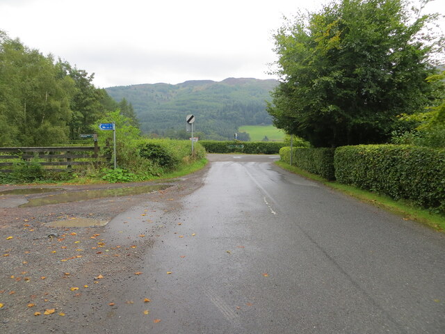
West Dundurn Wood is a picturesque forest located in the county of Perthshire, Scotland. Covering an area of approximately 100 hectares, it is situated near the village of Comrie and offers visitors a captivating natural environment to explore. The wood is easily accessible, being just a short drive from the town of Crieff.

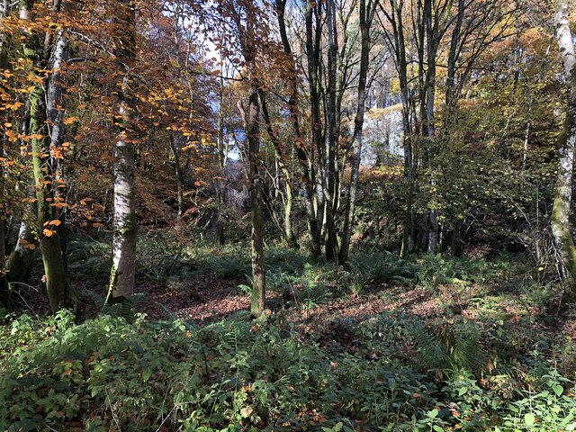
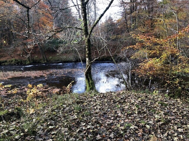
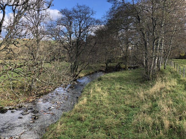
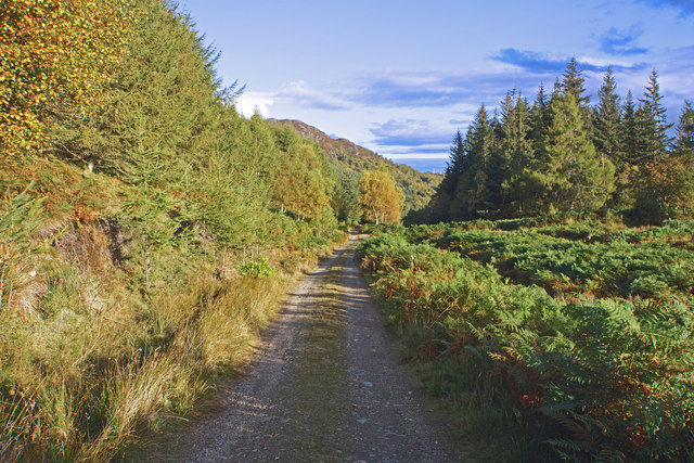
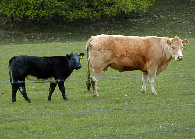
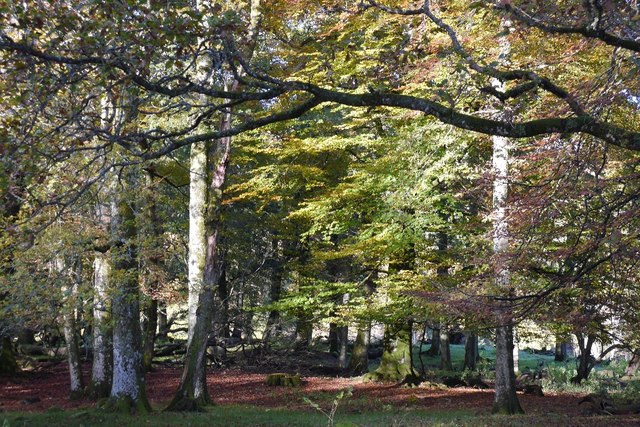
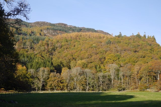
The forest is characterized by its diverse range of native tree species, including oak, birch, and Scots pine. These trees form a dense canopy that provides shelter and habitat for a variety of wildlife, making it a popular destination for birdwatchers and nature enthusiasts. Visitors may catch sight of species such as red squirrels, roe deer, and a variety of woodland birds.

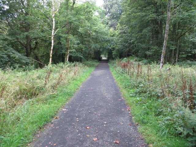
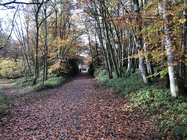
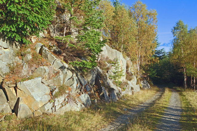
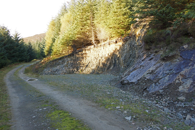
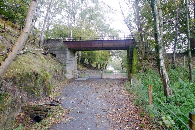
Tranquil walking trails wind their way through the wood, inviting visitors to immerse themselves in the peaceful surroundings. These paths are well-maintained, making it suitable for individuals of all fitness levels. As one strolls through the forest, they will come across babbling brooks, small waterfalls, and enchanting clearings that add to the charm of the wood.

West Dundurn Wood also holds historical significance, with remnants of ancient settlements and stone circles scattered throughout the area. These remnants serve as a reminder of the wood's rich cultural past and provide an opportunity for visitors to delve into the area's history.

Overall, West Dundurn Wood is a captivating natural haven with its diverse flora and fauna, picturesque trails, and historical significance. It offers a serene escape for those seeking solace in nature or wishing to explore the beauty of Perthshire.

If you have any feedback on the listing, please let us know in the comments section below.

West Dundurn Wood Images

Images are sourced within 2km of 56.381472/-4.0651206 or Grid Reference NN7222. Thanks to Geograph Open Source API. All images are credited.

Disused Railway finding new life as a Recreational Trail near Dalchonzie Looking westward.
Disused Railway finding new life as a Recreational Trail near Dalchonzie
Looking westward.
River Earn near Dalchonzie Looking eastward from the road bridge.
River Earn near Dalchonzie
Looking eastward from the road bridge.
Minor road from Dalchonzie joining the A85 Looking northward.
Minor road from Dalchonzie joining the A85
Looking northward.
Ordnance Survey Cut Mark This mark can be found on Dalchonzie Bridge,
The recorded details give a height of 73.116 metres above sea level.
For more detail see : <span class="nowrap"><a title="https://www.bench-marks.org.uk/bm150465" rel="nofollow ugc noopener" href="https://www.bench-marks.org.uk/bm150465">Link</a><img style="margin-left:2px;" alt="External link" title="External link - shift click to open in new window" src="https://s1.geograph.org.uk/img/external.png" width="10" height="10"/></span>
Ordnance Survey Cut Mark
This mark can be found on Dalchonzie Bridge, The recorded details give a height of 73.116 metres above sea level. For more detail see : LinkExternal link
A85 towards Comrie
A85 towards Comrie
Lochearnhead, St Fillans and Comrie Railway Closed in 1951 the trackbed is mostly available as a path from here to Lochearmhead. Begrudgingly here given the passive aggressive signage at parking area.

The railway ran to Balquhidder from the main line at Gleneagles via Crieff. Before the tracks were lifted, it was used to build some of the hydroelectric infrastructure.
Lochearnhead, St Fillans and Comrie Railway
Closed in 1951 the trackbed is mostly available as a path from here to Lochearmhead. Begrudgingly here given the passive aggressive signage at parking area. The railway ran to Balquhidder from the main line at Gleneagles via Crieff. Before the tracks were lifted, it was used to build some of the hydroelectric infrastructure.
Woodland, Strath Earn Between the A85 and the Balquidder to Gleneagles railway trackbed.
Woodland, Strath Earn
Between the A85 and the Balquidder to Gleneagles railway trackbed.
River Earn Downstream of a railway bridge, now carrying a path.
River Earn
Downstream of a railway bridge, now carrying a path.
Field, Dalchonzie The trees are Drumlochlan Wood on the other side of the Earn which appears to be a rhododendron infested deer park.
Field, Dalchonzie
The trees are Drumlochlan Wood on the other side of the Earn which appears to be a rhododendron infested deer park.
Allt an Tamhaisg Drains a bit of Mòr Bheinn into the River Earn.
Allt an Tamhaisg
Drains a bit of Mòr Bheinn into the River Earn.
Sun drenched cliffs Here the hillside has been dynamited to make way for the track. Rock debris lies in the valley to the right.
Sun drenched cliffs
Here the hillside has been dynamited to make way for the track. Rock debris lies in the valley to the right.
Small quarry in Glen Boltachan
On the Dunira estate
Is he really mine? Cattle near Dalchonzie House
Is he really mine?
Cattle near Dalchonzie House
Little and Large Dalchonzie House estate
Little and Large
Dalchonzie House estate
Woodland, Strathearn A small, mostly beech, wood beside the A85.
Woodland, Strathearn
A small, mostly beech, wood beside the A85.
Teynriach Wood North side of Strathearn.
Teynriach Wood
North side of Strathearn.
Bridge to nowhere? This substantial old bridge over the newly created railway path to Comrie is something of a mystery. What did it used to carry over the line?
On the north side is an almost sheer hillside; on the south is open country with the adjacent River Earn; it is hard now to see where any track would have gone except, perhaps, to ferry sheep down from the heights above.
Bridge to nowhere?
This substantial old bridge over the newly created railway path to Comrie is something of a mystery. What did it used to carry over the line? On the north side is an almost sheer hillside; on the south is open country with the adjacent River Earn; it is hard now to see where any track would have gone except, perhaps, to ferry sheep down from the heights above.
Show me another place!

West Dundurn Wood is located at Grid Ref: NN7222 (Lat: 56.381472, Lng: -4.0651206)

Unitary Authority: Perth and Kinross

Police Authority: Tayside

What 3 Words

///nail.barrel.throw. Near Comrie, Perth & Kinross

Related Wikis

Dunira, Perthshire

Dunira (Scottish Gaelic: Dùn Iar) is an estate of about 350 hectares (860 acres) in Perthshire, Scotland, 3 miles (5 kilometres) northwest of Comrie and...

Dalchonzie Halt railway station

Dalchonzie Halt railway station, Dalchonzie Platform railway station or Dalchonzie Siding in the Parish of Comrie, Perth and Kinross, Scotland was an intermediate...

Dalchonzie

Dalchonzie is a place by the river Earn in Perthshire. Buildings there include a country house, a hydro-electric power station and farms. From 1903 to...

Dundurn, Scotland

Dundurn is the site of a Pictish hillfort in what is now Strathearn in Perth and Kinross, Scotland. The fort was situated on a hill with the River Earn...

Aberuchill Castle

Aberuchill Castle is located 3 kilometres (1.9 mi) west of Comrie in Perthshire, Scotland. It comprises an early 17th-century tower house, which was extended...

St Fillans railway station

St Fillans railway station served the village of St Fillans, in the historical county of Perthshire, Scotland, from 1901 to 1951 on the Lochearnhead, St...

St Fillans

St Fillans is a village in Perthshire in the central highlands of Scotland, in the council area of Perth and Kinross. The village lies at the eastern end...

Central Lowlands

The Central Lowlands, sometimes called the Midland Valley or Central Valley, is a geologically defined area of relatively low-lying land in southern Scotland...

Nearby Amenities

Located within 500m of 56.381472,-4.0651206
Kindrochet Saw Mill
1860name: Saw Mill
Pont: no
Stobie1783: no
Designation: Historic Mill
Historic: archaeological_site
Source: OS Six inch First Series
Lat/Long: 56.3825/-4.0572753
Barrier: cattle_grid
Lat/Long: 56.3825673/-4.0674214
Power: pole
Source: Bing
Lat/Long: 56.3794112/-4.0586651
Power: pole
Source: Bing
Lat/Long: 56.3796832/-4.060243
Power: pole
Source: Bing
Lat/Long: 56.3805206/-4.0652113
Power: pole
Source: Bing
Lat/Long: 56.3807131/-4.0665973
Power: pole
Source: Bing
Lat/Long: 56.381263/-4.068051
Power: pole
Source: Bing
Lat/Long: 56.3819405/-4.0723117
Power: pole
Source: Bing
Lat/Long: 56.3819688/-4.0712327
Power: pole
Source: Bing
Lat/Long: 56.3819934/-4.0701699
Power: pole
Source: Bing
Lat/Long: 56.3820266/-4.0691074
Power: pole
Source: Bing
Lat/Long: 56.3823293/-4.0707354
Power: pole
Source: Bing
Lat/Long: 56.382679/-4.0714891
Power: pole
Source: Bing
Lat/Long: 56.3821696/-4.0647015
Power: pole
Lat/Long: 56.3825139/-4.0645666
Power: pole
Source: Bing
Lat/Long: 56.3830697/-4.0643425
Power: pole
Source: Bing
Lat/Long: 56.3839587/-4.0640396
Power: pole
Source: Bing
Lat/Long: 56.3844557/-4.0638703
Historic: archaeological_site
Wikidata: Q1103730
Lat/Long: 56.3817545/-4.0693992
Generator Method: photovoltaic
Generator Output Electricity: yes
Generator Source: solar
Generator Type: solar_photovoltaic_panel
Power: generator
Lat/Long: 56.384028/-4.0637907
The data included in this document is from www.openstreetmap.org. The data is made available under ODbL.

Have you been to West Dundurn Wood?

Leave your review of West Dundurn Wood below (or comments, questions and feedback).