Black Wood

Wood, Forest in Inverness-shire

Scotland

Black Wood

Ruins, by Battan This looks like the remains of some stone walls, maybe ruins of some sort of house or byre.
The 1st edition OS maps (1876) show several buildings here.
Ruins, by Battan Credit: Craig Wallace

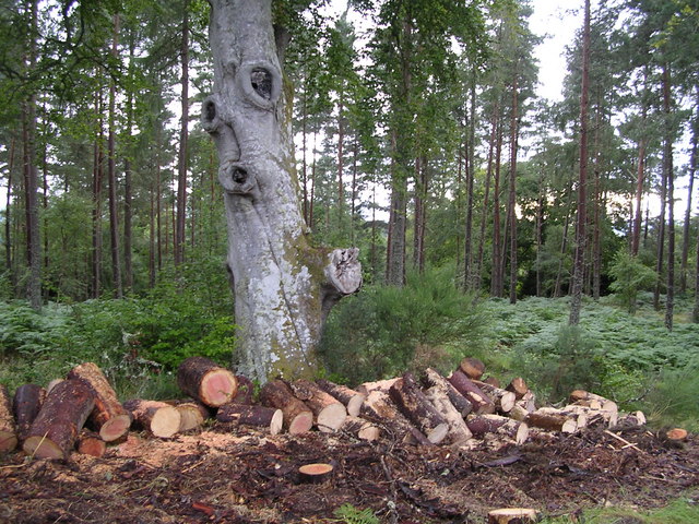
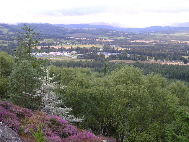
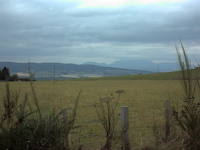
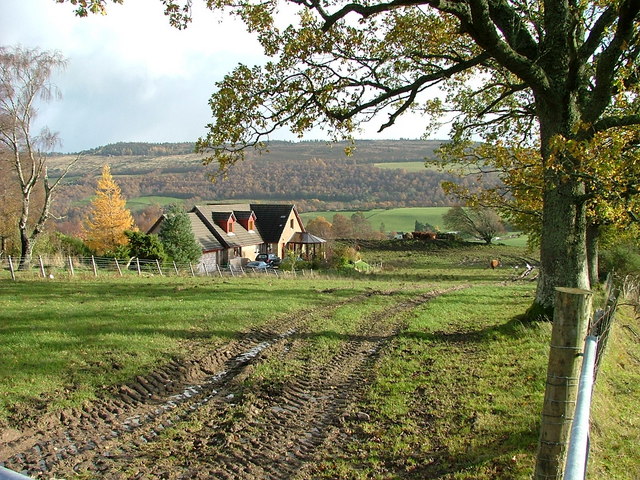
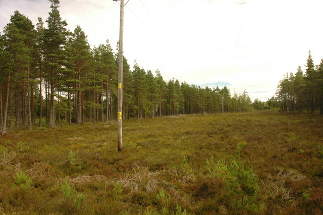
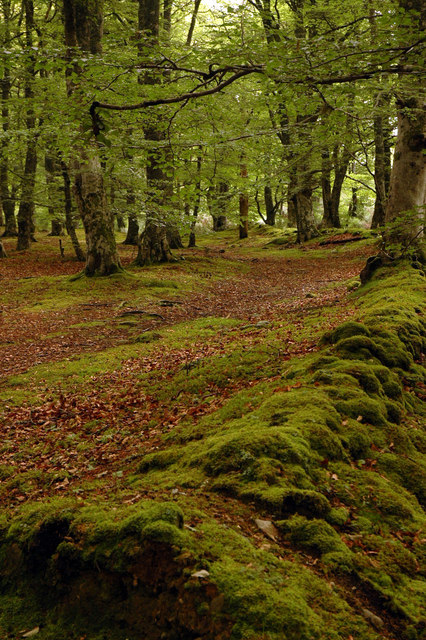
Black Wood is a picturesque forest located in Inverness-shire, a county in the northern part of Scotland. Covering an area of approximately 1,000 hectares, this ancient woodland is renowned for its rich biodiversity and stunning natural landscapes. The forest is primarily composed of native tree species such as oak, birch, and pine, which have flourished here for centuries.

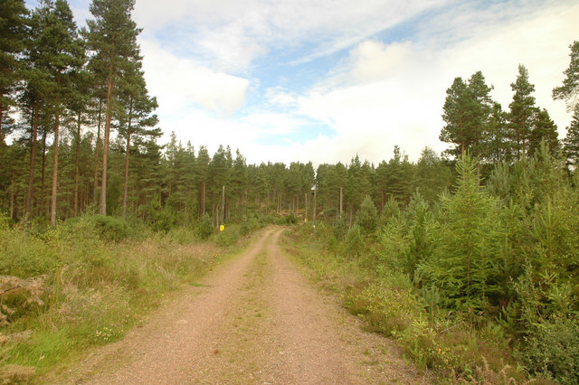
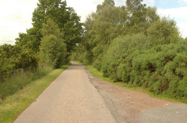
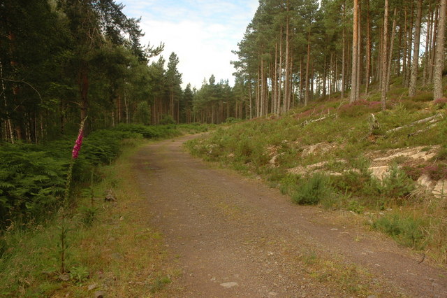
The dense canopy of Black Wood creates a serene and tranquil atmosphere, attracting nature enthusiasts and hikers from all over the world. The forest is crisscrossed with well-maintained trails, offering visitors the opportunity to explore its beauty on foot. These paths wind through a diverse range of habitats, including wetlands, heathlands, and lochs, providing a home for a wide array of flora and fauna.

Wildlife thrives in Black Wood, with species such as red deer, red squirrels, and several bird species making it their habitat. It is also known as a haven for rare and endangered species, including the Scottish wildcat and the capercaillie, a large woodland grouse. Birdwatchers flock to the forest to catch a glimpse of the iconic ospreys that nest in the vicinity.

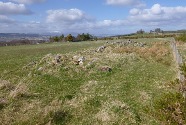
In addition to its natural wonders, Black Wood holds historical significance. It is believed that the forest has been present since the end of the last Ice Age, making it one of the oldest woodlands in Europe. The area also contains the remnants of ancient settlements, including burial cairns and standing stones, providing a glimpse into the region's rich cultural heritage.

Overall, Black Wood in Inverness-shire offers a captivating blend of natural beauty, biodiversity, and historical significance. It is a must-visit destination for anyone seeking to immerse themselves in Scotland's enchanting wilderness.

If you have any feedback on the listing, please let us know in the comments section below.

Black Wood Images

Images are sourced within 2km of 57.441092/-4.4512591 or Grid Reference NH5241. Thanks to Geograph Open Source API. All images are credited.

Ruins, by Battan This looks like the remains of some stone walls, maybe ruins of some sort of house or byre.
The 1st edition OS maps (1876) show several buildings here.
Ruins, by Battan
This looks like the remains of some stone walls, maybe ruins of some sort of house or byre. The 1st edition OS maps (1876) show several buildings here.
Belladrum Chapel A private family chapel on the Belladrum estate, which can be hired out for weddings or baptisms.
Belladrum Chapel
A private family chapel on the Belladrum estate, which can be hired out for weddings or baptisms.
Belladrum Tartan Heart Rock Festival
Cut Wood in Belladrum Forest
Summit of Phoineas Hill Looking towards Belladrum Tartan Heart Rock Festival
Summit of Phoineas Hill
Looking towards Belladrum Tartan Heart Rock Festival
Entrance to Beaufort Castle Built in 1882, the 24-bedroomed castle is now owned by Stagecoach bus tycoon Anne Gloag.
Entrance to Beaufort Castle
Built in 1882, the 24-bedroomed castle is now owned by Stagecoach bus tycoon Anne Gloag.
Beaufort Castle driveway Built in 1882, the 24-bedroomed castle is now owned by Stagecoach bus tycoon Anne Gloag.
Beaufort Castle driveway
Built in 1882, the 24-bedroomed castle is now owned by Stagecoach bus tycoon Anne Gloag.
Auchvaich farm
Auchvaich farm
A view to Ben Wyvis
A view to Ben Wyvis
Belladrum Mill An old mill building by the Belladrum Burn.
Belladrum Mill
An old mill building by the Belladrum Burn.
Bridge on the Belladrum Burn
Dalnamine Marked as 'Duffs House' on the OS, the nameplate for this house reads 'Dalnamine'.
Dalnamine
Marked as 'Duffs House' on the OS, the nameplate for this house reads 'Dalnamine'.
Farm at Easter Clunes Unnamed on the OS map.
Farm at Easter Clunes
Unnamed on the OS map.
Forest track A forest track marked on the map as a clearing in this square that mainly features coniferous forest just north of Wester Clunes farm.
Forest track
A forest track marked on the map as a clearing in this square that mainly features coniferous forest just north of Wester Clunes farm.
Unclassified public road between Foxhole and Moniack The unclassified public road between Foxhole and Moniack taken from a junction with a forest track. There is evidence that the area is popular with dog walkers.
Unclassified public road between Foxhole and Moniack
The unclassified public road between Foxhole and Moniack taken from a junction with a forest track. There is evidence that the area is popular with dog walkers.
Unmarked forest track A forest track leading toward Black Wood that currently does not appear the OS map.
Unmarked forest track
A forest track leading toward Black Wood that currently does not appear the OS map.
Fire Break The firebreak as marked on the map taken from a forest track.  A power line runs through the break.
Fire Break
The firebreak as marked on the map taken from a forest track. A power line runs through the break.
Woodland A small but beautiful area of deciduous woodland next to the public road as it descends steeply. Featured are the remains of an old wall lining what was possibly at one time a road or track.
Woodland
A small but beautiful area of deciduous woodland next to the public road as it descends steeply. Featured are the remains of an old wall lining what was possibly at one time a road or track.
Show me another place!

Black Wood is located at Grid Ref: NH5241 (Lat: 57.441092, Lng: -4.4512591)

Unitary Authority: Highland

Police Authority: Highlands and Islands

What 3 Words

///chop.behalf.shape. Near Beauly, Highland

Nearby Locations

Black Wood

Related Wikis

Belladrum, Scotland

Belladrum (Scottish Gaelic: Baile an Druim, meaning "Farm of the Ridge") is a small settlement in the Highland council area of Scotland. It is about 0...

Cabrich

Cabrich (Scottish Gaelic: Cabarach, meaning "Place of Tree-trunks") is a scattered crofting community in the Highland council area of Scotland. It is 1...

Tomnacross

Tomnacross is a small hamlet and part of the village of Kiltarlity, about 20 km west of the city of Inverness in the Highland Council area of Scotland...

Camault Muir

Camault Muir is a scattered crofting community and part of the village of Kiltarlity, in the Highland council area of Scotland. It is situated on a boggy...

Related Videos

A tour around Beauly Holiday Park

A tour around Beauly Holiday Park Camping and Caravanning in the Scottish Highlands Music from #Uppbeat (free for Creators!)

Pitches at Beauly Holiday Park

A quick tour around the pitches at Beauly Holiday Park.

Beauly Holiday Park Toilet & Shower Block

Our new toilet & shower block at Beauly Holiday Park www.beaulyholidaypark.scot.

Fox Visits Beauly Holiday Park

Fox Visits Beauly Holiday Park www.beaulyholidaypark.scot/nature-reserve.

Have you been to Black Wood?

Leave your review of Black Wood below (or comments, questions and feedback).