Nursery Wood

Wood, Forest in Inverness-shire

Scotland

Nursery Wood

Course of the Old Railway above Loch Oich (1) Now adopted by the Great Glen Way National Trail - a new lease of life for the former railway that ran between Spean Bridge and Fort Augustus
Course of the Old Railway above Loch Oich (1) Credit: Chris Heaton

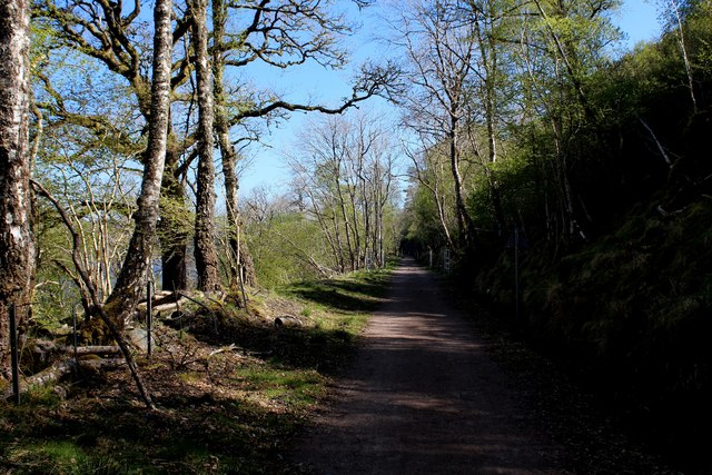
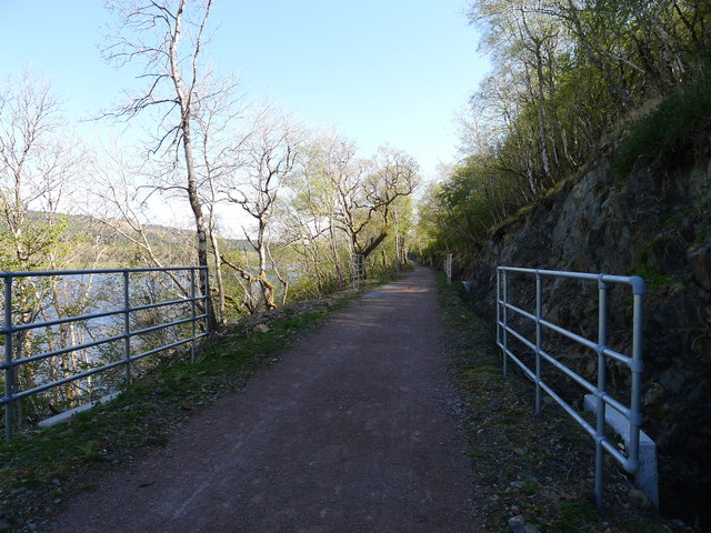
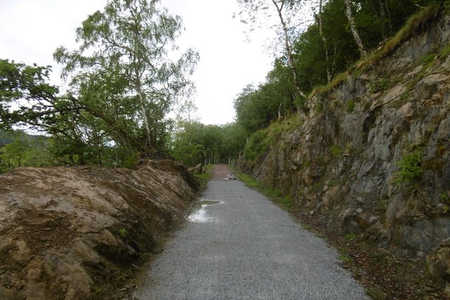
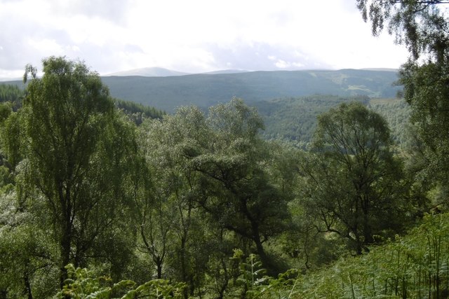
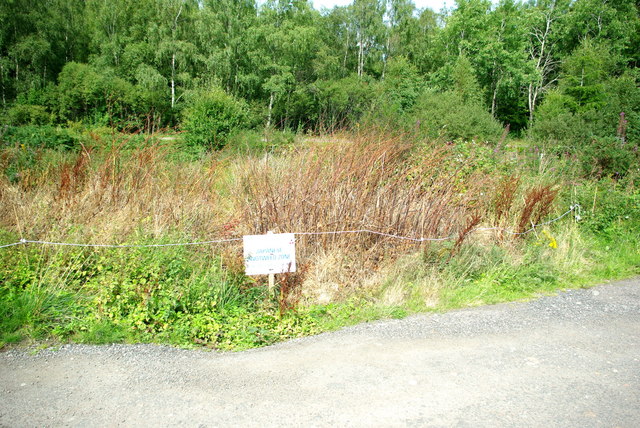
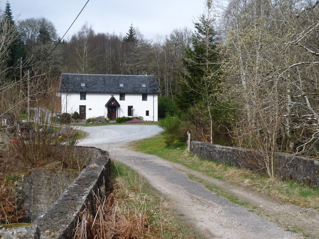
Nursery Wood is a picturesque forest located in the beautiful region of Inverness-shire, Scotland. Covering an area of approximately 50 acres, this woodland is known for its diverse range of tree species and enchanting natural beauty.

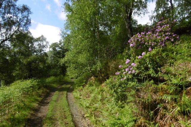
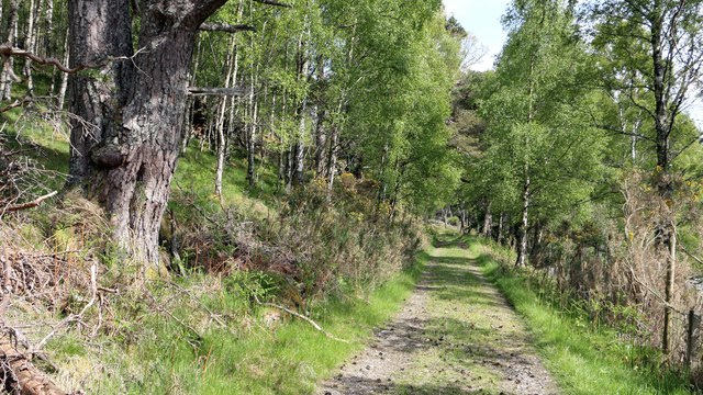
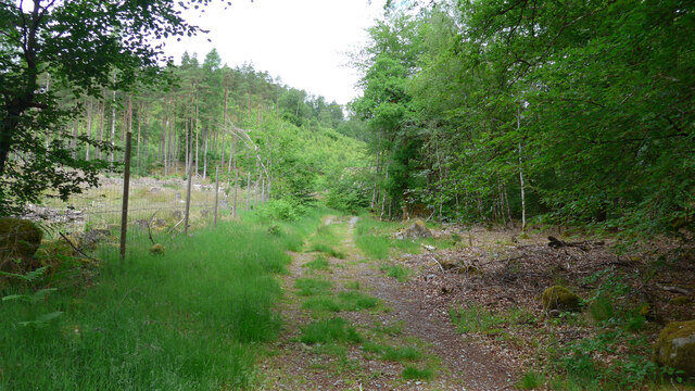
The forest is predominantly made up of native Scottish trees such as Scots pine, birch, oak, and rowan. These trees create a stunning canopy that filters sunlight and creates a serene ambiance throughout the wood. Additionally, the forest floor is carpeted with a variety of wildflowers, adding vibrant colors to the landscape during the spring and summer months.

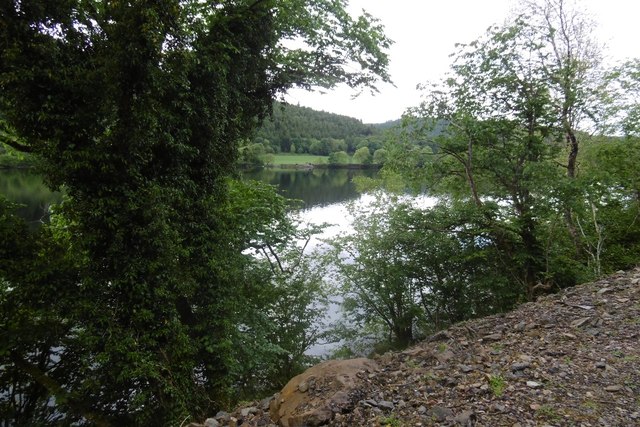
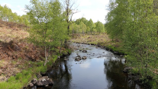
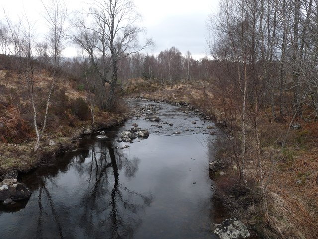
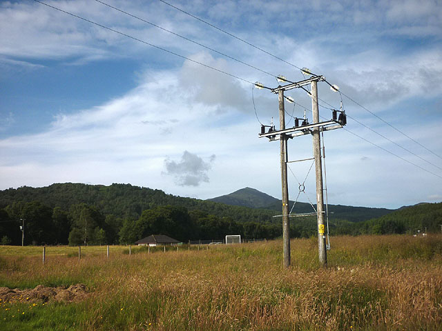
Nursery Wood is a popular destination for nature lovers and outdoor enthusiasts who enjoy activities such as walking, hiking, and birdwatching. The well-maintained trails winding through the forest offer visitors the opportunity to explore its hidden gems, including a small stream and several ponds that attract a diverse range of wildlife.

Birdwatchers will be delighted to find species such as woodpeckers, owls, and various songbirds inhabiting the wood. Additionally, the forest is home to numerous mammals, including red squirrels, rabbits, and deer, providing ample opportunities for wildlife spotting.

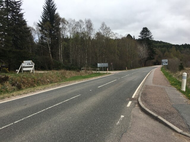
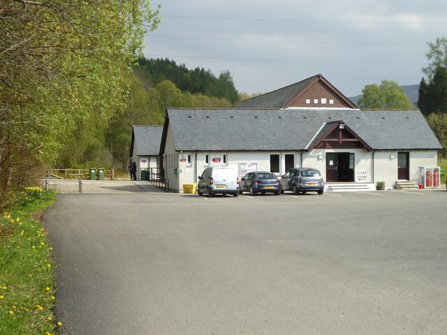
The forest is easily accessible by road, with a parking area available for visitors. It is also worth noting that Nursery Wood is managed by a local conservation organization, ensuring its protection and preservation for future generations to enjoy.

Overall, Nursery Wood in Inverness-shire is a true natural gem, offering a tranquil escape from the hustle and bustle of everyday life and providing a rich biodiversity for nature enthusiasts to explore and appreciate.

If you have any feedback on the listing, please let us know in the comments section below.
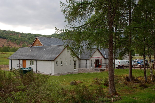
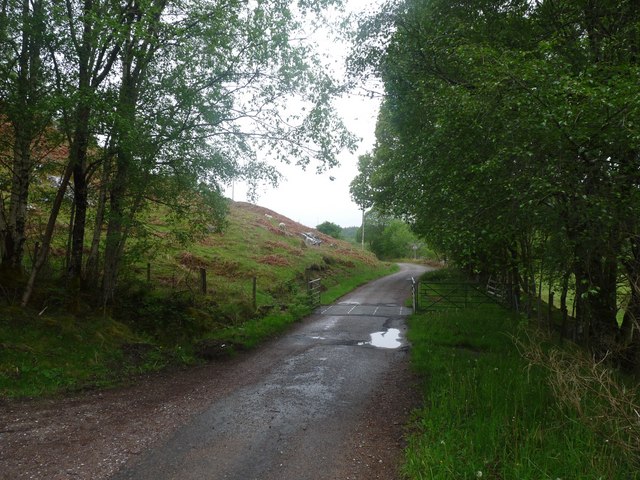
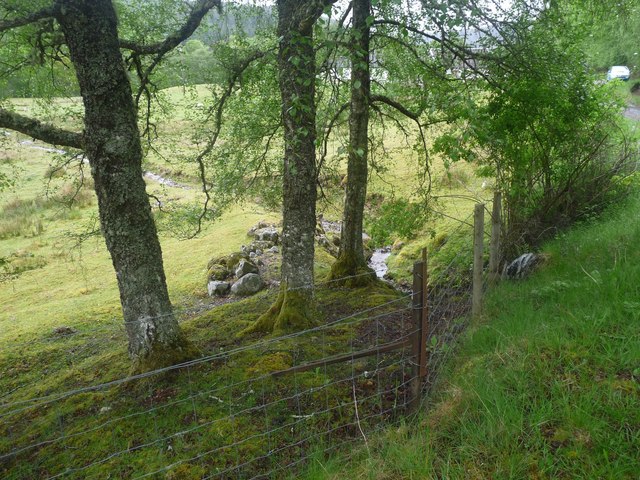
Nursery Wood Images

Images are sourced within 2km of 57.074162/-4.7841411 or Grid Reference NH3101. Thanks to Geograph Open Source API. All images are credited.

Course of the Old Railway above Loch Oich (1) Now adopted by the Great Glen Way National Trail - a new lease of life for the former railway that ran between Spean Bridge and Fort Augustus
Course of the Old Railway above Loch Oich (1)
Now adopted by the Great Glen Way National Trail - a new lease of life for the former railway that ran between Spean Bridge and Fort Augustus
'Health and Safety' gone mad? I count eleven pairs of railings visible in this picture of part of the restored trackbed of the Invergarry to Fort Augustus railway. The railings align with concrete drainage culverts. But the likelihood of injury from falling off the track at these points is surely no greater than at any other (non-railinged) part of the track.
'Health and Safety' gone mad?
I count eleven pairs of railings visible in this picture of part of the restored trackbed of the Invergarry to Fort Augustus railway. The railings align with concrete drainage culverts. But the likelihood of injury from falling off the track at these points is surely no greater than at any other (non-railinged) part of the track.
Invergarry and Fort Augustus Railway The railway, over engineered in an area of limited population was a financial disaster.  More over engineering is apparent in the conversion to a path - every culvert has railings, yet you are just as likely to come to grief on any other part of the track.   The rails to trails conversion is very welcome, taking out a long stretch of hostile A82.
Invergarry and Fort Augustus Railway
The railway, over engineered in an area of limited population was a financial disaster. More over engineering is apparent in the conversion to a path - every culvert has railings, yet you are just as likely to come to grief on any other part of the track. The rails to trails conversion is very welcome, taking out a long stretch of hostile A82.
Loch Oich View from the Great Glen Way on the trackbed of the Invergarry and Fort Augustus Railway.
Loch Oich
View from the Great Glen Way on the trackbed of the Invergarry and Fort Augustus Railway.
Coille Creag an t-Sagairt A scenic track, which leads to a familyphobic   campsite.  It gives very fine views over woodland around Invergarry.
Coille Creag an t-Sagairt
A scenic track, which leads to a familyphobic campsite. It gives very fine views over woodland around Invergarry.
Woodland, Invergarry A view over Glen Garry and the Great Glen from Coille Creag an t-Sagairt.
Woodland, Invergarry
A view over Glen Garry and the Great Glen from Coille Creag an t-Sagairt.
Aldernaig Burn  
This photograph was taken from a bridge over the burn. The bridge carries a track upstream to a point where the <a href="https://www.geograph.org.uk/photo/5660944">NH2902 : Outflow from Loch Lundie</a> can be viewed.

Some 500m to the south of the viewpoint (off the right of this photograph) the track splits with the left fork following the burn toward Invergarry and the right fork heading toward Faichemard Farm. To see a photograph of this branch, click here <a href="https://www.geograph.org.uk/photo/5661047">NH2901 : Track in woodland below Coille Creag an t-Sagairt</a>.

The photograph was taken in June. To see the same view, but taken in March see this photograph by Alan Reid, <a href="https://www.geograph.org.uk/photo/2942138">NH2902 : Aldernaig Burn</a>.
Aldernaig Burn
  This photograph was taken from a bridge over the burn. The bridge carries a track upstream to a point where the NH2902 : Outflow from Loch Lundie can be viewed. Some 500m to the south of the viewpoint (off the right of this photograph) the track splits with the left fork following the burn toward Invergarry and the right fork heading toward Faichemard Farm. To see a photograph of this branch, click here NH2901 : Track in woodland below Coille Creag an t-Sagairt. The photograph was taken in June. To see the same view, but taken in March see this photograph by Alan Reid, NH2902 : Aldernaig Burn.
Track in woodland below Coille Creag an t-Sagairt  
About a kilometre ahead along the track is a bridge over the <a href="https://www.geograph.org.uk/photo/5660926">NH2902 : Aldernaig Burn</a>.

Some 650m behind the viewpoint is Faichemard Farm.
Track in woodland below Coille Creag an t-Sagairt
  About a kilometre ahead along the track is a bridge over the NH2902 : Aldernaig Burn. Some 650m behind the viewpoint is Faichemard Farm.
Japanese knotweed control at Invergarry A rampant infestation of the invasive alien has been treated with strong herbicide and roped off.
Japanese knotweed control at Invergarry
A rampant infestation of the invasive alien has been treated with strong herbicide and roped off.
The track by the Aldernaig Burn
A87 near Invergarry
A87 near Invergarry
Community and Heritage Centre at Invergarry
Glengarry Community Hall, Invergarry The hall has toilets and a cafe for visitors and is next to the shinty pitch, which was in use this Saturday afternoon.
Glengarry Community Hall, Invergarry
The hall has toilets and a cafe for visitors and is next to the shinty pitch, which was in use this Saturday afternoon.
The road through Mandally An unusually dull scene for May
The road through Mandally
An unusually dull scene for May
A wee burn heads for the River Garry Under the Mandally road and across the last field
A wee burn heads for the River Garry
Under the Mandally road and across the last field
Aldernaig Burn
Aldernaig Burn
Cottage by an old bridge on the A87, now bypassed
Electricity pylon, Invergarry Carrying hydroelectricity no doubt. Looking towards Ben Tee.
Electricity pylon, Invergarry
Carrying hydroelectricity no doubt. Looking towards Ben Tee.
Show me another place!

Nursery Wood is located at Grid Ref: NH3101 (Lat: 57.074162, Lng: -4.7841411)

Unitary Authority: Highland

Police Authority: Highlands and Islands

What 3 Words

///haggis.duties.simmer. Near Gairlochy, Highland

Related Wikis

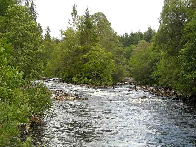
River Garry, Inverness-shire

The River Garry (Scottish Gaelic: Garadh / Abhainn Gharadh) in Inverness-shire is a Scottish river punctuated by two long Lochs, in the region of Lochaber...

Loch Oich

Loch Oich (; Scottish Gaelic: Loch Omhaich) is a freshwater loch in the Highlands of Scotland which forms part of the Caledonian Canal, of which it is...
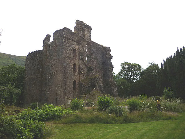
Invergarry Castle

Invergarry Castle in the Scottish Highlands was the seat of the Chiefs of the Clan MacDonell of Glengarry, a powerful branch of the Clan Donald. The castle...

Invergarry

Invergarry (Scottish Gaelic: Inbhir Garadh) is a village in the Highlands of Scotland. It is in the Great Glen, near where the River Garry flows into Loch...

Related Videos

First reaction to our holiday lodge in Scotland!|Scotland adventure Ep.1!

That's right! We are now in Scotland after a 300.3 mile long drive! (483.3 kilometre!) This lodge is really cool and it's only a few ...

The drive along Kyle of Loch Alsh to Invergarry (NC500)

A pleasant drive with stunning scenery. Part of the North Coast 500 route. Watching the Isle of Skye Convoy as we head to ...

Caledonian cabins, luxury in Scotland highlands, Invergarry

This is 'The Cabin' at Caledonian cabins at Scotland highlands. Highly recommended. We went on June 2022. Perfect weather for ...

A walk to Invergarry Castle, Loch Oich & the River Garry

A walk in Glengarry beside the River Garry, Invergarry Castle, Glengarry Castle hotel & Loch Oich. July 2023 #scotlandtourism ...

Nearby Amenities

Located within 500m of 57.074162,-4.7841411
Fuel
Fuel Diesel: yes
Fuel Lpg: yes
Fuel Octane 95: yes
Operator: Gleaner
Source: survey
Lat/Long: 57.0704918/-4.7885318
Glengarry War Memorial
Historic: memorial
Wheelchair: no
Lat/Long: 57.0705138/-4.7834456
Power: tower
Lat/Long: 57.0768689/-4.7827154
Power: tower
Lat/Long: 57.073979/-4.777408
Power: tower
Lat/Long: 57.0755265/-4.7802329
Power: tower
Lat/Long: 57.0777252/-4.7863564
Power: pole
Lat/Long: 57.0719657/-4.7774504
Power: pole
Lat/Long: 57.071851/-4.7789491
Power: pole
Lat/Long: 57.0717265/-4.7806768
Power: pole
Lat/Long: 57.0715116/-4.7817817
Power: pole
Lat/Long: 57.0711885/-4.7834495
Power: pole
Lat/Long: 57.0710046/-4.7844915
Power: pole
Lat/Long: 57.0708565/-4.7853554
Power: pole
Lat/Long: 57.0708426/-4.7865262
Power: pole
Lat/Long: 57.0709916/-4.7883108
Power: pole
Lat/Long: 57.0709525/-4.7899337
Power: pole
Lat/Long: 57.0714888/-4.7782289
The data included in this document is from www.openstreetmap.org. The data is made available under ODbL.

Have you been to Nursery Wood?

Leave your review of Nursery Wood below (or comments, questions and feedback).