Coed Caeddafydd

Wood, Forest in Merionethshire

Wales

Coed Caeddafydd

Landscape North of Croesor Yr Arddu in the background.
Landscape North of Croesor Credit: Chris Andrews

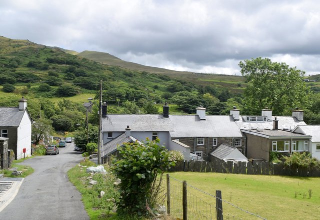
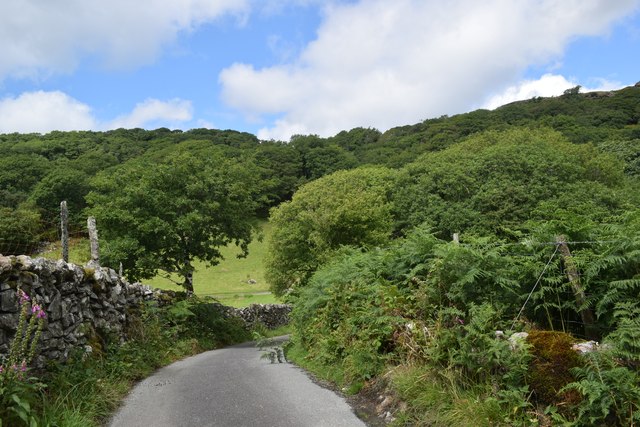
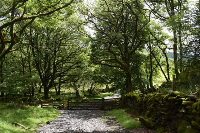
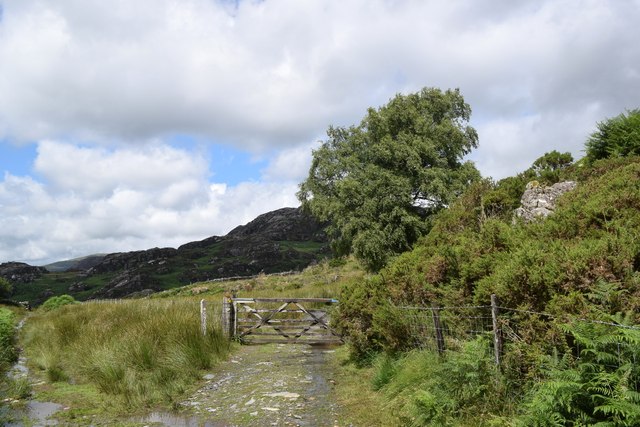
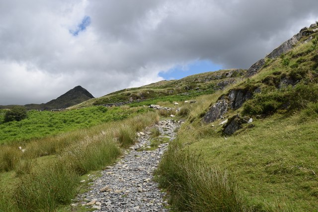
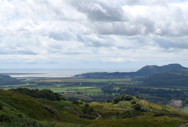
Coed Caeddafydd is a woodland located in Merionethshire, a county in northwest Wales. Spanning an area of approximately 100 acres, it is known for its natural beauty and abundant biodiversity. The woodland is situated near the village of Trawsfynydd, surrounded by the picturesque Snowdonia National Park.

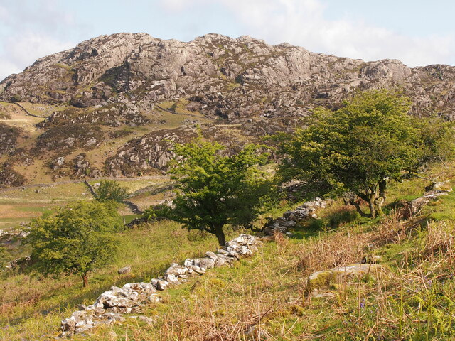
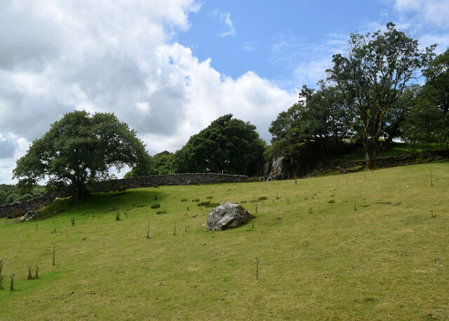
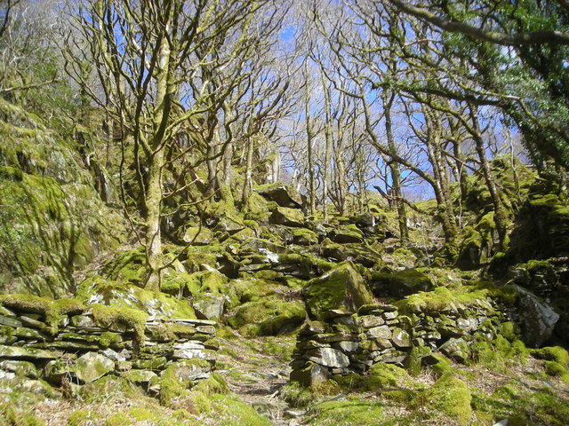
Coed Caeddafydd is predominantly composed of native broadleaf trees, including oak, beech, and birch, which create a dense canopy overhead. The forest floor is adorned with a rich carpet of ferns, mosses, and wildflowers, adding to its scenic charm. The wood is crisscrossed by a network of well-maintained footpaths, making it easily accessible for visitors to explore and enjoy its tranquil ambiance.

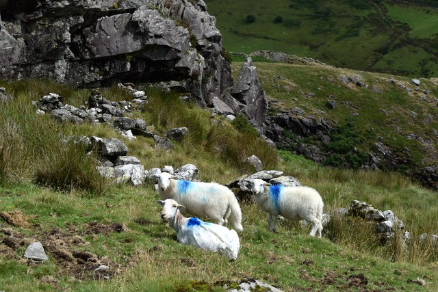
The woodland is home to a diverse range of wildlife species. It provides a haven for numerous bird species, including the redstart, pied flycatcher, and wood warbler, making it a popular spot for birdwatchers. Additionally, mammals such as badgers, foxes, and bats can be spotted amidst the trees.

Coed Caeddafydd holds historical significance as well. It is believed to have been part of the hunting grounds for the medieval princes of Gwynedd. Ruins of old stone walls and remnants of ancient settlements can still be found within the woods, offering glimpses into the area's past.

Overall, Coed Caeddafydd is a cherished natural gem in the heart of Merionethshire. Its enchanting woodlands, diverse wildlife, and historical remnants make it a must-visit destination for nature enthusiasts and history buffs alike.

If you have any feedback on the listing, please let us know in the comments section below.

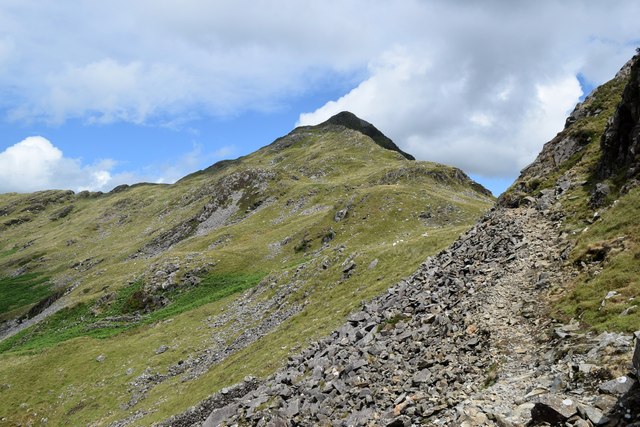
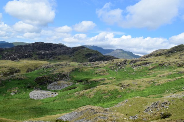
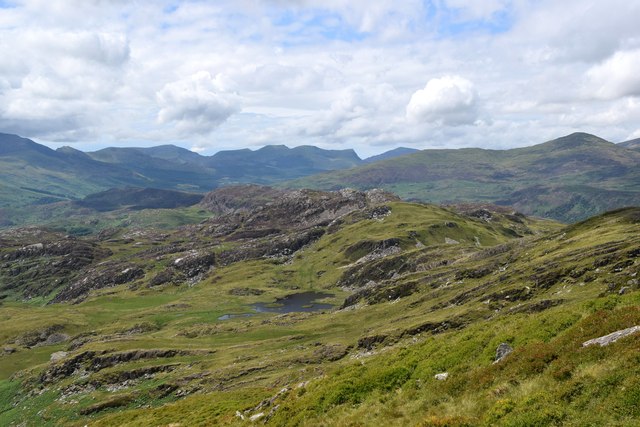
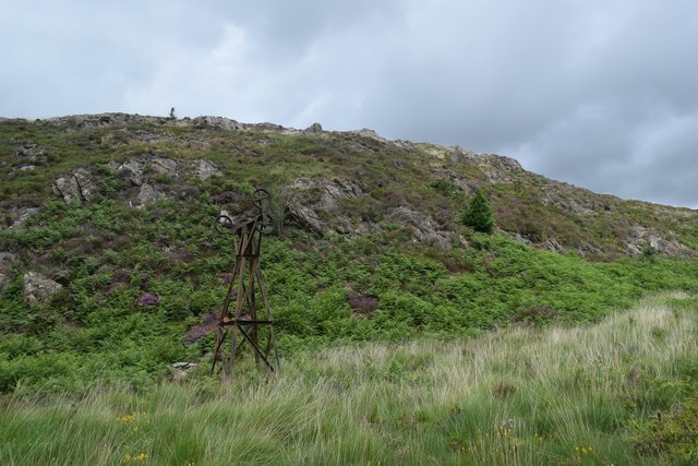
Coed Caeddafydd Images

Images are sourced within 2km of 52.997257/-4.0565906 or Grid Reference SH6246. Thanks to Geograph Open Source API. All images are credited.

Landscape North of Croesor Yr Arddu in the background.
Landscape North of Croesor
Yr Arddu in the background.
Croesor cottages Moelwyn Bach looms in the distance.
Croesor cottages
Moelwyn Bach looms in the distance.
Former chapel, Croesor Now in residential use.   If anybody knows the chapel denomination, I will amend the caption.   The steeply sloping road to the left leads towards the peak of Cnicht.
Former chapel, Croesor
Now in residential use. If anybody knows the chapel denomination, I will amend the caption. The steeply sloping road to the left leads towards the peak of Cnicht.
Erratic boulder, Croesor
Round the bend... ...on the way to Cnicht.
Round the bend...
...on the way to Cnicht.
Track through the woods... ...to the west of Croesor.
Track through the woods...
...to the west of Croesor.
Parting of the paths The Snowdonia Slate Trail to the left, the start of the ascent to Cnicht to the right...
Parting of the paths
The Snowdonia Slate Trail to the left, the start of the ascent to Cnicht to the right...
Climbing towards Cnicht The path of slate and granite chips is mostly well-defined.  Cnicht looms in the background.
Climbing towards Cnicht
The path of slate and granite chips is mostly well-defined. Cnicht looms in the background.
Looking back towards the coast The Glaslyn estuary and Porthmadog, some 10 km away, with clouds starting to gather...
Looking back towards the coast
The Glaslyn estuary and Porthmadog, some 10 km away, with clouds starting to gather...
Sheep by the path... ...on the way to Cnicht.  They seemed surprised to see me, perhaps they had a sense that a storm was blowing in...    The rock is (I think) part of an intrusion of igneous bedrock formed between 485.4 and 443.8 million years ago during the Ordovician period.
Sheep by the path...
...on the way to Cnicht. They seemed surprised to see me, perhaps they had a sense that a storm was blowing in... The rock is (I think) part of an intrusion of igneous bedrock formed between 485.4 and 443.8 million years ago during the Ordovician period.
Climbing towards Cnicht The terrain is getting rockier but there is still a long way to go...
Climbing towards Cnicht
The terrain is getting rockier but there is still a long way to go...
Looking towards Yr Arddu Yr Arddu is an igneous intrusion of rhyolite, being bedrock formed between 485.4 and 443.8 million years ago during the Ordovician period.   There are countless sheep in the blown-up photo...
Looking towards Yr Arddu
Yr Arddu is an igneous intrusion of rhyolite, being bedrock formed between 485.4 and 443.8 million years ago during the Ordovician period. There are countless sheep in the blown-up photo...
Scramble over the scree... ...on the way to Cnicht.    There is a path of sorts, but this is maybe the trickiest point of the ascent.
Scramble over the scree...
...on the way to Cnicht. There is a path of sorts, but this is maybe the trickiest point of the ascent.
Snowdonia glacial landscape Drumlins and waste heaps from abandoned late quarries.
Snowdonia glacial landscape
Drumlins and waste heaps from abandoned late quarries.
Glacial landscape south of Bwlch y Battel Rocks scoured and scraped by a glacier some 10,000 years ago.   A footpath on the OS map seems to pass through the middle of the lake.
Glacial landscape south of Bwlch y Battel
Rocks scoured and scraped by a glacier some 10,000 years ago. A footpath on the OS map seems to pass through the middle of the lake.
Remains of the cableway, Cwm Bychan This once transported copper ore down the valley.
Remains of the cableway, Cwm Bychan
This once transported copper ore down the valley.
Cableway tower, Cwm Bychan
World of moss The footpath descends through a wood full of mossy rocks.
World of moss
The footpath descends through a wood full of mossy rocks.
Show me another place!

Coed Caeddafydd is located at Grid Ref: SH6246 (Lat: 52.997257, Lng: -4.0565906)

Unitary Authority: Gwynedd

Police Authority: North Wales

What 3 Words

///tangling.mend.fork. Near Penrhyndeudraeth, Gwynedd

Related Wikis

Yr Arddu (South)

Yr Arddu is a large hill in Snowdonia, Wales (Not to be confused with the 589 metre Yr Arddu (North) to the east of Snowdon). It lies approximately 2.5...

Nantmor

Nantmor is a hamlet which lies about 1½ miles to the south of the village of Beddgelert in Gwynedd, Wales. The current spelling of the name Nantmor is...

Parc, Penrhyndeudraeth

Parc (meaning Park in English) is the name of an ancient mansion found near the village of Croesor in the community of Llanfrothen near Penrhyndeudraeth...

Croesor Tramway

The Croesor Tramway was a Welsh, 2 ft (610 mm) narrow gauge railway line built to carry slate from the Croesor slate mines to Porthmadog. It was built...

Related Videos

Have you ever been to the sygun copper mine? | Travel to Wales | November 2020

The sygun copper mine is in the Snowdonia Nationalpark. You can make self guided tours through the upper mine and discover ...

Cnicht and the Moelwyns (Eryri)

Monday 27th March 2023 From a trip to Snowdonia in March of this year, my first walk of the week was to take in Cnicht and ...

Cnicht from Croesor

A great little mountain in Snowdonia, cracking 360° view from the summit.

How to Enjoy a Forest Walk and a Refreshing Dip in Llyn Hafod, Snowdonia

Christine visits a forest in Snowdonia and walks around Llyn Mair before having a chilly 7 degree Celsius swim in Llyn Hafod.

Nearby Amenities

Located within 500m of 52.997257,-4.0565906
Power: pole
Lat/Long: 52.9953894/-4.0600736
Power: pole
Lat/Long: 52.9971121/-4.059249
Power: pole
Lat/Long: 52.9986294/-4.0585529
Power: pole
Lat/Long: 52.9994612/-4.0580967
Power: pole
Lat/Long: 53.0001893/-4.0576675
Power: pole
Lat/Long: 53.0005757/-4.057485
Power: pole
Lat/Long: 53.0014095/-4.0566435
Power: pole
Lat/Long: 52.9962457/-4.0596561
Power: pole
Lat/Long: 52.994444/-4.0605198
The data included in this document is from www.openstreetmap.org. The data is made available under ODbL.

Have you been to Coed Caeddafydd?

Leave your review of Coed Caeddafydd below (or comments, questions and feedback).