Deri-goch Wood

Wood, Forest in Cardiganshire

Wales

Deri-goch Wood

Lane leading past Falcondale Lake
Lane leading past Falcondale Lake Credit: Sandy Gerrard

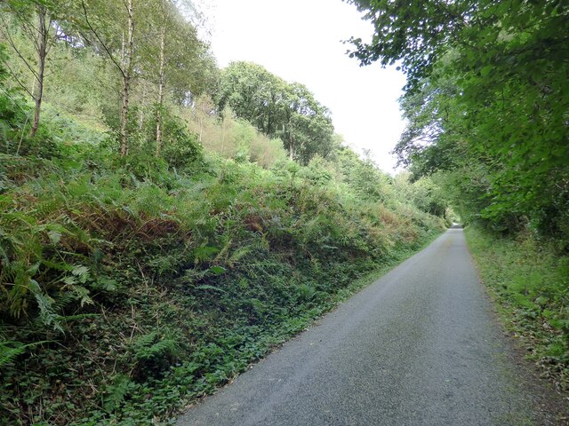
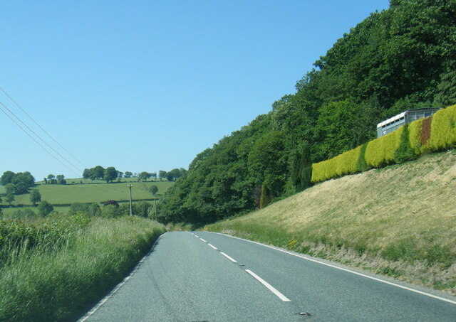
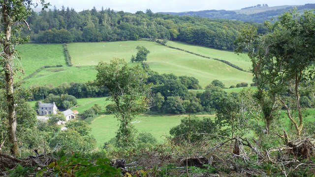
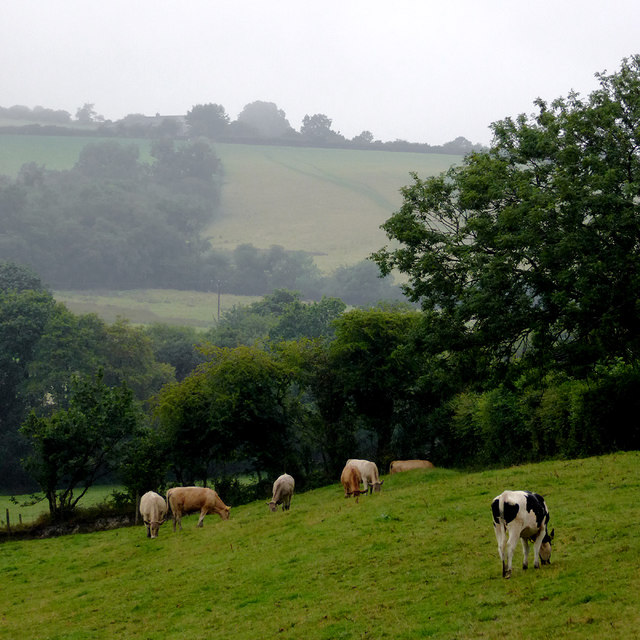
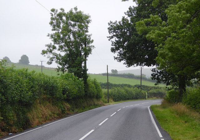
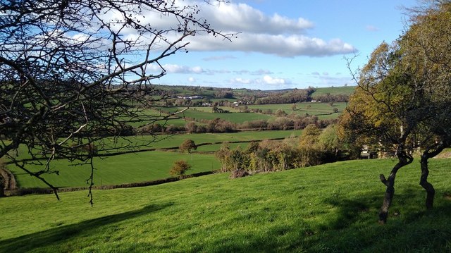
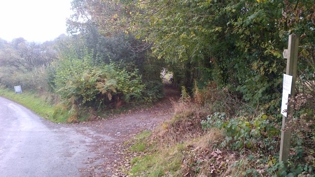
Deri-goch Wood, located in Cardiganshire, Wales, is a stunning woodland area that covers an extensive area of approximately 200 acres. This ancient forest, also known as Deri-goch Forest, is nestled in the foothills of the Cambrian Mountains, providing a picturesque and tranquil retreat for nature enthusiasts and hikers alike.

The wood is predominantly composed of native broadleaf trees, including oak, beech, and birch, creating a rich and diverse ecosystem. It is home to a wide range of flora and fauna, attracting numerous bird species, such as woodpeckers, owls, and red kites. The forest floor is adorned with a vibrant carpet of bluebells in the spring, adding to the area's natural beauty.

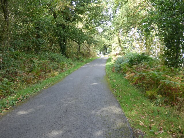
Deri-goch Wood offers a network of well-maintained footpaths that wind through the forest, providing visitors with the opportunity to explore its enchanting surroundings. The paths vary in difficulty, catering to both leisurely strolls and more adventurous hikes. Wooden benches and picnic areas are scattered throughout the woodland, allowing visitors to rest and take in the breathtaking scenery.

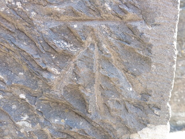
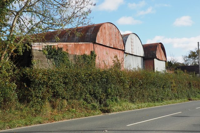
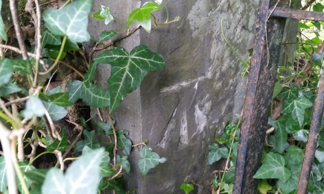
The forest is also well-known for its historical significance, with remnants of old mining activities still visible in some areas. The wood has been carefully managed and preserved by local authorities, ensuring its conservation and protection for future generations to enjoy.

With its serene ambiance, diverse wildlife, and captivating scenery, Deri-goch Wood is a must-visit destination for nature lovers seeking a peaceful retreat in the heart of Cardiganshire.

If you have any feedback on the listing, please let us know in the comments section below.

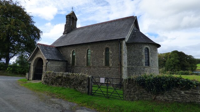
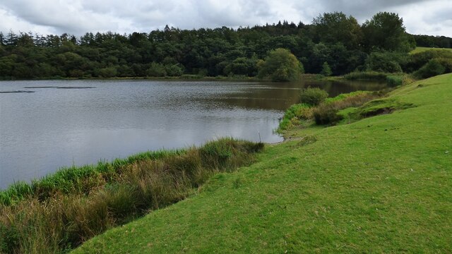
Deri-goch Wood Images

Images are sourced within 2km of 52.130178/-4.0933077 or Grid Reference SN5650. Thanks to Geograph Open Source API. All images are credited.

Lane leading past Falcondale Lake
A485 at Allt Coed Parc
A485 near Dyffryn Farm
Timber Lorry sheding its load Fortunately nobody was hurt.
Timber Lorry sheding its load
Fortunately nobody was hurt.
St Mary's Church, Maestir <span class="nowrap"><a title="https://coflein.gov.uk/cy/safle/310150/" rel="nofollow ugc noopener" href="https://coflein.gov.uk/cy/safle/310150/">Link</a><img style="margin-left:2px;" alt="External link" title="External link - shift click to open in new window" src="https://s1.geograph.org.uk/img/external.png" width="10" height="10"/></span>
St Mary's Church, Maestir
Falcondale Lake
Falcondale Lake
Country Lane North of Lampeter/Llanbedr Pont Stefan
Olwen Farmstead and Fields I had hoped to get a decent photograph of Castell Olwen but sadly the trees completely obscure it from this angle.
Olwen Farmstead and Fields
I had hoped to get a decent photograph of Castell Olwen but sadly the trees completely obscure it from this angle.
Ordnance Survey Benchmark - Lampeter, St. Peter’s Church Ordnance Survey Benchmark (OSBM) used for levelling height above Ordnance Datum (OD).
Height (1972): 136.9200m OD (Newlyn). Mark verified by the Ordnance Survey in 1971. Description: TWR ST PETERS CH W FACE SW ANG. 0.5m above ground. 2nd Order BM.

Context: <a href="https://www.geograph.org.uk/photo/7506634">SN5748 : Ordnance Survey Benchmark - Lampeter, St. Peter’s Church</a>
Ordnance Survey Benchmark - Lampeter, St. Peter’s Church
Ordnance Survey Benchmark (OSBM) used for levelling height above Ordnance Datum (OD). Height (1972): 136.9200m OD (Newlyn). Mark verified by the Ordnance Survey in 1971. Description: TWR ST PETERS CH W FACE SW ANG. 0.5m above ground. 2nd Order BM. Context: SN5748 : Ordnance Survey Benchmark - Lampeter, St. Peter’s Church
Ordnance Survey Benchmark - Lampeter, St. Peter’s Church Ordnance Survey Benchmark (OSBM) used for levelling height above Ordnance Datum (OD).
Height (1972): 136.9200m OD (Newlyn). Mark verified by the Ordnance Survey in 1971. Description: TWR ST PETERS CH W FACE SW ANG. 0.5m above ground. 2nd Order BM.

Close-up: <a href="https://www.geograph.org.uk/photo/7506633">SN5748 : Ordnance Survey Benchmark - Lampeter, St. Peter’s Church</a>
Ordnance Survey Benchmark - Lampeter, St. Peter’s Church
Ordnance Survey Benchmark (OSBM) used for levelling height above Ordnance Datum (OD). Height (1972): 136.9200m OD (Newlyn). Mark verified by the Ordnance Survey in 1971. Description: TWR ST PETERS CH W FACE SW ANG. 0.5m above ground. 2nd Order BM. Close-up: SN5748 : Ordnance Survey Benchmark - Lampeter, St. Peter’s Church
A485 at Lampeter town boundary
Grazing north-west of Lampeter, Ceredigion Cattle and the steep hillsides of Cwm Nant Creuddyn on a wet morning.
Grazing north-west of Lampeter, Ceredigion
Cattle and the steep hillsides of Cwm Nant Creuddyn on a wet morning.
The A482 to Lampeter, Ceredigion Looking south towards Lampeter; the road has come from Aberaeron.
The A482 passes through Lampeter and joins the A40 neat Llandovery.
The A482 to Lampeter, Ceredigion
Looking south towards Lampeter; the road has come from Aberaeron. The A482 passes through Lampeter and joins the A40 neat Llandovery.
Ordnance Survey Flush Bracket G3326 This can be found on the roadside wall of a building at Glan-Denys.
For more detail see : <span class="nowrap"><a title="http://www.bench-marks.org.uk/bm10589" rel="nofollow ugc noopener" href="http://www.bench-marks.org.uk/bm10589">Link</a><img style="margin-left:2px;" alt="External link" title="External link - shift click to open in new window" src="https://s1.geograph.org.uk/img/external.png" width="10" height="10"/></span>
Ordnance Survey Flush Bracket G3326
This can be found on the roadside wall of a building at Glan-Denys. For more detail see : LinkExternal link
Corrugated iron barns at Dderigoch Range of hoop-topped barns with a lean-to at the N end. Adjoins A482 road between Llanbedr Pont Steffan and Felin Fach
Corrugated iron barns at Dderigoch
Range of hoop-topped barns with a lean-to at the N end. Adjoins A482 road between Llanbedr Pont Steffan and Felin Fach
View of Glan Denys area from Long Wood above Allt-Goch View across the shallow valley of the Afon Dulas and the route of the former Aberystwyth to Carmarthen railway line at its junction with the Aberaeron branch.
View of Glan Denys area from Long Wood above Allt-Goch
View across the shallow valley of the Afon Dulas and the route of the former Aberystwyth to Carmarthen railway line at its junction with the Aberaeron branch.
Bridleway east of Silian
Ordnance Survey Cut Mark This OS cut mark can be found on the gatepost at the entrance to Tyn-Fron. It marks a point 214.250m above mean sea level.
Ordnance Survey Cut Mark
This OS cut mark can be found on the gatepost at the entrance to Tyn-Fron. It marks a point 214.250m above mean sea level.
Show me another place!

Deri-goch Wood is located at Grid Ref: SN5650 (Lat: 52.130178, Lng: -4.0933077)

Unitary Authority: Ceredigion

Police Authority: Dyfed Powys

What 3 Words

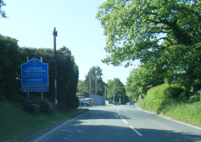
///series.respect.hinders. Near Lampeter, Ceredigion

Nearby Locations

Deri-goch Wood

Related Wikis

Falcondale Lake

Falcondale Lake is a man-made lake in the hamlet of Falcondale near Lampeter in Ceredigion It was created as part of the landscaping for Falcondale House...

Silian, Ceredigion

Silian, originally Sulien, is a village in the valley of the River Teifi, Ceredigion, Wales. It is located approximately two miles north-west of Lampeter...
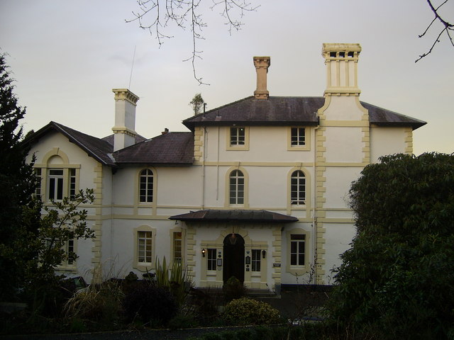
Falcondale House

Falcondale House is a Grade II listed former country house, now the Falcondale Mansion Hotel, which is situated some 1 mile north-west of Lampeter, Ceredigion...

Falcondale

Falcondale (Welsh: Glyn Hebog) is a hamlet in the community of Lampeter, Ceredigion, Wales, and occupies a low bluff overlooking the Nant Creuddyn north...

A485 road

The A485 is an A road linking Tanerdy near Carmarthen to Llanfarian near Aberystwyth in Wales. Settlements along the route include: Tanerdy Peniel Rhydargaeau...

Lampeter

Lampeter (; Welsh: Llanbedr Pont Steffan (formal); Llambed (colloquial)) is a town, community and electoral ward in Ceredigion, Wales, at the confluence...

Maestir

Maestir is a hamlet in the community of Llanwnnen, Ceredigion, Wales, which is 59.9 miles (96.3 km) from Cardiff and 175.5 miles (282.4 km) from London...

Silian Halt railway station

The Silian Halt railway station was a small railway station at Silian, the first stop after the junction on the Aberayron branch of the Carmarthen to Aberystwyth...

Have you been to Deri-goch Wood?

Leave your review of Deri-goch Wood below (or comments, questions and feedback).