Watkin Woods

Wood, Forest in Carmarthenshire

Wales

Watkin Woods

Telephone Box and Notice Board, Bro Nant, Nantyffin The telephone box and community notice board as they were in March 2004, when the telephone still took coins. BT wanted to remove it but local protests made them leave it in place. It can only be used by card now, but emergency calls are free. Just as well, as few mobile signals can be received around here.
Telephone Box and Notice Board, Bro Nant, Nantyffin Credit: Caroline Evans

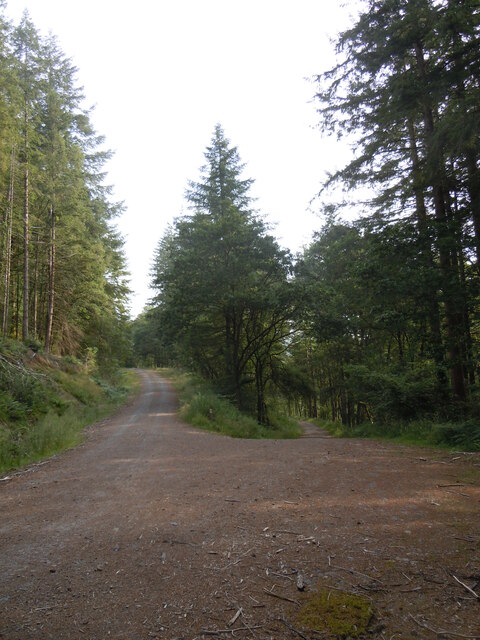
Watkin Woods is a picturesque woodland located in the county of Carmarthenshire, Wales. Covering an area of approximately 200 acres, it is a popular destination for nature enthusiasts and those seeking tranquility amidst the beauty of nature.

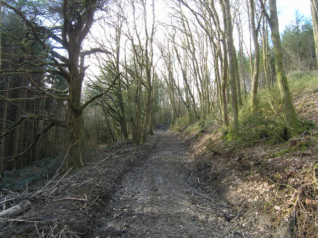
The woodland is characterized by its diverse range of tree species, including oak, beech, and birch trees, which create a stunning canopy of greenery. The forest floor is adorned with a carpet of wildflowers and ferns, adding to its enchanting atmosphere. A network of well-maintained footpaths allows visitors to explore the woods and discover its hidden treasures.

Watkin Woods is also home to a variety of wildlife, making it an ideal spot for birdwatching and animal spotting. Visitors may come across red kites soaring above the treetops, squirrels darting through the branches, or even glimpse deer grazing in the clearing. The peaceful ambiance of the woods provides a perfect habitat for these creatures, offering them a safe haven away from human disturbances.

In addition to its natural beauty, Watkin Woods holds historical significance. It is believed to have been part of an ancient Celtic settlement, and remnants of iron age fortifications can still be seen within the woodland. This adds an element of mystery and intrigue to the site, making it all the more captivating for visitors.

Overall, Watkin Woods is a haven for nature lovers, offering a tranquil escape from the bustle of everyday life. Its stunning scenery, diverse wildlife, and rich history make it a must-visit destination for anyone seeking a peaceful retreat in the heart of Carmarthenshire.

If you have any feedback on the listing, please let us know in the comments section below.

Watkin Woods Images

Images are sourced within 2km of 51.986069/-4.1060508 or Grid Reference SN5534. Thanks to Geograph Open Source API. All images are credited.
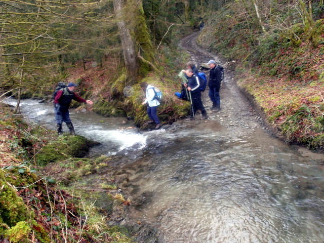
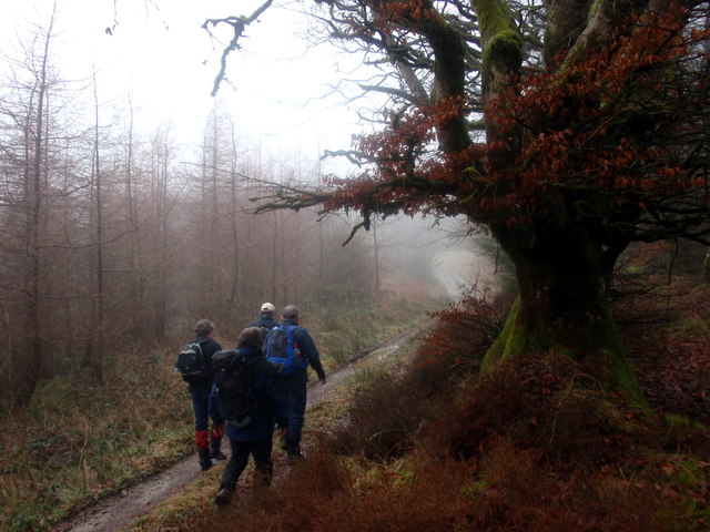
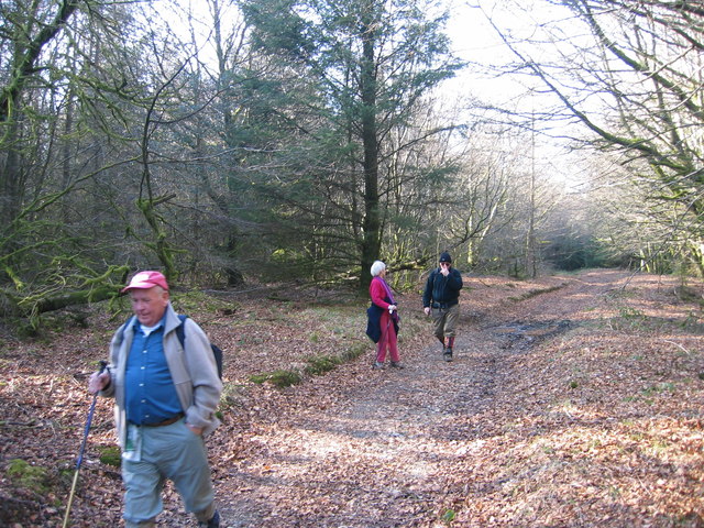
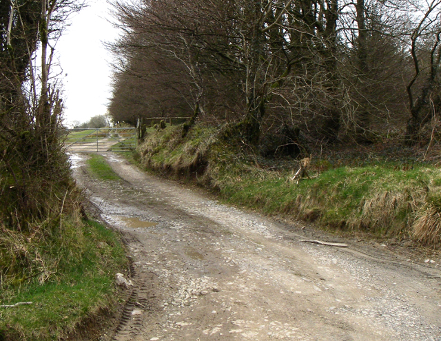
Telephone Box and Notice Board, Bro Nant, Nantyffin The telephone box and community notice board as they were in March 2004, when the telephone still took coins. BT wanted to remove it but local protests made them leave it in place. It can only be used by card now, but emergency calls are free. Just as well, as few mobile signals can be received around here.
Telephone Box and Notice Board, Bro Nant, Nantyffin
The telephone box and community notice board as they were in March 2004, when the telephone still took coins. BT wanted to remove it but local protests made them leave it in place. It can only be used by card now, but emergency calls are free. Just as well, as few mobile signals can be received around here.
Pant y Betws Cerddwyr yn mynd heibio i anhedd-dy o'r enw Pant y Betws.

Walkers passing a property known as Pant y Betws (trans. prayer house hollow)
Pant y Betws
Cerddwyr yn mynd heibio i anhedd-dy o'r enw Pant y Betws. Walkers passing a property known as Pant y Betws (trans. prayer house hollow)
Hen geuffordd / Old hollow way Cerddwyr yn mynd trwy geuffordd hynafol.

Walkers following an ancient hollow way.
Hen geuffordd / Old hollow way
Cerddwyr yn mynd trwy geuffordd hynafol. Walkers following an ancient hollow way.
Rhyd Nant y Ffin Ford Cerddwyr yn croesi Nantyffin. Roedd y rhyd ar y diwrnod yn rhy ddwfn i groesi.

Walkers crossing Nant y Ffin Stream (trans. boundary stream). On the day the water at the ford was too deep to cross.
Rhyd Nant y Ffin Ford
Cerddwyr yn croesi Nantyffin. Roedd y rhyd ar y diwrnod yn rhy ddwfn i groesi. Walkers crossing Nant y Ffin Stream (trans. boundary stream). On the day the water at the ford was too deep to cross.
Heol Rhandir Gini Road Cerddwyr yn dilyn hen heol i gyfeiriad Rhandir Gini (adfail)

Walkers following an old road in the direction of the ruined property known as Rhandir Gini.
Heol Rhandir Gini Road
Cerddwyr yn dilyn hen heol i gyfeiriad Rhandir Gini (adfail) Walkers following an old road in the direction of the ruined property known as Rhandir Gini.
Ger Banc Disgwylfa / Near Banc Disgwylfa Cerddwyr yn agosau at Fryn Disgwylfa.

Walkers going in the direction of Bryn Disgwylfa (trans. lookout hill).
Ger Banc Disgwylfa / Near Banc Disgwylfa
Cerddwyr yn agosau at Fryn Disgwylfa. Walkers going in the direction of Bryn Disgwylfa (trans. lookout hill).
Ger Ffarm y Banc / Near Banc Farm Cerddwyr yn dilyn cilfordd ucheldir ger Ffarm y Banc i gyfeiriad Abergorlech.

Walkers following an upland byway near Banc Farm in the direction of Abergorlech (trans. confluence of the Gorlech [stream]).
Ger Ffarm y Banc / Near Banc Farm
Cerddwyr yn dilyn cilfordd ucheldir ger Ffarm y Banc i gyfeiriad Abergorlech. Walkers following an upland byway near Banc Farm in the direction of Abergorlech (trans. confluence of the Gorlech [stream]).
Llwybr Ceffyl Llanfihangel Rhos y Corn Bridleway Cerddwyr yn dilyn llwybr ceffyl ger Eglwys Llanfihangel Rhos y Corn.

Walkers following a bridleway near Llanfihangel Rhos y Corn Church.
Llwybr Ceffyl Llanfihangel Rhos y Corn Bridleway
Cerddwyr yn dilyn llwybr ceffyl ger Eglwys Llanfihangel Rhos y Corn. Walkers following a bridleway near Llanfihangel Rhos y Corn Church.
Rhyd Nant Llwyd Ford Cerddwyr yn croesi Nant Llwyd.

Walkers fording Nant Llwyd stream.
Rhyd Nant Llwyd Ford
Cerddwyr yn croesi Nant Llwyd. Walkers fording Nant Llwyd stream.
Pompren Nant Byrgwm Footbridge Cerddwyr yn croesi pompren sy'n rhychwnatu Nant.


Walkers crossing a footbridge spanning a small stream.
Pompren Nant Byrgwm Footbridge
Cerddwyr yn croesi pompren sy'n rhychwnatu Nant. Walkers crossing a footbridge spanning a small stream.
Hen heol / Old road Cerddwyr yn dilyn hen heol i lawr y waered tuag at bentre Abergorlech.

Walkers descending along an old road in the direction of Aberegorlech.
Hen heol / Old road
Cerddwyr yn dilyn hen heol i lawr y waered tuag at bentre Abergorlech. Walkers descending along an old road in the direction of Aberegorlech.
Nant-Y-Ffin Valley The valley of Nant-Y-Ffin, with Crynarth on the left and Allt Esgair-onen on the right
Nant-Y-Ffin Valley
The valley of Nant-Y-Ffin, with Crynarth on the left and Allt Esgair-onen on the right
View from below Rhandir Gini
Cynarth Farm The remains of Cynarth Farm.
Cynarth Farm
The remains of Cynarth Farm.
Traciau Allt Byrgwm, Fforest Brechfa/Tracks Byrgwm Wood, Brechfa Forest Rhwng/Between Brechfa & Nantyffin
Traciau Allt Byrgwm, Fforest Brechfa/Tracks Byrgwm Wood, Brechfa Forest
Rhwng/Between Brechfa & Nantyffin
Lane Looking up the lane at SN 546 356 on a forestry edge.
Lane
Looking up the lane at SN 546 356 on a forestry edge.
Church Llanfihangel Rhos y Corn church.
I need to go back with a wider lens!
Church
Llanfihangel Rhos y Corn church. I need to go back with a wider lens!
Show me another place!

Watkin Woods is located at Grid Ref: SN5534 (Lat: 51.986069, Lng: -4.1060508)

Unitary Authority: Carmarthenshire

Police Authority: Dyfed Powys

What 3 Words

///forwarded.jazz.official. Near Llansawel, Carmarthenshire

Related Wikis

Llanfihangel Rhos-y-Corn

Llanfihangel Rhos-y-Corn is a sparsely populated community of Carmarthenshire, Wales. The population of the community taken at the 2011 census was 468...

Gwernogle

Gwernogle is an isolated hamlet in Carmarthenshire, Wales, nestled in the Brechfa Forest. The Ty Cwrdd Welsh Independent Chapel is situated in the hamlet...

Brechfa Forest

The Brechfa Forest is a forest in Carmarthenshire, south Wales. Brechfa Forest is the 'modern' name for part of the ancient Glyn Cothi Forest. From before...

Abergorlech

Abergorlech is a village 8 miles (13 km) to the north-west of Llandeilo in Carmarthenshire, Wales. It lies on the River Cothi on the B4310 road, between...

Brechfa Forest Wind Farm

Brechfa Forest West Wind Farm is a wind farm in Brechfa Forest in Carmarthenshire in south west Wales. Construction of the wind farm began in November...

Afon Marlais, Carmarthenshire

The Afon Marlais is a right-bank tributary of the Afon Cothi in Carmarthenshire, West Wales. It rises on the slopes of Mynydd Llanfihangel-rhos-y-corn...

Brechfa

Brechfa, situated between Llandeilo and Carmarthen in the county of Carmarthenshire, Wales, is a village that has existed since the 6th century at the...

Rhydcymerau

Rhydcymerau is a small village 8.5 kilometres to the south-east of Llanybydder, around the side of Mynydd Llanybydder, in Carmarthenshire, south-west Wales...

Have you been to Watkin Woods?

Leave your review of Watkin Woods below (or comments, questions and feedback).