Allt Gareg-gôch

Wood, Forest in Carmarthenshire

Wales

Allt Gareg-gôch

Ruins of Dryslwyn Castle
Ruins of Dryslwyn Castle Credit: John Lord

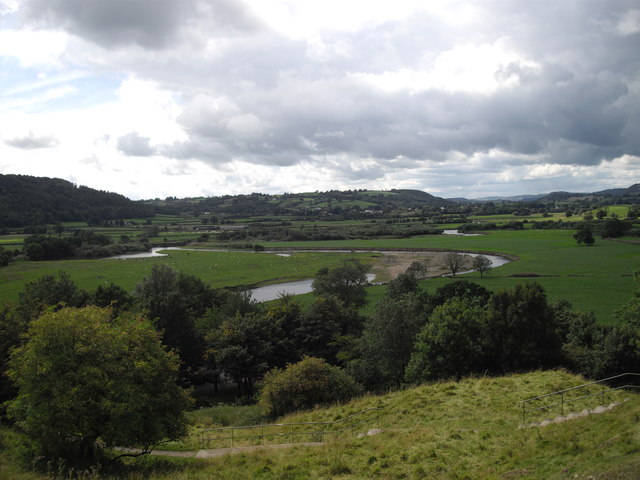
Allt Gareg-gôch is a stunning woodland area located in the county of Carmarthenshire, Wales. With its lush greenery and enchanting atmosphere, it is a haven for nature lovers and outdoor enthusiasts alike.

Covering an area of approximately 200 acres, Allt Gareg-gôch is characterized by its diverse range of tree species, including oak, birch, and beech. The woodland is known for its dense canopies and towering trees, creating a serene and picturesque setting. It is home to a variety of wildlife, such as squirrels, birds, and deer, making it an ideal spot for birdwatching and wildlife photography.

The woodland offers a network of well-maintained footpaths and trails, allowing visitors to explore the area at their own pace. These paths lead to breathtaking viewpoints, providing panoramic vistas of the surrounding countryside. The tranquil atmosphere of Allt Gareg-gôch offers the perfect opportunity for relaxation and escapism from the hustle and bustle of everyday life.

In addition to its natural beauty, Allt Gareg-gôch is also rich in historical and cultural significance. The woodland is dotted with remnants of ancient settlements, including stone circles and burial mounds, providing a glimpse into the area's past. These archaeological features add an extra layer of intrigue and fascination to the site.

Overall, Allt Gareg-gôch is a captivating woodland that showcases the beauty of Carmarthenshire's natural landscape. Its scenic trails, abundant wildlife, and historical artifacts make it a must-visit destination for anyone seeking a peaceful and immersive outdoor experience in Wales.

If you have any feedback on the listing, please let us know in the comments section below.

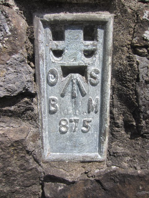
Allt Gareg-gôch Images

Images are sourced within 2km of 51.84943/-4.118641 or Grid Reference SN5418. Thanks to Geograph Open Source API. All images are credited.

Ruins of Dryslwyn Castle
Pont y Dryslwyn Road bridge over the River Towy.
Pont y Dryslwyn
Road bridge over the River Towy.
Ruins of Dryslwyn Castle
The meandering River Towy
Machlud Haul Dryslwyn Sunset Machlud haul o Bont Dryslwyn ym mis Chwefror

February sunset from Dryslwyn Bridge
Machlud Haul Dryslwyn Sunset
Machlud haul o Bont Dryslwyn ym mis Chwefror February sunset from Dryslwyn Bridge
Remains of Dryslwyn castle
St David's church, Llanarthney
Ordnance Survey Flush Bracket This OS Flush Bracket (875) can be found on the south face of a roadside wall at the Golden Grove Arms, Llanarthne. It was used during the Second Geodetic Levelling of England & Wales (1912-21) Carmarthen - Llandovery Levelling Line. Also the Third Geodetic Levelling of England & Wales (1950-68) Llandovery - Carmarthen Levelling Line. It marks a point 79.1530ft above mean sea level.
Ordnance Survey Flush Bracket
This OS Flush Bracket (875) can be found on the south face of a roadside wall at the Golden Grove Arms, Llanarthne. It was used during the Second Geodetic Levelling of England & Wales (1912-21) Carmarthen - Llandovery Levelling Line. Also the Third Geodetic Levelling of England & Wales (1950-68) Llandovery - Carmarthen Levelling Line. It marks a point 79.1530ft above mean sea level.
Former Llanarthney station View westward, towards Carmarthen: ex-LNW Llandilo - Carmarthen branch, closed 9/9/63. The station has been acquired as a private residence.
Former Llanarthney station
View westward, towards Carmarthen: ex-LNW Llandilo - Carmarthen branch, closed 9/9/63. The station has been acquired as a private residence.
Dryslwyn Castle The main remaining wall Dryslwyn Castle as seen from the road by the picnic area.
Dryslwyn Castle
The main remaining wall Dryslwyn Castle as seen from the road by the picnic area.
Picnic area at Dryslwyn On the opposite side of the main road (B4297) from the castle ruins is this pleasant area that is for parking and picnics and has exhibits suitable for children along with information plaques about the castle and its history.
Picnic area at Dryslwyn
On the opposite side of the main road (B4297) from the castle ruins is this pleasant area that is for parking and picnics and has exhibits suitable for children along with information plaques about the castle and its history.
Cadw  sign for Dryslwyn Castle Cadw is Welsh Historic Monuments for (Secretary of State for Wales) now the National Assembly of Wales.
Cadw sign for Dryslwyn Castle
Cadw is Welsh Historic Monuments for (Secretary of State for Wales) now the National Assembly of Wales.
Warning sign for the Monument This sign says nothing about the steep climb up to view Dryslwyn Castle remains!
Warning sign for the Monument
This sign says nothing about the steep climb up to view Dryslwyn Castle remains!
Pair of motor cycles and riders The sun was shinning and visitors were driving about, the two meticulous motor cycles with riders were enjoying the weather, I wonder if they had climbed up to see the ruin? or just stopped to chat and sit on the bench.
Pair of motor cycles and riders
The sun was shinning and visitors were driving about, the two meticulous motor cycles with riders were enjoying the weather, I wonder if they had climbed up to see the ruin? or just stopped to chat and sit on the bench.
Swans on the Afon Tywi Below Dryslwyn Castle on the Afon Tywi were these swans, photo taken from the road bridge on the B4297.
Swans on the Afon Tywi
Below Dryslwyn Castle on the Afon Tywi were these swans, photo taken from the road bridge on the B4297.
Dryslwyn Castle Prominent position for the castle, wonder what the surrounding area was like when the castle was complete? see <a href="https://www.geograph.org.uk/photo/3815775">SN5520 : Information sign about Dryslwyn Castle</a> for artists impression, The road bridge over the Afon Tywi has plenty of traffic, when I walked across the bridge the traffic was making the bridge structure rattle and move quite a bit!
Dryslwyn Castle
Prominent position for the castle, wonder what the surrounding area was like when the castle was complete? see SN5520 : Information sign about Dryslwyn Castle for artists impression, The road bridge over the Afon Tywi has plenty of traffic, when I walked across the bridge the traffic was making the bridge structure rattle and move quite a bit!
Date stone in bridge C.C.C. stands for Carmarthenshire County Council.
Date stone in bridge
C.C.C. stands for Carmarthenshire County Council.
Show me another place!

Allt Gareg-gôch is located at Grid Ref: SN5418 (Lat: 51.84943, Lng: -4.118641)

Unitary Authority: Carmarthenshire

Police Authority: Dyfed Powys

What 3 Words

///proudest.nuance.talkative. Near Llanddarog, Carmarthenshire

Nearby Locations

Allt Gareg-gôch Pen-Pàl

Related Wikis

Paxton's Tower

Paxton's Tower is a Neo-Gothic folly erected in honour of Lord Nelson. It is situated on the top of a hill near Llanarthney in the River Tywi valley in...

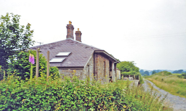
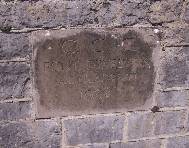
Dryslwyn railway station

== History == The station opened on 1 June 1865 by the Llanelly Railway. It was situated on the north side of the line west of the level crossing. There...
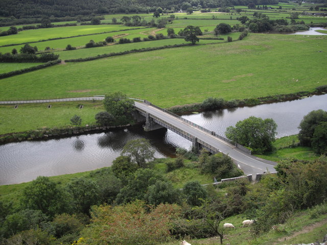
Llanarthney

Llanarthney (Welsh: Llanarthne; ) is a village and community in Carmarthenshire, south-west Wales. It is situated on the B4300 road, 12 km (7.5 miles)...

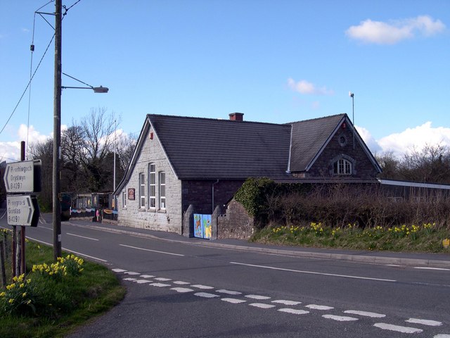
Llanarthney Halt railway station

Llanarthney railway station served the village of Llanarthney, in the historical county of Carmarthenshire, Wales, from 1865 to 1963 on the Llanelly Railway...
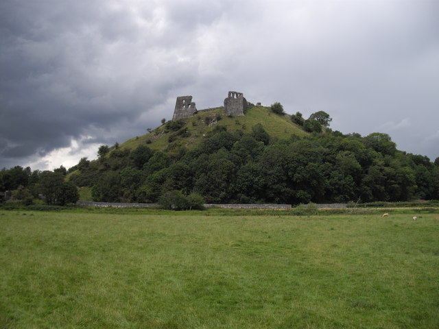
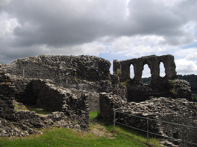
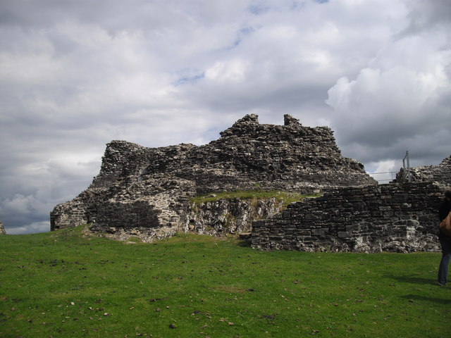
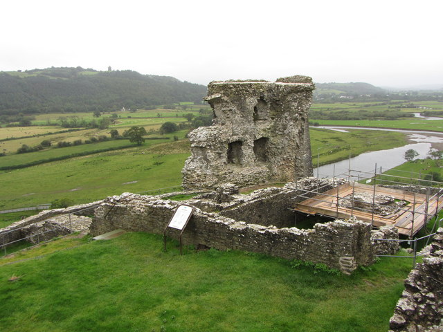
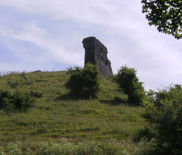
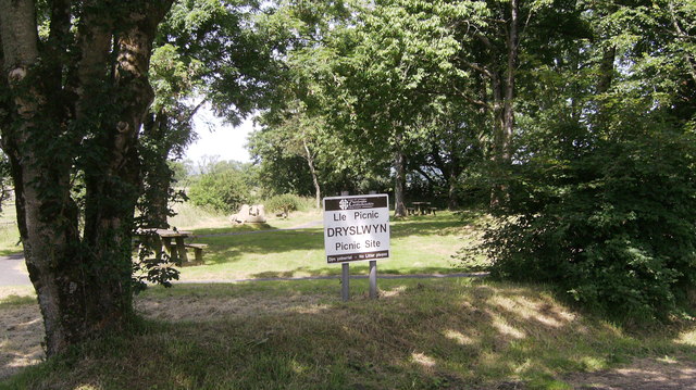
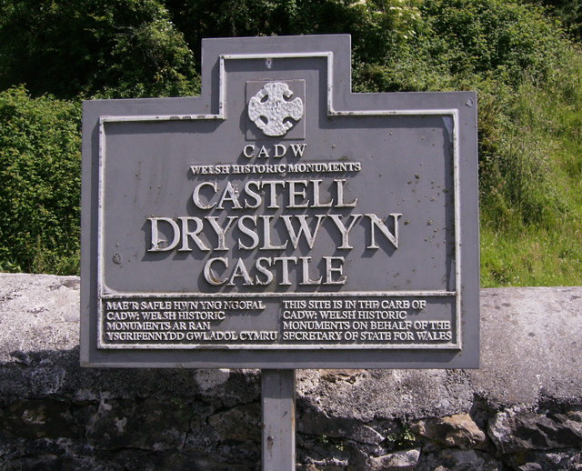
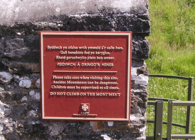
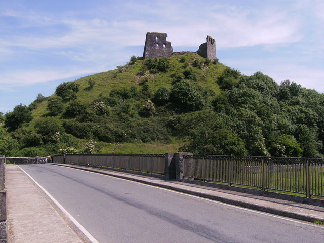
Dryslwyn Castle

Dryslwyn Castle (Welsh: Castell y Drysllwyn) is a native Welsh castle, sited on a rocky hill roughly halfway between Llandeilo and Carmarthen in Wales...

National Botanic Garden of Wales

The National Botanic Garden of Wales (Welsh: Gardd Fotaneg Genedlaethol Cymru) is a botanical garden located in Llanarthney in the River Tywi valley, Carmarthenshire...

Maesybont

Maesybont is a small village near Gorslas in Carmarthenshire, West Wales. The community consists of one school, a Welsh chapel with graveyard and several...

Llanegwad

Llanegwad () is a village and community located in Carmarthenshire, Wales. The population taken at the 2011 census was 1,473.Llanegwad is built up mainly...

Nearby Amenities

Located within 500m of 51.84943,-4.118641
Barrier: kissing_gate
Lat/Long: 51.8507043/-4.1215917
Barrier: kissing_gate
Lat/Long: 51.8516864/-4.1198465
Paxton's Tower Lodge
Building: residential
Lat/Long: 51.8506549/-4.1213184
The data included in this document is from www.openstreetmap.org. The data is made available under ODbL.

Have you been to Allt Gareg-gôch?

Leave your review of Allt Gareg-gôch below (or comments, questions and feedback).