Moss Lane

Settlement in Cheshire

England

Moss Lane

Gawsworth Road Looking towards Broken Cross.
Gawsworth Road Credit: David Kitching

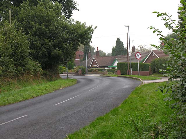
Moss Lane is a residential street located in the affluent village of Alderley Edge in Cheshire, England. The street is lined with large, detached houses, many of which are set back from the road and surrounded by well-maintained gardens. Moss Lane is known for its picturesque setting, with tree-lined sidewalks and an abundance of greenery.

The properties on Moss Lane are highly sought after, with many of them boasting modern amenities and luxurious features. The street is popular with families and professionals looking for a quiet and upscale neighborhood to call home. Moss Lane is close to the village center of Alderley Edge, which offers a range of shops, restaurants, and amenities.

In addition to its residential appeal, Moss Lane is also known for its convenient location. The street is within easy reach of major transport links, including the M56 motorway and Alderley Edge train station, making it a popular choice for commuters.

Overall, Moss Lane in Cheshire is a desirable and exclusive street that offers a high quality of living in a beautiful and well-connected location.

If you have any feedback on the listing, please let us know in the comments section below.
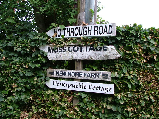
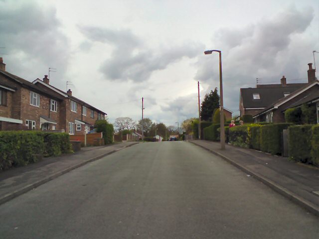
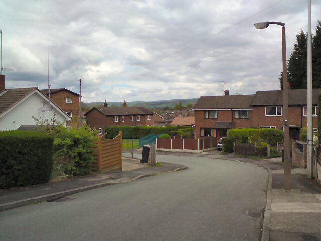
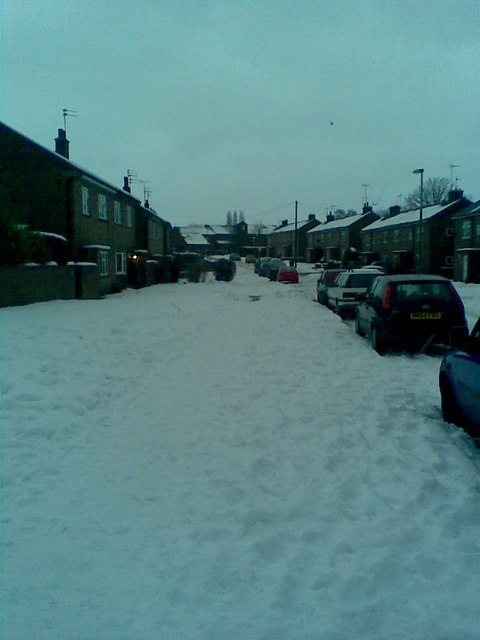
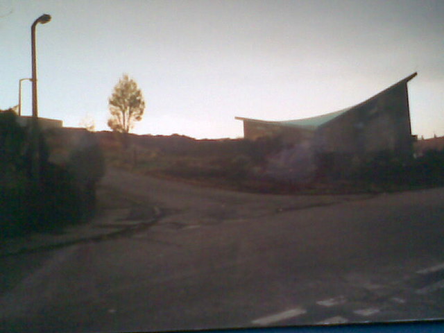
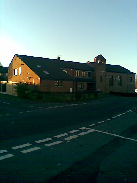
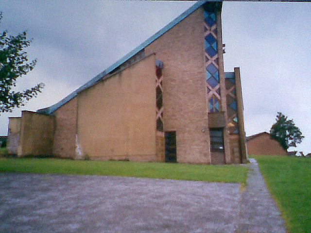
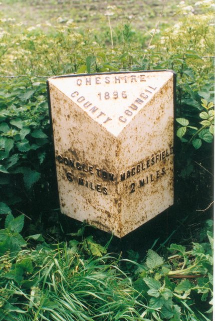
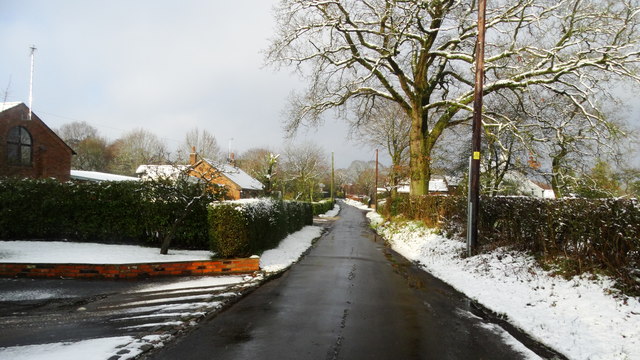
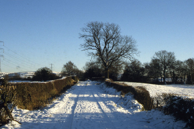
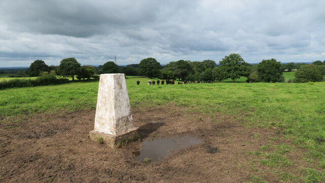
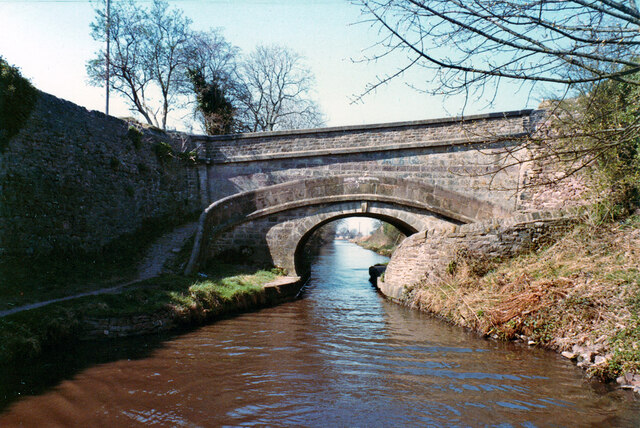
Moss Lane Images

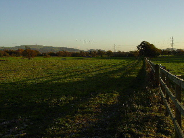
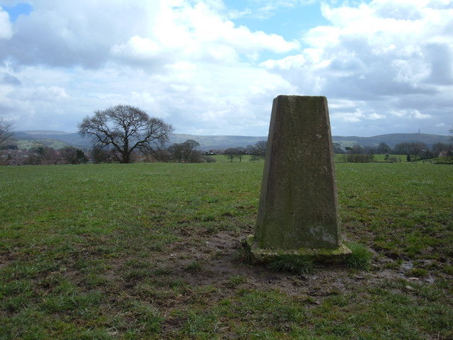
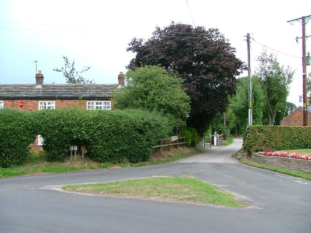
Images are sourced within 2km of 53.245376/-2.138586 or Grid Reference SJ9072. Thanks to Geograph Open Source API. All images are credited.

Gawsworth Road Looking towards Broken Cross.
Gawsworth Road
Looking towards Broken Cross.
View south from Pennington's Lane near Macclesfield View of farmland south of Pennington's Lane near Macclesfield. The hill with the tower on is Croker Hill.
View south from Pennington's Lane near Macclesfield
View of farmland south of Pennington's Lane near Macclesfield. The hill with the tower on is Croker Hill.
New Farm Trig pillar, 183m Sits on top of a neat hillock on the outskirts of Macclesfield with big views to the Cheshire/Derbyshire hills in the east.
New Farm Trig pillar, 183m
Sits on top of a neat hillock on the outskirts of Macclesfield with big views to the Cheshire/Derbyshire hills in the east.
Moss Houses A hamlet in Gawsworth parish.
Moss Houses
A hamlet in Gawsworth parish.
Signs in Moss Houses
Ivy Meade Road On the Weston estate, Macclesfield
Ivy Meade Road
On the Weston estate, Macclesfield
Ivy Meade Road On the Weston estate in Macclesfield looking towards the Southern Pennine hills.
Ivy Meade Road
On the Weston estate in Macclesfield looking towards the Southern Pennine hills.
Wilwick Lane on a winter's day
St John's church St John's church early 90s.
St John's church
St John's church early 90s.
St John's church St John's church, Weston estate.
St John's church
St John's church, Weston estate.
St John's church Weston St John's church 1992
St John's church Weston
St John's church 1992
Old Milepost by the A536, Congleton Road, Macclesfield Cast iron post by the A536, in parish of Gawsworth (Macclesfield District), near Danes Moss Farm entrance, on the verge back to metal railings, on South East side of road. Cast iron CCC1896, erected by the County Council in the 19th century. 

Inscription reads:-
: CONGLETON / 6 MILES : : CHESHIRE / 1896 / COUNTY COUNCIL : : MACCLESFIELD / 2 MILES :
Maker:-
: W H SMITH & CO / MAKERS / WHITCHURCH : 

Milestone Society National ID: CH_COMF06
Old Milepost by the A536, Congleton Road, Macclesfield
Cast iron post by the A536, in parish of Gawsworth (Macclesfield District), near Danes Moss Farm entrance, on the verge back to metal railings, on South East side of road. Cast iron CCC1896, erected by the County Council in the 19th century. Inscription reads:- : CONGLETON / 6 MILES : : CHESHIRE / 1896 / COUNTY COUNCIL : : MACCLESFIELD / 2 MILES : Maker:- : W H SMITH & CO / MAKERS / WHITCHURCH : Milestone Society National ID: CH_COMF06
Winter's day, Lowes Lane, Mosshouses, Gawsworth
Snowy track, southeast of Brownhills Farm
Trig point close to Gawsworth Road, Macclesfield
Combined farm bridge and roving bridge - Foden Bank bridge Bridge 43, Macclesfield Canal. The part for crossing the towing horse is partitioned from the farm crossing. A grade II listed structure, 1831.
Combined farm bridge and roving bridge - Foden Bank bridge
Bridge 43, Macclesfield Canal. The part for crossing the towing horse is partitioned from the farm crossing. A grade II listed structure, 1831.
Runners in Macclesfield parkrun assemble by the bandstand in South Park
Pre-race briefing for Macclesfield parkrun in South Park
Show me another place!

Moss Lane is located at Grid Ref: SJ9072 (Lat: 53.245376, Lng: -2.138586)

Unitary Authority: Cheshire East

Police Authority: Cheshire

What 3 Words

///ozone.frost.rush. Near Macclesfield, Cheshire

Nearby Locations

Moss Lane

Related Wikis

Macclesfield College

Macclesfield College is a Further Education College in Macclesfield, Cheshire which primarily offers BTEC and NVQ qualifications. The college is noted...

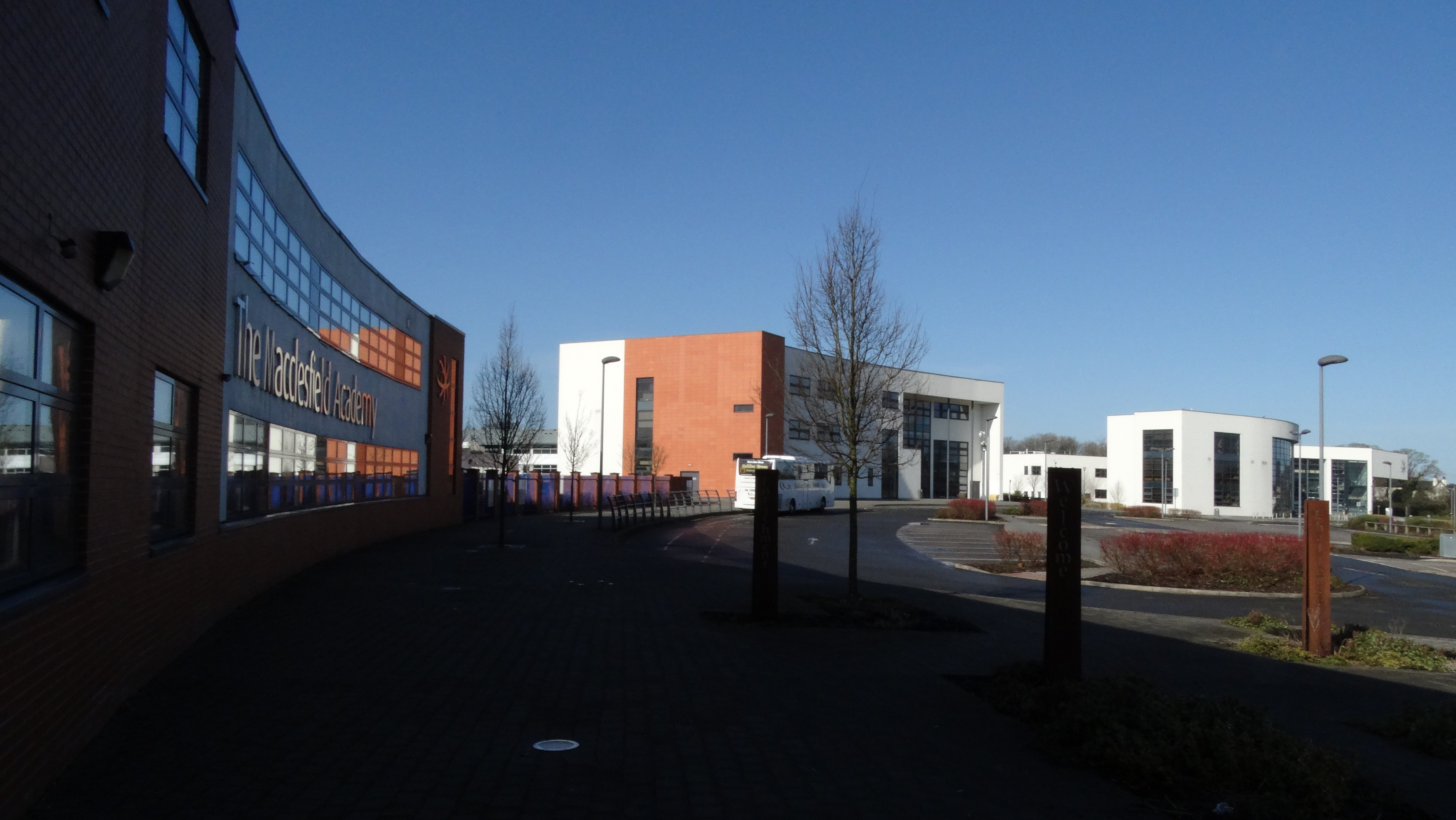
The Macclesfield Academy

Macclesfield Academy is an Academy situated in Macclesfield, Cheshire. The Academy opened on 1 September 2011 following the decision of Cheshire East Council...

Macclesfield

Macclesfield () is a market town and civil parish in the unitary authority of Cheshire East, Cheshire, England, on the River Bollin and the edge of the...

Moss Rose

Moss Rose, known as The Leasing.com Stadium for sponsorship reasons, is a football stadium in Macclesfield, Cheshire, England, which is the home ground...

Nearby Amenities

Located within 500m of 53.245376,-2.138586
Mini Roundabout
Direction: clockwise
Lat/Long: 53.2466392/-2.1440173
Turning Circle
Lat/Long: 53.2446953/-2.134951
Turning Circle
Lat/Long: 53.247255/-2.1434072
Crossing
Crossing: traffic_signals
Crossing Ref: pelican
Lat/Long: 53.2473251/-2.1443597
Turning Circle
Lat/Long: 53.246748/-2.143552
Post Box
Collection Times: Mo-Fr 09:00; Sa 07:00
Postal Code: SK11
Ref: SK11 203
Royal Cypher: EIIR
Lat/Long: 53.2480549/-2.1419014
Bus Stop
Weston, Congleton Road / Thornton Avenue
Bench: no
Bus: yes
Naptan AtcoCode: 0600MA0061
Naptan Bearing: NE
Naptan CommonName: Thornton Avenue
Naptan Crossing: Thornton Avenue
Naptan Indicator: cnr
Naptan Landmark: Thornton Avenue
Naptan LocalityName: Weston
Naptan NaptanCode: chegtmp
Naptan PlusbusZoneRef: MACLSFD
Naptan ShortCommonName: Thornton Avenue
Naptan Street: Congleton Road
Naptan Verified: no
Network: Cheshire East Council
Operator: Ansa Transport
Public Transport: platform
Shelter: no
Source: naptan_import
Lat/Long: 53.248338/-2.1434551
Bus Stop
Weston, Congleton Road / Thornton Avenue
Bench: no
Bin: no
Bus: yes
Naptan AtcoCode: 0600MA0062
Naptan Bearing: SW
Naptan CommonName: Thornton Avenue
Naptan Crossing: Thornton Avenue
Naptan Indicator: opp
Naptan Landmark: Thornton Avenue
Naptan LocalityName: Weston
Naptan NaptanCode: chegtmt
Naptan PlusbusZoneRef: MACLSFD
Naptan ShortCommonName: Thornton Avenue
Naptan Street: Congleton Road
Naptan Verified: no
Network: Cheshire East Council
Operator: Ansa Transport
Public Transport: platform
Shelter: no
Source: naptan_import
Tactile Paving: no
Lat/Long: 53.2479334/-2.1435436
Barrier: cycle_barrier
Cycle Barrier: single
Lat/Long: 53.2478372/-2.1362389
Turning Circle
Lat/Long: 53.2487887/-2.1411726
Turning Circle
Lat/Long: 53.2487814/-2.1404127
South Macclesfield Development Zone
Place: neighbourhood
Lat/Long: 53.2416895/-2.141502
Turning Circle
Lat/Long: 53.2496135/-2.1406753
Turning Circle
Lat/Long: 53.249415/-2.1403468
Barrier: cycle_barrier
Bicycle: yes
Cycle Barrier Installation: fixed
Lat/Long: 53.2480022/-2.1400259
Addr Housenumber: 70
Addr Street: Congleton Road
Lat/Long: 53.2477643/-2.1433967
Addr Housenumber: 82
Addr Street: Congleton Road
Lat/Long: 53.2474788/-2.143713
Addr Housenumber: 84
Addr Street: Congleton Road
Lat/Long: 53.2474406/-2.1437464
Addr Housenumber: 74
Addr Street: Congleton Road
Lat/Long: 53.2477031/-2.1434691
Addr Housenumber: 54
Addr Street: Congleton Road
Lat/Long: 53.2485288/-2.1427854
Addr Housenumber: 58
Addr Street: Congleton Road
Lat/Long: 53.2484058/-2.1428956
Addr Housenumber: 76
Addr Street: Congleton Road
Lat/Long: 53.2476291/-2.1435502
Addr Housenumber: 72
Addr Street: Congleton Road
Lat/Long: 53.2477296/-2.1434357
Addr Housenumber: 86
Addr Street: Congleton Road
Lat/Long: 53.2473961/-2.1437757
Addr Housenumber: 80
Addr Street: Congleton Road
Lat/Long: 53.2475478/-2.1436371
Addr Housenumber: 78
Addr Street: Congleton Road
Lat/Long: 53.247594/-2.1435924
Addr Housenumber: 56
Addr Street: Congleton Road
Lat/Long: 53.2484486/-2.1428515
Addr Housenumber: 62
Addr Street: Congleton Road
Lat/Long: 53.2482882/-2.1429939
Addr Housenumber: 60
Addr Street: Congleton Road
Lat/Long: 53.2483308/-2.1429664
Addr Housenumber: 52
Addr Street: Congleton Road
Lat/Long: 53.2485681/-2.1427497
Bus Stop
Macclesfield, Craig Road / Harewood Way
Bus: yes
Naptan AtcoCode: 0600MA6057
Naptan Bearing: NW
Naptan BusStopType: CUS
Naptan CommonName: Harewood Way
Naptan Crossing: Harewood Way
Naptan Indicator: nr
Naptan Landmark: Harewood Way
Naptan LocalityName: Macclesfield
Naptan NaptanCode: chetpam
Naptan PlusbusZoneRef: MACLSFD
Naptan ShortCommonName: Harewood Way
Naptan Street: Craig Road
Public Transport: platform
Source: naptan_import
Lat/Long: 53.2479167/-2.1402565
Generator Method: photovoltaic
Generator Output Electricity: yes
Generator Source: solar
Generator Type: solar_photovoltaic_panel
Location: roof
Power: generator
Lat/Long: 53.2473262/-2.1321288
Addr Housenumber: 12
Addr Street: Flying Fields Drive
Lat/Long: 53.246051/-2.144143
Addr Housenumber: 86
Addr Street: Craig Road
Lat/Long: 53.2477479/-2.1421697
Addr Housenumber: 19
Addr Street: Flying Fields Drive
Lat/Long: 53.2457813/-2.1434915
Addr Housenumber: 6
Addr Street: Haworth Close
Lat/Long: 53.2483571/-2.1421594
Addr Housenumber: 51
Addr Street: Congleton Road
Lat/Long: 53.2485818/-2.1433245
Addr Housenumber: 84
Addr Street: Craig Road
Lat/Long: 53.2477819/-2.1421598
Addr Housenumber: 7
Addr Street: Haworth Close
Lat/Long: 53.2480906/-2.1424648
Addr Housenumber: 5
Addr Street: Haworth Close
Lat/Long: 53.2480607/-2.1424073
Addr Housenumber: 1
Addr Street: Flying Fields Drive
Lat/Long: 53.2463743/-2.1439098
Addr Housenumber: 7
Addr Street: Flying Fields Drive
Lat/Long: 53.24624/-2.1436995
Addr Housenumber: 26
Addr Street: Flying Fields Drive
Lat/Long: 53.2456154/-2.1439566
Addr Housenumber: 3
Addr Street: Haddon Close
Lat/Long: 53.2466456/-2.142596
Addr Housenumber: 1
Addr Street: Haddon Close
Lat/Long: 53.2466335/-2.1425054
Addr Housenumber: 16
Addr Street: Flying Fields Drive
Lat/Long: 53.2459139/-2.1441027
Addr Housenumber: 10
Addr Street: Haworth Close
Lat/Long: 53.248397/-2.1423213
Addr Housenumber: 14
Addr Street: Flying Fields Drive
Lat/Long: 53.2459665/-2.1441134
Addr Housenumber: 22
Addr Street: Flying Fields Drive
Lat/Long: 53.2456908/-2.1440066
Addr Housenumber: 4
Addr Street: Haworth Close
Lat/Long: 53.2482904/-2.1420194
Addr Housenumber: 7
Addr Street: Haddon Close
Lat/Long: 53.246655/-2.1428141
Addr Housenumber: 80
Addr Street: Craig Road
Lat/Long: 53.2479281/-2.1420994
Addr Housenumber: 15
Addr Street: Flying Fields Drive
Lat/Long: 53.2459043/-2.1435524
Addr Housenumber: 13
Addr Street: Haddon Close
Lat/Long: 53.2466783/-2.143161
Addr Housenumber: 11
Addr Street: Flying Fields Drive
Lat/Long: 53.2460142/-2.1436085
Addr Housenumber: 9
Addr Street: Flying Fields Drive
Lat/Long: 53.2460939/-2.1436365
Addr Housenumber: 15
Addr Street: Haddon Close
Lat/Long: 53.2466923/-2.1432314
Addr Housenumber: 5
Addr Street: Flying Fields Drive
Lat/Long: 53.2462725/-2.1437432
Addr Housenumber: 20
Addr Street: Flying Fields Drive
Lat/Long: 53.2458207/-2.1440536
Addr Housenumber: 17
Addr Street: Haddon Close
Lat/Long: 53.2467008/-2.1433762
Addr Housenumber: 59
Addr Street: Haddon Close
Lat/Long: 53.2477862/-2.1424182
Addr Housenumber: 2
Addr Street: Haworth Close
Lat/Long: 53.2482886/-2.1419471
Addr Housenumber: 8
Addr Street: Flying Fields Drive
Lat/Long: 53.2461926/-2.1442424
Addr Housenumber: 10
Addr Street: Flying Fields Drive
Lat/Long: 53.246089/-2.144188
Addr Housenumber: 18
Addr Street: Flying Fields Drive
Lat/Long: 53.2458609/-2.1440772
Addr Housenumber: 3
Addr Street: Flying Fields Drive
Lat/Long: 53.2463414/-2.1438721
Waste Basket
Lat/Long: 53.2455361/-2.1435854
Addr Housenumber: 24
Addr Street: Flying Fields Drive
Lat/Long: 53.2456464/-2.143977
Addr Housenumber: 21
Addr Street: Flying Fields Drive
Lat/Long: 53.2457161/-2.1434905
Addr Housenumber: 57
Addr Street: Haddon Close
Lat/Long: 53.2477855/-2.142483
Addr Housenumber: 17
Addr Street: Flying Fields Drive
Lat/Long: 53.2458507/-2.143528
Addr Housenumber: 39
Addr Street: Craig Road
Lat/Long: 53.2480158/-2.1416407
Addr Housenumber: 5
Addr Street: Haddon Close
Lat/Long: 53.2466519/-2.1427392
Addr Housenumber: 6
Addr Street: Flying Fields Drive
Lat/Long: 53.2462242/-2.1442742
Addr Housenumber: 4
Addr Street: Flying Fields Drive
Lat/Long: 53.2464238/-2.1443765
Addr Housenumber: 3
Addr Street: Haworth Close
Lat/Long: 53.2480546/-2.142254
Addr Housenumber: 12
Addr Street: Haworth Close
Lat/Long: 53.2484177/-2.142385
Addr Housenumber: 37
Addr Street: Craig Road
Lat/Long: 53.2480095/-2.1415571
Addr Housenumber: 11
Addr Street: Haddon Close
Lat/Long: 53.2466709/-2.1430256
Addr Housenumber: 90
Addr Street: Craig Road
Lat/Long: 53.2475993/-2.1421704
Addr Housenumber: 2
Addr Street: Flying Fields Drive
Lat/Long: 53.2464966/-2.1443821
Waste Basket
Lat/Long: 53.2486652/-2.1394883
Addr Housenumber: 40
Addr Street: Craig Road
Lat/Long: 53.2479211/-2.1398541
Addr Housenumber: 13
Addr Street: Craig Road
Lat/Long: 53.2478066/-2.1402926
Addr Housenumber: 19
Addr Street: Haddon Close
Lat/Long: 53.2467062/-2.1434415
Addr Housenumber: 9
Addr Street: Haddon Close
Lat/Long: 53.2466559/-2.1429379
Addr Housenumber: 82
Addr Street: Craig Road
Lat/Long: 53.2478809/-2.1421111
Addr Housenumber: 88
Addr Street: Craig Road
Lat/Long: 53.2476477/-2.1421735
Addr Housenumber: 8
Addr Street: Haworth Close
Lat/Long: 53.2483772/-2.1422154
Addr Housenumber: 20A
Addr Street: Primrose Avenue
Lat/Long: 53.2483911/-2.1410414
Information: guidepost
Tourism: information
Lat/Long: 53.247943/-2.1401381
Addr Housenumber: 9
Addr Street: Haworth Close
Lat/Long: 53.2481305/-2.1425736
Addr Housenumber: 78
Addr Street: Craig Road
Lat/Long: 53.248284/-2.1417977
Addr Housenumber: 76
Addr Street: Craig Road
Lat/Long: 53.2482793/-2.1417341
Waste Basket
Lat/Long: 53.248718/-2.1393893
Addr Housenumber: 42
Addr Street: Craig Road
Lat/Long: 53.2479648/-2.1398725
Addr Housenumber: 15
Addr Street: Craig Road
Lat/Long: 53.2478468/-2.1402834
Addr Housenumber: 11
Addr Street: Haworth Close
Lat/Long: 53.2481548/-2.1426582
Addr Housenumber: 2A
Addr Street: Thornton Avenue
Lat/Long: 53.2478957/-2.1447297
Addr Housenumber: 45
Addr Street: Congleton Road
Lat/Long: 53.2487483/-2.1431486
Addr Housenumber: 1
Addr Street: Haworth Close
Lat/Long: 53.2480266/-2.1421843
Addr Housenumber: 49
Addr Street: Congleton Road
Lat/Long: 53.2486377/-2.1432638
Addr Housenumber: 57
Addr Street: Congleton Road
Lat/Long: 53.2483837/-2.143525
Information: guidepost
Tourism: information
Lat/Long: 53.2482446/-2.139085
Addr Housenumber: 53
Addr Street: Congleton Road
Lat/Long: 53.2485034/-2.1433968
Addr Housenumber: 59
Addr Street: Congleton Road
Lat/Long: 53.2483407/-2.1435677
Addr Housenumber: 55
Addr Street: Congleton Road
Lat/Long: 53.2484643/-2.1434504
Addr Housenumber: 43
Addr Street: Congleton Road
Lat/Long: 53.2488188/-2.1430785
Addr Housenumber: 47
Addr Street: Congleton Road
Lat/Long: 53.2487082/-2.1431954
Addr Housenumber: 2
Addr Street: Waldon Road
Lat/Long: 53.2483514/-2.1441404
Addr Housenumber: 41
Addr Street: Congleton Road
Lat/Long: 53.2488584/-2.1430349
Addr Housenumber: 5
Addr Street: Thornton Avenue
Lat/Long: 53.2482942/-2.1440348
Addr Housenumber: 2
Addr Street: Thornton Avenue
Lat/Long: 53.2479004/-2.1446206
The data included in this document is from www.openstreetmap.org. The data is made available under ODbL.

Have you been to Moss Lane?

Leave your review of Moss Lane below (or comments, questions and feedback).