Reigate Hill and Gatton Park

Heritage Site in Surrey

England

Reigate Hill and Gatton Park

Plaque, St Philip's Church Hall Plaque by the door of St Philip's Church Hall (see <a href="https://www.geograph.org.uk/photo/6908046">TQ2450 : St Philip's Church Hall</a>).  The inscription "St Mark's Mission House 1871" is a reminder that St Philip's Church, whilst privately funded, was for many years a "proprietary chapel" of St Mark's Church, only becoming a parish church in its own right around 1992.
Plaque, St Philip's Church Hall Credit: Ian Capper

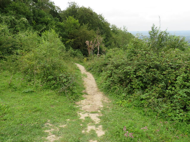
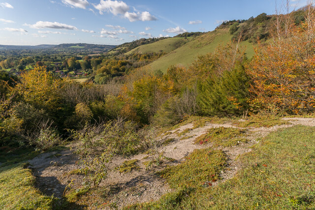
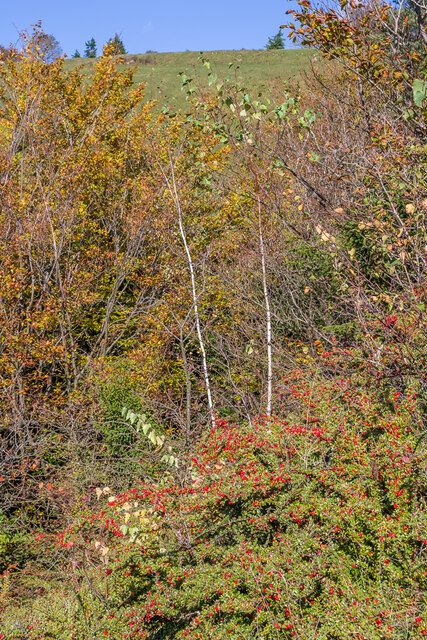
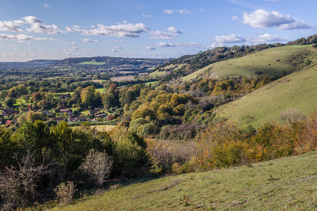
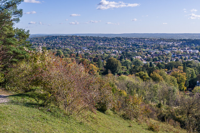
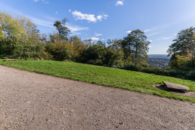
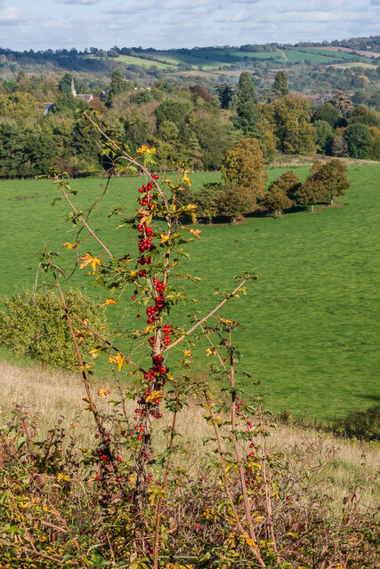
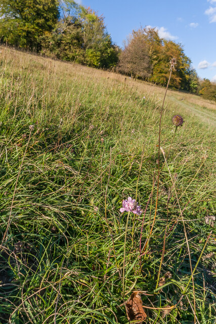
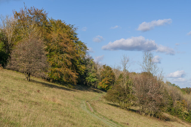
Reigate Hill and Gatton Park are two prominent heritage sites located in Surrey, England. Reigate Hill is a chalk hill that offers stunning panoramic views of the surrounding countryside. It is situated within the North Downs Area of Outstanding Natural Beauty, making it a popular destination for nature lovers and hikers alike. The hill is known for its diverse wildlife, including rare orchids and various butterfly species.

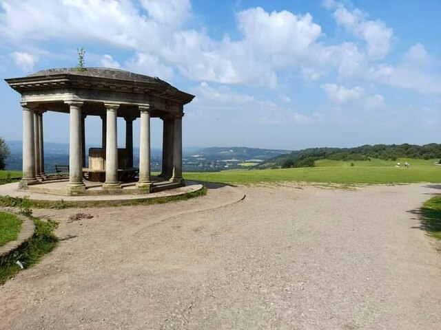
Gatton Park, on the other hand, is a historic parkland that encompasses an area of approximately 260 acres. It is situated adjacent to Reigate Hill and is renowned for its magnificent gardens and picturesque landscapes. The park is home to several notable features, including the Grade II listed Gatton Hall, a Georgian mansion built in the late 18th century.

Visitors to Gatton Park can explore its extensive network of walking trails, which provide access to various points of interest such as the Japanese garden, the lake, and the walled garden. The park also offers educational programs and guided tours, allowing visitors to learn about its rich history and architectural heritage.

Both Reigate Hill and Gatton Park offer a tranquil escape from the hustle and bustle of nearby urban areas. They provide an opportunity to immerse oneself in nature, enjoy breathtaking views, and appreciate the cultural significance of these remarkable heritage sites.

If you have any feedback on the listing, please let us know in the comments section below.

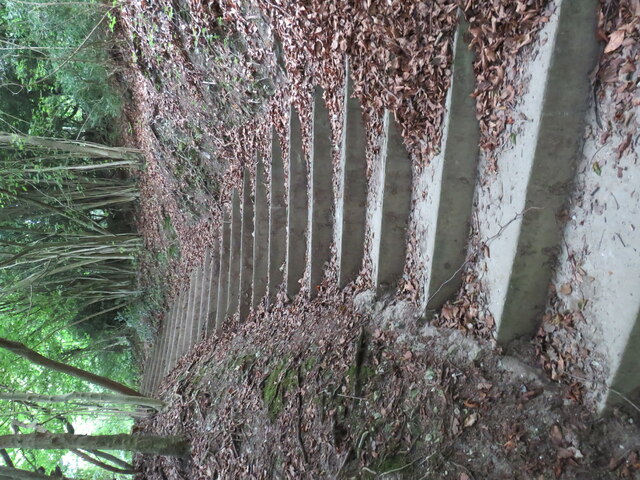
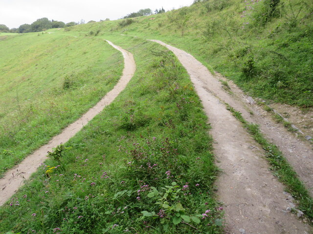
Reigate Hill and Gatton Park Images

Images are sourced within 2km of 51.253/-0.204 or Grid Reference TQ2551. Thanks to Geograph Open Source API. All images are credited.

Plaque, St Philip's Church Hall Plaque by the door of St Philip's Church Hall (see <a href="https://www.geograph.org.uk/photo/6908046">TQ2450 : St Philip's Church Hall</a>).  The inscription "St Mark's Mission House 1871" is a reminder that St Philip's Church, whilst privately funded, was for many years a "proprietary chapel" of St Mark's Church, only becoming a parish church in its own right around 1992.
Plaque, St Philip's Church Hall
Plaque by the door of St Philip's Church Hall (see TQ2450 : St Philip's Church Hall). The inscription "St Mark's Mission House 1871" is a reminder that St Philip's Church, whilst privately funded, was for many years a "proprietary chapel" of St Mark's Church, only becoming a parish church in its own right around 1992.
Steps on Colley Hill These steps eventually lead to the open space on Colley Hill and in particular the Inglis memorial <a href="https://www.geograph.org.uk/gridref/TQ2552">TQ2552</a>
Steps on Colley Hill
These steps eventually lead to the open space on Colley Hill and in particular the Inglis memorial TQ2552
Track/Path on Colley Hill This views shows the track just after it leaves woodland and reaches the open space at the top of Colley Hill on the North Downs near Reigate.
Track/Path on Colley Hill
This views shows the track just after it leaves woodland and reaches the open space at the top of Colley Hill on the North Downs near Reigate.
Saxon Way c.1970s housing off Beaufort Road.
Saxon Way
c.1970s housing off Beaufort Road.
Saxon Way c.1970s housing off Beaufort Road.
Saxon Way
c.1970s housing off Beaufort Road.
Path  from Colley Hill The path originates at the Inglis memorial; it leads down off the hill towards Reigate
Path from Colley Hill
The path originates at the Inglis memorial; it leads down off the hill towards Reigate
Inglis Memorial
Inglis Memorial
Old Milestone, A217, Reigate Hill, near M25 roundabout The milestone is located on the east side of the southern carriageway of Reigate Hill just off the M25 roundabout on the grass verge. Parish of Banstead (Reigate and Banstead district). Carved stone post, Surrey limestone pillar design, erected by the Reigate turnpike trust in the 19th century.

Inscription reads:-
LONDON / 19 / SUTTON / 8 : :  BRIGHTON / (  )2 / ( ) ON / 1(  )

Grade II listed, list entry number: 1480702  <span class="nowrap"><a title="https://historicengland.org.uk/listing/the-list/list-entry/1480702" rel="nofollow ugc noopener" href="https://historicengland.org.uk/listing/the-list/list-entry/1480702">Link</a><img style="margin-left:2px;" alt="External link" title="External link - shift click to open in new window" src="https://s1.geograph.org.uk/img/external.png" width="10" height="10"/></span>

The photograph was taken sometime between 2001 and 2005.

Milestone Society National ID: SY_LQR19
Old Milestone, A217, Reigate Hill, near M25 roundabout
The milestone is located on the east side of the southern carriageway of Reigate Hill just off the M25 roundabout on the grass verge. Parish of Banstead (Reigate and Banstead district). Carved stone post, Surrey limestone pillar design, erected by the Reigate turnpike trust in the 19th century. Inscription reads:- LONDON / 19 / SUTTON / 8 : : BRIGHTON / ( )2 / ( ) ON / 1( ) Grade II listed, list entry number: 1480702 LinkExternal link The photograph was taken sometime between 2001 and 2005. Milestone Society National ID: SY_LQR19
Railhead Treatment Train Windhoff CargoSprinter MPV DR98926 (with DR98976 at rear) approaching Reigate Station on a Railhead Treatment working.  This involves blasting water through a nozzle under the train, spraying the rail heads, to remove any build up of leaf residue following leaf fall in autumn.
Railhead Treatment Train
Windhoff CargoSprinter MPV DR98926 (with DR98976 at rear) approaching Reigate Station on a Railhead Treatment working. This involves blasting water through a nozzle under the train, spraying the rail heads, to remove any build up of leaf residue following leaf fall in autumn.
Aliens Cotoneaster and Buddleia plants, both aliens that have naturalised here, on a patch of bare chalk on Colley Hill, with the North Downs stretching on into the distance.
Aliens
Cotoneaster and Buddleia plants, both aliens that have naturalised here, on a patch of bare chalk on Colley Hill, with the North Downs stretching on into the distance.
Aliens A large patch of Cotoneaster, an alien that have naturalised here, on the south slope of Colley Hill.
Aliens
A large patch of Cotoneaster, an alien that have naturalised here, on the south slope of Colley Hill.
West along Colley Hill Looking along Colley Hill, with the North Downs stretching on into the distance.
West along Colley Hill
Looking along Colley Hill, with the North Downs stretching on into the distance.
Towards Reigate Looking over Reigate from the path up Colley Hill.
Towards Reigate
Looking over Reigate from the path up Colley Hill.
A217 Reigate Hill Looking down the A217 as it drops down from Reigate Hill, under an autumn sun.
A217 Reigate Hill
Looking down the A217 as it drops down from Reigate Hill, under an autumn sun.
B17 crash memorial, Reigate Hill  On 19 March 1945, a B17G Flying Fortress crewed by 9 men from the 384th Bombardment Group of the United States Army Air Corps crashed into Reigate Hill when returning to its base at Grafton Underwood in Northamptonshire from a raid near the German/Czech border.

This clearing in the trees is the site of the crash, as the Beech trees at the spot were destroyed by the impact.  Although the site has always been marked with a seat, a new memorial was unveiled in 2015 on the 70th anniversary of the crash.  It consists of two replica wingtips, carved by sculptor Roger Day. and placed 103 ft apart, being the aircraft's wingspan.

In the distance on the right is Reigate.
B17 crash memorial, Reigate Hill
On 19 March 1945, a B17G Flying Fortress crewed by 9 men from the 384th Bombardment Group of the United States Army Air Corps crashed into Reigate Hill when returning to its base at Grafton Underwood in Northamptonshire from a raid near the German/Czech border. This clearing in the trees is the site of the crash, as the Beech trees at the spot were destroyed by the impact. Although the site has always been marked with a seat, a new memorial was unveiled in 2015 on the 70th anniversary of the crash. It consists of two replica wingtips, carved by sculptor Roger Day. and placed 103 ft apart, being the aircraft's wingspan. In the distance on the right is Reigate.
Black Bryony Black Bryony (Dioscorea communis) in berry on Wingate Hill, with Gatton in the background and the North Downs beyond.
Black Bryony
Black Bryony (Dioscorea communis) in berry on Wingate Hill, with Gatton in the background and the North Downs beyond.
Wingate Hill A late flowering Field Scabious (Knautia arvensis) in grass downland on Wingate Hill.
Wingate Hill
A late flowering Field Scabious (Knautia arvensis) in grass downland on Wingate Hill.
Wingate Hill A path across grass downland on Wingate Hill.
Wingate Hill
A path across grass downland on Wingate Hill.
Show me another place!

Reigate Hill and Gatton Park is located at Grid Ref: TQ2551 (Lat: 51.253, Lng: -0.204)

What 3 Words

///funds.enable.costs. Near Lower Kingswood, Surrey

Related Wikis

London Defence Positions

The London Defence Positions were a late 19th-century scheme of earthwork fortifications in the southeast of England, designed to protect London from foreign...

Reigate transmitting station

Reigate transmitting station is a television and radio transmitting tower in southeastern England. It is located on the North Downs at Reigate Hill about...

Margery

Margery is a heavily buffered, lightly populated hamlet in the Reigate and Banstead district in the English county of Surrey. It sits on the North Downs...

Colley Hill

Colley Hill is part of the North Downs escarpment in the North Downs, Surrey, England. It is about 1 km east of Buckland Hills and 1 km west of Reigate...

Nearby Amenities

Located within 500m of 51.253,-0.204
Post Box
Ref: RH2 131
Source: P140-0942
Lat/Long: 51.248976/-0.2017292
Fuel
Reigate Manor Service Station
Addr City: Reigate
Addr Postcode: RH2 9JP
Addr Street: Reigate Hill
Brand: Esso
Brand Wikidata: Q867662
Deaf Description En: No Hearing LOOPs: 2011-10-11
Deaf Description Fr: sans bobine telephonique "T": 2011-10
Fuel Cng: no
Fuel Diesel: yes
Fuel Lpg: no
Fuel Octane 98: yes
Operator: Rontec
Operator Website: http://www.rontec-servicestations.co.uk/ss_results-id.cfm?id=7156
Operator Wikidata: Q107439152
Shop: convenience
Toilets Wheelchair: no
Wheelchair: limited
Wheelchair Description: Manual door and cramped aisles inside. High Counter in shop. No Service Call. No Hearing LOOP. Outside ATM now step-free accessible (new photo)
Lat/Long: 51.2501104/-0.2022948
The Yew Tree
Addr City: Reigate
Addr Housenumber: 99
Addr Postcode: RH2 9PJ
Addr Street: Reigate Hill
Note: Looks abandoned in Aug 2021
Phone: +44 1737 244944
Was Amenity: pub
Wheelchair: no
Wheelchair Description: Step at entrance. No Blue Badge spaces.
Lat/Long: 51.2505887/-0.2019467
Reigate Fort
Addr City: Reigate
Addr Street: Fort Lane
Historic: archaeological_site
Toilets Wheelchair: no
Website: https://www.nationaltrust.org.uk/reigate-hill-and-gatton-park/features/reigate-fort-at-reigate-hill-and-gatton-park
Wheelchair: limited
Wheelchair Description: Some displays accessible. Underground bunkers and ramparts via steps only. Two accessible parking bays at the top of Fort Lane.
Lat/Long: 51.2539228/-0.2007062
Bus Stop
Reigate Manor Hotel (o/s)
Bench: no
Bin: yes
Bus: yes
Lit: no
Naptan AtcoCode: 40004409092A
Naptan Bearing: N
Naptan CommonName: Reigate Manor Hotel
Naptan Indicator: O/s
Naptan Landmark: Yew Tree Inn
Naptan NaptanCode: surdgwpm
Naptan PlusbusZoneRef: REDHILL
Naptan Street: Reigate Hill
Naptan Verified: yes
Public Transport: platform
Shelter: no
Source: naptan_import
Tactile Paving: no
Toilets Wheelchair: no
Website: http://nextbuses.mobi/WebView/BusStopSearch/BusStopSearchResults/surdgwpm?currentPage=0
Wheelchair: limited
Wheelchair Description: Step-free to Hotel via steep slopes. Not Step-free to stop opposite (southbound). DANGER. Between entry and exit to Gas Station, near blind bend on busy main road.
Lat/Long: 51.2501854/-0.2020598
Bus Stop
Reigate Manor Hotel
Addr City: Reigate
Addr Street: Reigate Hill
Bench: no
Bin: no
Bus: yes
Lit: no
Naptan AtcoCode: 40004409092B
Naptan Bearing: S
Naptan CommonName: Reigate Manor Hotel
Naptan Indicator: Opp
Naptan Landmark: Yew Tree Inn
Naptan NaptanCode: surdgwpt
Naptan PlusbusZoneRef: REDHILL
Naptan Street: Reigate Hill
Naptan Verified: yes
Public Transport: platform
Shelter: no
Source: naptan_import
Tactile Paving: no
Toilets Wheelchair: no
Website: http://nextbuses.mobi/WebView/BusStopSearch/BusStopSearchResults/surdgwpt?currentPage=0
Wheelchair: limited
Wheelchair Description: Not Step-free to Reigate Manor Hotel, and stop opposite (northbound). DANGER. Near blind bend on busy main road.
Lat/Long: 51.2496552/-0.2021775
Fire Hydrant
Emergency: fire_hydrant
Fire Hydrant Position: lane
Fire Hydrant Type: underground
Lat/Long: 51.2509756/-0.2011398
Fire Hydrant
Emergency: fire_hydrant
Fire Hydrant Diameter: 180
Fire Hydrant Position: lane
Fire Hydrant Type: underground
Lat/Long: 51.2488729/-0.2024003
Reigate Hill
Communication: television
Man Made: tower
Note: There are 2 towers this close
Tower Type: communication
Lat/Long: 51.2545746/-0.200817
Fire Hydrant
Emergency: fire_hydrant
Fire Hydrant Diameter: fixme
Fire Hydrant Position: sidewalk
Fire Hydrant Type: underground
Lat/Long: 51.2548666/-0.1975984
Fire Hydrant
Emergency: fire_hydrant
Fire Hydrant Diameter: fixme
Fire Hydrant Position: fixme
Fire Hydrant Type: underground
Lat/Long: 51.2495432/-0.2068437
Barrier: stile
Lat/Long: 51.2541396/-0.2023741
Barrier: stile
Lat/Long: 51.2534352/-0.1995553
Bench
Lat/Long: 51.2536552/-0.2108291
Addr City: Reigate
Addr Country: GB
Addr Housenumber: 117
Addr Postcode: RH2 9PJ
Addr Street: Reigate Hill
Source: visual 2012-01-17 from stationary traffic
Lat/Long: 51.2510844/-0.2008414
Reigate Transmitter
Man Made: tower
Note: There are 2 towers this close
Tower Type: communication
Lat/Long: 51.2547386/-0.2000757
Reigate Manor Hotel
Addr City: Reigate
Addr Postcode: RH2 9PF
Addr Street: Reigate Hill
Phone: +44 1737 240125
Toilets Wheelchair: yes
Tourism: hotel
Website: https://www.reigatemanor.co.uk/
Wheelchair: limited
Wheelchair Description: 6 Dedicated Bays. Narrow ramp from car park. Entrance doors unpowered. High counter at Reception & Bar. Portable Loop not on/visible at Reception. No loops in Civil Ceremony rooms. Route from station steep uphill with crossing on blind bend.
Lat/Long: 51.2496907/-0.2026247
Traffic Calming: yes
Lat/Long: 51.2547334/-0.198488
Building: bunker
Bunker Type: pillbox
Military: bunker
Lat/Long: 51.2544058/-0.2024042
Building: bunker
Bunker Type: pillbox
Military: bunker
Lat/Long: 51.2538558/-0.2052929
Reigate Hill air crash
Historic: memorial
Memorial: war_memorial
Toilets Wheelchair: no
Website: https://www.nationaltrust.org.uk/reigate-hill-and-gatton-park/features/b17-plane-crash-on-reigate-hill--
Wheelchair: limited
Wheelchair Description: Descriptive sign is opposite, beside the path. Recommended step free route is from Margery Wood NT Car Park, which avoids the steep gradient from Reigate Hill car park.
Lat/Long: 51.2540149/-0.2038241
Man Made: tower
Tower Type: communication
Lat/Long: 51.2566674/-0.2003351
Reigate Manor Hotel
Bus: yes
Public Transport: stop_position
Lat/Long: 51.249664/-0.2022491
Margery Hall
Place: isolated_dwelling
Source Name: OS_OpenData_StreetView
Lat/Long: 51.2565188/-0.2028253
Bench
Backrest: yes
Seats: 3
Source: gps
Lat/Long: 51.2534762/-0.2105038
Speed Camera
30mph speed camera.
Comments: Speed changes about 300 meters up the road from 40 to 30mph, there are no repeaters informing you of the change of speed. Is it legal?
Addr Street: Reigate hill
Lat/Long: 51.2487864/-0.2025411
Post Box
Collection Times: Mo-Fr 09:00; Sa 07:00; Su off
Drive Through: no
Operator: Royal Mail
Post Box Type: wall
Ref: RH2 164D
Royal Cypher: EVIIR
Royal Cypher Wikidata: Q33102324
Source: survey
Lat/Long: 51.2493122/-0.2069689
Mounting Block
Lat/Long: 51.2537524/-0.2094737
Mounting Block
Lat/Long: 51.2538065/-0.2092602
Bench
Backrest: yes
Seats: 3
Lat/Long: 51.2537081/-0.2097542
Entrance: main
Lat/Long: 51.2496121/-0.2028904
The data included in this document is from www.openstreetmap.org. The data is made available under ODbL.

Have you been to Reigate Hill and Gatton Park?

Leave your review of Reigate Hill and Gatton Park below (or comments, questions and feedback).