Pen Anglais [spelling?]

Heritage Site in Pembrokeshire

Wales

Pen Anglais [spelling?]

Old stone field boundaries on Crincoed Point An isolated pocket of the coast, by-passed by the main Pembrokeshire Coast Path and therefore quiet and packed with wildlife; larks, wagtails, stonechats.
Old stone field boundaries on Crincoed Point Credit: Jeremy Bolwell

Pen Anglais, also spelled as Pen Anglaise, is a historic site located in Pembrokeshire, Wales. Situated on the spectacular coastline of West Wales, this heritage site holds significant historical and cultural importance.

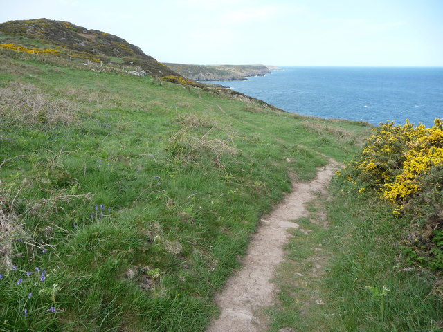
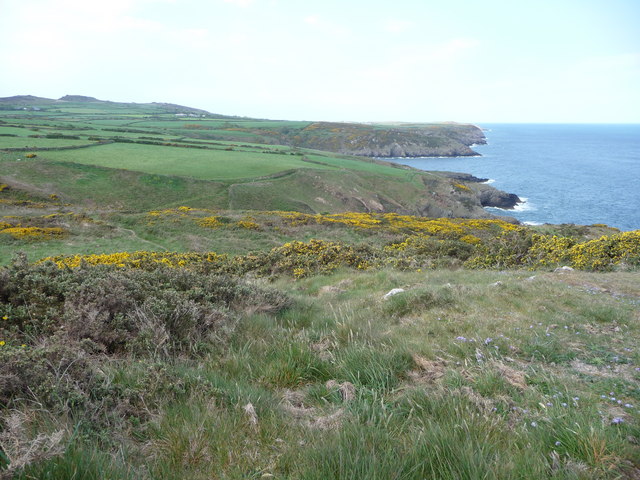
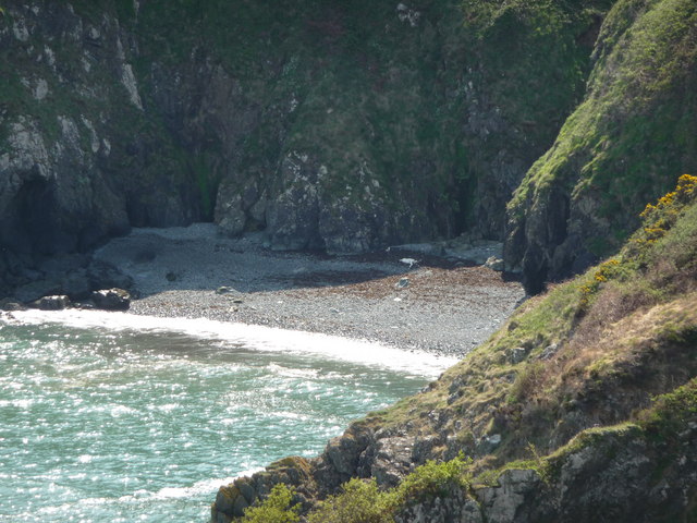
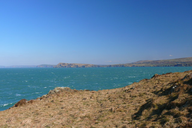
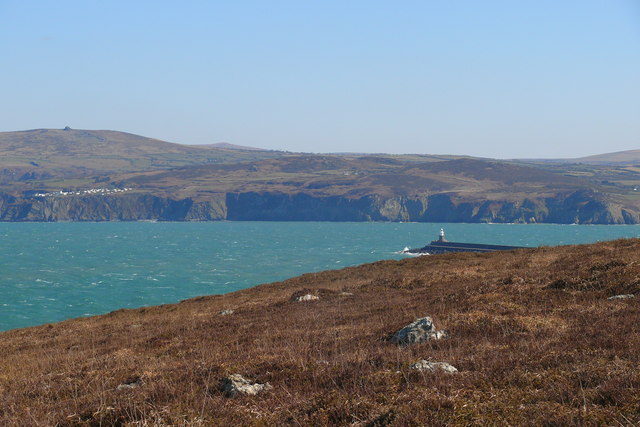
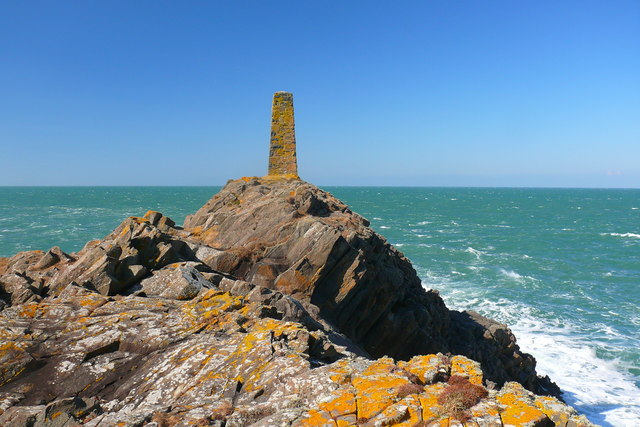
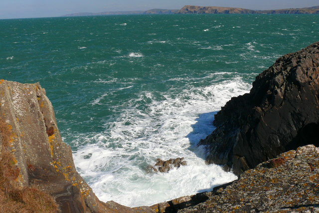
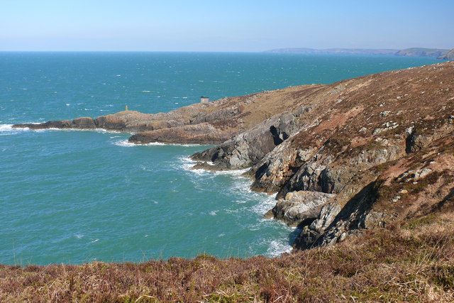
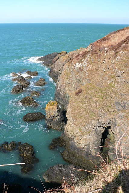
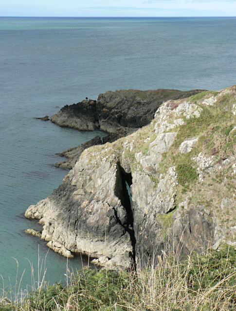
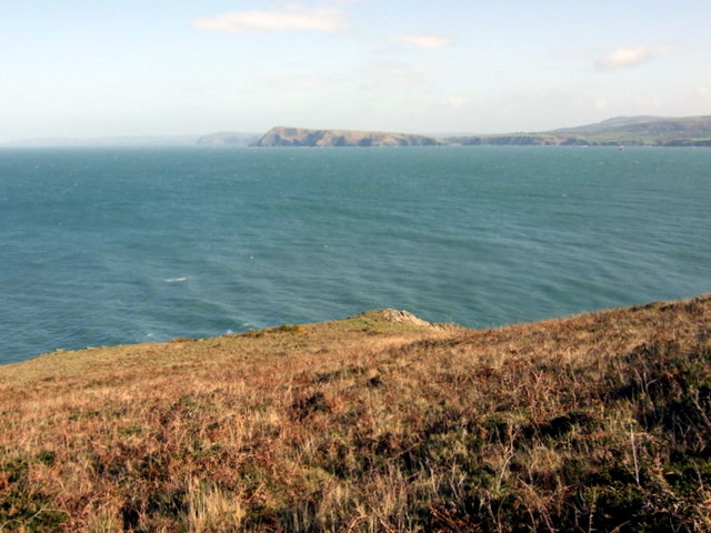
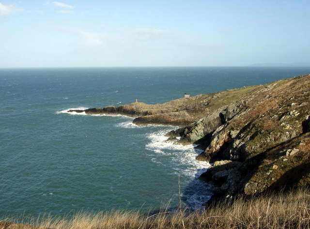
Pen Anglais is a prominent promontory that stretches out into the sea, offering breathtaking panoramic views of the surrounding landscape. The site is characterized by its rugged cliffs, dramatic rock formations, and pristine sandy beaches. It is a popular destination for nature lovers, photographers, and history enthusiasts alike.

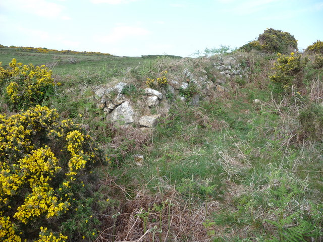
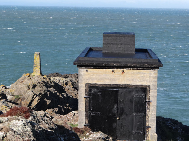
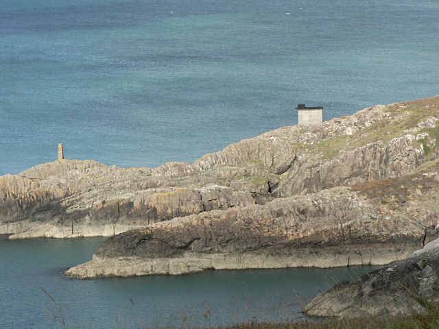
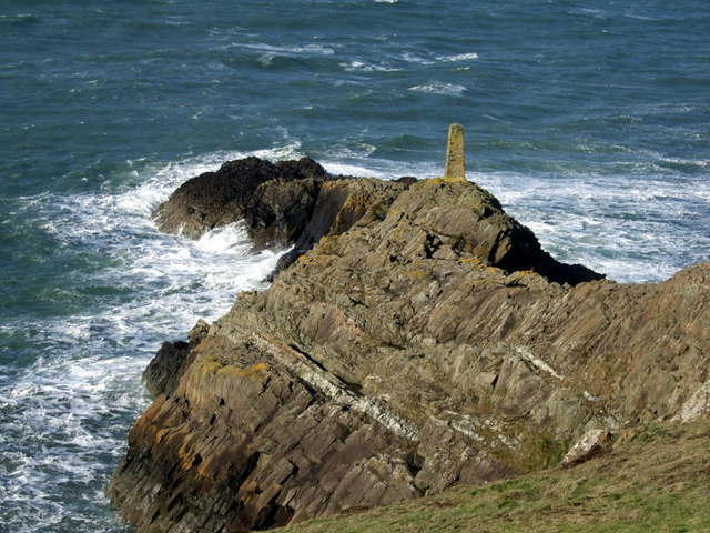
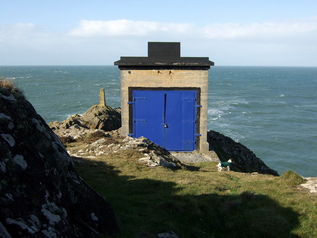
Historically, Pen Anglais has played a vital role in the defense of Pembrokeshire. It was a strategic vantage point during various conflicts, including the Norman invasion and World War II. The remnants of defensive structures and fortifications can still be observed, providing a glimpse into the region's military past.

In addition to its military significance, Pen Anglais is also a site of archaeological interest. Numerous ancient artifacts have been discovered in the area, shedding light on the early human settlements and their way of life. The site has been a subject of archaeological studies, contributing to our understanding of the region's rich history.

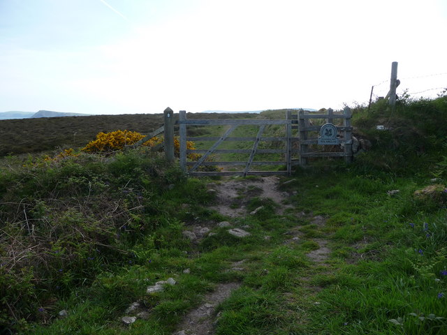
Today, Pen Anglais is protected as a heritage site, ensuring the preservation of its natural beauty and historical significance. Visitors can explore the rugged coastal paths, enjoy leisurely walks, and appreciate the stunning vistas. The site also offers opportunities for birdwatching, with various seabirds nesting in the cliffs.

With its stunning natural scenery and historical importance, Pen Anglais is a must-visit destination for those seeking a blend of natural beauty and cultural heritage in Pembrokeshire, Wales.

If you have any feedback on the listing, please let us know in the comments section below.

Pen Anglais [spelling?] Images

Images are sourced within 2km of 52.02/-4.992 or Grid Reference SM9439. Thanks to Geograph Open Source API. All images are credited.

Old stone field boundaries on Crincoed Point An isolated pocket of the coast, by-passed by the main Pembrokeshire Coast Path and therefore quiet and packed with wildlife; larks, wagtails, stonechats.
Old stone field boundaries on Crincoed Point
An isolated pocket of the coast, by-passed by the main Pembrokeshire Coast Path and therefore quiet and packed with wildlife; larks, wagtails, stonechats.
N.T. gate into Pen Anglas The Pembrokeshire Coast Path passes through this headland maintained by the National Trust.
N.T. gate into Pen Anglas
The Pembrokeshire Coast Path passes through this headland maintained by the National Trust.
Carnfathach looking west From this distinctive knoll you get excellent views down the coastline westwards towards Carregwastad Point.
Carnfathach looking west
From this distinctive knoll you get excellent views down the coastline westwards towards Carregwastad Point.
Part of the Pembrokeshire Coast Path Yes, that little grey figure down there is a walker ahead of me on the coastal path, no doubt also enjoying this section of varied coastline, even if the harmless St. Mark's flies are thick in the air, the gorse tugs at your clothing and small loose stones slip under your boots.
Part of the Pembrokeshire Coast Path
Yes, that little grey figure down there is a walker ahead of me on the coastal path, no doubt also enjoying this section of varied coastline, even if the harmless St. Mark's flies are thick in the air, the gorse tugs at your clothing and small loose stones slip under your boots.
Beach flotsam below Carregwastad Point I had seen a grey seal bottling in Aber Felin cove here and scanning the beach for other seals I spied what appears to be a large portion of dead pony. A grey pony seems to have fallen down the very steep gully above this beach and either been injured or trapped on the beach (though I can't believe that if this was the case that a rescue wasn't attempted) and subsequently died. Gulls were interested in the carcase and vulture-like hopped on and off, chased each other and generally set off a macabre scene.
Beach flotsam below Carregwastad Point
I had seen a grey seal bottling in Aber Felin cove here and scanning the beach for other seals I spied what appears to be a large portion of dead pony. A grey pony seems to have fallen down the very steep gully above this beach and either been injured or trapped on the beach (though I can't believe that if this was the case that a rescue wasn't attempted) and subsequently died. Gulls were interested in the carcase and vulture-like hopped on and off, chased each other and generally set off a macabre scene.
Pen Anglas Fog Warning Station The fog warning station at Pen Anglas
Pen Anglas Fog Warning Station
The fog warning station at Pen Anglas
Crincoed Point Golygfa dros Crincoed Point tuag at Pen Dinas / A view over Crincoed Point towards  Dinas Head.
Crincoed Point
Golygfa dros Crincoed Point tuag at Pen Dinas / A view over Crincoed Point towards Dinas Head.
Bae Abergwaun / Fishguard Bay
Pen Anglas
Pen Anglas
Pen Anglas
Pen Anglas
Bae Anglas Bay
Bae Anglas Bay
Aber Felin
Aber Felin
Natural arch
Natural arch
Pen Anglas
Pen Anglas
Crincoed Point A terrific view and not much else. The name Crincoed, meaning Withered Wood, accurately conveys the sort of wind-parched vegetation to be seen on this exposed headland although nothing resembling a wood exists now.
Crincoed Point
A terrific view and not much else. The name Crincoed, meaning Withered Wood, accurately conveys the sort of wind-parched vegetation to be seen on this exposed headland although nothing resembling a wood exists now.
Geology at Pen Anglas Rocky headland is owned by the National Trust and famed for its remarkable rock formations.  "Pen Anglas is formed of a dolerite intrusion, and on the NE-facing cliffs below the stone pillar there are some excellent examples of columnar jointing. This inclined rock face shows sections through the columns demonstrating the hexagonal cooling joints. Climb over the ridge to the SW side of the headland where the long axes of the columns can be seen. The whole intrusion therefore appears to be dipping at about 450 towards the NE where the upper surface is exposed." Information from <span class="nowrap"><a title="http://www.jdgeology.co.uk/Ordovician/Ordovician.htm" rel="nofollow ugc noopener" href="http://www.jdgeology.co.uk/Ordovician/Ordovician.htm">Link</a><img style="margin-left:2px;" alt="External link" title="External link - shift click to open in new window" src="https://s1.geograph.org.uk/img/external.png" width="10" height="10"/></span> (unfortunately this site appears to be no longer extant).
Geology at Pen Anglas
Rocky headland is owned by the National Trust and famed for its remarkable rock formations. "Pen Anglas is formed of a dolerite intrusion, and on the NE-facing cliffs below the stone pillar there are some excellent examples of columnar jointing. This inclined rock face shows sections through the columns demonstrating the hexagonal cooling joints. Climb over the ridge to the SW side of the headland where the long axes of the columns can be seen. The whole intrusion therefore appears to be dipping at about 450 towards the NE where the upper surface is exposed." Information from LinkExternal link (unfortunately this site appears to be no longer extant).
Structures at Pen Anglas A concrete column stands out on the point and this impenetrable hut is perched a little higher up. No clue as to what it is but possibly a beacon or signal of some kind to shipping. This is a hostile and windwhipped location.
Update: it has been suggested that this structure housed a Diaphone fog signal at one time.
Structures at Pen Anglas
A concrete column stands out on the point and this impenetrable hut is perched a little higher up. No clue as to what it is but possibly a beacon or signal of some kind to shipping. This is a hostile and windwhipped location. Update: it has been suggested that this structure housed a Diaphone fog signal at one time.
Anglas Bay Looking northeast towards the spectacular rock formations around Pen Anglas. A fine but windy February day, hence the rough sea.
In 1797 it was when the French ships rounded the point here into Fishguard Bay, and were warned off by a cannon shot across the bows from Fishguard Fort, that they turned back and landed at Carregwasted a little to the west.
Anglas Bay
Looking northeast towards the spectacular rock formations around Pen Anglas. A fine but windy February day, hence the rough sea. In 1797 it was when the French ships rounded the point here into Fishguard Bay, and were warned off by a cannon shot across the bows from Fishguard Fort, that they turned back and landed at Carregwasted a little to the west.
Show me another place!

Pen Anglais [spelling?] is located at Grid Ref: SM9439 (Lat: 52.02, Lng: -4.992)

Unitary Authority: Pembrokeshire

Police Authority: Dyfed Powys

What 3 Words

///taking.inflates.field. Near Goodwick, Pembrokeshire

Related Wikis

Fishguard Lifeboat Station

Fishguard Lifeboat Station (based in Goodwick, Pembrokeshire, Wales) is a Royal National Lifeboat Institution (RNLI) station. Located on the quay between...

Fishguard Harbour railway station

Fishguard Harbour railway station serves the port of Fishguard Harbour, Wales. It is the terminus of one of the branches of the West Wales Line from Swansea...

Pencaer

Pencaer is a community which covers an area of dispersed settlement in Pembrokeshire, Wales, on the peninsula of Pen Caer and comprises the village of...

Llanwnda, Pembrokeshire

Llanwnda is a rural village and parish to the north of the Welsh county of Pembrokeshire and part of the community of Pencaer. It lies some two miles northwest...

Nearby Amenities

Located within 500m of 52.02,-4.992
Direction: S
Generator Method: photovoltaic
Generator Output Electricity: yes
Generator Solar Modules: 19
Generator Source: solar
Generator Type: solar_photovoltaic_panel
Location: roof
Power: generator
Lat/Long: 52.0173949/-4.9951932
The data included in this document is from www.openstreetmap.org. The data is made available under ODbL.

Have you been to Pen Anglais [spelling?]?

Leave your review of Pen Anglais [spelling?] below (or comments, questions and feedback).