Manor House

Heritage Site in Northamptonshire

England

Manor House

All Saints Church
All Saints Church Credit: Tim Glover

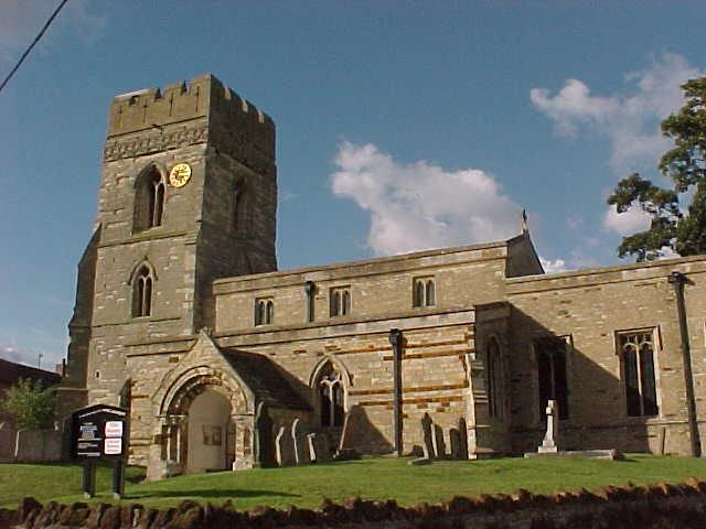
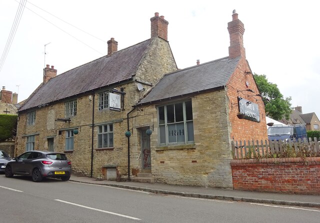
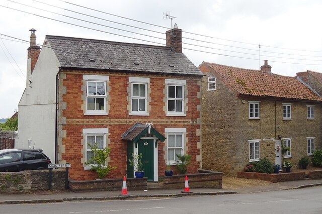
Manor House, located in the picturesque county of Northamptonshire, is a prominent heritage site that exudes historical charm and architectural significance. Dating back to the 16th century, this magnificent house has witnessed centuries of English history and has been meticulously preserved to showcase its rich heritage.

The Manor House boasts an impressive Tudor-style architecture, characterized by its timber-framed structure, steep gabled roofs, and mullioned windows. The exterior is adorned with ornate carvings and intricate details, showcasing the craftsmanship of the era. The house is surrounded by beautifully landscaped gardens and expansive grounds, adding to its visual appeal.

Entering the Manor House, visitors are greeted by a grand entrance hall that exudes elegance and grandeur. The interior is a testament to the house's historical significance, with original features such as exposed beams, stone fireplaces, and oak paneling. Each room tells a story of its own, adorned with period furniture, antique artwork, and tapestries that transport visitors back in time.

The Manor House also houses a collection of artifacts and exhibits that highlight the local history and cultural heritage of Northamptonshire. Visitors can explore the well-preserved medieval kitchen, the library filled with rare books, and the chapel with its beautiful stained glass windows.

In addition to guided tours, Manor House offers various educational programs and events throughout the year, including workshops, lectures, and reenactments. These activities provide an immersive experience for visitors to learn and engage with the history and heritage of the region.

Overall, Manor House, Northamptonshire is a captivating heritage site that offers a glimpse into the past, showcasing the architectural splendor and historical significance of the Tudor era.

If you have any feedback on the listing, please let us know in the comments section below.
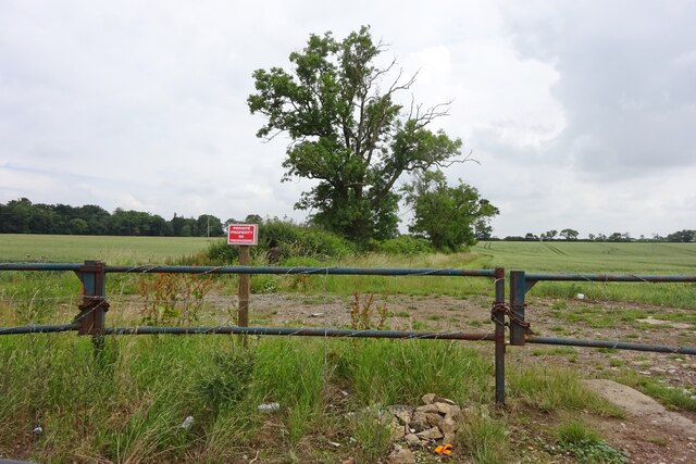
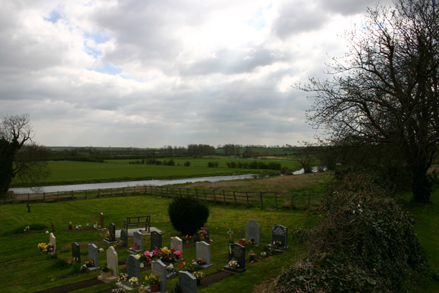
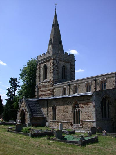
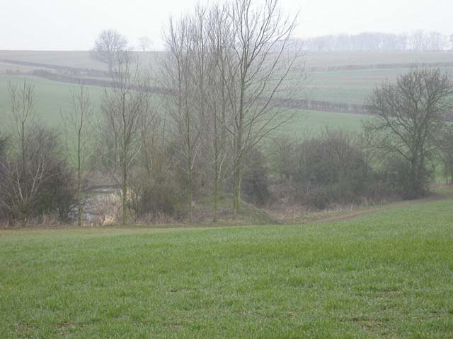
Manor House Images

Images are sourced within 2km of 52.368/-0.597 or Grid Reference SP9575. Thanks to Geograph Open Source API. All images are credited.

All Saints Church
All Saints Church
The Nene Way crosses the River Nene
Woodford Road, Great Addington
Entrance to Manor Close
Woodford Road, Little Addington
Towards Great Addington
Great Addington-The Hare and Hounds Public House on Main Street.
Great Addington-The Hare and Hounds
Public House on Main Street.
Great Addington Cottages Opposite the church.
Great Addington Cottages
Opposite the church.
Great Addington-Woodford Road Looking up the hill.
Great Addington-Woodford Road
Looking up the hill.
Little Addington Church St Mary.
Little Addington Church
St Mary.
Little Addington Farmland On High Street.
Little Addington Farmland
On High Street.
Great Addington Farmland Off Cranford Road.
Great Addington Farmland
Off Cranford Road.
River Nene from Woodford Church Looking south over the river from Woodford Churchyard, at the extreme east of the grid square.
River Nene from Woodford Church
Looking south over the river from Woodford Churchyard, at the extreme east of the grid square.
St Mary's Church, Little Addington St Mary's Church, Little Addington. Built with the local ironstone.
St Mary's Church, Little Addington
St Mary's Church, Little Addington. Built with the local ironstone.
Large Pond North end of pond seen from Bridleway
Large Pond
North end of pond seen from Bridleway
Old-fashioned Footbridge This carries a footpath across a brook. This style is gradually being replaced with something more convenient by the County Council.cf <a href="https://www.geograph.org.uk/photo/61045">SP7768 : Bridge over Brook</a> and <a href="https://www.geograph.org.uk/photo/49314">SP9984 : The Lyveden Way</a>
Old-fashioned Footbridge
This carries a footpath across a brook. This style is gradually being replaced with something more convenient by the County Council.cf SP7768 : Bridge over Brook and SP9984 : The Lyveden Way
Patch Spinney Taken from a footpath to the north-west. The red roof of Patch Lodge is visible.
Patch Spinney
Taken from a footpath to the north-west. The red roof of Patch Lodge is visible.
Show me another place!

Manor House is located at Grid Ref: SP9575 (Lat: 52.368, Lng: -0.597)

What 3 Words

///acre.unspoiled.rang. Near Woodford, Northamptonshire

Nearby Locations

Manor House

Related Wikis

Great Addington

Great Addington is a small village and civil parish in Northamptonshire, England. It lies near the west bank of the River Nene, about 5 miles (8 km) east...

Ringstead and Addington railway station

Ringstead and Addington railway station was a railway station serving Great and Little Addington and Ringstead in Northamptonshire on the former Northampton...

Woodford, Northamptonshire

Woodford is a large village and civil parish located in North Northamptonshire, England. At the time of the 2011 census, the parish's population (including...

Little Addington

Little Addington is a village and civil parish in North Northamptonshire, England, about 8 miles (13 km) south-east of Kettering. At the time of the 2011...

Kinewell Lake

Kinewell Lake is a 35.4 hectare Local Nature Reserve west of Ringstead in Northamptonshire, England. It is owned by Ringstead Parish Council and managed...

Woodwell

Woodwell is a hamlet in the English county of Northamptonshire, about a mile west of the village of Woodford. It is at the end of a cul-de-sac lane....

Twywell Gullet

Twywell Gullet is a 17.1-hectare (42-acre) biological Site of Special Scientific Interest east of Kettering in Northamptonshire. It is part of the 54.6...

Twywell railway station

Twywell railway station served the village of Twywell, Northamptonshire, England, from 1866 to 1951 on the Kettering, Thrapston and Huntingdon Railway...

Nearby Amenities

Located within 500m of 52.368,-0.597
Great Addington
Is In: Northamptonshire
Place: village
Wikidata: Q2519648
Wikipedia: en:Great Addington
Lat/Long: 52.3657878/-0.5937434
Place: farm
Lat/Long: 52.3687086/-0.602893
Barrier: stile
Lat/Long: 52.3680927/-0.5916049
Kindergarten
Great Addington Stay And Play
Addr City: Kettering
Addr Country: GB
Addr Housename: Memorial Hall
Addr Place: Great Addington
Addr Postcode: NN14 4BS
Fhrs Authority: North Northamptonshire
Fhrs Id: 1495117
Fhrs Local Authority Id: 22/00011/COM
Lat/Long: 52.3655507/-0.5930203
Give Way
Direction: forward
Lat/Long: 52.3654367/-0.5933932
Shelter
Shelter Type: public_transport
Lat/Long: 52.3652407/-0.5933335
Booth: K6
Covered: booth
Disused Amenity: telephone
Man Made: telephone_box
Old Phone: +44 1536 330664
Lat/Long: 52.3651337/-0.5932852
Power: transformer
Lat/Long: 52.3658532/-0.5960754
Power: pole
Lat/Long: 52.3664246/-0.5964709
Power: pole
Lat/Long: 52.3670213/-0.5968557
Power: pole
Lat/Long: 52.3676378/-0.5972322
Power: pole
Lat/Long: 52.3690742/-0.6002133
Power: pole
Lat/Long: 52.3696107/-0.5995205
Power: pole
Lat/Long: 52.3680456/-0.5980207
Power: pole
Lat/Long: 52.3684606/-0.5987945
Power: pole
Lat/Long: 52.3688539/-0.5995054
Power: pole
Lat/Long: 52.3701469/-0.5987971
Power: pole
Lat/Long: 52.3706643/-0.5980727
Power: pole
Lat/Long: 52.3712284/-0.5973438
Power: pole
Lat/Long: 52.3708538/-0.5963893
Power: pole
Lat/Long: 52.3704534/-0.5953752
Power: pole
Lat/Long: 52.3701227/-0.5945276
Power: pole
Lat/Long: 52.3696938/-0.5933754
Power: pole
Lat/Long: 52.3692448/-0.5922632
Power: pole
Lat/Long: 52.3688348/-0.5912013
Power: pole
Lat/Long: 52.3683939/-0.5900626
Power: pole
Lat/Long: 52.3716495/-0.5984276
Power: pole
Lat/Long: 52.3720604/-0.5995138
The data included in this document is from www.openstreetmap.org. The data is made available under ODbL.

Have you been to Manor House?

Leave your review of Manor House below (or comments, questions and feedback).