West Earlham

Settlement in Norfolk Norwich

England

West Earlham

The Village Shop, Grove Avenue, Costessey See <a href="https://www.geograph.org.uk/photo/1972424">TG1810 : Your shop Village Store, Grove Avenue, Costessey</a> for an earlier view.
The Village Shop, Grove Avenue, Costessey Credit: Hugh Venables

West Earlham is a small village located in the county of Norfolk, England. Situated about 4 miles west of the city of Norwich, it falls within the South Norfolk district. The village has a population of around 1,500 residents and is characterized by its picturesque rural setting.

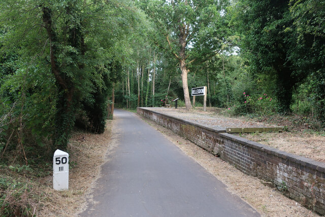
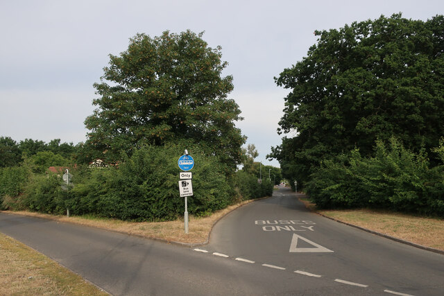
West Earlham is known for its tranquil atmosphere and scenic surroundings. The village is surrounded by beautiful countryside, with rolling fields and meadows providing a peaceful and idyllic backdrop. The nearby Earlham Park, a 200-acre public park, offers stunning green spaces, woodland areas, and a lake, making it a popular spot for leisure activities such as walking, picnicking, and wildlife spotting.

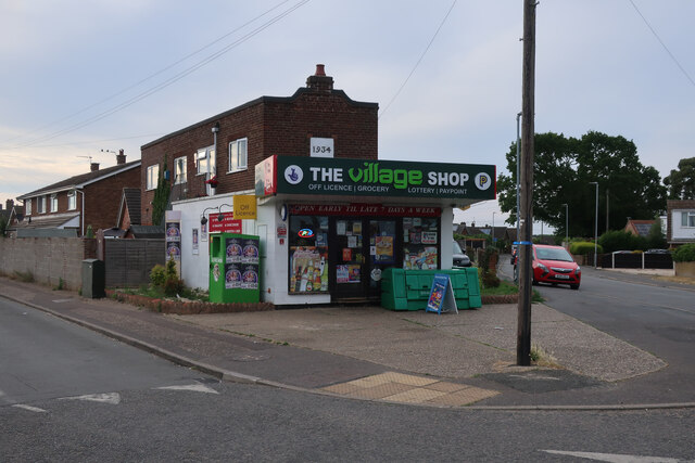
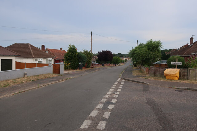
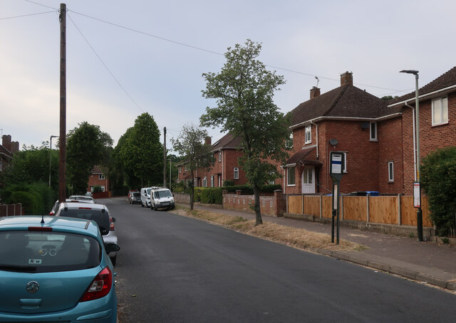
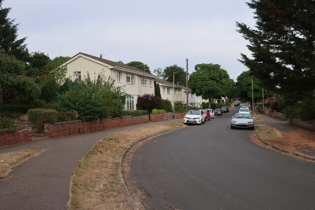
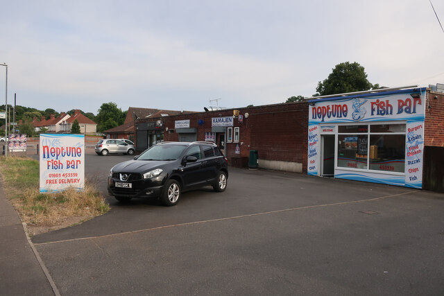
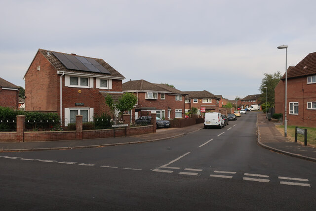
The village itself consists mainly of residential properties, ranging from traditional cottages to more modern houses. There is a small selection of amenities available, including a local convenience store, a primary school, and a community center. The village also benefits from good transport links, with regular bus services connecting West Earlham to Norwich and other nearby towns.

West Earlham is known for its strong sense of community, with various social and recreational activities taking place throughout the year. The village hosts events such as fairs, festivals, and sports tournaments, bringing residents together and fostering a vibrant community spirit.

Overall, West Earlham offers a peaceful and picturesque place to live, combining the benefits of rural living with easy access to nearby urban amenities.

If you have any feedback on the listing, please let us know in the comments section below.
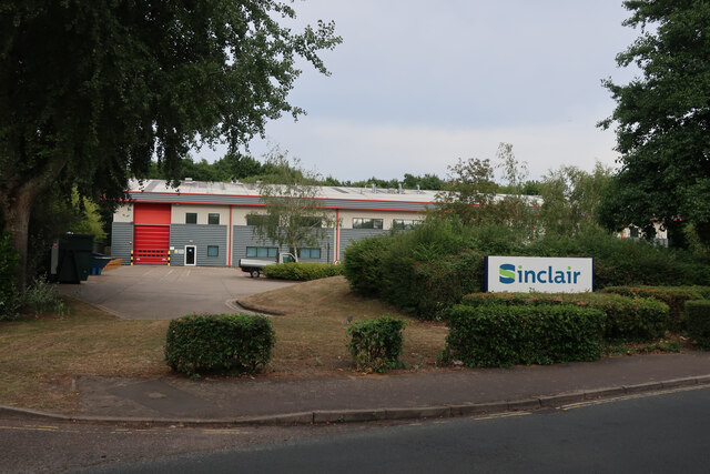
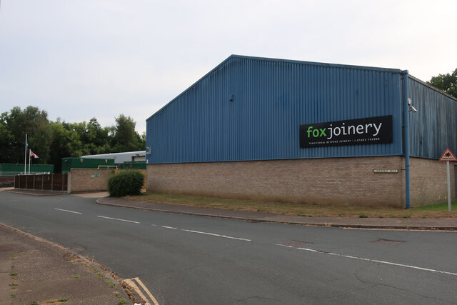
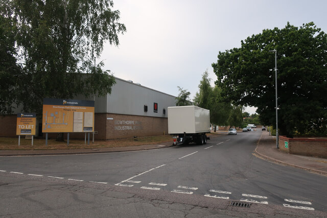
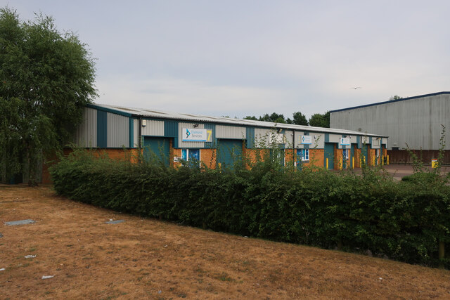
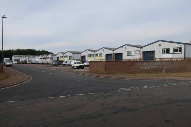
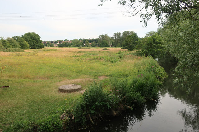
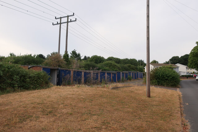
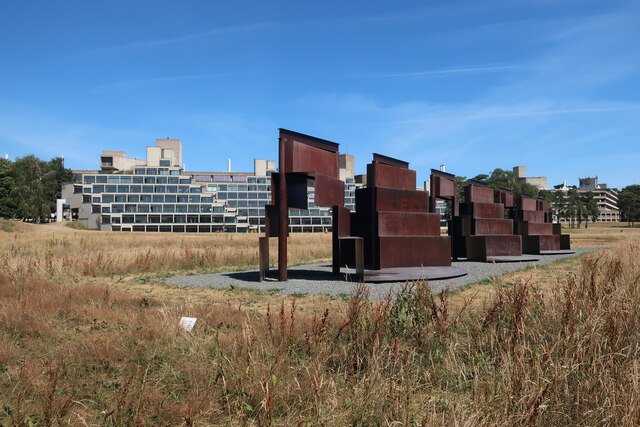
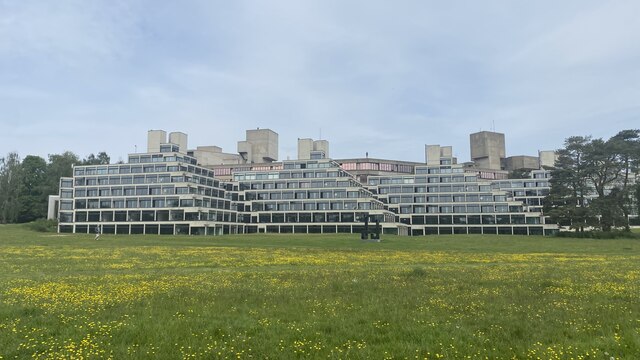
West Earlham Images

Images are sourced within 2km of 52.632617/1.2343591 or Grid Reference TG1808. Thanks to Geograph Open Source API. All images are credited.

The Village Shop, Grove Avenue, Costessey See <a href="https://www.geograph.org.uk/photo/1972424">TG1810 : Your shop Village Store, Grove Avenue, Costessey</a> for an earlier view.
The Village Shop, Grove Avenue, Costessey
Olive Road
Olive Road
Hellesdon platform, Marriott's Way The station opened on 2 December 1882 and was closed on 15 September 1952, before the line was closed to passengers in 1959. It stayed as a freight line until 1985.
Hellesdon platform, Marriott's Way
The station opened on 2 December 1882 and was closed on 15 September 1952, before the line was closed to passengers in 1959. It stayed as a freight line until 1985.
Royal Mail depot and Screwfix, Bowthorpe Industrial Area
Sinclair International, Jarrold Way Producing labels for fresh produce.
Sinclair International, Jarrold Way
Producing labels for fresh produce.
Fox Joinery, Bowthorpe Industrial Area
Bowthorpe Park Industrial Estate
Paddocks by River Wensum
Wilberforce Road, West Earlham
Garages on St Mildreds Road
St Mildreds Road, West Earlham
Earlham Green Lane
Earlham Green Lane
Bus link to Earlham Green Lane
Holworthy Road
Holworthy Road
Goodwood Steps, UEA campus Anthony Caro sculpture which sits well with the stepped nature of the campus buildings behind.
Goodwood Steps, UEA campus
Anthony Caro sculpture which sits well with the stepped nature of the campus buildings behind.
Suffolk Terrace (ziggurats), University of East Anglia
Show me another place!

West Earlham is located at Grid Ref: TG1808 (Lat: 52.632617, Lng: 1.2343591)

Administrative County: Norfolk

District: Norwich

Police Authority: Norfolk

What 3 Words

///exams.holly.shin. Near Bowthorpe, Norfolk

Nearby Locations

West Earlham

Related Wikis

Earlham Hall

Earlham Hall is a country house in Norfolk, England. It is located just to the west of the city of Norwich, on Earlham Road, on the outskirts of the village...

Bowthorpe Marsh

Bowthorpe Marsh is a 5.9-hectare (15-acre) Local Nature Reserve in Norwich in Norfolk. It is owned and managed by Norwich City Council.This site adjacent...

City Academy Norwich

City Academy Norwich is a secondary school in Norwich, England. It opened in September 2009, replacing Earlham High School. It is located near the University...

Earlham Park Woods

Earlham Park Woods is a 8.1-hectare (20-acre) Local Nature Reserve on the western outskirts of Norwich in Norfolk. It is owned and managed by Norwich...

Norwich Radiology Academy

The Norwich Radiology Academy, opened in November 2005, is part of the Norfolk and Norwich University Hospital NHS Trust and is one of only three training...

Colney

Colney () is a village in the western outskirts of Norwich in the English county of Norfolk. == History == Colney's name is of Anglo-Saxon origin and derives...

Norwich Research Park

Norwich Research Park is a business community located to the southwest of Norwich in East Anglia close to the A11 and the A47 roads. Set in over 230 hectares...

Earlham Institute

Earlham Institute (EI, formerly The Genome Analysis Centre (TGAC)) is a life science research institute located at the Norwich Research Park (NRP), Norwich...

Nearby Amenities

Located within 500m of 52.632617,1.2343591
Crossing
Crossing: unmarked
Crossing Island: yes
Tactile Paving: no
Lat/Long: 52.6357297/1.2393323
Traffic Calming: cushion
Lat/Long: 52.630459/1.2365623
Mini Roundabout
Direction: clockwise
Lat/Long: 52.6359029/1.2388972
Access: permissive
Barrier: kissing_gate
Foot: yes
Material: metal
Lat/Long: 52.6312639/1.2303051
West Earlham
Place: suburb
Lat/Long: 52.632808/1.2394722
Barrier: lift_gate
Bicycle: yes
Foot: yes
Lat/Long: 52.6286815/1.2377965
Post Box
Collection Times: Mo-Fr 18:30; Sa 13:00
Operator: Royal Mail
Postal Code: NR5
Ref: NR5 512
Lat/Long: 52.6287733/1.2379293
Post Box
Collection Times: Mo-Fr 17:30; Sa 11:00
Operator: Royal Mail
Postal Code: NR5
Ref: NR5 515
Lat/Long: 52.6319535/1.2410203
Post Box
Collection Times: Mo-Fr 09:00, Sa 07:00
Operator: Royal Mail
Post Box Type: pillar
Ref: NR5 513
Lat/Long: 52.6337187/1.2330965
Post Box
Collection Times: Mo-Fr 09:00, Sa 07:00
Operator: Royal Mail
Post Box Mounting: brick_pillar
Post Box Type: wall
Ref: NR5 514
Royal Cypher: GR
Royal Cypher Wikidata: Q33102273
Lat/Long: 52.6365911/1.2359002
Power: pole
Lat/Long: 52.6305404/1.2279931
Power: pole
Lat/Long: 52.6315091/1.2275961
Power: pole
Lat/Long: 52.632367/1.2271857
Power: pole
Lat/Long: 52.6333079/1.2276417
Power: pole
Lat/Long: 52.6342081/1.2280682
Power: pole
Lat/Long: 52.6352499/1.2285644
Power: pole
Lat/Long: 52.6359954/1.2295434
Power: pole
Lat/Long: 52.6301839/1.2281916
Power: pole
Lat/Long: 52.6311167/1.2274593
Power: pole
Lat/Long: 52.6319551/1.2270677
Recycling
Enfield Road
Location: overground
Recycling Cans: yes
Recycling Glass Bottles: yes
Recycling Paper: yes
Recycling Shoes: yes
Recycling Textiles: yes
Recycling Type: container
Url: http://www.norwich.gov.uk/intranet_docs/A-Z/Recycling/Recycling_Centres.pdf
Lat/Long: 52.632559/1.240905
Recycling
Freed Man PH, St Mildreds Road
Recycling Glass Bottles: yes
Recycling Paper: yes
Recycling Type: container
Website: https://www.norwich.gov.uk/intranet_docs/A-Z/Recycling/Recycling_Centres.pdf
Lat/Long: 52.6351539/1.2304171
Bus Stop
West Earlham / Centre
Bench: yes
Naptan AtcoCode: 2900N1220
Naptan Bearing: N
Naptan CommonName: Retail Park
Naptan Indicator: adj
Naptan Locality: West Earlham
Naptan NaptanCode: nfodjapt
Naptan PlusbusZoneRef: NRCH
Naptan Street: West Earlham Centre
Operator: Norfolk County Council
Route Ref: 21;22;22A
Shelter: yes
Source: naptan_import;survey
Tactile Paving: no
Lat/Long: 52.631887/1.2410248
Bus Stop
Rockingham Rd / opp Wordsworth Dr
Naptan AtcoCode: 2900N12326
Naptan Bearing: W
Naptan CommonName: Rockingham Road
Naptan Indicator: opp
Naptan Landmark: Wordsworth Road
Naptan Locality: Norwich
Naptan NaptanCode: nfodjmgt
Naptan PlusbusZoneRef: NRCH
Naptan ShortCommonName: Rockingham Road
Naptan Street: Rockingham Road
Operator: Norfolk County Council
Route Ref: 21;22;22A
Shelter: no
Source: naptan_import;survey
Lat/Long: 52.6308268/1.2387526
Bus Stop
West Earlham / Rockingham Road
Naptan AtcoCode: 2900N12327
Naptan Bearing: E
Naptan CommonName: Rockingham Road
Naptan Indicator: adj
Naptan Landmark: Wordsworth Road
Naptan Locality: Norwich
Naptan NaptanCode: nfodjmgw
Naptan PlusbusZoneRef: NRCH
Naptan ShortCommonName: Rockingham Road
Naptan Street: Rockingham Road
Operator: First Eastern Counties
Route Ref: 21;22
Shelter: no
Source: naptan_import;survey
Lat/Long: 52.6308027/1.237931
Bus Stop
Wilberforce Road
Naptan AtcoCode: 2900N12328
Naptan Bearing: NW
Naptan CommonName: Malbrook Road
Naptan Indicator: opp
Naptan Landmark: Malbrook Road
Naptan Locality: Norwich
Naptan NaptanCode: nfodjmja
Naptan PlusbusZoneRef: NRCH
Naptan Street: Wilberforce Road
Operator: Norfolk County Council
Route Ref: 21
Shelter: no
Source: naptan_import;survey
Lat/Long: 52.6333596/1.2333956
Bus Stop
Bowthorpe / Wilberforce Road
Naptan AtcoCode: 2900N12329
Naptan Bearing: SE
Naptan CommonName: Robson Road
Naptan Indicator: opp
Naptan Landmark: Robson Road
Naptan Locality: Norwich
Naptan NaptanCode: nfodjmjd
Naptan PlusbusZoneRef: NRCH
Naptan Street: Wilberforce Road
Operator: First Eastern Counties
Route Ref: 21;22
Shelter: no
Source: naptan_import;survey
Lat/Long: 52.6312233/1.2358981
Bus Stop
West Earlham / Malbrook Road
Bench: no
Check Date Shelter: 2020-11-10
Naptan AtcoCode: 2900N12330
Naptan Bearing: NE
Naptan CommonName: Freshfield Close
Naptan Indicator: opp
Naptan Landmark: Freshfield Close
Naptan Locality: West Earlham
Naptan NaptanCode: nfodjmjm
Naptan PlusbusZoneRef: NRCH
Naptan Street: Malbrook Road
Operator: First Eastern Counties
Route Ref: 21;22
Shelter: no
Source: naptan_import;survey
Lat/Long: 52.6357591/1.2346154
Bus Stop
Wilberforce Road
Naptan AtcoCode: 2900N12331
Naptan Bearing: SE
Naptan CommonName: Malbrook Road
Naptan Indicator: adj
Naptan Landmark: No. 30
Naptan Locality: Norwich
Naptan NaptanCode: nfodjmjp
Naptan PlusbusZoneRef: NRCH
Naptan Street: Wilberforce Road
Operator: Norfolk County Council
Route Ref: 21
Shelter: no
Source: naptan_import;survey
Lat/Long: 52.6331133/1.2338505
Bus Stop
West Earlham / Runcton Close
Naptan AtcoCode: 2900N12332
Naptan Bearing: NW
Naptan CommonName: Runcton Close
Naptan Indicator: adj
Naptan Locality: West Earlham
Naptan NaptanCode: nfodjmjt
Naptan PlusbusZoneRef: NRCH
Naptan Street: Earlham Green lane
Physically Present: no
Shelter: no
Source: naptan_import;survey
Lat/Long: 52.6370765/1.2344058
Bus Stop
West Earlham / Malbrooke Road
Bench: no
Check Date Shelter: 2020-11-10
Naptan AtcoCode: 2900N12333
Naptan Bearing: SW
Naptan CommonName: Freshfield Close
Naptan Indicator: adj
Naptan Landmark: Freshfield Close
Naptan Locality: West Earlham
Naptan NaptanCode: nfodjmjw
Naptan PlusbusZoneRef: NRCH
Naptan Street: Malbrook Road
Note: Sign's road name is wrong, should be "Malbrook Road" without an e
Operator: Norfolk County Council
Shelter: no
Source: naptan_import;survey
Lat/Long: 52.6354872/1.2345372
Bus Stop
Bowthorpe / Wilberforce Road
Naptan AtcoCode: 2900N12711
Naptan Bearing: NW
Naptan CommonName: Robson Road
Naptan Indicator: adj
Naptan Landmark: Robson Road
Naptan Locality: Norwich
Naptan NaptanCode: nfodmpma
Naptan PlusbusZoneRef: NRCH
Naptan Street: Wilberforce Road
Operator: First Eastern Counties
Route Ref: 21;22
Shelter: no
Source: naptan_import;survey
Lat/Long: 52.6310098/1.2359961
University Village
Naptan AtcoCode: 2900N1300
Naptan Bearing: S
Naptan BusStopType: MKD
Naptan CommonName: University Village
Naptan Indicator: opp
Naptan Locality: Earlham
Naptan NaptanCode: nfogmjpw
Naptan PlusbusZoneRef: NRCH
Naptan Street: Wilberforce Road
Physically Present: no
Shelter: no
Source: naptan_import;survey
Lat/Long: 52.6287711/1.238159
Traffic Calming: cushion
Lat/Long: 52.6292119/1.2377233
Traffic Calming: cushion
Lat/Long: 52.6298034/1.2371925
Waste Basket
Colour: green
Material: plastic
Lat/Long: 52.6310078/1.2359997
Barrier: bollard
Lat/Long: 52.6351884/1.2375279
Check Date: 2021-07-20
Traffic Calming: hump
Lat/Long: 52.6325956/1.2406196
Bicycle Parking
Village - Hawthorn
Capacity: 12
Covered: no
Operator: University of East Anglia
Lat/Long: 52.62884/1.235206
Bicycle Parking
Village - Willow
Capacity: 12
Covered: no
Operator: University of East Anglia
Lat/Long: 52.629081/1.235055
Bicycle Parking
Village - Beech
Capacity: 10
Covered: no
Operator: University of East Anglia
Lat/Long: 52.628501/1.236654
Bicycle Parking
Village - Elm
Capacity: 12
Covered: no
Operator: University of East Anglia
Lat/Long: 52.628811/1.237459
Bicycle Parking
Village - Pine
Capacity: 12
Covered: no
Operator: University of East Anglia
Lat/Long: 52.629192/1.235114
Bicycle Parking
Village - Yew
Capacity: 11
Covered: no
Operator: University of East Anglia
Lat/Long: 52.628641/1.236772
Crossing
Bicycle: yes
Crossing: uncontrolled
Tactile Paving: yes
Lat/Long: 52.6358877/1.2384579
Crossing
Crossing: unmarked
Crossing Island: yes
Tactile Paving: yes
Lat/Long: 52.6359809/1.2389731
Traffic Calming: hump
Lat/Long: 52.6325187/1.2355636
Bicycle Parking
Covered: no
Lat/Long: 52.6317437/1.241295
Bunker's Hill
Place: locality
Lat/Long: 52.6364289/1.2310829
Barrier: bollard
Lat/Long: 52.6346357/1.2372048
Barrier: kissing_gate
Foot: yes
Lat/Long: 52.6325188/1.2277671
Bench
Backrest: no
Material: wood
Lat/Long: 52.6295549/1.2345237
Bench
Backrest: no
Material: wood
Lat/Long: 52.6290395/1.2345857
Barrier: kissing_gate
Bicycle: yes
Foot: yes
Lat/Long: 52.6302375/1.2346018
Barrier: kissing_gate
Colour: grey
Foot: yes
Material: metal
Lat/Long: 52.6307435/1.234041
Barrier: stile
Colour: grey
Foot: yes
Material: metal
Step Count: 2
Lat/Long: 52.6307613/1.2340261
Barrier: kissing_gate
Foot: yes
Material: wood
Lat/Long: 52.6301774/1.2324931
Barrier: stile
Foot: yes
Material: wood
Step Count: 2
Lat/Long: 52.6322335/1.2308027
Entrance: yes
Lat/Long: 52.6281932/1.2351285
Give Way
Lat/Long: 52.6320723/1.2350655
Give Way
Lat/Long: 52.6320427/1.234984
Give Way
Lat/Long: 52.6337249/1.2330144
Traffic Calming: cushion
Lat/Long: 52.6325153/1.2344686
Traffic Calming: cushion
Lat/Long: 52.6319516/1.2351342
Traffic Calming: cushion
Lat/Long: 52.6313817/1.2356793
Give Way
Lat/Long: 52.6305879/1.2364886
Give Way
Lat/Long: 52.6305646/1.2363994
Traffic Calming: hump
Lat/Long: 52.6330907/1.2357466
Give Way
Lat/Long: 52.6309537/1.2394128
Give Way
Lat/Long: 52.6308858/1.2393864
Give Way
Lat/Long: 52.6337555/1.2297819
Give Way
Lat/Long: 52.6336978/1.2297813
Give Way
Lat/Long: 52.6359408/1.2347938
Give Way
Lat/Long: 52.6359147/1.2348836
Give Way
Lat/Long: 52.6341792/1.2333374
Give Way
Lat/Long: 52.6341464/1.2334217
Give Way
Lat/Long: 52.6351069/1.234098
Give Way
Lat/Long: 52.6350821/1.2341849
Give Way
Lat/Long: 52.6317757/1.2342261
Give Way
Lat/Long: 52.6318043/1.2343059
Crossing
Crossing: unmarked
Crossing Island: yes
Tactile Paving: yes
Lat/Long: 52.6359254/1.2387286
Traffic Calming: hump
Lat/Long: 52.6360716/1.2381879
Traffic Calming: cushion
Lat/Long: 52.636919/1.2351193
Traffic Calming: cushion
Lat/Long: 52.6367141/1.2357588
Traffic Calming: cushion
Lat/Long: 52.6364061/1.236923
Give Way
Lat/Long: 52.6294021/1.2380383
Grit Bin
Colour: yellow
Lat/Long: 52.6320243/1.235235
Entrance: main
Lat/Long: 52.6320059/1.2353665
Entrance: yes
Lat/Long: 52.6318619/1.2354796
Entrance: yes
Lat/Long: 52.6312025/1.2412799
Grit Bin
Lat/Long: 52.6293594/1.2381348
Dentist
West Earlham Dental Practice
Addr City: Norwich
Addr Housenumber: 50
Addr Postcode: NR5 8AD
Addr Street: Earlham West Centre
Website: https://www.westearlhamdental.co.uk/
Lat/Long: 52.6317907/1.2414438
Entrance: main
Lat/Long: 52.632285/1.2408034
Entrance: main
Lat/Long: 52.6319703/1.2409395
Entrance: main
Lat/Long: 52.6316102/1.2408554
Entrance: main
Lat/Long: 52.6313425/1.2405304
Bicycle Rental
Earlham West Centre
Capacity: 10
Email: support@beryl.cc
Fee: yes
Name Signed: no
Network: Beryl - Norwich
Official Name: Earlham West Centre
Operator: Beryl
Operator Wikidata: Q106575369
Payment App: yes
Payment App Android: cc.beryl.basis
Payment App Ios: 1386768364
Payment Cash: no
Payment Credit Cards: no
Payment Cryptocurrencies: no
Payment Debit Cards: no
Payment Electronic Purses: no
Phone: +44 20 3003 5044
Ref Gbfs: beryl_norwich:1842
Rental: city_bike;ebike;escooter
Website: https://beryl.cc/scheme/norwich
Lat/Long: 52.6319962/1.241083
Give Way
Lat/Long: 52.6348539/1.2298089
Give Way
Lat/Long: 52.6346305/1.228899
Waste Basket
Lat/Long: 52.6328333/1.240719
Waste Basket
Colour: green
Material: plastic
Lat/Long: 52.6319961/1.2410675
Waste Basket
Lat/Long: 52.628687/1.2362376
Waste Basket
Lat/Long: 52.6332383/1.2308561
Waste Basket
Colour: green
Material: plastic
Lat/Long: 52.6369905/1.2346675
Waste Basket
Colour: green
Material: plastic
Lat/Long: 52.6314705/1.240926
Waste Basket
Colour: green
Material: plastic
Lat/Long: 52.6324475/1.240685
Waste Basket
Colour: green
Material: plastic
Lat/Long: 52.6347612/1.2369876
Give Way
Lat/Long: 52.6322777/1.2384417
Give Way
Lat/Long: 52.6325706/1.2384622
Give Way
Lat/Long: 52.6319843/1.2382644
Give Way
Lat/Long: 52.6326316/1.2343843
Give Way
Lat/Long: 52.6328414/1.2341298
Crossing
Crossing: unmarked
Tactile Paving: no
Lat/Long: 52.6322204/1.2415884
Colour: white
Communication Mobile Phone: yes
Man Made: mast
Material: metal
Note: New 5G
Operator: Three UK
Start Date: 2023-04
Tower Construction: freestanding
Tower Type: communication
Lat/Long: 52.6303272/1.236544
Give Way
Lat/Long: 52.6306027/1.236782
Bench
Backrest: no
Material: wood
Seats: 3
Lat/Long: 52.6312181/1.2303708
The data included in this document is from www.openstreetmap.org. The data is made available under ODbL.

Have you been to West Earlham?

Leave your review of West Earlham below (or comments, questions and feedback).