Newtown

Settlement in Montgomeryshire

Wales

Newtown

Bridge over the River Severn Heading east
Bridge over the River Severn Credit: Chris Gunns

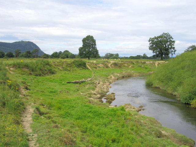
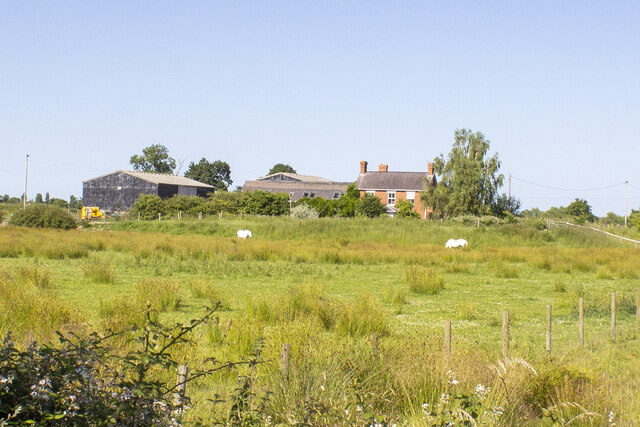
Newtown is a small town located in the county of Montgomeryshire, Wales. Situated on the banks of the River Severn, it lies approximately 3 miles southwest of the larger town of Llanidloes. Newtown has a population of around 12,783 residents, making it the largest town in Montgomeryshire.

The town has a rich history, dating back to the 13th century when it was founded by the Norman Lord, Robert de Bellême. Newtown quickly grew in importance due to its strategic location on the trade routes between North Wales and the Midlands. The arrival of the railway in the 19th century further boosted the town's development, leading to the establishment of industries such as textiles, flannel, and leather.

Today, Newtown is a vibrant town with a mix of modern amenities and historical charm. The town center boasts a variety of shops, cafes, and restaurants, providing residents and visitors with a range of options for dining and shopping. The town also has several schools, a library, and a leisure center, ensuring that the community's needs are well catered for.

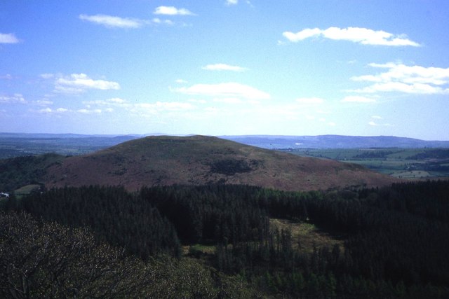
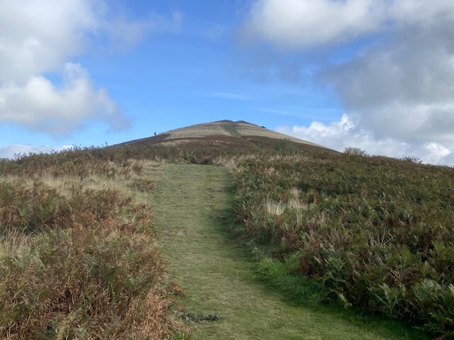
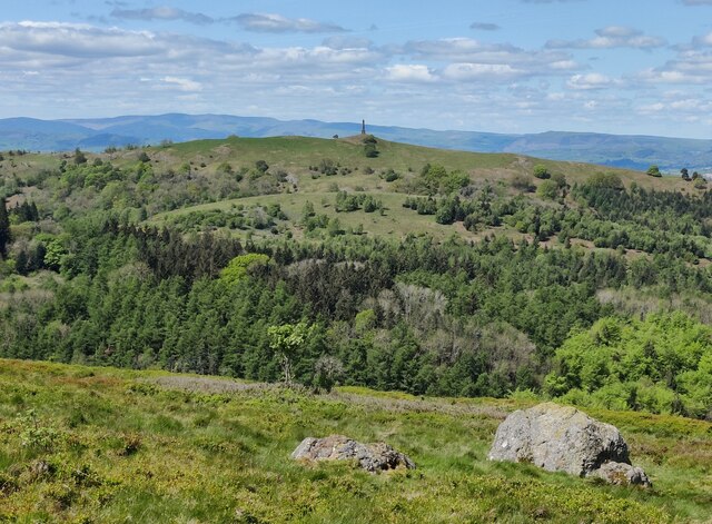
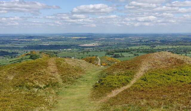
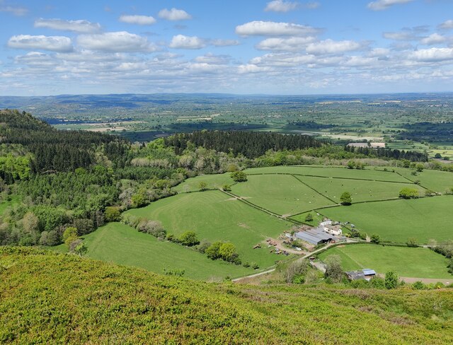
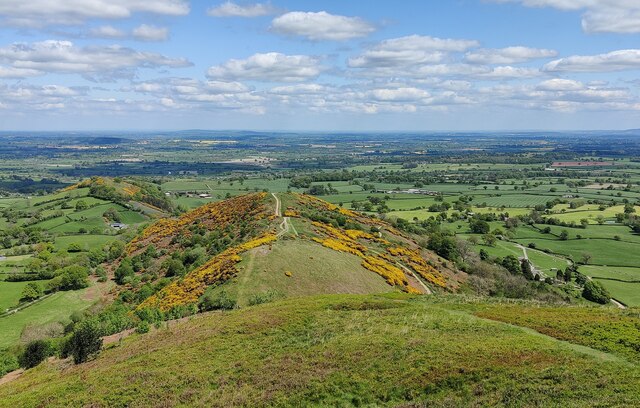
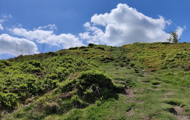
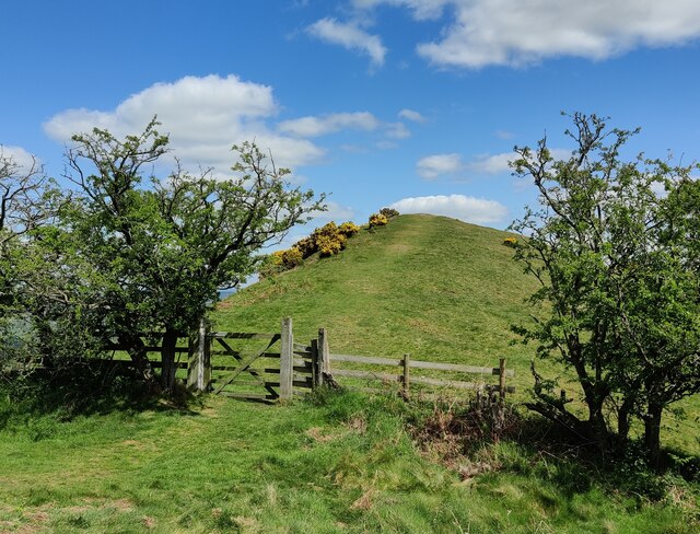
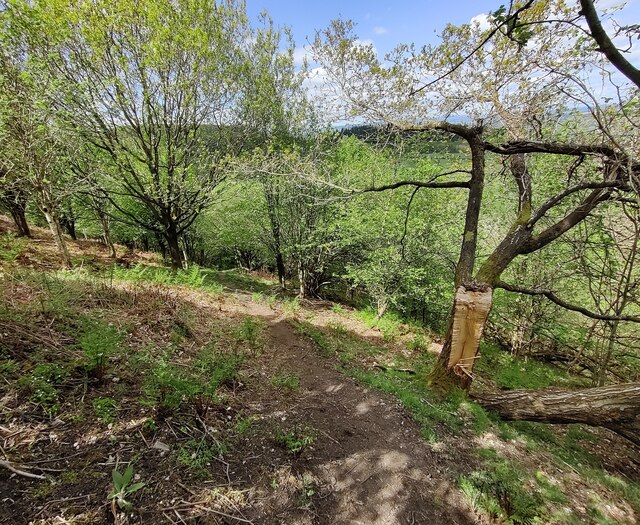
Nature lovers are drawn to Newtown for its picturesque surroundings, with the nearby Cambrian Mountains offering scenic hiking and cycling trails, as well as opportunities for fishing and wildlife spotting. The town is also home to the Hafren Forest, which provides a tranquil escape for those seeking peace and tranquility.

Overall, Newtown is a charming town with a rich heritage, offering a mix of historical attractions, modern amenities, and stunning natural beauty.

If you have any feedback on the listing, please let us know in the comments section below.
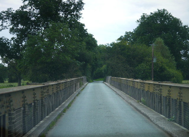
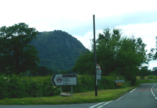
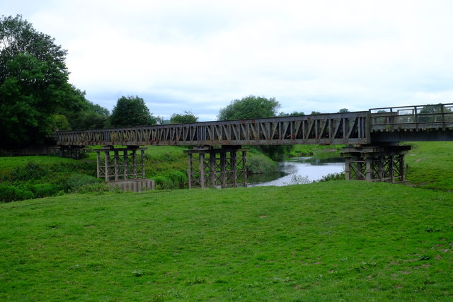
Newtown Images

Images are sourced within 2km of 52.729396/-3.0214404 or Grid Reference SJ3115. Thanks to Geograph Open Source API. All images are credited.

Bridge over the River Severn Heading east
Bridge over the River Severn
Heading east
Junction on B4393 west of Crewgreen
Track up Breidden Hill
Former railway bridge at Melverley This is the old railway viaduct which once carried a branch of the Potteries, Shrewsbury and North Wales Railway (known as the "Potts") across the River Severn at Melverley. The bridge in its current form was built by the Great Western Railway in 1947 but there had been a rather rickety wooden bridge built on this site when the original builders of the Potts line opened a branch to Criggion in 1871 in an attempt to capture lucrative quarry traffic. The extra revenue wasn't enough to prevent the railway going into receivership in 1877, and closing altogether in 1880. Various companies attempted to run the line profitably, to no avail and in 1902 the original wooden viaduct at Melverley collapsed into the Severn, which you would think would be the end of the story. However, in 1907, Colonel Stephens formed the Shropshire and Montgomeryshire Light Railway Company and reopened the line, which involved rebuilding the viaduct using secondhand girders from elsewhere on the system. Freight trains resumed on this section in early 1912 with passenger trains - made up of a variety of bizarre vehicles including a converted tram - following later that year. There was some tourist traffic, but in the 1920s the viaduct was again declared unsafe and all traffic on the Criggion branch ceased, with the entire Potts system closing (under its fourth set of owners) in 1939. The viaduct was seriously damaged by ice floes in the severe winter of 1940.
The Second World War gave the fortunes of the line a boost, with the MOD requisitioning the whole system and repairing the viaduct (albeit on the cheap, to the point where it needed rebuilding again after the war). Stone was once again transported from Criggion across the viaduct, although it was declared unsafe (again) in 1945. It was rebuilt in the form you see here in 1947 by the Great Western Railway. However in 1959, the last War Department stone traffic ran from Criggion and the line was returned to civilian operation; by March 1960 the line was closed. It was reopened as a road bridge, a function it still serves today, in 1962. Much of the information in this caption - in fact, all of it - was lifted from <span class="nowrap"><a title="http://www.bbc.co.uk/shropshire/content/articles/2008/10/08/potts_line_railway_feature.shtml" rel="nofollow ugc noopener" href="http://www.bbc.co.uk/shropshire/content/articles/2008/10/08/potts_line_railway_feature.shtml">Link</a><img style="margin-left:2px;" alt="External link" title="External link - shift click to open in new window" src="https://s1.geograph.org.uk/img/external.png" width="10" height="10"/></span>. Also worth a look for more detail of the bridge itself is <span class="nowrap"><a title="http://colonelstephenssociety.co.uk/shropshire%20ww1/melverley%20bridge.html" rel="nofollow ugc noopener" href="http://colonelstephenssociety.co.uk/shropshire%20ww1/melverley%20bridge.html">Link</a><img style="margin-left:2px;" alt="External link" title="External link - shift click to open in new window" src="https://s1.geograph.org.uk/img/external.png" width="10" height="10"/></span> which contains some fascinating pictures of the various incarnations of the bridge in railway days.
Former railway bridge at Melverley
This is the old railway viaduct which once carried a branch of the Potteries, Shrewsbury and North Wales Railway (known as the "Potts") across the River Severn at Melverley. The bridge in its current form was built by the Great Western Railway in 1947 but there had been a rather rickety wooden bridge built on this site when the original builders of the Potts line opened a branch to Criggion in 1871 in an attempt to capture lucrative quarry traffic. The extra revenue wasn't enough to prevent the railway going into receivership in 1877, and closing altogether in 1880. Various companies attempted to run the line profitably, to no avail and in 1902 the original wooden viaduct at Melverley collapsed into the Severn, which you would think would be the end of the story. However, in 1907, Colonel Stephens formed the Shropshire and Montgomeryshire Light Railway Company and reopened the line, which involved rebuilding the viaduct using secondhand girders from elsewhere on the system. Freight trains resumed on this section in early 1912 with passenger trains - made up of a variety of bizarre vehicles including a converted tram - following later that year. There was some tourist traffic, but in the 1920s the viaduct was again declared unsafe and all traffic on the Criggion branch ceased, with the entire Potts system closing (under its fourth set of owners) in 1939. The viaduct was seriously damaged by ice floes in the severe winter of 1940. The Second World War gave the fortunes of the line a boost, with the MOD requisitioning the whole system and repairing the viaduct (albeit on the cheap, to the point where it needed rebuilding again after the war). Stone was once again transported from Criggion across the viaduct, although it was declared unsafe (again) in 1945. It was rebuilt in the form you see here in 1947 by the Great Western Railway. However in 1959, the last War Department stone traffic ran from Criggion and the line was returned to civilian operation; by March 1960 the line was closed. It was reopened as a road bridge, a function it still serves today, in 1962. Much of the information in this caption - in fact, all of it - was lifted from LinkExternal link. Also worth a look for more detail of the bridge itself is LinkExternal link which contains some fascinating pictures of the various incarnations of the bridge in railway days.
Middletown Hill as seen from Breidden Hill
River Vyrnwy Shortly before its confluence with the Severn. Breidden Hill is on the horizon.
River Vyrnwy
Shortly before its confluence with the Severn. Breidden Hill is on the horizon.
Hedgerows and fields Hedgerows and fields off Criggion Lane
Hedgerows and fields
Hedgerows and fields off Criggion Lane
Criggion Lane Layby boulders on Criggion Lane
Criggion Lane
Layby boulders on Criggion Lane
Lower House Farm Vernacular and modern farm buildings at Lower House Farm
Lower House Farm
Vernacular and modern farm buildings at Lower House Farm
Path up Middletown Hill
Moel y Golfa viewed from Middletown Hill Middletown Hill is part of the Breidden Hills, which are made up of Breidden Hill (365m 1,197ft), Moel y Golfa (meaning Bare or Bald Hill), the highest at (403m 1,322ft), Middletown Hill (367m 1,204ft), Kempsters Hill and Bausely Hill. They are on the border of England and Wales (Shropshire/Powys), about ten miles west of Shrewsbury.
Breidden Hill is an extinct volcano, and has Rodney's Pillar on its summit. Middletown Hill has an ancient Iron Age Hill fort on its summit.
Moel y Golfa viewed from Middletown Hill
Middletown Hill is part of the Breidden Hills, which are made up of Breidden Hill (365m 1,197ft), Moel y Golfa (meaning Bare or Bald Hill), the highest at (403m 1,322ft), Middletown Hill (367m 1,204ft), Kempsters Hill and Bausely Hill. They are on the border of England and Wales (Shropshire/Powys), about ten miles west of Shrewsbury. Breidden Hill is an extinct volcano, and has Rodney's Pillar on its summit. Middletown Hill has an ancient Iron Age Hill fort on its summit.
Breidden Hill viewed from Middletown Hill The Breidden Hills are made up of Breidden Hill (365m 1,197ft), Moel y Golfa (meaning Bare or Bald Hill), the highest at (403m 1,322ft), Middletown Hill (367m 1,204ft), Kempsters Hill and Bausely Hill. They are on the border of England and Wales (Shropshire/Powys), about ten miles west of Shrewsbury.
Breidden Hill is an extinct volcano, and has Rodney's Pillar on its summit. Middletown Hill has an ancient Iron Age Hill fort on its summit.
Breidden Hill viewed from Middletown Hill
The Breidden Hills are made up of Breidden Hill (365m 1,197ft), Moel y Golfa (meaning Bare or Bald Hill), the highest at (403m 1,322ft), Middletown Hill (367m 1,204ft), Kempsters Hill and Bausely Hill. They are on the border of England and Wales (Shropshire/Powys), about ten miles west of Shrewsbury. Breidden Hill is an extinct volcano, and has Rodney's Pillar on its summit. Middletown Hill has an ancient Iron Age Hill fort on its summit.
Earthworks on Middletown Hill Middletown Hill is part of the Breidden Hills, which are made up of Breidden Hill (365m 1,197ft), Moel y Golfa (meaning Bare or Bald Hill), the highest at (403m 1,322ft), Middletown Hill (367m 1,204ft), Kempsters Hill and Bausely Hill. They are on the border of England and Wales (Shropshire/Powys), about ten miles west of Shrewsbury.
Breidden Hill is an extinct volcano, and has Rodney's Pillar on its summit. Middletown Hill has an ancient Iron Age Hill fort on its summit.
Earthworks on Middletown Hill
Middletown Hill is part of the Breidden Hills, which are made up of Breidden Hill (365m 1,197ft), Moel y Golfa (meaning Bare or Bald Hill), the highest at (403m 1,322ft), Middletown Hill (367m 1,204ft), Kempsters Hill and Bausely Hill. They are on the border of England and Wales (Shropshire/Powys), about ten miles west of Shrewsbury. Breidden Hill is an extinct volcano, and has Rodney's Pillar on its summit. Middletown Hill has an ancient Iron Age Hill fort on its summit.
Belle Eisle Farm viewed from Middletown Hill Middletown Hill is part of the Breidden Hills, which are made up of Breidden Hill (365m 1,197ft), Moel y Golfa (meaning Bare or Bald Hill), the highest at (403m 1,322ft), Middletown Hill (367m 1,204ft), Kempsters Hill and Bausely Hill. They are on the border of England and Wales (Shropshire/Powys), about ten miles west of Shrewsbury.
Breidden Hill is an extinct volcano, and has Rodney's Pillar on its summit. Middletown Hill has an ancient Iron Age Hill fort on its summit.
Belle Eisle Farm viewed from Middletown Hill
Middletown Hill is part of the Breidden Hills, which are made up of Breidden Hill (365m 1,197ft), Moel y Golfa (meaning Bare or Bald Hill), the highest at (403m 1,322ft), Middletown Hill (367m 1,204ft), Kempsters Hill and Bausely Hill. They are on the border of England and Wales (Shropshire/Powys), about ten miles west of Shrewsbury. Breidden Hill is an extinct volcano, and has Rodney's Pillar on its summit. Middletown Hill has an ancient Iron Age Hill fort on its summit.
Bulthy Hill viewed from Middletown Hill Middletown Hill is part of the Breidden Hills, which are made up of Breidden Hill (365m 1,197ft), Moel y Golfa (meaning Bare or Bald Hill), the highest at (403m 1,322ft), Middletown Hill (367m 1,204ft), Bulthy Hill, Kempsters Hill and Bausely Hill. They are on the border of England and Wales (Shropshire/Powys), about ten miles west of Shrewsbury.
Breidden Hill is an extinct volcano, and has Rodney's Pillar on its summit. Middletown Hill has an ancient Iron Age Hill fort on its summit.
Bulthy Hill viewed from Middletown Hill
Middletown Hill is part of the Breidden Hills, which are made up of Breidden Hill (365m 1,197ft), Moel y Golfa (meaning Bare or Bald Hill), the highest at (403m 1,322ft), Middletown Hill (367m 1,204ft), Bulthy Hill, Kempsters Hill and Bausely Hill. They are on the border of England and Wales (Shropshire/Powys), about ten miles west of Shrewsbury. Breidden Hill is an extinct volcano, and has Rodney's Pillar on its summit. Middletown Hill has an ancient Iron Age Hill fort on its summit.
Steep path ascending Middletown Hill Middletown Hill is part of the Breidden Hills, which are made up of Breidden Hill (365m 1,197ft), Moel y Golfa (meaning Bare or Bald Hill), the highest at (403m 1,322ft), Middletown Hill (367m 1,204ft), Bulthy Hill, Kempsters Hill and Bausely Hill. They are on the border of England and Wales (Shropshire/Powys), about ten miles west of Shrewsbury.
Breidden Hill is an extinct volcano, and has Rodney's Pillar on its summit. Middletown Hill has an ancient Iron Age Hill fort on its summit.
Steep path ascending Middletown Hill
Middletown Hill is part of the Breidden Hills, which are made up of Breidden Hill (365m 1,197ft), Moel y Golfa (meaning Bare or Bald Hill), the highest at (403m 1,322ft), Middletown Hill (367m 1,204ft), Bulthy Hill, Kempsters Hill and Bausely Hill. They are on the border of England and Wales (Shropshire/Powys), about ten miles west of Shrewsbury. Breidden Hill is an extinct volcano, and has Rodney's Pillar on its summit. Middletown Hill has an ancient Iron Age Hill fort on its summit.
Gate and path on Bulthy Hill Bulthy Hill is part of the Breidden Hills, which are made up of Breidden Hill (365m 1,197ft), Moel y Golfa (meaning Bare or Bald Hill), the highest at (403m 1,322ft), Middletown Hill (367m 1,204ft), Bulthy Hill, Kempsters Hill and Bausely Hill. They are on the border of England and Wales (Shropshire/Powys), about ten miles west of Shrewsbury.
Breidden Hill is an extinct volcano, and has Rodney's Pillar on its summit. Middletown Hill has an ancient Iron Age Hill fort on its summit.
Gate and path on Bulthy Hill
Bulthy Hill is part of the Breidden Hills, which are made up of Breidden Hill (365m 1,197ft), Moel y Golfa (meaning Bare or Bald Hill), the highest at (403m 1,322ft), Middletown Hill (367m 1,204ft), Bulthy Hill, Kempsters Hill and Bausely Hill. They are on the border of England and Wales (Shropshire/Powys), about ten miles west of Shrewsbury. Breidden Hill is an extinct volcano, and has Rodney's Pillar on its summit. Middletown Hill has an ancient Iron Age Hill fort on its summit.
Path and woodland on the slopes of Bulthy Hill Bulthy Hill is part of the Breidden Hills, which are made up of Breidden Hill (365m 1,197ft), Moel y Golfa (meaning Bare or Bald Hill), the highest at (403m 1,322ft), Middletown Hill (367m 1,204ft), Bulthy Hill, Kempsters Hill and Bausely Hill. They are on the border of England and Wales (Shropshire/Powys), about ten miles west of Shrewsbury.
Breidden Hill is an extinct volcano, and has Rodney's Pillar on its summit. Middletown Hill has an ancient Iron Age Hill fort on its summit.
Path and woodland on the slopes of Bulthy Hill
Bulthy Hill is part of the Breidden Hills, which are made up of Breidden Hill (365m 1,197ft), Moel y Golfa (meaning Bare or Bald Hill), the highest at (403m 1,322ft), Middletown Hill (367m 1,204ft), Bulthy Hill, Kempsters Hill and Bausely Hill. They are on the border of England and Wales (Shropshire/Powys), about ten miles west of Shrewsbury. Breidden Hill is an extinct volcano, and has Rodney's Pillar on its summit. Middletown Hill has an ancient Iron Age Hill fort on its summit.
Show me another place!

Newtown is located at Grid Ref: SJ3115 (Lat: 52.729396, Lng: -3.0214404)

Unitary Authority: Powys

Police Authority: Dyfed Powys

What 3 Words

///clever.troll.yawned. Near Four Crosses, Powys

Nearby Locations

Newtown

Related Wikis

Bausley with Criggion

Bausley with Criggion is a community in Montgomeryshire, Powys, Wales, 87 miles (140 km) from Cardiff and 148 miles (238 km) from London. The Bausley and...

Llandrinio Road railway station

Llandrinio Road railway station was a station to the northeast of Criggion, Powys, Wales. The station opened in 1871 and closed in 1932. The station was...

Criggion railway station

Criggion railway station was a station in Criggion, Powys, Wales. The station opened in 1871 and closed in 1932. The station house now forms two private...

Crew Green railway station

Crew Green railway station was a station to the east of Criggion, Powys, Wales. The station opened in 1871 and closed in 1932. == References == == Further... ==

Admiral Rodney's Pillar

Admiral Rodney's Pillar (Welsh: Pilar Rodney) is a monument on Breidden Hill in Powys, Wales. It was built in 1781–82 to commemorate the naval victories...

Criggion

Criggion (Welsh: Crugion) is a village in Powys, Wales. Criggion Radio Station was located nearby. A branch of the now defunct Shropshire and Montgomeryshire...

River Vyrnwy

The River Vyrnwy (Welsh: Afon Efyrnwy, pronounced [ɛˈvərnʊɨ]) is a river which flows through northern Powys, Wales, and Shropshire, England. The name derives...

Llandrinio

Llandrinio is a small village and community in Montgomeryshire, Powys, Wales, close to the Wales-England border. It is situated on the B4393 road which...

Nearby Amenities

Located within 500m of 52.729396,-3.0214404
Pub
Admiral Rodney
Lat/Long: 52.7290529/-3.0219298
Brimford House
Designation: Farmhouse B and B
Tourism: guest_house
Lat/Long: 52.7281777/-3.0259053
Ford: yes
Lat/Long: 52.7265152/-3.0185983
Direction: 145
Generator Method: photovoltaic
Generator Output Electricity: yes
Generator Solar Modules: 16
Generator Source: solar
Generator Type: solar_photovoltaic_panel
Location: roof
Power: generator
Lat/Long: 52.7293613/-3.0224472
The data included in this document is from www.openstreetmap.org. The data is made available under ODbL.

Have you been to Newtown?

Leave your review of Newtown below (or comments, questions and feedback).