Markwell

Settlement in Cornwall

England

Markwell

The River Lynher, Cornwall
The River Lynher, Cornwall Credit: Roy Hughes

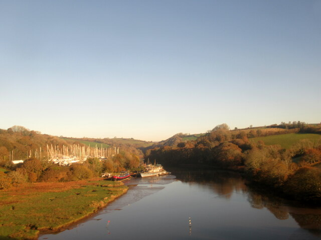
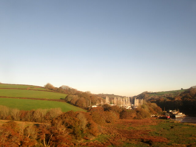
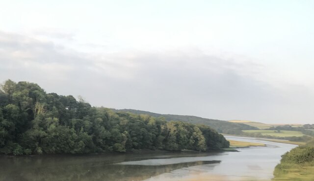
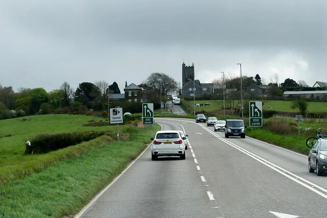
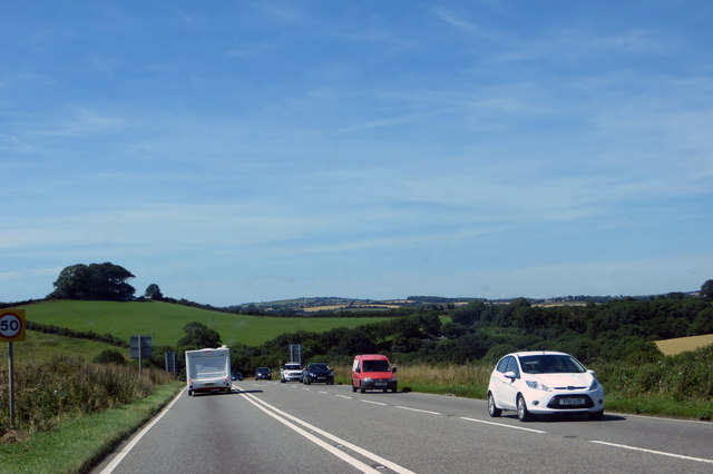
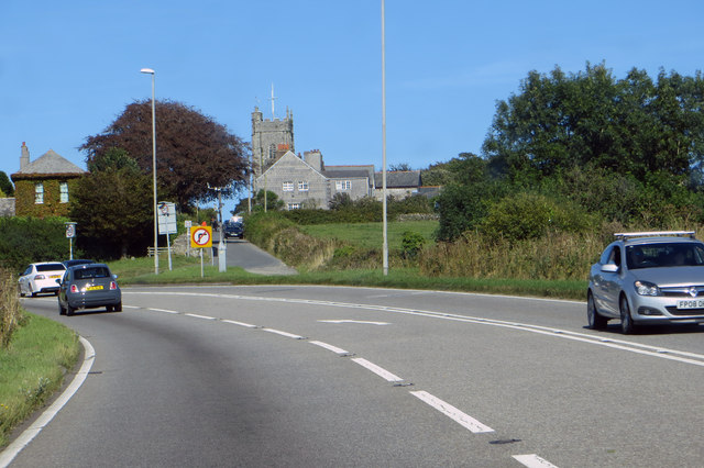
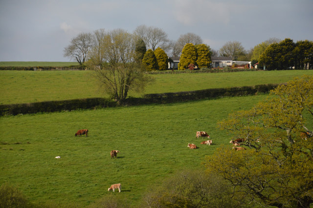
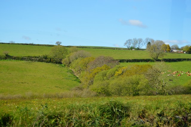
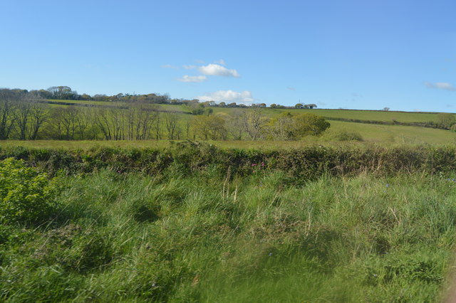
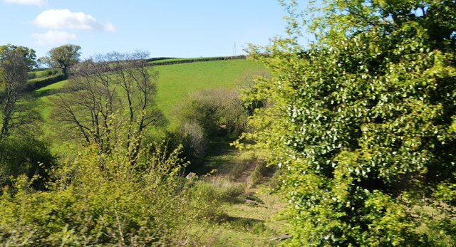
Markwell is a small picturesque village located in the county of Cornwall, England. Situated near the coast, it offers stunning views of the Atlantic Ocean and the rugged cliffs that line the shoreline. The village is surrounded by rolling green fields and is known for its tranquil and idyllic setting.

Markwell is a close-knit community with a population of around 500 residents. The village is characterized by its charming cottages, many of which date back several centuries, giving it a unique historic charm. The village center is centered around a quaint village square, where a local farmer's market is held every Saturday, offering a variety of fresh produce and locally made goods.

The village also boasts a number of amenities for its residents and visitors. These include a small but well-stocked grocery store, a traditional pub serving local ales and hearty pub food, and a primary school. The local community center hosts various events and activities, fostering a strong sense of community spirit.

Nature lovers will find plenty to explore in Markwell and its vicinity. The nearby coastal path offers breathtaking views and is a popular destination for hiking enthusiasts. The village is also a short drive away from several beautiful sandy beaches, perfect for a day out with family and friends.

In conclusion, Markwell is a charming and peaceful village in Cornwall, offering a serene coastal setting, a close-knit community, and easy access to nature's beauty. It is a place that embodies the quintessential charm and tranquility of rural Cornwall.

If you have any feedback on the listing, please let us know in the comments section below.
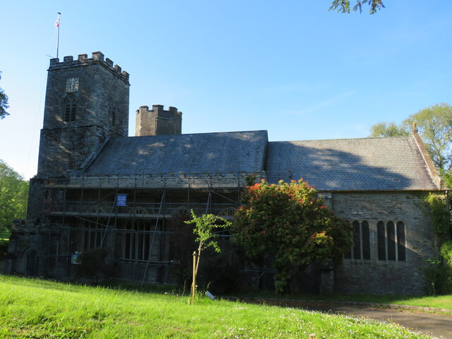
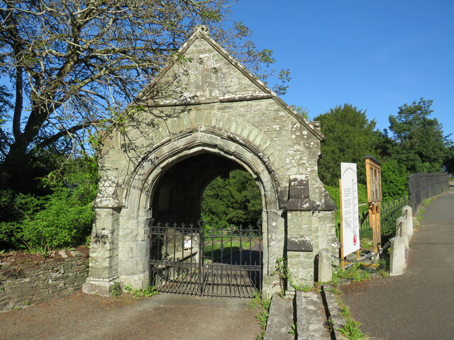
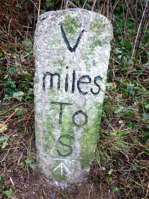
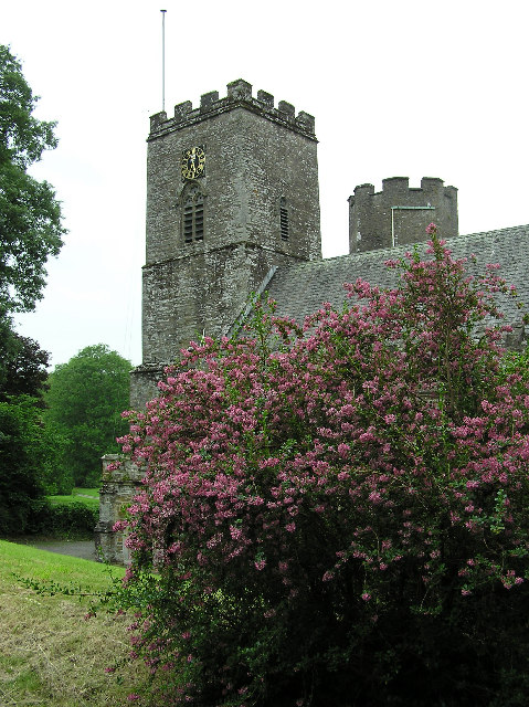
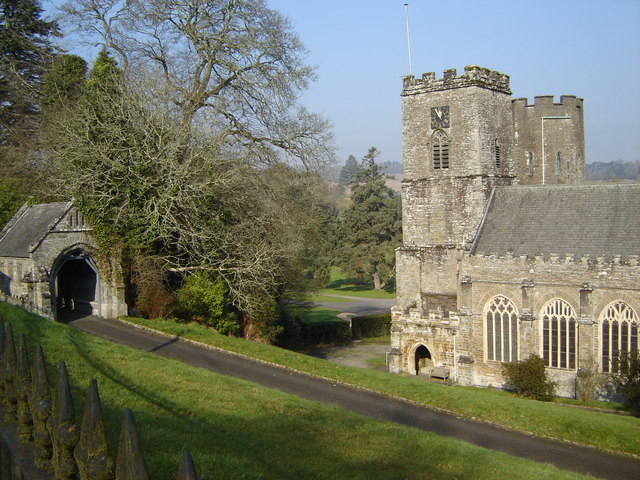
Markwell Images

Images are sourced within 2km of 50.402978/-4.2957393 or Grid Reference SX3658. Thanks to Geograph Open Source API. All images are credited.

The River Lynher, Cornwall
The west bank of the River Lynher, Cornwall
St Germans Priory Church The present church building dates to the 13th century when it was built as part of an Augustinian Priory on the site of the county’s first cathedral. When Henry VIII dissolved the monasteries, the Priory church was spared from destruction in 1539 due to its continued use as the parish church.
St Germans Priory Church
The present church building dates to the 13th century when it was built as part of an Augustinian Priory on the site of the county’s first cathedral. When Henry VIII dissolved the monasteries, the Priory church was spared from destruction in 1539 due to its continued use as the parish church.
Lychgate, St Germans Priory Church The Lychgate is Grade II listed, dating from the mid-19th century.
Lychgate, St Germans Priory Church
The Lychgate is Grade II listed, dating from the mid-19th century.
River Lynher
River Lynher
HGV on the A38 The A38 is a major A-class trunk route. When first designated in 1922, it ran from Derby to Plymouth but it was later extended at both ends so that it now runs for 292 miles from Mansfield in Nottinghamshire to Bodmin in Cornwall.

Prior to the opening of the M5 motorway in the 1960s and 1970s, the A38 formed the main "holiday route" from the Midlands to Somerset, Devon and Cornwall and the south-western section was notorious at holiday times for the congestion. Nowadays, for most of the southern section, the A38 is a fairly quiet road shadowing the M5 extremely closely; often running alongside the motorway as a single carriageway road. The section between Exeter and Plymouth is, however, a busy dual carriageway which serves as the southern extension of the M5 and is known as “the Devon Expressway”.

More information at <span class="nowrap"><a title="http://en.wikipedia.org/wiki/A38_road" rel="nofollow ugc noopener" href="http://en.wikipedia.org/wiki/A38_road">Link</a><img style="margin-left:2px;" alt="External link" title="External link - shift click to open in new window" src="https://s1.geograph.org.uk/img/external.png" width="10" height="10"/></span>  (Wikipedia) and <span class="nowrap"><a title="http://www.sabre-roads.org.uk/wiki/index.php?title=A38" rel="nofollow ugc noopener" href="http://www.sabre-roads.org.uk/wiki/index.php?title=A38">Link</a><img style="margin-left:2px;" alt="External link" title="External link - shift click to open in new window" src="https://s1.geograph.org.uk/img/external.png" width="10" height="10"/></span>  (SABRE).
HGV on the A38
The A38 is a major A-class trunk route. When first designated in 1922, it ran from Derby to Plymouth but it was later extended at both ends so that it now runs for 292 miles from Mansfield in Nottinghamshire to Bodmin in Cornwall. Prior to the opening of the M5 motorway in the 1960s and 1970s, the A38 formed the main "holiday route" from the Midlands to Somerset, Devon and Cornwall and the south-western section was notorious at holiday times for the congestion. Nowadays, for most of the southern section, the A38 is a fairly quiet road shadowing the M5 extremely closely; often running alongside the motorway as a single carriageway road. The section between Exeter and Plymouth is, however, a busy dual carriageway which serves as the southern extension of the M5 and is known as “the Devon Expressway”. More information at LinkExternal link (Wikipedia) and LinkExternal link (SABRE).
A38 west of Landrake The A38 is a major A-class trunk route. When first designated in 1922, it ran from Derby to Plymouth but it was later extended at both ends so that it now runs for 292 miles from Mansfield in Nottinghamshire to Bodmin in Cornwall.

Prior to the opening of the M5 motorway in the 1960s and 1970s, the A38 formed the main "holiday route" from the Midlands to Somerset, Devon and Cornwall and the south-western section was notorious at holiday times for the congestion. Nowadays, for most of the southern section, the A38 is a fairly quiet road shadowing the M5 extremely closely; often running alongside the motorway as a single carriageway road. The section between Exeter and Plymouth is, however, a busy dual carriageway which serves as the southern extension of the M5 and is known as “the Devon Expressway”.

More information at <span class="nowrap"><a title="http://en.wikipedia.org/wiki/A38_road" rel="nofollow ugc noopener" href="http://en.wikipedia.org/wiki/A38_road">Link</a><img style="margin-left:2px;" alt="External link" title="External link - shift click to open in new window" src="https://s1.geograph.org.uk/img/external.png" width="10" height="10"/></span>  (Wikipedia) and <span class="nowrap"><a title="http://www.sabre-roads.org.uk/wiki/index.php?title=A38" rel="nofollow ugc noopener" href="http://www.sabre-roads.org.uk/wiki/index.php?title=A38">Link</a><img style="margin-left:2px;" alt="External link" title="External link - shift click to open in new window" src="https://s1.geograph.org.uk/img/external.png" width="10" height="10"/></span>  (SABRE).
A38 west of Landrake
The A38 is a major A-class trunk route. When first designated in 1922, it ran from Derby to Plymouth but it was later extended at both ends so that it now runs for 292 miles from Mansfield in Nottinghamshire to Bodmin in Cornwall. Prior to the opening of the M5 motorway in the 1960s and 1970s, the A38 formed the main "holiday route" from the Midlands to Somerset, Devon and Cornwall and the south-western section was notorious at holiday times for the congestion. Nowadays, for most of the southern section, the A38 is a fairly quiet road shadowing the M5 extremely closely; often running alongside the motorway as a single carriageway road. The section between Exeter and Plymouth is, however, a busy dual carriageway which serves as the southern extension of the M5 and is known as “the Devon Expressway”. More information at LinkExternal link (Wikipedia) and LinkExternal link (SABRE).
A38 between Tideford and Landrake The A38 is a major A-class trunk route. When first designated in 1922, it ran from Derby to Plymouth but it was later extended at both ends so that it now runs for 292 miles from Mansfield in Nottinghamshire to Bodmin in Cornwall.

Prior to the opening of the M5 motorway in the 1960s and 1970s, the A38 formed the main "holiday route" from the Midlands to Somerset, Devon and Cornwall and the south-western section was notorious at holiday times for the congestion. Nowadays, for most of the southern section, the A38 is a fairly quiet road shadowing the M5 extremely closely; often running alongside the motorway as a single carriageway road. The section between Exeter and Plymouth is, however, a busy dual carriageway which serves as the southern extension of the M5 and is known as “the Devon Expressway”.

More information at <span class="nowrap"><a title="http://en.wikipedia.org/wiki/A38_road" rel="nofollow ugc noopener" href="http://en.wikipedia.org/wiki/A38_road">Link</a><img style="margin-left:2px;" alt="External link" title="External link - shift click to open in new window" src="https://s1.geograph.org.uk/img/external.png" width="10" height="10"/></span>  (Wikipedia) and <span class="nowrap"><a title="http://www.sabre-roads.org.uk/wiki/index.php?title=A38" rel="nofollow ugc noopener" href="http://www.sabre-roads.org.uk/wiki/index.php?title=A38">Link</a><img style="margin-left:2px;" alt="External link" title="External link - shift click to open in new window" src="https://s1.geograph.org.uk/img/external.png" width="10" height="10"/></span>  (SABRE).
A38 between Tideford and Landrake
The A38 is a major A-class trunk route. When first designated in 1922, it ran from Derby to Plymouth but it was later extended at both ends so that it now runs for 292 miles from Mansfield in Nottinghamshire to Bodmin in Cornwall. Prior to the opening of the M5 motorway in the 1960s and 1970s, the A38 formed the main "holiday route" from the Midlands to Somerset, Devon and Cornwall and the south-western section was notorious at holiday times for the congestion. Nowadays, for most of the southern section, the A38 is a fairly quiet road shadowing the M5 extremely closely; often running alongside the motorway as a single carriageway road. The section between Exeter and Plymouth is, however, a busy dual carriageway which serves as the southern extension of the M5 and is known as “the Devon Expressway”. More information at LinkExternal link (Wikipedia) and LinkExternal link (SABRE).
A38 towards Landrake The A38 is a major A-class trunk route. When first designated in 1922, it ran from Derby to Plymouth but it was later extended at both ends so that it now runs for 292 miles from Mansfield in Nottinghamshire to Bodmin in Cornwall.

Prior to the opening of the M5 motorway in the 1960s and 1970s, the A38 formed the main "holiday route" from the Midlands to Somerset, Devon and Cornwall and the south-western section was notorious at holiday times for the congestion. Nowadays, for most of the southern section, the A38 is a fairly quiet road shadowing the M5 extremely closely; often running alongside the motorway as a single carriageway road. The section between Exeter and Plymouth is, however, a busy dual carriageway which serves as the southern extension of the M5 and is known as “the Devon Expressway”.

More information at <span class="nowrap"><a title="http://en.wikipedia.org/wiki/A38_road" rel="nofollow ugc noopener" href="http://en.wikipedia.org/wiki/A38_road">Link</a><img style="margin-left:2px;" alt="External link" title="External link - shift click to open in new window" src="https://s1.geograph.org.uk/img/external.png" width="10" height="10"/></span>  (Wikipedia) and <span class="nowrap"><a title="http://www.sabre-roads.org.uk/wiki/index.php?title=A38" rel="nofollow ugc noopener" href="http://www.sabre-roads.org.uk/wiki/index.php?title=A38">Link</a><img style="margin-left:2px;" alt="External link" title="External link - shift click to open in new window" src="https://s1.geograph.org.uk/img/external.png" width="10" height="10"/></span>  (SABRE).
A38 towards Landrake
The A38 is a major A-class trunk route. When first designated in 1922, it ran from Derby to Plymouth but it was later extended at both ends so that it now runs for 292 miles from Mansfield in Nottinghamshire to Bodmin in Cornwall. Prior to the opening of the M5 motorway in the 1960s and 1970s, the A38 formed the main "holiday route" from the Midlands to Somerset, Devon and Cornwall and the south-western section was notorious at holiday times for the congestion. Nowadays, for most of the southern section, the A38 is a fairly quiet road shadowing the M5 extremely closely; often running alongside the motorway as a single carriageway road. The section between Exeter and Plymouth is, however, a busy dual carriageway which serves as the southern extension of the M5 and is known as “the Devon Expressway”. More information at LinkExternal link (Wikipedia) and LinkExternal link (SABRE).
The A38 The rolling hills of Cornwall.
The A38
The rolling hills of Cornwall.
The A38 Entering Landrake.
The A38
Entering Landrake.
Cornwall : Grassy Field A grassy field and cattle.
Cornwall : Grassy Field
A grassy field and cattle.
Sornish countryside
Sornish countryside
Hedge by the A38
Hedge by the A38
Hay Lake Bottom
Hay Lake Bottom
Old Milestone by the A38, south of Landallack Cross Carved stone post by the A38, in parish of LANDRAKE WITH ST ERNEY (CARADON District), Pencavo, near Tredinnick Lane junction, on fast 3-lane uphill bend, on the verge, on North side of road. Saltash 'S' stone post, erected by the Saltash turnpike trust in the 19th century. 

Inscription reads:-
V
miles
To
S  
Carved benchmark on front.

Grade II Listed. List Entry Number:1392528
<span class="nowrap"><a title="https://historicengland.org.uk/listing/the-list/list-entry/1392528" rel="nofollow ugc noopener" href="https://historicengland.org.uk/listing/the-list/list-entry/1392528">Link</a><img style="margin-left:2px;" alt="External link" title="External link - shift click to open in new window" src="https://s1.geograph.org.uk/img/external.png" width="10" height="10"/></span>

Milestone Society National ID: CW_SHLK05.
Old Milestone by the A38, south of Landallack Cross
Carved stone post by the A38, in parish of LANDRAKE WITH ST ERNEY (CARADON District), Pencavo, near Tredinnick Lane junction, on fast 3-lane uphill bend, on the verge, on North side of road. Saltash 'S' stone post, erected by the Saltash turnpike trust in the 19th century. Inscription reads:- V miles To S Carved benchmark on front. Grade II Listed. List Entry Number:1392528 LinkExternal link Milestone Society National ID: CW_SHLK05.
Old Milestone by the A38, south of Landallack Cross Carved stone post by the A38, in parish of LANDRAKE WITH ST ERNEY (CARADON District), Pencavo, near Tredinnick Lane junction, on fast 3-lane uphill bend, on the verge, on North side of road. Saltash 'S' stone post, erected by the Saltash turnpike trust in the 19th century. 

Inscription reads:-
V
miles
To
S
Carved benchmark on lower front.

Grade II listed. 
List Entry Number: 1392528 <span class="nowrap"><a title="https://historicengland.org.uk/listing/the-list/list-entry/1392528" rel="nofollow ugc noopener" href="https://historicengland.org.uk/listing/the-list/list-entry/1392528">Link</a><img style="margin-left:2px;" alt="External link" title="External link - shift click to open in new window" src="https://s1.geograph.org.uk/img/external.png" width="10" height="10"/></span>

Milestone Society National ID: CW_SHLK05.
Old Milestone by the A38, south of Landallack Cross
Carved stone post by the A38, in parish of LANDRAKE WITH ST ERNEY (CARADON District), Pencavo, near Tredinnick Lane junction, on fast 3-lane uphill bend, on the verge, on North side of road. Saltash 'S' stone post, erected by the Saltash turnpike trust in the 19th century. Inscription reads:- V miles To S Carved benchmark on lower front. Grade II listed. List Entry Number: 1392528 LinkExternal link Milestone Society National ID: CW_SHLK05.
Saint German's church Was originally the seat of the bishop of Cornwall, consecrated in 1261. Really surprising inside, looks more like a small cathedral
Saint German's church
Was originally the seat of the bishop of Cornwall, consecrated in 1261. Really surprising inside, looks more like a small cathedral
Show me another place!

Markwell is located at Grid Ref: SX3658 (Lat: 50.402978, Lng: -4.2957393)

Unitary Authority: Cornwall

Police Authority: Devon and Cornwall

What 3 Words

///exhaling.duplicity.crackles. Near Landrake, Cornwall

Related Wikis

St Erney

St Erney is a hamlet with a Church of England church in Cornwall, England, United Kingdom. == See also == Landrake with St Erney == External links == St...
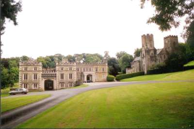
Port Eliot

Port Eliot in the parish of St Germans, Cornwall, England, United Kingdom, is the ancestral seat of the Eliot family, whose present head is Albert Eliot...
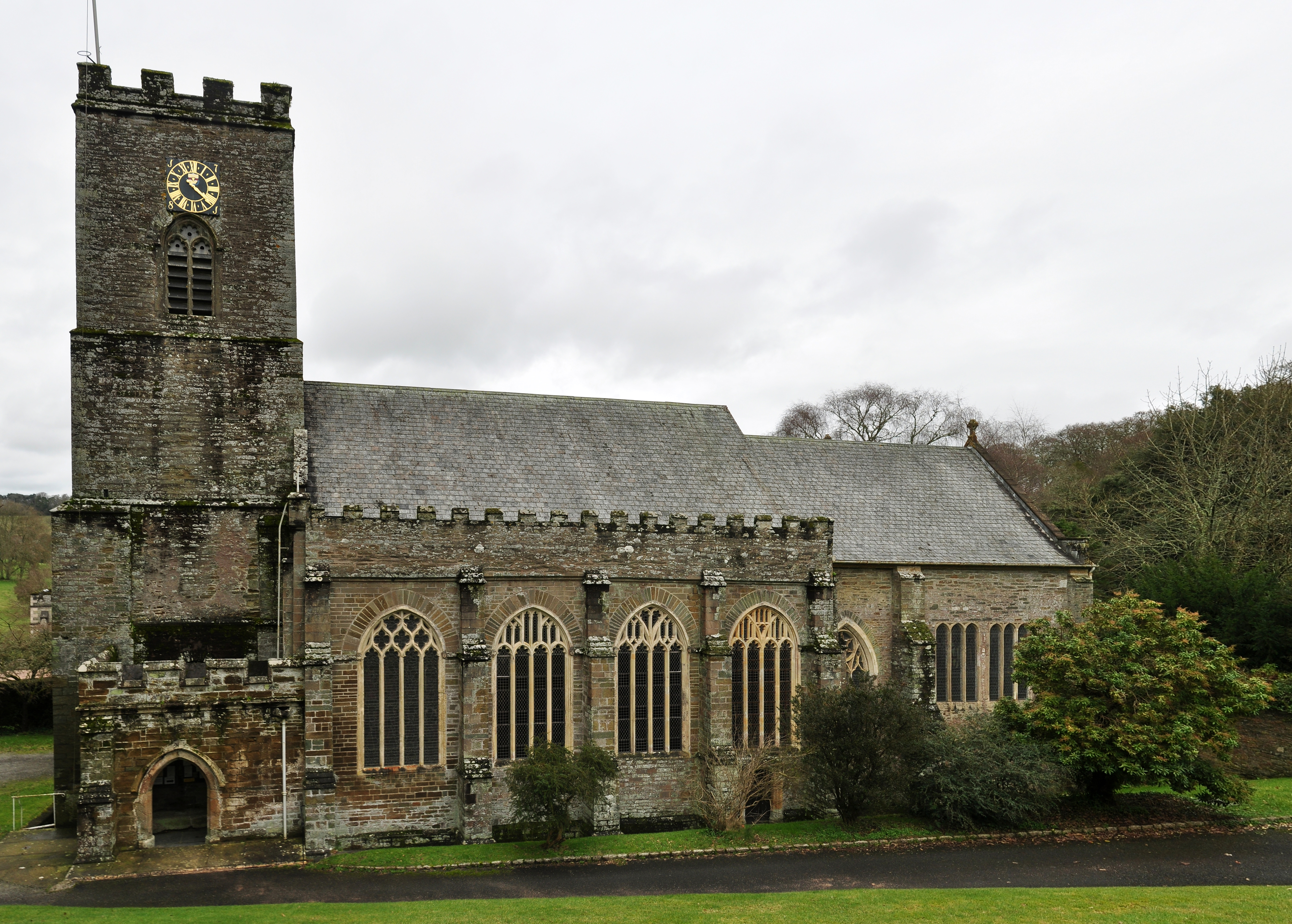
St German's Priory

St Germans Priory is a large Norman church in the village of St Germans in south-east Cornwall, England, UK. == History == According to a credible tradition...

St Germans, Cornwall

St Germans (Cornish: Lannaled) is a village and civil parish in east Cornwall, England, United Kingdom. It stands on the River Tiddy, just upstream of...

Nearby Amenities

Located within 500m of 50.402978,-4.2957393
Created By: almien_coastlines
Source: PGS
Lat/Long: 50.404255/-4.302358
Markwell
Name Kw: Fentenvargh
Place: hamlet
Lat/Long: 50.4029965/-4.2946221
The data included in this document is from www.openstreetmap.org. The data is made available under ODbL.

Have you been to Markwell?

Leave your review of Markwell below (or comments, questions and feedback).