Lyncombe Vale

Settlement in Somerset

England

Lyncombe Vale

Bath: River Avon through Bath This picture was taken from the south side of the bridge and east of the Abbey and Roman Baths. The bridge is situated right in the upper left quadrant of the square.
Bath: River Avon through Bath Credit: Pam Brophy

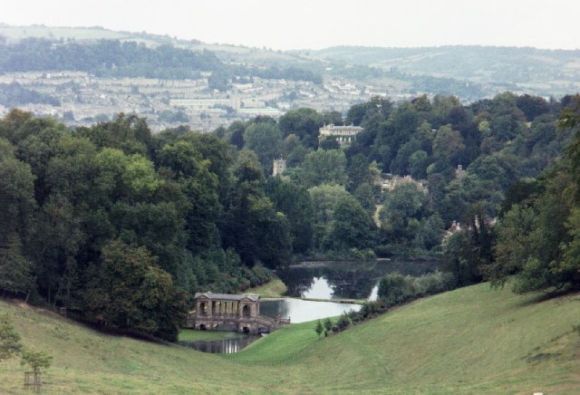
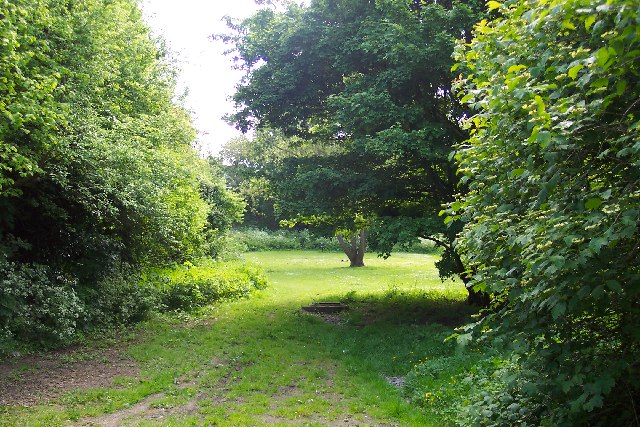
Lyncombe Vale is an enchanting valley located in Somerset, England. Nestled amidst the rolling hills, this picturesque destination is a haven for nature lovers and outdoor enthusiasts. The valley stretches for approximately two miles and is surrounded by lush greenery, meandering streams, and dense woodlands, making it a truly idyllic retreat.

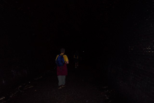
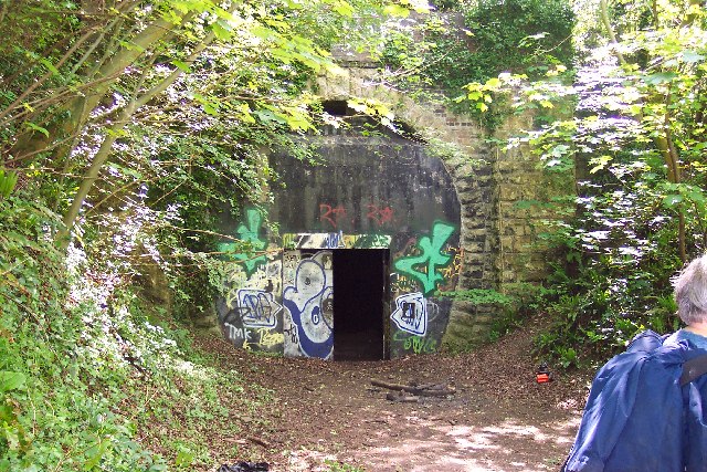
Lyncombe Vale is famous for its diverse wildlife, including an array of bird species, foxes, badgers, and deer. The valley's tranquil atmosphere and natural beauty make it a popular destination for walking, hiking, and exploring. There are numerous well-marked trails that meander through the valley, offering stunning views of the surrounding countryside.

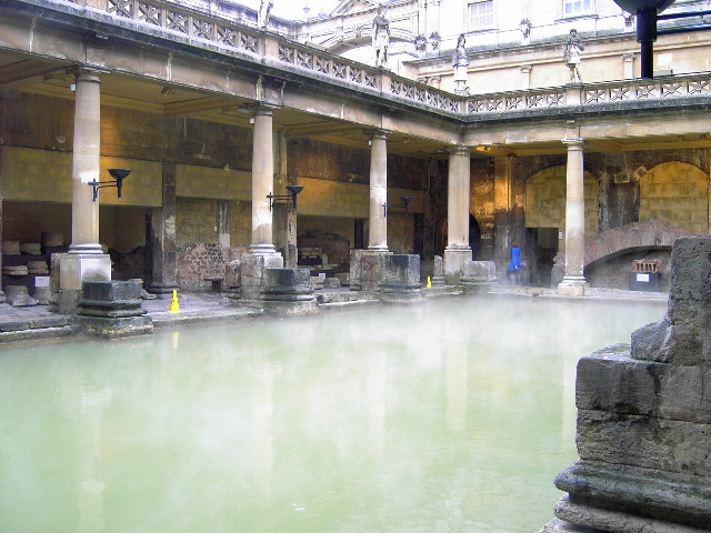
In addition to its natural wonders, Lyncombe Vale is also home to historical landmarks and archaeological sites. The remains of a Roman villa have been discovered in the valley, providing a glimpse into the region's rich history. Visitors can also explore the nearby Lyncombe Hill, an Iron Age hillfort that offers panoramic views of the surrounding landscape.

For those seeking a peaceful escape from the hustle and bustle of city life, Lyncombe Vale provides the perfect retreat. Its serene surroundings and abundance of natural beauty make it an ideal destination for relaxation and rejuvenation. Whether it's a leisurely stroll through the valley or a challenging hike up the hills, Lyncombe Vale offers something for everyone to enjoy.

If you have any feedback on the listing, please let us know in the comments section below.

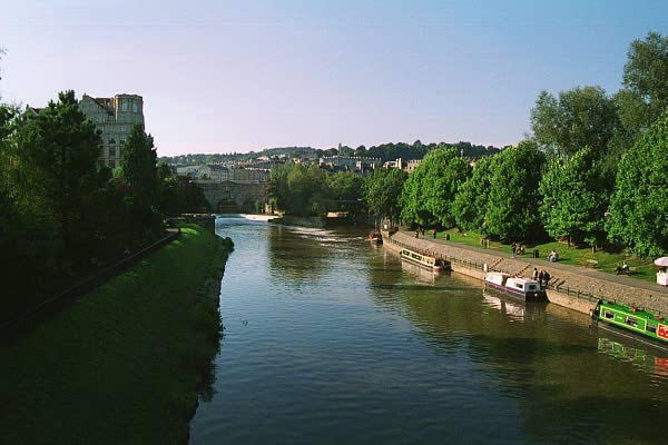
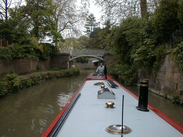
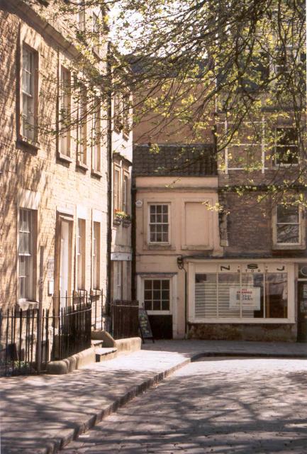
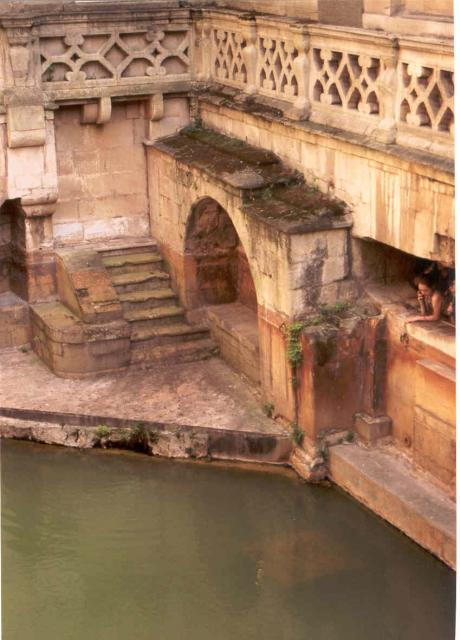
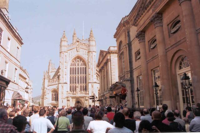
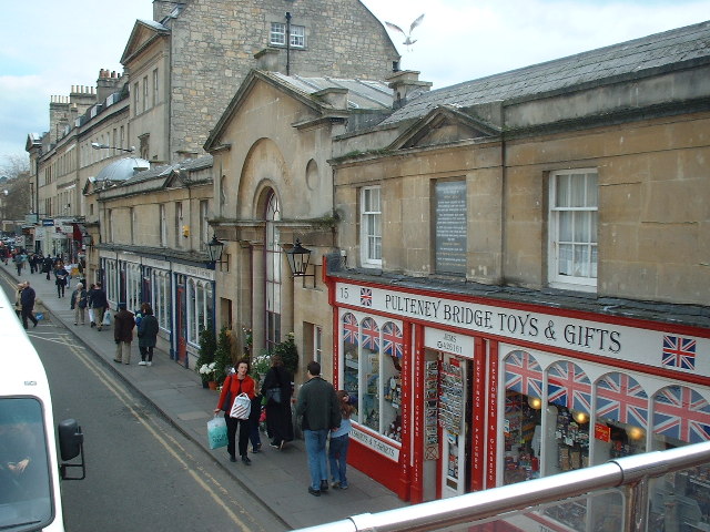
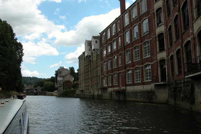
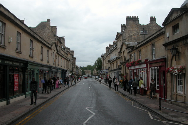
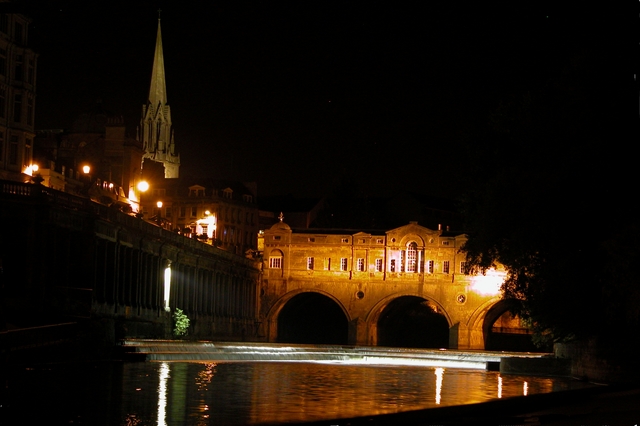
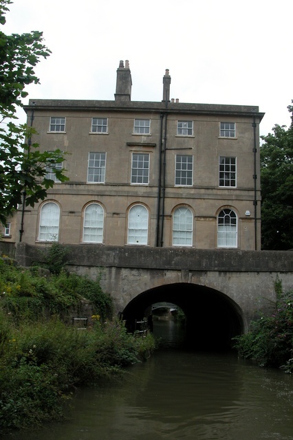
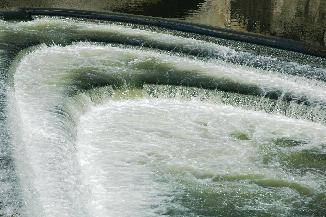
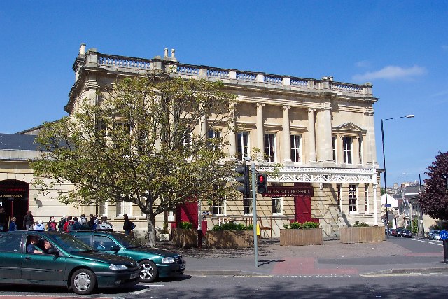
Lyncombe Vale Images

Images are sourced within 2km of 51.370406/-2.3555249 or Grid Reference ST7563. Thanks to Geograph Open Source API. All images are credited.

Bath: River Avon through Bath This picture was taken from the south side of the bridge and east of the Abbey and Roman Baths. The bridge is situated right in the upper left quadrant of the square.
Bath: River Avon through Bath
This picture was taken from the south side of the bridge and east of the Abbey and Roman Baths. The bridge is situated right in the upper left quadrant of the square.
Sydney Gardens, Bath A very distinctive length of the Kennet & Avon Canal as it passes under ornate bridges in Sydney Gardens.
Sydney Gardens, Bath
A very distinctive length of the Kennet & Avon Canal as it passes under ornate bridges in Sydney Gardens.
Pulteney Bridge, Bath from the park
Pulteney Bridge, Bath
from the park
Near North Parade Passage, Bath Close to Bath Abbey
Near North Parade Passage, Bath
Close to Bath Abbey
Sacred Springs Roman Baths, Bath Part of the Roman Bath site
Sacred Springs Roman Baths, Bath
Part of the Roman Bath site
Bath Abbey Pump Rooms on the right
Bath Abbey
Pump Rooms on the right
Prior Park Landscape Garden, Bath Property of the National Trust.  The view down the valley shows the Palladian Bridge (18th century) and the lakes beyond.
Prior Park Landscape Garden, Bath
Property of the National Trust. The view down the valley shows the Palladian Bridge (18th century) and the lakes beyond.
Pulteney Bridge
Pulteney Bridge
Warehouses by River Avon in the centre of Bath.
Pulteney Bridge, Bath - at street level This is the only bridge in the UK which has shops all across it. It was modelled on the Ponte Vecchio in Florence.
Pulteney Bridge, Bath - at street level
This is the only bridge in the UK which has shops all across it. It was modelled on the Ponte Vecchio in Florence.
Pulteney Bridge, Bath - from river level This is the only bridge in the UK covered with shops. It was modelled on the Pont Aveccio. I think the church is St Michael with St Paul.
Pulteney Bridge, Bath - from river level
This is the only bridge in the UK covered with shops. It was modelled on the Pont Aveccio. I think the church is St Michael with St Paul.
The tunnel at Sydney Gardens, Bath. The Kennet and Avon canal going under the house at Sydney Gardens.
The tunnel at Sydney Gardens, Bath.
The Kennet and Avon canal going under the house at Sydney Gardens.
Pulteney Weir Bath
Pulteney Weir Bath
Inside Combe Down tunnel, near Bath Combe Down tunnel was on the old Somerset & Dorset Joint Railway which ran from Bath to Bournemouth. The line closed in 1966 and the tunnel, which is more than a mile long, is now owned by Wessex Water. It is occasionally opened to the public.
Inside Combe Down tunnel, near Bath
Combe Down tunnel was on the old Somerset & Dorset Joint Railway which ran from Bath to Bournemouth. The line closed in 1966 and the tunnel, which is more than a mile long, is now owned by Wessex Water. It is occasionally opened to the public.
Bath Green Park railway station Bath Green Park was the station which served both the Midland Railway line to Birmingham and it was the northern terminus of the Somerset & Dorset Railway to Bournemouth. It closed in 1966 but was subsequently fully restored as part of the development of a Sainsbury's store in the adjacent station yard. Cars now park where trains once stood.
Bath Green Park railway station
Bath Green Park was the station which served both the Midland Railway line to Birmingham and it was the northern terminus of the Somerset & Dorset Railway to Bournemouth. It closed in 1966 but was subsequently fully restored as part of the development of a Sainsbury's store in the adjacent station yard. Cars now park where trains once stood.
Combe Down Tunnel, near Bath Combe Down tunnel was on the old Somerset & Dorset Joint Railway which ran from Bath to Bournemouth. The line closed in 1966 and the tunnel, which is more than a mile long, is now owned by Wessex Water. This tunnel and the Devonshire tunnel were opened as permanent cycle/foot paths in April 2013.
Combe Down Tunnel, near Bath
Combe Down tunnel was on the old Somerset & Dorset Joint Railway which ran from Bath to Bournemouth. The line closed in 1966 and the tunnel, which is more than a mile long, is now owned by Wessex Water. This tunnel and the Devonshire tunnel were opened as permanent cycle/foot paths in April 2013.
Who's pinched my tunnel?! This grassy glade in the southern suburbs of Bath marks the spot where the northern portal of the Somerset & Dorset Railway's Devonshire Tunnel once stood. It has now been buried by infilling the approach cutting. In the middle of the picture is a manhole which gives access to it so that occasional inspections can be carried out.
Who's pinched my tunnel?!
This grassy glade in the southern suburbs of Bath marks the spot where the northern portal of the Somerset & Dorset Railway's Devonshire Tunnel once stood. It has now been buried by infilling the approach cutting. In the middle of the picture is a manhole which gives access to it so that occasional inspections can be carried out.
Roman Baths, Bath
Roman Baths, Bath
Show me another place!

Lyncombe Vale is located at Grid Ref: ST7563 (Lat: 51.370406, Lng: -2.3555249)

Unitary Authority: Bath and North East Somerset

Police Authority: Avon and Somerset

What 3 Words

///sings.given.plays. Near Bath, Somerset

Related Wikis

Lyncombe, Bath

Lyncombe is a district and electoral ward in Bath, Somerset, and a former parish in the Diocese of Bath and Wells. In the mid-19th century the parish was...

Beechen Cliff School

Beechen Cliff School is a boys' secondary school in Bath, Somerset, England, with about 1,150 pupils. Its earliest predecessor school was founded in 1896...

Bath Abbey Cemetery

The Anglican Bath Abbey Cemetery, officially dedicated as the Cemetery of St Peter and St Paul (the patron saints that Bath Abbey is dedicated to), was...

Widcombe Crescent, Bath

Widcombe Crescent in Bath, Somerset, England is a terrace of 14 Georgian houses built in 1808 by Thomas Baldwin, and designated a Grade I listed building...

Nearby Amenities

Located within 500m of 51.370406,-2.3555249
Barrier: kissing_gate
Lat/Long: 51.3724974/-2.3548999
Post Box
Operator: Royal Mail
Post Box Type: wall
Postal Code: BA2
Ref: BA2 191
Royal Cypher: EIIR
Lat/Long: 51.3708688/-2.3551336
Barrier: kissing_gate
Lat/Long: 51.3688376/-2.3572699
Post Box
Lat/Long: 51.3704846/-2.3493129
Post Box
Lat/Long: 51.3690593/-2.3517076
Man Made: manhole
Manhole: drain
Tunnel: culvert
Lat/Long: 51.3721836/-2.3501851
Bench
Backrest: yes
Colour: brown
Material: wood
Seats: 3
Lat/Long: 51.3738348/-2.3579098
Bench
Backrest: yes
Material: wood
Lat/Long: 51.3743949/-2.3580212
Bench
Backrest: yes
Colour: brown
Material: wood
Seats: 3
Lat/Long: 51.3740106/-2.3579474
Bench
Backrest: yes
Colour: brown
Material: wood
Seats: 3
Lat/Long: 51.3739135/-2.3579299
Bench
Backrest: yes
Material: wood
Lat/Long: 51.3743848/-2.3581083
Bus Stop
Bewdley Road
Bus: yes
Naptan AtcoCode: 0180BAC30102
Naptan Bearing: NW
Naptan CommonName: Bewdley Road
Naptan Crossing: Bewdley Road
Naptan NaptanCode: bthjtwp
Naptan PlusbusZoneRef: BATHSPA
Naptan Street: Prior Park Road
Naptan Verified: no
Public Transport: platform
Source: naptan_import
Toilets Wheelchair: no
Wheelchair: yes
Lat/Long: 51.3736731/-2.3508396
Bus Stop
Bewdley Road
Bus: yes
Naptan AtcoCode: 0180BAC30103
Naptan Bearing: SE
Naptan BusStopType: CUS
Naptan CommonName: Bewdley Road
Naptan Crossing: Bewdley Road
Naptan NaptanCode: bthjwag
Naptan PlusbusZoneRef: BATHSPA
Naptan Street: Prior Park Road
Naptan Verified: no
Public Transport: platform
Source: naptan_import
Lat/Long: 51.3737111/-2.3506372
Bus Stop
Abbey Cemetery
Bus: yes
Naptan AtcoCode: 0180BAC30104
Naptan Bearing: S
Naptan CommonName: Abbey Cemetery
Naptan Crossing: Ralph Allen Drive
Naptan NaptanCode: bthjwga
Naptan PlusbusZoneRef: BATHSPA
Naptan Street: Perrymead
Naptan Verified: no
Public Transport: platform
Source: naptan_import
Toilets Wheelchair: no
Wheelchair: yes
Lat/Long: 51.3723095/-2.3490122
Barrier: kissing_gate
Lat/Long: 51.3743013/-2.3567472
Barrier: kissing_gate
Lat/Long: 51.3702357/-2.3490049
Barrier: kissing_gate
Lat/Long: 51.3695766/-2.3577434
Barrier: kissing_gate
Lat/Long: 51.3713157/-2.3586782
Tourism: viewpoint
Lat/Long: 51.3743906/-2.3581499
Kindergarten
Squirrels Nursery
Addr Housename: Lyncombe House
Addr Postcode: BA2 4LT
Addr Street: Lyncombe Vale
Fixme: rough location
Website: https://www.paragonschool.co.uk/squirrels-nursery
Lat/Long: 51.3696588/-2.355805
Lyncombe
Place: suburb
Wikidata: Q6708521
Wikipedia: en:Lyncombe, Bath
Lat/Long: 51.372884/-2.3546706
Tunnel: culvert
Lat/Long: 51.3735231/-2.350745
Tunnel: culvert
Lat/Long: 51.3737166/-2.3509381
Waste Basket
Lat/Long: 51.3743385/-2.3580598
Bench
Backrest: yes
Material: wood
Lat/Long: 51.3742502/-2.3582217
Bench
Backrest: yes
Material: wood
Lat/Long: 51.3742629/-2.3583058
Recycling
Recycling Type: container
Lat/Long: 51.3742319/-2.3581377
Waste Basket
Lat/Long: 51.3742414/-2.3581759
Bench
Backrest: yes
Material: wood
Lat/Long: 51.3743369/-2.3582345
Bench
Backrest: yes
Material: wood
Lat/Long: 51.3742717/-2.3583823
Waste Basket
Lat/Long: 51.3739427/-2.3579288
Bench
Backrest: yes
Material: wood
Lat/Long: 51.3743834/-2.3582459
Bench
Backrest: yes
Colour: brown
Material: wood
Seats: 3
Lat/Long: 51.3736446/-2.357621
Bench
Backrest: yes
Colour: brown
Material: wood
Seats: 3
Lat/Long: 51.3736752/-2.3576333
Bench
Backrest: yes
Colour: brown
Material: wood
Seats: 3
Lat/Long: 51.3736172/-2.3585327
Waste Basket
Lat/Long: 51.3735949/-2.3585354
Bench
Backrest: yes
Colour: brown
Material: wood
Seats: 3
Lat/Long: 51.3737149/-2.3585148
Waste Basket
Lat/Long: 51.3737356/-2.3585148
Waste Basket
Lat/Long: 51.3730287/-2.3585176
Bench
Backrest: yes
Colour: brown
Material: wood
Seats: 3
Lat/Long: 51.373408/-2.3584205
Waste Basket
Lat/Long: 51.3729388/-2.3599265
Bench
Backrest: yes
Colour: brown
Material: wood
Seats: 3
Lat/Long: 51.3729347/-2.3599813
Waste Basket
Lat/Long: 51.3725004/-2.3612946
Waste Basket
Lat/Long: 51.372293/-2.3609686
Waste Basket
Lat/Long: 51.3722532/-2.3609253
Waste Basket
Lat/Long: 51.372212/-2.3608694
Lyncombe Vale
Place: suburb
Lat/Long: 51.3702347/-2.3550699
Information: board
Tourism: information
Lat/Long: 51.3682948/-2.3555591
Leisure: picnic_table
Lat/Long: 51.3683138/-2.3555907
Club
Next Thing Education Camps
Addr Postcode: BA2 4LT
Addr Street: Lyncombe Vale
Fhrs Id: 1582388
Website: https://www.nextthing.education/product-category/bath/
Lat/Long: 51.3700057/-2.3558768
Post Box
Operator: Royal Mail
Post Box Type: wall
Ref: BA2 225
Royal Cypher: VR
Lat/Long: 51.3709934/-2.3580587
The data included in this document is from www.openstreetmap.org. The data is made available under ODbL.

Have you been to Lyncombe Vale?

Leave your review of Lyncombe Vale below (or comments, questions and feedback).