Lydgate

Settlement in Yorkshire

England

Lydgate

Old milestone On a bend on the south side of the A635 between Holmfirth and New Mills is this 19C West Riding CC milestone.   This area is called Wooldale and that name is on the top section.  Left face - HOLMFIRTH/1 MILE, right face - DENBY/DALE/5¾ MILES/CAWTHORNE/9 MILES/BARNSLEY/13 MILES.   The foundry name, BRAYSHAW & BOOTH/LIVERSEDGE is on the bevel.   Grade II listed 1313589.  It is in need of a clean and possible repaint.
Old milestone Credit: Chris Minto

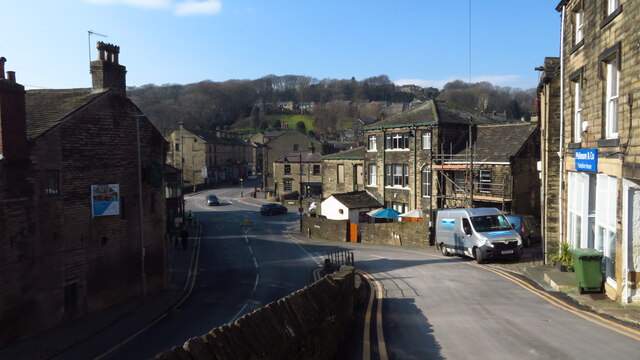
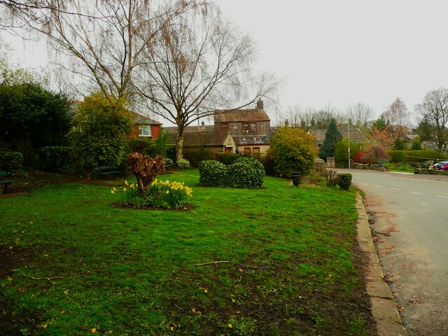
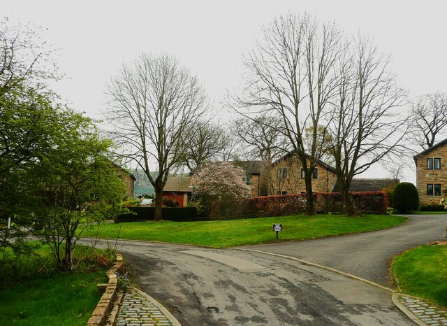
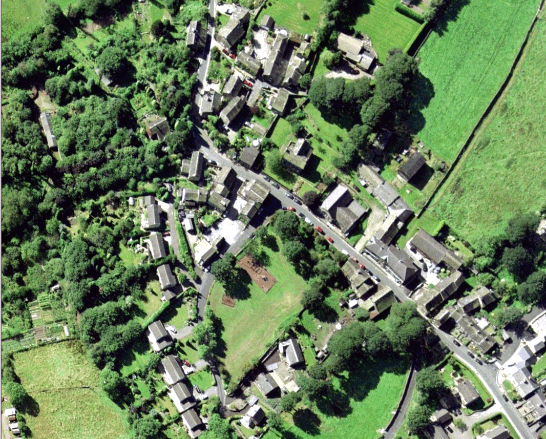
Lydgate is a picturesque village located in the county of Yorkshire, England. Situated in the beautiful countryside, it is surrounded by rolling hills and offers stunning panoramic views. With a population of around 600 residents, it is known for its close-knit community and friendly atmosphere.

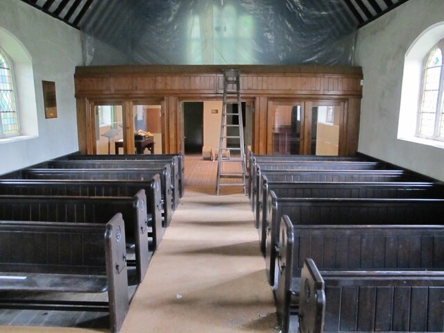
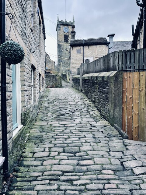
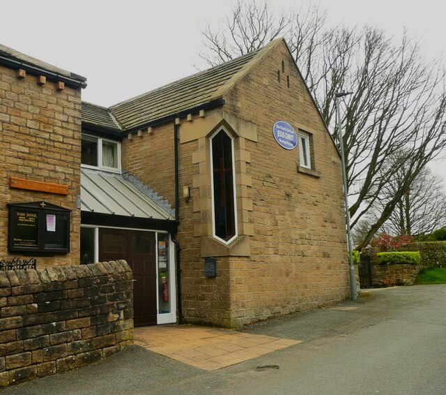
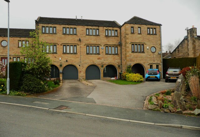
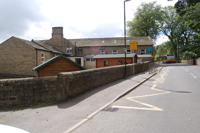
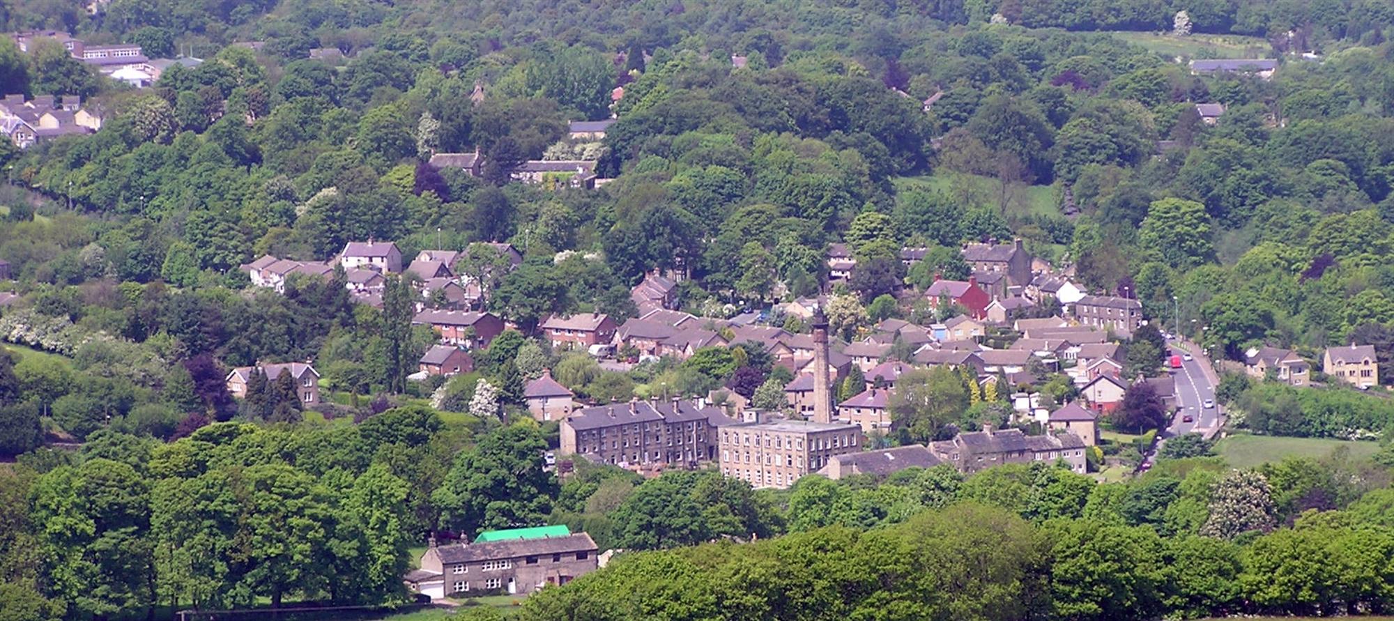
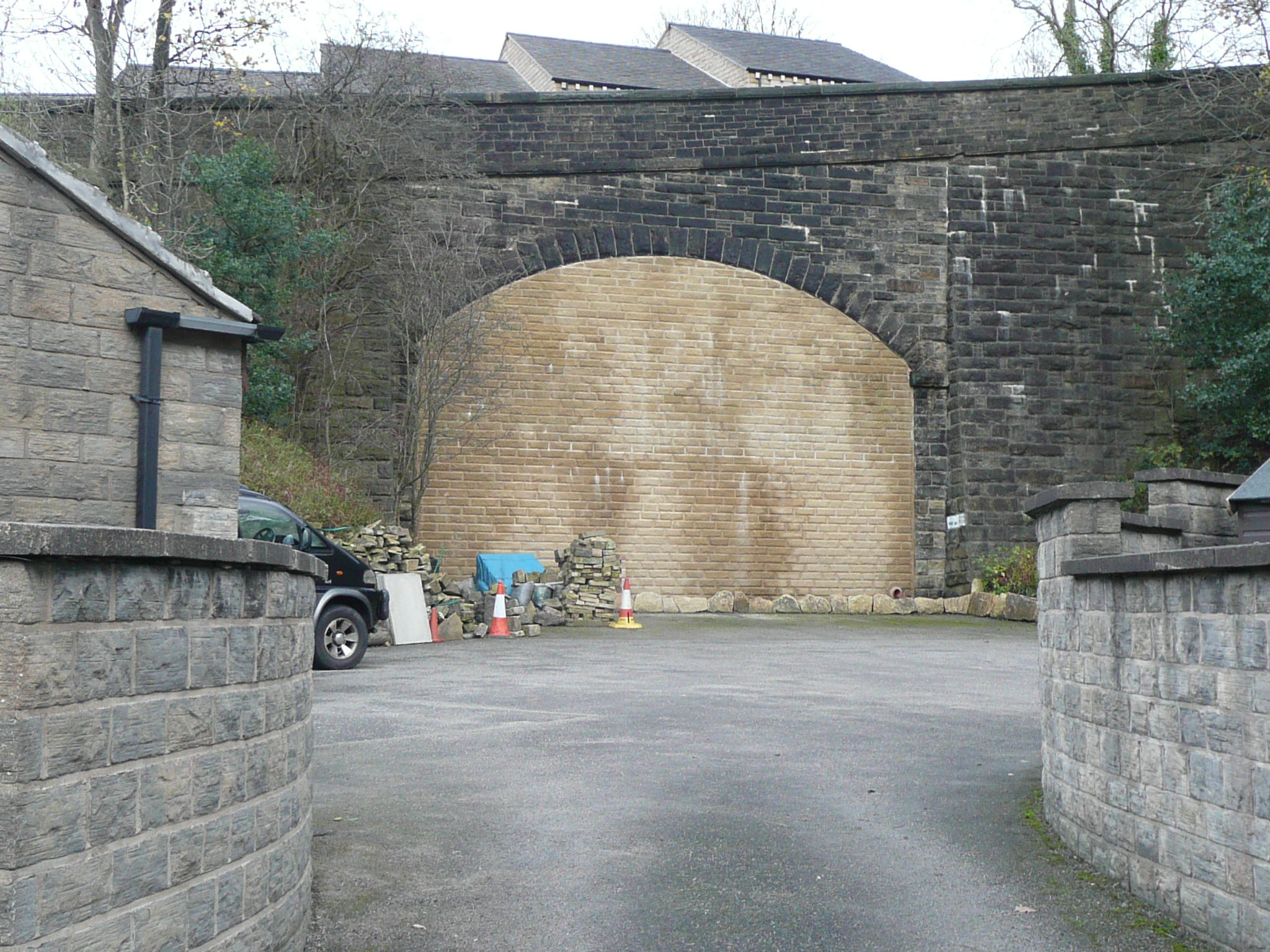
The village of Lydgate boasts a rich history, dating back to medieval times. Many of the buildings in the village still retain their original architecture, adding to its charm and character. The centerpiece of the village is the historic St. Mary's Church, a magnificent structure that dates back to the 12th century. It serves as a reminder of the village's long-standing religious heritage.

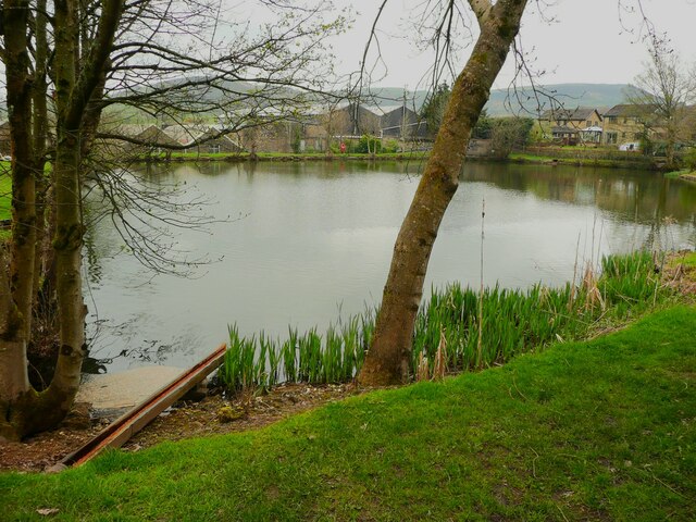
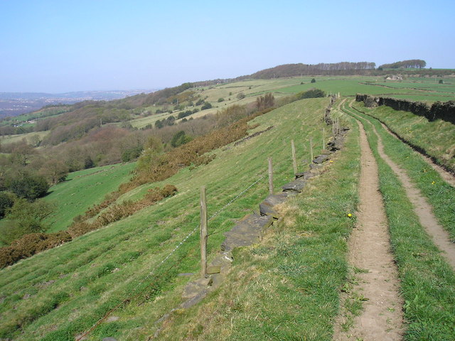
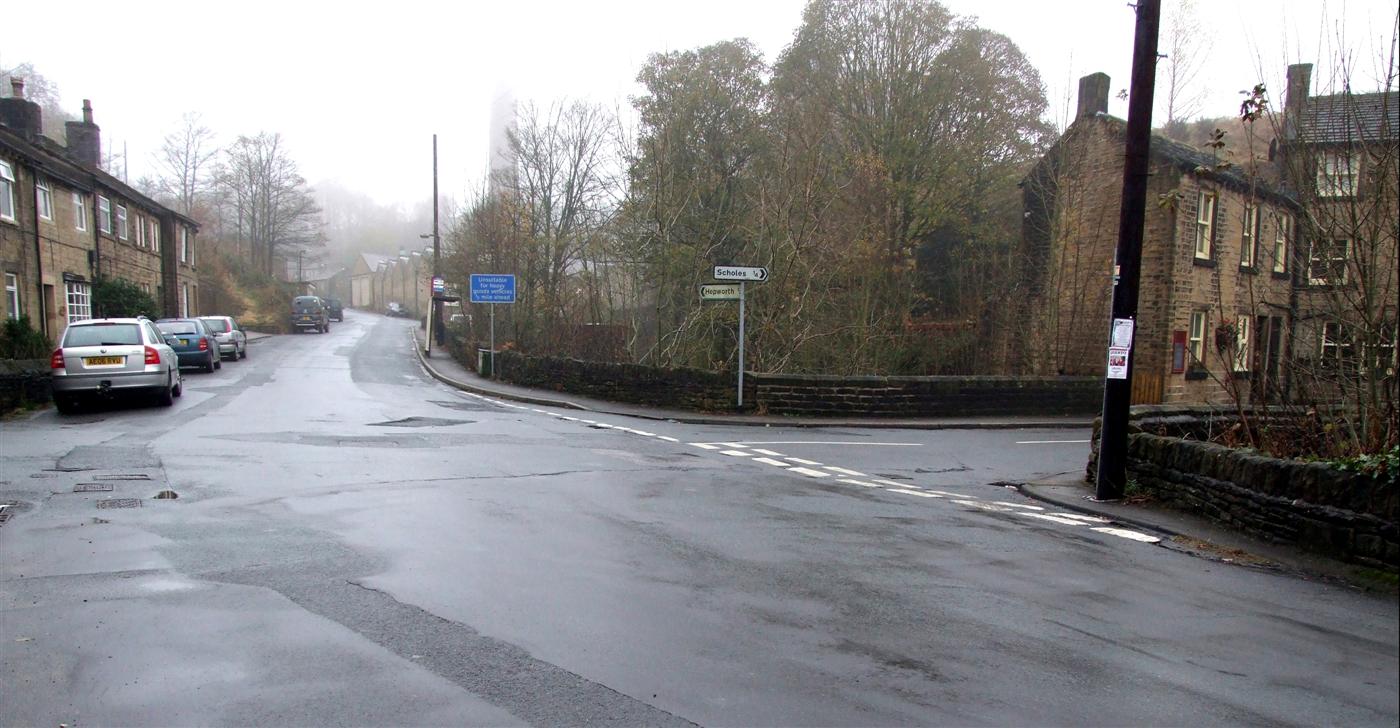
Lydgate is famous for its proximity to breathtaking natural landscapes. The village is located near the renowned Yorkshire Dales, offering residents and visitors ample opportunities for outdoor activities such as hiking, cycling, and bird-watching. The nearby Lydgate Reservoir is also a popular spot for fishing and boating enthusiasts.

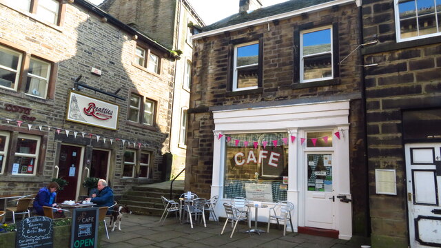
The village is well-served by a range of amenities, including a local pub, a post office, and a village hall that hosts various community events throughout the year. The Lydgate Primary School provides excellent education for the younger residents, while public transportation links make it convenient for commuting to nearby towns.

Overall, Lydgate is an idyllic village that combines a rich history with stunning natural beauty. Its warm community spirit and range of amenities make it an attractive place to live or visit for those seeking a peaceful and picturesque setting in the heart of Yorkshire.

If you have any feedback on the listing, please let us know in the comments section below.
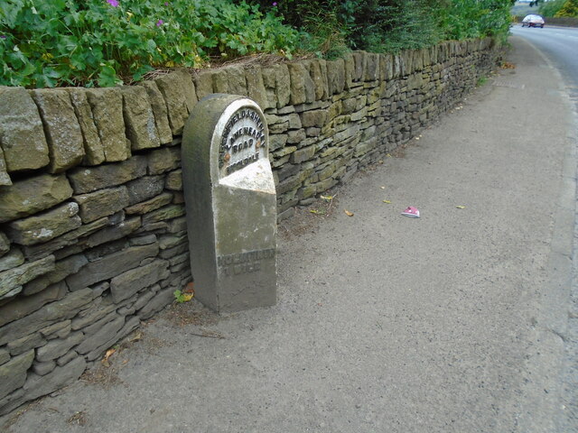
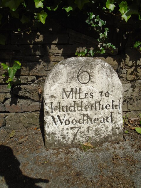
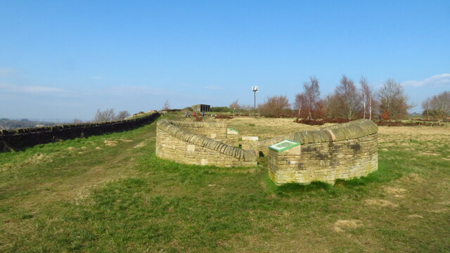
Lydgate Images

Images are sourced within 2km of 53.578724/-1.7603659 or Grid Reference SE1509. Thanks to Geograph Open Source API. All images are credited.

Old milestone On a bend on the south side of the A635 between Holmfirth and New Mills is this 19C West Riding CC milestone.   This area is called Wooldale and that name is on the top section.  Left face - HOLMFIRTH/1 MILE, right face - DENBY/DALE/5¾ MILES/CAWTHORNE/9 MILES/BARNSLEY/13 MILES.   The foundry name, BRAYSHAW & BOOTH/LIVERSEDGE is on the bevel.   Grade II listed 1313589.  It is in need of a clean and possible repaint.
Old milestone
On a bend on the south side of the A635 between Holmfirth and New Mills is this 19C West Riding CC milestone. This area is called Wooldale and that name is on the top section. Left face - HOLMFIRTH/1 MILE, right face - DENBY/DALE/5¾ MILES/CAWTHORNE/9 MILES/BARNSLEY/13 MILES. The foundry name, BRAYSHAW & BOOTH/LIVERSEDGE is on the bevel. Grade II listed 1313589. It is in need of a clean and possible repaint.
Old milestone Just to the north of the town centre this stone from the 1768-1876 Huddersfield to Woodhead turnpike road is in a small lay-by.   Painted a few years ago it now needs a good wash.   The rest of the stones towards the top of Holme Moss, 7, 8, 9 AD 10 are in place and well painted.   In 2011 the Huddersfield 4 and 5 stones were also by the roadside.
Old milestone
Just to the north of the town centre this stone from the 1768-1876 Huddersfield to Woodhead turnpike road is in a small lay-by. Painted a few years ago it now needs a good wash. The rest of the stones towards the top of Holme Moss, 7, 8, 9 AD 10 are in place and well painted. In 2011 the Huddersfield 4 and 5 stones were also by the roadside.
Interior of St Andrew's church, Thongsbridge For the outside of the church, see <a href="https://www.geograph.org.uk/photo/751457">SE1409 : St Andrew's Church, Thongsbridge, Wooldale</a>. This is the inside, looking liturgical west (geographically south-west). 

The church was built in 1877 as a chapel of ease. A school was added in 1891. There was a burial ground opened in 1938 but it was never used for burials and was sold in 1988. 

Note: the building was closed for worship in 2013 and sold to a private owner in 2020 (after this photo was taken) with planning permission for residential conversion, so is no longer publicly accessible. This view shows it as it had been as a place of worship.
Interior of St Andrew's church, Thongsbridge
For the outside of the church, see SE1409 : St Andrew's Church, Thongsbridge, Wooldale. This is the inside, looking liturgical west (geographically south-west). The church was built in 1877 as a chapel of ease. A school was added in 1891. There was a burial ground opened in 1938 but it was never used for burials and was sold in 1988. Note: the building was closed for worship in 2013 and sold to a private owner in 2020 (after this photo was taken) with planning permission for residential conversion, so is no longer publicly accessible. This view shows it as it had been as a place of worship.
Stone sculpture with seating area at Wooldale Cliff above Holmfirth
View towards Victoria St, Holmfirth from South Lane
Holmfirth - Sid's Cafe
Daisy Lane and Holy Trinity Church, Holmfirth
Scholes Methodist Church, Wadman Road This is the entrance doorway and a tall corner window.
Scholes Methodist Church, Wadman Road
This is the entrance doorway and a tall corner window.
A little park at the wells, White Wells Road, Scholes The pump base and well weren't photogenic; they could do with cleaning and tidying.
A little park at the wells, White Wells Road, Scholes
The pump base and well weren't photogenic; they could do with cleaning and tidying.
Houses on Wickleton Gate, Scholes Houses with an unusual design, with arched entrances to the lower ground floor.
Houses on Wickleton Gate, Scholes
Houses with an unusual design, with arched entrances to the lower ground floor.
Millpond, Lee Mills, Scholes This is now a fishing lake. I had hoped that there was a path alongside it to the bottom end of St George's Road but the gate was locked, with a Keep Out sign. The heron that I saw had no such problems.
Millpond, Lee Mills, Scholes
This is now a fishing lake. I had hoped that there was a path alongside it to the bottom end of St George's Road but the gate was locked, with a Keep Out sign. The heron that I saw had no such problems.
Grass and trees, Wickleden Gate, Scholes It is good that three mature trees have been spared and a grass are created for them. These trees were on an old field boundary, so were probably hedgerow trees. there was a small mill dam behind them.
Grass and trees, Wickleden Gate, Scholes
It is good that three mature trees have been spared and a grass are created for them. These trees were on an old field boundary, so were probably hedgerow trees. there was a small mill dam behind them.
Old milestone Where space on a road or path was limited, Brayshaw and Booth of Liversedge made flat castings for the West Riding CC instead of protruding ones.   This one is on the A616 Sheffield Road, New Mill opposite No. 30 Fulstone.   When a town name had more than 10 letters the name had to be cast at an angle as with Huddersfield.   Then Sheffield was cast the same way to match.   The foundry name on these flat plates is always at the top of the left-hand side.  This milestone is Grade II listed 1228473.
Old milestone
Where space on a road or path was limited, Brayshaw and Booth of Liversedge made flat castings for the West Riding CC instead of protruding ones. This one is on the A616 Sheffield Road, New Mill opposite No. 30 Fulstone. When a town name had more than 10 letters the name had to be cast at an angle as with Huddersfield. Then Sheffield was cast the same way to match. The foundry name on these flat plates is always at the top of the left-hand side. This milestone is Grade II listed 1228473.
Old Milestone, A616, Sheffield Road, New Mill Opposite No 30 Fulstone. Located on the West side of road, opposite a terrace row, against stone wall. Metal plate attached to stone post, Brayshaw & Booth casting design, erected by Wadsley & Langsett - New Mill District turnpike trust, 19th century. An earlier photograph can be found here <a title="https://www.geograph.org.uk/photo/6748931" href="https://www.geograph.org.uk/photo/6748931">Link</a>.

Inscription reads: HUDDERSFIELD / 6½ MILES :: SHEFFIELD / 20 MILES // NEW MILL DISTRICT / ROAD / FULSTONE :: BRAYSHAW & BOOTH / MAKERS / LIVERSEDGE 

Grade II listed by Historic England. <span class="nowrap"><a title="https://historicengland.org.uk/listing/the-list/list-entry/1228473" rel="nofollow ugc noopener" href="https://historicengland.org.uk/listing/the-list/list-entry/1228473">Link</a><img style="margin-left:2px;" alt="External link" title="External link - shift click to open in new window" src="https://s1.geograph.org.uk/img/external.png" width="10" height="10"/></span>

Milestone Society National ID: YW_SFHU20
Old Milestone, A616, Sheffield Road, New Mill
Opposite No 30 Fulstone. Located on the West side of road, opposite a terrace row, against stone wall. Metal plate attached to stone post, Brayshaw & Booth casting design, erected by Wadsley & Langsett - New Mill District turnpike trust, 19th century. An earlier photograph can be found here Link. Inscription reads: HUDDERSFIELD / 6½ MILES :: SHEFFIELD / 20 MILES // NEW MILL DISTRICT / ROAD / FULSTONE :: BRAYSHAW & BOOTH / MAKERS / LIVERSEDGE Grade II listed by Historic England. LinkExternal link Milestone Society National ID: YW_SFHU20
The Lidl supermarket, Holmfirth
Top of the Hill A weavers' hamlet below Thurstonland.
Top of the Hill
A weavers' hamlet below Thurstonland.
Lane near Thurstonland An old lane along the edge of a steep drop.
Lane near Thurstonland
An old lane along the edge of a steep drop.
Thurstonland Primary School
Show me another place!

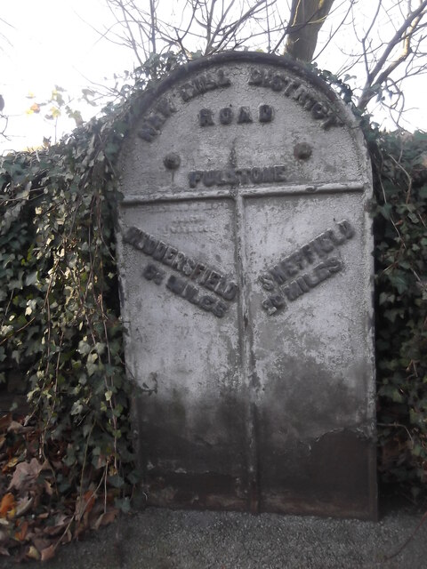
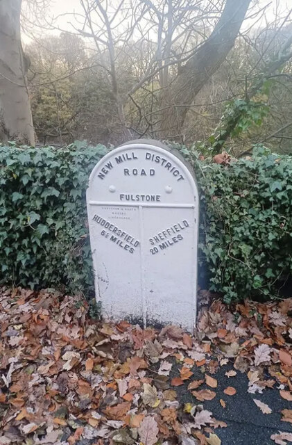
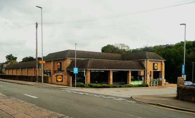
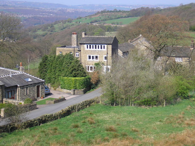
Lydgate is located at Grid Ref: SE1509 (Lat: 53.578724, Lng: -1.7603659)

Division: West Riding

Unitary Authority: Kirklees

Police Authority: West Yorkshire

What 3 Words

///reset.configure.pizza. Near Holmfirth, West Yorkshire

Related Wikis

Wooldale

Wooldale is a small village nestled on a hill, overlooking the Kirkroyds area of New Mill, Holmfirth in West Yorkshire, England. It has a population of...

New Mill, West Yorkshire

New Mill, West Yorkshire, England, is a small, semi-rural village near the town of Holmfirth. It is in the metropolitan borough of Kirklees and the civil...

Holmfirth High School

Holmfirth High School is a coeducational secondary school located on Heys Road in Thongsbridge, Holmfirth, West Yorkshire, England. Holmfirth High School...

Totties

Totties is a hamlet between New Mill and Scholes near Holmfirth in West Yorkshire, England. Although it consists of no more than 70-80 houses, it has within...

Thongs Bridge railway station

Thongs Bridge railway station was the only intermediate stop on the railway line between Brockholes and Holmfirth, West Yorkshire, England. Opened in July...

Thongsbridge

Thongsbridge is a small village in the Kirklees district of West Yorkshire, England. It is in the semi-rural Holme Valley and the village boundaries merge...

Jackson Bridge

Jackson Bridge is a small village in the civil parish of Holme Valley in the Metropolitan Borough of Kirklees in West Yorkshire, England and within the...

A635 road

The A635 is a main road that runs between Manchester and Doncaster running east–west through Stalybridge, Saddleworth Moor, Holmfirth, Barnsley and the...

Nearby Amenities

Located within 500m of 53.578724,-1.7603659
Crossing
Crossing: zebra
Crossing Island: no
Source: survey
Tactile Paving: yes
Lat/Long: 53.5760754/-1.7558451
New Mill Crossroads
Junction: yes
Lat/Long: 53.5758675/-1.7551783
Bus Stop
Holmfirth Road Kirkroyd Lane
Bus: yes
Local Ref: 45022006
Naptan AtcoCode: 450022006
Naptan Bearing: W
Naptan CommonName: Holmfirth Road Kirkroyd Lane
Naptan Crossing: Kirkroyd Lane
Naptan Indicator: Stop 45022006
Naptan PlusbusZoneRef: LEEDS
Naptan ShortCommonName: Kirkroyd Lane
Naptan Street: Holmfirth Road
Naptan Verified: no
Public Transport: platform
Source: naptan_import
Lat/Long: 53.5787166/-1.7631009
Bus Stop
Holmfirth Road Kirkroyds Lane
Bench: no
Bin: no
Bus: yes
Lit: yes
Local Ref: 45022007
Naptan AtcoCode: 450022007
Naptan Bearing: E
Naptan CommonName: Holmfirth Road Kirkroyds Lane
Naptan Crossing: Kirkroyds Lane
Naptan Indicator: Stop 45022007
Naptan PlusbusZoneRef: LEEDS
Naptan ShortCommonName: Kirkroyds Lane
Naptan Street: Holmfirth Road
Naptan Verified: no
Public Transport: platform
Shelter: yes
Source: naptan_import
Tactile Paving: no
Lat/Long: 53.5788136/-1.7621337
Bus Stop
Holmfirth Road Greenhill Bank Road
Bench: yes
Bin: yes
Bus: yes
Lit: yes
Local Ref: 45022009
Naptan AtcoCode: 450022009
Naptan Bearing: SE
Naptan CommonName: Holmfirth Road Greenhill Bank Road
Naptan Crossing: Greenhill Bank Road
Naptan Indicator: Stop 45022009
Naptan PlusbusZoneRef: LEEDS
Naptan ShortCommonName: Greenhill Bank Road
Naptan Street: Holmfirth Road
Naptan Verified: no
Public Transport: platform
Shelter: yes
Source: naptan_import
Tactile Paving: no
Lat/Long: 53.5763029/-1.7562426
Bus Stop
Holmfirth Road Greenhill Bank Road
Bench: no
Bin: yes
Bus: yes
Lit: no
Local Ref: 45022010
Naptan AtcoCode: 450022010
Naptan Bearing: NW
Naptan CommonName: Holmfirth Road Greenhill Bank Road
Naptan Crossing: Greenhill Bank Road
Naptan Indicator: Stop 45022010
Naptan Landmark: Play Ground
Naptan PlusbusZoneRef: LEEDS
Naptan ShortCommonName: Greenhill Bank Road
Naptan Street: Holmfirth Road
Naptan Verified: no
Public Transport: platform
Shelter: yes
Source: naptan_import
Tactile Paving: no
Lat/Long: 53.5764114/-1.7565592
Bus Stop
Huddersfield Road Holme Lane
Bench: no
Bus: yes
Local Ref: 45022011
Naptan AtcoCode: 450022011
Naptan Bearing: NW
Naptan CommonName: Huddersfield Road Holme Lane
Naptan Crossing: Nr-At Holme Lane
Naptan Indicator: Stop 45022011
Naptan PlusbusZoneRef: LEEDS
Naptan ShortCommonName: Rock Cottages
Naptan Street: Huddersfield Road
Naptan Verified: no
Public Transport: platform
Shelter: no
Source: naptan_import
Lat/Long: 53.5792462/-1.7582345
Bus Stop
New Mill Road Ray Gate
Bench: no
Bin: no
Bus: yes
Local Ref: 45022012
Naptan AtcoCode: 450022012
Naptan Bearing: SE
Naptan CommonName: New Mill Road Ray Gate
Naptan Crossing: Ray Gate
Naptan Indicator: Stop 45022012
Naptan PlusbusZoneRef: LEEDS
Naptan ShortCommonName: Ray Gate
Naptan Street: New Mill Road
Naptan Verified: no
Public Transport: platform
Shelter: no
Source: naptan_import
Lat/Long: 53.5814801/-1.7605629
Bus Stop
New Mill Road Kirkbridge Lane
Bench: yes
Bus: yes
Local Ref: 45022013
Naptan AtcoCode: 450022013
Naptan Bearing: N
Naptan CommonName: New Mill Road Kirkbridge Lane
Naptan Crossing: Kirkbridge Lane
Naptan Indicator: Stop 45022013
Naptan PlusbusZoneRef: LEEDS
Naptan ShortCommonName: Kirkbridge Lane
Naptan Street: New Mill Road
Naptan Verified: no
Public Transport: platform
Shelter: yes
Source: naptan_import
Lat/Long: 53.5816694/-1.7608338
Bus Stop
New Mill Road Bromley Avenue
Bus: yes
Local Ref: 45023937
Naptan AtcoCode: 450023937
Naptan Bearing: E
Naptan CommonName: New Mill Road Bromley Avenue
Naptan Crossing: Bromley Avenue
Naptan Indicator: Stop 45023937
Naptan PlusbusZoneRef: LEEDS
Naptan ShortCommonName: Bromley Avenue
Naptan Street: New Mill Road
Naptan Verified: no
Public Transport: platform
Source: naptan_import
Lat/Long: 53.5794067/-1.7666313
Bus Stop
Holmfirth Road Moorcroft Park Drive
Bus: yes
Local Ref: 45023944
Naptan AtcoCode: 450023944
Naptan Bearing: NW
Naptan CommonName: Holmfirth Road Moorcroft Park Drive
Naptan Crossing: Moorcroft Park Drive
Naptan Indicator: Stop 45023944
Naptan PlusbusZoneRef: LEEDS
Naptan ShortCommonName: Moorcroft Park Dr
Naptan Street: Holmfirth Road
Naptan Verified: no
Public Transport: platform
Source: naptan_import
Lat/Long: 53.5780872/-1.7584828
Bus Stop
Holmfirth Road Holme Lane
Bus: yes
Local Ref: 45023945
Naptan AtcoCode: 450023945
Naptan Bearing: SE
Naptan CommonName: Holmfirth Road Holme Lane
Naptan Crossing: Holme Lane
Naptan Indicator: Stop 45023945
Naptan PlusbusZoneRef: LEEDS
Naptan ShortCommonName: Holme Lane
Naptan Street: Holmfirth Road
Naptan Verified: no
Public Transport: platform
Source: naptan_import
Lat/Long: 53.578204/-1.7584368
Bus Stop
Royds Avenue Royds Drive
Bus: yes
Local Ref: 45024802
Naptan AtcoCode: 450024802
Naptan Bearing: W
Naptan CommonName: Royds Avenue Royds Drive
Naptan Crossing: Royds Drive
Naptan Indicator: Stop 45024802
Naptan PlusbusZoneRef: LEEDS
Naptan ShortCommonName: Royds Drive
Naptan Street: Royds Avenue
Naptan Verified: no
Public Transport: platform
Source: naptan_import
Lat/Long: 53.5762131/-1.7652443
Bus Stop
Royds Avenue Lydgate Drive
Bus: yes
Local Ref: 45024866
Naptan AtcoCode: 450024866
Naptan Bearing: W
Naptan CommonName: Royds Avenue Lydgate Drive
Naptan Crossing: Lydgate Drive
Naptan Indicator: Stop 45024866
Naptan PlusbusZoneRef: LEEDS
Naptan ShortCommonName: Lydgate Drive
Naptan Street: Royds Avenue
Naptan Verified: no
Public Transport: platform
Source: naptan_import
Lat/Long: 53.5764803/-1.7594887
Bus Stop
Royds Avenue
Bus: yes
Local Ref: 45024867
Naptan AtcoCode: 450024867
Naptan Bearing: W
Naptan CommonName: Royds Avenue
Naptan Crossing: Nr-Opp Royds Drive
Naptan Indicator: Stop 45024867
Naptan Landmark: Wooldale Junior School
Naptan PlusbusZoneRef: LEEDS
Naptan ShortCommonName: Royds Avenue
Naptan Street: Royds Avenue
Naptan Verified: no
Public Transport: platform
Source: naptan_import
Lat/Long: 53.5765868/-1.7633091
Bus Stop
Royds Avenue Royds Close
Bus: yes
Local Ref: 45024868
Naptan AtcoCode: 450024868
Naptan Bearing: S
Naptan CommonName: Royds Avenue Royds Close
Naptan Crossing: Nr-At Royds Close
Naptan Indicator: Stop 45024868
Naptan PlusbusZoneRef: LEEDS
Naptan ShortCommonName: Kirkroyds Lane
Naptan Street: Royds Avenue
Naptan Verified: no
Public Transport: platform
Source: naptan_import
Lat/Long: 53.5767017/-1.766918
Bus Stop
Kirkroyds Lane Royds Avenue
Bus: yes
Local Ref: 45024869
Naptan AtcoCode: 450024869
Naptan Bearing: W
Naptan CommonName: Kirkroyds Lane Royds Avenue
Naptan Crossing: Royds Avenue
Naptan Indicator: Stop 45024869
Naptan Landmark: Kirkroyds Infant School
Naptan PlusbusZoneRef: LEEDS
Naptan ShortCommonName: Royds Avenue
Naptan Street: Kirkroyds Lane
Naptan Verified: no
Public Transport: platform
Source: naptan_import
Lat/Long: 53.5778894/-1.7675307
Bus Stop
New Mill Road Bromley Avenue
Bus: yes
Naptan AtcoCode: 450028643
Naptan Bearing: W
Naptan CommonName: New Mill Road Bromley Avenue
Naptan Crossing: Bromley Avenue
Naptan Landmark: Unknown
Naptan PlusbusZoneRef: LEEDS
Naptan ShortCommonName: Bromley Avenue
Naptan Street: New Mill Road
Naptan Verified: no
Public Transport: platform
Source: naptan_import
Lat/Long: 53.5790634/-1.7657421
Bus Stop
Royds Avenue Lydgate Drive
Bus: yes
Local Ref: 45027987
Naptan AtcoCode: 450027987
Naptan Bearing: E
Naptan CommonName: Royds Avenue Lydgate Drive
Naptan Crossing: Lydgate Drive
Naptan Indicator: Stop 45027987
Naptan Landmark: Unknown
Naptan PlusbusZoneRef: LEEDS
Naptan ShortCommonName: Lydgate Drive
Naptan Street: Royds Avenue
Naptan Verified: no
Public Transport: platform
Source: naptan_import
Lat/Long: 53.5766329/-1.7593821
Bus Stop
Royds Avenue Royds Drive
Bus: yes
Local Ref: 45027988
Naptan AtcoCode: 450027988
Naptan Bearing: E
Naptan CommonName: Royds Avenue Royds Drive
Naptan Crossing: Royds Drive
Naptan Indicator: Stop 45027988
Naptan Landmark: Wooldale Junior School
Naptan PlusbusZoneRef: LEEDS
Naptan ShortCommonName: Royds Avenue
Naptan Street: Royds Avenue
Naptan Verified: no
Public Transport: platform
Source: naptan_import
Lat/Long: 53.5766769/-1.7634294
Bus Stop
Royds Avenue Royds Drive
Bus: yes
Local Ref: 45027989
Naptan AtcoCode: 450027989
Naptan Bearing: E
Naptan CommonName: Royds Avenue Royds Drive
Naptan Crossing: Royds Drive
Naptan Indicator: Stop 45027989
Naptan PlusbusZoneRef: LEEDS
Naptan ShortCommonName: Royds Drive
Naptan Street: Royds Avenue
Naptan Verified: no
Public Transport: platform
Source: naptan_import
Lat/Long: 53.5763213/-1.7654552
New Mill Road
Local Ref: 45051181
Naptan AtcoCode: 450051181
Naptan Bearing: SE
Naptan BusStopType: CUS
Naptan CommonName: New Mill Road
Naptan Indicator: Stop 45051181
Naptan PlusbusZoneRef: LEEDS
Naptan ShortCommonName: Holme Lane
Naptan Street: New Mill Road
Naptan Verified: no
Source: naptan_import
Lat/Long: 53.5793089/-1.7581133
Royds Avenue
Local Ref: 45051484
Naptan AtcoCode: 450051484
Naptan Bearing: N
Naptan BusStopType: CUS
Naptan CommonName: Royds Avenue
Naptan Indicator: Stop 45051484
Naptan PlusbusZoneRef: LEEDS
Naptan ShortCommonName: Royds Close
Naptan Street: Royds Avenue
Naptan Verified: no
Source: naptan_import
Lat/Long: 53.5767019/-1.7670087
Kirkroyds Lane Kirkroyds Infants School
Local Ref: 45051485
Naptan AtcoCode: 450051485
Naptan Bearing: E
Naptan BusStopType: CUS
Naptan CommonName: Kirkroyds Lane Kirkroyds Infants School
Naptan Indicator: Stop 45051485
Naptan PlusbusZoneRef: LEEDS
Naptan ShortCommonName: Daleside Avenue
Naptan Street: Kirkroyds Lane
Naptan Verified: no
Source: naptan_import
Lat/Long: 53.5779343/-1.7675003
Fast Food
Cuisine: pizza
Source: survey
Lat/Long: 53.5760736/-1.7552481
Turning Circle
Kirklands
Lat/Long: 53.5772394/-1.763715
Turning Circle
Royds Drive
Lat/Long: 53.5771767/-1.7642266
Turning Circle
The Crescent
Lat/Long: 53.5769219/-1.7577753
Removed Amenity: telephone
Lat/Long: 53.5758081/-1.7555398
Barrier: cycle_barrier
Material: wood
Lat/Long: 53.5803623/-1.765388
Post Box
Collection Plate Date: 2017-09-19
Collection Times: Mo-Fr 17:00; Sa 11:15
Operator: Royal Mail
Post Box Type: pillar
Ref: HD9 384
Royal Cypher: GVIR
Royal Cypher Wikidata: Q33102169
Source: survey
Lat/Long: 53.5760212/-1.7553746
Pharmacy
The Valley Pharmacy
Dispensing: yes
Healthcare: pharmacy
Phone: +44 1484 766097
Source: survey
Lat/Long: 53.5760964/-1.7553738
Fast Food
B Medina
Cuisine: asian
Source: survey
Lat/Long: 53.576088/-1.7551729
Post Office
New Mill Post Office
Addr City: Holmfirth
Addr Country: GB
Addr Postcode: HD9 7JU
Addr Suburb: New Mill
Brand: Post Office
Brand Wikidata: Q1783168
Contact Website: https://www.postoffice.co.uk/branch-finder/207320x/new-mill
Ref Pol Id: 7352
Lat/Long: 53.5760466/-1.7553285
Waste Basket
Colour: black
Material: metal
Source: survey
Waste: litter
Lat/Long: 53.5766225/-1.7563503
Pub
The White Hart
Source: survey
Lat/Long: 53.5759702/-1.7547948
Waste Basket
Check Date: 2023-08-24
Material: metal
Source: survey
Lat/Long: 53.5763917/-1.756284
Waste Basket
Check Date: 2023-08-25
Material: metal
Source: survey
Lat/Long: 53.5759446/-1.7554036
Waste Basket
Check Date: 2023-08-20
Material: metal
Source: survey
Lat/Long: 53.5760657/-1.7551166
Waste Basket
Check Date: 2023-08-20
Material: metal
Source: survey
Lat/Long: 53.5760498/-1.7551837
Waste Basket
Check Date: 2023-08-24
Material: metal
Source: survey
Lat/Long: 53.575999/-1.7555484
Defibrillator
Access: yes
Defibrillator Location: On the outside wall at the back of the club on a balcony up some metal steps.
Emergency: defibrillator
Indoor: no
Level: 1
Opening Hours: 24/7
Lat/Long: 53.5753614/-1.7558555
Recycling
Colour: white
Recycling Glass Bottles: yes
Recycling Type: container
Lat/Long: 53.5767044/-1.7563932
Barrier: stile
Stile: stepover
Lat/Long: 53.5760767/-1.7591278
Power: pole
Lat/Long: 53.579007/-1.7528344
Power: pole
Lat/Long: 53.5802843/-1.7538959
Power: pole
Lat/Long: 53.5816342/-1.7550174
Defibrillator
Access: yes
Colour Border: yellow
Colour Main: green
Defibrillator Location: wall
Description: New Mill Co-Op
Emergency: defibrillator
Indoor: no
Opening Hours: 24/7
Ref: AAH86
Source: survey
Support: wall
Survey Date: 2021-06-23
Lat/Long: 53.5760283/-1.7554964
Stop
Direction: backward
Stop: minor
Lat/Long: 53.5762411/-1.7577286
Description: 10 panels
Generator Method: photovoltaic
Generator Output Electricity: small_installation
Generator Source: solar
Generator Type: solar_photovoltaic_panel
Note: roof household
Power: generator
Lat/Long: 53.5773989/-1.7583604
Description: 15 panels
Generator Method: photovoltaic
Generator Output Electricity: small_installation
Generator Source: solar
Generator Type: solar_photovoltaic_panel
Note: roof household
Power: generator
Lat/Long: 53.5778656/-1.7594717
Generator Method: photovoltaic
Generator Output Electricity: small_installation
Generator Source: solar
Generator Type: solar_photovoltaic_panel
Note: roof household
Power: generator
Lat/Long: 53.5780725/-1.7587652
Description: 12 panels
Generator Method: photovoltaic
Generator Output Electricity: small_installation
Generator Source: solar
Generator Type: solar_photovoltaic_panel
Note: roof household
Power: generator
Lat/Long: 53.5793935/-1.760639
Description: 10 panels
Generator Method: photovoltaic
Generator Output Electricity: small_installation
Generator Source: solar
Generator Type: solar_photovoltaic_panel
Note: roof household
Power: generator
Lat/Long: 53.5772229/-1.7651348
Description: 12 panels
Generator Method: photovoltaic
Generator Output Electricity: small_installation
Generator Source: solar
Generator Type: solar_photovoltaic_panel
Note: roof household
Power: generator
Lat/Long: 53.5786933/-1.7677826
Description: 16 panels
Generator Method: photovoltaic
Generator Output Electricity: small_installation
Generator Source: solar
Generator Type: solar_photovoltaic_panel
Note: roof household
Power: generator
Lat/Long: 53.5786242/-1.767344
Description: 10 panels
Generator Method: photovoltaic
Generator Output Electricity: small_installation
Generator Source: solar
Generator Type: solar_photovoltaic_panel
Note: roof household
Power: generator
Lat/Long: 53.579191/-1.7667069
Noexit: yes
Lat/Long: 53.5805969/-1.7659745
Post Box
Collection Times: Mo-Fr 09:00; Sa 07:00
Operator: Royal Mail
Post Box Type: lamp
Ref: HD9 360D
Royal Cypher: EIIR
Royal Cypher Wikidata: Q33102113
Source: survey
Lat/Long: 53.5785253/-1.7627919
Kirkroyds
Place: neighbourhood
Lat/Long: 53.577788/-1.7645977
Turning Circle
Lydgate Close
Lat/Long: 53.5770201/-1.7586721
Power: substation
Substation: minor_distribution
Lat/Long: 53.5782924/-1.7678063
Barrier: cycle_barrier
Material: wood
Lat/Long: 53.5804217/-1.7655413
Turning Circle
Lingwood Close
Lat/Long: 53.5796172/-1.7616075
Bench
Backrest: yes
Lat/Long: 53.5760195/-1.7554107
Bench
Backrest: yes
Lat/Long: 53.5760169/-1.7554277
Recycling
Colour: green
Recycling Glass Bottles: yes
Recycling Type: container
Lat/Long: 53.576708/-1.7563769
Recycling
Colour: brown
Recycling Glass Bottles: yes
Recycling Type: container
Lat/Long: 53.5767018/-1.7563605
Recycling
Colour: green
Recycling Glass Bottles: yes
Recycling Type: container
Lat/Long: 53.576691/-1.75635
Recycling
Colour: white
Recycling Glass Bottles: yes
Recycling Type: container
Lat/Long: 53.5766802/-1.75634
Recycling
Colour: brown
Recycling Glass Bottles: yes
Recycling Type: container
Lat/Long: 53.5766694/-1.7563307
Recycling
Colour: green
Recycling Glass Bottles: yes
Recycling Type: container
Lat/Long: 53.5766656/-1.7563494
Recycling
Colour: blue
Operator: Variety, the Children's Charity
Recycling Shoes: yes
Recycling Type: container
Lat/Long: 53.5766503/-1.7563588
Recycling
Colour: yellow
Operator: Yorkshire Air Ambulance
Recycling Clothes: yes
Recycling Shoes: yes
Recycling Type: container
Lat/Long: 53.5766336/-1.756357
Waste Basket
Colour: black
Material: metal
Source: survey
Waste: litter
Lat/Long: 53.5766144/-1.7563441
Waste Basket
Colour: black
Material: metal
Source: survey
Waste: litter
Lat/Long: 53.5767263/-1.7563871
Bench
Backrest: yes
Colour: black
Material: metal
Lat/Long: 53.5767271/-1.7563366
The data included in this document is from www.openstreetmap.org. The data is made available under ODbL.

Have you been to Lydgate?

Leave your review of Lydgate below (or comments, questions and feedback).